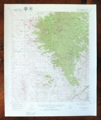
MAP DETAILS | |
|---|---|
| TITLE | Mount Wrightson |
| STATE | Arizona |
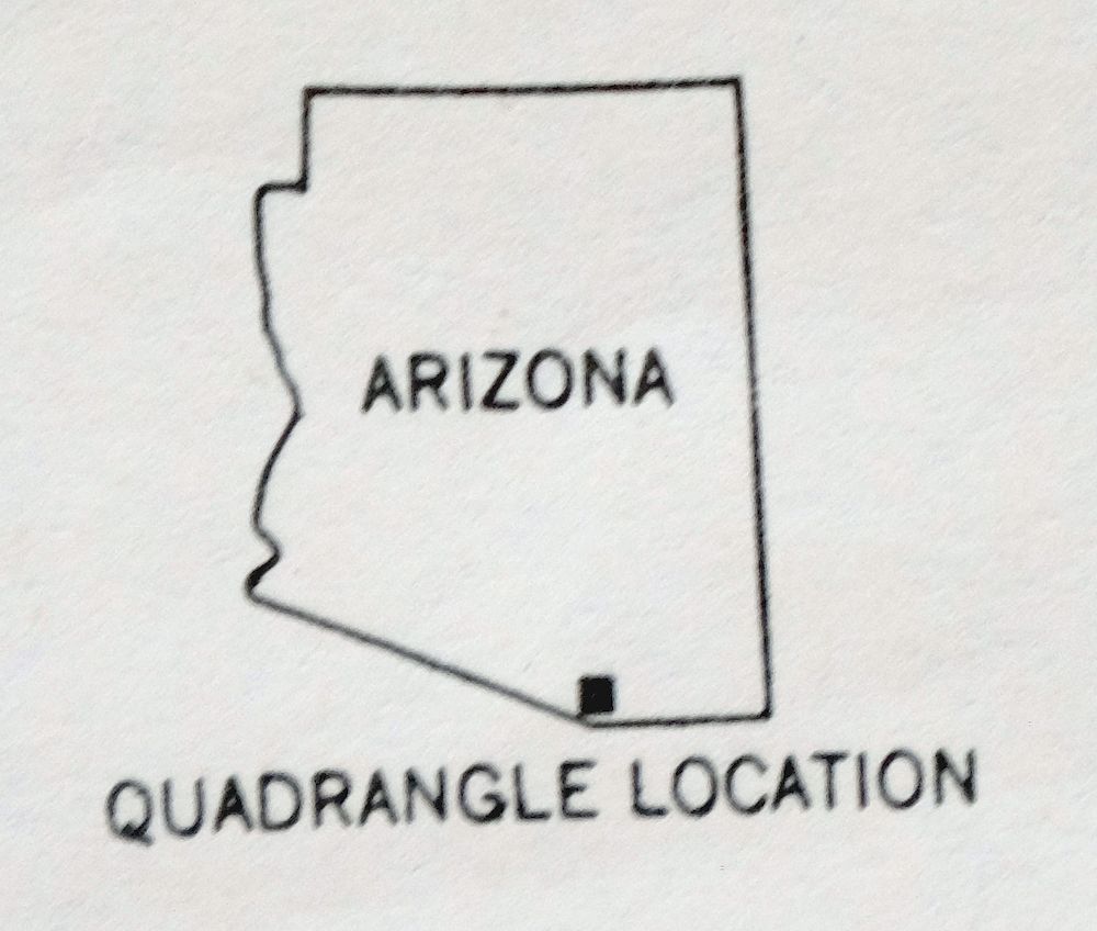
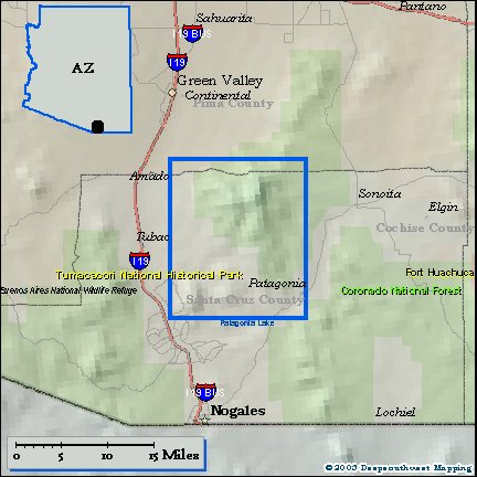
| LOCATION | Vicinity of Rio Rico Northeast, 40 miles south of Tucson |
| SERIES | 15-minute |
| SURVEYED | 1955 and 1958 Aerial and Field Survey |
| EDITION | 1958 |
| PRINTED | 1979 |
| PRINT NOTES | Thick paper stock, includes woodland tint (green to indicate vegetated areas) |
| SCALE | 1:62500 |
| CONTOUR INTERVAL | 80 feet |
| SHEET DIMENSIONS | 17 7/8 x 21 7/8 inches |
| MAP DIMENSIONS | 14 7/8 x 17 1/2 inches |
| COVERAGE AREA | 15 x 17 miles |
| SOURCE | From the vintage map collection of Art Christiansen, Tempe, Arizona |
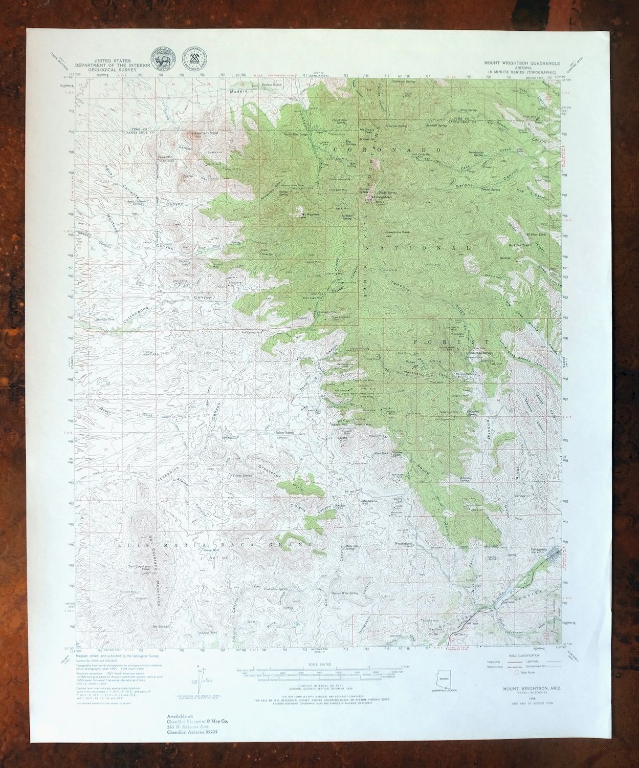
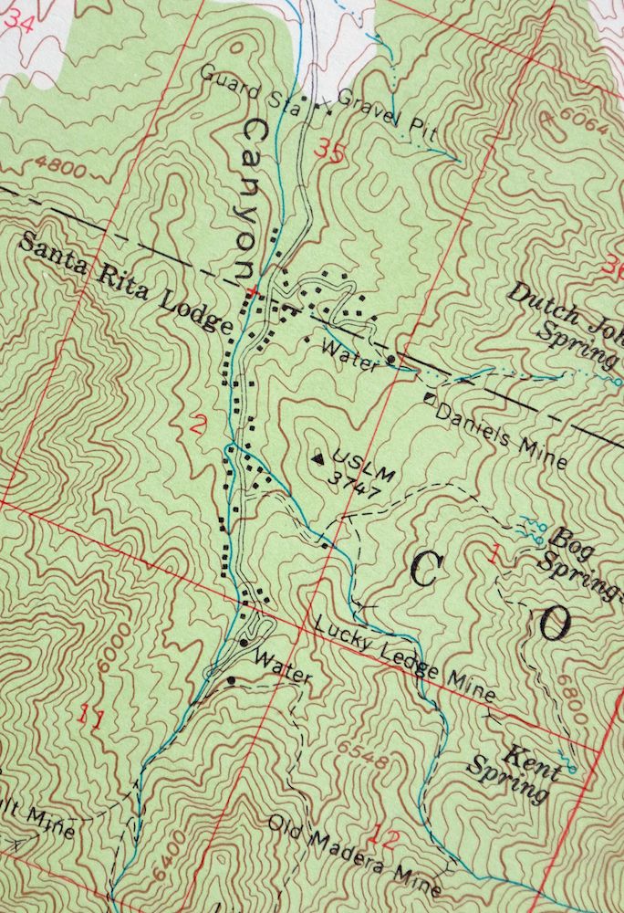
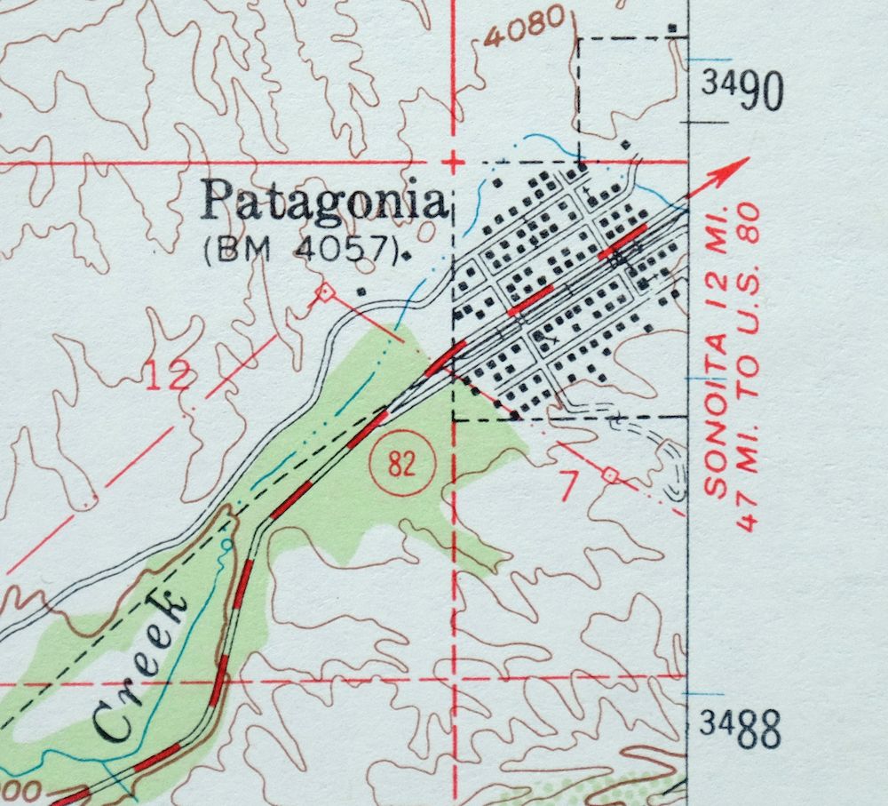
| MAP NOTES | An interesting historical snapshot of the Santa Rita Mountains and Patagonia, surveyed in the 1950s, showing all houses known at the time. |
| SHEET CONDITION For maps of this vintage, effort is made to note all visible flaws, no matter how minor. | |
| OVERALL CONDITION | Excellent |
| SHEET NOTES | lightly handled, never folded |
| MAP AREA | flawless map area |
| COLLARS | no wear or tears, no markings, no blemishes, small inventory stamp in bottom collar |
| MAP COVERAGE Quadrangle extent overlaid on current basemap. | |
| PLACENAMES Depending on map series and survey date, all of the features listed below may not be shown on this map. This list contains features that currently exist or historically existed within the area covered by the map. The list can be used as a reference to determine if this map covers your area of interest. Placenames are listed alphabetically next to each feature type. | |
| NOTABLE PLACES | Patagonia, Santa Rita Mountains, and Madera Canyon |
| CITIES AND TOWNS (CURRENT) | Rio Rico Northeast and Sonoita |
| COUNTIES COVERED | Pima and Santa Cruz |
| FEDERAL LAND UNITS | Coronado National Forest and Mt. Wrightson Wilderness |
| RIVERS AND STREAMS | Sonoita Creek |
| WATER BODIES | Patagonia Lake |
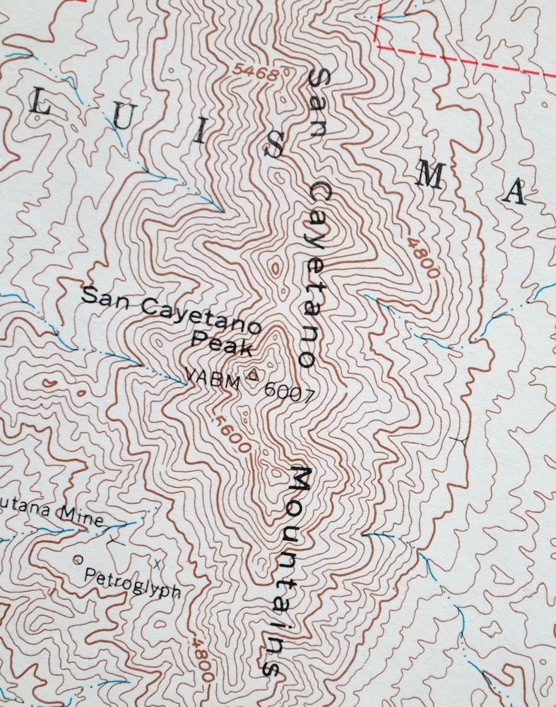
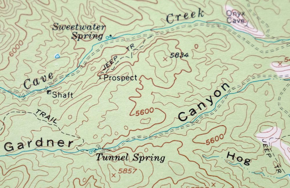
| Locations: Bergier Ranch, Fish Well Corral, Gatlin Ranch, Hard Luck Ranch, Madera Administrative Site, Madora Picnic Area, Proctor Ranch, Salero Ranch, Santa Rita Lodge, and Weatherhead Ranch. Administrative Boundaries: Luis Maria Baca Grant. Mountains, Peaks, and Summits: Castle Butte, Ditch Mountain, Elephant Head, Florida Peak, Grosvenor Hills, Mount Hopkins, Jack Mountain, Josephine Peak, McCleary Peak, Old Baldy, Pete Mountain, El Plomo, Salero Mountain, San Cayetano Mountains, San Cayetano Peak, Sanford Butte, Mount Shibell, Squaw Peak, Mount Wrightson, and Yoas Mountain. Valleys and Canyons: Alamo Canyon, Alto Gulch, Alum Canyon, Alum Gulch, Aztec Gulch, Bond Canyon, CCC Canyon, Chino Canyon, Cieneguita Canyon, Coal Mine Canyon, Copper Canyon, East Sawmill Canyon, Flux Canyon, Goat Canyon, Gringo Gulch, Jones Canyon, Madera Canyon, Mansfield Canyon, Piper Gulch, Rattlesnake Canyon, Smith Gulch, Squaw Gulch, Temporal Gulch, and Walker Canyon. Parks: Bog Springs Campground, Roundup Picnic Ground, and Wrightson Wilderness. Trails: Cave Canyon Trail One Hundred Forty-Seven, Josephine Canyon Trail Number 133, Josephine Saddle Madera Trail Number 134, Kent Spring Trail 156, Old Baldy National Recreation Trail Loop, Onal Recreation Trail, Sawmill Canyon Trail 146, Sweetwater Baldy Saddle Trail 143, Vault Mine Trail One Hundred Forty, and Walker Basin Trail Number One Hundred Thirty Six. Drainages: Cave Creek. Mines: Alto Group, Arizona Pittsburg Mine, Armada Mine, Black Eagle Mine, Bland Mine, Bradford Mine, Bull Springs Mine, Burro Mine, Compadre Mine, Connecticut Mine, Daniels Mine, Dixie Mine, Double Header Mine, Dragon Z Mine, East Compadre Shaft, Eureka Mine, Florida Mine, Glove Mine, Happy Jack Mine, Helvetia Mine, Hermits Home Mine, Hosey Mine, Ivanhoe Mine, Jefferson Mine, Joplin Mine, Last Chance Mine, Lee Shaft, Leroy Mine, Little Joker Mine, Little Shot Mine, Lucky Ledge Mine, Mammoth Mine, Mansfield Group, Mohawk Mine, Montezuma Mine, Montosa Mine, Old Madera Mine, Philadelphia Mine, Quantrell Mine, Rock Candy Mountain Mine, Rosario Mine, Royal Blue Mine, Saint Louis Mine, Salero Mine, San Ramon Mine, Silver King Mine, Snyder Mine, Tiajuana Mine, Treasure Vault Mine, Trenton Mine, Tubutana Mine, Ultimo Mine, Viceroy Mine, Victor Mine, Walker Mine, Wandering Jew Group, and Wildcat Mine. Lakes and Ponds: Bathtub Water. Buildings: Smithsonian Astrophysical Observatory. Dams: Green Dam. Gaps: Agua Caliente Saddle, Baldy Saddle, Florida Saddle, Josephine Saddle, and Riley Saddle. Basins: Chino Basin, Montosa Basin, and Walker Basin. Ridges: Devils Cash Box and Tia Juana Ridge. Reservoirs and Tanks: Bath Tub Tank, Bergier Tank, Canyon Tank, Chivas Tank, Cinigita Tank, El Pilar Tank, Fish Canyon Tank, Henry Tank, Little Casa Tank, Mine Tank, Ocotillo Tank, El Pilar Tank, Sawmill Canyon Tank, and Upper Walker Tank. Flats: Juniper Flat. Towers: KMSB-TV (Nogales) and KZAZ-TV (Nogales). Wells: Juniper Well, Montezuma Well, Sheuy Well, and Siphon Well. Springs: Agua Caliente Spring, Aliso Spring, Anaconda Spring, Armour Spring, Baldy Spring, Bellows Spring, Bog Springs, Bear Spring, Chino Spring, Chino Spring Number Two, Coal Mine Spring, Dripping Spring, Dutch John Spring, Florida Spring, Fresno Spring, George Wise Spring, Iron Spring, Johnson Spring, Kent Spring, Mata Siete Spring, McBeth Spring, Ranger Station Spring, Robinson Spring, Sawmill Spring, Sprung Spring, Sweetwater Spring, Sylvester Spring, Tejano Spring, Tunnel Spring, and Walnut Spring. | |
| SHIPPING AND RETURNS | |
 This map sheet will be carefully rolled in a sturdy tube and shipped via the US Postal Service. If you find that the sheet you receive is not as described in the listing, you may ship it back to us for a refund of the purchase price. | |
1979 Mount Wrightson Arizona USGS Topo Map: Patagonia
$48
An interesting historical snapshot of the Santa Rita Mountains and Patagonia, surveyed in the 1950s, showing all houses known at the time. This is a 15-minute USGS topographic sheet of the Mount Wrightson quadrangle in southern Arizona, first published in 1958 and printed in 1979, with a green woodland tint marking the forested slopes. The quad area covers the heart of the Santa Rita Mountains south of Tucson, including Madera Canyon and portions of the Coronado National Forest and Mount Wrightson Wilderness, spanning parts of Pima and Santa Cruz counties.
In stock
This vintage sheet is a 1958 edition of the Mount Wrightson Arizona USGS topographic map. It is an original 47-year-old 1979 United States Geological Survey print in excellent condition.
HOW THIS MAP CAN BE USED
In addition to making a fascinating conversation piece, this sheet would look great in a frame or on display, make a unique and prized gift for anyone interested in this area, be perfect as a reference for genealogy studies or general historical research, or fill that missing piece in your collection. Maps of this vintage are printed on durable stock and are well-suited for outdoor activities and recreation of all kinds, including hiking, backpacking, hunting, rafting and kayaking, backcountry skiing, geocaching, general exploration, treasure hunting, etc.
FEATURES SHOWN ON THE MAP
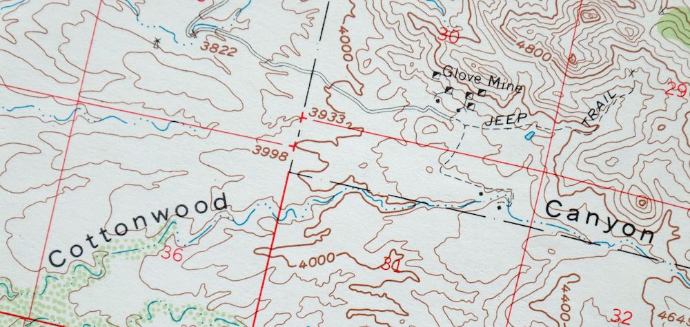
The Mount Wrightson 15-minute map shows cities and towns, roads, railroads, utilities and energy infrastructure, rivers, creeks, elevation contour lines, public land survey lines, county, state, and other administrative boundaries as they existed at the time of the survey in 1955 and 1958. All known structures (houses, businesses, churches, schools, barns, cabins, etc) are also shown.
A VALUABLE HISTORICAL RECORD
Maps from the 15-minute series for the continental United States are no longer produced or printed by the USGS and original prints are becoming increasingly difficult to find. They are a valuable historical record for an area, as they contain many placenames and features that have been dropped from more recent maps.
Nearby maps
-

Elgin Arizona Patagonia Sonoita USGS Topo Map 1971 Vintage
$52 Add to cart -
Nogales Arizona Rio Rico Northeast USGS 15-Min Topo Map 1972
$38 Add to cart -
Empire Mountains Arizona Vail Pantano USGS Topo Map 1961
$47 Add to cart -
Lochiel Arizona USGS 15-Min Topographic Map 1965 Vintage
$47 Add to cart -
1973 Ruby Arizona USGS Topo Map: Pena Blanca Lake
$45 Add to cart -
Benson Arizona Coronado NF St. David USGS Topo Map 1962
$38 Add to cart -
Oro Blanco Arizona USGS 15-Min Topographic Map 1944 Vintage
$22 Add to cart -

Sunnyside Arizona Sierra Vista USGS Topo Map 1965 Vintage
$46 Add to cart -

Tucson Arizona Davis-Monthan Tanque Verde USGS Topo Map 1963
$58 Add to cart -
Tucson Arizona Davis-Monthan Tanque Verde USGS Topo Map 1948
$50 Add to cart -
San Xavier Mission Arizona Tucson USGS Topo Map 1961 Vintage
$52 Add to cart -
Tombstone Arizona Sierra Vista USGS Topo Map 1959 Vintage
$65 Add to cart -
Presumido Peak Arizona USGS 15-Min Topo Map 1960 Vintage
$48 Add to cart -
Baboquivari Peak Arizona USGS 15-Min Topo Map 1967 Vintage
$48 Add to cart -

1967 Mount Lemmon Arizona USGS Topo Map: Tucson
$65 Add to cart -
Cortaro Arizona Tucson Oro Valley USGS Topographic Map 1947
$58 Add to cart -

Vamori Arizona San Miguel USGS 15-Min Topo Map 1958 Vintage
$34 Add to cart -
1965 Silver Bell Peak Arizona USGS Topo Map: Marana
$52 Add to cart -
Sells Arizona Topawa Cowlic USGS 15-Min Topographic Map 1948
$45 Add to cart -

Bisbee Arizona Naco Mule Mountains USGS 15-Min Topo Map 1959
$48 Add to cart -
Bisbee Arizona Naco Mule Mountains USGS Topographic Map 1910
$75 Add to cart -

Winchester Mountains Arizona The Mesas USGS Topo Map 1962
$40 Add to cart -
Vaca Hills Arizona Papago USGS Topographic Map 1965 Vintage
$32 Add to cart -
Winchester Mountains Arizona The Mesas USGS Topo Map 1945
$27 Add to cart