MAP DETAILS | |
|---|---|
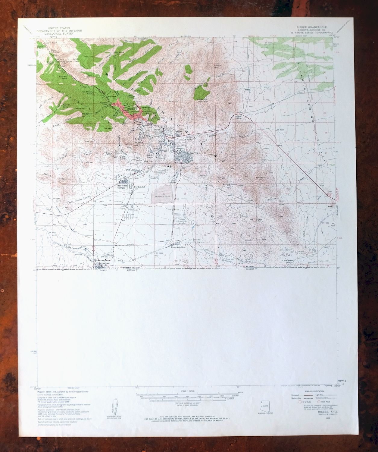
| TITLE | Bisbee |
| STATE | Arizona |
| LOCATION | 85 miles southeast of Tucson |
| SERIES | 15-minute |
| SURVEYED | 1956 and 1958 Aerial and Field Survey |
| EDITION | 1958 |
| PRINTED | 1959 |
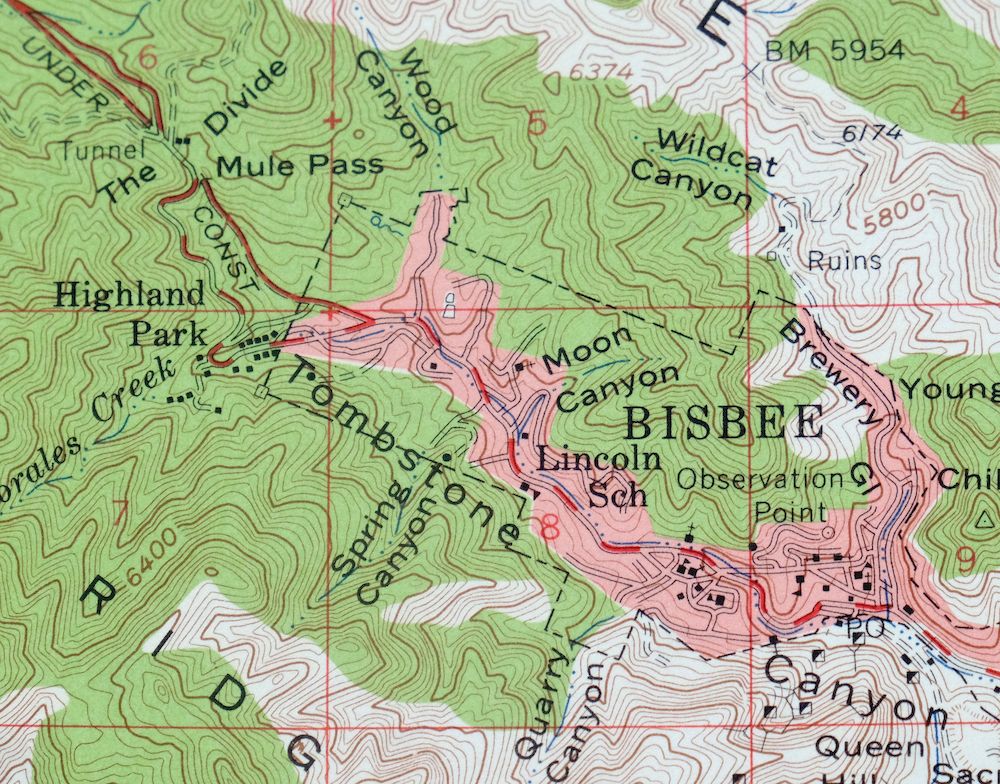
| PRINT NOTES | Thick paper stock, includes woodland tint (green to indicate vegetated areas). A reddish tint is used to indicate urban areas where only landmark buildings are shown. |
| SCALE | 1:62500 |
| CONTOUR INTERVAL | 40 feet |
| SHEET DIMENSIONS | 16 7/8 x 21 inches |
| MAP DIMENSIONS | 15 x 17 1/2 inches |
| COVERAGE AREA | 15 x 17 miles |
| SOURCE | From the vintage map collection of Art Christiansen, Tempe, Arizona |
| MAP NOTES | The Mexico side of the border is not surveyed on this sheet. |
| SHEET CONDITION For maps of this vintage, effort is made to note all visible flaws, no matter how minor. | |
| OVERALL CONDITION | Excellent |
| SHEET NOTES | lightly handled, never folded, very lightly age-toned paper |
| MAP AREA | flawless map area |
| COLLARS | no wear or tears, no markings, very minor blemishes |
| MAP COVERAGE Quadrangle extent overlaid on current basemap. | |
| PLACENAMES Depending on map series and survey date, all of the features listed below may not be shown on this map. This list contains features that currently exist or historically existed within the area covered by the map. The list can be used as a reference to determine if this map covers your area of interest. Placenames are listed alphabetically next to each feature type. | |
| CITIES AND TOWNS (CURRENT) | Bisbee and Naco |
| COUNTIES COVERED | Cochise |
| RIVERS AND STREAMS | Banning Creek and Spring Creek |
| Locations: Banning Toll Station, Bisbee Municipal Golf Course, Briggs Sewage Disposal, Christiansen Ranch, Forrest Ranch, Goat Ranch, Mule Mountain Ranch, Oak Thicket Ranch, Rock Creek Ranch, The Mountain Ranch, Watkins Ranch, and Rancho de Hannon. Mountain Ranges: Mule Mountains. Mountains, Peaks, and Summits: Mount Ballard, Black Knob, Chihuahua Hill, Cintura Hill, Copper King Hill, Fissure Peak, Gold Hill, Grassy Hill, Jones Hill, Knob Hill, Mount Martin, Mural Hill, Naco Hills, Quality Hill, Queen Hill, Red Mountain, Mount Reilly, Sacramento Hill, School Hill, and Youngblood Hill. Valleys and Canyons: Abrigo Canyon, Bolsa Canyon, Brewery Gulch, Copper King Canyon, Dubacher Canyon, Durazo Canyon, Escacado Canyon, Gold Gulch, Hendricks Gulch, Korp Canyon, Little Dry Canyon, Mexican Canyon, Moon Canyon, Moore Canyon, Mule Gulch, Quarry Canyon, Scherer Canyon, Silver Bear Gulch, Spring Canyon, Steele Canyon, Tombstone Canyon, Uncle Sam Gulch, Wildcat Canyon, and Wood Canyon. Parks: Old City Park - Bisbee. Drainages: Glance Creek and Morales Creek. Mines: Bisbee West, Boras Mine, Calumet Mine, Campbell, Cochise, Cole, Cole Number Three, Contact, Copper King, Copper Queen, Dallas, Dern Mine, Easter Sunday Mine, Galena, Glance Mine, Hoatson, Irish Mag, Ivanhoe Mine, Lavender Open Pit Mine, Lovers Leap, Marquette Mine, Night Hawk, Old Bisbee West, Powell, Saginaw, Shattuck, Silver Bear, Sunrise, Superior Mine, Uncle Sam, Wade Hampton Pit Mine, Warren, White Tail Deer, and Wolverine Mines. Buildings: Bisbee City Hall, Bisbee Junction Railroad Station, Bisbee Railroad Station, Cochise County Courthouse, Lorta Railroad Station, United States Custom and Immigration Building, and Warren Railroad Station. Crossings: Brewery Gulch Interchange and West Boulevard Interchange. Bluffs: Bucky O'Neil Hill and Castle Rock. Gaps: Black Gap, The Divide, and Mule Pass. Basins: Wade Hampton Pit. Airports: Bisbee Municipal Airport. Schools: Bisbee High School, Central School, Don Luis School, Greenway School, Horace Mann School, Huachuca Terrace School, Lincoln School, Lowell School, Old Bisbee High School, and Saint Patrick School. Ridges: Art Hill, Bailey Hill, Congdon, Escabrosa Ridge, Higgins Hill, Laundry Hill, Lucky Jack, Mason Hill, Miller Hill, Tank Hill, Warren Hill, and Williams Hill. Flats: Juniper Flats. Tunnels: Crook Tunnel and Mule Pass Tunnel. Towers: KBZB-AM (Bisbee) and KZMK-FM (Bisbee). Springs: Pete Moore Spring. | |
| SHIPPING AND RETURNS | |
 This map sheet will be carefully rolled in a sturdy tube and shipped via the US Postal Service. If you find that the sheet you receive is not as described in the listing, you may ship it back to us for a refund of the purchase price. | |
Bisbee Arizona Naco Mule Mountains USGS 15-Min Topo Map 1959
$48
This USGS 15-minute topographic map of Bisbee, Arizona is a 1958 edition printed in 1959, in excellent condition on thick stock and never folded, with very lightly age-toned paper. Covering a stretch of Cochise County about 85 miles southeast of Tucson, the quad takes in the copper-mining town of Bisbee, the border community of Naco, and the Mule Mountains, with the Mexico side of the border left unsurveyed on this sheet. The Mule Mountains give the quad its rugged character, and the map records the mining country around Bisbee as it stood at the end of the 1950s. From the vintage map collection of Art Christiansen, Tempe, Arizona.
In stock
This vintage sheet is a 1958 edition of the Bisbee Arizona USGS topographic map. It is an original 67-year-old 1959 United States Geological Survey print in excellent condition.
HOW THIS MAP CAN BE USED
In addition to making a fascinating conversation piece, this sheet would look great in a frame or on display, make a unique and prized gift for anyone interested in this area, be perfect as a reference for genealogy studies or general historical research, or fill that missing piece in your collection. Maps of this vintage are printed on durable stock and are well-suited for outdoor activities and recreation of all kinds, including hiking, backpacking, hunting, rafting and kayaking, backcountry skiing, geocaching, general exploration, treasure hunting, etc.
FEATURES SHOWN ON THE MAP
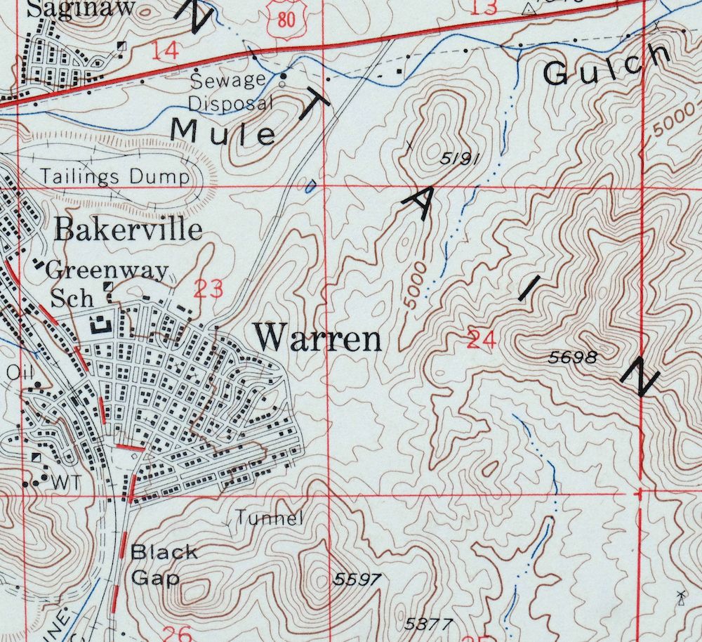
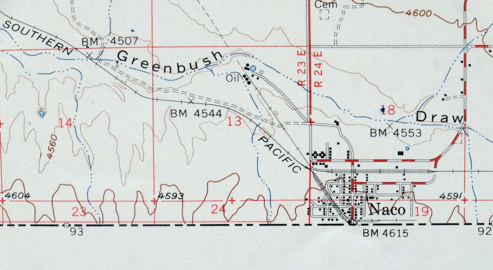
The Bisbee 15-minute map shows cities and towns, roads, railroads, utilities and energy infrastructure, rivers, creeks, elevation contour lines, public land survey lines, county, state, and other administrative boundaries as they existed at the time of the survey in 1956 and 1958. A reddish tint is used on this sheet to indicate urban areas where only landmark buildings are depicted. Outside of those areas, all known structures (houses, businesses, churches, schools, barns, cabins, etc) are shown.
A VALUABLE HISTORICAL RECORD
Maps from the 15-minute series for the continental United States are no longer produced or printed by the USGS and original prints are becoming increasingly difficult to find. They are a valuable historical record for an area, as they contain many placenames and features that have been dropped from more recent maps.
Nearby maps
-
Tombstone Arizona Sierra Vista USGS Topo Map 1959 Vintage
$56 Add to cart -

Sunnyside Arizona Sierra Vista USGS Topo Map 1965 Vintage
$46 Add to cart -
College Peaks Arizona Douglas USGS Topo Map 1959 Vintage
$31 Add to cart -
Lochiel Arizona USGS 15-Min Topographic Map 1965 Vintage
$47 Add to cart -
Benson Arizona Coronado NF St. David USGS Topo Map 1962
$38 Add to cart -
Chiricahua Peak Arizona Coronado NF USGS Topo Map 1962
$38 Add to cart -

Elgin Arizona Patagonia Sonoita USGS Topo Map 1971 Vintage
$52 Add to cart -
Cochise Arizona Willcox USGS 15-Min Topo Map 1963 Vintage
$43 Add to cart -
Empire Mountains Arizona Vail Pantano USGS Topo Map 1961
$47 Add to cart -
Portal Arizona Rodeo USGS 15-Min Topo Map 1963 Vintage
$54 Add to cart -
Nogales Arizona Rio Rico Northeast USGS 15-Min Topo Map 1972
$38 Add to cart -
Cochise Head Arizona USGS 15-Min Topo Map 1957 Vintage
$44 Add to cart -
Animas Peak New Mexico Coronado NF USGS 15-Min Topo Map 1932
$38 Add to cart -
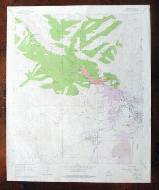
Bisbee Arizona USGS 7.5-Min Topographic Map 1978 Vintage
$40 Add to cart -
Hereford Arizona Sierra Vista USGS Topo Map 1946 Vintage
$45 Add to cart -
Tombstone Arizona Walnut Gulch USGS Topo Map 1964 Vintage
$34 Add to cart -
Pearce Arizona McNeal Gleeson USGS Topo Map 1948 Vintage
$55 Add to cart -
Perilla Arizona Douglas USGS 30-Min Topo Map 1919 Antique
$46 Add to cart -

San Simon Arizona Bowie USGS 30-Min Topo Map 1948 Vintage
$55 Add to cart -

Winchester Mountains Arizona The Mesas USGS Topo Map 1962
$35 Add to cart -

Tucson SE Arizona Rita Ranch Littletown USGS Topo Map 1980
$35 Add to cart -
Bowie Arizona USGS 15-Min Topographic Map 1950 Vintage
$36 Add to cart -

Tucson Arizona Davis-Monthan Tanque Verde USGS Topo Map 1963
$58 Add to cart -
Tucson SW Arizona Summit Sahuarita USGS Topographic Map 1977
$33 Add to cart
