MAP DETAILS | |
|---|---|
| TITLE | Cochise Head |
| STATE | Arizona |
| LOCATION | 30 miles east of Willcox |
| SERIES | 15-minute |
| SURVEYED | 1947 and 1950 Aerial and Field Survey |
| EDITION | 1950 |
| PRINTED | 1957 |
| PRINT NOTES | Thick paper stock, includes woodland tint (green to indicate vegetated areas) |
| SCALE | 1:62500 |
| CONTOUR INTERVAL | 40 feet |
| SHEET DIMENSIONS | 17 x 21 inches |
| MAP DIMENSIONS | 14 7/8 x 17 1/2 inches |
| COVERAGE AREA | 15 x 17 miles |
| SHEET CONDITION For maps of this vintage, effort is made to note all visible flaws, no matter how minor. | |
| OVERALL CONDITION | Excellent |
| SHEET NOTES | very lightly handled, never folded, smooth and flat |
| MAP AREA | flawless map area |
| COLLARS | no wear or tears, no markings, no blemishes, hole punches in left collar |
| MAP COVERAGE Quadrangle extent overlaid on current basemap. | |
| PLACENAMES Depending on map series and survey date, all of the features listed below may not be shown on this map. This list contains features that currently exist or historically existed within the area covered by the map. The list can be used as a reference to determine if this map covers your area of interest. Placenames are listed alphabetically next to each feature type. | |
| COUNTIES COVERED | Cochise |
| FEDERAL LAND UNITS | Chiricahua National Monument, Chiricahua National Monument Wilderness, Coronado National Forest, Dos Cabezas Mountains Wilderness, and Fort Bowie National Historic Site |
| RIVERS AND STREAMS | Big Sand Wash, Bitter Creek, Brad Creek, Cottonwood Creek, East Whitetail Creek, Indian Creek, Keating Creek, Oak Creek, Pinery Creek, South Fork Keating Creek, and West Whitetail Creek |
| WATER BODIES | Government Tank |
| Locations: Alreds Ranch, Analong Ranch, Bear Spring Ranch, Cross J Windmill, Double Z Windmill, East Windmill, Erickson Tank, Faraway Ranch, Fort Bowie Ruins, HYL Ranch, Knape Ranch, Lamberson Ranch, Mulkins Ranch, Ninemile Ranch, Riggs Home Ranch, Shafer Ranch, Stephenson Ranch, and YY Ranch. Areas: Hells Half Acre. Mountains, Peaks, and Summits: Bowie Mountain, Cochise Head, Dug Road Mountain, Dunn Springs Mountain, Emigrant Hills, Helens Dome, Massai Point, Maverick Peak, Red Mountain, Riggs Mountain, Rough Mountain, San Simon Head, Sugarloaf Mountain, Timber Mountain, and Wood Mountain. Valleys and Canyons: Anderson Canyon, Blumberg Canyon, Bonita Canyon, Bear Gulch, Cutoff Canyon, Echo Canyon, Emigrant Canyon, Goodwin Canyon, Little Emigrant Canyon, Little Picket Canyon, Little Wood Canyon, Long Canyon, Lost Canyon, Madrone Canyon, Marble Canyon, Maverick Canyon, Newton Canyon, North Bonita Canyon, Overton Canyon, Picket Canyon, Rhyolite Canyon, Sarah Deming Canyon, Sheep Canyon, Siphon Canyon, South Fork Wood Canyon, Surprise Canyon, Totem Canyon, Willow Gulch Canyon, and Wood Canyon. Parks: Camp Bowie and Chiricahua National Monument. Trails: East White Tail Trail Two Hundred Fiftythree and Emigrant Canyon Trail Two Hundred Fiftyfive. Drainages: Bitter Creek, Big Sand Wash, Brad Creek, Cottonwood Creek, Indian Creek, Little Sand Wash, Ninemile Creek, Pine Creek, and West Whitetail Creek. Mines: King of Lead Mine, Marble Quarry, Silverstrike Mine, and Willie Rose Mine. Bluffs: Inspiration Point and Rattlesnake Point. Gaps: Apache Pass, Bear Spring Pass, Emigrant Pass, and Whitetail Pass. Basins: Buckhorn Basin. Natural Arches: Chiricahua Natural Bridge. Schools: El Dorado School. Ridges: Erickson Ridge and Overlook Ridge. Reservoirs and Tanks: Dickson Tank, Emigrant Tank, Government Tank, Maggie Tank, Pass Tank, Red Tank, and Roosevelt Tank. Flats: Bonita Park, Echo Park, Picket Park, and Wood Canyon Park. Wells: Quillian Well, Red Wing Well, and Whitehouse Well. Pillars: Tevs Rocks. Springs: Apache Spring, Barrel Spring, Bonita Spring, Bear Spring, The Comet Spring, Dunn Spring, Goodwin Spring, Little Wood Spring, Outlaw Spring, Shake Spring, Sheep Canyon Spring, Silver Spur Spring, Silverstrike Spring, and Upper Cherry Spring. | |
| SHIPPING AND RETURNS | |
 This map sheet will be carefully rolled in a sturdy tube and shipped via the US Postal Service. If you find that the sheet you receive is not as described in the listing, you may ship it back to us for a refund of the purchase price. | |
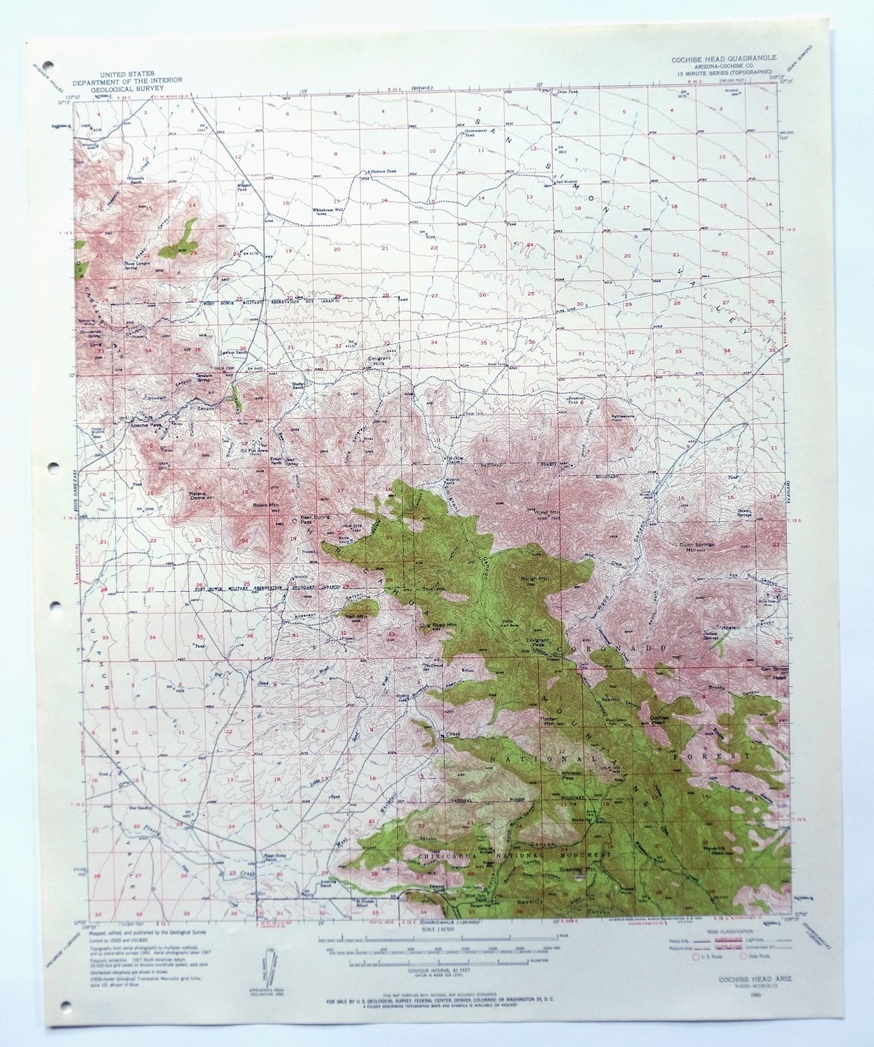
Cochise Head Arizona USGS 15-Min Topo Map 1957 Vintage
$44
This USGS 15-minute topographic map is a 1950 edition printed in 1957, and the sheet is in excellent condition: very lightly handled, never folded, smooth and flat, with a flawless map area and hole punches in the left collar. Covering a stretch of Cochise County about 30 miles east of Willcox, the quad takes in part of the Chiricahua Mountains country, including portions of Coronado National Forest, Chiricahua National Monument, and the Dos Cabezas Mountains Wilderness. Printed on thick stock and never creased, the sheet lies flat, and its 40-foot contours trace the rugged high country around Cochise Head that gives the quad its name.
In stock
This vintage sheet is a 1950 edition of the Cochise Head Arizona USGS topographic map. It is an original 69-year-old 1957 United States Geological Survey print in excellent condition.
HOW THIS MAP CAN BE USED
In addition to making a fascinating conversation piece, this sheet would look great in a frame or on display, make a unique and prized gift for anyone interested in this area, be perfect as a reference for genealogy studies or general historical research, or fill that missing piece in your collection. Maps of this vintage are printed on durable stock and are well-suited for outdoor activities and recreation of all kinds, including hiking, backpacking, hunting, rafting and kayaking, backcountry skiing, geocaching, general exploration, treasure hunting, etc.
FEATURES SHOWN ON THE MAP
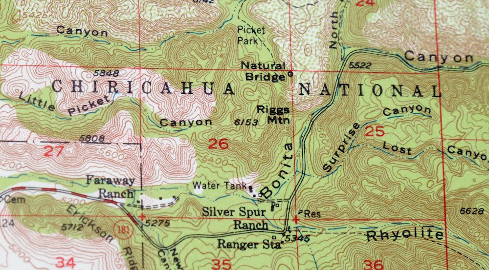
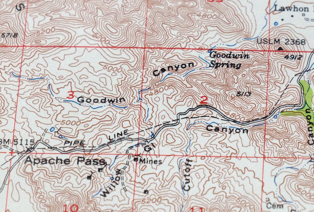
The Cochise Head 15-minute map shows cities and towns, roads, railroads, utilities and energy infrastructure, rivers, creeks, elevation contour lines, public land survey lines, county, state, and other administrative boundaries as they existed at the time of the survey in 1947 and 1950. All known structures (houses, businesses, churches, schools, barns, cabins, etc) are also shown.
A VALUABLE HISTORICAL RECORD
Maps from the 15-minute series for the continental United States are no longer produced or printed by the USGS and original prints are becoming increasingly difficult to find. They are a valuable historical record for an area, as they contain many placenames and features that have been dropped from more recent maps.
Nearby maps
-
Bowie Arizona USGS 15-Min Topographic Map 1950 Vintage
$36 Add to cart -
Chiricahua Peak Arizona Coronado NF USGS Topo Map 1962
$38 Add to cart -
Portal Arizona Rodeo USGS 15-Min Topo Map 1963 Vintage
$54 Add to cart -
Cochise Arizona Willcox USGS 15-Min Topo Map 1963 Vintage
$43 Add to cart -
Animas Peak New Mexico Coronado NF USGS 15-Min Topo Map 1932
$38 Add to cart -

Winchester Mountains Arizona The Mesas USGS Topo Map 1962
$35 Add to cart -
College Peaks Arizona Douglas USGS Topo Map 1959 Vintage
$31 Add to cart -

Safford Arizona Thatcher Solomon USGS Topo Map 1980 Vintage
$44 Add to cart -
Tombstone Arizona Sierra Vista USGS Topo Map 1959 Vintage
$56 Add to cart -

Bisbee Arizona Naco Mule Mountains USGS 15-Min Topo Map 1959
$48 Add to cart -
Benson Arizona Coronado NF St. David USGS Topo Map 1962
$38 Add to cart -

San Simon Arizona Bowie USGS 30-Min Topo Map 1948 Vintage
$55 Add to cart -
Pearce Arizona McNeal Gleeson USGS Topo Map 1948 Vintage
$55 Add to cart -
Tombstone Arizona Walnut Gulch USGS Topo Map 1964 Vintage
$34 Add to cart -
Bisbee Arizona USGS 7.5-Min Topographic Map 1978 Vintage
$40 Add to cart -
Perilla Arizona Douglas USGS 30-Min Topo Map 1919 Antique
$46 Add to cart -
Empire Mountains Arizona Vail Pantano USGS Topo Map 1961
$47 Add to cart -

Morenci Arizona Clifton Blue River USGS 30-Min Topo Map 1954
$64 Add to cart -

Klondyke Arizona USGS 15-Min Topographic Map 1971 Vintage
$44 Add to cart -

Sunnyside Arizona Sierra Vista USGS Topo Map 1965 Vintage
$46 Add to cart -
Hereford Arizona Sierra Vista USGS Topo Map 1946 Vintage
$45 Add to cart -

Elgin Arizona Patagonia Sonoita USGS Topo Map 1971 Vintage
$52 Add to cart -

Tucson SE Arizona Rita Ranch Littletown USGS Topo Map 1980
$35 Add to cart -
Mogollon New Mexico Pleasanton Mule Creek USGS Topo Map 1964
$54 Add to cart