MAP DETAILS | |
|---|---|
| TITLE | South Wayne |
| STATE | Wisconsin, Illinois |
| LOCATION | Vicinity of Warren, 40 miles southwest of Madison |
| SERIES | 15-minute |
| SURVEYED | 1921 Field Survey |
| GEOGRAPHER | C.H. Birdseye |
| ENGRAVED | 1922 |
| EDITION | 1923 |
| PRINTED | 1923 |
| PRINT NOTES | Thick paper stock |
| SCALE | 1:62500 |
| CONTOUR INTERVAL | 20 feet |
| SHEET DIMENSIONS | 16 1/2 x 20 inches (approximate) |
| MAP DIMENSIONS | 12 7/8 x 17 1/2 inches |
| COVERAGE AREA | 13 x 17 miles |
| SHEET CONDITION For maps of this vintage, effort is made to note all visible flaws, no matter how minor. | |
| OVERALL CONDITION | Excellent |
| SHEET NOTES | very lightly handled, never folded, lightly age-toned sheet, smooth and flat |
| MAP AREA | flawless map area |
| COLLARS | no wear or tears, no markings, no blemishes |
| MAP COVERAGE Quadrangle extent overlaid on current basemap. | |
| BACKSIDE LEGEND | |
 A map summary is printed on the back side of the South Wayne sheet similar to the one shown in the picture. It outlines the history, purpose, and status of the USGS mapping program at the time of the printing in 1923. It also provides instructions on how to read contour lines and a description of how they are used to depict the terrain. At the bottom of the page is a legend showing all of the symbols used to represent the cultural, relief, and water features found on the map. | |
| PLACENAMES Depending on map series and survey date, all of the features listed below may not be shown on this map. This list contains features that currently exist or historically existed within the area covered by the map. The list can be used as a reference to determine if this map covers your area of interest. Placenames are listed alphabetically next to each feature type. | |
| CITIES AND TOWNS (CURRENT) | Argyle, Browntown, South Wayne, Warren, Winslow, Wiota, and Woodford |
| COUNTIES COVERED | Green, Jo Daviess, Lafayette, and Stephenson |
| RIVERS AND STREAMS | Apple Branch, Braezels Branch, Brennan Creek, Brown Branch Spafford Creek, Cherry Branch, Dougherty Creek, East Branch Pecatonica River, Feather Branch, Honey Creek, Indian Creek, Jordan Creek, Lovett Creek, Mud Branch, Pecatonica River, Prairie Brook, Silver Spring Creek, Skinner Creek, Smock Creek, Spafford Creek, Trotter Branch, Turtle Creek, Whiteside Creek, and Yellowstone River |
| WATER BODIES | Beckman Lake 4, Hidden Valley Lake 1, and Horseshoe Lake |
| Wisconsin Locations: Five Corners and Jordan Center. Administrative Boundaries: Town of Adams, Town of Argyle, Village of Argyle, Village of Browntown, Town of Cadiz, Town of Jordan, Village of South Wayne, Town of Wayne, and Town of Wiota. Valleys and Canyons: Jockey Hollow and Puddledock Hollow. Drainages: Apple Branch, Brown Branch Spafford Creek, Braezels Branch, Brennan Creek, Cherry Branch, Dougherty Creek, East Branch Pecatonica River, Feather Branch, Jordan Creek, Mud Branch, Prairie Brook, Silver Spring Creek, Skinner Creek, Smock Creek, Spafford Creek, Trotter Branch, Turtle Creek, Whiteside Creek, Winn Creek, Yellowstone River, and Zander Creek. Churches: Apple Grove Lutheran Church, Jordan Church, Saint Francis Church, Saint Pauls Church, and West Wiota Church. Lakes and Ponds: Horseshoe Lake and Zander Lake. Dams: Beckman Lake E12.237 Dam. Bridges: Lattice Bridge. Schools: Argyle High School, Blaisdell School, Cadiz Center School, Black Hawk High School, Cherry Branch School, Dobbs School, Engebretson School, Everson School, Hawley School, Jennings School, Mud Hollow School, Porter School, Rush School, Van Meter School, Watson School, Wayne Center School, West Wayne School, and Zion School. Reservoirs and Tanks: Beckman Lake 4. | |
| Illinois Drainages: Spafford Creek. | |
| SHIPPING AND RETURNS | |
 This map sheet will be carefully rolled in a sturdy tube and shipped via the US Postal Service. If you find that the sheet you receive is not as described in the listing, you may ship it back to us for a refund of the purchase price. | |
South Wayne Wisconsin Argyle Wiota USGS Topographic Map 1923
$54
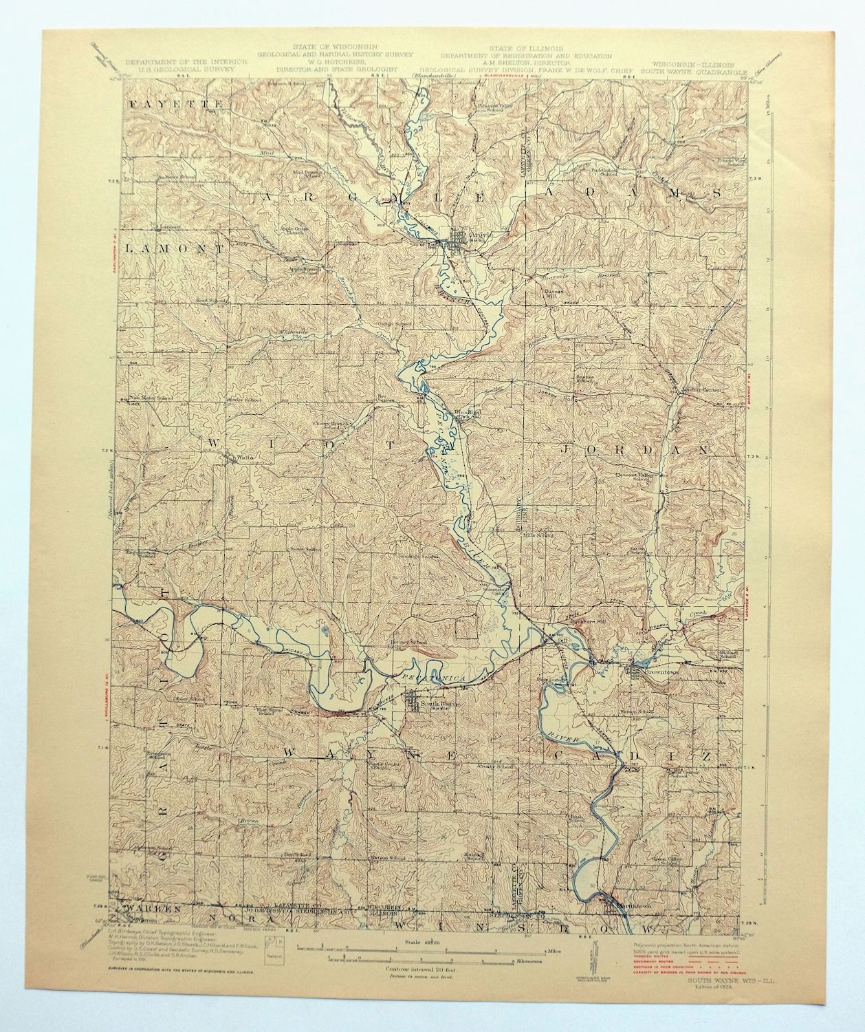
Printed in its first year of publication, 1923, this USGS 15-minute topographic sheet is in excellent condition, with a never-folded, smooth and flat sheet on thick stock that survives with only light age-toning and a flawless map area. The quad straddles the Wisconsin-Illinois line southwest of Madison near Warren, taking in Argyle and South Wayne on the Wisconsin side and Winslow, Browntown, and Woodford within its boundaries, with parts of Green, Lafayette, Jo Daviess, and Stephenson counties. Drawn from a 1921 field survey and engraved in 1922 under geographer C.H. Birdseye, it records the farm country and river valleys of this border region as they were mapped in the early 1920s.
In stock
This antique sheet is a 1923 edition of the South Wayne Wisconsin USGS topographic map. It is an authentic 103-year-old United States Geological Survey print in excellent condition.
HOW THIS MAP CAN BE USED
In addition to making a fascinating conversation piece, this sheet would look great in a frame or on display, make a unique and prized gift for anyone interested in this area, be perfect as a reference for genealogy studies or general historical research, or fill that missing piece in your collection.
FEATURES SHOWN ON THE MAP
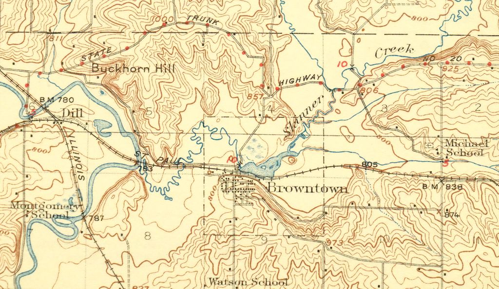
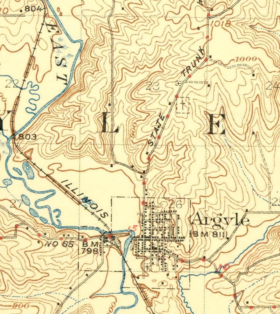
The South Wayne 15-minute map shows cities and towns, roads, railroads, rivers, creeks, elevation contour lines, public land survey lines, county, state, and other administrative boundaries as they existed at the time of the survey in 1921. All known structures (houses, businesses, churches, schools, barns, cabins, etc) are also shown, with exceptions in some urban areas, where only landmark buildings may be shown.
A VALUABLE HISTORICAL RECORD
Maps from the 15-minute series for the continental United States are no longer produced or printed by the USGS and original prints are becoming increasingly difficult to find. They are a valuable historical record for an area, as they contain many placenames and features that have been dropped from more recent maps.
Nearby maps
-

Brodhead Wisconsin Orfordville Albany USGS Topo Map 1910
$80 Add to cart -
Evansville Wisconsin Madison Fitchburg USGS Topo Map 1925
$43 Add to cart -

Cross Plains Wisconsin Madison Middleton USGS Topo Map 1942
$25 Add to cart -
Forreston Illinois Freeport Shannon USGS Topo Map 1972
$14 Add to cart -

Shopiere Wisconsin Janesville Clinton USGS Topo Map 1910
$85 Add to cart -

Denzer Wisconsin Baraboo West Baraboo USGS Topo Map 1929
$77 Add to cart -
Lancaster Wisconsin Dubuque Asbury USGS Topographic Map 1953
$30 Add to cart -

Briggsville Wisconsin Portage Lake Delton USGS Topo Map 1931
$37 Add to cart -
Oconomowoc Wisconsin Waukesha Plat USGS Topographic Map 1947
$26 Add to cart -

Woodhull Illinois Wataga Windsor USGS Topo Map 1947 Vintage
$20 Add to cart -
Evanston Illinois Chicago USGS 7.5-Min Topo Map 1964 Vintage
$31 Add to cart -
Blue Island Illinois Chicago Posen USGS Topographic Map 1965
$28 Add to cart -
Jackson Park Illinois Chicago USGS Topo Map 1973 Vintage
$36 Add to cart -
Harvey Illinois Chicago Heights Dolton USGS Topo Map 1965
$46 Add to cart -
Lake Calumet Illinois Chicago Hammond USGS Topo Map 1966
$35 Add to cart -
Calumet City Illinois Harvey USGS Topographic Map 1970
$45 Add to cart -

Whitehall Wisconsin Arcadia Independence USGS Topo Map 1929
$38 Add to cart -
La Harpe Illinois Stronghurst Raritan USGS Topo Map 1918
$49 Add to cart -
Colchester Illinois Plymouth Tennessee USGS Topo Map 1913
$25 Add to cart -
Springfield East Illinois Sherman USGS Topo Map 1973 Vintage
$32 Add to cart -

Quincy Illinois Hannibal Payson USGS Topo Map 1962 Vintage
$43 Add to cart -
1968 Bar Lake Michigan USGS Topo Map: Manistee NF
$25 Add to cart -
Raymond Illinois Farmersville Waggoner USGS Topo Map 1925
$46 Add to cart -

Pearl Illinois Kampsville Eldred USGS Topo Map 1956 Vintage
$40 Add to cart