MAP DETAILS | |
|---|---|
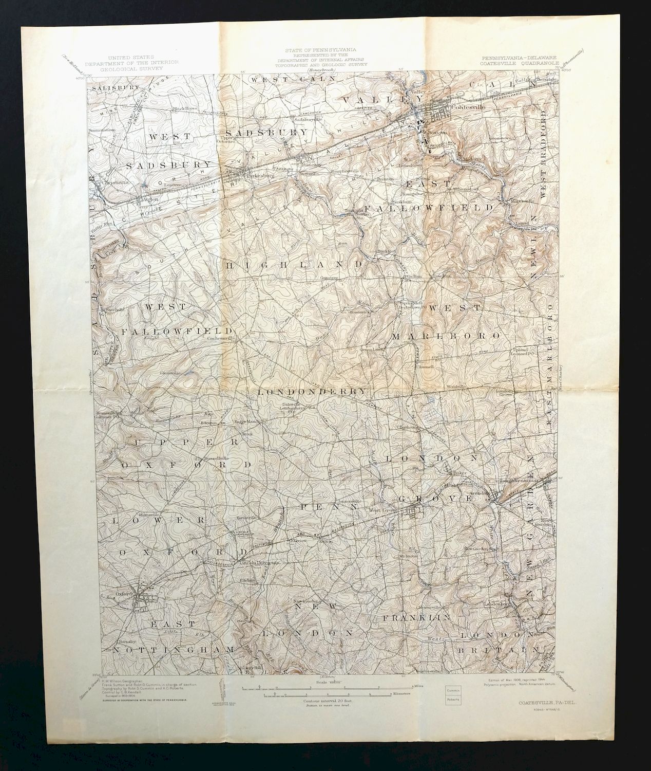
| TITLE | Coatesville |
| STATE | Pennsylvania, Delaware |
| LOCATION | 40 miles west of Philadelphia |
| SERIES | 15-minute |
| SURVEYED | 1903 and 1904 Field Survey |
| GEOGRAPHER | H.M. Wilson |
| EDITION | 1906 |
| PRINTED | 1944 |
| PRINT NOTES | Thick paper stock |
| SCALE | 1:62500 |
| CONTOUR INTERVAL | 20 feet |
| SHEET DIMENSIONS | 16 1/2 x 20 inches (approximate) |
| MAP DIMENSIONS | 13 3/8 x 17 1/2 inches |
| COVERAGE AREA | 13 x 17 miles |
| SHEET CONDITION For maps of this vintage, effort is made to note all visible flaws, no matter how minor. | |
| OVERALL CONDITION | Good |
| SHEET NOTES | midsheet horizontal foldline (in half), minor age toning along foldlines |
| MAP AREA | no markings |
| COLLARS | very minor wear or tears, no markings |
| MAP COVERAGE Quadrangle extent overlaid on current basemap. | |
| BACKSIDE LEGEND | |
 A map summary is printed on the back side of the Coatesville sheet similar to the one shown in the picture. It outlines the history, purpose, and status of the USGS mapping program at the time of the printing in 1944. It also provides instructions on how to read contour lines and a description of how they are used to depict the terrain. At the bottom of the page is a legend showing all of the symbols used to represent the cultural, relief, and water features found on the map. | |
| PLACENAMES Depending on map series and survey date, all of the features listed below may not be shown on this map. This list contains features that currently exist or historically existed within the area covered by the map. The list can be used as a reference to determine if this map covers your area of interest. Placenames are listed alphabetically next to each feature type. | |
| CITIES AND TOWNS (CURRENT) | Atglen, Avondale, Chatham, Christiana, Coatesville, Cochranville, Ercildoun, Gap, Homeville, Jennersville, Kelton, Landenberg, Lincoln University, Modena, New London, North Star, Oxford, Parkesburg, Pomeroy, Russellville, Sadsburyville, South Coatesville, Thorndale, Toughkenamon, and West Grove |
| COUNTIES COVERED | Chester, Lancaster, and New Castle |
| RIVERS AND STREAMS | Annan Run, Big Elk Creek, Birch Run, Broad Run, Buck Run, Dennis Run, Doe Run, East Branch Octoraro Creek, East Branch White Clay Creek, Egypt Run, Glen Run, Hodgson Run, Indian Run, Knight Run, Knott Run, Little Elk Creek, McDonald Run, Middle Branch White Clay Creek, Pine Creek, Rock Run, South Brook, Trout Run, Tweed Creek, Valley Creek, Valley Run, Walnut Run, Ways Run, West Branch Big Elk Creek, West Branch Brandywine Creek, West Branch Red Clay Creek, West Branch White Clay Creek, and White Clay Creek |
| WATER BODIES | Green Valley Farms Lake |
| Pennsylvania Locations: Camp Saginaw, Doe Run Station, Gum Tree, Highland, Loch Nairn Golf Course, London Grove, Modena Station, New Garden Station, Oxford Mall, Rock Run, and Valley Station. Administrative Boundaries: Borough of Atglen, Borough of Avondale, Township of Caln, Borough of Christiana, City of Coatesville, Township of East Fallowfield, Township of Franklin, Township of Highland, Township of London Britain, Township of London Grove, Township of Londonderry, Township of Lower Oxford, Borough of Modena, Township of New Garden, Township of New London, Borough of Oxford, Borough of Parkesburg, Township of Penn, Township of Sadsbury, Township of Sadsbury, Borough of South Coatesville, Township of Upper Oxford, Township of Valley, Township of West Caln, Township of West Fallowfield, Borough of West Grove, and Township of West Marlborough. Drainages: Annan Run, Birch Run, Broad Run, Buck Run, Dennis Run, Doe Run, East Branch Big Elk Creek, Egypt Run, Glen Run, Indian Run, Knight Run, Knott Run, McDonald Run, Middle Branch White Clay Creek, Officers Run, Pine Creek, Rattlesnake Run, Rock Run, Sucker Run, Trout Run, Valley Creek, Valley Run, Walnut Run, West Branch Big Elk Creek, and West Branch White Clay Creek. Churches: Beulah Church, Doe Run Church, Friendship Church, Hozannah Church, Maple Grove Church, Penns Grove Church, Saint Francis Xavier Church, Saint Malachi Church, and Zion Hill Church. Hospitals: Highland Medical Center. Buildings: Black Horse Tavern and Maccabees Home. Dams: Beaver Dam, Buck Run Dam, Green Valley Farms Dam, Kurtz Dam, Parkesburg Iron Company Dam, Rock Run Dam, and Rockby Dam. Airports: Caln Township Heliport, Chester County/G O Carlson Airport, Ginns Airport, Harris Airport, Kelton Airport, New Garden Flying Field, New London Airport, and The New Garden Flying Field. Schools: Bonsall School, Carl O Benner Elementary School, Auburn School, Avon Grove High School, Buena Vista School, Caln Elementary School, Caln Township School, Charlton School, Chester County Area Vocational Technical School, Chestnut Grove School, Coatesville Area Senior High School, Cream School, East Fallowfield Elementary School, Elkview School, Franklin School, Gordon Middle School, Hickory Hill School, Jordan Bank Hopewell Elementary School, Lincoln University, Maple Grove School, Media School, New London Academy, North Bank School, Nottingham Elementary School, Oak Grove School, Octorara Middle and High School, Oxford Area High School, Oxford Area Middle School, Parkesburg School, Penns Grove School, Pleasant View School, Preton Hall School, Rainbow Elementary School, Rattlesnake Run School, Scott High School, South Brandywine Middle School, and West Fallowfield School. Reservoirs and Tanks: Green Valley Farms Lake and Lake Kurtz. Towers: WLIU-FM (Lincoln University). Pillars: Oxford Press Church Spire. | |
| Delaware | |
| Delaware None | |
| SHIPPING AND RETURNS | |
 This map sheet will be carefully rolled in a sturdy tube and shipped via the US Postal Service. If you find that the sheet you receive is not as described in the listing, you may ship it back to us for a refund of the purchase price. | |
Coatesville Pennsylvania Oxford USGS Topographic Map 1944
$36
This USGS 15-minute topographic sheet is a 1906 edition printed in 1944, and it survives in good condition on thick stock, with a midsheet horizontal foldline and minor age toning along the foldlines. Mapped from a 1903 and 1904 field survey at a scale of 1:62,500, it takes in a stretch of southern Chester County about 40 miles west of Philadelphia, with Coatesville, Parkesburg, Oxford, and West Grove within the quad boundaries, and the coverage reaches south to the Delaware state line in New Castle County. Lincoln University, one of the country’s early historically Black colleges, sits within this quad’s boundaries, a detail that gives the sheet a particular tie to the area’s history.
In stock
This vintage sheet is a 1906 edition of the Coatesville Pennsylvania USGS topographic map. It is an original 82-year-old 1944 United States Geological Survey print in good condition.
HOW THIS MAP CAN BE USED
In addition to making a fascinating conversation piece, this sheet would look great in a frame or on display, make a unique and prized gift for anyone interested in this area, be perfect as a reference for genealogy studies or general historical research, or fill that missing piece in your collection.
FEATURES SHOWN ON THE MAP
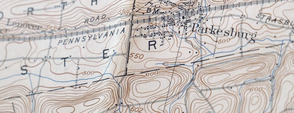
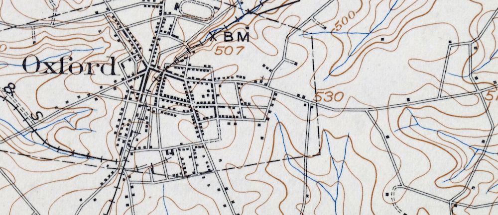
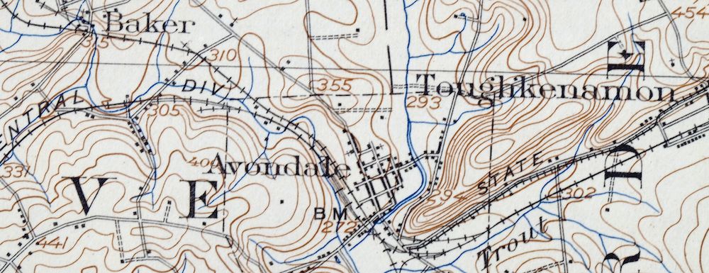
The Coatesville 15-minute map shows cities and towns, roads, railroads, rivers, creeks, elevation contour lines, public land survey lines, county, state, and other administrative boundaries as they existed at the time of the survey in 1903 and 1904. All known structures (houses, businesses, churches, schools, barns, cabins, etc) are also shown, with exceptions in some urban areas, where only landmark buildings may be shown.
A VALUABLE HISTORICAL RECORD
Maps from the 15-minute series for the continental United States are no longer produced or printed by the USGS and original prints are becoming increasingly difficult to find. They are a valuable historical record for an area, as they contain many placenames and features that have been dropped from more recent maps.
Nearby maps
-

Quarryville Pennsylvania Oxford USGS Topographic Map 1944
$53 Add to cart -

Honey Brook Pennsylvania Thorndale USGS Topographic Map 1962
$49 Add to cart -

New Holland Pennsylvania Ephrata Akron USGS Topo Map 1962
$48 Add to cart -

Lancaster Pennsylvania Columbia Lititz USGS Topo Map 1943
$58 Add to cart -

Wernersville Pennsylvania Mohnton USGS Topographic Map 1963
$45 Add to cart -
Germantown Pennsylvania Horsham USGS Topographic Map 1912
$125 Add to cart -

Quakertown Pennsylvania Lansdale Perkasie USGS Topo Map 1911
$120 Add to cart -

Hummelstown Pennsylvania Hershey Palmyra USGS Topo Map 1965
$37 Add to cart -

Burlington Pennsylvania Trenton USGS Topographic Map 1958
$49 Add to cart -

Lykens Pennsylvania Valley View Reinerton USGS Topo Map 1964
$45 Add to cart -

Carlisle Pennsylvania Schlusser USGS Topographic Map 1964
$45 Add to cart -
Dover Delaware Bombay Hook NWR Middletown USGS Topo Map 1906
$47 Add to cart -

Tolchester Maryland Dundalk Essex USGS Topo Map 1908 Antique
$145 Add to cart -
Vineland New Jersey Dover Millville USGS Topo Map 1905
$115 Add to cart -
Rancocas New Jersey Vineland Lindenwold USGS Topo Map 1913
$135 Add to cart -

Patapsco Maryland Baltimore Jessup USGS Topographic Map 1908
$195 Add to cart -

Trenton New Jersey Philadelphia Levittown USGS Topo Map 1907
$150 Add to cart -

Hazleton Pennsylvania Lansford Tamaqua USGS Topo Map 1956
$48 Add to cart -

Catawissa Pennsylvania Bloomsburg Ashland USGS Topo Map 1960
$45 Add to cart -

Hazleton Pennsylvania McAdoo Jeddo USGS Topographic Map 1962
$47 Add to cart -

Dennisville New Jersey Villas Woodbine USGS Topo Map 1910
$90 Add to cart -
Whiting New Jersey Barnegat Toms River USGS Topo Map 1907
$115 Add to cart -

Newville Pennsylvania Shippensburg USGS 15-Min Topo Map 1959
$40 Add to cart -

New Brunswick New Jersey Spotswood Edison USGS Topo Map 1965
$32 Add to cart
