MAP DETAILS | |
|---|---|
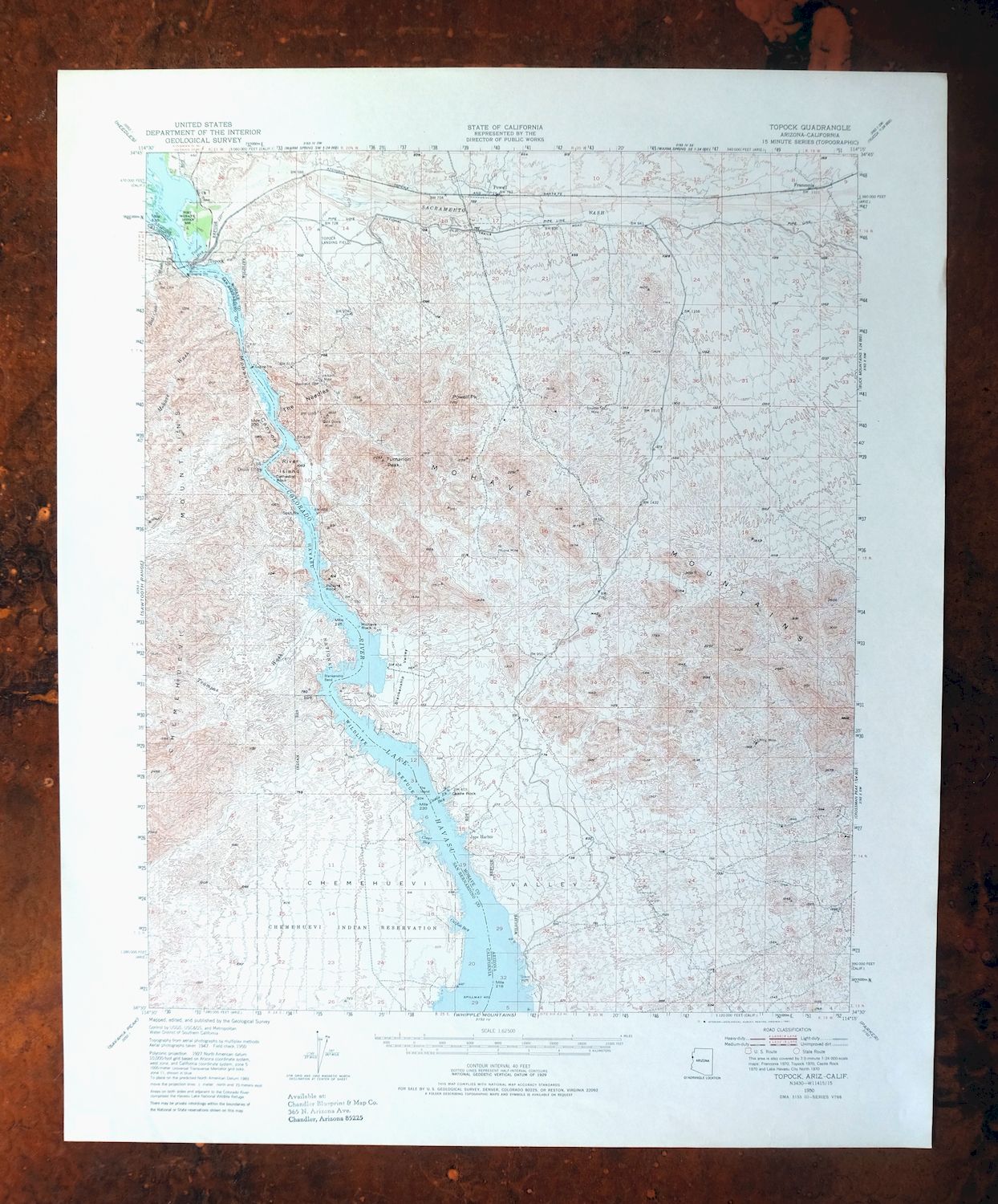
| TITLE | Topock |
| STATE | Arizona, California |
| LOCATION | Vicinity of Lake Havasu City |
| SERIES | 15-minute |
| SURVEYED | 1947 and 1950 Aerial and Field Survey |
| EDITION | 1950 |
| PRINTED | 1981 |
| PRINT NOTES | Thick paper stock, includes woodland tint (green to indicate vegetated areas) |
| SCALE | 1:62500 |
| CONTOUR INTERVAL | 40 feet |
| SHEET DIMENSIONS | 18 x 22 inches |
| MAP DIMENSIONS | 14 3/8 x 17 1/2 inches |
| COVERAGE AREA | 14 x 17 miles |
| SOURCE | From the vintage map collection of Art Christiansen, Tempe, Arizona |
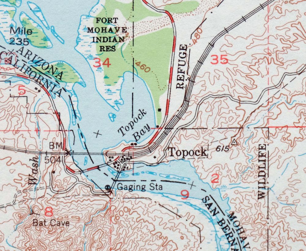
| MAP NOTES | A fascinating historical snapshot of the Colorado River from Topock Bay to the north side of present-day Lake Havasu City, surveyed before the existence of Interstate 40 and Lake Havasu City. |
| SHEET CONDITION For maps of this vintage, effort is made to note all visible flaws, no matter how minor. | |
| OVERALL CONDITION | Excellent |
| SHEET NOTES | lightly handled, never folded, smooth and flat |
| MAP AREA | flawless map area |
| COLLARS | no wear or tears, no markings, no blemishes, small inventory stamp on bottom left collar |
| MAP COVERAGE Quadrangle extent overlaid on current basemap. | |
| PLACENAMES Depending on map series and survey date, all of the features listed below may not be shown on this map. This list contains features that currently exist or historically existed within the area covered by the map. The list can be used as a reference to determine if this map covers your area of interest. Placenames are listed alphabetically next to each feature type. | |
| CITIES AND TOWNS (CURRENT) | Desert Hills, Franconia, Lake Havasu City, and Topock |
| COUNTIES COVERED | Mohave and San Bernardino |
| FEDERAL LAND UNITS | Chemehuevi Indian Reservation, Chemehuevi Mountains Wilderness, Havasu National Wildlife Refuge, and Havasu Wilderness |
| RIVERS AND STREAMS | Agua Wash, Avalon Drain, Bat Cave Wash, Colorado River, El Dorado Wash, Falls Springs Wash, Franconia Wash, Havasupai Wash, Hillside Drain, Indian Peak Wash, Iroquois Wash, Mohave Wash, Neptune Wash, Palmtree Wash, Palo Verde Wash, Sacramento Wash, San Juan Drain, Smoketree Wash, Topock Bay, and Warm Springs Wash |
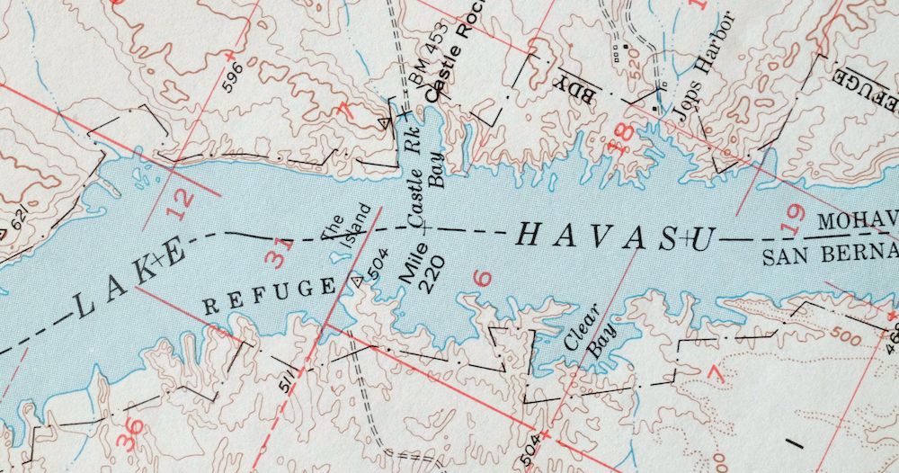
| WATER BODIES | Lake Havasu and Topock Marsh |
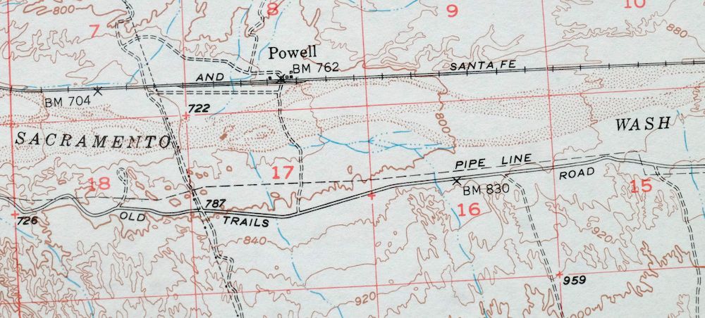
| Arizona Locations: Powell. Mountain Ranges: Mohave Mountains. Mountains, Peaks, and Summits: Cathedral Rock, Powell Peak, Pulpit Rock, and Tumarion Peak. Valleys and Canyons: Mohave Canyon and Topock Gorge. Drainages: Atlantic Drain, Avalon Drain, Falls Springs Wash, Franconia Wash, Havasupai Wash, Hillside Drain, Kiowa Drain, Neptune Wash, Palmtree Wash, Sacramento Wash, Sage Drain, San Juan Drain, Sandwood Drain, and Warm Springs Wash. Islands: Mohave Rock and River Island. Mines: Boulder Mine, Gold Dome Mine, Jackpot Mine, Wing Mine, and Yucca Mine. Buildings: Powell Railroad Station. Bends: Blankenship Bend. Bays: Castle Rock Bay, Jops Harbor, and Topock Bay. Basins: Blankenship Valley and Picture Rock. Airports: Lake Havasu City Airport. Schools: Havasupai Elementary School. Towers: KBBC-FM (Lake Havasu City). Pillars: Castle Rock and The Needles. Springs: Jackpot Spring. | |
| California Reserves: Chemehuevi Indian Reservation. Mountains, Peaks, and Summits: Split Rock. Valleys and Canyons: Mohave Canyon and Topock Gorge. Parks: Havasu National Wildlife Refuge. Drainages: Bat Cave Wash, Mohave Wash, and Trampas Wash. Islands: The Island. Waterfalls: Red Rock Falls. Bridges: Red Rock Bridge. Bends: Devils Elbow. Bays: Catfish Bay and Clear Bay. Airports: Chemehuevi Valley Airport. | |
| SHIPPING AND RETURNS | |
 This map sheet will be carefully rolled in a sturdy tube and shipped via the US Postal Service. If you find that the sheet you receive is not as described in the listing, you may ship it back to us for a refund of the purchase price. | |
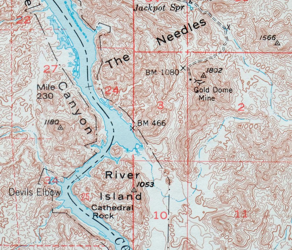
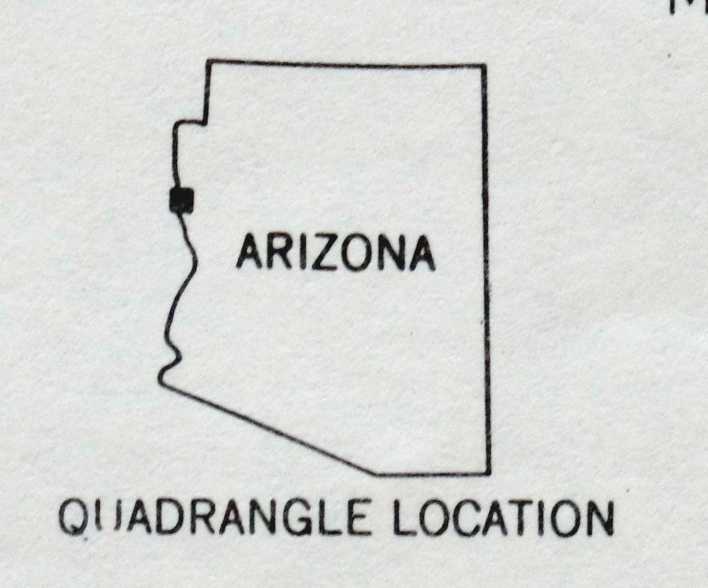
Topock Arizona Lake Havasu City Franconia USGS Topo Map 1981
$50
This 1950 edition of the Topock quad, printed in 1981 on thick stock, is in excellent condition, lightly handled and never folded, smooth and flat with a flawless map area and only a small inventory stamp on the bottom left collar. Part of the 15-minute series, it follows the Colorado River along the Arizona–California line where the quad crosses into both Mohave and San Bernardino counties, taking in the area of Topock, Franconia, and the north side of present-day Lake Havasu City, along with portions of the Havasu National Wildlife Refuge and the Chemehuevi Indian Reservation. The base edition captures the river country before Interstate 40 was built and before Lake Havasu City had taken shape, so the landscape it shows predates much of what defines the area today; this sheet comes from the vintage map collection of Art Christiansen of Tempe, Arizona.
In stock
This vintage sheet is a 1950 edition of the Topock Arizona USGS topographic map. It is an original 45-year-old 1981 United States Geological Survey print in excellent condition.
HOW THIS MAP CAN BE USED
In addition to making a fascinating conversation piece, this sheet would look great in a frame or on display, make a unique and prized gift for anyone interested in this area, be perfect as a reference for genealogy studies or general historical research, or fill that missing piece in your collection. Maps of this vintage are printed on durable stock and are well-suited for outdoor activities and recreation of all kinds, including hiking, backpacking, hunting, rafting and kayaking, backcountry skiing, geocaching, general exploration, treasure hunting, etc.
FEATURES SHOWN ON THE MAP
The Topock 15-minute map shows cities and towns, roads, railroads, utilities and energy infrastructure, rivers, creeks, elevation contour lines, public land survey lines, county, state, and other administrative boundaries as they existed at the time of the survey in 1947 and 1950. All known structures (houses, businesses, churches, schools, barns, cabins, etc) are also shown.
A VALUABLE HISTORICAL RECORD
Maps from the 15-minute series for the continental United States are no longer produced or printed by the USGS and original prints are becoming increasingly difficult to find. They are a valuable historical record for an area, as they contain many placenames and features that have been dropped from more recent maps.
Nearby maps
-

Needles Arizona Mohave Valley USGS Topo Map 1968 Vintage
$38 Add to cart -
Yucca Arizona Black Mountains USGS Topo Map 1947 Vintage
$45 Add to cart -
Castaneda Hills Arizona USGS 15-Min Topo Map 1967 Vintage
$30 Add to cart -
Ives Peak Arizona USGS 15-Min Topographic Map 1967 Vintage
$34 Add to cart -
Kingman SE Arizona Griffith USGS Topographic Map 1968
$32 Add to cart -
Kingman NW Arizona Golden Valley USGS Topo Map 1968 Vintage
$25 Add to cart -
Kingman Arizona Hualapai Mountains Harris USGS Topo Map 1980
$28 Add to cart -
Camp Mohave Arizona El Dorado WSA Kingman USGS Topo Map 1920
$74 Add to cart -
White Hills Arizona Dolan Springs USGS Topo Map 1980 Vintage
$36 Add to cart -

Quartzsite Arizona USGS 15-Min Topographic Map 1971 Vintage
$44 Add to cart -

Gladden Arizona Aguila Valley USGS Topographic Map 1971
$30 Add to cart -

Diamond Creek Arizona Grand Canyon Nelson USGS Topo Map 1927
$130 Add to cart -
Hope Arizona Salome USGS 15-Min Topographic Map 1967 Vintage
$35 Add to cart -
Sheridan Mountain Arizona Sycamore Creek USGS Topo Map 1978
$35 Add to cart -
Trigo Peaks Arizona Dome Rock Mountains USGS Topo Map 1955
$37 Add to cart -
Camp Wood Arizona Prescott NF USGS Topographic Map 1949
$32 Add to cart -

Black Canyon Arizona Lake Mead NRA USGS 15-Min Topo Map 1974
$35 Add to cart -
Garnet Mountain Arizona Meadview USGS Topo Map 1966 Vintage
$30 Add to cart -
Cibola Arizona Palo Verde Trigo Mountains USGS Topo Map 1961
$41 Add to cart -

Congress Arizona Yarnell Wilhoit USGS Topo Map 1948 Vintage
$38 Add to cart -

Simmons Arizona Paulden Williamson USGS 15-Min Topo Map 1964
$42 Add to cart -

Virgin Basin Arizona Lake Mead USGS Topo Map 1972 Vintage
$43 Add to cart -

Red Hill Arizona Castle Dome Plain USGS Topographic Map 1955
$42 Add to cart -
Picacho Butte Arizona Chino Valley USGS 15-Min Topo Map 1950
$24 Add to cart
