MAP DETAILS | |
|---|---|
| TITLE | Diamond Creek |
| STATE | Arizona |
| LOCATION | Grand Canyon National Park, vicinity of Kingman |
| SERIES | 60-minute |
| SURVEYED | 1876 through 1884 Field Survey |
| GEOGRAPHER | Henry Gannett |
| EDITION | 1892 |
| PRINTED | 1927 |
| PRINT NOTES | Thick paper stock |
| SCALE | 1:250000 |
| CONTOUR INTERVAL | 250 feet |
| SHEET DIMENSIONS | 16 1/2 x 20 inches |
| MAP DIMENSIONS | 14 1/4 x 17 1/2 inches |
| COVERAGE AREA | 56 x 69 miles |
| SOURCE | From the vintage map collection of Art Christiansen, Tempe, Arizona |
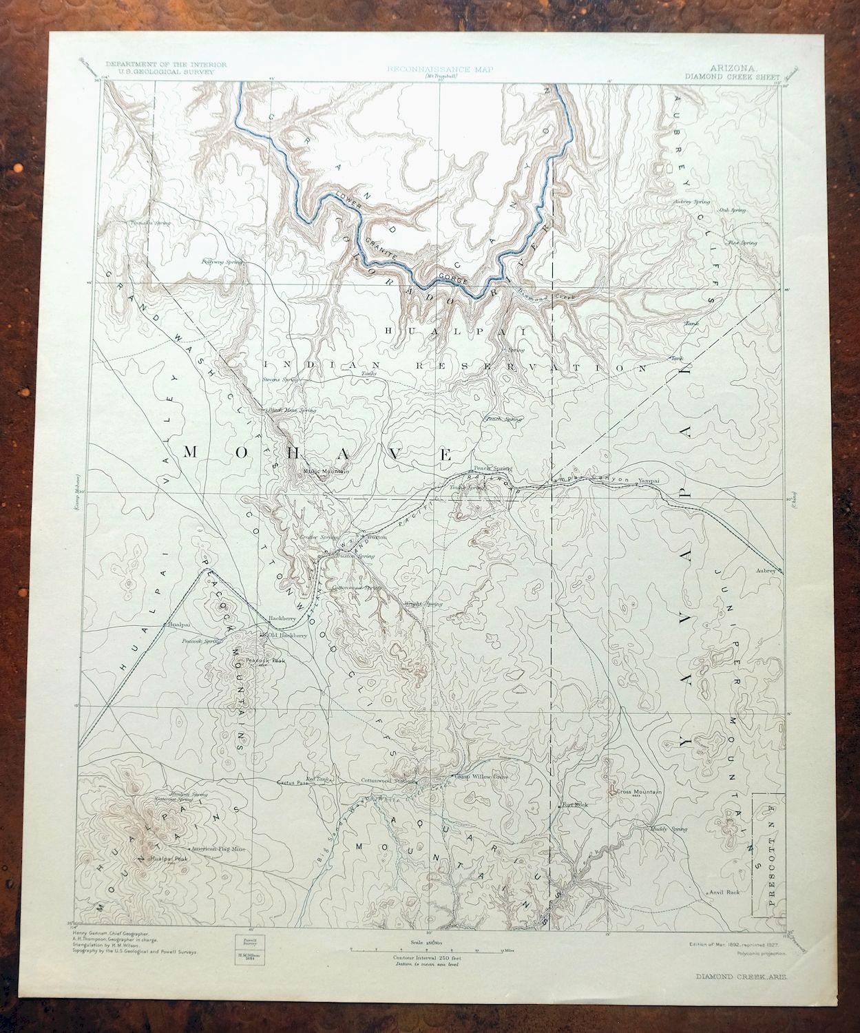
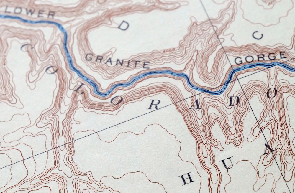
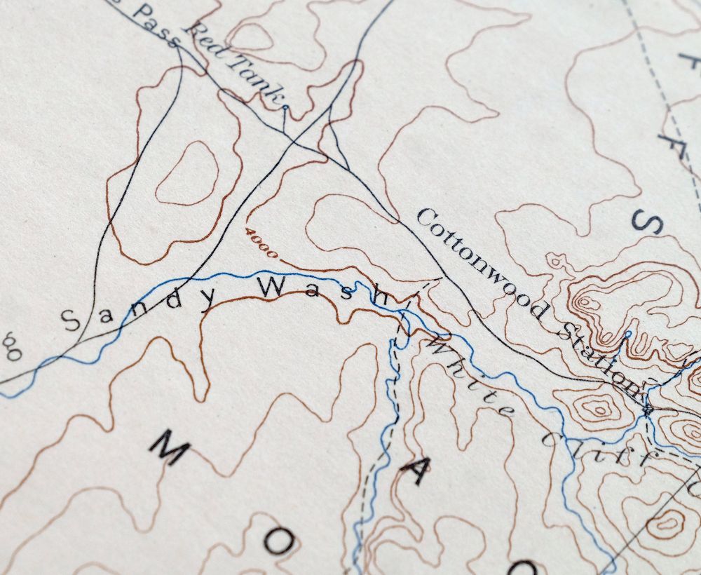
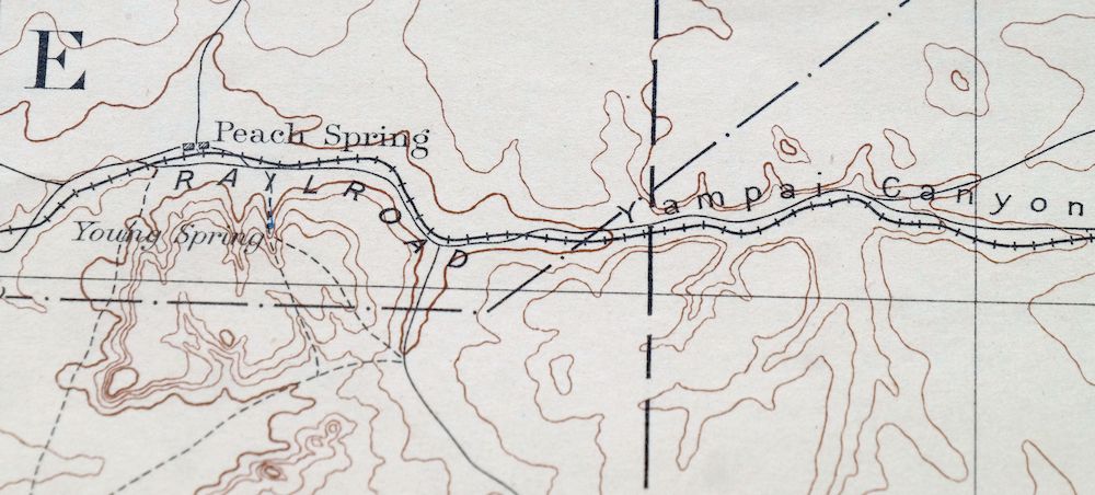
| MAP NOTES | A historical snapshot of Peach Springs and the Granite Gorge of the Grand Canyon, including the Atlantic and Pacific Railroad along present-day Route 66, with the north half mapped from the Powell Survey. |
| SHEET CONDITION For maps of this vintage, effort is made to note all visible flaws, no matter how minor. | |
| OVERALL CONDITION | Excellent |
| SHEET NOTES | lightly handled, never folded |
| MAP AREA | no wear, no markings, no blemishes |
| COLLARS | no markings, no blemishes, very minor edge tears with archival quality repair |
| MAP COVERAGE Quadrangle extent overlaid on current basemap. | |
| BACKSIDE LEGEND | |
 A map summary is printed on the back side of the Diamond Creek sheet similar to the one shown in the picture. It outlines the history, purpose, and status of the USGS mapping program at the time of the printing in 1927. It also provides instructions on how to read contour lines and a description of how they are used to depict the terrain. At the bottom of the page is a legend showing all of the symbols used to represent the cultural, relief, and water features found on the map. | |
| PLACENAMES Depending on map series and survey date, all of the features listed below may not be shown on this map. This list contains features that currently exist or historically existed within the area covered by the map. The list can be used as a reference to determine if this map covers your area of interest. Placenames are listed alphabetically next to each feature type. | |
| CITIES AND TOWNS (CURRENT) | Berry, Hackberry, Kingman, Nelson, New Kingman-Butler, Peach Springs, Truxton, Valentine, and Walapai |
| COUNTIES COVERED | Coconino, Mohave, and Yavapai |
| FEDERAL LAND UNITS | Grand Canyon National Park, Grand Canyon National Park Wilderness Study Area, Grand Canyon-Parashant National Monument, Hualapai Indian Reservation, Lake Mead National Recreation Area, Prescott National Forest, and Wabayuma Peak Wilderness |
| RIVERS AND STREAMS | Albers Wash, Antelope Wash, Ash Creek, Bottleneck Wash, Cedar Wash, Colorado River, Cottonwood Creek, Cow Creek, Diamond Creek, East Ash Creek, Fork Rock Creek, Frees Wash, Hackberry Wash, Iron Spring Wash, Jackman Wash, Kabba Wash, Kingman Wash, Knight Creek, Left Hand Moss Wash, Lookout Wash, Lost Creek, Lost Man Creek, Markham Wash, McGarrys Wash, Moss Wash, Mount Hope Tank, Muddy Creek, Peach Springs Wash, Peacock Wash, Reference Point Creek, Salt Creek, Thornton Wash, Timber Wash, Trout Creek, Truxton Wash, Tuckayou Wash, Two Hundred and Fifteenmile Creek, Two Hundred and Fourteenmile Creek, Two Hundred and Twentytwo Mile Creek, Walnut Creek, Wheeler Wash, Willow Creek, and Yellow Flower Creek |
| WATER BODIES | Box Canyon Tank Number Two, Jeff Tank, Laguna Lake, Lake Mead, Mud Tank, New Water Tank, Plain Tank, Red Lake, Sage Tank, and Shipping Pasture Tank |
| Locations: Anvil Rock Ranch, Bottleneck Windmill, Camp Levi Levi, Camp Stephens, Canyon Viewpoint, D S Ranch, D-W Ranch, Deer Lodge, Dennys Ranch, Diamond Bar Ranch, Dutton Ranch, E L Camp, End Water Corral, Fort Rock Ranch, Getz Ranch, H-Ranch, Hackberry, Henifin Ranch, Hualapai Valley Joshua Trees, Hyde Park, Indian Health Station, Lady Y U Ranch, Long Mountain Ranch, New Water Line Camp, Odle Ranch, Pica Camp, Pickett Corral, Quartermaster View Point, Rock House, Round Valley Ranch, Stonys Cabin, Truxton, Valentine, Windmill Ranch, and X Bar One Ranch. Areas: Potato Patch and Twenty Pine Burn. Mountain Ranges: Aquarius Mountains, Cottonwood Mountains, Music Mountains, and Peacock Mountains. Reserves: Hualapai Indian Reservation and Hualapai Indian School Reserve. Mountains, Peaks, and Summits: Anvil Rock, Austin Peak, Biscuit Hill, Blue Mountain, Black Mesa, Black Mountain, Cherokee Point, Cross Mountain, Dean Peak, Devils Hump, Diamond Peak, Farrel Mountain, Hayden Peak, Hualapai Peak, Indian Head, Laughing Jack Butte, Long Mountain, Peacock Peak, Penitentiary Mountain, Pony Mesa, Price Point, Prospect Point, Rattlesnake Hill, Slate Mountain, Snow Mountain, Squaw Peak, Sugarloaf Peak, Three Sisters, Thumb, Tin Mountain, Tower of Babylon, Twin Buttes, and West Mesa. Arroyos and Washes: Cherokee Wash, Dividing Canyon, Markham Wash, Muddy Canyon, and Peacock Wash. Valleys and Canyons: Barks Canyon, Blue Mountain Canyon, Blye Canyon, Box Canyon, Bridge Canyon, Bull Canyon, Burnt Canyon, Cedar Basin Canyon, Clay Tank Canyon, Crater Canyon, Diamond Canyon, Dripping Springs Canyon, East Fork Wright Canyon, Fall Canyon, Faught Canyon, Gneiss Canyon, Granite Park Canyon, Granite Spring Canyon, Grapevine Canyon, Green Spring Canyon, Hells Canyon, Hidden Wash, Hindu Canyon, Hope Wash, Horse Canyon, Horse Flat Canyon, Horse Spring Canyon, Hualapai Canyon, Hualapai Valley, Indian Canyon, Jackson Canyon, Jeff Canyon, Laguna Valley, Ledge Canyon, Little Purcell Canyon, McGee Wash, Meriwhitica Canyon, Milkweed Canyon, Mohon Canyon, Munds Canyon, Nelson Canyon, Palomino Draw, Peach Springs Canyon, Pine Canyon, Price Canyon, Quartermaster Canyon, Red Horn Canyon, Red Lake Draw, Rhodes Canyon, Robbers Roost Canyon, Rock Canyon, Round Valley, Row Water Canyon, Separation Canyon, Sewer Canyon, Soap Canyon, Spencer Canyon, Surprise Canyon, Three Springs Canyon, Trail Canyon, Travertine Canyon, Truxton Canyon, Twin Spring Canyon, Two Hundred and Ninemile Canyon, Two Hundred and Seventeenmile Canyon, Two Hundred and Twentyeightmile Canyon, Two Hundred and Twentyfour Mile Canyon, Two Hundred and Twentymile Canyon, West Fork Separation Canyon, West Water Canyon, Wright Canyon, and Yampai Canyon. Parks: Hualapai Mountain County Park and Mesquite Springs Campground. Drainages: Antelope Wash, Ash Creek, Bottleneck Wash, Cottonwood Creek, Cow Creek, Diamond Creek, East Ash Creek, Fork Rock Creek, Frees Wash, Hackberry Wash, Iron Spring Wash, Jackman Wash, Kabba Wash, Lookout Wash, Lost Creek, Lost Man Creek, McGarrys Wash, Muddy Creek, Muddy Wash, Peach Springs Wash, Reference Point Creek, Salt Creek, Thornton Wash, Timber Wash, Tuckayou Wash, Two Hundred and Fifteenmile Creek, Two Hundred and Fourteenmile Creek, Two Hundred and Twentytwo Mile Creek, Vock Wash, Wheeler Wash, and Willow Creek. Islands: Pyramid Rock. Mines: Alabama Mine, Century Mine, Copper Giant Mine, Dean Mine, Democrat Mine, Enterprise Mine, Flag Mine, Frost Mine, Gold King Mine, Hackberry Mine, Kabba Mine, Keystone Extension Mine, Merlo Mine, Mica Giant Mine, Music Mountain Mine, North Hackberry Mine, Old Bonnie Tunnel, Snyder Mine, Standard Mineral Mine, Sunshine Mine, Victoria Mine, and Walkover Mine. Lakes and Ponds: Horse Lake, Laguna Lake, Meadow Lake, Pine Lake, Red Lake, and Tom Bacon Lake. Buildings: Audley Railroad Station, Berry Railroad Station, Crozier Railroad Station, Hackberry Railroad Station, Nelson Railroad Station, Peach Springs Railroad Station, Pica Railroad Station, Truxton Railroad Station, Valentine Railroad Station, Walapai Railroad Station, and Yampai Railroad Station. Waterfalls: Travertine Falls. Dams: AIC Dam, Big Dam, Buck Dam, Cofer Dam, Cooksie Dam, Corner Dam, Cross Mountain Dam, Dam Number One, Dam Number Two, Dead Horse Dam, Greeley Dam, Hay Dam, Lucky Dam, Slurry Pond Number One Dam, Soto Dam, and W F Cattle Company Dam. Crossings: Hualapai Interchange and Round Valley Interchange. Bluffs: Amos Point, Cottonwood Cliffs, Grand Wash Cliffs, Kelly Point, and Lava Cliff. Gaps: Yampai Divide. Basins: Cedar Basin, Cornwall Basin, Dinner Pocket, and Whiskey Basin. Natural Arches: Natural Bridge. Airports: Grand Canyon Caverns Airport, Grand Canyon West Airport, Hualapai Airport, Kingman Airport, Peach Springs Airport, Transwestern Pipeline Number One Airport, X Bar One Ranch Airstrip, X Bar One Ranch Lower Airport, and X-1 Ranch Upper Headquarters Airport. Schools: Hackberry Elementary School, Miller School, and Valentine Elementary School. Ridges: Prospect Ridge. Reservoirs and Tanks: Airport Tank, Albers Tank, Antelope Tank, Apache Tank, Audley Tank, B Flat Tank, Babylon Tank, Bacon Tank, Badger Flat Tank, Basin Tank, Beecher Tank, Bender Tank, Biscuit Hill Tank, Black Canyon Tank, Black Tank, Blue Mountain Tank, Blye Tank, Bear Canyon Two Hundred Ninety-Nine Trail, Bear Tank, Berry Tank, Berry Tank Number Two, Big Chief Tank, Big Purcell Tank, Boston Tank, Boulder Tank, Box Canyon Tank, Box Canyon Tank Number Two, Broken Dam Tank, Brown Basin Tank, Bryce Tank, Buck Tanks, Bull Pasture Tank, Butch Nichols Tank, Butte Tank, Camel Tank, Caufman Tank, Cedar Basin Tank, Celedonio Tank, Charley Tank, Cherokee Tank, Circle Tank, Clay Tank, Cole Campbell Tank, Company Tank, Conejo Tank, Cook Tank, Copper Tank, Corral Tank, Crack Tank, Crater Tank, Crozier Tank, D S Ranch Tank, Dead Cow Tank, Deer Flat Tank, Deer Tank, Devils Hump Tank, Dividing Canyon Tank, Dutchman Tank, Eagle Tank, East Jack Tank, East New Water Tank, East Tank, Easter Tank, Fence Line Tank, Field Tank, Fields Tank, Foo Tank, Franks Tank, Fred Cook Tank, Freeway Tank, Gabriel Tank, Gnat Tank, Gosney Tank, Government Tank, Grapevine Tank, Greeley Tank, Gus Tank, Hackberry Tank, Hanson Tank, Hasken Tank, Hay Fever Tank, Hazen Tank, Hells Canyon Tank, Henry Brown Tank, Hidden Valley Tank, Hodges Tank, Hoggy John Tank, Honeymoon Tank, Hooker Tank, Horse Flat Tank, Hualapai Reservoir, Indian Tank, Jack Webb Tank, Jackson Tank, Jake McCain Tank, Jamison Tank, Jean Entz Tank, Jeff Tank, Jim Smith Tanks, Joe Entz Tank, Johns Tank, Jolly Place Tank, Kelly Tanks, Kirk Tank, Lagoon Tank, Last Chance Tank, Last Minute Well, Lemonade Tank, Limestone Tank, Lindburg Tank, Lion Tank, Little Dam North Tank, Little Jeff Tank, Little Phil Tank, Little Purcell Tank, Little Soto Tank, Little South Tank, Lost Creek Reservoir, Lost Tank, Lower Badger Tank, Lower Bald Mountain Tank, Lower Laguna Tank, Maggie Dam, Mapes Tank, Marshall Tank, Maveric Tank, Meriwhitica Tank, Metuck Tank, Mexican Tank, Mohon Tank, Mud Tank, Munds Tank, Natural Tank, Nelson Tank, New Limestone Tank, New Mud Tank, New Water Tank, North Blye Tank, North Horse Flat Tank, North Iron Gate Tank, North Laguna Tank, North Split Tank, North Tank, Northwest Boundary Tank, Norton Tank, Number Five Trough, Number Two Tanks, Oak Tank, Oakes Tank, Old Limestone Tank, Old Miller Tank, One More Day Tank, Orejana Dam, Park Tank, Pasture Three Tank, Penitentiary Tanks, Pet Tank, Pine Tank, Pinnacle Tank, Pipeline Tank, Plain Tank, Pocket Tank, Pothole Tank, Prospect Tank, Quail Tank, Red Hill Tank, Red Lake Tank, Red Rock Tank, Red Tank, Reservation Tank, Rincon Tank, Roadside Tank, Robbers Roost Tank, Rock Tank, Rodger Tank, Rose Tank, Rucker Tank, Sage Tank, Sand Trap Tank, Section One Well, Section Tank, Seven Tank, Shanley Tank, Shipley Tank, Shipping Pasture Tank, Short Creek Tank, Shorty Davis Tank, Silt Tank, Siple Tank, Six Tank, Slats Tank, Slurry Pond Number One, Small Tank, Smith Tank, Smith and Evans Tank, Soto Dam Tank, South Blye Tank, South Iron Gate Tank, South Tank, Starkweather Tank, Steel Tank, Sugarbowl Tank, Sugarloaf Tank, Thompson Tank, Thornton Tank, Three Sisters Tank, Topside Reservoir, Trail Tank, Trap Tank, Trible Tank, Turkey Tank, Twentyone Tank, Twin Tanks, Upper Bald Mountain Tank, Valley Tank, Walkover Tank, West Jack Tank, West Tank, Wheeler Tank, White Rock Tank, Willow Tank, Windy Roberts Tank, Windy Tank, Wooden Tower Tank, Wright Canyon Tank, X I Tank, Yampai Tank, and Youth Camp Tank. Rapids: Bridge Canyon Rapids, Devils Slide Rapids, Diamond Creek Rapids, Gneiss Canyon Rapids, Granite Spring Rapids, Last Chance Rapids, Lava Cliff Rapids, Lost Creek Rapids, Reference Point Rapids, Roadrunner Rapids, Separation Rapids, Surprise Rapids, Travertine Rapids, Triumphal Arch Rapids, Two Hundred and Fortymile Rapids, Two Hundred and Fortyone Mile Rapids, Two Hundred and Seventeen Mile Rapids, Two Hundred and Thirtyfour Mile Rapids, Two Hundred and Thirtyone Mile Rapids, Two Hundred and Thirtyseven Mile Rapids, Two Hundred and Thirtytwo Mile Rapids, Two Hundred and Twentyfour Mile Rapids, Wards Cove Rapids, and Waterfall Rapids. Flats: Badger Flat, Granite Park, Horse Flat, Indian Gardens, Plain Tank Flat, and Red Lake Flat. Towers: KGMN-FM (Kingman), KZZZ-FM (Kingman), and Thornton Lookout Tower. Plains and Plateaus: Seventyfour Plains. Wells: Antelope Well, Badger Flat Windmill, Barney Well, Black Mountain Well, Broken Foot Well, Camp Well, Carl F Well, Coyote Well, Dripping Springs Well, Dry Well, E L Well, Esther F Well, Ferichs Well, Five Wells, Frazier Wells, Frerichs Well, Henifin Well, Indian Well, Jones Well, Limestone Well, Maggie Well, Markham Well, Misery Well, Munds Well, New Water Well, New Well, Norton Well, Well Number Five, Well Number Five, Well Number Four, Well Number Four, Well Number One, Well Number Three, Well Number Twenty One, Old Well, Pasa Robles Well, Red Lake Well, Ruth Cowden Well, Section Eight Well, Shipley Well, Stokes Well, Thumb Rock Well, Timber-Antelope Well, Tin Barn Well, West Well, White Rock Well, and X I Well. Springs: Alkali Spring, Amos Spring, Antler Spring, Arroweed Spring, Barrel Spring, Black Rock Spring, Blackjack Spring, Blue Mud Spring, Bobby Spring, Big Spring, Black Inky Spring, Bull Spring, Burn Spring, Campos Water Spring, Casa Grande Spring, Cedar Spring, Cement Tank, Chalk Spring, Clay Springs, Cornwall Basin Spring, Cottonwood Spring, Cow Creek Spring, Coyote Spring, Crescent Spring, Crozier Canyon Spring, Crozier Spring, Dewey Mahone Spring, Diamond Creek Spring, Diamond Spring, Faculty Springs, Falls Spring, Flat Rock Spring, Fred Jackson Spring, Grande Spring, Grapevine Spring, Green Waterhole Spring, Harding Spring, Hells Canyon Spring, Hillside Springs, Hockey Puck Spring, Horse Trough Spring, Hualapai Spring, Iron Spring, Jackman Spring, Knight Creek Spring, Kohinoor Spring, Ledge Spring, Limestone Spring, Lion Kill Spring, Little Cottonwood Spring, Lower Ledge Spring, Lower Peach Springs, Lower Water Spring, Meriwhitica Springs, Mesquite Spring, Mesquite Thicket Spring, Metuck Springs, Middle Water Spring, Milkweed Spring, Mine Spring, Mud Spring, Mulberry Spring, New Water Spring, New Years Cabin Spring, North Burn Spring, North Water Spring, Peach Springs, Penitentiary Spring, Pine Spring, Pocomate Springs, Pole Corral Spring, Price Pocket, Quartermaster Springs, Ray Cowden Tank, Red Horn Spring, Red Spring, Row Water Spring, Schoolhouse Spring, Shack Spring, Shanley Spring, Sheep Spring, Sheepcamp Spring, Spencer Springs, Stone Corral Spring, Surprise Springs, Tinnaka Spring, Trap Spring, Truxton Spring, Upper Grapevine Spring, Upper Live Water Spring, Upper Moss Spring, Upper Pine Spring, Walnut Creek Mine Spring, Walnut Spring, West Water Spring, Whiskey Spring, White Spring, Wild Cow Spring, Wilder Springs, Willow Spring, Yellow Flower Spring, and Yellow Pine Spring. | |
| SHIPPING AND RETURNS | |
 This map sheet will be carefully rolled in a sturdy tube and shipped via the US Postal Service. If you find that the sheet you receive is not as described in the listing, you may ship it back to us for a refund of the purchase price. | |
Diamond Creek Arizona Grand Canyon Nelson USGS Topo Map 1927
$130
This USGS Reconnaissance Topo Map is a 60-minute sheet, first published in 1892 and printed in 1927, in excellent condition on thick stock, lightly handled and never folded. It takes in a wide stretch of northwestern Arizona at 1:250,000, from the Granite Gorge of the Grand Canyon south toward Kingman, with the quad area including Peach Springs, Truxton, Valentine, Hackberry, and part of the Hualapai Indian Reservation. The listing notes that the sheet traces the Atlantic and Pacific Railroad along what is now Route 66, with its north half mapped from the Powell Survey and the work carried out under geographer Henry Gannett. Its collar shows very minor edge tears with archival-quality repair, and the reverse carries printed reference material about the mapping program of the era. This sheet comes from the vintage map collection of Art Christiansen of Tempe, Arizona.
In stock
This antique sheet is an 1892 edition of the Diamond Creek Arizona USGS topographic map. It is an authentic 99-year-old 1927 United States Geological Survey print in excellent condition.
HOW THIS MAP CAN BE USED
In addition to making a fascinating conversation piece, this sheet would look great in a frame or on display, make a unique and prized gift for anyone interested in this area, be perfect as a reference for genealogy studies or general historical research, or fill that missing piece in your collection.
FEATURES SHOWN ON THE MAP
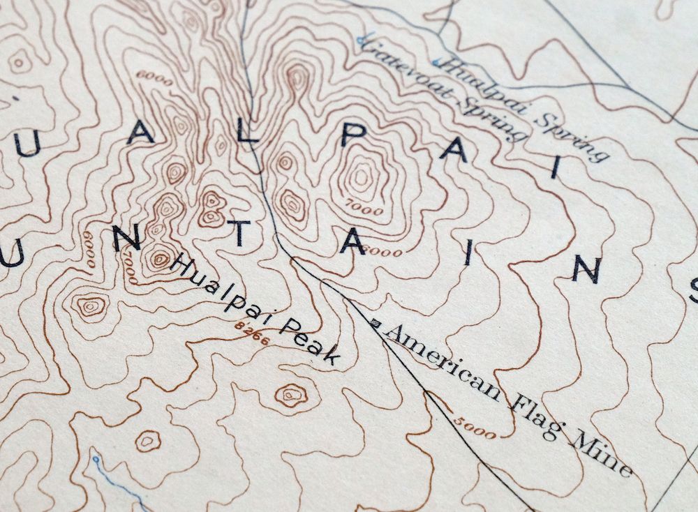
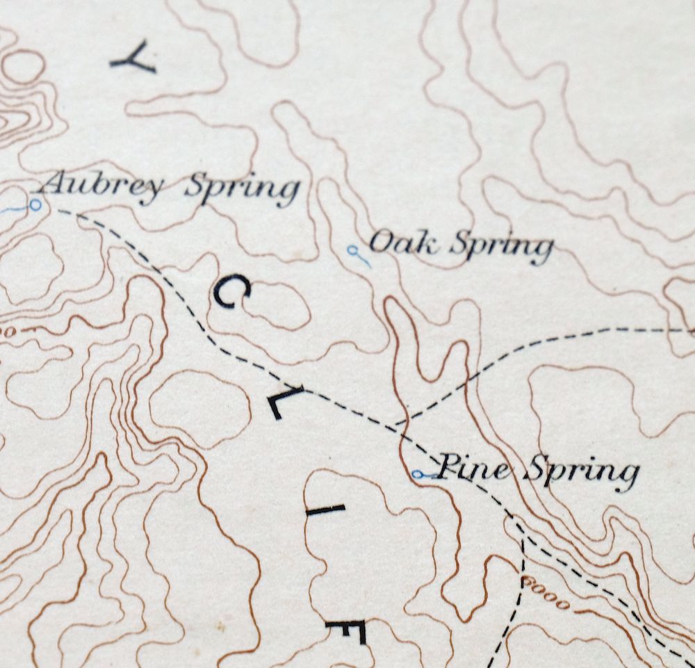
The Diamond Creek 60-minute map shows cities and towns, roads, railroads, rivers, creeks, elevation contour lines, public land survey lines, county, state, and other administrative boundaries as they existed at the time of the survey in 1876 through 1884.
A VALUABLE HISTORICAL RECORD
Maps from the 60-minute series have been out of print for many years. They have never been common and original prints are increasingly difficult to find. Only about 85 quadrangles (covering about 10% of the continental US) were mapped in this series, all in western states. For the limited areas where the 60-minute map was produced, it was generally a product of the very first USGS survey done for that area. These quadrangles are a valuable historical record, as they contain many placenames and features that have been dropped from more recent series’ and editions.
Nearby maps
-
Camp Mohave Arizona El Dorado WSA Kingman USGS Topo Map 1920
$74 Add to cart -
Echo Cliffs Arizona Tuba City Page USGS 60-Min Topo Map 1913
$48 Add to cart -

Tusayan Arizona Winslow Dilkon USGS Topo Map 1901 Antique
$65 Add to cart -
Marsh Pass Arizona Kayenta Pinon USGS Topo Map 1922 Antique
$74 Add to cart -
Beaver Utah Dixie NF Fishlake NF USGS Topo Map 1921 Antique
$63 Add to cart -
Kingman Arizona Hualapai Mountains Harris USGS Topo Map 1980
$28 Add to cart -
Garnet Mountain Arizona Meadview USGS Topo Map 1966 Vintage
$30 Add to cart -
Kingman SE Arizona Griffith USGS Topographic Map 1968
$32 Add to cart -
Kingman NW Arizona Golden Valley USGS Topo Map 1968 Vintage
$25 Add to cart -
White Hills Arizona Dolan Springs USGS Topo Map 1980 Vintage
$36 Add to cart -
Yucca Arizona Black Mountains USGS Topo Map 1947 Vintage
$45 Add to cart -
Camp Wood Arizona Prescott NF USGS Topographic Map 1949
$32 Add to cart -
Picacho Butte Arizona Chino Valley USGS 15-Min Topo Map 1950
$24 Add to cart -

National Canyon Arizona Grand Canyon USGS Topo Map 1964
$37 Add to cart -

Virgin Basin Arizona Lake Mead USGS Topo Map 1972 Vintage
$43 Add to cart -

Simmons Arizona Paulden Williamson USGS 15-Min Topo Map 1964
$42 Add to cart -
Supai Arizona USGS 15-Min Topographic Map 1970 Vintage
$41 Add to cart -

Black Canyon Arizona Lake Mead NRA USGS 15-Min Topo Map 1974
$35 Add to cart -
Ash Fork Arizona Kaibab NF Prescott NF USGS Topo Map 1978
$44 Add to cart -
Sheridan Mountain Arizona Sycamore Creek USGS Topo Map 1978
$35 Add to cart -
Tuckup Canyon Arizona Grand Canyon USGS 15-Min Topo Map 1974
$35 Add to cart -

Needles Arizona Mohave Valley USGS Topo Map 1968 Vintage
$38 Add to cart -

Topock Arizona Lake Havasu City Franconia USGS Topo Map 1981
$50 Add to cart -
Valle Arizona Kaibab Quivero USGS Topo Map 1964 Vintage
$28 Add to cart
