MAP DETAILS | |
|---|---|
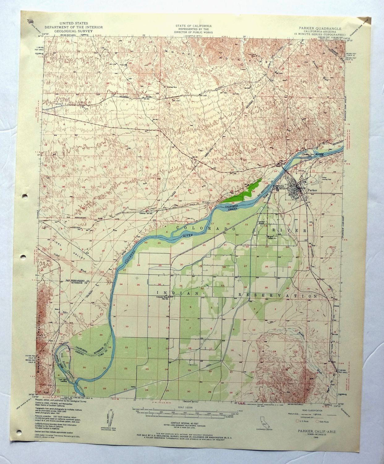
| TITLE | Parker |
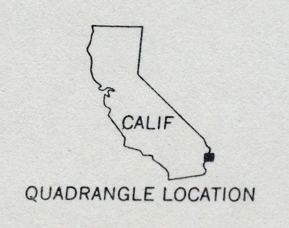
| STATE | California, Arizona |
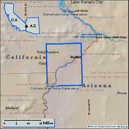
| LOCATION | 25 miles south of Lake Havasu City, AZ |
| SERIES | 15-minute |
| SURVEYED | 1947 through 1949 Aerial and Field Survey |
| EDITION | 1949 |
| PRINTED | 1960 |
| PRINT NOTES | Thick paper stock, includes woodland tint (green to indicate vegetated areas) |
| SCALE | 1:62500 |
| CONTOUR INTERVAL | 40 feet |
| SHEET DIMENSIONS | 17 x 21 inches |
| MAP DIMENSIONS | 14 1/2 x 17 1/2 inches |
| COVERAGE AREA | 14 x 17 miles |
| SHEET CONDITION For maps of this vintage, effort is made to note all visible flaws, no matter how minor. | |
| OVERALL CONDITION | Excellent |
| SHEET NOTES | lightly handled, never folded, smooth and flat |
| MAP AREA | flawless map area |
| COLLARS | no wear or tears, no markings, hole punches along left collar |
| MAP COVERAGE Quadrangle extent overlaid on current basemap. | |
| PLACENAMES Depending on map series and survey date, all of the features listed below may not be shown on this map. This list contains features that currently exist or historically existed within the area covered by the map. The list can be used as a reference to determine if this map covers your area of interest. Placenames are listed alphabetically next to each feature type. | |
| CITIES AND TOWNS (CURRENT) | Big River, Bluewater, and Parker |
| COUNTIES COVERED | La Paz, Riverside, and San Bernardino |
| FEDERAL LAND UNITS | Colorado River Indian Reservation and Whipple Mountains Wilderness |
| RIVERS AND STREAMS | Arch Creek, Bennett Wash, Bouse Wash, Bowmans Wash, Colorado River, and Vidal Wash |
| WATER BODIES | Lost Lake |
| California Locations: Lost Lake Resort and West Portal. Mountains, Peaks, and Summits: Squaw Peak and Vista Peak. Valleys and Canyons: Vidal Valley. Drainages: Arch Creek and Vidal Wash. Islands: Deer Island. Mines: Blue Cloud Mine, Lucky Day Mine, Riverview Mine, Turk Mine, and Twin Lode Mine. Lakes and Ponds: Lost Lake. Reservoirs and Tanks: Moovalya Lake. | |
| Arizona Locations: Arizona Agricultural Inspection Station and Colorado River Indian Tribes Administration. Mountains, Peaks, and Summits: Fivemile Hill and Headgate Rock. Parks: Blue Water Marina Park, Manataba Park, Parker Rodeo Grounds, Pop Harvey Park, and Western Park. Drainages: Bouse Wash. Islands: Deer Island. Churches: Harvest Mission. Hospitals: Parker Hospital and Public Health Agency Hospital. Buildings: Colorado River Indian Agency Headquarters, Colorado River Water Pollution Control Center, La Paz County Courthouse, and Parker City Hall. Dams: Headgate Rock Dam. Canals: East Drain, Feeder Drain Number Five, Feeder Drain Number Four, Lateral Number Seventy-nine, Main Canal, Lateral Nineteen R, Lateral Nineteen R-37, Lateral Nineteen R-37-24, Pump Drain Number One, Lateral Twenty-seven R, and Lateral Twenty-seven R-25. Bayous and Sloughs: Twelvemile Slough. Bends: Gravel Hill Bend. Airports: Avi Suquilla Airport, Parker Community Hospital Heliport, and Parker Municipal Airport. Schools: Blake School, Colorado River Day School, Parker High School, and Wallace School. Reservoirs and Tanks: Moovalya Lake. Towers: KLPZ-AM (Parker), KMDX-FM (Parker), and KZUL-AM (Parker). | |
| SHIPPING AND RETURNS | |
| This map sheet ships via the US Postal Service. Choose your preferred packaging at eBay checkout: rolled in a sturdy tube, or folded in a padded mailer. If you find that the sheet you receive is not as described in the listing, you may ship it back to us for a refund of the purchase price. | |
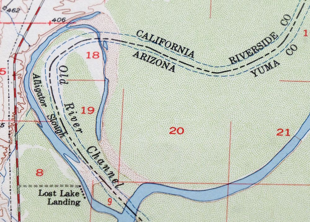
1960 USGS Topo Map: Parker, California/Arizona
$50
This 15-minute topographic sheet maps the Parker quadrangle, drawn from aerial and field survey work done between 1947 and 1949. It straddles the Colorado River along the California-Arizona line, covering the town of Parker, Arizona and the communities of Big River and Bluewater on the California side, with the river itself threading through the quad and part of the Colorado River Indian Reservation included. The sheet shows the Whipple Mountains rising west of the river, country later set aside as the Whipple Mountains Wilderness. Printed in 1960 on thick stock with a green woodland tint, it is in excellent condition, never folded, smooth and flat.
In stock
This vintage sheet is a 1949 edition of the Parker California USGS topographic map. It is an original 61-year-old 1960 United States Geological Survey print in excellent condition.
HOW THIS MAP CAN BE USED
In addition to making a fascinating conversation piece, this sheet would look great in a frame or on display, make a unique and prized gift for anyone interested in this area, be perfect as a reference for genealogy studies or general historical research, or fill that missing piece in your collection. Maps of this vintage are printed on durable stock and are well-suited for outdoor activities and recreation of all kinds, including hiking, backpacking, hunting, rafting and kayaking, backcountry skiing, geocaching, general exploration, treasure hunting, etc.
FEATURES SHOWN ON THE MAP
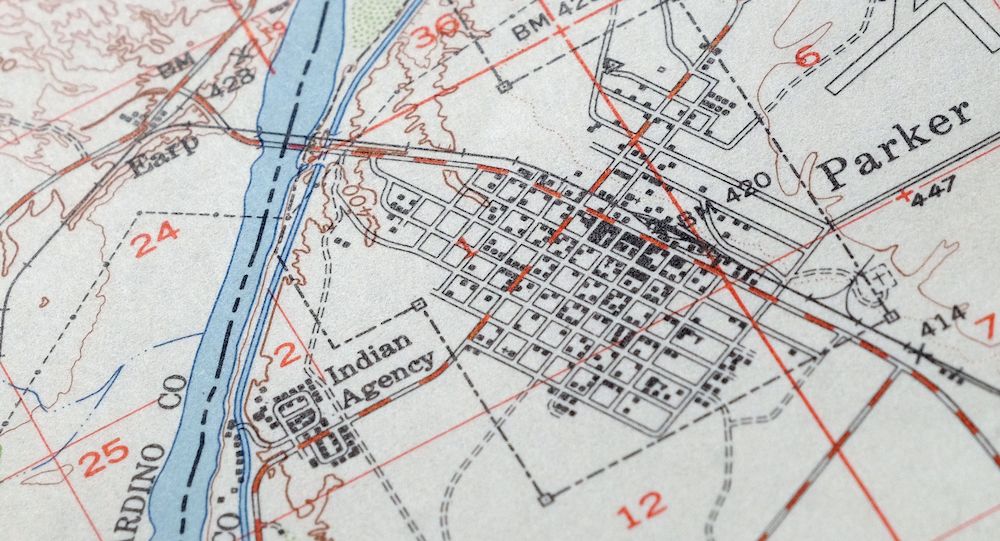
The Parker 15-minute map shows cities and towns, roads, railroads, utilities and energy infrastructure, rivers, creeks, elevation contour lines, public land survey lines, county, state, and other administrative boundaries as they existed at the time of the survey in 1947 through 1949. All known structures (houses, businesses, churches, schools, barns, cabins, etc) are also shown.
A VALUABLE HISTORICAL RECORD
Maps from the 15-minute series for the continental United States are no longer produced or printed by the USGS and original prints are becoming increasingly difficult to find. They are a valuable historical record for an area, as they contain many placenames and features that have been dropped from more recent maps.
Nearby maps
-
Castaneda Hills Arizona USGS 15-Min Topo Map 1967 Vintage
$30 Add to cart -

Topock Arizona Lake Havasu City Franconia USGS Topo Map 1981
$50 Add to cart -

Quartzsite Arizona USGS 15-Min Topographic Map 1971 Vintage
$44 Add to cart -
Ives Peak Arizona USGS 15-Min Topographic Map 1967 Vintage
$34 Add to cart -
Trigo Peaks Arizona Dome Rock Mountains USGS Topo Map 1955
$37 Add to cart -

Needles Arizona Mohave Valley USGS Topo Map 1968 Vintage
$38 Add to cart -
Yucca Arizona Black Mountains USGS Topo Map 1947 Vintage
$45 Add to cart -
Cibola Arizona Palo Verde Trigo Mountains USGS Topo Map 1961
$41 Add to cart -
Hope Arizona Salome USGS 15-Min Topographic Map 1967 Vintage
$35 Add to cart -

Gladden Arizona Aguila Valley USGS Topographic Map 1971
$30 Add to cart -
Kingman SE Arizona Griffith USGS Topographic Map 1968
$32 Add to cart -

Red Hill Arizona Castle Dome Plain USGS Topographic Map 1955
$42 Add to cart -
Kingman NW Arizona Golden Valley USGS Topo Map 1968 Vintage
$25 Add to cart -
Engesser Pass Arizona USGS 15-Min Topo Map 1971 Vintage
$36 Add to cart -
Kingman Arizona Hualapai Mountains Harris USGS Topo Map 1980
$28 Add to cart -
Roll Arizona Growler USGS 15 Minute Topo Map 1962 Vintage
$35 Add to cart -
Sheridan Mountain Arizona Sycamore Creek USGS Topo Map 1978
$35 Add to cart -
Cottonwood Spring California USGS Topo Map 1973 Vintage
$39 Add to cart -

Congress Arizona Yarnell Wilhoit USGS Topo Map 1948 Vintage
$38 Add to cart -
Camp Mohave Arizona El Dorado WSA Kingman USGS Topo Map 1920
$74 Add to cart -
Stoval Arizona Kofa Horn USGS 15-Min Topo Map 1966 Vintage
$38 Add to cart -
Yuma California San Luis Somerton USGS Topo Map 1954 Vintage
$40 Add to cart -
Camp Wood Arizona Prescott NF USGS Topographic Map 1949
$32 Add to cart -
Fortuna Arizona Yuma Ligurta USGS Topo Map 1956 Vintage
$50 Add to cart