MAP DETAILS | |
|---|---|
| TITLE | Monroe |
| STATE | Washington |
| LOCATION | 23 miles northeast of Seattle |
| SERIES | 7.5-minute |
| SURVEYED | 1952 and 1953 Aerial and Field Survey |
| EDITION | 1953 |
| REVISIONS | Photo revisions in 1968 and 1973 are shown in purple. |
| PRINTED | 1976 |
| PRINT NOTES | Includes woodland tint (green to indicate vegetated areas). A reddish tint is used to indicate urban areas where only landmark buildings are shown. |
| SCALE | 1:24000 |
| CONTOUR INTERVAL | 20 feet |
| SHEET DIMENSIONS | 22 x 27 inches (approximate) |
| MAP DIMENSIONS | 15 1/4 x 22 3/4 inches |
| COVERAGE AREA | 6 x 9 miles |
| SHEET CONDITION For maps of this vintage, effort is made to note all visible flaws, no matter how minor. | |
| OVERALL CONDITION | Excellent |
| SHEET NOTES | very lightly handled, never folded, smooth and flat |
| MAP AREA | flawless map area |
| COLLARS | no wear or tears, no blemishes, library stamp in top collar, very small inventory notation in extreme lower right collar corner |
| MAP COVERAGE Quadrangle extent overlaid on current basemap. | |
| PLACENAMES Depending on map series and survey date, all of the features listed below may not be shown on this map. This list contains features that currently exist or historically existed within the area covered by the map. The list can be used as a reference to determine if this map covers your area of interest. Placenames are listed alphabetically next to each feature type. | |
| CITIES AND TOWNS (CURRENT) | Duvall, High Rock, Monroe, and Woods Creek |
| COUNTIES COVERED | King and Snohomish |
| RIVERS AND STREAMS | Barr Creek, Cherry Creek, Hannan Creek, Hanstead Creek, Haskel Slough, Margaret Creek, Peoples Creek, Richardson Creek, Riley Slough, Skykomish River, Snoqualmie River, West Fork Woods Creek, and Woods Creek |
| WATER BODIES | Crescent Lake, Lake Fontal, Lake Hannan, Harts Swamp, Johnsons Swamp, King Lake, Round Lake, Soup Hole, and Trestle Swamp |
| Populated Place: Monroe Mobile Home Park, High Rock, Monroe, Monroe Junction, and Pearson Eddy. Locations: Alden Farms, Bolles Organic Farm, Brugger Ranch, Cascade Meadows, Country Green Turf Farms, Frohning Dairy, Hollandia Farms, Kosterland Dairy, Miedema Dairy, Monroe Honor Farm, Monroe Plaza Shopping Center, Monroe Sewage Treatment Plant, Skyhart Farms, Werkhoven Dairy, Woods Creek Farm, Bacus, Evergreen State Fairgrounds, and Monroe Golf Course. Administrative Boundaries: City of Monroe. Mountains, Peaks, and Summits: High Rock. Valleys and Canyons: Cherry Valley. Parks: Al Borlin Park and Skykomish River Centennial Park. Drainages: Steffen Creek, Barr Creek, Cherry Creek, Foye Creek, Hannan Creek, Hanstead Creek, Haskel Slough, High Rock Creek, Isakson Creek, Peoples Creek, Richardson Creek, West Fork Woods Creek, and Woods Creek. Post Office: Monroe Post Office. Hospitals: EvergreenHealth Monroe and Monroe General Hospital. Lakes and Ponds: Johnsons Swamp, King Lake, Lake Fontal, Lake Hannan, Long Lake, Round Lake, Soup Hole, Treen Lake, Trestle Swamp, and Wellin Lake. Buildings: Duvall Fire / King County Fire Protection District 45 Station 68, Holland America Nursery, Monroe Fire District 3 Station 31 Headquarters, Monroe Historical Society Museum, Monroe Police Department, Pine Creek Nursery, Regency Care Center at Monroe, and Snohomish County Sheriff's Office Monroe. Waterfalls: McCauley Falls. Dams: Lake Margaret Dam and Lakes Unlimited Dam. Bends: Big Bend. Basins: Tualco Valley. Airports: First Air Field and Van de Plasch Airport. Swamps: Harts Swamp and Roths Swamp. Schools: Frank Wagner Elementary School, Kids Country Child Care Center Monroe, Leaders in Learning School, Monroe Montessori School, Monroe Public Schools District Office, Park Place Middle School, Leaders in Learning High School, Monroe Christian School, Monroe Middle School, Park Place School, Sky Valley Adventist School, and Wagner School. Reservoirs and Tanks: Lake Margaret and Monroe Reservoir. Cemetery: Independent Order of Odd Fellows Cemetery and Monroe Memorial Park. | |
| SHIPPING AND RETURNS | |
 This map sheet will be carefully rolled in a sturdy tube and shipped via the US Postal Service. If you find that the sheet you receive is not as described in the listing, you may ship it back to us for a refund of the purchase price. | |
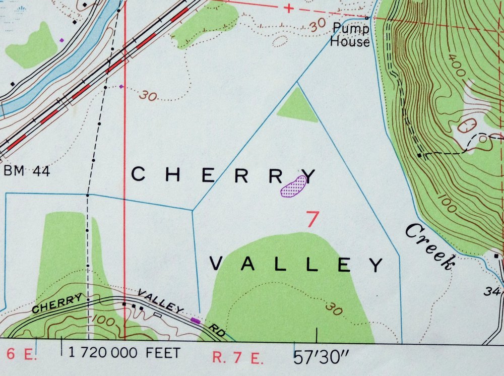
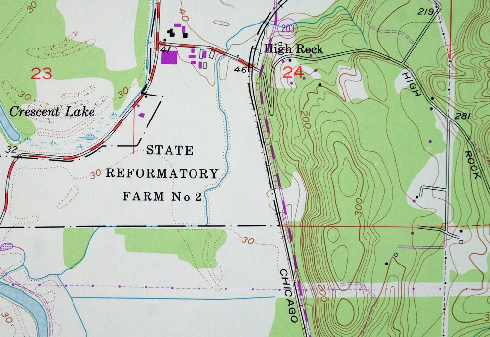
Monroe Washington Duvall High Rock USGS Topographic Map 1976
$46
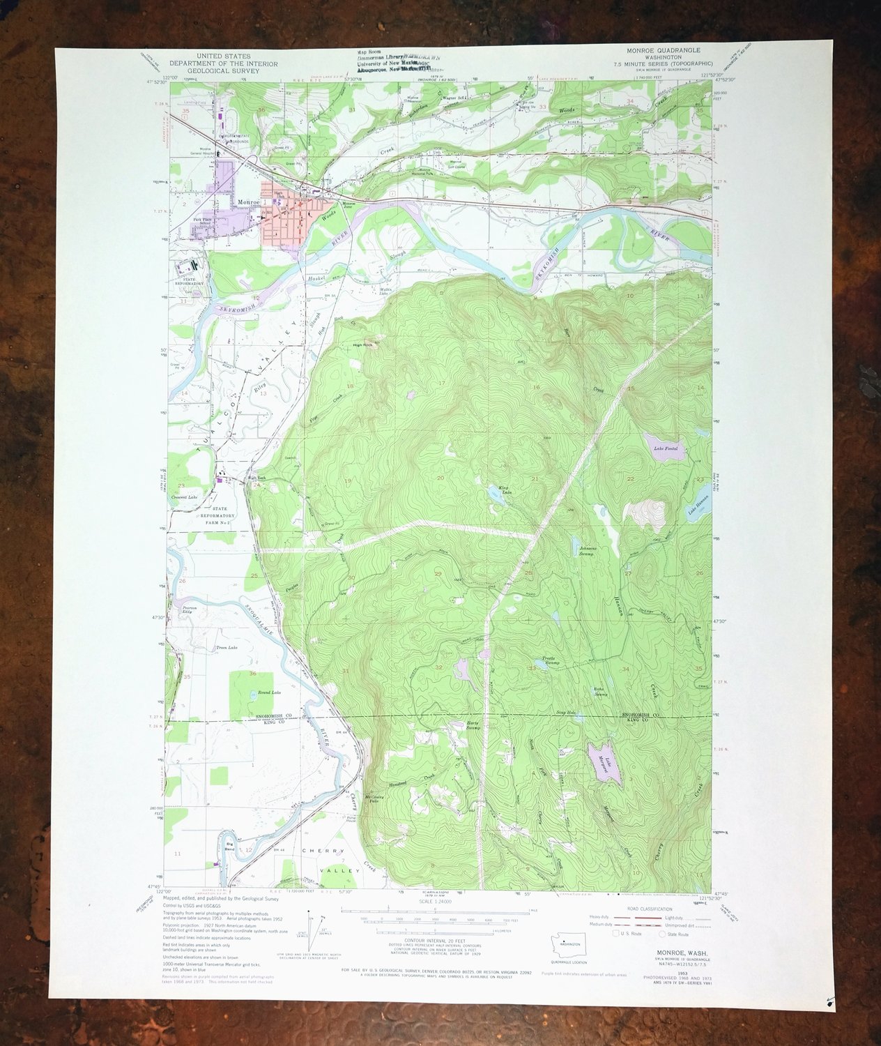
First published in 1953 with revisions in 1968 and 1973, this sheet was printed in 1976 and is in excellent condition, never folded and kept smooth and flat. The quad area covers the town of Monroe in the Snohomish River valley northeast of Seattle, spanning parts of both King and Snohomish counties, with Duvall, Woods Creek, and High Rock also within its boundaries. The base map reflects mid-1950s aerial and field survey work carried through updates into the early 1970s, and the flawless map area and clean, unfolded sheet make it a good candidate for framing, marked only by a library stamp in the top collar.
In stock
This vintage sheet is a 1953 edition of the Monroe Washington USGS topographic map revised in 1968 and 1973 using aerial photography. It is an original 50-year-old 1976 United States Geological Survey print in excellent condition.
HOW THIS MAP CAN BE USED
In addition to making a fascinating conversation piece, this sheet would look great in a frame or on display, make a unique and prized gift for anyone interested in this area, be perfect as a reference for genealogy studies or general historical research, or fill that missing piece in your collection. Maps of this vintage are printed on durable stock and are well-suited for outdoor activities and recreation of all kinds, including hiking, backpacking, hunting, rafting and kayaking, backcountry skiing, geocaching, general exploration, treasure hunting, etc.
FEATURES SHOWN ON THE MAP
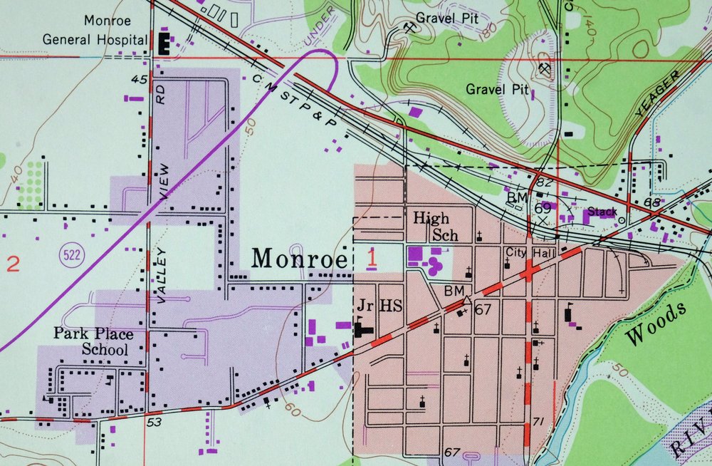
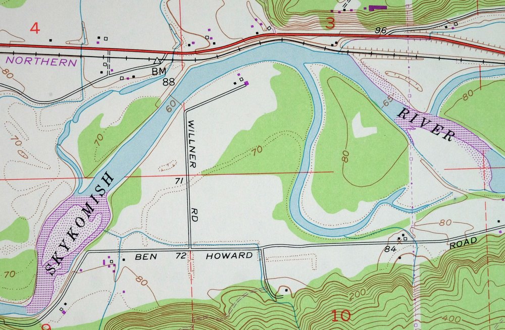
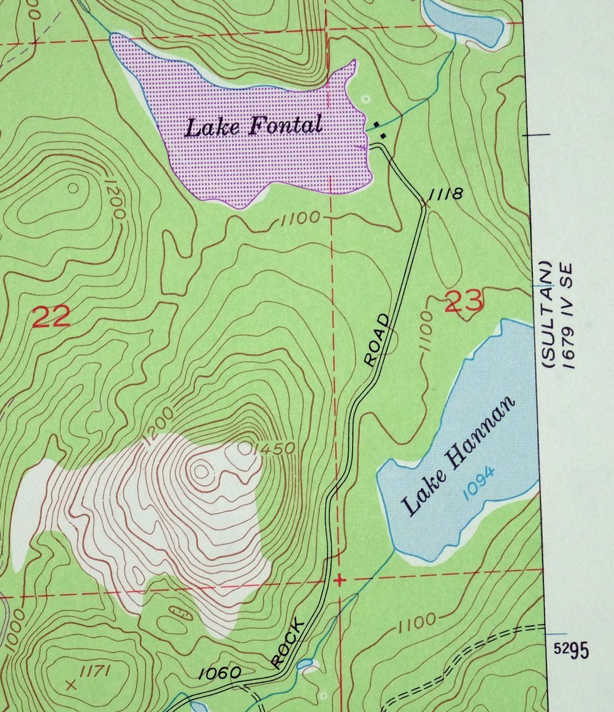
The Monroe 7.5-minute map shows cities and towns, roads, paths, railroads, utilities and energy infrastructure, rivers, creeks, elevation contour lines, public land survey lines, county, state, and other administrative boundaries as they existed at the time of the survey in 1952 and 1953. A reddish tint is used on this sheet to indicate urban areas where only landmark buildings are depicted. Outside of those areas, all known structures (houses, businesses, churches, schools, barns, cabins, etc) are shown.
A VALUABLE HISTORICAL RECORD
This map is from the 7.5-minute series, the most detailed series that is widely available from the USGS. The 1953 Monroe map is a valuable historical record for the area. It contains some placenames and features that have been dropped from more recent maps.
The map was photorevised in 1968 and 1973. Any features that changed or were added between the original edition year of 1953 and the photorevision year of 1968 and 1973 are overlayed in purple. The purple overlay provides an excellent view of the fast-growing and changing areas within the quad boundary.
Nearby maps
-
Edmonds East Washington Shoreline Brier USGS Topo Map 1976
$38 Add to cart -

Edmonds West Washington Shoreline Woodway USGS Topo Map 1976
$47 Add to cart -

Maple Valley Washington Covington USGS Topographic Map 1976
$43 Add to cart -

Renton Washington Seattle Kent USGS Topo Map 1976 Vintage
$38 Add to cart -
Blanca Lake Washington USGS 7.5-Min Topo Map 1982 Vintage
$40 Add to cart -
Silverton Washington Darrington Verlot USGS Topo Map 1975
$36 Add to cart -
Olalla Washington Vashon USGS 7.5-Min Topo Map 1975 Vintage
$30 Add to cart -
Oso Washington Lake Cavanaugh USGS Topo Map 1977 Vintage
$40 Add to cart -
Snoqualmie Pass Washington Hyak USGS Topographic Map 1965
$21 Add to cart -
Enumclaw Washington Buckley Upper Mill USGS Topo Map 1976
$45 Add to cart -
Glacier Peak Washington Suiattle River USGS Topo Map 1946
$36 Add to cart -

Sumner Washington South Hill Auburn USGS Topo Map 1976
$43 Add to cart -

Puyallup Washington Tacoma Waller USGS Topographic Map 1976
$46 Add to cart -
Oak Harbor Washington Ault Field USGS Topo Map 1977 Vintage
$46 Add to cart -
The Brothers Washington Eldon USGS Topo Map 1950 Vintage
$38 Add to cart -
Wickersham Washington Lyman Acme USGS Topographic Map 1974
$43 Add to cart -
Longbranch Washington USGS 7.5-Min Topo Map 1969 Vintage
$46 Add to cart -

Lopez Pass Washington USGS 7.5-Min Topo Map 1977 Vintage
$45 Add to cart -

Lucerne Washington USGS 15-Min Topographic Map 1949 Vintage
$42 Add to cart -
Mount Angeles Washington Olympic NF USGS Topo Map 1964
$32 Add to cart -
Yelm Washington Rainier North Yelm USGS 15-Min Topo Map 1944
$33 Add to cart -
Mount Shuksan Washington USGS 15-Min Topo Map 1957 Vintage
$37 Add to cart -
Sumas Washington Bellingham Lynden USGS 15-Min Topo Map 1931
$59 Add to cart -

Lummi Bay Washington Ferndale Birch Bay USGS Topo Map 1974
$47 Add to cart
