MAP DETAILS | |
|---|---|
| TITLE | Hardinville |
| STATE | Illinois |
| LOCATION | Vicinity of Robinson |
| SERIES | 15-minute |
| SURVEYED | 1907 and 1908 Field Survey |
| GEOGRAPHER | R.B. Marshall |
| ENGRAVED | 1910 |
| EDITION | 1910 |
| SCALE | 1:62500 |
| CONTOUR INTERVAL | 20 feet |
| SHEET DIMENSIONS | 14 1/2 x 18 inches |
| MAP DIMENSIONS | 13 5/8 x 17 1/2 inches |
| COVERAGE AREA | 13 x 17 miles |
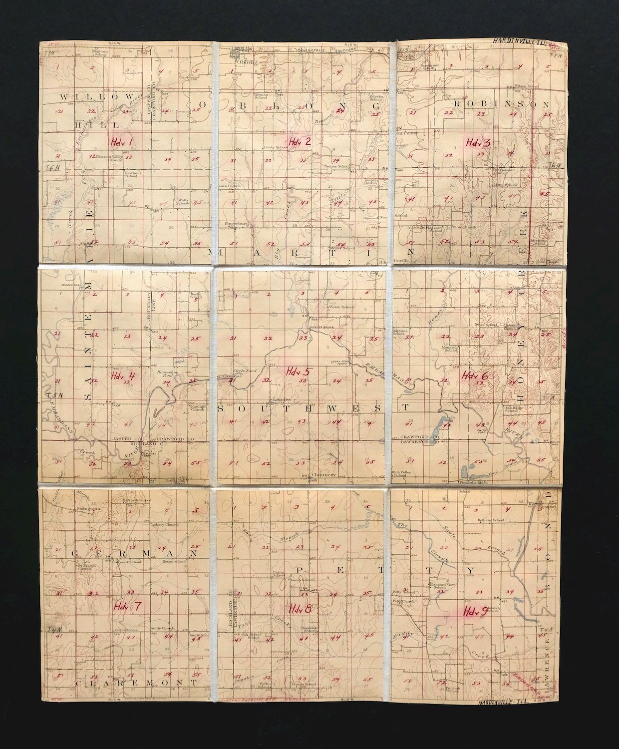
| MAP NOTES | Includes a carefully overlaid grid system that does not detract from the wealth of information contained on this sheet, the canvas backing makes the sheets extraordinarily durable and the folding panel setup is ideal for historical study and research of t |
| SHEET CONDITION For maps of this vintage, effort is made to note all visible flaws, no matter how minor. | |
| OVERALL CONDITION | Very Good |
| SHEET NOTES | lightly handled, publisher folds, lightly age-toned sheet, divided into 9 panels for easy folding, canvas-backed and durable |
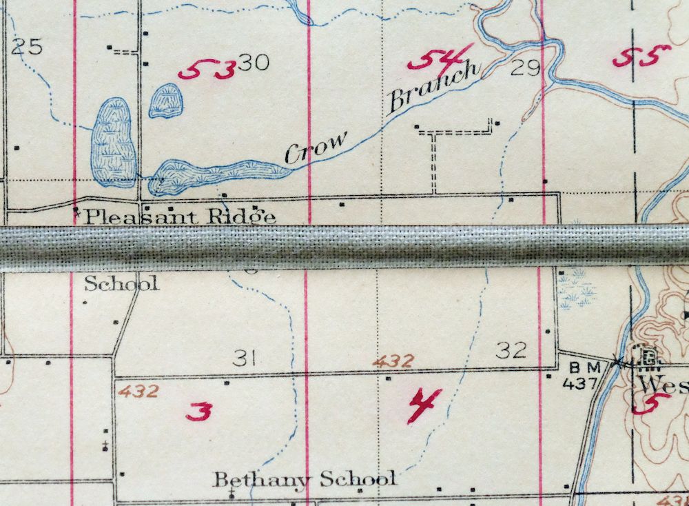
| MAP AREA | no wear, no blemishes, each panel has been divided by a 5x5 red grid system where each cell is numbered (cells are approximately a square mile) |
| COLLARS | the collars are about an eighth of an inch and include neighboring sheet names and township information |
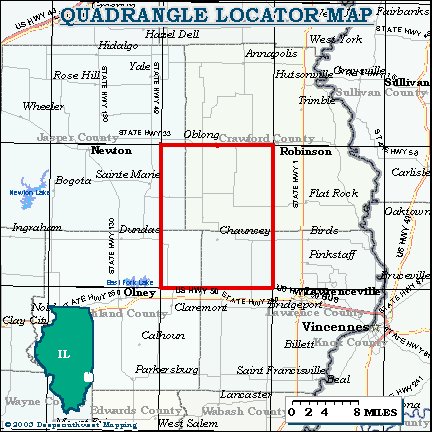
| MAP COVERAGE Quadrangle extent overlaid on current basemap. | |
| PLACENAMES Depending on map series and survey date, all of the features listed below may not be shown on this map. This list contains features that currently exist or historically existed within the area covered by the map. The list can be used as a reference to determine if this map covers your area of interest. Placenames are listed alphabetically next to each feature type. | |
| CITIES AND TOWNS (CURRENT) | Chauncey, Oblong, Robinson, and Stoy |
| COUNTIES COVERED | Crawford, Jasper, Lawrence, and Richland |
| RIVERS AND STREAMS | Bennett Creek, Brush Creek, Bugaboo Creek, Carter Creek, Dead River, Eagle Branch, East Fork Fox River, Embarras River, Freeport Creek, Hickory Creek, Honey Creek, Mad Creek, McNary Branch, Muddy Creek, Old Channel Embarras River, Painter Fork, Paul Creek, The Slough, and West Branch Honey Creek |
| WATER BODIES | Brooks Lake and West Lake |
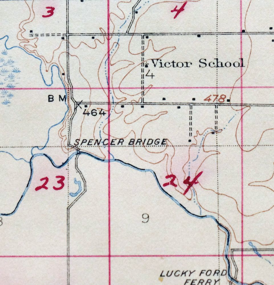
| Locations: Cow Ford Ferry and Lucky Ford Ferry. Administrative Boundaries: Township of German, Township of Martin, Township of Petty, and Township of Southwest. Parks: Chauncey Marsh Nature Preserve. Drainages: Bennett Creek, Big Creek, Brush Creek, Bugaboo Creek, Calfkiller Creek, Carter Creek, Crow Branch, Dead River, Dogwood Creek, Douglas Creek, Eagle Branch, Freeport Creek, Hickory Creek, Honey Creek, Little Creek, Mad Creek, Muddy Creek, Murphy Creek, North Fork Embarras River, Painter Fork, Paul Creek, The Slough, and West Branch Honey Creek. Churches: Amity Chapel, Asbury Church, Berlin Congregational Church, Bethany Church, Bible Chapel, Eureka Church, Island Church, Leeper Church, Pearl Chapel United Methodist Church, Pleasant Hill Church, Prairie Chapel, Prairie Hall Church, Prior Grove Baptist Church, Saint Valentine Church, Seed Chapel, South Bend Church, and Zion Church. Lakes and Ponds: Circle Pond and Horseshoe Pond. Buildings: Sainte Marie Townhall. Dams: Brooks Lake Dam. Crossings: Smith Ford. Bridges: Spencer Bridge. Schools: Bend School, Mount North School, Oblong High School, Petty Elementary School, and Saint Joseph School. Reservoirs and Tanks: Brooks Lake. Oilfields: Main Consolidated Oil and Gas Field. | |
| SHIPPING AND RETURNS | |
| This map sheet will be shipped folded in a padded mailer via the US Postal Service. If you find that the sheet you receive is not as described in the listing, you may ship it back to us for a refund of the purchase price. | |
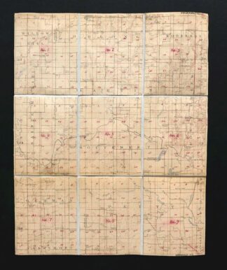
1910 Hardinville Illinois USGS Topo Map: Robinson
$22
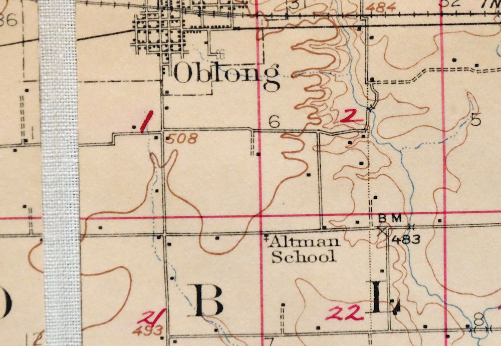
Includes a carefully overlaid grid system that does not detract from the wealth of information contained on this sheet, the canvas backing makes the sheets extraordinarily durable and the folding panel setup is ideal for historical study and research of t This is a 15-minute USGS topographic map of the Hardinville quadrangle in southeastern Illinois, surveyed in the field in 1907 and 1908 under geographer R.B. Marshall, engraved in 1910, and backed with canvas and divided into nine folding panels. The area it covers sits in the vicinity of Robinson and takes in Oblong as well as the smaller communities of Stoy and Chauncey, spanning parts of Crawford, Jasper, Lawrence, and Richland counties.
In stock
This sheet is a 1910 edition of the Hardinville Illinois USGS topographic map. It is an original United States Geological Survey print in very good condition.
HOW THIS MAP CAN BE USED
In addition to making a fascinating conversation piece, this sheet would look great in a frame or on display, make a unique and prized gift for anyone interested in this area, be perfect as a reference for genealogy studies or general historical research, or fill that missing piece in your collection.
FEATURES SHOWN ON THE MAP
The Hardinville 15-minute map shows cities and towns, roads, railroads, rivers, creeks, elevation contour lines, public land survey lines, county, state, and other administrative boundaries as they existed at the time of the survey in 1907 and 1908. All known structures (houses, businesses, churches, schools, barns, cabins, etc) are also shown, with exceptions in some urban areas, where only landmark buildings may be shown.
A VALUABLE HISTORICAL RECORD
Maps from the 15-minute series for the continental United States are no longer produced or printed by the USGS and original prints are becoming increasingly difficult to find. They are a valuable historical record for an area, as they contain many placenames and features that have been dropped from more recent maps.
Nearby maps
-
1910 USGS Topo Map: Hardinville, Robinson, Illinois
$55 Add to cart -
Birds Illinois Flat Rock Robinson USGS Topographic Map 1917
$68 Add to cart -

Effingham Illinois Altamont Watson USGS Topographic Map 1964
$46 Add to cart -
Patoka Illinois Vernon Shobonier USGS Topo Map 1977 Vintage
$32 Add to cart -
New Haven Illinois Ridgway Herald USGS Topo Map 1920 Antique
$43 Add to cart -
Pleasant Mound Illinois Tamalco USGS Topographic Map 1977
$28 Add to cart -
Carlyle Illinois Beckemeyer Huey USGS Topographic Map 1910
$58 Add to cart -
Raymond Illinois Farmersville Waggoner USGS Topo Map 1925
$46 Add to cart -
Springfield East Illinois Sherman USGS Topo Map 1973 Vintage
$32 Add to cart -
Georgetown Indiana Galena Greenville USGS Topo Map 1947
$32 Add to cart -
Georgetown Indiana Galena Greenville USGS Topo Map 1939
$27 Add to cart -

Speed Indiana Clarksville Memphis USGS Topographic Map 1947
$27 Add to cart -
Bethalto Illinois Alton Wood River USGS Topographic Map 1977
$43 Add to cart -
Alton Illinois Godfrey East Alton USGS Topographic Map 1986
$37 Add to cart -

Granite City Illinois St. Louis Jennings USGS Topo Map 1982
$46 Add to cart -

Cahokia Illinois St. Louis Dupo USGS Topographic Map 1975
$45 Add to cart -

Chester Missouri Perryville Saint Mary USGS Topo Map 1964
$44 Add to cart -
Florissant Missouri Hazelwood Ferguson USGS Topo Map 1982
$38 Add to cart -
Jonesboro Illinois Cape Girardeau Anna USGS Topo Map 1963
$42 Add to cart -
Renault Illinois Ste. Genevieve Red Bud USGS Topo Map 1915
$45 Add to cart -
1963 USGS Topo Map: Renault, Bloomsdale, Illinois/Missouri
$46 Add to cart -

Cairo Illinois Mounds Barlow USGS Topo Map 1964 Vintage
$41 Add to cart -

Hardin Illinois Fieldon Batchtown USGS Topo Map 1964 Vintage
$42 Add to cart -

Pearl Illinois Kampsville Eldred USGS Topo Map 1956 Vintage
$40 Add to cart