MAP DETAILS | |
|---|---|
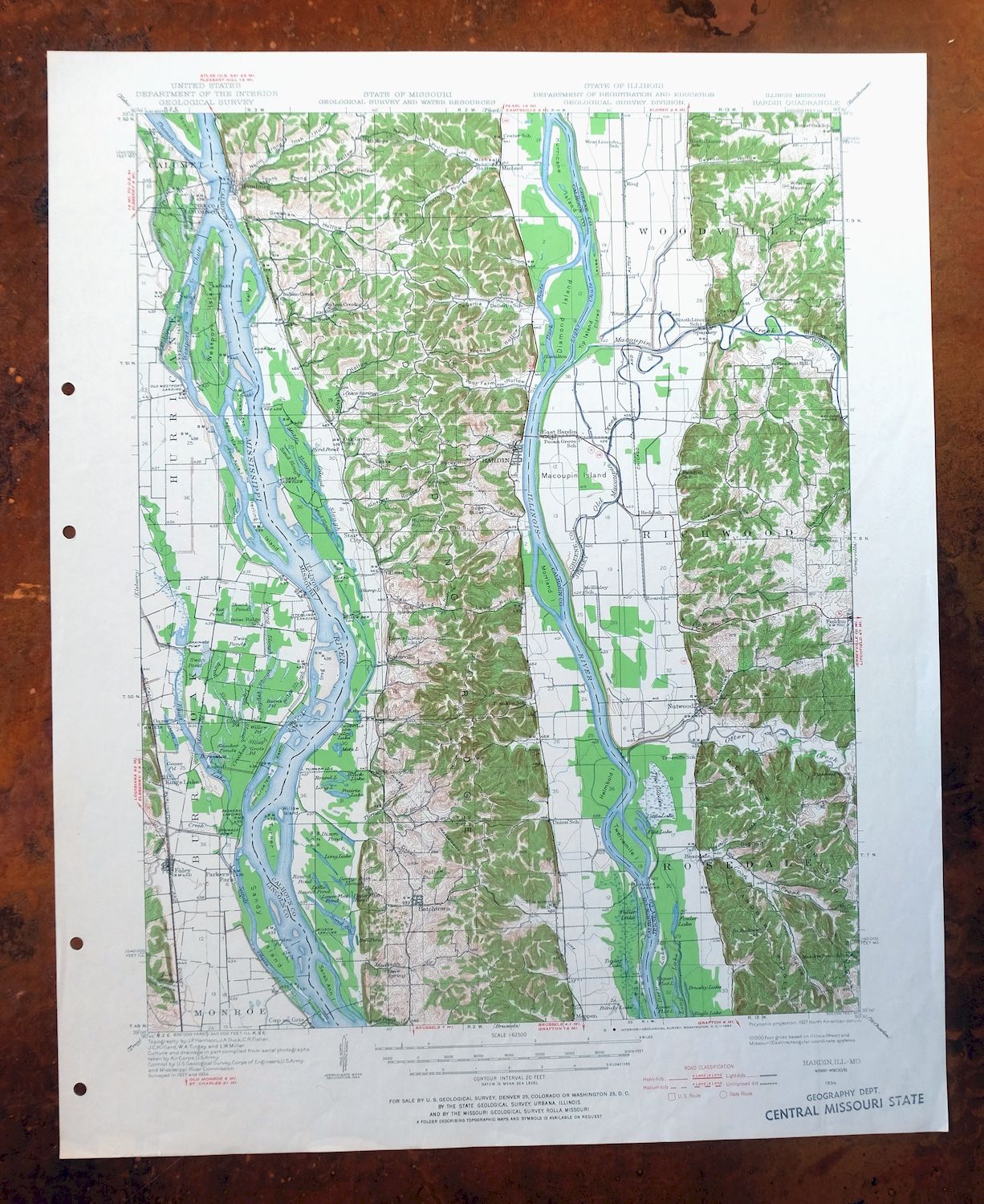
| TITLE | Hardin |
| STATE | Illinois, Missouri |
| LOCATION | 40 miles northwest of Saint Louis |
| SERIES | 15-minute |
| SURVEYED | 1927 and 1934 Field Survey |
| GEOGRAPHER | J.P Harrison |
| EDITION | 1934 |
| PRINTED | 1964 |
| PRINT NOTES | Thick paper stock, includes woodland tint (green to indicate vegetated areas). A reddish tint is used to indicate urban areas where only landmark buildings are shown. |
| SCALE | 1:62500 |
| CONTOUR INTERVAL | 20 feet |
| SHEET DIMENSIONS | 17 x 21 inches |
| MAP DIMENSIONS | 13 5/8 x 17 1/2 inches |
| COVERAGE AREA | 13 x 17 miles |
| SHEET CONDITION For maps of this vintage, effort is made to note all visible flaws, no matter how minor. | |
| OVERALL CONDITION | Very Good |
| SHEET NOTES | moderately handled, never folded |
| MAP AREA | no wear, no markings, no blemishes |
| COLLARS | no wear or tears, no markings, no blemishes, library stamp in bottom right collar, hole punches along left collar |
| MAP COVERAGE Quadrangle extent overlaid on current basemap. | |
| PLACENAMES Depending on map series and survey date, all of the features listed below may not be shown on this map. This list contains features that currently exist or historically existed within the area covered by the map. The list can be used as a reference to determine if this map covers your area of interest. Placenames are listed alphabetically next to each feature type. | |
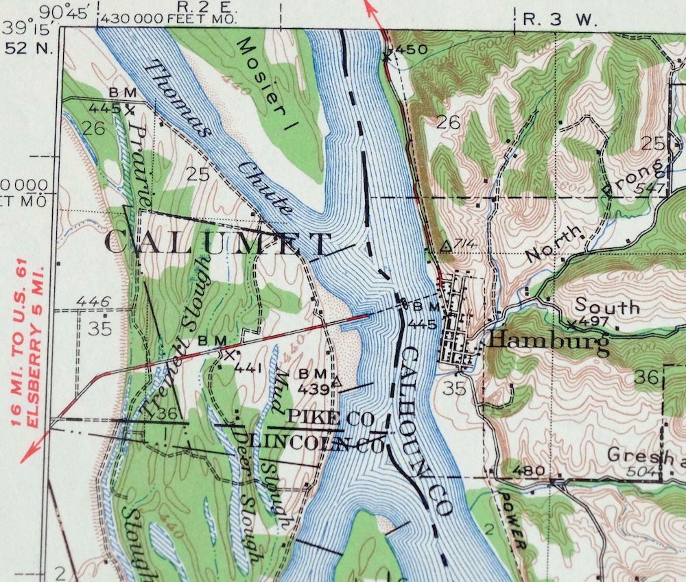
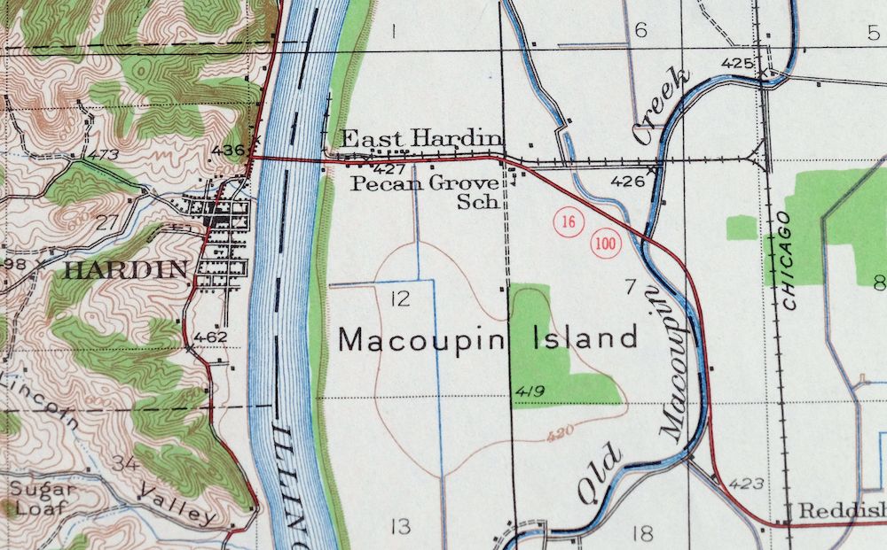
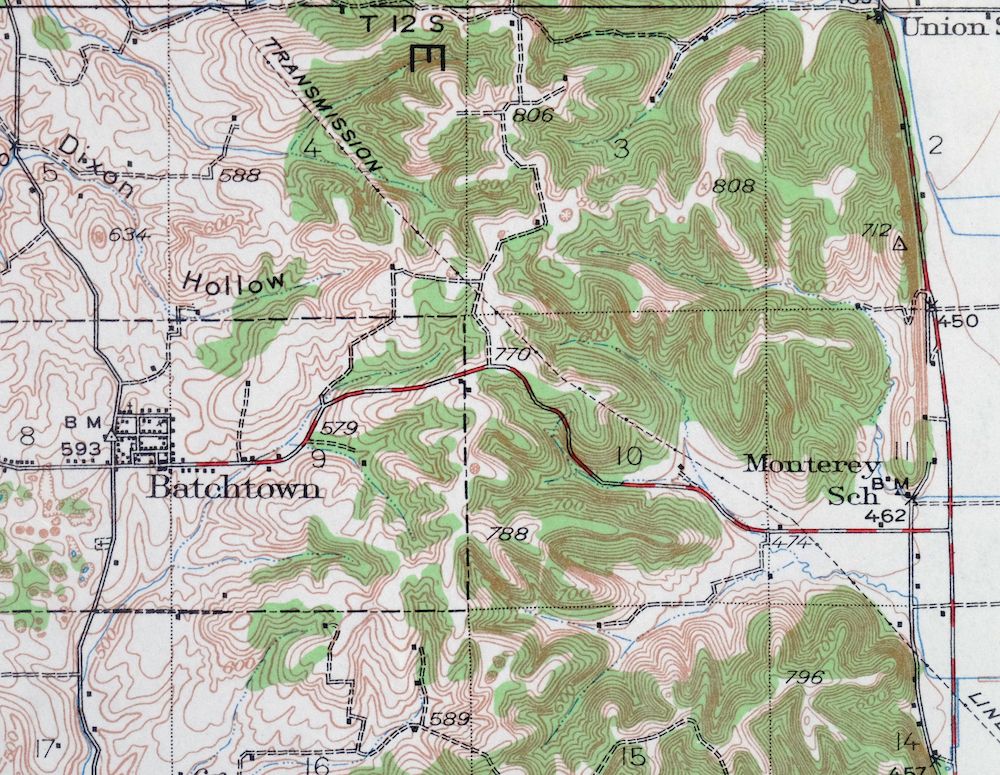
| CITIES AND TOWNS (CURRENT) | Batchtown, Fieldon, Foley, Hamburg, and Hardin |
| COUNTIES COVERED | Calhoun, Greene, Jersey, Lincoln, and Pike |
| FEDERAL LAND UNITS | Mark Twain National Wildlife Refuge (Batchtown Division) and Mark Twain National Wildlife Refuge (Calhoun Division) |
| RIVERS AND STREAMS | Barley Branch, Cole Creek, Crater Creek, Illinois River, Kickapoo Chute, Macoupin Creek, Michael Creek, Mississippi River, Old Kings Lake Creek, Otter Creek, Possum Creek, Sand Branch, Sandy Chute, Spring Creek, and Westport Chute |
| WATER BODIES | Bailey Lake, Burns Pond, Byrd Pond, Clear Pond, Deep Lake, Flat Lake, Flat Pond, Fuller Lake, Godar Swamp, Goose Pond, Grots Pond, Hamilton Lake, Horseshoe Lake, Jakes Pond, Kings Lake, Knocker Ponds, Lamey Pond, Masons Pond, Nelson Pond, Oasis Lake, Skunk Pond, Strator Pond, Swan Lake, Upper Stump Lake, and Willow Pond |
| Illinois Locations: Burr Oak Landing, Camp Piasa, Camp Potawatomi, Camp Quatoga, Diamond Island Public Access Area, Fuller Landing, Gilead Gun Club, Gilead Landing, Gilford, Glades Public Access Area, Hadley Landing Public Access Area, Hogville Landing, Michael Landing Public Access, Red Landing, Stump Lake Public Access Area, Turner Landing, Willow Bar Landing, and Wilson Landing. Administrative Boundaries: Gilead Election Precinct, Hardin Election Precinct, Richwood Election Precinct, Township of Richwood, Township of Rosedale, and Township of Woodville. Mountains, Peaks, and Summits: Anderson Hill, Bobtail Hill, Dug Hill, Franklin Hill, Gaske Hill, Kintown Hill, McCoy Hill, Plummer Hill, Rocky Hill, Spankey Hill, Sugar Loaf, Witachek Mound, and Zerby Hill. Valleys and Canyons: Coon Hollow, Dayton Hollow, DeGerlia Hollow, Dixon Hollow, Godar Hollow, Gresham Hollow, Kintown Hollow, Lead Hollow, Lincoln Valley, Lost Hollow, McNabb Hollow, Michael Hollow, North Prong Irish Hollow, North Prong Michael Hollow, Poor Farm Hollow, Salt Spring Hollow, Shaw Hollow, South Prong Irish Hollow, South Prong Michael Hollow, and Tar Hollow. Parks: Batchtown State Fish and Waterfowl Management Area, Diamond-Hurricane Island State Fish and Waterfowl Management Area, Fuller Lake State Fish And Waterfowl Management Area, Mark Twain National Wildlife Refuge, Mortland Island State Fish And Waterfowl Man, Reds Landing State Fish And Waterfowl Manage, Stump Lake State Fish And Waterfowl Manageme, The Glades State Fish And Waterfowl Manageme, and Titus Hollow Public Access Area. Drainages: Cole Creek, Coon Creek, Crater Creek, Dark Chute, Helmbold Slough, Indian Creek, Light Chute, Macoupin Creek, Madison Creek, Michael Creek, Otter Creek, Possum Creek, Sand Branch, Spring Creek, Turner Branch, and West Point Creek. Islands: Campbells Island, Diamond Island, Helmbold Island, Hurricane Island, Kelly Island, Macoupin Island, Maple Island, Maxey Island, Mortland Island, Sarah Ann Island, Tip Island, Turner Island, Twelvemile Island, and Willow Island. Churches: Indian Creek Church. Lakes and Ponds: Bailey Lake, Bell Pond, Black Lake, Bundy Lake, Byrd Pond, Deep Lake, Dixon Pond, Flat Lake, Fowler Lake, Fuller Lake, Hamilton Lake, Horse Shoe Lake, Lamey Pond, Little Round Pond, Long Lake, Lower Flat Lake, Lower Flat Pond, Metz Lake, Nelson Pond, Prairie Lake, Round Lake, Round Pond, Sand Bay, Strator Pond, Stump Lake, Upper Flat Lake, Upper Flat Pond, and Watson Lake. Levees: Eldred Levee. Dams: Lock and Dam Number 25. Crossings: Hamburg Ferry. Gaps: The Narrows. Canals: White Ditch. Bayous and Sloughs: Church Slough, Dixon Slough, George Bain Slough, Gilead Slough, Middle Slough, Miller Slough, Mud Slough, Old Macoupin Creek, and Sand Slough. Bridges: Page Bridge and Reddish Bridge. Swamps: The Glades and Godar Swamp. Schools: Calhoun Elementary School, Calhoun High School, Fieldon Elementary, Lower Gilead School, and Mount Victory School. Ridges: Blue Ridge, Dividing Ridge, Meadow Branch Ridge, Pea Ridge, and Saint Andrew Ridge. Springs: Cave Spring, Clary Spring, and Salt Spring. | |
| Missouri Locations: Foley Public Access, Hamburg Ferry, and Norton Woods Public Access. Valleys and Canyons: Lick Hollow. Parks: Bradley Island Public Use Area and Upper Mississippi River State Wildlife Manag. Drainages: Barley Branch, Kickapoo Chute, Lost Creek, Old Kings Lake Creek, Sandy Chute, Sandy Creek, Thomas Chute, Westport Chute, and Whiteside Creek. Islands: Eagle Island, Four Acre Island, Hausgen Island, Jim Crow Island, Keeton Island, Kickapoo Island, Little Stag Island, Mink Island, Mozier Island, Sandy Island, Schwanigan Island, Stag Island, Sterling Island, and Westport Island. Lakes and Ponds: Burns Pond, Clear Pond, Flat Pond, Goose Pond, Grots Pond, Horseshoe Lake, Jakes Pond, Kings Lake, Knocker Ponds, Masons Pond, Oasis Lake, Ox Pond, Round Lake, Skunk Pond, Swan Pond, Twin Ponds, and Willow Pond. Dams: Lock and Dam 25 and Lock and Dam Number Twenty-five. Canals: Sandy Creek Ditch. Bayous and Sloughs: Birch Slough, Bates Slough, Crooked Slough, Deer Slough, Dogfish Slough, Ligon Slough, Logging Slough, Mud Slough, Prairie Slough, and Tremell Slough. Airports: Beach Ann Landing Strip and Sloans Airport. Schools: Briar Ridge School, Cap au Gris School, and Foley School. Reservoirs and Tanks: Pool 25. Springs: Lick Spring. | |
| SHIPPING AND RETURNS | |
 This map sheet will be carefully rolled in a sturdy tube and shipped via the US Postal Service. If you find that the sheet you receive is not as described in the listing, you may ship it back to us for a refund of the purchase price. | |
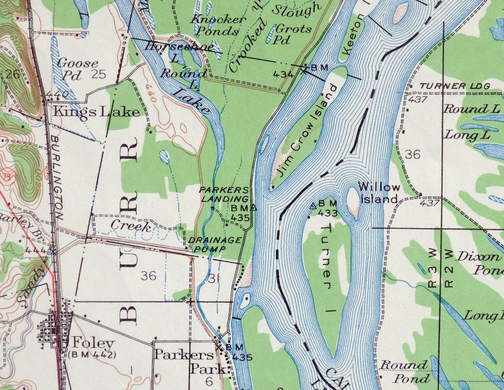
Hardin Illinois Fieldon Batchtown USGS Topo Map 1964 Vintage
$42
This USGS topographic map is a 1934 edition printed in 1964, a 15-minute quadrangle in very good condition on thick stock. The quad straddles the Illinois-Missouri line about 40 miles northwest of Saint Louis, taking in the town of Hardin along with Fieldon, Batchtown, and Hamburg, plus the Calhoun and Batchtown Divisions of the Mark Twain National Wildlife Refuge. Sitting where the Illinois River meets the Mississippi bottoms of Calhoun County, the map records a stretch of river country and its low-lying refuge lands at 20-foot contour intervals. The sheet was moderately handled but never folded, and it carries a library stamp in the bottom right collar and hole punches along the left collar.
In stock
This vintage sheet is a 1934 edition of the Hardin Illinois USGS topographic map. It is an original 62-year-old 1964 United States Geological Survey print in very good condition.
HOW THIS MAP CAN BE USED
In addition to making a fascinating conversation piece, this sheet would look great in a frame or on display, make a unique and prized gift for anyone interested in this area, be perfect as a reference for genealogy studies or general historical research, or fill that missing piece in your collection. Maps of this vintage are printed on durable stock and are well-suited for outdoor activities and recreation of all kinds, including hiking, backpacking, hunting, rafting and kayaking, backcountry skiing, geocaching, general exploration, treasure hunting, etc.
FEATURES SHOWN ON THE MAP
The Hardin 15-minute map shows cities and towns, roads, railroads, utilities and energy infrastructure, rivers, creeks, elevation contour lines, public land survey lines, county, state, and other administrative boundaries as they existed at the time of the survey in 1927 and 1934. All known structures (houses, businesses, churches, schools, barns, cabins, etc) are also shown, with exceptions in some urban areas, where only landmark buildings may be shown.
A VALUABLE HISTORICAL RECORD
Maps from the 15-minute series for the continental United States are no longer produced or printed by the USGS and original prints are becoming increasingly difficult to find. They are a valuable historical record for an area, as they contain many placenames and features that have been dropped from more recent maps.
Nearby maps
-

Pearl Illinois Kampsville Eldred USGS Topo Map 1956 Vintage
$40 Add to cart -
Raymond Illinois Farmersville Waggoner USGS Topo Map 1925
$46 Add to cart -

Quincy Illinois Hannibal Payson USGS Topo Map 1962 Vintage
$43 Add to cart -
Alton Illinois Godfrey East Alton USGS Topographic Map 1986
$37 Add to cart -
Florissant Missouri Hazelwood Ferguson USGS Topo Map 1982
$38 Add to cart -
Bethalto Illinois Alton Wood River USGS Topographic Map 1977
$43 Add to cart -

Granite City Illinois St. Louis Jennings USGS Topo Map 1982
$48 Add to cart -

Cahokia Illinois St. Louis Dupo USGS Topographic Map 1975
$50 Add to cart -

Sullivan Missouri Mark Twain NF Union USGS Topo Map 1916
$42 Add to cart -
Pleasant Mound Illinois Tamalco USGS Topographic Map 1977
$28 Add to cart -
Renault Illinois Ste. Genevieve Red Bud USGS Topo Map 1915
$45 Add to cart -
Springfield East Illinois Sherman USGS Topo Map 1973 Vintage
$32 Add to cart -
Carlyle Illinois Beckemeyer Huey USGS Topographic Map 1910
$40 Add to cart -
Patoka Illinois Vernon Shobonier USGS Topo Map 1977 Vintage
$32 Add to cart -
Colchester Illinois Plymouth Tennessee USGS Topo Map 1913
$25 Add to cart -
Potosi Missouri Mark Twain NF Caledonia USGS Topo Map 1906
$55 Add to cart -

Chester Missouri Perryville Saint Mary USGS Topo Map 1964
$44 Add to cart -
Ironton Missouri Mark Twain NF Pilot Knob USGS Topo Map 1968
$37 Add to cart -
La Harpe Illinois Stronghurst Raritan USGS Topo Map 1918
$49 Add to cart -

Effingham Illinois Altamont Watson USGS Topographic Map 1964
$50 Add to cart -

Jonesboro Illinois Cape Girardeau Anna USGS Topo Map 1963
$42 Add to cart -

Woodhull Illinois Wataga Windsor USGS Topo Map 1947 Vintage
$20 Add to cart -

New Haven Illinois Ridgway Herald USGS Topo Map 1920 Antique
$24 Add to cart -
New Haven Illinois Ridgway Herald USGS Topo Map 1920 Antique
$38 Add to cart
