MAP DETAILS | |
|---|---|
| TITLE | Mount Adams |
| STATE | Washington |
| LOCATION | 35 miles northwest of Goldendale |
| SERIES | 30-minute |
| SURVEYED | 1903 and 1904 Field Survey |
| GEOGRAPHER | E.M. Douglas |
| ENGRAVED | 1906 |
| EDITION | 1907 |
| PRINTED | 1923 |
| PRINT NOTES | Thick paper stock |
| SCALE | 1:125000 |
| CONTOUR INTERVAL | 100 feet |
| SHEET DIMENSIONS | 16 1/2 x 20 inches |
| MAP DIMENSIONS | 12 1/8 x 17 1/2 inches |
| COVERAGE AREA | 24 x 35 miles |
| SHEET CONDITION For maps of this vintage, effort is made to note all visible flaws, no matter how minor. | |
| OVERALL CONDITION | Very Good |
| SHEET NOTES | moderately handled, never folded, lightly age-toned sheet, minor horizontal creases |
| MAP AREA | no wear, no markings, no blemishes |
| COLLARS | no markings, no blemishes, minor edge tears carefully stabilized with archival tape on backside of sheet |
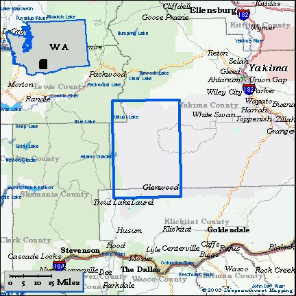
| MAP COVERAGE Quadrangle extent overlaid on current basemap. | |
| BACKSIDE LEGEND | |
 A map summary is printed on the back side of the Mount Adams sheet similar to the one shown in the picture. It outlines the history, purpose, and status of the USGS mapping program at the time of the printing in 1923. It also provides instructions on how to read contour lines and a description of how they are used to depict the terrain. At the bottom of the page is a legend showing all of the symbols used to represent the cultural, relief, and water features found on the map. | |
| PLACENAMES Depending on map series and survey date, all of the features listed below may not be shown on this map. This list contains features that currently exist or historically existed within the area covered by the map. The list can be used as a reference to determine if this map covers your area of interest. Placenames are listed alphabetically next to each feature type. | |
| CITIES AND TOWNS (CURRENT) | Glenwood |
| COUNTIES COVERED | Klickitat, Lewis, and Yakima |
| FEDERAL LAND UNITS | Gifford Pinchot National Forest, Goat Rocks Wilderness, Mount Adams Wilderness, Snoqualmie National Forest, and Yakama Indian Reservation |
| RIVERS AND STREAMS | Agency Creek, Bacon Creek, Bear Creek, Big Muddy Creek, Bird Creek, Blue Creek, Branch Creek, Brush Creek, Butte Meadows Creek, Cedar Creek, Chaparral Creek, Cispus River, Clearwater Creek, Clock Creek, Cold Creek, Conrad Creek, Corral Creek, Cougar Creek, Crawford Creek, Cunningham Creek, Dairy Creek, Deer Creek, Diamond Dick Creek, Diamond Fork, Dry Creek, East Fork McCreedy Creek, Elk Creek, Elkhorn Creek, Featherbed Creek, Fish Lake Stream, Goat Creek, Gotchen Creek, Hellroaring Creek, Hole in the Ground Creek, Huckleberry Creek, Joe Creek, Klickitat River, Little Muddy Creek, McCreedy Creek, Middle Fork Ahtanum Creek, Middle Fork McCreedy Creek, Morrison Creek, Mosquito Creek, Muddy Fork, North Fork Chaparral Creek, North Fork Dairy Creek, North Fork Simcoe Creek, North Fork Toppenish Creek, O'Connor Creek, Panther Creek, Pearl Creek, Petross Creek, Pile Up Creek, Piscoe Creek, Pole Creek, Reservation Creek, Rusk Creek, Schafer Creek, Sheep Creek, Soda Spring Creek, South Fork Ahtanum Creek, South Fork Simcoe Creek, South Fork Tieton River, South Fork Toppenish Creek, Summit Creek, Surveyors Creek, Swamp Creek, Tenday Creek, Tepee Creek, Toppenish Creek, Trappers Creek, Trout Creek, Wahtum Creek, Walupt Creek, West Fork Klickitat River, West Fork White Creek, White Creek, White Deer Creek, and Yedlick Creek |
| WATER BODIES | Bench Lake, Bird Lake, Cirque Lake, Lake Corral, Diamond Lake, Fish Lake, Gertrude Lake, Howard Lake, LeConte Lake, Mill Pond, Mount Adams Lake, Surprise Lake, Two Lakes, and Walupt Lake |
| Locations: Alpine Camp, Blue Jay Campground, Brush Corral, Bypass Camp, Camp Chaparral, Beauty Camp, Bird Creek Campground, Bird Creek Meadows Picnic Area, Buck Camp, Cold Springs Campground, Cougar Creek Guard Station, Cowboy Parking Lot, Cress Camp, Draper Springs Camp, Gotchen Creek Guard Station, Island Campground, Jerusalem Camp, Kesslers Ranch, Klickitat Camp, Klickitat State Fish Hatchery, Lost Springs Campground, Nannie Peak Lookout, Olney Corral, Outlet Creek Campground, Potato Hill Guard Station, Short Trail Camp, Signal Peak Ranger Station, Soda Spring Campground, Stout Campground, Timberline Campground, Tree Phones Campground, Walupt Lake Campground, Walupt Lake Guard Station, and Walupt Lake Horse Camp. Areas: Coleman Weedpatch, Cultus Hole, and Devils Gardens. Mountains, Peaks, and Summits: Mount Adams, Bunnell Butte, Diamond Butte, Gilbert Peak, Glaciate Butte, Goat Butte, Goat Rocks, Jennies Butte, Johns Butte, Jungle Butte, King Mountain, Klose Butte, Lakeview Mountain, Little Mount Adams, Meadow Butte, Mulligan Butte, Nannie Peak, Oak Hill, Panther Butte, Panther Creek Lookout, Petross Sidehill, Pikers Peak, Poland Butte, Red Butte, Signal Peak, Smith Butte, Snipes Mountain, Snowplow Mountain, South Butte, Spencer Point, and Twin Buttes. Valleys and Canyons: Avalanche Valley. Parks: Mount Adams Wilderness. Trails: Highline Trail. Drainages: Bacon Creek, Bear Creek, Blue Creek, Brush Creek, Butte Meadows Creek, Big Muddy Creek, Cedar Creek, Chaparral Creek, Clearwater Creek, Cold Creek, Conrad Creek, Corral Creek, Cougar Creek, Coyote Creek, Crawford Creek, Crooked Creek, Cuitin Creek, Cunningham Creek, Dairy Creek, Deer Creek, Diamond Fork, Dry Creek, East Fork McCreedy Creek, Elk Creek, Elkhorn Creek, Featherbed Creek, Fish Lake Stream, Hellroaring Creek, Howard Lake Stream, Huckleberry Creek, Icksix Creek, Joe Creek, Kingfish Creek, Little Muddy Creek, McCreedy Creek, Middle Fork McCreedy Creek, Mosquito Creek, North Fork Chaparral Creek, North Fork Dairy Creek, O'Connor Creek, Outlet Creek, Panther Creek, Pearl Creek, Petross Creek, Pile Up Creek, Piscoe Creek, Pole Creek, Reservation Creek, Rusk Creek, Schafer Creek, Sheep Creek, Skunk Creek, Soda Spring Creek, South Fork Toppenish Creek, Surveyors Creek, Swamp Creek, Tenday Creek, Tepee Creek, Trappers Creek, Trout Creek, Walupt Creek, West Fork Klickitat River, West Fork White Creek, White Creek, and Yedlick Creek. Capes: Sheep Point. Lakes and Ponds: Bluff Lake, Bench Lake, Bird Lake, Cirque Lake, Lake Corral, Diamond Lake, Fish Lake, Gertrude Lake, Heart Lake, Howard Lake, LeConte Lake, Mirror Lake, Mount Adams Lake, Shadow Lake, Sheep Lake, Surprise Lake, Two Lakes, Walupt Lake, and Warm Lake. Waterfalls: Castile Falls, Crooked Creek Falls, and Outlet Falls. Dams: Mill Pond Dam. Bluffs: Esel Point, Miller Point, Roosevelt Cliff, and Windy Point. Gaps: Cispus Pass and Red Saddle. Canals: Hellroaring Ditch and Sage Flat Ditch. Basins: Cedar Valley and Schafer Pocket. Lava Fields: A G Aiken Lava Bed. Airports: Flying L Ranch Airport and Signal Peak Lookout Heliport. Swamps: Cedar Swamp, Hog Swamp, and Huckleberry Swamp. Schools: Glenwood High and Elementary School. Ridges: Battlement Ridge, Bullgrouse Ridge, Fairview Ridge, Klickton Divide, Mike Coon Hillside, Nannie Ridge, North Cleaver, Peavine Ridge, Pinegrass Ridge, Rattlesnake Ridge, Ridge Of Wonders, The Spearhead, Suksdorf Ridge, and Victory Ridge. Reservoirs and Tanks: Mill Pond. Flats: Butte Meadows, Caldwell Prairie, Bird Creek Meadows, Borde Flats, Foggy Flat, Hellroaring Meadow, Holdaway Meadow, Hussey Meadow, Klickitat Meadow, McCormick Meadow, Piscoe Meadow, and Snowgrass Flat. Plains and Plateaus: Lincoln Plateau and Lost Horse Plateau. Pillars: The Castle, Coyote Rocks, and Saxton Rock. Springs: Bup Spring, Coffeepot Spring, Cold Springs, Draper Springs, Indian Ford Springs, Island Spring, Jungle Spring, Lost Springs, Lyon Spring, Maiden Springs, McCumber Spring, Mud Spring, Shamrock Spring, Soda Spring, and Wonder Spring. | |
| SHIPPING AND RETURNS | |
 This map sheet will be carefully rolled in a sturdy tube and shipped via the US Postal Service. If you find that the sheet you receive is not as described in the listing, you may ship it back to us for a refund of the purchase price. | |
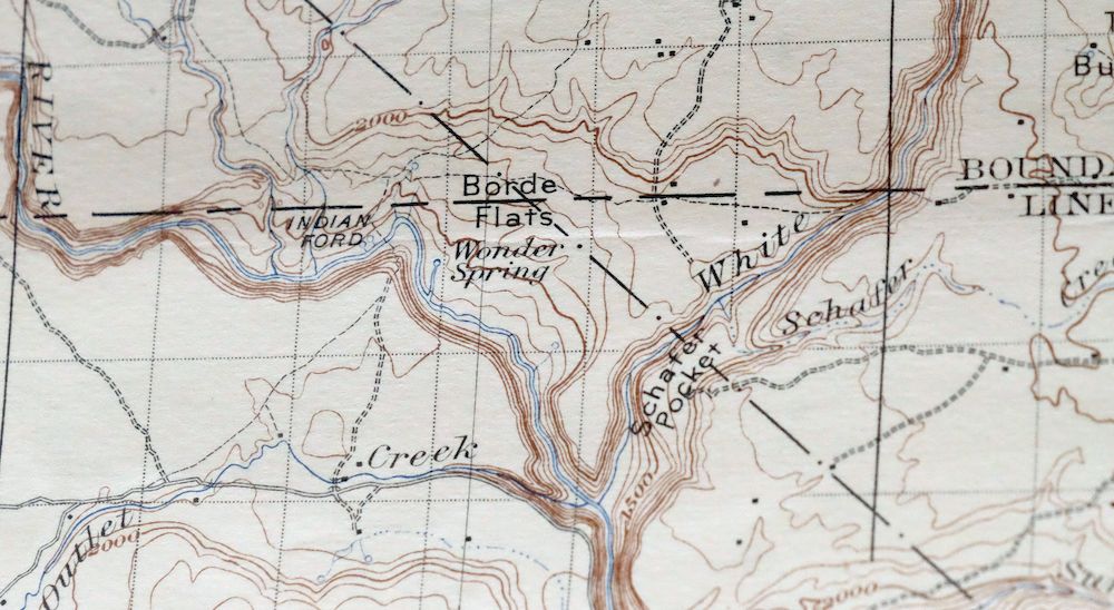
1923 USGS Topo Map: Mount Adams, Washington
$57
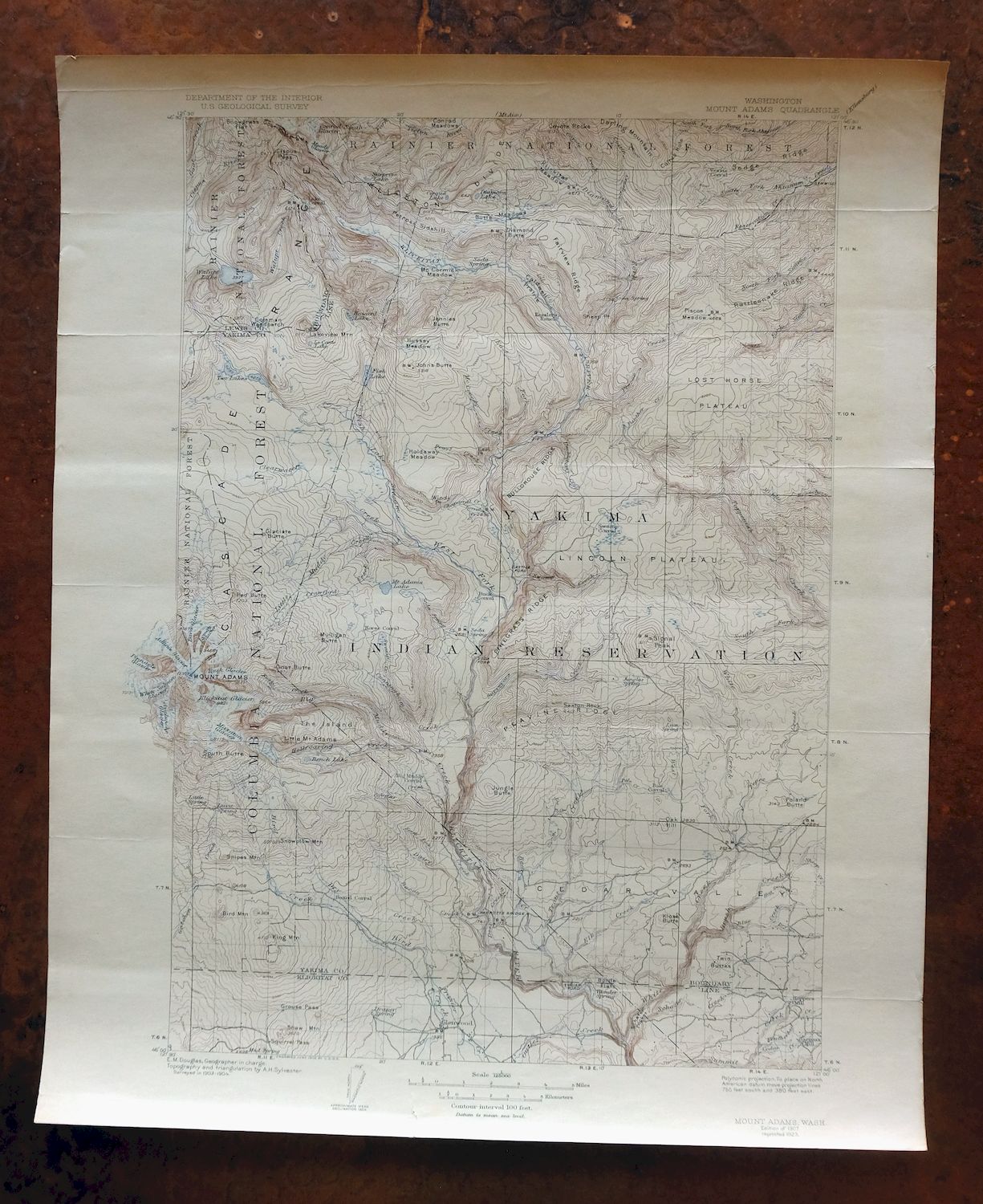
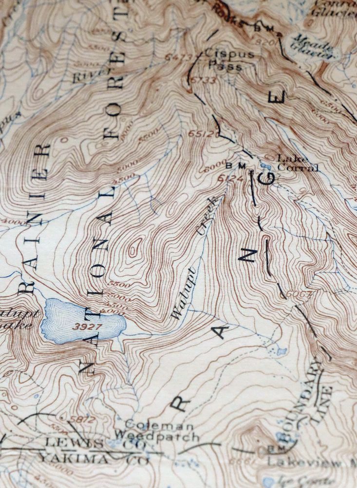
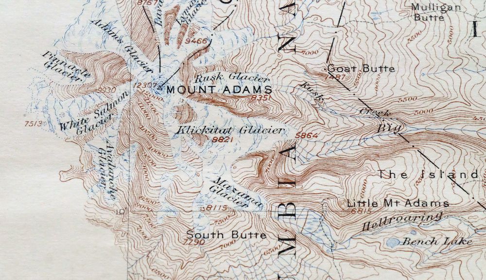
This 1907 edition of the Mount Adams quadrangle, printed in 1923 on thick paper stock, is a 30-minute USGS topographic map drawn from field survey work done in 1903 and 1904 by geographer E.M. Douglas. The sheet covers a stretch of the south Washington Cascades roughly 35 miles northwest of Goldandale, taking in the Mount Adams high country, parts of what is now Gifford Pinchot National Forest, and the small community of Glenwood. The 100-foot contours trace the volcano’s bulk and the surrounding ridgelines, a terrain mapped before the forest boundaries and wilderness designations that shape it today. The sheet is in very good condition at 103 years old, lightly age-toned and never folded.
In stock
This antique sheet is a 1907 edition of the Mount Adams Washington USGS topographic map. It is an authentic 103-year-old 1923 United States Geological Survey print in very good condition.
HOW THIS MAP CAN BE USED
In addition to making a fascinating conversation piece, this sheet would look great in a frame or on display, make a unique and prized gift for anyone interested in this area, be perfect as a reference for genealogy studies or general historical research, or fill that missing piece in your collection.
FEATURES SHOWN ON THE MAP
The Mount Adams 30-minute map shows cities and towns, roads, railroads, rivers, creeks, elevation contour lines, public land survey lines, county, state, and other administrative boundaries as they existed at the time of the survey in 1903 and 1904.
A VALUABLE HISTORICAL RECORD
Maps from the USGS 30-minute series have been out of print for many years. They have never been common and original prints are increasingly difficult to find. For areas where the 30-minute map was produced, it is usually the first large-scale survey done by the USGS for that area. These are a valuable historical record, as they contain many placenames and features that have been dropped from more recent series’ and editions.
Nearby maps
-
Chehalis Washington Lacey Tumwater USGS Topographic Map 1916
$75 Add to cart -
Colockum Pass Washington Wenatchee USGS 30-Min Topo Map 1922
$36 Add to cart -
Wallula Washington Finley Burbank USGS Topo Map 1918 Antique
$34 Add to cart -

Connell Washington Lind Mesa USGS Topo Map 1918 Antique
$34 Add to cart -
Yakima East Washington Moxee Parker USGS Topo Map 1985
$37 Add to cart -
Yakima East Washington Union Gap USGS Topographic Map 1968
$25 Add to cart -
Yakima East Washington Union Gap USGS Topographic Map 1941
$51 Add to cart -
Black Rock Spring Washington Yakima Ridge USGS Topo Map 1941
$32 Add to cart -
Grandview Washington Sunnyside USGS Topo Map 1951 Vintage
$42 Add to cart -
Boylston Washington Vantage Doris USGS Topographic Map 1943
$44 Add to cart -
Washougal Washington Camas Troutdale USGS Topo Map 1971
$43 Add to cart -
Enumclaw Washington Buckley Upper Mill USGS Topo Map 1976
$45 Add to cart -
Orchards Washington Vancouver Minnehaha USGS Topo Map 1977
$37 Add to cart -
Snoqualmie Pass Washington Hyak USGS Topographic Map 1965
$21 Add to cart -
Yelm Washington Rainier North Yelm USGS 15-Min Topo Map 1944
$33 Add to cart -

Sumner Washington South Hill Auburn USGS Topo Map 1976
$43 Add to cart -
Coyote Rapids Washington USGS 15-Min Topo Map 1916 Antique
$45 Add to cart -

Puyallup Washington Tacoma Waller USGS Topographic Map 1976
$46 Add to cart -
Red Rock Washington Royal City Smyrna USGS Topo Map 1911
$20 Add to cart -

Maple Valley Washington Covington USGS Topographic Map 1976
$43 Add to cart -
Adna Washington Centralia Fords Prairie USGS Topo Map 1955
$38 Add to cart -

Badger Mountain Washington South Richland USGS Topo Map 1978
$43 Add to cart -

Renton Washington Seattle Kent USGS Topo Map 1976 Vintage
$38 Add to cart -
Rock Island Washington South Wenatchee USGS Topo Map 1967
$41 Add to cart