MAP DETAILS | |
|---|---|
| TITLE | Eagles Mere |
| STATE | Pennsylvania |
| LOCATION | Vicinity of Picture Rocks, 20 miles northeast of Williamsport |
| SERIES | 15-minute |
| SURVEYED | 1925 through 1930 Field Survey |
| EDITION | 1953 |
| REVISIONS | 1953 |
| PRINTED | 1961 |
| PRINT NOTES | Thick paper stock, includes woodland tint (green to indicate vegetated areas) |
| SCALE | 1:62500 |
| CONTOUR INTERVAL | 20 feet |
| SHEET DIMENSIONS | 17 x 21 inches |
| MAP DIMENSIONS | 13 1/8 x 17 1/2 inches |
| COVERAGE AREA | 13 x 17 miles |
| SHEET CONDITION For maps of this vintage, effort is made to note all visible flaws, no matter how minor. | |
| OVERALL CONDITION | Very Good |
| SHEET NOTES | lightly handled, never folded |
| MAP AREA | no wear, no markings, no blemishes |
| COLLARS | no markings, edge protectors applied, no edge tears, library stamp in right collar, minor paperclip residue in lower right collar corner |
 | |
| MAP COVERAGE Quadrangle extent overlaid on current basemap. | |
| PLACENAMES Depending on map series and survey date, all of the features listed below may not be shown on this map. This list contains features that currently exist or historically existed within the area covered by the map. The list can be used as a reference to determine if this map covers your area of interest. Placenames are listed alphabetically next to each feature type. | |
| CITIES AND TOWNS (CURRENT) | Eagles Mere, Forksville, Laporte, Picture Rocks, and Sonestown |
| COUNTIES COVERED | Lycoming and Sullivan |
| RIVERS AND STREAMS | Bear Creek, Bear Run, Bearwallow Run, Beaver Run, Big Run, Buck Run, Coal Run, Deep Hollow Run, Derr Run, Double Run, Dry Run, Elk Creek, Falls Run, Fishing Creek, Fox Run, Grandad Run, Gregs Run, Hemlock Run, Hessler Branch, High Rock Run, Hoagland Branch, Huckle Run, Joes Run, Kettle Creek, Lake Run, Lick Run, Little Indian Run, Little Loyalsock Creek, Little Muncy Creek, Little Swamp Run, Loyalsock Creek, Mackeys Run, Marsh Run, Mill Creek, Mosey Run, Muncy Creek, Pine Run, Plunketts Creek, Roaring Run, Rock Run, Scar Run, Shanerburg Run, Shingle Mill Run, Slip Run, South Fork Bear Creek, Spring Run, Sugar Run, Swamp Run, Swanks Run, Tamarack Run, The Outlet, Trout Run, West Branch Little Muncy Creek, West Creek, and Wolf Run |
| WATER BODIES | Beaver Lake, Celestial Lake, Crystal Lake, Deer Lake, Eagles Mere Lake, Highland Lake, Hunters Lake, Rainbow Lake, Sones Pond, and Wild Rice Lake |
| Locations: Camp Genesee, Camp Lycogis, Dry Run Picnic Area, Dunwoody Camp, Eagles Mere Golf Course, Hemlock Grove, High Knob Overlook, Ogdonia Clubhouse, and Straw. Areas: High Knob Natural Area, Kettle Creek Gorge Natural Area, and Rock Garden. Administrative Boundaries: Borough of Eagles Mere, Township of Elkland, Township of Forks, Borough of Forksville, Township of Fox, Township of Hillsgrove, Township of Plunketts Creek, Township of Shrewsbury, and Township of Shrewsbury. Mountains, Peaks, and Summits: Bad Hill, Bear Mountain, Camp Mountain, Frantz Hill, Gooseberry Hill, High Knob, Hogback Hill, Lovers Rock, Middle Hill, Pole Hill, Prospect Hill, Rough Hill, Round Top, and Roundtop. Valleys and Canyons: Dry Run Gorge, Kettle Creek Gorge, Loyalsock Creek Gorge, Painter Hollow, and Warburton Hollow. Parks: State Game Lands Number 13 and Worlds End State Park. Trails: Ash Ridge Spur, Bark Shed Trail, Big Run Spur, Big Timber Spur, Browns Trail, Camels Trail, Camslab Trail, Crane Spur, Dead Horse Trail, Detters Trail, Double Run Trail, East Slab Trail, Falls Run Trail, Fox Hollow Spur, Gooseberry Trail, Hardwood Trail, High Knob Trail, High Landing Trail, High Rock Spur, Irish Settlement Trail, Jackson Trail, Laurel Ridge Trail, Loyalsock Trail, Middle Hill Trail, Nettle Ridge Trail, Old House Trail, Pole Bridge Trail, Pole Hill Trail, Ridge Trail, Rock Run Trail, Ryans Trail, Scar Run Trail, Short Trail, Springhill Trail, Stony Run Trail, Trout Hill Trail, Walnut Trail, and World End Trail. Drainages: Cape Run, Barkshed Run, Bear Run, Big Run, Brunnerdale Run, Buck Run, Bully Run, Coal Run, Deep Hollow Run, Double Run, Dry Run, Elk Creek, Falls Run, Fox Run, Grandad Run, Hemlock Run, Hessler Branch, High Rock Run, Hoagland Branch, Huckle Run, Joes Run, Ketchum Run, Kettle Creek, Lake Run, Laurel Run, Lick Run, Little Loyalsock Creek, Little Swamp Run, Mackeys Run, Marsh Run, Mill Creek, Mill Race, Mosey Run, Ogdonia Creek, The Outlet, Pine Run, Pole Bridge Run, Roaring Run, Rock Run, Rusty Run, Scar Run, Shanerburg Run, Slab Run, Slip Run, South Fork Bear Creek, Spring Run, Stony Run, Swamp Run, Swanks Run, Tamarack Run, Trout Run, West Branch Little Muncy Creek, and West Creek. Churches: Bethel Church, Ebenezer Church, Fairview Church, Franklin Church, Kedron Church, Mapleton Church, Mount Zion Church, and Rock Run Church. Lakes and Ponds: Beaver Lake, Celestial Lake, Crystal Lake, Deer Lake, Eagles Mere Lake, Highland Lake, Hunters Lake, Mud Lake, Rainbow Lake, and Wild Rice Lake. Buildings: Maurglen Post Office. Waterfalls: Angel Falls, Cold Run Road Falls, Dry Run Falls, and Wenonan Falls. Dams: Beaver Lake Dam, Hunters Lake Dam, and Sones Pond Dam. Bluffs: Picture Rocks. Bridges: High Bridge. Bars: Haystacks. Airports: Eagles Mere Municipal Airport. Swamps: Slab Run Swamp and Spook Swamp. Schools: Frantz School, Sullivan Highland School, and Villa Grove School. Ridges: Chestnut Ridge, Devils Garden, Nettle Ridge, and Sugar Camp Spur. Reservoirs and Tanks: Beaver Lake and Sones Pond. Pillars: Castle Rock, Labyrinth, and Ticklish Rock. | |
| SHIPPING AND RETURNS | |
 This map sheet will be carefully rolled in a sturdy tube and shipped via the US Postal Service. If you find that the sheet you receive is not as described in the listing, you may ship it back to us for a refund of the purchase price. | |
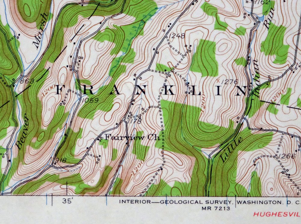
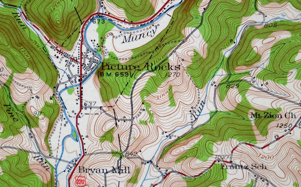


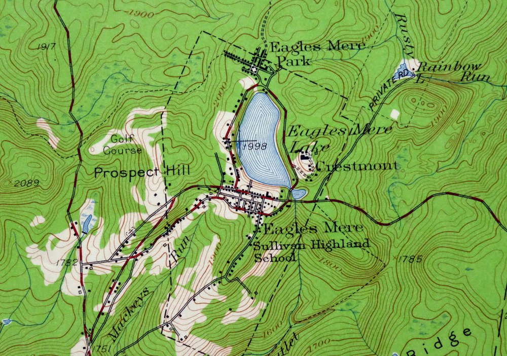

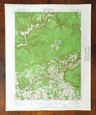
Eagles Mere Pennsylvania Laporte USGS Topographic Map 1961
$36
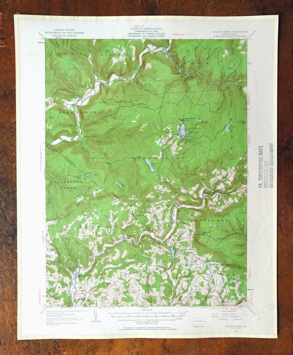
This USGS 15-minute topographic sheet is a 1953 edition, printed in 1961, and has been kept in very good condition—lightly handled and never folded, on thick stock. The quad covers a stretch of northern Pennsylvania near Picture Rocks, about 20 miles northeast of Williamsport, taking in the boundaries of Lycoming and Sullivan counties and communities including Eagles Mere, Laporte, Forksville, and Sonestown. The resort village of Eagles Mere, tucked into the Endless Mountains, gives the quad its name and is the kind of place a summer visitor to that country would recognize on the map. A library stamp and minor paperclip residue in the collar are the only marks; the map area itself shows no wear or blemishes, and edge protectors have been applied.
In stock
This vintage sheet is a 1953 edition of the Eagles Mere Pennsylvania USGS topographic map. It is an original 65-year-old 1961 United States Geological Survey print in very good condition.
HOW THIS MAP CAN BE USED
In addition to making a fascinating conversation piece, this sheet would look great in a frame or on display, make a unique and prized gift for anyone interested in this area, be perfect as a reference for genealogy studies or general historical research, or fill that missing piece in your collection. Maps of this vintage are printed on durable stock and are well-suited for outdoor activities and recreation of all kinds, including hiking, backpacking, hunting, rafting and kayaking, backcountry skiing, geocaching, general exploration, treasure hunting, etc.
FEATURES SHOWN ON THE MAP
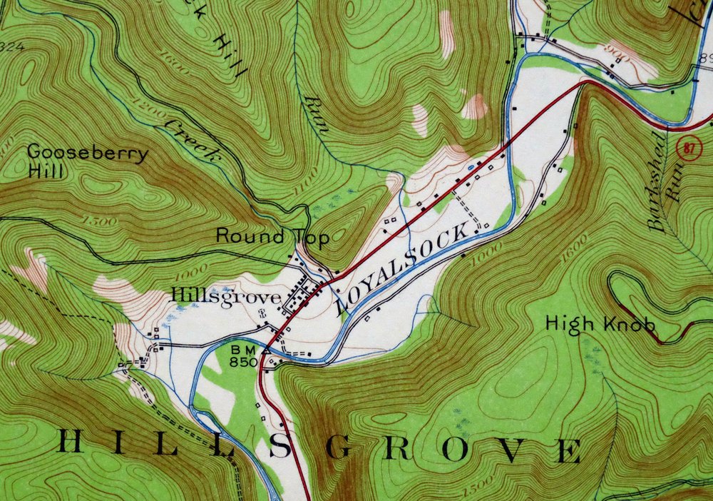
The Eagles Mere 15-minute map shows cities and towns, roads, railroads, utilities and energy infrastructure, rivers, creeks, elevation contour lines, public land survey lines, county, state, and other administrative boundaries as they existed at the time of the survey in 1925 through 1930. All known structures (houses, businesses, churches, schools, barns, cabins, etc) are also shown.
A VALUABLE HISTORICAL RECORD
Maps from the 15-minute series for the continental United States are no longer produced or printed by the USGS and original prints are becoming increasingly difficult to find. They are a valuable historical record for an area, as they contain many placenames and features that have been dropped from more recent maps.
Nearby maps
-
Warrensville Pennsylvania Barbours USGS Topographic Map 1962
$42 Add to cart -

Hughesville Pennsylvania Millville Iola USGS Topo Map 1962
$42 Add to cart -

Canton Pennsylvania Alba Ralston USGS Topo Map 1958 Vintage
$20 Add to cart -
Towanda Pennsylvania Rome USGS 15-Min Topo Map 1960 Vintage
$43 Add to cart -

Catawissa Pennsylvania Bloomsburg Ashland USGS Topo Map 1960
$45 Add to cart -

Tunkhannock Pennsylvania Dalton Glenburn USGS Topo Map 1952
$40 Add to cart -

Tioga Pennsylvania Mansfield USGS Topo Map 1903 Antique
$68 Add to cart -
Le Raysville Pennsylvania Little Meadows USGS Topo Map 1965
$41 Add to cart -

Lykens Pennsylvania Valley View Reinerton USGS Topo Map 1964
$45 Add to cart -

Elkland Pennsylvania Wellsboro Knoxville USGS Topo Map 1903
$52 Add to cart -

Hazleton Pennsylvania Lansford Tamaqua USGS Topo Map 1956
$48 Add to cart -
Susquehanna Pennsylvania Hallstead USGS 15-Min Topo Map 1959
$46 Add to cart -

Centre Hall Pennsylvania Bellefonte Zion USGS Topo Map 1958
$28 Add to cart -
Renovo West Pennsylvania Westport USGS Topographic Map 1965
$38 Add to cart -
Honesdale Pennsylvania Carbondale Waymart USGS Topo Map 1945
$49 Add to cart -

Conrad Pennsylvania Hammersley Wild Area USGS Topo Map 1958
$34 Add to cart -
Kingston Pennsylvania Wilkes-Barre USGS Topographic Map 1959
$39 Add to cart -
Wilkes-barre West Pennsylvania Nanticoke USGS Topo Map 1958
$30 Add to cart -

Wilkes-barre East Pennsylvania Laurel Run USGS Topo Map 1959
$36 Add to cart -

Hazleton Pennsylvania McAdoo Jeddo USGS Topographic Map 1962
$47 Add to cart -
Olyphant Pennsylvania Scranton Dunmore USGS Topo Map 1960
$37 Add to cart -
Catatonk New York Ithaca Endicott USGS Topo Map 1908 Antique
$65 Add to cart -
Snow Shoe SE Pennsylvania Orviston USGS Topographic Map 1962
$34 Add to cart -

Hummelstown Pennsylvania Hershey Palmyra USGS Topo Map 1965
$37 Add to cart