MAP DETAILS | |
|---|---|
| TITLE | Torrey |
| STATE | Utah |
| LOCATION | Capitol Reef National Park, 50 miles southeast of Richfield |
| SERIES | 15-minute |
| SURVEYED | 1951 and 1952 Aerial and Field Survey |
| EDITION | 1952 |
| PRINTED | 1958 |
| PRINT NOTES | Thick paper stock |
| SCALE | 1:62500 |
| CONTOUR INTERVAL | 80 feet |
| SHEET DIMENSIONS | 17 x 21 inches |
| MAP DIMENSIONS | 13 3/4 x 17 1/2 inches |
| COVERAGE AREA | 14 x 17 miles |
| SHEET CONDITION For maps of this vintage, effort is made to note all visible flaws, no matter how minor. | |
| OVERALL CONDITION | Very Good |
| SHEET NOTES | never folded |
| MAP AREA | no markings, no blemishes |
| COLLARS | no markings, no blemishes, minor handling dents in bottom collar, repaired edge tear in right collar, has library stamp in bottom right collar |
| MAP COVERAGE Quadrangle extent overlaid on current basemap. | |
| PLACENAMES Depending on map series and survey date, all of the features listed below may not be shown on this map. This list contains features that currently exist or historically existed within the area covered by the map. The list can be used as a reference to determine if this map covers your area of interest. Placenames are listed alphabetically next to each feature type. | |
| NOTABLE PLACES | Capitol Reef NP, Waterpocket Fold, and Fremont River |
| CITIES AND TOWNS (CURRENT) | Teasdale and Torrey |
| COUNTIES COVERED | Emery and Wayne |
| FEDERAL LAND UNITS | Capitol Reef National Park, Dixie National Forest, Fishlake National Forest, and Fremont Gorge Wilderness Study Area |
| RIVERS AND STREAMS | Boulder Creek, Bullberry Creek, Carcass Creek, Cottonwood Creek, Deep Creek, Donkey Creek, Fish Creek, Polk Creek, and Sulphur Creek |
| WATER BODIES | Snow Lake |
| Populated Place: Teasdale and Torrey. Locations: Capitol Reef National Park Visitor Center, Cathedral Valley View Area, Elkhorn Campground, Elkhorn Guard Station, Elkhorn Ranger Station and Forest Camp, Goosenecks Overlook, Rim Rock Resort Ranch, and Teasdale District Ranger Station. Areas: Cathedral Valley. Administrative Boundaries: Town of Torrey. Mountains, Peaks, and Summits: Acklin Peak, Cathedral Mountain, Chimney Rock, Cooks Mesa, Flat Top, Hens Hole Peak, Meeks Mesa, Needle Mountain, Point Lookout, The Ant Hill, The Castle, Thousand Lake Mountain, and Twin Rocks. Valleys and Canyons: Calf Canyon, Chimney Rock Canyon, Cigarette Hollow, Holt Draw, Paradise Draw, Pierce Draw, South Fork Spring Canyon, Water Canyon, and Wide Hollow. Parks: Red Cliff Oasis. Trails: Stair Trail. Drainages: Birch Creek, Boulder Creek, Bullberry Creek, Carcass Creek, Collins Creek, Cottonwood Creek, Donkey Creek, Fish Creek, Lake Creek, Polk Creek, and Sand Creek. Churches: The Church of Jesus Christ of Latter Day Saints. Post Office: Teasdale Post Office and Torrey Post Office. Lakes and Ponds: Blue Lake, Deep Creek Lake, Heart Lake, Round Lake, and Snow Lake. Buildings: Teasdale Fire Department, Torrey Fire Department, and United States Forest Service Fire Station Teasdale Work Station. Dams: Neffs Dam. Bluffs: Mummy Cliff. Gaps: Billings Pass and Bullings Pass. Canals: Torrey Canal. Bends: Goosenecks. Basins: Gypsum Sinkhole, Hells Hole, McDonld Basin, and Sulphur Basin. Airports: Torrey Airport. Census: Teasdale Census Designated Place. Ridges: Deep Creek Ridge, Polk Creek Ridge, and Velvet Ridge. Reservoirs and Tanks: Coleman Reservoir, Flatiron Lakes, and Neff Reservoir. Flats: Beas Lewis Flats, Bull Run Flat, Bullberry Flat, Hens Hole Flat, Jahu Flat, Little Sand Flat, Paradise Flats, Poverty Flat, Sand Flat, Tub Flat, Whiskey Flat, and Wiffs Pasture. Bench: Teasdale Bench. Pillars: The Motorman. Springs: Alex Spring, Chaffin Spring, Clay Dugway Spring, Deep Creek Spring, East Sand Creek Spring, Flat Top Spring, Hens Peak Spring, Hickman Spring, Indian Spring, Mud Spring, Pine Spring, Ring Water Spring, Round Lake Springs, Sand Creek Spring, Sawmill Spring, Sidehill Spring, South Desert Spring, Sulphur Spring, and Upper Deep Creek Spring. Cemetery: Torrey Cemetery and Teasdale Cemetery. | |
| SHIPPING AND RETURNS | |
 This map sheet will be carefully rolled in a sturdy tube and shipped via the US Postal Service. If you find that the sheet you receive is not as described in the listing, you may ship it back to us for a refund of the purchase price. | |
1958 USGS Topo Map: Torrey, Capitol Reef NP, Utah
$37
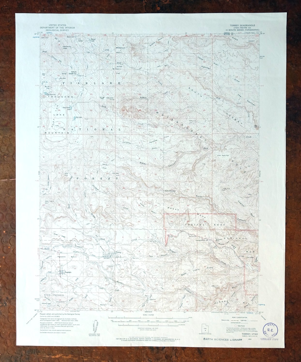
This 15-minute topographic sheet covers the Torrey quad in south-central Utah, from a 1952 edition printed in 1958 on thick paper, at a scale of 1:62500 with 80-foot contours. The quad takes in the towns of Torrey and Teasdale in Wayne County, part of Capitol Reef National Park, and portions of the Fishlake National Forest, reaching across into Emery County. This is the Waterpocket Fold country along the Fremont River, where the park was still a national monument in these years, and the sheet maps the folded sandstone ridges that define it. Never folded and in very good condition, it carries only minor handling dents and a small repaired tear in the collar.
In stock
This vintage sheet is a 1952 edition of the Torrey Utah USGS topographic map. It is an original 68-year-old 1958 United States Geological Survey print in very good condition.
HOW THIS MAP CAN BE USED
In addition to making a fascinating conversation piece, this sheet would look great in a frame or on display, make a unique and prized gift for anyone interested in this area, be perfect as a reference for genealogy studies or general historical research, or fill that missing piece in your collection. Maps of this vintage are printed on durable stock and are well-suited for outdoor activities and recreation of all kinds, including hiking, backpacking, hunting, rafting and kayaking, backcountry skiing, geocaching, general exploration, treasure hunting, etc.
FEATURES SHOWN ON THE MAP
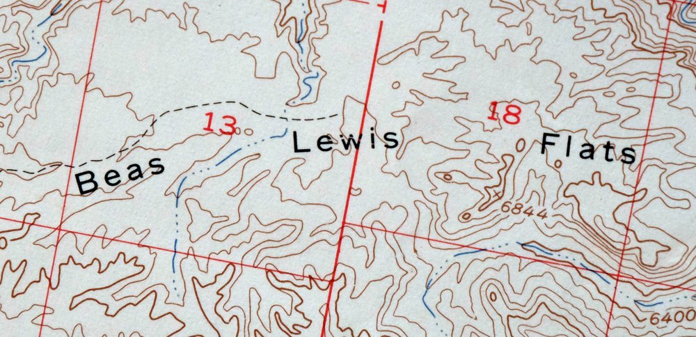
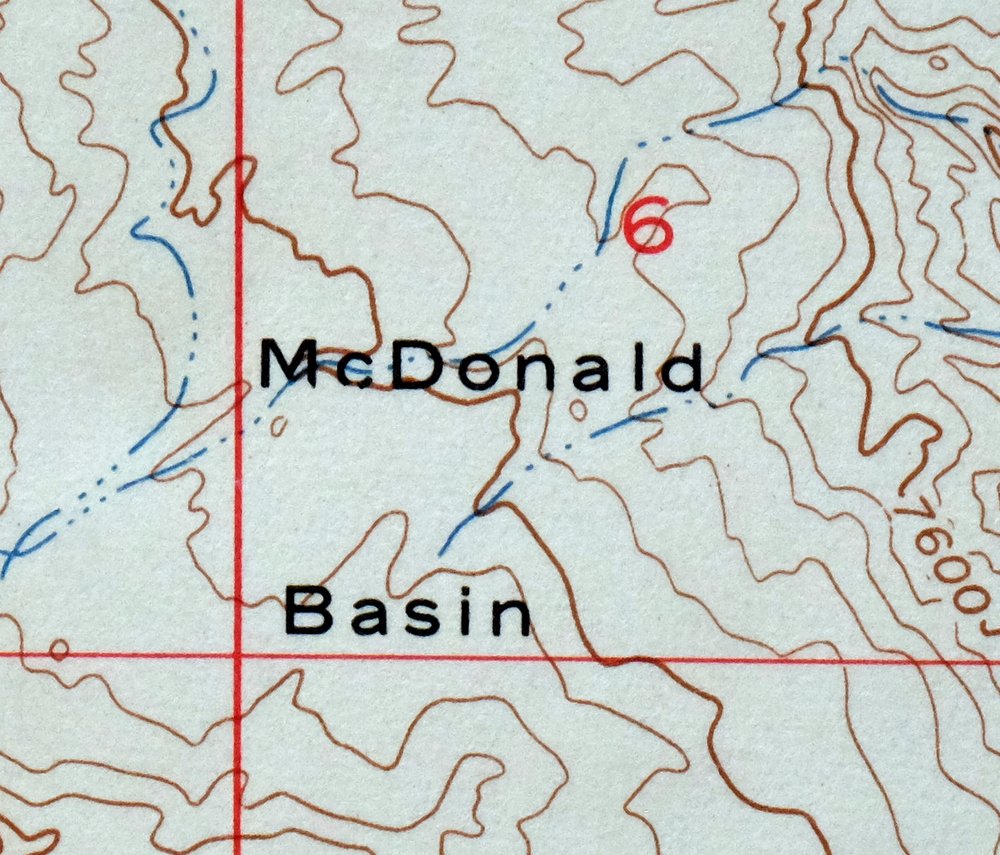
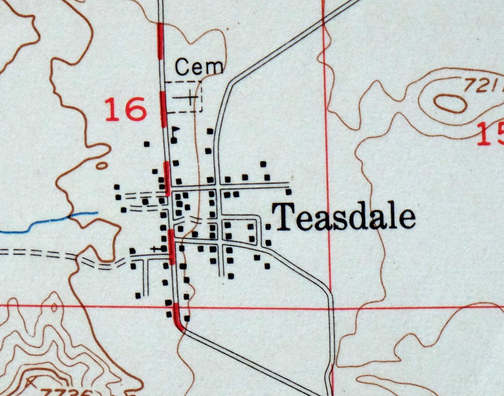
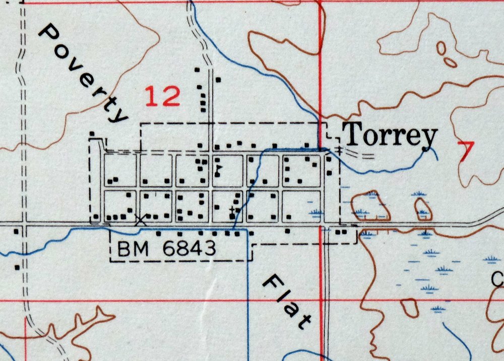
The Torrey 15-minute map shows cities and towns, roads, railroads, utilities and energy infrastructure, rivers, creeks, elevation contour lines, public land survey lines, county, state, and other administrative boundaries as they existed at the time of the survey in 1951 and 1952. All known structures (houses, businesses, churches, schools, barns, cabins, etc) are also shown.
A VALUABLE HISTORICAL RECORD
Maps from the 15-minute series for the continental United States are no longer produced or printed by the USGS and original prints are becoming increasingly difficult to find. They are a valuable historical record for an area, as they contain many placenames and features that have been dropped from more recent maps.
Nearby maps
-
Notom Capitol Reef NP Utah USGS 15-Min Topo Map 1958 Vintage
$45 Add to cart -
Marysvale Utah Piute Reservoir Junction USGS Topo Map 1947
$44 Add to cart -
1965 USGS Topo Map: Hanksville, Dirty Devil River, Utah
$38 Add to cart -
The Wickiup Utah Mexican Mountain WSA USGS Topo Map 1967
$20 Add to cart -

Castle Dale Utah Ferron Clawson USGS Topographic Map 1925
$47 Add to cart -
1968 USGS Topo Map: Castle Dale, Ferron, Utah (1923 Edition)
$44 Add to cart -
Fiddler Butte Utah USGS 15-Min Topographic Map 1958 Vintage
$38 Add to cart -
Fillmore Utah Kanosh Meadow USGS 15-Min Topographic Map 1975
$40 Add to cart -
The Spur Utah Canyonlands USGS 15-Min Topo Map 1971 Vintage
$38 Add to cart -
Beaver Utah Dixie NF Fishlake NF USGS Topo Map 1921 Antique
$62 Add to cart -

Moroni Utah Fountain Green USGS 15-Min Topo Map 1968 Vintage
$39 Add to cart -
1957 USGS Topo Map: Scofield, Clear Creek, Utah (Wattis)
$46 Add to cart -
Cummings Mesa Utah USGS 15-Min Topographic Map 1978 Vintage
$40 Add to cart -

Cummings Mesa Glen Canyon Utah Vintage USGS Topo Map 1964
$55 Add to cart -
Nipple Butte Utah Wahweap WSA Big Water USGS Topo Map 1962
$36 Add to cart -
Woodside Utah Book Cliffs Cedar USGS Topographic Map 1973
$22 Add to cart -

Castle Gate Utah Price Helper USGS Topo Map 1968 Vintage
$44 Add to cart -
1973 Nephi Utah USGS Topo Map: Levan (San Pitch Mountains)
$42 Add to cart -
1960 Milford Utah USGS Topo Map: Star Range (Vintage Print)
$40 Add to cart -
1956 USGS Topo Map: Range Creek, Desolation Canyon, Utah
$42 Add to cart -
Bears Ears Utah USGS 15 Minute Topographic Map 1974 Vintage
$45 Add to cart -
Sunnyside Utah Book Cliffs East Carbon USGS Topo Map 1915
$57 Add to cart -

Lees Ferry Arizona Page Marble Canyon USGS Topo Map 1971
$53 Add to cart -
Soldier Summit Utah Gilluly Colton USGS Topographic Map 1942
$49 Add to cart