MAP DETAILS | |
|---|---|
| TITLE | Hannagan Meadow |
| STATE | Arizona |
| LOCATION | 60 miles north of Safford |
| SERIES | 15-minute |
| EDITION | 1958 |
| PRINTED | 1960 |
| PRINT NOTES | Thick paper stock |
| SCALE | 1:62500 |
| SHEET DIMENSIONS | 17 x 21 inches (approximate) |
| MAP DIMENSIONS | 14 5/8 x 17 1/2 inches |
| COVERAGE AREA | 14 x 17 miles |
| MAP NOTES | Popular elk hunting area, home of the Mexican Gray Wolf. |
| SHEET CONDITION For maps of this vintage, effort is made to note all visible flaws, no matter how minor. | |
| OVERALL CONDITION | Excellent |
| SHEET NOTES | lightly handled, never folded |
| MAP AREA | flawless map area |
| COLLARS | no markings, no blemishes, no edge tears |
| MAP COVERAGE Quadrangle extent overlaid on current basemap. | |
| PLACENAMES Depending on map series and survey date, all of the features listed below may not be shown on this map. This list contains features that currently exist or historically existed within the area covered by the map. The list can be used as a reference to determine if this map covers your area of interest. Placenames are listed alphabetically next to each feature type. | |
| COUNTIES COVERED | Apache, Graham, and Greenlee |
| FEDERAL LAND UNITS | Apache National Forest, Bear Wallow Wilderness, Fort Apache Indian Reservation, and San Carlos Indian Reservation |
| RIVERS AND STREAMS | Bear Creek, Bear Wallow Creek, Beaver Creek, Black River, Boggy Creek, Centerfire Creek, Conklin Creek, Corduroy Creek, Double Cienega Creek, Dry Prong Creek, East Eagle Creek, Fish Creek, Foote Creek, Grant Creek, Hannagan Creek, Heifer Branch Beaver Creek, Horton Creek, KP Creek, McKittrick Creek, Raspberry Creek, Reservation Creek, Rose Creek, Salt House Creek, Snake Creek, South Fork Bear Wallow Creek, Steeple Creek, Thomas Creek, Wildcat Creek, and Willow Creek |
| WATER BODIES | Horseshoe Cienega |
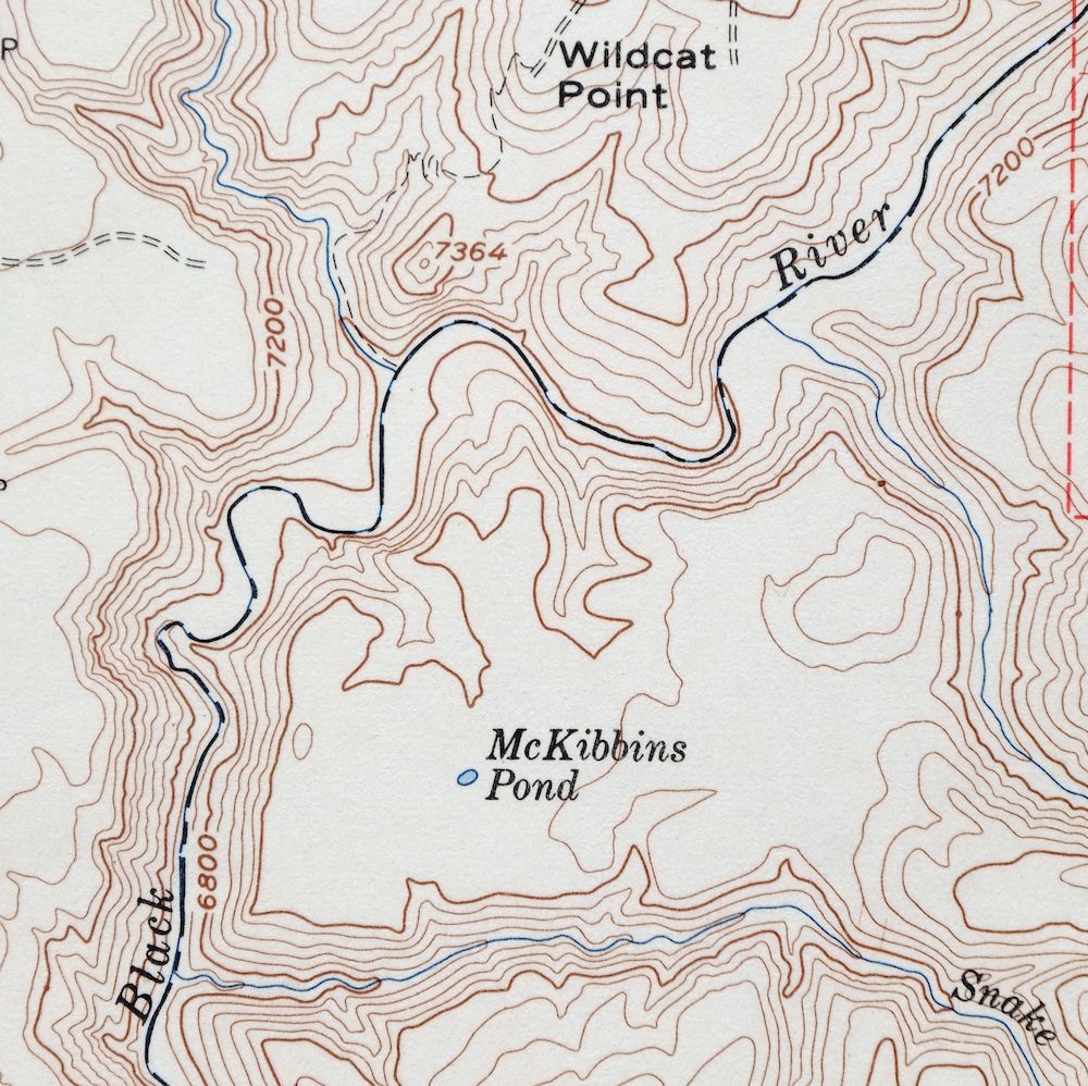
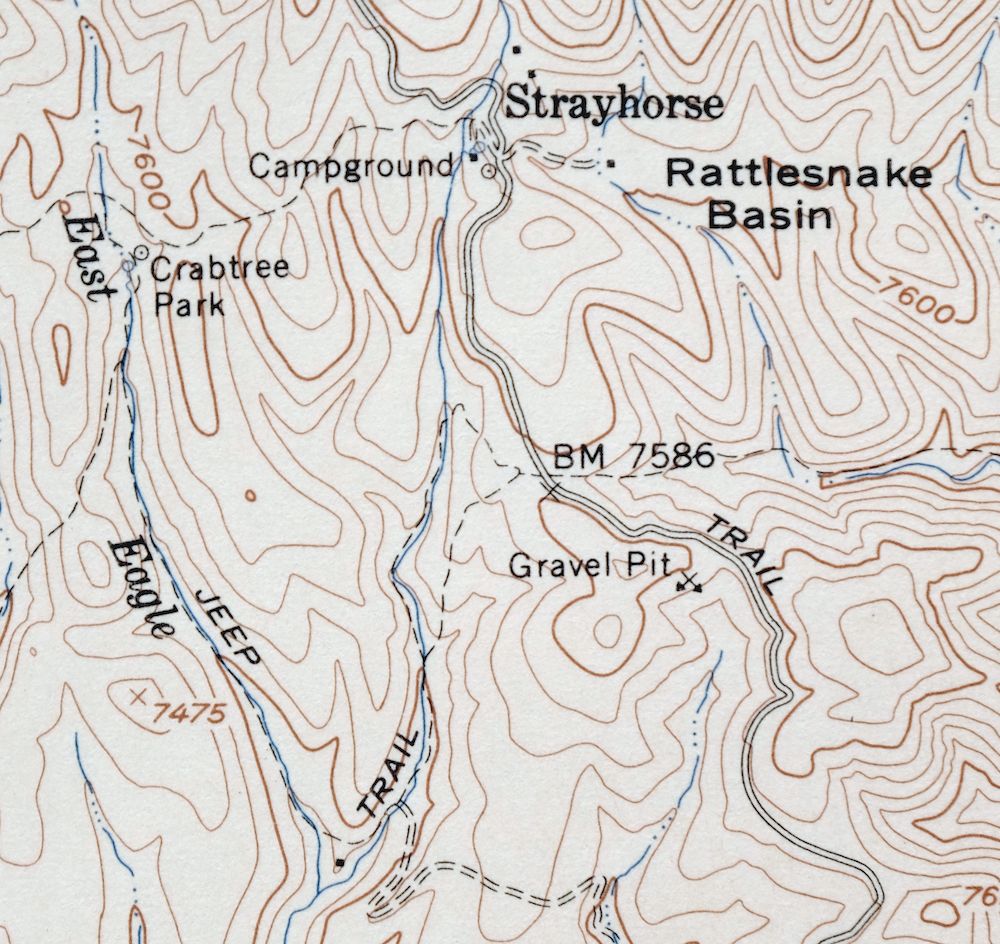
| Locations: Arizona Highway Department Maintance Yard, Balke Cabin, Blue Lookout, Blue Peak Lookout, Caldwell Administrative Site, Cauldwell Administration Site, Chitty Trap Corral, Hagen Corral, Hannagan Forest Service Facility, Hannagan Meadow Administrative Site, Malay Corral, McBride Corral, Reno Lookout, Salt House, Sanders Corral, Saunders Cabin, Strayhorse Administative Site, Strayhorse Forest Service Facility, and Upper Bear Canyon Seep. Areas: Rocky Prairie. Mountains, Peaks, and Summits: Blue Peak, Crooks Mesa, Gobbler Point, Hoodoo Knoll, Indian Peak, Raspberry Peak, Sawed Off Mountain, and Wildcat Point. Valleys and Canyons: Bardman Canyon, Bear Canyon, Burnt Corral Draw, Chitty Canyon, Hagen Draw, Hawks Nest Canyon, Johns Canyon, McBridge Canyon, Schell Canyon, Slaughter Draw, Squirrel Canyon, and Warren Canyon. Parks: Bear Wallow Wilderness, Conklin Creek Campgrounds, Crabtree Park, Hannagan Campground, KP Cienega Campground, and Stray Horse Campground. Trails: Chitty Canyon Trail Thirty Four, Crabtree Trail Twenty-two, Dry Prong Trail Forty-five, KP Trail Seventy, Lengthy Canyon Trail Eighty-nine, Raspberry Trail Thirty-five, and Salt House Eighteen Trail. Drainages: Boggy Creek, Beaver Creek, Centerfire Creek, Conklin Creek, Corduroy Creek, Double Cienega Creek, Fish Creek, Hagen Creek, Heifer Branch Beaver Creek, Horton Creek, North Fork Bear Wallow Creek, Reservation Creek, Salt House Creek, Snake Creek, South Fork Bear Wallow Creek, Thomas Creek, Wildcat Creek, and Willow Creek. Lakes and Ponds: Aker Lake, Elk Lake, Lost Lake, McKibbins Pond, P Bar Lake, Rattlesnake Lake, and Taylor Pond. Waterfalls: Chitty Falls. Dams: Thomas Creek Weir and Willow Creek Weir. Bluffs: Baldy Bill Point. Basins: Coyote Sink, Fish Sink, Raspberry Basin, Rattlesnake Basin, and Taylor Sink. Swamps: Horseshoe Cienega. Reservoirs and Tanks: Bardman Canyon Tank, Bardman Tank, Black Tank, Bear Tank, Borrow Pit Tank, Burn Tank, Carlock Tank, Clay Tank, Clear Cut Tank, Cole Tank, Cottonwood Tank, Cowhead Tank, Dart Tank, Deep Cienega Tank, East Becker Tank, Elk Tank, Far Tank, Fish Tank, Fishbench Tank, Gobbler Tank, Gravel Pit Tank, Holiday Tank, Juno Tank, K P Tank, Knoll Tank, L Fifty-six Tank, Long Canyon Tank, Loop Tank, Malay Tank, Maverick Tank, May Meadow Tank, PS Tank, Pond Tank, Rattlesnake Tank, Red Tail Tank, Reservation Tank, Salt Lick Tank, Section Three Tank, Seep Tank, Slaughter Tank, Snake Tank, Spruce Tank, Squirrel Canyon Tank, Squirrel Tank, Steer Pasture Tank, Tadpole Tank, Triple Tank, Turkey Enclosure Tank, Turkey Tank, Turkey Track Tank, Turkey Trap Tank, Upper Malay Tank, Wallow Tank, Walnut Tank, West Becker Tank, Wildcat Tank, and Wren Tank. Flats: Butterfly Cienega, Cache Cienega, Deep Cienega, Double Cienega, KP Cienega, Lost Cienega, Moonshine Park, and Paradise Park. Springs: Balke Spring, Bill Earl Spring, Bear Spring, Burk Seep, Chitty Creek Spring, Clell Spring, Crabtree Spring, Dogwood Spring, Horse Pasture Spring, Lengthy Spring, Long Canyon Spring, Lower Hagen Seep, Lower Hannagan Spring, Maverick Spring, Middle Turkey Spring, Miller Spring, Moth Seep, Mushroom Seep, Perry Spring, Reno Spring, Siamese Meadow Seep, Side Canyon Spring, South Squirrel Spring, Squirrel Spring, Taylor Tank and Spring, Triangle Seeps, Turkey Spring, Upper Bear Canyon Seep, Upper Bear Spring, Upper Hannagan Seep, Upper McBride Spring, Walnut Spring, West Becker Seep, Willow Corral SPring, and Willow Spring. | |
| SHIPPING AND RETURNS | |
 This map sheet will be carefully rolled in a sturdy tube and shipped via the US Postal Service. If you find that the sheet you receive is not as described in the listing, you may ship it back to us for a refund of the purchase price. | |
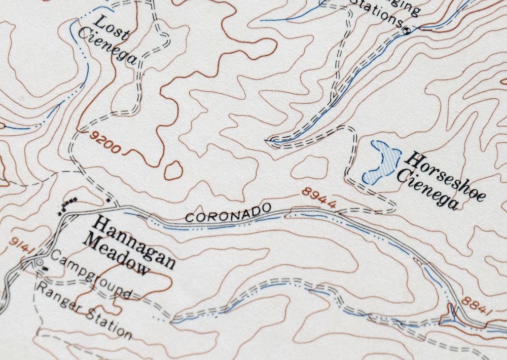
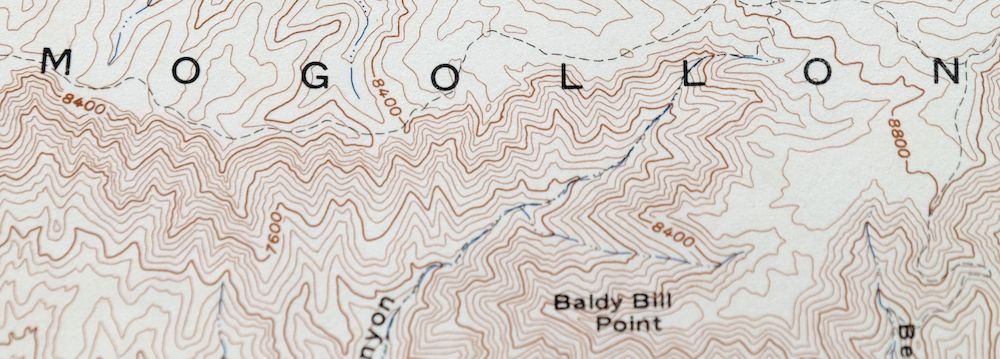
Hannagan Meadow Arizona Apache NF USGS Topo Map 1960 Vintage
$38
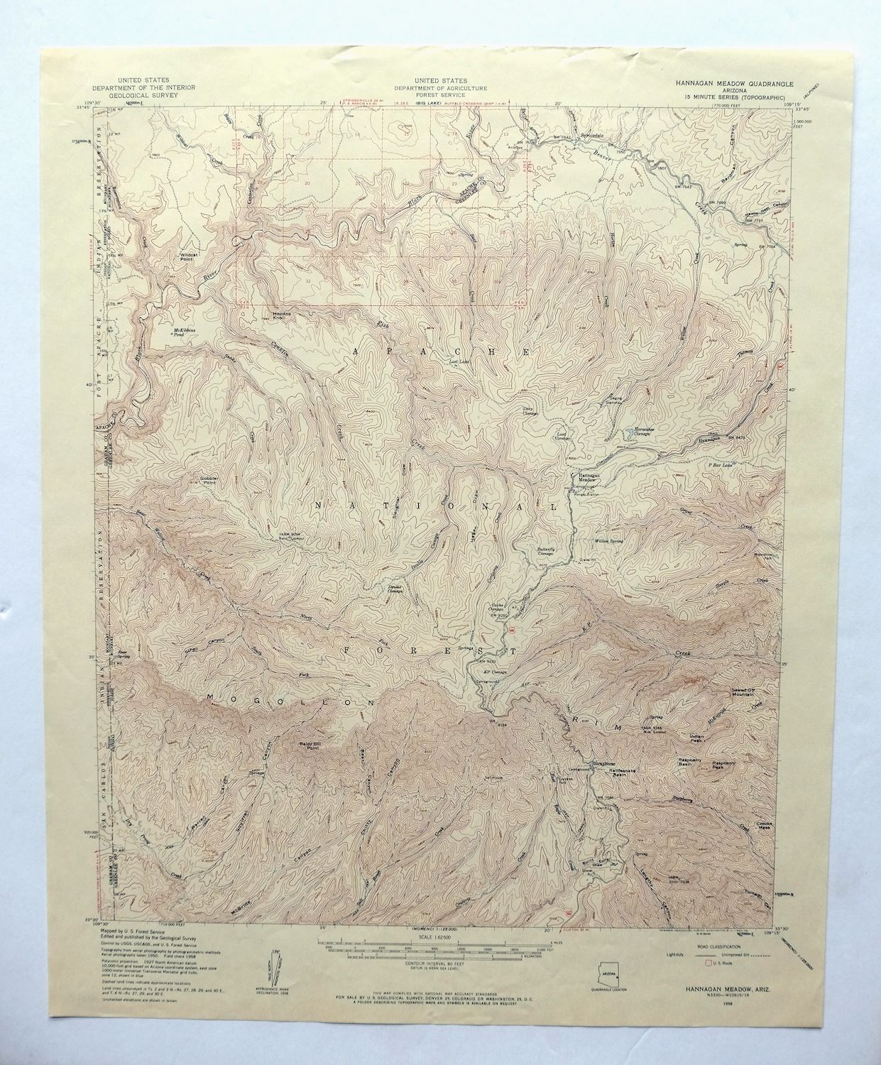
This USGS 15-minute topographic map is a 1958 edition printed in 1960, kept in excellent condition on thick stock, lightly handled and never folded. Covering high country in the White Mountains of eastern Arizona about 60 miles north of Safford, the quad takes in parts of the Apache National Forest and the Bear Wallow Wilderness, with the surrounding boundaries reaching into Apache, Graham, and Greenlee counties. The map depicts a stretch of forested backcountry long known for elk and as home range of the Mexican gray wolf, the kind of high, wooded terrain that gives Hannagan Meadow its character. Having never been folded and printed on heavy stock, the flawless map area and clean collar make this a strong candidate for framing.
In stock
This vintage sheet is a 1958 edition of the Hannagan Meadow Arizona USGS topographic map. It is an original 66-year-old 1960 United States Geological Survey print in excellent condition.
HOW THIS MAP CAN BE USED
In addition to making a fascinating conversation piece, this sheet would look great in a frame or on display, make a unique and prized gift for anyone interested in this area, be perfect as a reference for genealogy studies or general historical research, or fill that missing piece in your collection. Maps of this vintage are printed on durable stock and are well-suited for outdoor activities and recreation of all kinds, including hiking, backpacking, hunting, rafting and kayaking, backcountry skiing, geocaching, general exploration, treasure hunting, etc.
FEATURES SHOWN ON THE MAP
The Hannagan Meadow 15-minute map shows cities and towns, roads, railroads, utilities and energy infrastructure, rivers, creeks, elevation contour lines, public land survey lines, county, state, and other administrative boundaries as they existed at the time of the survey. All known structures (houses, businesses, churches, schools, barns, cabins, etc) are also shown.
A VALUABLE HISTORICAL RECORD
Maps from the 15-minute series for the continental United States are no longer produced or printed by the USGS and original prints are becoming increasingly difficult to find. They are a valuable historical record for an area, as they contain many placenames and features that have been dropped from more recent maps.
Nearby maps
-
Blue Arizona Apache NF USGS 15-Min Topo Map 1963 Vintage
$52 Add to cart -

Safford Arizona Thatcher Solomon USGS Topo Map 1980 Vintage
$44 Add to cart -
Show Low Arizona Pinetop-Lakeside USGS Topo Map 1972 Vintage
$40 Add to cart -
Cibecue Arizona Sitgreaves NF USGS Topo Map 1963 Vintage
$32 Add to cart -

Morenci Arizona Clifton Blue River USGS 30-Min Topo Map 1954
$64 Add to cart -
Mogollon New Mexico Pleasanton Mule Creek USGS Topo Map 1964
$54 Add to cart -
Hunt Arizona USGS 15-Min Topographic Map 1974 Vintage
$30 Add to cart -
Clay Springs Arizona Pinedale Aripine USGS Topo Map 1971
$34 Add to cart -

Klondyke Arizona USGS 15-Min Topographic Map 1971 Vintage
$44 Add to cart -
Chediski Peak Arizona Cibecue USGS Topo Map 1963 Vintage
$32 Add to cart -
Christmas Arizona USGS 15-Min Topographic Map 1917 Antique
$57 Add to cart -
Globe Arizona Miami Claypool USGS Topo Map 1982 Vintage
$28 Add to cart -
Bowie Arizona USGS 15-Min Topographic Map 1950 Vintage
$36 Add to cart -
Globe Arizona Miami Claypool USGS Topo Map 1955 Vintage
$54 Add to cart -
Heber Arizona Overgaard Mogollon Rim USGS Topo Map 1982
$45 Add to cart -

Petrified Forest Arizona USGS 15-Min Topo Map 1956 Vintage
$62 Add to cart -

San Simon Arizona Bowie USGS 30-Min Topo Map 1948 Vintage
$55 Add to cart -
Holbrook Arizona Woodruff USGS 15-Min Topo Map 1969 Vintage
$36 Add to cart -

Winchester Mountains Arizona The Mesas USGS Topo Map 1962
$35 Add to cart -
Woods Canyon Arizona Sitgreaves NF USGS 15-Min Topo Map 1963
$35 Add to cart -
Winkelman Arizona Dudleyville Hayden USGS Topo Map 1966
$43 Add to cart -

Superior Arizona Top-of-the-World USGS Topo Map 1957 Vintage
$45 Add to cart -
Cochise Head Arizona USGS 15-Min Topo Map 1957 Vintage
$44 Add to cart -
Cochise Arizona Willcox USGS 15-Min Topo Map 1963 Vintage
$43 Add to cart