MAP DETAILS | |
|---|---|
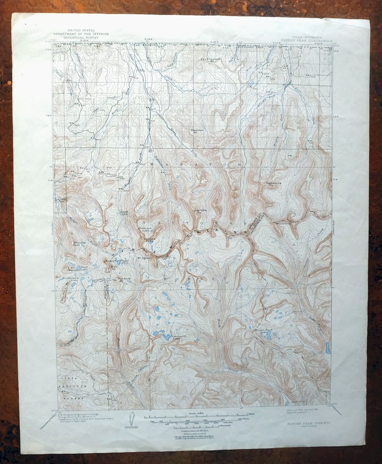
| TITLE | Hayden Peak |
| STATE | Utah, Wyoming |
| LOCATION | 60 miles east of Salt Lake City |
| SERIES | 30-minute |
| SURVEYED | 1900 and 1901 Field Survey |
| GEOGRAPHER | E.M. Douglas |
| EDITION | 1903 |
| PRINTED | 1946 |
| PRINT NOTES | Thick paper stock |
| SCALE | 1:125000 |
| CONTOUR INTERVAL | 100 feet |
| SHEET DIMENSIONS | 17 x 20 7/8 inches |
| MAP DIMENSIONS | 13 1/4 x 17 1/2 inches |
| COVERAGE AREA | 26 x 35 miles |
| MAP NOTES | A fascinating historical snapshot surveyed before the existence of Highway 150. |
| SHEET CONDITION For maps of this vintage, effort is made to note all visible flaws, no matter how minor. | |
| OVERALL CONDITION | Very Good |
| SHEET NOTES | lightly handled, never folded |
| MAP AREA | flawless map area |
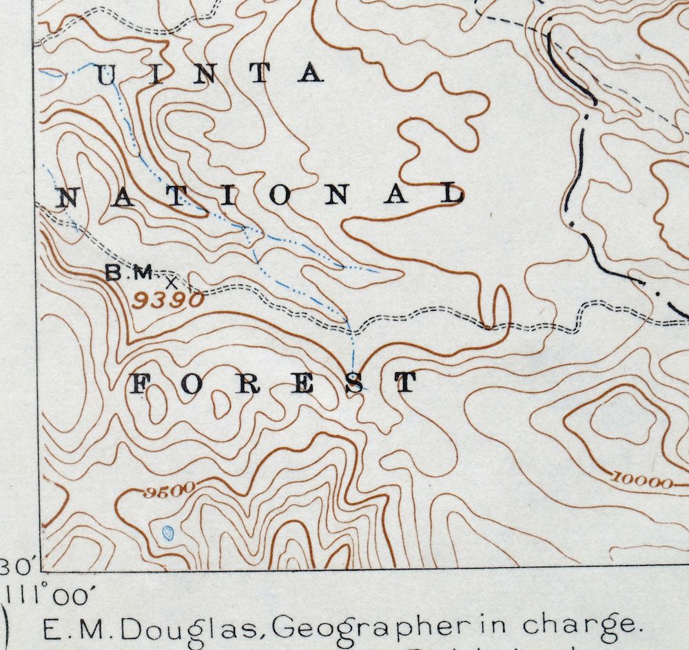
| COLLARS | no markings, no blemishes, no edge tears, minor handling wear in collars |
| MAP COVERAGE Quadrangle extent overlaid on current basemap. | |
| BACKSIDE LEGEND | |
 A map summary is printed on the back side of the Hayden Peak sheet similar to the one shown in the picture. It outlines the history, purpose, and status of the USGS mapping program at the time of the printing in 1946. It also provides instructions on how to read contour lines and a description of how they are used to depict the terrain. At the bottom of the page is a legend showing all of the symbols used to represent the cultural, relief, and water features found on the map. | |
| PLACENAMES Depending on map series and survey date, all of the features listed below may not be shown on this map. This list contains features that currently exist or historically existed within the area covered by the map. The list can be used as a reference to determine if this map covers your area of interest. Placenames are listed alphabetically next to each feature type. | |
| COUNTIES COVERED | Duchesne, Summit, Uinta, and Wasatch |
| FEDERAL LAND UNITS | Ashley National Forest, High Uintas Wilderness, Moon Lake, Uinta National Forest, Uintah and Ouray Indian Reservation, and Wasatch National Forest |
| RIVERS AND STREAMS | Archie Creek, Atwine Creek, Bear River, Blacks Fork, Boundary Creek, Brown Duck Creek, Brush Creek, Bull Creek, Cabin Creek, Carter Creek, Cataract Creek, Chalk Creek, Christmas Tree Creek, Clements Creek, Cobble Creek, Coyote Creek, Deadman Creek, Deer Creek, Dry Fork, Duchesne River, East Basin Creek, East Fork Bear River, East Fork Blacks Fork, East Fork Moffit Creek, East Fork Rock Creek, East Muddy Creek, Fall Creek, Farm Creek, Fish Creek, Florence Creek, Hades Creek, Hayden Fork, Horse Creek, Humpy Creek, Iron Mine Creek, LaChapelle Creek, Lake Fork River, Left Hand Fork East Fork Bear River, Little Deer Creek, Little East Fork, Little Yellow Creek, Lost Dog Creek, Main Fork, McKenzie Creek, Meadow Creek, Middle Fork Blacks Fork, Middle Fork Weber River, Mill City Creek, Mill Creek, Mill Fork, Moffit Creek, North Fork Mill Creek, North Fork Provo River, Ostler Fork, Ottoson Creek, Oweep Creek, Provo River, Rock Creek, Shale Creek, Slate Creek, Soapstone Creek, South Fork Phelps Brook, South Fork Rock Creek, Squaw Basin Creek, Steel Creek, Stillwater Fork, Sulphur Creek, Swift Creek, Weber River, West Fork Bear River, West Fork Farm Creek, West Fork Rock Creek, West Muddy Creek, Whiskey Creek, Willow Creek, and Yellow Creek |
| WATER BODIES | Abes Lake, Alexander Lake, Allen Lake, Allsop Lake, Anderson Lake, Arta Lake, Aspen Lake, Atwine Lake, Audry Lake, Azure Lake, Bear Lake, Beaver Lake, Bench Lake, Beth Lake, Betsy Lake, Big Dog Lake, Black Lake, Blue Lake, Blythe Lake, Bobs Lake, Boot Lake, Brinkley Lake, Broadhead Lake, Brown Duck Lake, Buckeye Lake, Cabin Lake, Carolyn Lake, Cleveland Lake, Cliff Lake, Clyde Lake, Continent Lake, Crater Lake, Crystal Lake, Cuberant Lake, Dale Lake, Daynes Lake, Dead Horse Lake, Dean Lake, Diamond Lake, Duck Lake, East Slide Lake, Echo Lake, Lake Ejod, Evermann Lake, Fall Lakes, Farney Lake, Faxon Lake, Fern Lake, Fish Hatchery Lake, Fish Lake, Francis Lake, Gladys Lake, Governor Dern Lake, Grandaddy Lake, Grassy Lake, Hades Lake, Haystack Lake, Helen Lake, Hell Hole Lake, Hidden Lake, Horseshoe Lake, Hourglass Lake, Ibantik Reservoir, Iron Mine Lake, Island Lake, Jack and Jill Lake, Jean Lake, Joan Lake, Jordan Lake, Kamas Lake, Kermsuh Lake, Kidney Lake, Lambert Lake, LeConte Lake, Ledge Lake, Lightning Lake, Lilly Lake, Lily Lake, Lily Pad Lake, Little Lyman Lake, Lodgepole Lake, Long Lake, Lake Lorena, Lost Lake, Lost Lake Number Two, Lower Ottoson Lake, Lym Lake, Lyman Lake, Margie Lake, Margo Lake, Marjorie Lake, Marsell Lake, Marshall Lake, McPheters Lake, Meadow Lake, Meeks Cabin Reservoir, Mohawk Lake, Moon Lake, Moosehorn Lake, Morat Lakes, Moslander Reservoir, Mud Lake, Norice Lake, Ostler Lake, Packard Lake, Palisade Lake, Pass Lake, Petit Lake, Phinney Lake, Picture Lake, Picturesque Lake, Pine Island Lake, Pinto Lake, Powell Lake, Priord Lake, Pyramid Lake, Rainbow Lake, Reconnaissance Lake, Rock Lakes, Rosalie Lake, Round Lake, Rudolph Lake, Ryder Lake, Sand Lake, Scow Lake, Sea Lion Lake, Shadow Lake, Shamrock Lake, Shepard Lake, Shoestring Lake, Slide Lake, Sonny Lake, Squaw Lake, Star Lake, Stewart Lake, Tail Lake, Thompson Lake, Trial Lake, Twin Lakes, Tworoose Lake, Uintah Lake, Upper Ottoson Lake, Wall Lake, Washington Lake, Watson Lake, Whitney Reservoir, and Young Lake |
| Utah Locations: Bald Mountain Campground, Bald Mountain Overlook, Bald Mountain Trailhead Picnic Area, Bear River Campground, Bear River Ranger Station, Beaver View Campground, Big Meadow Forest Service Station, Brinton Meadow Guard Station, Burts-Miller Ranch, Butterfly Campground, Camp Steiner, Castle Cliffs Campground, Christmas Meadows Campground, Cobblerest Campground, Crystal Lake Trail Head, Defas Dude Ranch, Del Monte Mine, East Fork Bear River Camp, East Fork Blacks Fork Guard Station, East Fork Campground, East Portal, Grandview Trailhead, Grandview Transfer Camp, Hades Campground, Hades Recreation Site, Hayden Fork Campground, Highline Trail Head Campground, Hill Air Force Base Recreation Camp, Iron Mine Campground, Island Ranch, Lake Fork Forest Service Station, Lake Fork Guard Station, Lilly Lake Campground, Little Lyman Lake Campground, Lost Creek Campground, MacKays Cabin, Mill City Ghost Town, Mill Creek Guard Station, Mill Flat Campground, Miners Gulch Campground, Mirror Lake Campground, Mirror Lake Guard Station, Moon Lake Campground, Moosehorn Campground, Old Blacks Fork Commissary, Pass Lake Trailhead, Provo River Falls Overlook, Robbins Ranch, Rock Creek Corral, Rock Creek Ranch, Rock Creek Resort, Slate Gorge Overlook, South Fork Campground, Splash Dam Campground, Stillwater Campground, Trial Lake Campground, Upper Provo Bridge Picnic Area, Upper Stillwater Campground, West Portal, Whitney Guard Station, Wilderness Area Overlook, Wolverine Recreation Trailhead, and Yellow Pine Campground. Areas: Big Meadow and High Uintas Primitive Area. Mountains, Peaks, and Summits: A-1 Peak, Mount Agassiz, Bald Mountain, Mount Beulah, Mount Cardwell, Castle Rocks, The Cathedral, Brown Duck Mountain, Cleveland Peak, Kletting Peak, Deadman Mountain, East Grandaddy Mountain, Elizabeth Mountain, Explorer Peak, Gold Hill, Hayden Peak, Haystack Mountain, Holiday Park Peak, Humpy Peak, Iron Mine Mountain, Lamotte Peak, Lone Mountain, Mount Lovenia, Mount Marsell, Moffit Peak, Murdock Mountain, Notch Mountain, Ostler Peak, Red Knob, Reids Peak, Round Mountain, Spread Eagle Peak, Squaw Peak, Table Top, Tokewanna Peak, Mount Watson, West Grandaddy Mountain, and Yard Peak. Valleys and Canyons: Carrot Hollow, Cataract Gorge, Cow Hollow, Coyote Hollow, Dry Canyon, Hades Canyon, Marsell Canyon, Miners Gulch, Peterson Gulch, Road Hollow, Slate Gorge, Trail Hollow, and Wedge Hollow. Woods: The Woodpile. Parks: Mirror Lake Recreation Site, Organization Camp Recreation Site, and Steel Creek Park. Trails: Bear River Smiths Fork Trail, East Fork Pinto Lake Trail, Highline Trail, Lofty Lake Trail, Notch Mountain Trail, Skinner Cutoff Trail, and Slope Trail. Drainages: Atwine Creek, Beaver Creek, Carter Creek, Cataract Creek, Boundary Creek, Brown Duck Creek, Brush Creek, Cabin Creek, Christmas Tree Creek, Clements Creek, Cobble Creek, Deadman Creek, Deer Creek, Dry Fork, East Basin Creek, East Fork Bear River, East Fork Blacks Fork, East Fork Duchesne River, East Fork Moffit Creek, East Fork Rock Creek, Fall Creek, Fish Creek, Florence Creek, Gardners Fork, Hades Creek, Hayden Fork, Humpy Creek, Iron Mine Creek, Left Hand Fork East Fork Bear River, Little Deer Creek, Little East Fork, Lost Creek, Lost Dog Creek, Main Fork, McKenzie Creek, Meadow Creek, Middle Fork Blacks Fork, Middle Fork Weber River, Mill City Creek, North Fork Mill Creek, Ostler Fork, Ottoson Creek, Oweep Creek, Plot Creek, Right Hand Fork East Fork Bear River, Shale Creek, Slate Creek, South Fork Rock Creek, Squaw Basin Creek, Stillwater Fork, Swift Creek, Trail Creek, West Fork Bear River, West Fork Blacks Fork, West Fork Rock Creek, and Whiskey Creek. Mines: Paint Mine. Lakes and Ponds: Alexander Lake, Allen Lake, Allsop Lake, Amy Lake, Anderson Lake, Arta Lake, Aspen Lake, Atwine Lake, Audry Lake, Azure Lake, Baker Lake, Baum Lake, Bear Lake, Beaver Lake, Bedground Lake, Bench Lake, Beth Lake, Betsy Lake, Big Dog Lake, Brinkley Lake, Broadhead Lake, Brooks Lake, Butterfly Lake, Carl Lake, Carolyn Lake, Castle Lake, Black Lake, Blizzard Lake, Blue Lake, Blythe Lake, Bobs Lake, Bonnie Lake, Booker Lake, Boot Lake, Buckeye Lake, Bud Lake, Cabin Lake, Clegg Lake, Clements Lake, Cleveland Lake, Cliff Lake, Clyde Lake, Continent Lake, James Lake, Jean Lake, Jeff Lake, Jewel Lake, Joan Lake, Jodie Lake, John Lake, Jordan Lake, Kermsuh Lake, Crater Lake, Crystal Lake, Cuberant Lake, Cutthroat Lake, Dale Lake, Daynes Lake, Dead Horse Lake, Dean Lake, Diamond Lake, Docs Lake, Doug Lake, Duck Lake, East Slide Lake, Echo Lake, Lake Ejod, Elizabeth Lake, Emerald Lake, Evermann Lake, Fall Lakes, Farney Lake, Faxon Lake, Fehr Lake, Fern Lake, Fir Lake, Fish Hatchery Lake, Francis Lake, Gatman Lake, Gem Lake, Gladys Lake, Governor Dern Lake, Grandaddy Lake, Hades Lake, Hayden Lake, Haystack Lake, Heart Lake, Helen Lake, Hell Hole Lake, Hidden Lake, Hoover Lake, Hope Lake, Horseshoe Lake, Hyatt Lake, Iron Mine Lake, Jack and Jill Lake, LaMarla Lake, Lambert Lake, LeConte Lake, Ledge Lake, Lightning Lake, Lilly Lake, Lily Lake, Lily Lakes, Lily Pad Lake, Linear Lake, Little Dog Lake, Lodgepole Lake, Lofty Lake, Lake Lorena, Lost Lake, Lovenia Lake, Lower Ottoson Lake, Lym Lake, Maba Lake, Margie Lake, Margo Lake, Lake Marion, Marsell Lake, Marshall Lake, McPheters Lake, Meadow Lake, Mid Lake, Milk Lake, Mirror Lake, Mohawk Lake, Moosehorn Lake, Morat Lakes, Mud Lake, Naomi Lake, Norice Lake, North Twin Lake, Notch Lake, Olga Lake, Ostler Lake, Ouray Lake, Packard Lake, Palisade Lake, Pass Lake, Pearl Lake, Peter Lake, Petit Lake, Phinney Lake, Picture Lake, Picturesque Lake, Pine Island Lake, Pinto Lake, Ponds Lake, Powell Lake, Priord Lake, Pyramid Lake, Rainbow Lake, Range Lake, Reconnaissance Lake, Red Cliff Lake, Reids Lake, Rock Lake, Rock Lakes, Rosalie Lake, Rudolph Lake, Ruth Lake, Ryder Lake, Salamander Lake, Scout Lake, Scow Lake, Scudder Lake, Sea Lion Lake, Shadow Lake, Shale Lake, Shaler Lake, Shallow Lake, Shamrock Lake, Shepard Lake, Shoestring Lake, Slide Lake, Sonny Lake, South Twin Lake, Spectacle Lake, Splash Dam Lake, Squaw Lake, Stewart Lake, Survey Lake, Tadpole Lake, Tail Lake, Teal Lake, Thompson Lake, Three Divide Lakes, Three Lakes, Toomset Lake, Triangle Lake, Trident Lake, Twin Lakes, Tworoose Lake, Uintah Lake, Upper Ottoson Lake, Verrill Lake, Walcott Lake, Watson Lake, Whiskey Island Lake, Wilder Lake, Wyman Lake, and Young Lake. Waterfalls: Provo River Falls and Smooth Rock Falls. Dams: Abes Lake Dam, Brown Duck Dam, Clement Lake Dam, Cliff Lake Dam, Kamas Lake Dam, Kidney Lake Dam, Fish Lake Dam, Grassy Lake Dam, Ibantik Dam, Island Lake Dam, Long Lake Dam, Lost Lake Dam, Lost Lake Number Two Dam, Marjorie Lake Dam, Moslander Dam, Price Dam, Sand Lake Dam, Seymour Meadow Lake Dam, Star Lake Dam, Trial Lake Dam, Wall Lake Dam, Washington Lake Dam, Whitney Reservoir Dam, and Windsor Dam. Gaps: Bald Mountain Pass, Cleveland Pass, Cyclone Pass, Dead Horse Pass, Deadman Pass, East Basin Pass, Elizabeth Pass, Gold Hill Pass, Hades Pass, Hayden Pass, Moffit Pass, The Notch, Red Knob Pass, Rocky Sea Pass, and Squaw Pass. Canals: Hilliard Canal, Hilliard East Fork Canal, Hilliard Westside Canal, Hovarka Canal, and Lannon Ditch. Bridges: Miners Gulch Bridge and Miners Gulch Campground Bridge. Bends: Hell Hole. Basins: Amethyst Basin, Cataract Basin, Brown Duck Basin, East Basin, Four Lakes Basin, Lake Basin, Middle Basin, Murdock Basin, Naturalist Basin, Ottoson Basin, Squaw Basin, and West Basin. Airports: Stillwater Heliport. Ridges: Big Ridge, Burnt Ridge, and Dry Ridge. Reservoirs and Tanks: Abes Lake, Amethyst Lake, Bourbon Lake, Brown Duck Lake, Clement Lake, Cliff Lake, Kamas Lake, Kidney Lake, Fish Lake, Grassy Lake, Ibantik Lake, Island Lake, Little Lyman Lake, Little Pond, Long Lake, Lost Lake, Lost Lake Number Two, Lyman Lake, Marjorie Lake, Meadow Lake, Meeks Cabin Reservoir, Moslander Reservoir, Round Lake, Sand Lake, Spruce Springs Reservoir, Star Lake, Trial Lake, Wall Lake, Washington Lake, and Whitney Reservoir. Flats: Brinton Meadow, Broadhead Meadows, Broadwater Meadows, Buck Pasture, Christmas Meadows, Lambert Meadow, Mill Flat, Reids Meadow, Seven Tree Flat, Tarwood Flat, and West Park. Tunnels: Duchesne Tunnel, East Portal Duchesne Tunnel, Hades Rhoades Tunnel, and Stillwater Tunnel. Pillars: Duchesne Monument. Springs: Burnt Ridge Spring, Cold Spring, Corner Spring, East Slope Spring, Fence Spring, Log Hollow Spring, Pigeon Milk Spring, Pine Spring, Red Bedground Spring, Rock Spring, and Slope Spring. Slopes: The East Slope and The West Slope. | |
| Wyoming | |
| Wyoming None | |
| SHIPPING AND RETURNS | |
 This map sheet will be carefully rolled in a sturdy tube and shipped via the US Postal Service. If you find that the sheet you receive is not as described in the listing, you may ship it back to us for a refund of the purchase price. | |
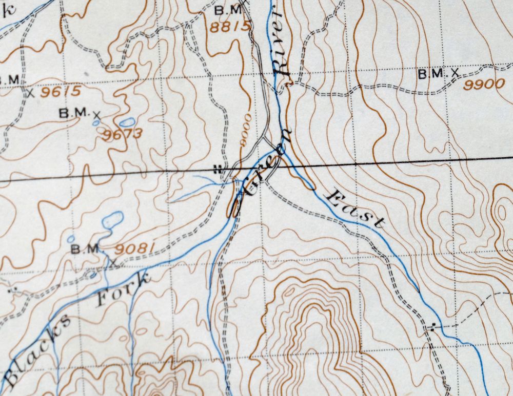
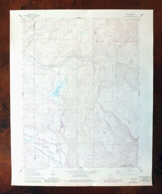
Hayden Peak Utah Uinta Mountains USGS Topo Map 1946 Vintage
$45
First published in 1903, this USGS 30-minute topographic sheet was printed in 1946 on thick stock and survives in very good condition, lightly handled and never folded. Straddling the Utah-Wyoming line about 60 miles east of Salt Lake City, it takes in the high country of the Uinta Mountains and portions of the Wasatch, Uinta, and Ashley National Forests, along with the Uintah and Ouray Indian Reservation and Moon Lake. Drawn from an 1900 and 1901 field survey under geographer E.M. Douglas, it records this stretch of the Uintas before Highway 150 was built through the range.
In stock
This vintage sheet is a 1903 edition of the Hayden Peak Utah USGS topographic map. It is an original 80-year-old 1946 United States Geological Survey print in very good condition.
HOW THIS MAP CAN BE USED
In addition to making a fascinating conversation piece, this sheet would look great in a frame or on display, make a unique and prized gift for anyone interested in this area, be perfect as a reference for genealogy studies or general historical research, or fill that missing piece in your collection.
FEATURES SHOWN ON THE MAP
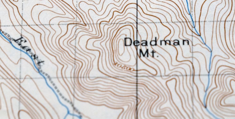
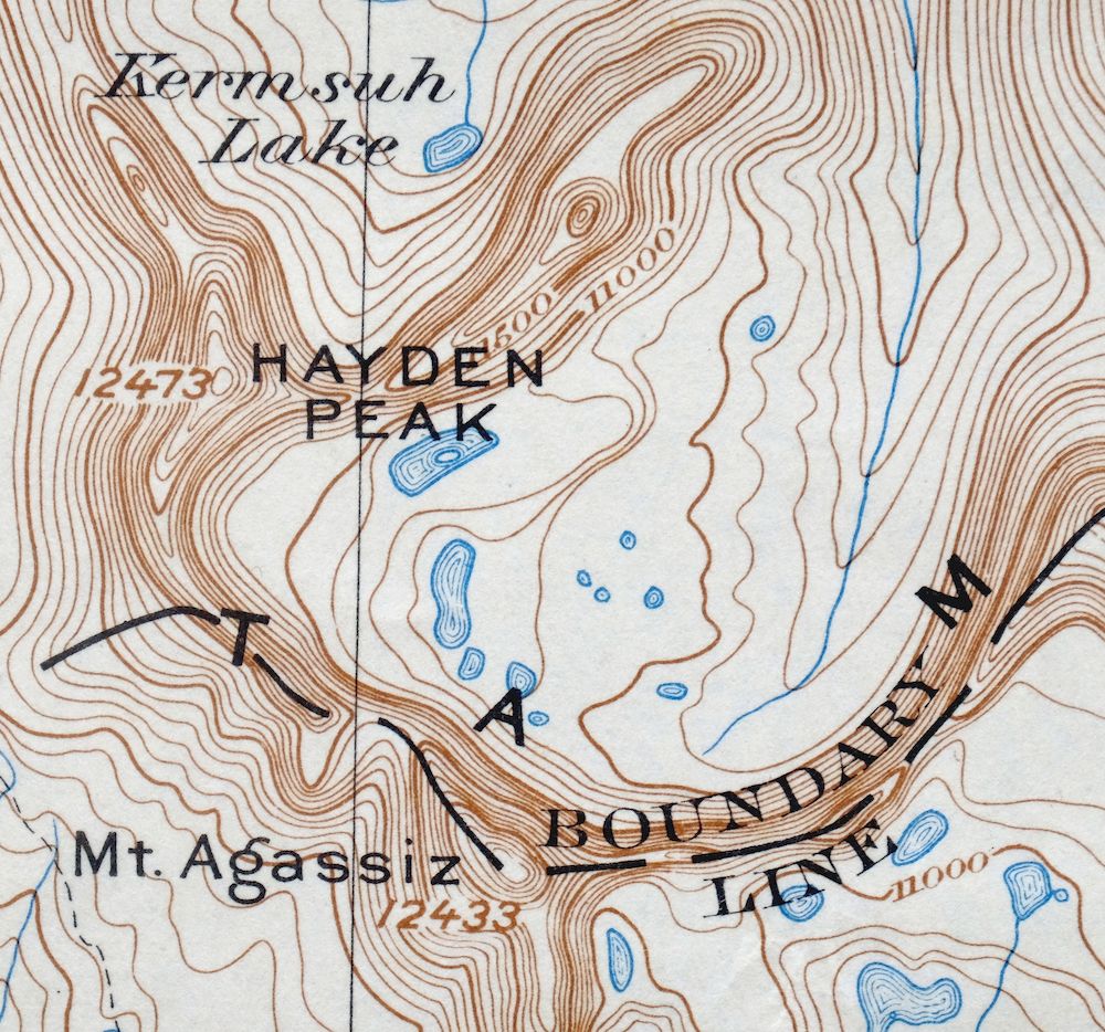
The Hayden Peak 30-minute map shows cities and towns, roads, railroads, rivers, creeks, elevation contour lines, public land survey lines, county, state, and other administrative boundaries as they existed at the time of the survey in 1900 and 1901.
A VALUABLE HISTORICAL RECORD
Maps from the USGS 30-minute series have been out of print for many years. They have never been common and original prints are increasingly difficult to find. For areas where the 30-minute map was produced, it is usually the first large-scale survey done by the USGS for that area. These are a valuable historical record, as they contain many placenames and features that have been dropped from more recent series’ and editions.
Nearby maps
-

Duchesne Utah Roosevelt Neola USGS Topo Map 1939 Antique
$36 Add to cart -

Jensen Utah Vernal Dinosaur USGS 30-Min Topographic Map 1910
$50 Add to cart -
Provo Utah Uinta NF Spanish Fork USGS Topo Map 1959 Vintage
$36 Add to cart -

Castle Gate Utah Price Helper USGS Topo Map 1968 Vintage
$44 Add to cart -
Sunnyside Utah Book Cliffs East Carbon USGS Topo Map 1915
$54 Add to cart -
Stockton Utah Tooele Rush Valley USGS Topo Map 1941 Antique
$32 Add to cart -

Moroni Utah Fountain Green USGS 15-Min Topo Map 1968 Vintage
$39 Add to cart -
Woodside Utah Book Cliffs Cedar USGS Topographic Map 1973
$26 Add to cart -

Castle Dale Utah Ferron Clawson USGS Topographic Map 1925
$45 Add to cart -
The Wickiup Utah Mexican Mountain WSA USGS Topo Map 1967
$20 Add to cart -
Soda Springs Idaho Cache NF Grace USGS Topo Map 1951 Vintage
$32 Add to cart -
Fillmore Utah Kanosh Meadow USGS 15-Min Topographic Map 1975
$40 Add to cart -

Roan Creek Colorado USGS 15-Min Topographic Map 1950 Vintage
$39 Add to cart -
Grand Junction Colorado Redlands USGS Topo Map 1964 Vintage
$58 Add to cart -
Monument Butte Colorado Moffat Hamilton USGS Topo Map 1915
$49 Add to cart -
The Spur Utah Canyonlands USGS 15-Min Topo Map 1971 Vintage
$38 Add to cart -
Grand Hogback Colorado Rifle Silt USGS Topographic Map 1959
$35 Add to cart -

Daton Peak Colorado Routt NF Hayden USGS Topo Map 1965
$28 Add to cart -
Beaver Utah Dixie NF Fishlake NF USGS Topo Map 1921 Antique
$63 Add to cart -
Notom Capitol Reef NP Utah USGS 15-Min Topo Map 1958 Vintage
$46 Add to cart -
Fiddler Butte Utah USGS 15-Min Topographic Map 1958 Vintage
$38 Add to cart -
Pilot Knob Colorado Routt NF USGS Topo Map 1963 Vintage
$37 Add to cart -

Hatch Rock La Sal Utah Vintage Original USGS Topo Map 1965
$20 Add to cart -
Leon White River NF Colorado USGS 7.5-Min Topo Map 1988
$36 Add to cart
