MAP DETAILS | |
|---|---|
| TITLE | Jensen |
| STATE | Utah, Colorado |
| LOCATION | Vicinity of Vernal |
| SERIES | 30-minute |
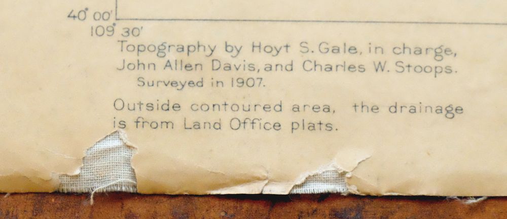
| SURVEYED | 1907 Field Survey |
| GEOGRAPHER | Hoyt S. Gale |
| EDITION | 1910 |
| PRINTED | 1910 |
| PRINT NOTES | Thick paper stock |
| SCALE | 1:125000 |
| CONTOUR INTERVAL | 100 feet |
| SHEET DIMENSIONS | 16 1/2 x 20 inches |
| MAP DIMENSIONS | 13 3/8 x 17 1/2 inches |
| COVERAGE AREA | 26 x 35 miles |
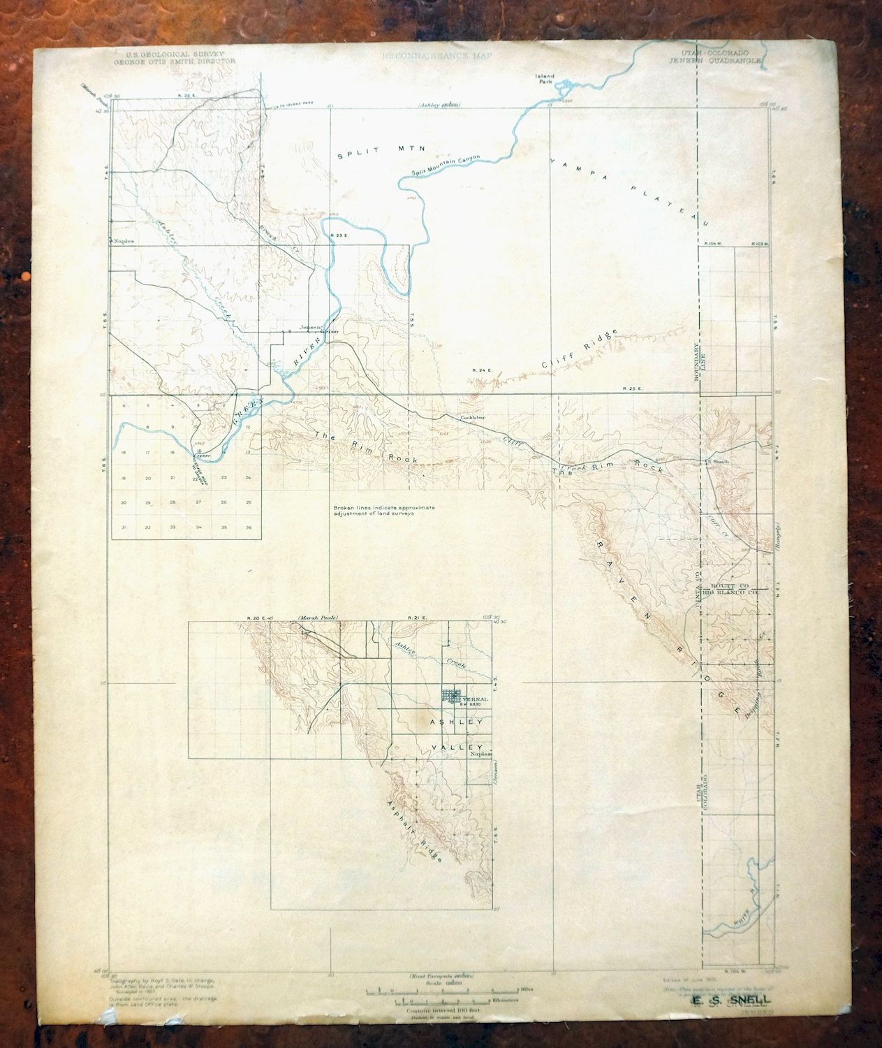
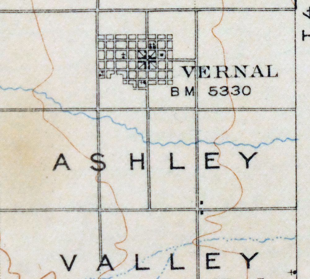
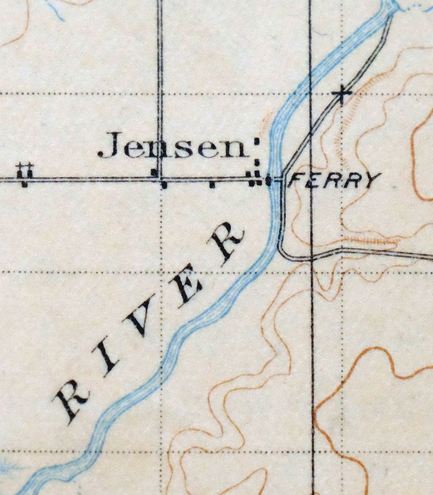
| MAP NOTES | Surveyed before the modern highway system, showing historic travel corridors, river ferries, and placenames; this sheet is partially surveyed and includes an inset of Vernal and the Ashley Valley. |
| SHEET CONDITION For maps of this vintage, effort is made to note all visible flaws, no matter how minor. | |
| OVERALL CONDITION | Good |
| SHEET NOTES | moderately handled, never folded, has original canvas-backing, age-toned paper |
| MAP AREA | no markings, scattered blemishes within map area |
| COLLARS | no markings, moderate blemishes, minor handling wear and chips along bottom collar, ownership stamp in bottom right collar |
 | |
| MAP COVERAGE Quadrangle extent overlaid on current basemap. | |
| PLACENAMES Depending on map series and survey date, all of the features listed below may not be shown on this map. This list contains features that currently exist or historically existed within the area covered by the map. The list can be used as a reference to determine if this map covers your area of interest. Placenames are listed alphabetically next to each feature type. | |
| CITIES AND TOWNS (CURRENT) | Bonanza, Dinosaur, Jensen, Naples, and Vernal |
| COUNTIES COVERED | Moffat, Rio Blanco, and Uintah |
| FEDERAL LAND UNITS | Bull Canyon Wilderness Study Area, Daniels Canyon Wilderness Study Area, Dinosaur National Monument, and Uintah and Ouray Indian Reservation |
| RIVERS AND STREAMS | Ashley Creek, Birch Creek, Brush Creek, Cliff Creek, Cottonwood Creek, Dripping Rock Creek, Green River, K Creek, Middle Creek, Sand Spring Wash, South Fork Cub Creek, Trail Creek, and White River |
| WATER BODIES | Hacking Reservoir, Hatch Reservoir, Herman-Sadlier Reservoir, Siddoways Reservoir, and Stewart Lake |
| Utah Locations: Blue Mountain Indian Writings, Bonanza RV and Mobile Home Campground, Daniels Ranch, Dinosaur Quarry, Doc Valley Overlook, Douglas Chew Cabin, Green River Campground, Green River Ranger Station, Iron Springs Bench Overlook, Island Park Overlook, Morris Ranch, Rainbow Park Campground, Snow Cabin, Split Mountain Gorge Campground, Split Mountain Overlook, Vernal Golf Course, Vernal Substation, and Wilkins Cabin. Mountains, Peaks, and Summits: Blue Mountain Plateau, The Rim Rock, Ruple Point, Split Mountain, Vivas Cake Hill, and Walsh Knolls. Valleys and Canyons: Ashley Valley, Baser Wash, Beach Draw, Bean Draw, Bear Hollow, Blind Draw, Bourdette Draw, Jensen Wash, Kane Hollow, Kennedy Wash, Cottonwood Wash, Cow Wash, Cowboy Canyon, Coyote Wash, Daniels Canyon, Docs Valley, Fantasy Canyon, Hog Canyon, Island Park Fault, Left Fork Walker Hollow, Mantle Gulch, Miners Draw, Mitten Canyon, Moonshine Draw, Orchid Draw, Pole Line Wash, Powder Springs Wash, Rasmussen Hollow, Red Wash, Right Fork Walker Hollow, Sand Spring Wash, Sand Wash, Snake John Wash, Split Mountain Canyon, Spring Hollow, Steinaker Draw, Stuntz Draw, Sunshine Bench, Trail Draw, and Walker Hollow. Woods: Cheney Ranch. Parks: Dinosaur National Monument, Escalante Trail Historical Marker, Point of Pines Recreation Site, and Stewart Lake Waterfowl Management Area. Trails: Daniels Trail and Red Rock Nature Trail. Drainages: Ashley Creek, Birch Creek, Brush Creek, Cliff Creek, K Creek, Cub Creek, Iron Springs Wash Pool Creek, South Fork Cub Creek, and Trail Creek. Churches: Jehovahs Witnesses Vernal Congregation, Grace Baptist Church, and The Church of Jesus Christ of Latter Day Saints. Lakes and Ponds: Snyder Seeps. Buildings: Bonanza Power Plant. Dams: Herman-Sadlier Dam. Crossings: Escalante Crossing. Gaps: First Gap. Bends: Little Dicks Bottom. Basins: Clay Basin, Coyote Basin, and The V. Airports: Bonanza Air Strip, Bonanza Power Plant Heliport, and Split Mountain Landing. Schools: Davis School and Naples School. Ridges: Cliff Ridge, Deadman Bench Divide, Raven Ridge, Ruple Ridge, Sand Ridge, Snake John Reef, Squaw Ridge, and Stuntz Ridge. Reservoirs and Tanks: Bullwinkle Reservoir, Burns Bench Reservoir, Cow Wash Reservoir, Hacking Reservoir, Hatch Reservoir, Herman-Sadlier Reservoir, Siddoways Reservoir, Stewart Lake, and Wooley Reservoir. Rapids: Inglesby Rapids, Moonshine Rapids, S O B Rapids, and Schoolboy Rapids. Flats: Little Rainbow Park. Oilfields: Chapita Wells Gas Field, Coyote Basin Oil Field, East White River Gas Field, Horseshoe Bend Oil And Gas Field, Powder Springs Gas Field, Red Wash Oil And Gas Field, Walker Hollow Oil And Gas Field, White River Oil and Gas Field, and Wonsits-Wonsits Valley Oil Field. Plains and Plateaus: Yampa Plateau. Pillars: Devils Playground and Ship Rock. Springs: Davis Spring, Elder Spring, Glen Spring, and Warm Springs. | |
| Colorado Locations: Chew Ranch, Harland Cabin, Jensen Cabin, and K Ranch. Valleys and Canyons: Buckwater Draw, Bull Canyon, Gilsonite Draw, Miners Draw, Richardson Draw, and Sand Draw. Drainages: Cottonwood Creek, Dripping Rock Creek, K Creek, Middle Creek, Sand Spring Wash, and Trail Creek. Mines: Iron Bridge Mine and Rich Mine. Gaps: Mormon Gap. Basins: Coyote Basin. Ridges: Raven Ridge, Snake John Reef, and Stuntz Ridge. Reservoirs and Tanks: Dudley Pond and Stuntz Reservoir. | |
| SHIPPING AND RETURNS | |
 This map sheet will be carefully rolled in a sturdy tube and shipped via the US Postal Service. If you find that the sheet you receive is not as described in the listing, you may ship it back to us for a refund of the purchase price. | |
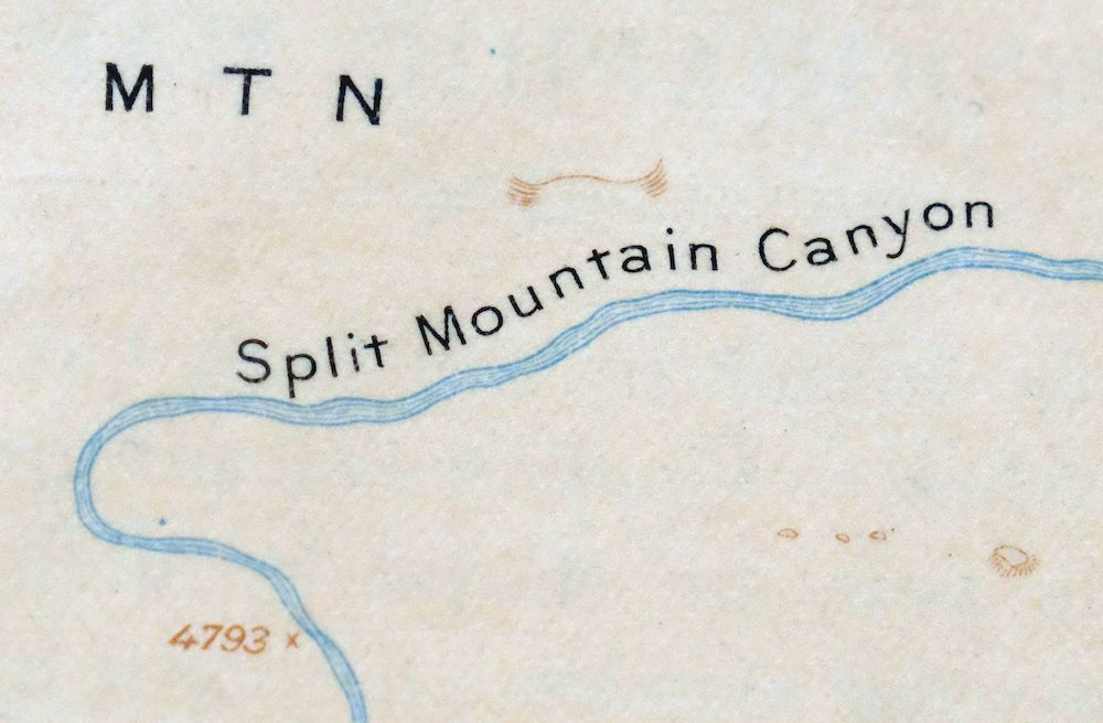
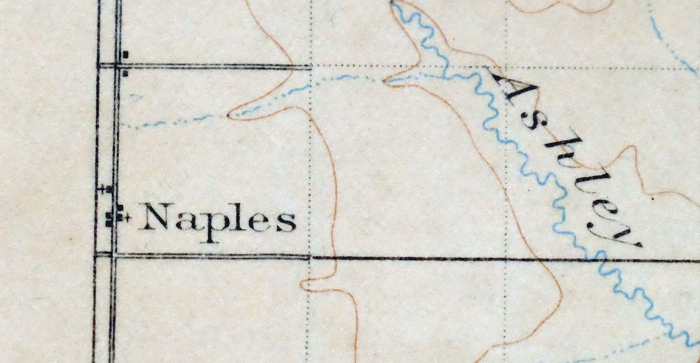
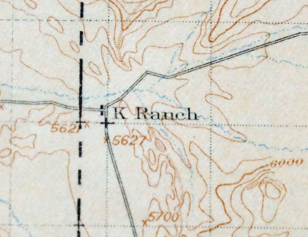
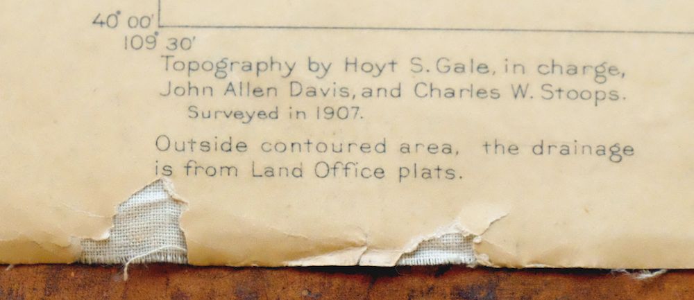
Jensen Utah Vernal Dinosaur USGS 30-Min Topographic Map 1910
$50
Printed in its year of first publication, 1910, this antique 30-minute topographic sheet from the USGS is in good condition, with age-toned paper, original canvas-backing, and never a fold in it; the thick stock has held up well through moderate handling. Spanning the Utah-Colorado line near Vernal, the quad area takes in Naples, Jensen, and Bonanza, along with parts of the Uintah and Ouray Indian Reservation and Dinosaur National Monument. Surveyed in 1907 by geographer Hoyt S. Gale, before the modern highway system, it records historic travel corridors, river ferries, and placenames, and carries an inset of Vernal and the Ashley Valley.
In stock
This antique sheet is a 1910 edition of the Jensen Utah USGS topographic map. It is an authentic 116-year-old United States Geological Survey print in good condition.
HOW THIS MAP CAN BE USED
In addition to making a fascinating conversation piece, this sheet would look great in a frame or on display, make a unique and prized gift for anyone interested in this area, be perfect as a reference for genealogy studies or general historical research, or fill that missing piece in your collection.
FEATURES SHOWN ON THE MAP
The Jensen 30-minute map shows cities and towns, roads, railroads, rivers, creeks, elevation contour lines, public land survey lines, county, state, and other administrative boundaries as they existed at the time of the survey in 1907.
A VALUABLE HISTORICAL RECORD
Maps from the USGS 30-minute series have been out of print for many years. They have never been common and original prints are increasingly difficult to find. For areas where the 30-minute map was produced, it is usually the first large-scale survey done by the USGS for that area. These are a valuable historical record, as they contain many placenames and features that have been dropped from more recent series’ and editions.
Nearby maps
-

Duchesne Utah Roosevelt Neola USGS Topo Map 1939 Antique
$36 Add to cart -

Hayden Peak Utah Uinta Mountains USGS Topo Map 1946 Vintage
$45 Add to cart -
Grand Hogback Colorado Rifle Silt USGS Topographic Map 1959
$35 Add to cart -
Sunnyside Utah Book Cliffs East Carbon USGS Topo Map 1915
$54 Add to cart -

Roan Creek Colorado USGS 15-Min Topographic Map 1950 Vintage
$39 Add to cart -
Woodside Utah Book Cliffs Cedar USGS Topographic Map 1973
$26 Add to cart -
Monument Butte Colorado Moffat Hamilton USGS Topo Map 1915
$49 Add to cart -
Grand Junction Colorado Redlands USGS Topo Map 1964 Vintage
$58 Add to cart -

Castle Gate Utah Price Helper USGS Topo Map 1968 Vintage
$44 Add to cart -

Daton Peak Colorado Routt NF Hayden USGS Topo Map 1965
$28 Add to cart -
Pilot Knob Colorado Routt NF USGS Topo Map 1963 Vintage
$37 Add to cart -
The Wickiup Utah Mexican Mountain WSA USGS Topo Map 1967
$20 Add to cart -
Provo Utah Uinta NF Spanish Fork USGS Topo Map 1959 Vintage
$36 Add to cart -

Castle Dale Utah Ferron Clawson USGS Topographic Map 1925
$45 Add to cart -
Leon White River NF Colorado USGS 7.5-Min Topo Map 1988
$36 Add to cart -

Moroni Utah Fountain Green USGS 15-Min Topo Map 1968 Vintage
$39 Add to cart -
The Spur Utah Canyonlands USGS 15-Min Topo Map 1971 Vintage
$38 Add to cart -
Highland Peak Colorado Snowmass Village USGS Topo Map 1988
$43 Add to cart -

Pearl Colorado USGS 15-Min Topographic Map 1969 Vintage
$43 Add to cart -

Hatch Rock Utah La Sal La Sal USGS Topo Map 1965 Vintage
$20 Add to cart -
Anthracite Colorado USGS 15-Min Topographic Map 1918 Antique
$38 Add to cart -
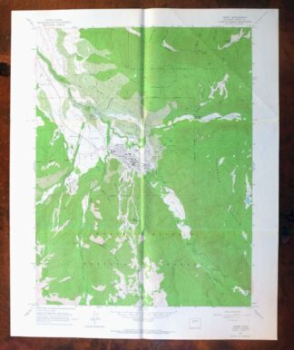
Aspen Colorado USGS 7.5-Min Topographic Map 1964 Vintage
$48 Add to cart -
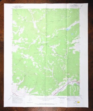
Vail West Colorado Avon USGS 7.5-Min Topo Map 1973 Vintage
$38 Add to cart -

Mount Powell Colorado Gore Range USGS Topo Map 1940 Antique
$32 Add to cart
