MAP DETAILS | |
|---|---|
| TITLE | Provo |
| STATE | Utah |
| SERIES | 15-minute |
| SURVEYED | 1946 through 1949 Aerial and Field Survey |
| EDITION | 1949 |
| PRINTED | 1959 |
| PRINT NOTES | Thick paper stock. A reddish tint is used to indicate urban areas where only landmark buildings are shown. |
| SCALE | 1:62500 |
| CONTOUR INTERVAL | 80 feet |
| SHEET DIMENSIONS | 16 7/8 x 20 7/8 inches |
| MAP DIMENSIONS | 13 3/8 x 17 1/2 inches |
| COVERAGE AREA | 13 x 17 miles |
| SOURCE | A sheet from a decommissioned Arizona university library collection |
| SHEET CONDITION For maps of this vintage, effort is made to note all visible flaws, no matter how minor. | |
| OVERALL CONDITION | Very Good |
| SHEET NOTES | never folded, moderate handling in bottom of sheet |
| MAP AREA | no wear, no markings, no blemishes |
| COLLARS | no wear or tears, very minor markings, no blemishes, ASU library stamps on lower collar |
| MAP COVERAGE Quadrangle extent overlaid on current basemap. | |
| PLACENAMES Depending on map series and survey date, all of the features listed below may not be shown on this map. This list contains features that currently exist or historically existed within the area covered by the map. The list can be used as a reference to determine if this map covers your area of interest. Placenames are listed alphabetically next to each feature type. | |
| CITIES AND TOWNS (CURRENT) | Benjamin, Elk Ridge, Lake Shore, Mapleton, Palmyra, Payson, Provo, Salem, Spanish Fork, Spring Lake, Springville, and Woodland Hills |
| COUNTIES COVERED | Utah |
| FEDERAL LAND UNITS | Uinta National Forest |
| RIVERS AND STREAMS | Beer Creek, Big Dry Creek, Diamond Fork, Dry Creek, Hobble Creek, Mill Race, Provo River, Spring Creek, and Thistle Creek |
| WATER BODIES | Dixon Pond, Grimes Pond, Spring Lake, and Utah Lake |
| Locations: Benjamin Station, Continental Plaza, KOA Campground, Kolob Basin Overlook, Lakeside Campground, Mapleton Siding, Northgate Plaza, Provo Town Square, Silver Fox Campground, Spanish Fork Forest Ranger Station, Spanish Fork Station, Springville Station, Utah County Infirmary, and Whiting Camp. Mountains, Peaks, and Summits: Buckley Mountain, Corral Mountain, Dominguez Hill, Ether Peak, Horse Mountain, Little Mountain, Mollies Nipple, Powerhouse Mountain, Provo Peak, Rattlesnake Point, Round Peak, Spanish Fork Peak, Three Sisters, Tithing Mountain, and Toad Head. Valleys and Canyons: Big Slide Canyon, Broad Hollow, Buckley Draw, Jennings Hollow, Joes Canyon, Creer Hollow, Crowd Canyon, Deadmans Hollow, Dibbles Canyon, Ether Hollow, Flat Canyon, Grindstone Canyon, Left Fork Maple Canyon, Left Fork Pole Canyon, Left Fork Shurtz Canyon, Lions Canyon, Little Rock Canyon, Little Slide Canyon, Loafer Canyon, Lone Pine Gulch, Magpie Hollow, Maple Canyon, Maple Slide Canyon, Middle Slide Canyon, Payson Canyon, Picayune Canyon, Pole Canyon, Right Fork Maple Canyon, Right Fork Pole Canyon, Right Fork Shurtz Canyon, Serviceberry Hollow, Shurtz Canyon, Slate Canyon, Slide Canyon, Snell Canyon, Snell Hollow, Snowslide Canyon, Spanish Fork Canyon, Spillway Hollow, Sterling Hollow, Thurber Canyon, Water Canyon, Water Hollow, and Wolf Hollow. Parks: L and J RV Park, Loafer Mountain Wildlife Management Area, and Utah Lake State Park. Drainages: Big Dry Creek, Diamond Fork, Dry Creek, Hobble Creek, Left Fork Hobble Creek, Mill Race, Peteetneet Creek, Provo River, Right Fork Hobble Creek, Spanish Fork, and Spring Creek. Mines: Dream Mine, Leader Mine, Nelson Mine, and Old Spanish Mine. Churches: Church of the Nazarene, Community Congregational Church, Kingdom Hall of Jehovahs Witnesses, Faith Baptist Church, First Baptist Chapel, Harvest Bible Fellowship, Payson Bible Chapel, Provo United Pentacostal Church, Saint Francis Catholic Church, Saint Marys Episcopal Church, San Andres Catholic Church, Seventh Day Adventist Church, Springville Community Presbyterian Church, and The Church of Jesus Christ of Latter Day Saints. Hospitals: Mountain View Hospital, Riverwood Hospital, Utah State Hospital, and Utah Valley Regional Medical Center. Lakes and Ponds: Burt Spring Pond, Dixon Pond, Grimes Pond, Lower Pond, Maple Canyon Lake, Shurtz Lake, Spring Lake, and Strongs Lake. Gaps: Camel Pass. Canals: Center Ditch, East Bench Canal, Leland Mill Race, Lower Union Canal, Mapleton Lateral, Mill Race Canal, Power Canal, Salem Canal, South Ditch, South Field Canal, and Strawberry Highline Canal. Bays: Provo Bay. Basins: Kolob Basin, Goose Nest, and Pace Hollow. Airports: Mountain View Hospital Heliport, Provo Heliport, Provo Municipal Airport, Rocky Mountain Helicopters Incorporated Heliport, Spanish Fork-Springville Airport, and Utah Valley Regional Medical Center Heliport. Schools: Art City School, Barnett School, Brigham Young University, Brockbank School, Brookside School, Central School, Jefferson School, Joaquin School, Dixon Junior High School, Farrer Junior High School, Franklin School, Grant School, Larsen School, Lincoln School, Maeser School, Mapleton School, Park School, Parkview School, Payson High School, Payson Junior High School, Payson Middle School, Peteetneet School, Provo High School, Provost School, Rees School, Sage Creek School, Salem School, Spanish Fork High School, Spanish Fork Intermediate School, Springville High School, Springville Junior High School, Springville Middle School, Sunset View School, Taylor School, Thurber School, Timpanogos School, Utah Valley Vocational School, Wasatch School, Westside School, and Wilson School. Ridges: Dry Diamond Ridge, Grindstone Ridge, Loafer Ridge, Lone Pine Ridge, Rocky Ridge, Thurber Ridge, Twin Ridges, and Wind Rock Ridge. Reservoirs and Tanks: Salem Lake. Flats: Green Flat, Maple Flat, The Pasture, and Walker Flat. Towers: KDOT-AM (Provo), KEYY-AM (Provo), KFTN-AM (Provo), KONI-AM (Spanish Fork), and KTMP-FM (Spanish Fork). Springs: Big Springs, Boardman Spring, Castilla Springs, Clyde Spring, Cold Spring, Cold Springs, Knight Spring, Konold Spring, Fullmer Spring, Hathenbrook Spring, Osler Spring, and Wheeler Springs. | |
| SHIPPING AND RETURNS | |
 This map sheet will be carefully rolled in a sturdy tube and shipped via the US Postal Service. If you find that the sheet you receive is not as described in the listing, you may ship it back to us for a refund of the purchase price. | |


Provo Utah Uinta NF Spanish Fork USGS Topo Map 1959 Vintage
$36
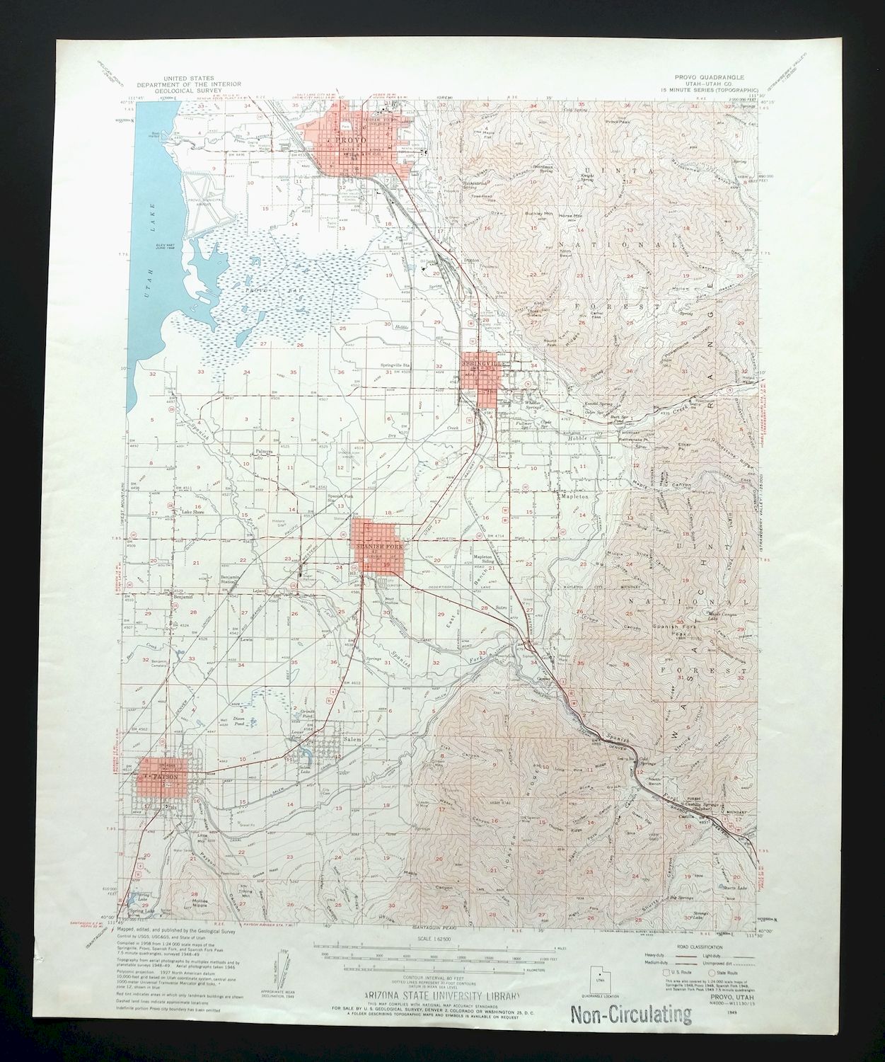
This USGS 15-minute topographic map is a 1949 edition printed in 1959, in very good condition on thick stock and never folded, with only moderate handling to the bottom of the sheet. Covering a 13-by-17-mile stretch of Utah County, the quad takes in Provo, Springville, Spanish Fork, and Payson, along with smaller communities like Mapleton, Salem, and Benjamin, and reaches into part of the Uinta National Forest. Anyone with ties to the Utah Valley cities strung along the Wasatch Front will recognize this stretch of country as it was mapped at mid-century, and the map itself carries ASU library stamps on the lower collar from the decommissioned Arizona university collection it came from.
In stock
This vintage sheet is a 1949 edition of the Provo Utah USGS topographic map. It is an original 67-year-old 1959 United States Geological Survey print in very good condition.
HOW THIS MAP CAN BE USED
In addition to making a fascinating conversation piece, this sheet would look great in a frame or on display, make a unique and prized gift for anyone interested in this area, be perfect as a reference for genealogy studies or general historical research, or fill that missing piece in your collection. Maps of this vintage are printed on durable stock and are well-suited for outdoor activities and recreation of all kinds, including hiking, backpacking, hunting, rafting and kayaking, backcountry skiing, geocaching, general exploration, treasure hunting, etc.
FEATURES SHOWN ON THE MAP
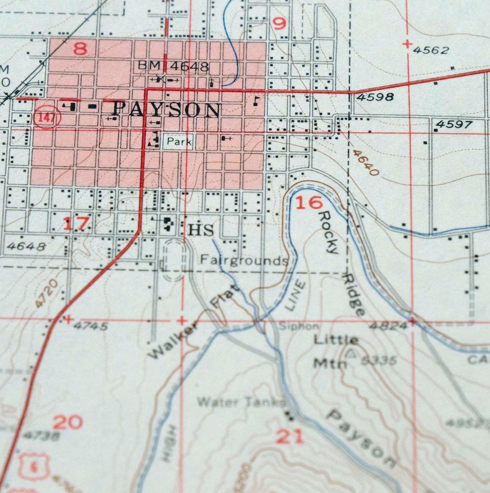
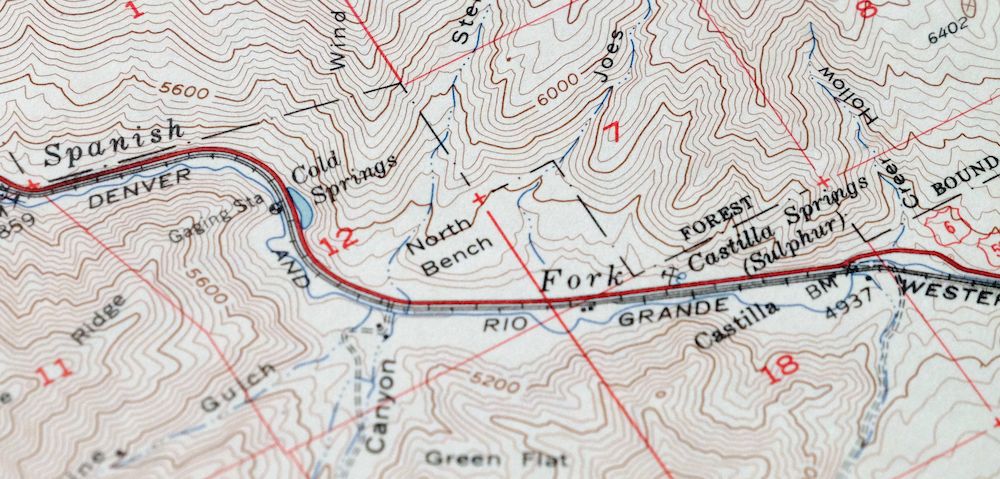
The Provo 15-minute map shows cities and towns, roads, railroads, utilities and energy infrastructure, rivers, creeks, elevation contour lines, public land survey lines, county, state, and other administrative boundaries as they existed at the time of the survey in 1946 through 1949. A reddish tint is used on this sheet to indicate urban areas where only landmark buildings are depicted. Outside of those areas, all known structures (houses, businesses, churches, schools, barns, cabins, etc) are shown.
A VALUABLE HISTORICAL RECORD
Maps from the 15-minute series for the continental United States are no longer produced or printed by the USGS and original prints are becoming increasingly difficult to find. They are a valuable historical record for an area, as they contain many placenames and features that have been dropped from more recent maps.
Nearby maps
-

Moroni Utah Fountain Green USGS 15-Min Topo Map 1968 Vintage
$39 Add to cart -
Stockton Utah Tooele Rush Valley USGS Topo Map 1941 Antique
$32 Add to cart -

Castle Gate Utah Price Helper USGS Topo Map 1968 Vintage
$44 Add to cart -

Hayden Peak Utah Uinta Mountains USGS Topo Map 1946 Vintage
$45 Add to cart -

Duchesne Utah Roosevelt Neola USGS Topo Map 1939 Antique
$36 Add to cart -

Castle Dale Utah Ferron Clawson USGS Topographic Map 1925
$45 Add to cart -
Sunnyside Utah Book Cliffs East Carbon USGS Topo Map 1915
$54 Add to cart -
Woodside Utah Book Cliffs Cedar USGS Topographic Map 1973
$26 Add to cart -
Fillmore Utah Kanosh Meadow USGS 15-Min Topographic Map 1975
$40 Add to cart -
The Wickiup Utah Mexican Mountain WSA USGS Topo Map 1967
$20 Add to cart -
Beaver Utah Dixie NF Fishlake NF USGS Topo Map 1921 Antique
$63 Add to cart -

Jensen Utah Vernal Dinosaur USGS 30-Min Topographic Map 1910
$50 Add to cart -
Notom Capitol Reef NP Utah USGS 15-Min Topo Map 1958 Vintage
$46 Add to cart -
The Spur Utah Canyonlands USGS 15-Min Topo Map 1971 Vintage
$38 Add to cart -
Fiddler Butte Utah USGS 15-Min Topographic Map 1958 Vintage
$38 Add to cart -
Soda Springs Idaho Cache NF Grace USGS Topo Map 1951 Vintage
$32 Add to cart -
Grand Junction Colorado Redlands USGS Topo Map 1964 Vintage
$58 Add to cart -

Roan Creek Colorado USGS 15-Min Topographic Map 1950 Vintage
$39 Add to cart -

Hatch Rock La Sal Utah Vintage Original USGS Topo Map 1965
$20 Add to cart -
Grand Hogback Colorado Rifle Silt USGS Topographic Map 1959
$35 Add to cart -
Nipple Butte Utah Wahweap WSA Big Water USGS Topo Map 1962
$36 Add to cart -
Cummings Mesa Utah USGS 15-Min Topographic Map 1978 Vintage
$40 Add to cart -

Cummings Mesa Glen Canyon Utah Vintage USGS Topo Map 1964
$64 Add to cart -
Blanding Utah Montezuma Canyon White Mesa USGS Topo Map 1964
$33 Add to cart