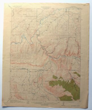
MAP DETAILS | |
|---|---|
| TITLE | Monument Butte |
| STATE | Colorado |
| LOCATION | 10 miles south of Craig |
| SERIES | 15-minute |
| SURVEYED | 1912 Field Survey |
| GEOGRAPHER | R.B. Marshall |
| ENGRAVED | 1914 |
| EDITION | 1915 |
| PRINTED | 1915 |
| PRINT NOTES | Thick paper stock, includes woodland tint (green to indicate vegetated areas) |
| SCALE | 1:62500 |
| CONTOUR INTERVAL | 50 feet |
| SHEET DIMENSIONS | 16 1/2 x 20 inches (approximate) |
| MAP DIMENSIONS | 13 3/8 x 17 1/2 inches |
| COVERAGE AREA | 13 x 17 miles |
| SHEET CONDITION For maps of this vintage, effort is made to note all visible flaws, no matter how minor. | |
| OVERALL CONDITION | Very Good |
| SHEET NOTES | lightly handled, never folded, lightly age-toned sheet |
| MAP AREA | flawless map area |
| COLLARS | no markings, no blemishes, very minor collar wear, no edge tears, inventory notation hand written in pencil in upper right collar corner |
| MAP COVERAGE Quadrangle extent overlaid on current basemap. | |
| BACKSIDE LEGEND | |
 A map summary is printed on the back side of the Monument Butte sheet similar to the one shown in the picture. It outlines the history, purpose, and status of the USGS mapping program at the time of the printing in 1915. It also provides instructions on how to read contour lines and a description of how they are used to depict the terrain. At the bottom of the page is a legend showing all of the symbols used to represent the cultural, relief, and water features found on the map. | |
| PLACENAMES Depending on map series and survey date, all of the features listed below may not be shown on this map. This list contains features that currently exist or historically existed within the area covered by the map. The list can be used as a reference to determine if this map covers your area of interest. Placenames are listed alphabetically next to each feature type. | |
| CITIES AND TOWNS (CURRENT) | Hamilton and Moffat |
| COUNTIES COVERED | Moffat |
| RIVERS AND STREAMS | Badger Creek, Bogenschutz Creek, Deer Creek, Fortification Creek, Good Spring Creek, Milk Creek, North Fork Deer Creek, Waddle Creek, Williams Fork, and Yampa River |
| WATER BODIES | Culverwell Reservoir and Waddle Creek Reservoir |
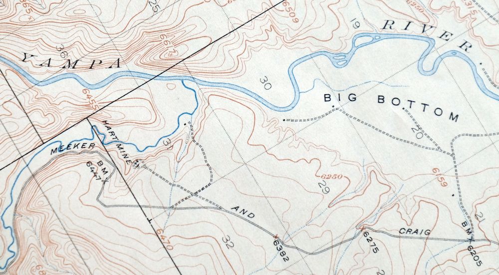
| Mountains, Peaks, and Summits: Harper Hill, Iles Mountain, Monument Butte, and Thompson Hill. Valleys and Canyons: Bell Rock Gulch, Flume Gulch, Castor Gulch, Deacon Gulch, Deal Gulch, Deep Rock Gulch, Hart Gulch, Herring Draw, Horse Gulch, Johnson Gulch, Long Gulch, Moody Gulch, Post Oak Draw, Pyeatt Gulch, Ralston Draw, Ratcliff Gulch, Seeping Spring Gulch, Stock Pass Gulch, Sulphur Gulch, Ute Gulch, West Gulch, and Wood Gulch. Drainages: Badger Creek, Bogenschutz Creek, Deer Creek, Fortification Creek, Morapos Creek, North Fork Deer Creek, Waddle Creek, and Williams Fork. Mines: Baker Mine, Blair Coal Mine, Banker Mine, Brant Mine, Mount Evans Mine, Fields Mine, Eagle Number Five Mine, Eagle Number Nine Mine, Eberle Mine, Hamilton Mine, Hart Mine, Haubrich Mine, Leon Claims, Mack Pit, Mine Number Five, Phillips Mine, Round Bottom Mine, Trapper Strip Mine, Walker Mine, Weisbeck Mine, Whitlock Mine, Williamsfork Number One Mine, and Wise Hill Mine Number Five. Dams: Craig Holding and Evaporation Dam, Craig Raw Water Dam, Ellgen Dam, Ellgen Number 2 Dam, Martin Lilly Pond Dam, and Waddell Creek Dam. Canals: Deep Cut Ditch. Bends: Big Bottom and Round Bottom. Airports: Craig-Moffat Airport. Schools: Hamilton School and Morapos School. Reservoirs and Tanks: Craig Holding and Evaporation Reservoir, Craig Raw Water Reservoir, Ellgen Reservoir, Ellgen Reservoir Number 2, Martin Lily Pond, and Waddle Creek Reservoir. Oilfields: Iles Dome Oil Field, Moffat Oil Field, and Waddle Creek Oil Field. Pillars: Bell Rock. Springs: Post Oak Spring and Ralston Springs. | |
| SHIPPING AND RETURNS | |
 This map sheet will be carefully rolled in a sturdy tube and shipped via the US Postal Service. If you find that the sheet you receive is not as described in the listing, you may ship it back to us for a refund of the purchase price. | |
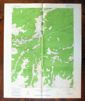
Monument Butte Colorado Moffat Hamilton USGS Topo Map 1915
$49
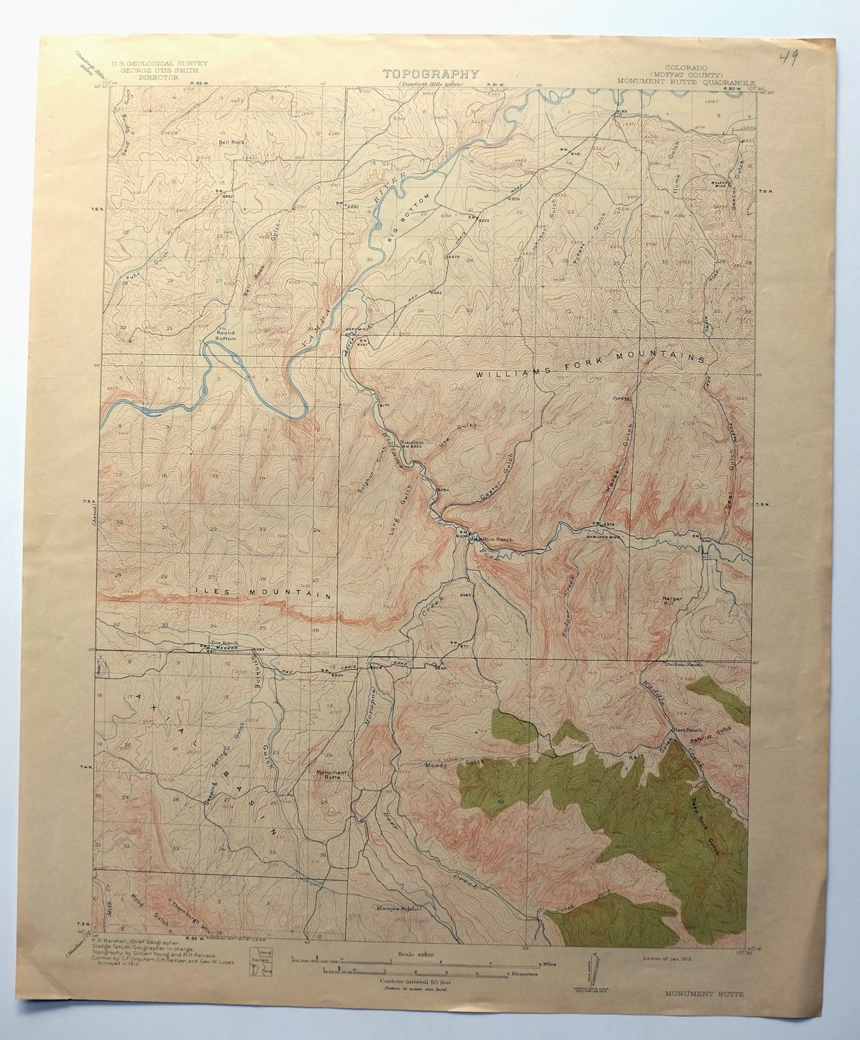
Printed in its year of first publication, 1915, this USGS 15-minute topographic sheet is a first-year print in very good condition, on thick stock, never folded with only light handling and light age-toning. The quad sits about 10 miles south of Craig in Moffat County, Colorado, taking in Monument Butte itself along with the communities of Hamilton and Moffat within its boundaries. Engraved in 1914 under geographer R.B. Marshall from a 1912 field survey, it captures this stretch of northwestern Colorado high country as it was mapped over a century ago, with a flawless map area that has survived remarkably intact; the reverse carries printed USGS reference material.
In stock
This antique sheet is a 1915 edition of the Monument Butte Colorado USGS topographic map. It is an authentic 111-year-old United States Geological Survey print in very good condition.
HOW THIS MAP CAN BE USED
In addition to making a fascinating conversation piece, this sheet would look great in a frame or on display, make a unique and prized gift for anyone interested in this area, be perfect as a reference for genealogy studies or general historical research, or fill that missing piece in your collection.
FEATURES SHOWN ON THE MAP
The Monument Butte 15-minute map shows cities and towns, roads, railroads, rivers, creeks, elevation contour lines, public land survey lines, county, state, and other administrative boundaries as they existed at the time of the survey in 1912. All known structures (houses, businesses, churches, schools, barns, cabins, etc) are also shown, with exceptions in some urban areas, where only landmark buildings may be shown.
A VALUABLE HISTORICAL RECORD
Maps from the 15-minute series for the continental United States are no longer produced or printed by the USGS and original prints are becoming increasingly difficult to find. They are a valuable historical record for an area, as they contain many placenames and features that have been dropped from more recent maps.
Nearby maps
-

Daton Peak Colorado Routt NF Hayden USGS Topo Map 1965
$28 Add to cart -
Pilot Knob Colorado Routt NF USGS Topo Map 1963 Vintage
$37 Add to cart -

Pearl Colorado USGS 15-Min Topographic Map 1969 Vintage
$43 Add to cart -
Grand Hogback Colorado Rifle Silt USGS Topographic Map 1959
$35 Add to cart -
Leon White River NF Colorado USGS 7.5-Min Topo Map 1988
$36 Add to cart -

Mount Powell Colorado Gore Range USGS Topo Map 1940 Antique
$32 Add to cart -
Vail West Colorado Avon USGS 7.5-Min Topo Map 1973 Vintage
$38 Add to cart -

Roan Creek Colorado USGS 15-Min Topographic Map 1950 Vintage
$39 Add to cart -
Hot Sulphur Springs Colorado Parshall USGS Topo Map 1963
$39 Add to cart -
Vail East Colorado USGS 7.5-Min Topographic Map 1973 Vintage
$37 Add to cart -
Kings Canyon Colorado North Sand Hills USGS Topo Map 1969
$34 Add to cart -

Jensen Utah Vernal Dinosaur USGS 30-Min Topographic Map 1910
$50 Add to cart -

Red Cliff Colorado Vail USGS 7.5-Min Topo Map 1988 Vintage
$35 Add to cart -
Highland Peak Colorado Snowmass Village USGS Topo Map 1988
$43 Add to cart -
Aspen Colorado USGS 7.5-Min Topographic Map 1964 Vintage
$48 Add to cart -

Frisco Colorado Dillon Reservoir Dillon USGS Topo Map 1973
$38 Add to cart -
Trail Ridge Colorado USGS 7.5-Min Topo Map 1962 Vintage
$25 Add to cart -

Mount Massive Colorado USGS 7.5-Min Topo Map 1975 Vintage
$36 Add to cart -
Grand Junction Colorado Redlands USGS Topo Map 1964 Vintage
$58 Add to cart -

Keystone Colorado USGS 7.5-Min Topographic Map 1963 Vintage
$35 Add to cart -
Montezuma Colorado Keystone USGS 15-Min Topographic Map 1926
$65 Add to cart -
Anthracite Colorado USGS 15-Min Topographic Map 1918 Antique
$38 Add to cart -

Estes Park Colorado USGS 7.5-Min Topo Map 1961 Vintage
$31 Add to cart -
Georgetown Colorado Silver Plume USGS Topo Map 1962 Vintage
$33 Add to cart