MAP DETAILS | |
|---|---|
| TITLE | Grand Hogback |
| STATE | Colorado |
| LOCATION | Vicinity of Rifle, 65 miles northeast of Grand Junction, CO |
| SERIES | 30-minute |
| SURVEYED | 1906 Field Survey |
| GEOGRAPHER | Hoyt S. Gale |
| EDITION | 1906 |
| PRINTED | 1959 |
| PRINT NOTES | Thick paper stock |
| SCALE | 1:125000 |
| CONTOUR INTERVAL | 100 feet |
| SHEET DIMENSIONS | 16 x 20 inches (approximate) |
| MAP DIMENSIONS | 13 1/2 x 17 1/2 inches |
| COVERAGE AREA | 27 x 35 miles |
| SHEET CONDITION For maps of this vintage, effort is made to note all visible flaws, no matter how minor. | |
| OVERALL CONDITION | Flawless |
| SHEET NOTES | very lightly handled, never folded, smooth and flat |
| MAP AREA | no wear, no markings, no blemishes |
| COLLARS | no wear or tears, no markings, no blemishes |
| MAP COVERAGE Quadrangle extent overlaid on current basemap. | |
| PLACENAMES Depending on map series and survey date, all of the features listed below may not be shown on this map. This list contains features that currently exist or historically existed within the area covered by the map. The list can be used as a reference to determine if this map covers your area of interest. Placenames are listed alphabetically next to each feature type. | |
| CITIES AND TOWNS (CURRENT) | New Castle, Rifle, Rio Blanco, and Silt |
| COUNTIES COVERED | Garfield and Rio Blanco |
| FEDERAL LAND UNITS | Flat Tops Wilderness, Naval Oil Shale Reserve, Rifle Gap Reservoir, and White River National Forest |
| RIVERS AND STREAMS | Alkali Creek, Baldy Creek, Bear Creek, Beaver Creek, Beckman Creek, Ben Good Creek, Big Beaver Creek, Big Parker Creek, Bitter Creek, Boiler Creek, Brush Creek, Buckeye Creek, Butler Creek, Caoughs Creek, Cattle Creek, Cave Creek, Colorado River, Corral Creek, Deep Creek, Divide Creek, Dry Creek, Dry Hollow Creek, Dry Rifle Creek, Dry Thirteenmile Creek, Dutch Creek, East Elk Creek, East Fork Flag Creek, East Fork Parachute Creek, East Rifle Creek, First Anvil Creek, Flag Creek, Forbes Creek, Fourmile Creek, Fourteenmile Creek, Fowler Creek, G V Creek, Garfield Creek, George Creek, Gooseberry Creek, Government Creek, Greenstreet Creek, Hazard Creek, Hill Creek, Lone Tree Creek, Main Elk Creek, Mamm Creek, Mansfield Creek, Meadow Creek, Middle Fork North Elk Creek, Middle Fork Parachute Creek, Middle Miller Creek, Middle Rifle Creek, Miller Creek, Moose Creek, North Elk Creek, North Fork White River, Northwater Creek, Old Mans Creek, Peltier Creek, Piceance Creek, Rasberry Creek, Rifle Creek, Salt Creek, Sawmill Creek, Schneider Creek, Second Anvil Creek, Sheep Creek, South Fork White River, Spring Creek, Swede Creek, Thirteenmile Creek, Three Forks Creek, Twelvemile Creek, Vaughn Creek, Ward Creek, West Branch Cow Creek, West Fork North Elk Creek, West Miller Creek, West Rifle Creek, White Creek, White River, and Yellowjacket Creek |
| WATER BODIES | Bailey Lake, Bar-Bel Lake, Big Beaver Reservoir, Fravert Reservoir, Grass Valley Reservoir, Harker Park Lake, Harris Reservoir, Howey Reservoir, Larson Reservoir Number 2, Peltier Lake, Seventh Lake, and Sterry Lake |
| Locations: Bel-aire Rearing Station, Bar H L Guard Station, Blue Spruce Campground, Buford District Ranger Office, Buford Ranger Station, Bureau of Mines Oil Shale Experiment Station, Clark Cabin Campground, Cliff Lake Trailhead, Clinetop Cow Camp, Hamilton Camp, Hill Creek Campground and Trailhead, Lacy, Little Box Campground, Little Box Canyon Campground, Meadow Creek Campground, Meadow Creek Cow Camp, Miller Creek Cow Camp, Mud Spring Ranch, North Elk Cow Camp, Rifle Creek Community Club, Rifle Creek Cow Camp, Rifle Falls Fish Hatchery, Russell Camp, South Fork Campground, Spring Cow Camp, Spruce Picnic Area, T I Cow Camp, Three Forks Campground, West Elk Forest Service Station, and White River Community House. Mountains, Peaks, and Summits: Big Mountain, Hubbard Mesa, Buford Peak, Burning Mountain, Burro Mountain, Coulter Mesa, Graham Mesa, Hadley Point, Horse Mountain, Joe Hill, LO 7 Hill, Little Hill, Middle Mountain, Monument Peak, Prefontaine Mesa, Roan Plateau, Snowdrift Mountain, Webster Hill, Webster Mesa, and Weible Peak. Valleys and Canyons: Bear Gulch, Beef Draw, Ball Gulch, Balzac Gulch, Bloodsworth Gulch, Hubbard Gulch, Buckskin Gulch, First Water Gulch, Camp Gulch, Corral Gulch, Daum Draw, Deadman Gulch, Doodlebug Gulch, Estes Gulch, Fuches Gulch, Garden Gulch, Golden Castle Gulch, Goodrich Gulch, Grassy Gulch, Hadley Gulch, Harris Gulch, Helmer Gulch, Hoover Gulch, Huffman Gulch, Irish Gulch, J Q S Gulch, J V Gulch, Jackson Gulch, Langlas Draw, Little Box Canyon, Magpie Gulch, Missoo Gulch, Moog Gulch, Mullen Gulch, Prospect Draw, Ramsey Gulch, Red Canyon, Salt Gulch, Sawmill Gulch, Second Water Gulch, Smith Gulch, Smizer Gulch, South Fork Canyon, Spring Gulch, Stillwater Valley, Stump Gulch, Sykes Gulch, Tangle Gulch, Third Water Gulch, Thirty Two Mile Gulch, Tichner Draw, Timber Gulch, Trappers Gulch, Veatch Gulch, Ward Gulch, Whiskey Gulch, and Yellow Slide Gulch. Parks: Rifle Mountain Park. Trails: Bailey Lake Trail, Fayville Trail, Doyle Trail, Hay Flat Trail, Last Chance Trail, Mansfield Ditch Trail, Ute Stock Driveway, and West Elk Stock Driveway. Drainages: Alkali Creek, Bear Creek, Beaver Creek, Big Beaver Creek, Bitter Creek, Baldy Creek, Beckman Creek, Big Parker Creek, Boiler Creek, Brush Creek, Buckeye Creek, Butler Creek, First Anvil Creek, Cattle Creek, Cave Creek, Cherry Creek, Clark Creek, Corral Creek, Coughs Creek, Deep Creek, Divide Creek, Dry Creek, Dry Hollow Creek, Dry Rifle Creek, Dutch Creek, East Elk Creek, East Fork Flag Creek, East Fork North Elk Creek, East Miller Creek, East Rifle Creek, Elk Creek, Fourmile Creek, Fowler Creek, G V Creek, Garfield Creek, George Creek, Gooseberry Creek, Government Creek, Greenstreet Creek, Hazard Creek, Hill Creek, Main Elk Creek, Mamm Creek, Mansfield Creek, Meadow Creek, Middle Fork North Elk Creek, Middle Miller Creek, Middle Rifle Creek, Miller Creek, Moose Creek, North Elk Creek, North Fork White River, Old Mans Creek, Peltier Creek, Rasberry Creek, Rifle Creek, Salt Creek, Sawmill Creek, Second Anvil Creek, Sheep Creek, South Fork White River, Spring Creek, Swede Creek, Thirteenmile Creek, Three Forks Creek, Twelvemile Creek, Vaughn Creek, Ward Creek, West Branch Cow Creek, West Elk Creek, West Fork North Elk Creek, West Miller Creek, West Rifle Creek, White Creek, and Yellowjacket Creek. Mines: Anvil Points Oil Shale Mines, Black Raven Mine, Big Three Mine, Chambers Pit, Coryell Mine, East Anderson Mine, Eastside Mine, Elk Van Tunnel and UV Claims, Garfield Mine, Grandview Mine, Gray Eagle Mine, Ingle Haas and Ingle Mine, Le Donne Mine, Lily Mine, McLearn Mine, New Castle Pit, Nu Gap Number Three Mine, Parker Mine, Rauman Mine, Rifle Mine, Rifle Pit, Rio Blanco Mine, Rulison Oil Shale Mine, Silt Mine, Sunshine Mine, Ted Estes Mine, Tipple Mine, Vulcan Mine, Wheeler Mine, and Zeiseniss Mine. Lakes and Ponds: Bear Lake, Bloodsworth Pond, Buckskin Lake, Burro Mountain Lake, Cliff Lakes, Corbett Lake, Dynamite Lake, Harker Park Lake, One Mile Pond, Parker Lake, Peltier Lake, Sterry Lake, Swede Lake, Trojan Lake, and Wilbur Lake. Waterfalls: Rifle Falls. Dams: Bailey Lake Dam, Big Beaver Dam, Beaver Lake Dam, Howey Reservoir Dam, Coulter Dam, Grass Valley Dam, Gregor Dam, Larson Number 2 Dam, Meadow Creek Dam, Park Dam, Rifle Gap Dam, Rifle Valley Dam, West Miller Dam, and Wilson Dam. Bluffs: Clark Point, Cottonwood Point, Deep Creek Point, East Anvil Point, Meadow Creek Point, Nimerick Point, Red Elephant Point, Roan Cliffs, Warner Point, West Anvil Point, and Windy Point. Gaps: Harvey Gap and Rifle Gap. Canals: Beckman Ditch, Farmers Irrigation Company Ditch, Davie Ditch, East Lateral Farmers Irrigation Company Ditch, Grand Tunnel Ditch, Grass Valley Canal, Highland Ditch, Last Chance Ditch, Lower Cactus Valley Ditch, Marcott Ditch, Mineota Ditch, Pioneer Ditch, Rifle Creek Canyon Ditch, Rising Sun Ditch, Tompkins Ditch, Wards and Reynolds Ditch, and Ware and Hinds Ditch. Basins: Cactus Valley, Calhoun Basin, and Peltier Basin. Airports: Garfield County Regional Airport, Rifle Municipal Airport, and Rio Blanco Heliport. Swamps: White Springs. Schools: Upper Rifle Creek School. Ridges: Banner Ridge, Big Ridge, Buford Ridge, Burnt Ridge, Clark Ridge, Grand Hogback, Irish Ridge, J K Ridge, Parker Ridge, and Wells Ridge. Reservoirs and Tanks: Bailey Lake, Big Beaver Reservoir, Bar-Bel Lake, Beaver Lake, Beaver Lake Reservoir, Howey Reservoir, Cabin Lake, Coulter Lake, Dobbs Reservoir, Fravert Reservoir, Gilley Lake, Grass Valley Reservoir, Gregor Reservoir, Harris Reservoir, Lake Avery, Larson Reservoir Number 2, Meadow Creek Lake, Meadow Creek Reservoir, Murphy Reservoir, Park Reservoir, Rifle Gap Reservoir, Rifle Valley Reservoir, Seventh Lake, Shadow Lake, Stump Lake, West Elk Reservoir, West Miller Reservoir, and Wilson Reservoir. Flats: Bar H L Park, Crooks Park, Devils Park, Elk Park, Glover Park, Goodrich Park, Hay Flat, Horse Park, Lake Park, Long Park, Saddle Horse Park, Seaman Park, Sharrard Park, Triangle Park, and Wear Park. Towers: KKGD-AM (Rifle) and KRMW-AM (Silt). Springs: Bear Spring, Bloodsworth Spring, Finley Spring, Buttermilk SPring, Clark Cabin Spring, Clark RIdge Spring Number Six, Clark Ridge Spring Number Five, Clark Ridge Spring Number Four, Clark Ridge Spring Number One, Clark Ridge Spring Number Three, Clark Ridge Spring Number Two, Edwards Spring, G V Spring, Hiner Spring, Indian Spring, Irish Spring, Janes Spring, Joe Hill Spring, Little GV SPring, Machine Spring, Mud Spring, Orphan Spring, Prospect Spring, Twin Springs, and Widow Spring. | |
| SHIPPING AND RETURNS | |
 This map sheet will be carefully rolled in a sturdy tube and shipped via the US Postal Service. If you find that the sheet you receive is not as described in the listing, you may ship it back to us for a refund of the purchase price. | |
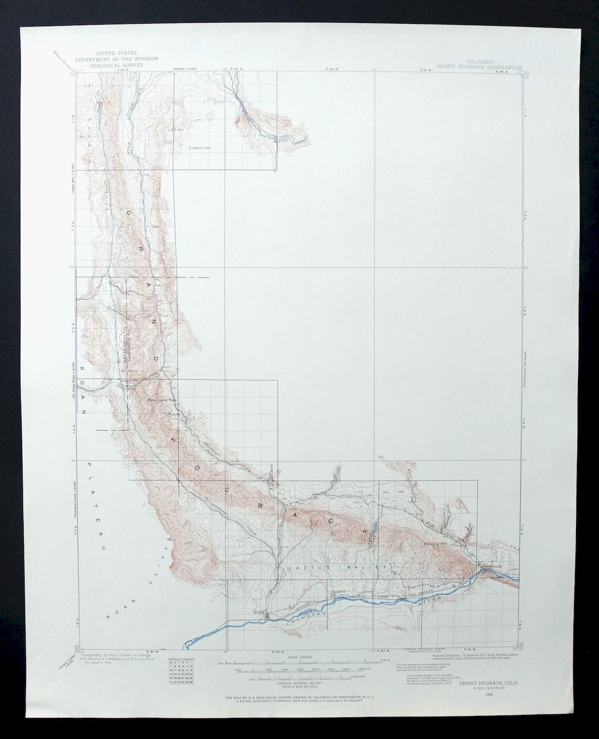
Grand Hogback Colorado Rifle Silt USGS Topographic Map 1959
$35
First published in 1906, this sheet was printed in 1959 and grades flawless – very lightly handled, never folded, and printed on thick stock that has kept it smooth and flat. The 30-minute quad takes in the country north of Rifle in Garfield and Rio Blanco Counties, including New Castle and Silt along the Colorado River valley, with part of the White River National Forest and the Flat Tops Wilderness rising to the north and Rifle Gap Reservoir within its bounds. The map carries the name of the Grand Hogback, the long tilted ridge that runs through this stretch of western Colorado, and was drawn from a 1906 field survey by geographer Hoyt S. Gale.
In stock
This vintage sheet is a 1906 edition of the Grand Hogback Colorado USGS topographic map. It is an original 67-year-old 1959 United States Geological Survey print in flawless condition.
HOW THIS MAP CAN BE USED
In addition to making a fascinating conversation piece, this sheet would look great in a frame or on display, make a unique and prized gift for anyone interested in this area, be perfect as a reference for genealogy studies or general historical research, or fill that missing piece in your collection. Maps of this vintage are printed on durable stock and are well-suited for outdoor activities and recreation of all kinds, including hiking, backpacking, hunting, rafting and kayaking, backcountry skiing, geocaching, general exploration, treasure hunting, etc.
FEATURES SHOWN ON THE MAP
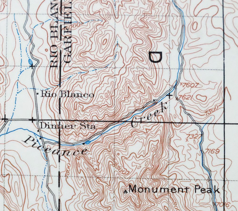
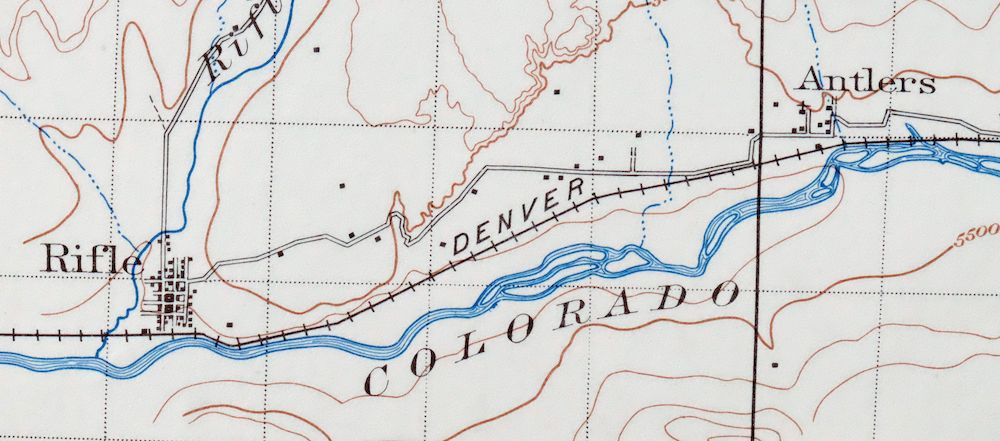
The Grand Hogback 30-minute map shows cities and towns, roads, railroads, utilities and energy infrastructure, rivers, creeks, elevation contour lines, public land survey lines, county, state, and other administrative boundaries as they existed at the time of the survey in 1906.
A VALUABLE HISTORICAL RECORD
Maps from the USGS 30-minute series have been out of print for many years. They have never been common and original prints are increasingly difficult to find. For areas where the 30-minute map was produced, it is usually the first large-scale survey done by the USGS for that area. These are a valuable historical record, as they contain many placenames and features that have been dropped from more recent series’ and editions.
Nearby maps
-

Jensen Utah Vernal Dinosaur USGS 30-Min Topographic Map 1910
$50 Add to cart -

Duchesne Utah Roosevelt Neola USGS Topo Map 1939 Antique
$36 Add to cart -

Roan Creek Colorado USGS 15-Min Topographic Map 1950 Vintage
$39 Add to cart -
Leon White River NF Colorado USGS 7.5-Min Topo Map 1988
$36 Add to cart -
Monument Butte Colorado Moffat Hamilton USGS Topo Map 1915
$49 Add to cart -

Daton Peak Colorado Routt NF Hayden USGS Topo Map 1965
$28 Add to cart -
Highland Peak Colorado Snowmass Village USGS Topo Map 1988
$43 Add to cart -
Aspen Colorado USGS 7.5-Min Topographic Map 1964 Vintage
$48 Add to cart -
Grand Junction Colorado Redlands USGS Topo Map 1964 Vintage
$58 Add to cart -
Pilot Knob Colorado Routt NF USGS Topo Map 1963 Vintage
$37 Add to cart -
Anthracite Colorado USGS 15-Min Topographic Map 1918 Antique
$38 Add to cart -
Vail West Colorado Avon USGS 7.5-Min Topo Map 1973 Vintage
$38 Add to cart -

Mount Powell Colorado Gore Range USGS Topo Map 1940 Antique
$32 Add to cart -
Vail East Colorado USGS 7.5-Min Topographic Map 1973 Vintage
$37 Add to cart -

Red Cliff Colorado Vail USGS 7.5-Min Topo Map 1988 Vintage
$35 Add to cart -

Mount Massive Colorado USGS 7.5-Min Topo Map 1975 Vintage
$36 Add to cart -
Hot Sulphur Springs Colorado Parshall USGS Topo Map 1963
$39 Add to cart -

Frisco Colorado Dillon Reservoir Dillon USGS Topo Map 1973
$38 Add to cart -

Keystone Colorado USGS 7.5-Min Topographic Map 1963 Vintage
$35 Add to cart -

Pearl Colorado USGS 15-Min Topographic Map 1969 Vintage
$43 Add to cart -
Iola Colorado USGS 7.5-Min Topographic Map 1963 Vintage
$31 Add to cart -
Montezuma Colorado Keystone USGS 15-Min Topographic Map 1926
$65 Add to cart -
Georgetown Colorado Silver Plume USGS Topo Map 1962 Vintage
$33 Add to cart -
Georgetown Colorado Idaho Springs USGS Topo Map 1980 Vintage
$42 Add to cart