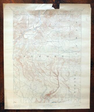
MAP DETAILS | |
|---|---|
| TITLE | Camas Prairie |
| STATE | Idaho |
| SURVEYED | 1889 Field Survey |
| GEOGRAPHER | A.H. Thompson |
| PRINT NOTES | Thick paper stock |
| SCALE | 1:125000 |
| CONTOUR INTERVAL | 100 feet |
| SHEET DIMENSIONS | 16 1/2 x 19 7/8 inches |
| MAP DIMENSIONS | 12 3/4 x 17 1/2 inches |
| COVERAGE AREA | 25 x 35 miles |
| SHEET CONDITION For maps of this vintage, effort is made to note all visible flaws, no matter how minor. | |
| SHEET NOTES | moderately handled, never folded, lightly age-toned paper |
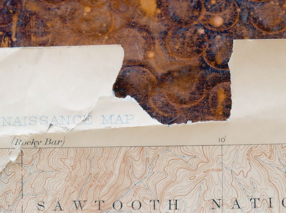
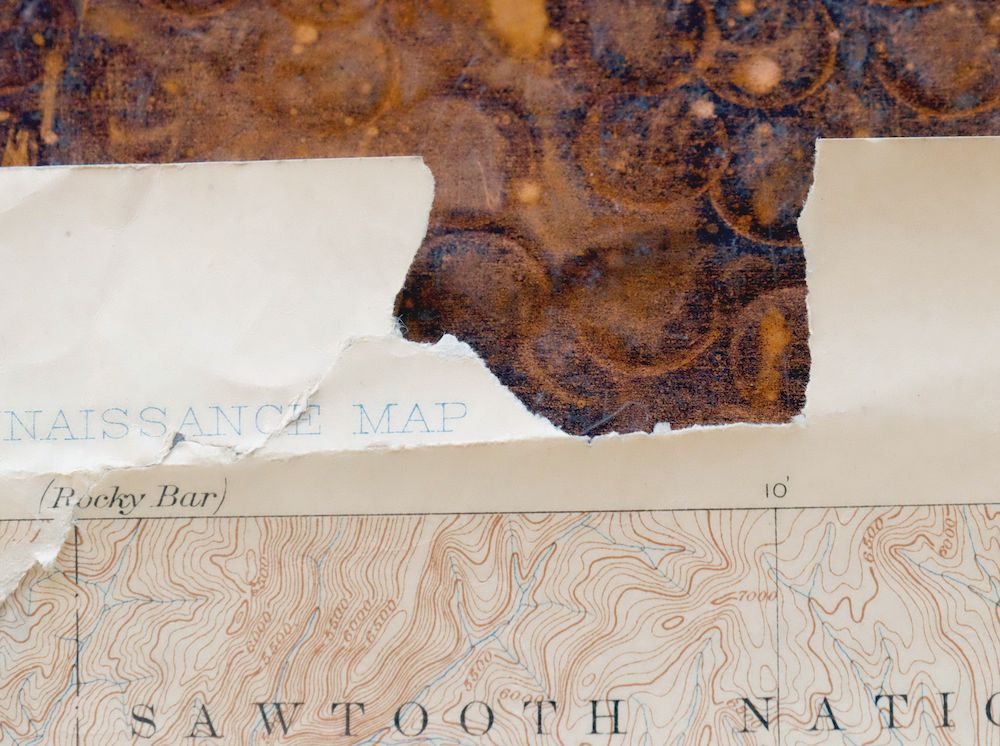
| MAP AREA | very minor blemishes, colored pencil notation in east-central edge of map, previously repaired edge tear extends an inch into north-central portion of map |
| COLLARS | considerable wear or tears, no markings, minor blemishes, damage to top collar including section torn away |
 | |
| MAP COVERAGE Quadrangle extent overlaid on current basemap. | |
| BACKSIDE LEGEND | |
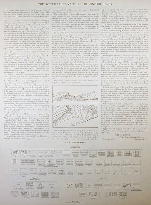 A map summary is printed on the back side of the Camas Prairie sheet similar to the one shown in the picture. It outlines the history, purpose, and status of the USGS mapping program at the time of the printing in 1922. It also provides instructions on how to read contour lines and a description of how they are used to depict the terrain. At the bottom of the page is a legend showing all of the symbols used to represent the cultural, relief, and water features found on the map. | |
| PLACENAMES Depending on map series and survey date, all of the features listed below may not be shown on this map. This list contains features that currently exist or historically existed within the area covered by the map. The list can be used as a reference to determine if this map covers your area of interest. Placenames are listed alphabetically next to each feature type. | |
| NOTABLE PLACES | Pine, Castle Rocks, and King Hill |
| CITIES AND TOWNS (CURRENT) | Hill City |
| COUNTIES COVERED | Camas, Elmore, and Gooding |
| FEDERAL LAND UNITS | Anderson Ranch Reservoir, Boise National Forest, Deer Creek Wilderness Study Area, King Hill Creek Wilderness Study Area, Sawtooth National Forest, and Snake River Birds of Prey National Conservation Area |
| RIVERS AND STREAMS | Alkali Creek, Bell Mare Creek, Bennett Creek, Big Deer Creek, Big Springs Creek, Calf Creek, Camas Creek, Camp Creek, Castle Creek, Cat Creek, Chimney Creek, Clover Creek, Cold Springs Creek, Cow Creek, Deer Creek, Deer Heaven Creek, Dive Creek, Dry Creek, Ear Creek, East Dempsey Creek, East Fork Bell Mare Creek, East Fork Cold Springs Creek, East Fork Long Tom Creek, Elk Creek, Evans Creek, Fall Creek, Goat Creek, Granite Creek, Guay Creek, Hearn Creek, Hog Creek, Honey Creek, Hot Springs Creek, King Hill Creek, Knox Creek, Lake Creek, Lester Creek, Lime Creek, Little Camas Creek, Little Canyon Creek, Little Deer Creek, Little Wood Creek, Louse Creek, Magpie Creek, Malad River, Maniece Creek, Maxfield Creek, Meadow Creek, Middle Fork Lime Creek, Moores Creek, Myrtle Creek, Negro Creek, North Fork Deer Creek, North Fork Lime Creek, Pierce Creek, Rock Creek, Ryegrass Creek, Salix Creek, Salt Log Creek, Sheep Creek, Slickear Creek, Snake River, South Fork Boise River, South Fork Deer Creek, South Fork Lime Creek, Sprout Creek, Stavley Creek, Stewart Creek, Tally Baker Creek, Thompson Creek, Thorn Creek, Towne Creek, Trail Creek, Walker Ditch, West Dempsey Creek, West Fork Bell Mare Creek, West Fork Cold Springs Creek, West Fork King Hill Creek, Wild Horse Creek, Williams Creek, Wilson Creek, and Wood Creek |
| WATER BODIES | Anderson Ranch Reservoir and Little Camas Reservoir |
| Locations: Bennett Patrol Cabin Site, Berry Ranch, Castle Rock Campground, Curlew Creek Recreation Site, Deer Creek Boat Ramp, Devils Dive, Devils Playground, Elk Creek Boat Ramp, Elk Creek Recreation Site, Evans Creek Campground, Fall Creek Lodge, Fall Creek Recreation Site, Ice Springs Campground, Idaho State Highway Maintenance Station, Lester Creek Forest Service Station, Lime Creek Campground, Little Camas Recreation Site, Little Camas Reservoir Access Area, Little Wilson Creek Campground, Pine AIrport Boat Ramp, Pine Recreation Site, and View Point. Areas: The Cottonwoods, Lazy Grove, and Water Holes. Mountain Ranges: Mount Bennnett Hills. Reserves: Anderson Ranch Big Game Range, Camas Prairie Centennial Marsh Wildlife Management Area, and Clover Creek Wildlife Habitat Area. Mountains, Peaks, and Summits: Bennett Mountain, Cat Creek Summit, Deer Heaven Mountain, Deer Mountain, Granite Mountain, House Mountain, Kings Crown, The Knob, The Knob, Packer Butte, Sprout Mountain, and Wood Creek Mountain. Valleys and Canyons: Beaverdam Gulch, Bear Gulch, Bird Gulch, Blackburn Gulch, Boyer Gulch, Burns Gulch, Browns Gulch, Buck Gulch, Buckbrush Draw, Caldwell Gulch, Cannon Gulch, Ellis Gulch, Hall Gulch, Hawk Gulch, Lockman Gulch, Murphy Gulch, Porcupine Gulch, Sawmill Gulch, Skelton Gulch, Sloans Gulch, Steep Gulch, and Walker Gulch. Parks: Soldier Mountain Game Preserve. Trails: Bremner Trail and Sheep Drive Trail. Drainages: Adams Creek, Antelope Creek, Badger Creek, Bell Mare Creek, Big Deer Creek, Big Springs Creek, Biswell Creek, Bremner Creek, Buck Creek, Calf Creek, Camp Creek, Casey Creek, Castle Creek, Castle Rock Creek, Cat Creek, Chimney Creek, Cooper Creek, Corker Creek, Curlew Creek, Deer Creek, Deer Heaven Creek, Dixie Creek, Dollar Creek, Dry Creek, Ear Creek, East Dempsey Creek, East Fork Bell Mare Creek, East Fork Cold Springs Creek, Elk Creek, Evans Creek, Fall Creek, Goat Creek, Guay Creek, Hearn Creek, Herrin Creek, Hog Creek, Hole-In Wall Creek, Honey Creek, Hot Springs Creek, Iron Mountain Creek, Jefferson Creek, Knox Creek, Lake Creek, Lester Creek, Lime Creek, Little Camas Creek, Little Deer Creek, Little Wilson Creek, Little Wood Creek, Louse Creek, Madison Creek, Magpie Creek, Malad River, Maniece Creek, Maxfield Creek, McCarter Creek, Meadow Creek, Middle Fork Lime Creek, Mill Creek, Mineral Creek, Monroe Creek, Monument Gulch Creek, Moores Creek, Myrtle Creek, Negro Creek, Nettle Creek, North Fork Deer Creek, North Fork Lime Creek, Polson Creek, Rattlesnake Creek, Roanhide Creek, Rock Creek, Ryegrass Creek, Salix Creek, Salt Log Creek, Sheep Creek, Silverton Creek, Slickear Creek, Snowslide Creek, South Fork Deer Creek, South Fork Lime Creek, Sprout Creek, Stewart Creek, Tally Baker Creek, Thompson Creek, Thorn Creek, Tiger Creek, Towne Creek, Trail Creek, West Dempsey Creek, West Fork Bell Mare Creek, West Fork Cold Springs Creek, West Fork King Hill Creek, Whitney Creek, Wild Horse Creek, Willow Creek, Wilson Creek, and Wood Creek. Mines: Daley Con Mines, Franklin Mine, and Reber Mine. Lakes and Ponds: Kerosene Lake. Dams: Anderson Ranch Dam, Cow Creek Dam, Francis Dam, Hall Dam, Hot Springs Number Two Dam, Little Camas Dam, Little Canyon Dam, Olson Dam, Rhead Dam, Teapot-Lower Dam, Teapot-Upper Dam, Trail Dam, Trail Diversion Dam, and Walker Dam. Crossings: Little Canyon Creek Longs Crossing. Gaps: Dixie Summit and Windy Gap. Canals: Ricke Ditch and Walker Ditch. Bays: Big Water Hole. Basins: Bennett Creek Basin. Airports: Bennett Airport, Pine Airport, and Tracy Ranch Airport. Schools: County Line School. Ridges: Spring Ridge. Reservoirs and Tanks: Anderson Ranch Reservoir, Blair Trail Reservoir, Cow Creek Reservoir, Hot Springs Creek Reservoir, Little Camas Reservoir, Lower Teapot Reservoir, Morrow Reservoir, Upper Teapot Reservoir, and Walker Reservoir. Flats: Babs Flat, Dempsey Meadows, Goodman Flat, High Prairie, Little Camas Prairie, Moores Flat, White Flat, and Wilson Flat. Pillars: Skull Rock. Springs: Abbott Springs, Bainbridge Spring, Beer Can Spring, Bell Mare Spring, Blackhawk Spring, Bourbon Spring, Bullet Spring, Buckbrush Spring, Cedar Spring, Cedar Tree Spring, Chalk Spring, Cold Spring, Cook Spring, Corker Springs, Coyote Spring, Craster Spring, Daveys Spring, Dead Horse Spring, Doe Spring, Echo Spring, Goat Spring, Ground Hog Spring, Hat Spring, High Spring, Hog Creek Spring, Ice Springs, Indian Writing Water Hole, Lansing Springs, Latty Hot Spring, Lester Creek Springs, Light Spring, Lone Tree Spring, McFarney Spring, Moores Spring, Mud Springs, Orr Springs, Prince Albert Spring, Rustican Spring, Scrub Spring, Sterpernell Spring, Tate Spring, Teapot Spring, Thoroughbred Spring, Tub Spring, Twin Deer Springs, Twin Springs, Warm Spring, Whiskey Spring, and Whitson Spring. | |
| SHIPPING AND RETURNS | |
 This map sheet will be carefully rolled in a sturdy tube and shipped via the US Postal Service. If you find that the sheet you receive is not as described in the listing, you may ship it back to us for a refund of the purchase price. | |
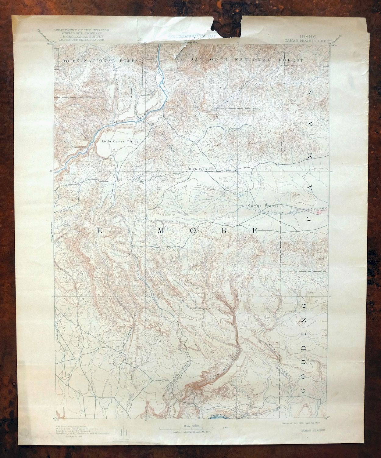
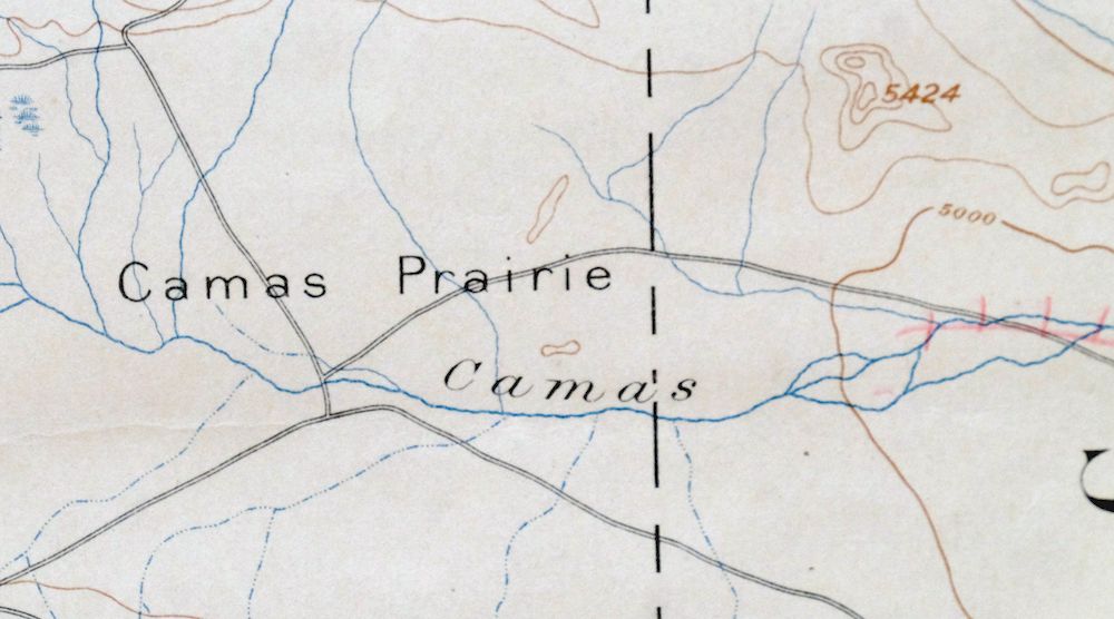
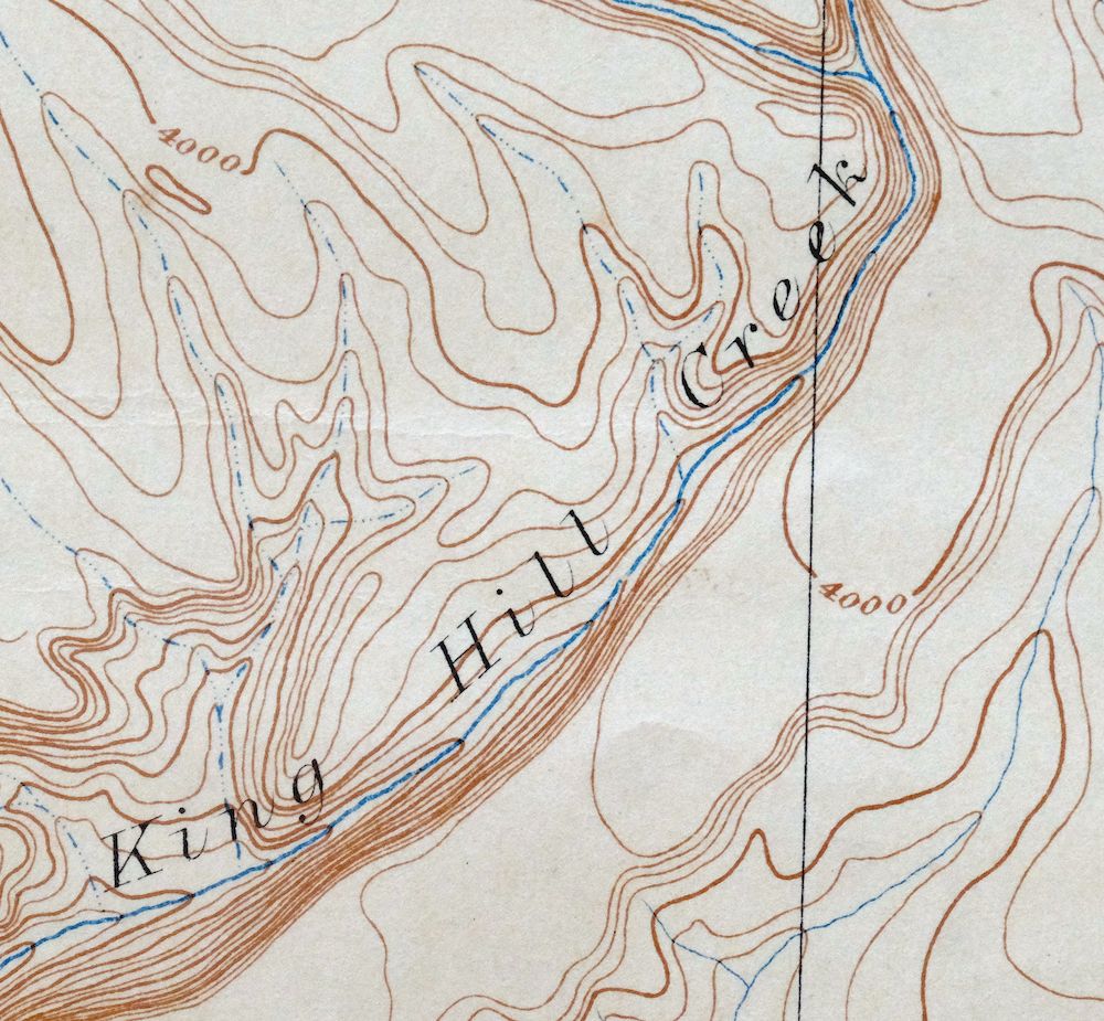
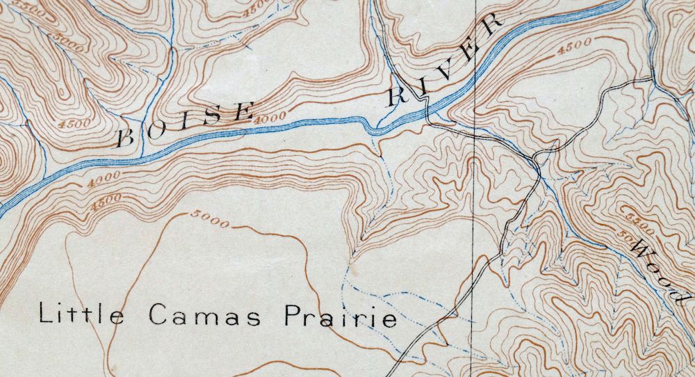
1893 USGS Topo Map: Camas Prairie, Pine, Idaho (1922 Print)
$17
A fascinating historical snapshot surveyed before the existence of Anderson Ranch Reservoir.
- 55 miles southeast of Boise.
- 30-minute series, 1893 edition, printed in 1922.
- Fair condition, never folded.
In stock
This antique sheet is an 1893 edition of the Camas Prairie Idaho USGS topographic map. It is an authentic 104-year-old 1922 United States Geological Survey print in fair condition.
HOW THIS MAP CAN BE USED
In addition to making a fascinating conversation piece, this sheet would make a unique and prized gift for anyone interested in this area, be perfect as a reference for genealogy studies or general historical research, or fill that missing piece in your collection.
FEATURES SHOWN ON THE MAP
The Camas Prairie 30-minute map shows cities and towns, roads, railroads, rivers, creeks, elevation contour lines, public land survey lines, county, state, and other administrative boundaries as they existed at the time of the survey in 1889.
A VALUABLE HISTORICAL RECORD
Maps from the USGS 30-minute series have been out of print for many years. They have never been common and original prints are increasingly difficult to find. For areas where the 30-minute map was produced, it is usually the first large-scale survey done by the USGS for that area. These are a valuable historical record, as they contain many placenames and features that have been dropped from more recent series’ and editions.
Nearby maps
-

1893 USGS Topo Map: Mountain Home, Cleft, Idaho (1916 Print)
$49 Add to cart -

Nampa, Idaho/Oregon 1898 USGS Topo Map (1948 Print)
$37 Add to cart -
Squaw Creek, Idaho 1894 USGS Topo Map: Alpha (1948 Print)
$38 Add to cart -

1936 USGS Topo Map: Mountain City, Nevada/Idaho (1956 Print)
$41 Add to cart -
Owyhee, Nevada/Idaho 1939 USGS Topo Map (1965 Print)
$32 Add to cart -
1952 USGS Topo Map: Olds Ferry, Eaton, Idaho/Oregon
$40 Add to cart -
1957 USGS Topo Map: Cuprum, Helena, Idaho/Oregon
$28 Add to cart -

1956 USGS Topo Map: Goldstone Mountain, Baker, Idaho/Montana
$22 Add to cart -
Lawen, Oregon 1959 USGS Topo Map: Malheur Lake
$30 Add to cart -
Carlin, Humboldt River, Nevada 1952 USGS Topo Map
$24 Add to cart -
Soda Springs, Idaho 1949 USGS Topo Map: Cache NF
$32 Add to cart -
Monument Ridge, Montana 1950 USGS Topo Map (1975 Print)
$38 Add to cart -
1893 USGS Topo Map: Disaster, Adler Creek, Nevada
$60 Add to cart -
Cliff Lake, Montana 1950 USGS Topo Map (1981 Print)
$43 Add to cart -
Limekiln Rapids, Idaho/Washington 1946 USGS Topo Map
$32 Add to cart -
Butte South, Divide, Montana 1961 USGS Topo Map
$42 Add to cart -
1950 USGS Topo Map: Sphinx Mountain, Montana (1968 Print)
$43 Add to cart -

1949 USGS Map: Ennis, Madison Range, Montana (1969 Print)
$38 Add to cart -

Tepee Creek, Montana/Wyoming 1958 USGS Topo Map
$35 Add to cart -
Morgan, Devils Slide, Utah 1961 USGS Topo Map
$33 Add to cart -

1950 USGS Topo Map: Spanish Peaks, Montana (1973 Print)
$37 Add to cart -

Crown Butte, Montana/Wyoming 1955 USGS Topo Map (1979 Print)
$40 Add to cart -

Mount Holmes, WY/MT 1958 USGS Topo Map (1979 Print)
$47 Add to cart -

Walla Walla, Washington/Oregon 1966 USGS Topo Map: Langdon
$35 Add to cart