MAP DETAILS | |
|---|---|
| TITLE | Olds Ferry |
| STATE | Idaho, Oregon |
| LOCATION | 70 miles northwest of Boise, ID |
| SERIES | 15-minute |
| SURVEYED | 1950 and 1952 Aerial and Field Survey |
| EDITION | 1952 |
| PRINTED | 1965 |
| PRINT NOTES | Thick paper stock, includes woodland tint (green to indicate vegetated areas) |
| SCALE | 1:62500 |
| CONTOUR INTERVAL | 40 feet |
| SHEET DIMENSIONS | 16 7/8 x 20 7/8 inches |
| MAP DIMENSIONS | 12 1/2 x 17 1/2 inches |
| COVERAGE AREA | 12 x 17 miles |
| SHEET CONDITION For maps of this vintage, effort is made to note all visible flaws, no matter how minor. | |
| OVERALL CONDITION | Very Good |
| SHEET NOTES | lightly handled, never folded |
| MAP AREA | flawless map area |
| COLLARS | no markings, no edge tears, minor blemish in lower right collar, minor handling wear in bottom collar |
| MAP COVERAGE Quadrangle extent overlaid on current basemap. | |
| PLACENAMES Depending on map series and survey date, all of the features listed below may not be shown on this map. This list contains features that currently exist or historically existed within the area covered by the map. The list can be used as a reference to determine if this map covers your area of interest. Placenames are listed alphabetically next to each feature type. | |
| NOTABLE PLACES | Eaton and Snake River |
| COUNTIES COVERED | Baker, Malheur, and Washington |
| FEDERAL LAND UNITS | Deer Flat National Wildlife Refuge and Payette National Forest |
| RIVERS AND STREAMS | Bay Horse Creek, Bear Creek, Benson Creek, Birch Creek, Burnt River, Deafy Creek, Galloway Canal, Grouse Creek, Henley Creek, Hibbard Creek, Hog Creek, Jenkins Creek, Little Rock Creek, McBride Ditch, Monroe Creek, Morgan Creek, Perkins Creek, Pine Tree Ridge Creek, Rock Creek, Scott Creek, Trail Creek, and Warm Springs Creek |
| Idaho Locations: Blakes Junction, Crawford Place, Olds Ferry, Porters Ferry, and Rock Island Station. Mountains, Peaks, and Summits: Haystack, Indian Head Mountain, and Kelly Mountain. Valleys and Canyons: Coal Mine Gulch. Drainages: Grouse Creek, Henley Creek, Hog Creek, Little Rock Creek, Perkins Creek, Rock Creek, Scott Creek, and Warm Springs Creek. Islands: Rock Island. Dams: Scott Creek Dam. Bluffs: Rocky Point. Canals: Grimmet Lateral and Smith-Hemenway Lateral. Bends: Farewell Bend. Basins: Henley Basin. Schools: Central School, Eaton School, Haas School, and Hale School. Ridges: Dead Indian Ridge. Flats: West Weiser Flat. Springs: Devils Hole and Weiser Warm Springs. | |
| Oregon Locations: Blakes, Blakes Junction, Day, Farewell Bend, Gypsum, Nagle, Prevost, and Realore. Areas: Snake River Slides Safety Rest Area. Valleys and Canyons: Billy Gulch, Louse Canyon, Road Gulch, Ryan Gulch, and Wheel Gulch. Parks: Farewell Bend State Park and Spring Recreation Site. Drainages: Bay Horse Creek, Bear Creek, Benson Creek, Birch Creek, Burnt River, Chicken Creek, Deafy Creek, Hibbard Creek, and Morgan Creek. Islands: Darrows Islands, Huffman Island, and Porters Island. Crossings: Benson Interchange. Canals: Domby Ditch and McBride Ditch. Bends: Farewell Bend. Ridges: Slaughterhouse Range. Reservoirs and Tanks: McBride Reservoir. Flats: Porters Flat. Springs: Hush Spring, Reiber Spring, and Slaughterhouse Spring. | |
| SHIPPING AND RETURNS | |
 This map sheet will be carefully rolled in a sturdy tube and shipped via the US Postal Service. If you find that the sheet you receive is not as described in the listing, you may ship it back to us for a refund of the purchase price. | |
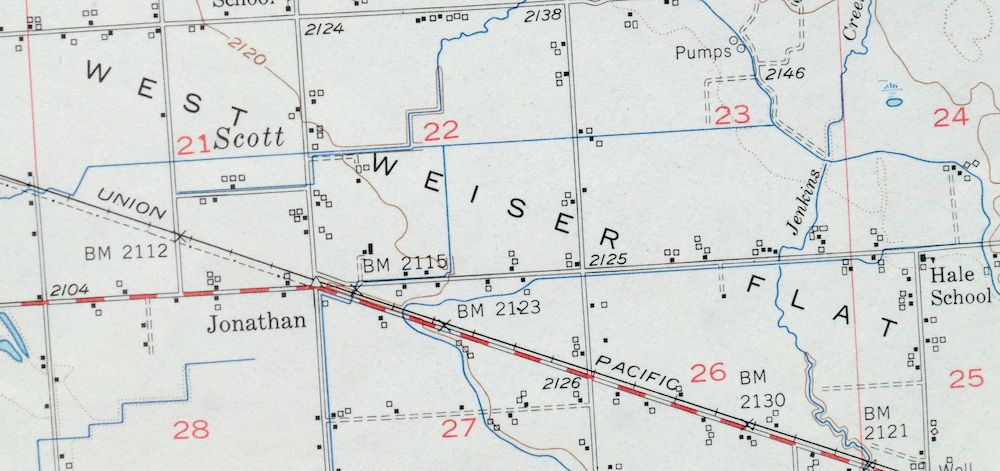
1965 USGS Topo Map: Olds Ferry, Eaton, Idaho/Oregon
$40
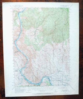
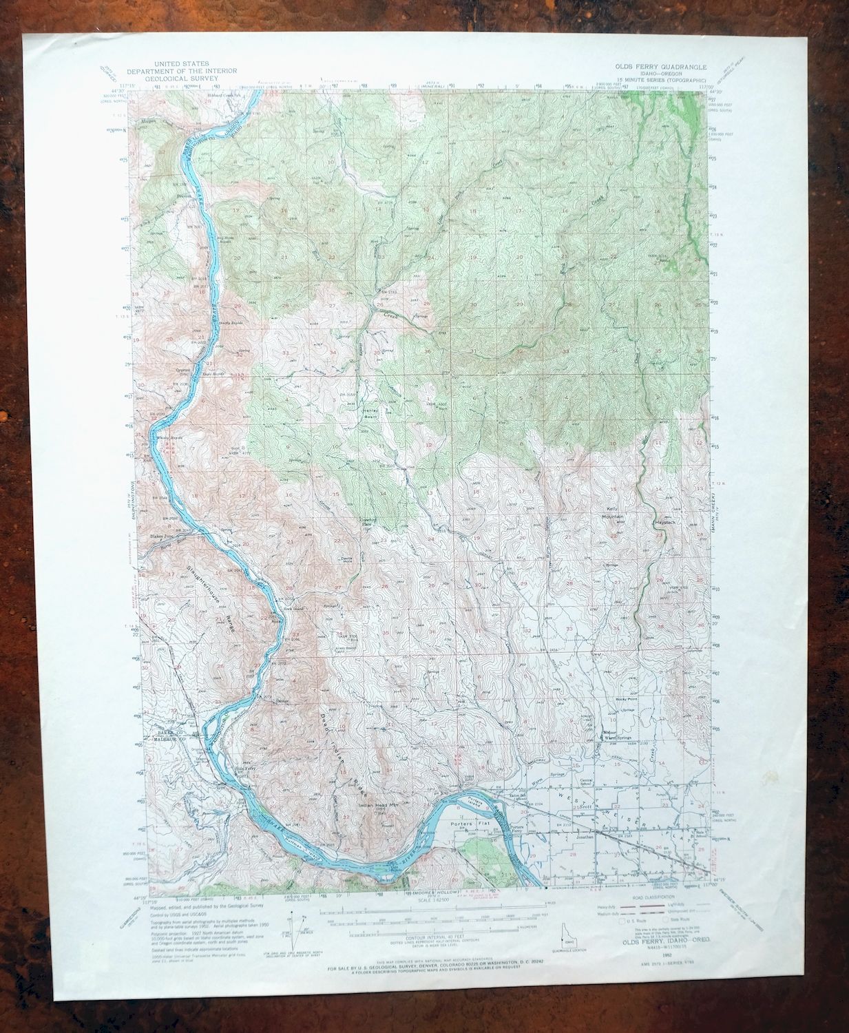
This 15-minute topographic map, printed in 1965 from a 1952 edition, covers the Olds Ferry quad along the Idaho-Oregon border about 70 miles northwest of Boise. The Snake River runs through the area, which spans parts of Washington County in Idaho and Baker and Malheur counties in Oregon, with Eaton among the places inside its bounds. The woodland tint marks vegetated ground against the river canyon country, and the never-folded sheet on thick stock has a flawless map area well suited to framing.
In stock
This vintage sheet is a 1952 edition of the Olds Ferry Idaho USGS topographic map. It is an original 61-year-old 1965 United States Geological Survey print in very good condition.
HOW THIS MAP CAN BE USED
In addition to making a fascinating conversation piece, this sheet would look great in a frame or on display, make a unique and prized gift for anyone interested in this area, be perfect as a reference for genealogy studies or general historical research, or fill that missing piece in your collection. Maps of this vintage are printed on durable stock and are well-suited for outdoor activities and recreation of all kinds, including hiking, backpacking, hunting, rafting and kayaking, backcountry skiing, geocaching, general exploration, treasure hunting, etc.
FEATURES SHOWN ON THE MAP
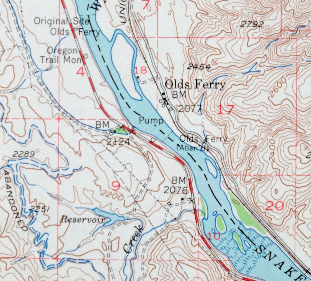
The Olds Ferry 15-minute map shows cities and towns, roads, railroads, utilities and energy infrastructure, rivers, creeks, elevation contour lines, public land survey lines, county, state, and other administrative boundaries as they existed at the time of the survey in 1950 and 1952. All known structures (houses, businesses, churches, schools, barns, cabins, etc) are also shown.
A VALUABLE HISTORICAL RECORD
Maps from the 15-minute series for the continental United States are no longer produced or printed by the USGS and original prints are becoming increasingly difficult to find. They are a valuable historical record for an area, as they contain many placenames and features that have been dropped from more recent maps.
Nearby maps
-
Cuprum Idaho USGS 15-Min Topographic Map 1958 Vintage
$28 Add to cart -
Squaw Creek Idaho Alpha Cascade USGS Topo Map 1948 Vintage
$38 Add to cart -

Nampa Idaho Caldwell Emmett USGS 30-Min Topographic Map 1948
$37 Add to cart -

Mountain Home Idaho Cleft Mayfield USGS 30-Min Topo Map 1916
$49 Add to cart -
Lawen Oregon Malheur Lake USGS Topographic Map 1961 Vintage
$30 Add to cart -
Limekiln Rapids Idaho USGS 15-Min Topo Map 1946 Vintage
$32 Add to cart -

Walla Walla Washington Langdon Mill Creek USGS Topo Map 1978
$35 Add to cart -
Wallula Washington Finley Burbank USGS Topo Map 1918 Antique
$34 Add to cart -

Badger Mountain Washington South Richland USGS Topo Map 1978
$34 Add to cart -
Eagle Rock Oregon Ochoco NF USGS Topo Map 1973 Vintage
$34 Add to cart -

La Crosse Washington Winona Palouse River USGS Topo Map 1952
$34 Add to cart -

Benge Washington Hooper Palouse River USGS Topo Map 1952
$35 Add to cart -

Goldstone Mountain Idaho Baker USGS Topo Map 1969 Vintage
$22 Add to cart -
Owyhee Nevada Duck Valley USGS 15-Min Topo Map 1965 Vintage
$40 Add to cart -

Connell Washington Lind Mesa USGS Topo Map 1918 Antique
$34 Add to cart -

Mountain City Nevada Owyhee River Owyhee USGS Topo Map 1956
$41 Add to cart -
Grandview Washington Sunnyside USGS Topo Map 1951 Vintage
$30 Add to cart -
Coyote Rapids Washington USGS 15-Min Topo Map 1916 Antique
$48 Add to cart -

Oakesdale Washington Saint Joe NF Tekoa USGS Topo Map 1938
$29 Add to cart -
Disaster Nevada Adler Creek WSA Denio USGS Topo Map 1909
$65 Add to cart -
Red Rock Washington Royal City Smyrna USGS Topo Map 1911
$20 Add to cart -
1966 USGS Topo Map: Smyrna, Royal City, Washington
$40 Add to cart -
Black Rock Spring Washington Yakima Ridge USGS Topo Map 1941
$32 Add to cart -

Missoula Montana Stevensville Lolo USGS Topographic Map 1925
$57 Add to cart