MAP DETAILS | |
|---|---|
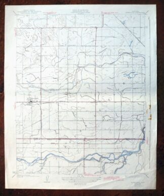
| TITLE | Riverdale |
| STATE | California |
| SURVEYED | 1924 Field Survey |
| GEOGRAPHER | L.O.Newsome |
| PRINT NOTES | Thick paper stock |
| SCALE | 1:31680 |
| CONTOUR INTERVAL | 5 feet |
| SHEET DIMENSIONS | 16 1/2 x 20 inches |
| MAP DIMENSIONS | 13 7/8 x 17 1/4 inches |
| COVERAGE AREA | 7 x 9 miles |
| SHEET CONDITION For maps of this vintage, effort is made to note all visible flaws, no matter how minor. | |
| SHEET NOTES | moderately handled, never folded |
| MAP AREA | no wear, no markings, no blemishes |
| COLLARS | minor wear or tears, no markings, notable blemish in center of right collar |
| MAP COVERAGE Quadrangle extent overlaid on current basemap. | |
| BACKSIDE LEGEND | |
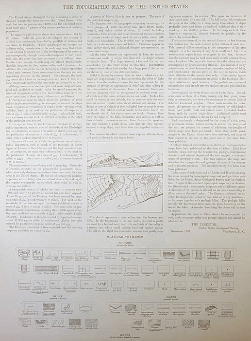 A map summary is printed on the back side of the Riverdale sheet similar to the one shown in the picture. It outlines the history, purpose, and status of the USGS mapping program at the time of the printing in 1942. It also provides instructions on how to read contour lines and a description of how they are used to depict the terrain. At the bottom of the page is a legend showing all of the symbols used to represent the cultural, relief, and water features found on the map. | |
| PLACENAMES Depending on map series and survey date, all of the features listed below may not be shown on this map. This list contains features that currently exist or historically existed within the area covered by the map. The list can be used as a reference to determine if this map covers your area of interest. Placenames are listed alphabetically next to each feature type. | |
| NOTABLE PLACES | Clint, Gepford, Kings River, and San Joaquin Valley |
| CITIES AND TOWNS (CURRENT) | Camden and Riverdale |
| COUNTIES COVERED | Fresno and Kings |
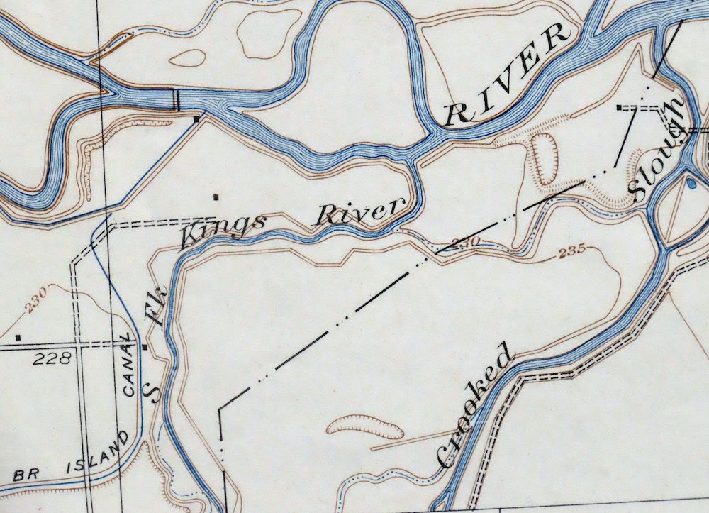
| RIVERS AND STREAMS | Faull Slough and North Fork Kings River |
| Locations: North Fork School. Administrative Boundaries: Laguna de Tache. Buildings: Veterans Memorial Auditorium. Dams: Island Weir and New Island Weir. Canals: E Canal, G Canal, Grant Canal, Liberty Ditch, Little Millrace, Riverdale Ditch, and Settlers Ditch. Bayous and Sloughs: Sand Slough. Schools: Assembly of God School, Laguna School, Riverdale Elementary School, Riverdale High School, and Riverdale Joint Union High Alternative Education School. Oilfields: Camden Oil Field. | |
| SHIPPING AND RETURNS | |
 Ships carefully rolled in a sturdy 2" x 18" mailing tube. Shipping and return details are in our terms. | |


Riverdale, Clint, California 1927 USGS Topo Map
$19
A fascinating historical snapshot of the Riverdale area of the San Joaquin Valley, surveyed before the modern road system, showing early lateral, ditch, and slough alignments, rail lines, placenames, and all known structures.
- 21 miles south of Fresno.
- 7.5-minute series, 1927 edition, printed in 1942.
- Fair condition, never folded.
In stock
This antique sheet is a 1927 edition of the Riverdale California USGS topographic map. It is an authentic 84-year-old 1942 United States Geological Survey print in fair condition.
HOW THIS MAP CAN BE USED
In addition to making a fascinating conversation piece, this sheet would make a unique and prized gift for anyone interested in this area, be perfect as a reference for genealogy studies or general historical research, or fill that missing piece in your collection.
FEATURES SHOWN ON THE MAP
The Riverdale 7.5-minute map shows cities and towns, roads, paths, railroads, rivers, creeks, elevation contour lines, public land survey lines, county, state, and other administrative boundaries as they existed at the time of the survey in 1924. All known structures (houses, businesses, churches, schools, barns, cabins, etc) are also shown, with exceptions in some urban areas, where only landmark buildings may be shown.
A VALUABLE HISTORICAL RECORD
This map is from the 7.5-minute series, the most detailed series that is widely available from the USGS. The 1927 Riverdale map is a valuable historical record for the area. It contains some placenames and features that have been dropped from more recent maps.
Nearby maps
-

Raisin, California 1947 USGS Topo Map: San Joaquin Valley
$37 Add to cart -

Raisin, California 1947 USGS Topo Map: San Joaquin Valley
$45 Add to cart -
Raisin, San Joaquin Valley, California 1925 USGS Topo Map
$21 Add to cart -
1947 USGS Topo Map: Helm, Fresno Slough, California
$20 Add to cart -
1925 USGS Topo Map: Helm, California (1944 Print)
$20 Add to cart -

Remnoy, Hamblin, California 1927 USGS Topo Map
$25 Add to cart -
Sanger, Del Ray, California 1923 USGS Topo Map
$25 Add to cart -
Kerman, California 1947 USGS Topo Map
$23 Add to cart -

1936 USGS Topo Map: El Rico Ranch, Helm Corner, California
$20 Add to cart -
1924 USGS Topo Map: Jamesan, Tranquility, California
$12 Add to cart -
Jamesan, California 1947 USGS Topo Map: Tranquility
$21 Add to cart -
1947 USGS Topo Map: Englebrecht Ranch, California
$15 Add to cart -
1923 USGS Topo Map: Englebrecht Ranch, California
$21 Add to cart -
1926 USGS Topo Map: Ivanhoe, California (1946 Print)
$29 Add to cart -
1946 USGS Topo Map: Selma, Fresno, California
$30 Add to cart -
Visalia, California 1949 USGS Topo Map: Goshen
$39 Add to cart -
1926 USGS Topo Map: Exeter, California (1944 Print)
$32 Add to cart -
1933 USGS Topo Map: Kettleman Plain, California
$16 Add to cart -
Reef Ridge, Avenal Canyon, California 1937 USGS Topo Map
$12 Add to cart -

1947 USGS Topo Map: Firebaugh, Mendota, California (Cromir)
$16 Add to cart -
Kentucky Well, California 1948 USGS Topo Map
$31 Add to cart -
Trimmer, California 1965 USGS Topo Map (1987 Print)
$17 Add to cart -
Kismet, California 1948 USGS Topo Map: Notarb
$31 Add to cart -
1914 USGS Topo Map: Lost Hills, Kern NWR, California
$38 Add to cart