MAP DETAILS | |
|---|---|
| TITLE | Sag Harbor |
| STATE | New York |
| LOCATION | Vicinity of Hampton Bays, 15 miles east of Riverhead |
| SERIES | 15-minute |
| SURVEYED | 1903 Field Survey |
| GEOGRAPHER | H.M. Wilson |
| ENGRAVED | 1904 |
| EDITION | 1904 |
| PRINTED | 1913 |
| PRINT NOTES | Thick paper stock |
| SCALE | 1:62500 |
| CONTOUR INTERVAL | 20 feet |
| SHEET DIMENSIONS | 16 1/2 x 20 inches |
| MAP DIMENSIONS | 13 1/4 x 17 1/2 inches |
| COVERAGE AREA | 13 x 17 miles |
| SOURCE | From an uncommonly well-preserved collection |
| MAP NOTES | A fascinating historical snapshot surveyed before the modern highway system, showing historic travel routes, rail lines, placenames, and all structures known at the time. |
| SHEET CONDITION For maps of this vintage, effort is made to note all visible flaws, no matter how minor. | |
| OVERALL CONDITION | Excellent |
| SHEET NOTES | very lightly handled, never folded, smooth and flat |
| MAP AREA | flawless map area |
| COLLARS | no wear or tears, no markings, no blemishes, hole punches along left collar |
| MAP COVERAGE Quadrangle extent overlaid on current basemap. | |
| BACKSIDE LEGEND | |
 A map summary is printed on the back side of the Sag Harbor sheet similar to the one shown in the picture. It outlines the history, purpose, and status of the USGS mapping program at the time of the printing in 1913. It also provides instructions on how to read contour lines and a description of how they are used to depict the terrain. At the bottom of the page is a legend showing all of the symbols used to represent the cultural, relief, and water features found on the map. | |
| PLACENAMES Depending on map series and survey date, all of the features listed below may not be shown on this map. This list contains features that currently exist or historically existed within the area covered by the map. The list can be used as a reference to determine if this map covers your area of interest. Placenames are listed alphabetically next to each feature type. | |
| CITIES AND TOWNS (CURRENT) | Bridgehampton, Cutchogue, Hampton Bays, Mattituck, New Suffolk, North Sea, Northwest Harbor, Noyack, Sag Harbor, Sagaponack, Shinnecock Hills, Southampton, Tuckahoe, Wainscott, and Watermill |
| COUNTIES COVERED | Suffolk |
| RIVERS AND STREAMS | Calf Creek, Ligonee Brook, Rattlesnake Creek, Sebonac Creek, and Swan Creek |
| WATER BODIES | Agawan Lake, Big Fresh Pond, Black Pond, Channel Pond, Cold Spring Pond, Coopers Neck Pond, Crooked Pond, Fairfield Pond, Goldfish Pond, Haines Pond, Halsey Neck Pond, Jule Pond, Kellis Pond, Lily Pond, Little Fresh Pond, Little Long Pond, Little Poxabogue Pond, Little Round Pond, Long Pond, Middle Pond, Mill Pond, Old Fort Pond, Old Town Pond, Otter Pond, Phillips Pond, Poxabogue Pond, Round Pond, Sagaponack Pond, Sayre Pond, Scallop Pond, Seven Ponds, Shorts Pond, Slate Pond, Trout Pond, Wickapogue Pond, and Wooley Pond |
| Locations: National Golf Links of America, Old Cove Yacht Club, Sag Harbor Golf Course, Shinnecock Hills Golf Course, Southampton Golf Course, Wainscott Station, and Watermill Beach Club. Administrative Boundaries: Shinnecock Reservation and Town of Southampton. Reserves: Shinnecock Indian Reservation. Mountains, Peaks, and Summits: Shinnecock Hills. Parks: Agawam Park and Mashashimuet Park. Drainages: Calf Creek, Davis Creek, Downs Creek, Heady Creek, Island Creek, Ligonee Brook, Little Sebonac Creek, Rattlesnake Creek, Sams Creek, Sebonac Creek, Swan Creek, Taylor Creek, West Creek, and West Neck Creek. Islands: Clam Island, Ram Island, Robins Island, and Warner Islands. Capes: Bluff Point, Brush Neck, Conscience Point, Cormorant Point, Cow Neck, Cow Neck Point, Flying Point, Kimogene Point, Long Point, Nassau Point, Sebonac Neck, Towd Point, and West Neck. Churches: Padgett Temple, Saint Andrews Church, Saint Johns Church, and Union Chapel. Lakes and Ponds: Agawan Lake, Big Fresh Pond, Black Pond, Camps Pond, Channel Pond, Cold Spring Pond, Coopers Neck Pond, Crooked Pond, Fairfield Pond, Far Pond, Fresh Pond, Goldfish Pond, Haines Pond, Halsey Neck Pond, Jule Pond, Kellis Pond, Lily Pond, Little Fresh Pond, Little Long Pond, Little Poxabogue Pond, Little Round Pond, Long Pond, Middle Pond, Mill Pond, Old Fort Pond, Old Town Pond, Otter Pond, Phillips Pond, Poxabogue Pond, Round Pond, Sagaponack Pond, Sayre Pond, Scallop Pond, Seven Ponds, Shorts Pond, Slate Pond, Wickapogue Pond, and Wooley Pond. Channels: The Big Narrows, The Little Narrows, North Race, Shinnecock Inlet, and South Race. Bayous and Sloughs: Mud Creek. Bridges: Bridgehampton Golf Club. Beaches: Long Beach, Southampton Beach, and Watermill Beach. Bays: Bullhead Bay, Burnett Creek, Bennett Cove, Cutchogue Harbor, Fish Cove, Hayground Cove, Little Peconic Bay, Mecox Bay, Mill Creek, Morris Cove, North Sea Harbor, Noyack Creek, Paynes Creek, Shinnecock Bay, Turtle Cove, and Upper Sag Harbor Cove. Bars: Robbins Island Rock and Rodger Rock. Airports: East Hampton Airport, Southampton Heliport, and Southampton Village Heliport. Swamps: Peters Pond. Schools: Sacred Hearts School, Shinnecock School, and Tuckahoe School. Reservoirs and Tanks: Trout Pond. Towers: Noyack Radio Tower, WBAZ-FM (Southold), WHFM-FM (Southampton), WLNG-AM (Sag Harbor), WLNG-FM (Sag Harbor), and WPBX-FM (Southampton). | |
| SHIPPING AND RETURNS | |
 This map sheet will be carefully rolled in a sturdy tube and shipped via the US Postal Service. If you find that the sheet you receive is not as described in the listing, you may ship it back to us for a refund of the purchase price. | |
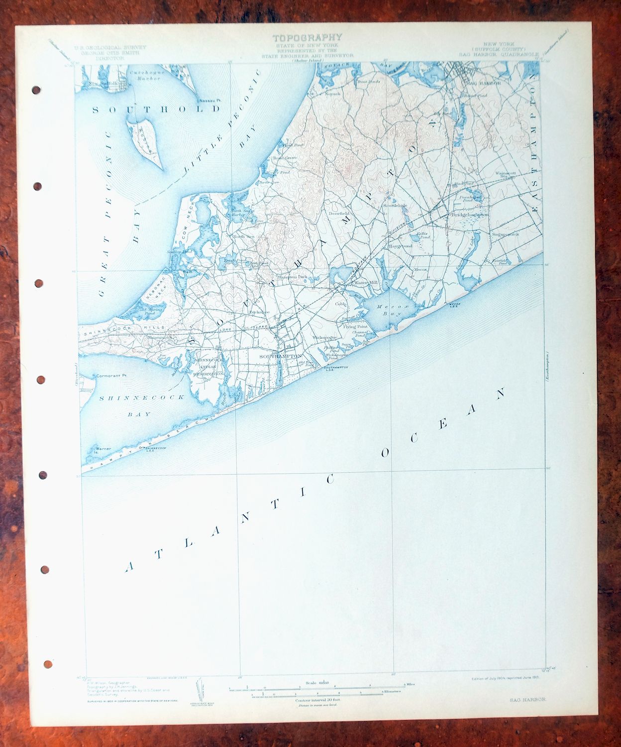
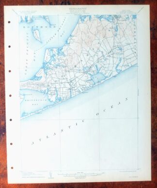
Sag Harbor New York Hampton Bays USGS Topo Map 1913 Antique
$145
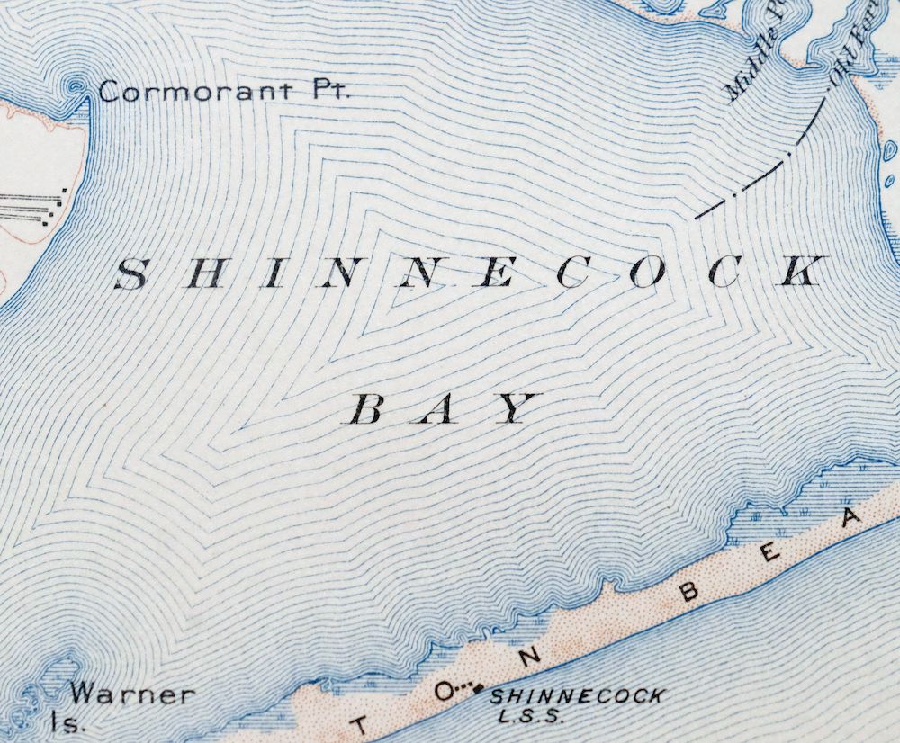
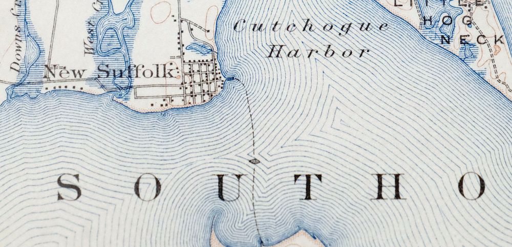
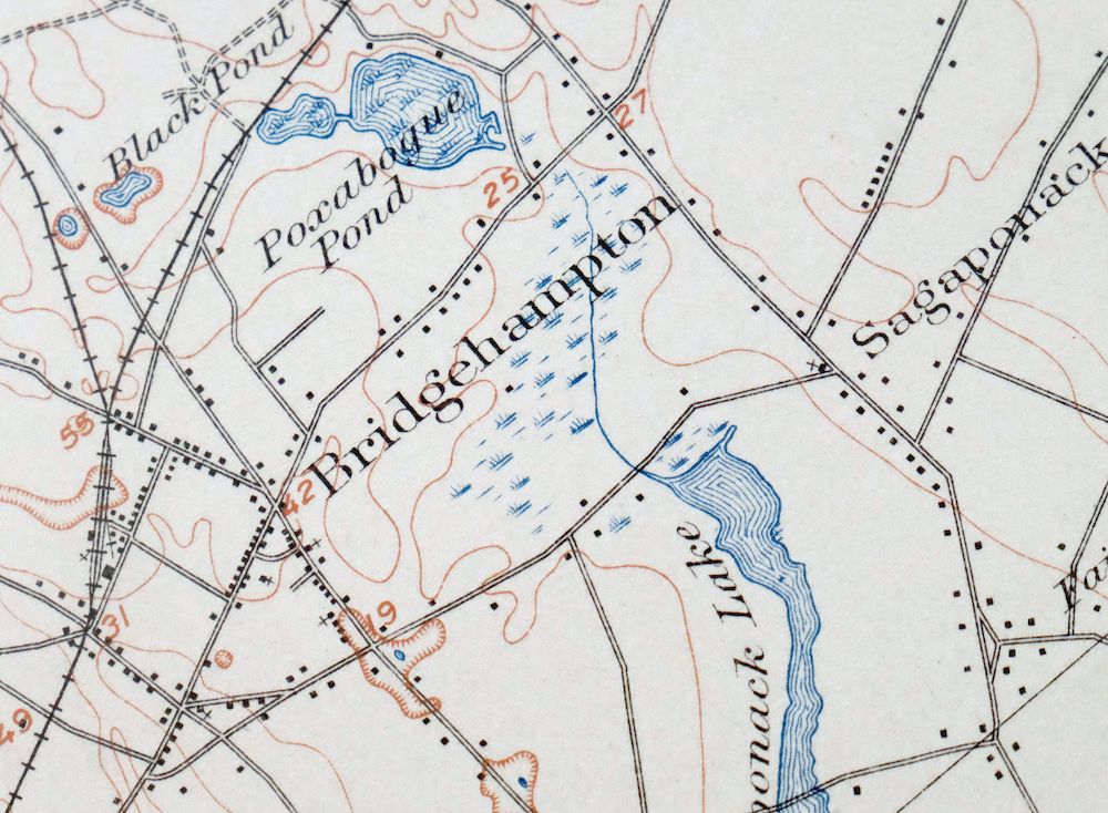
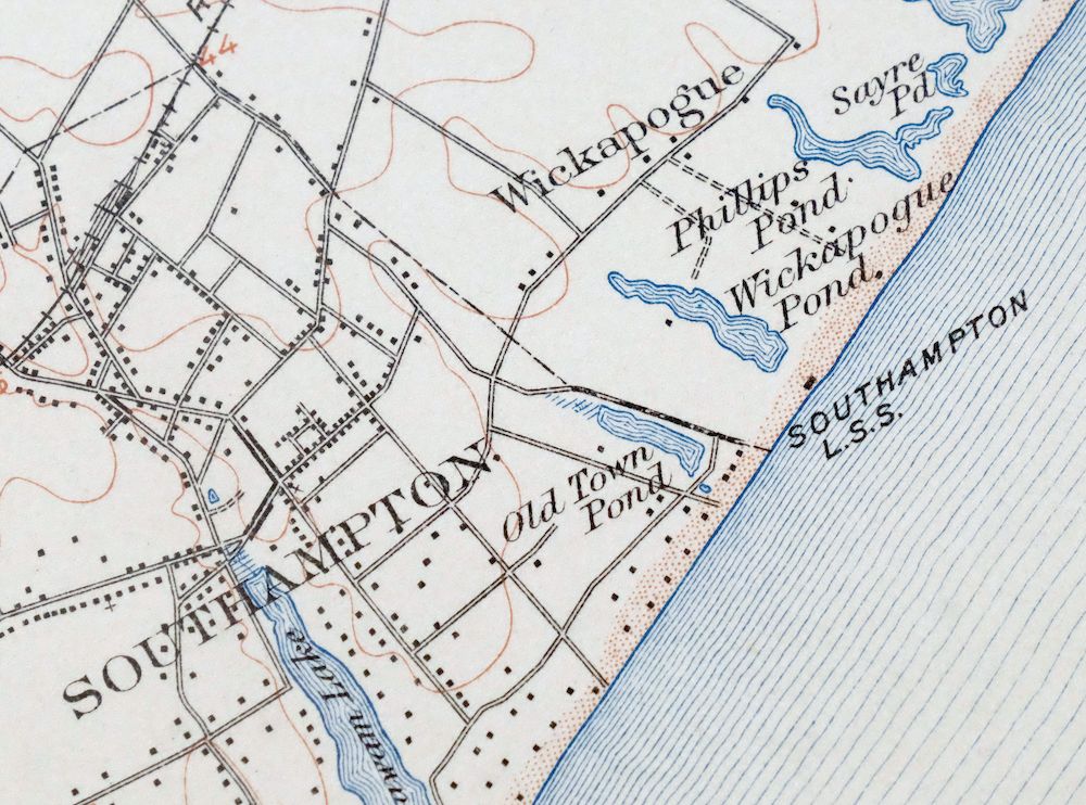
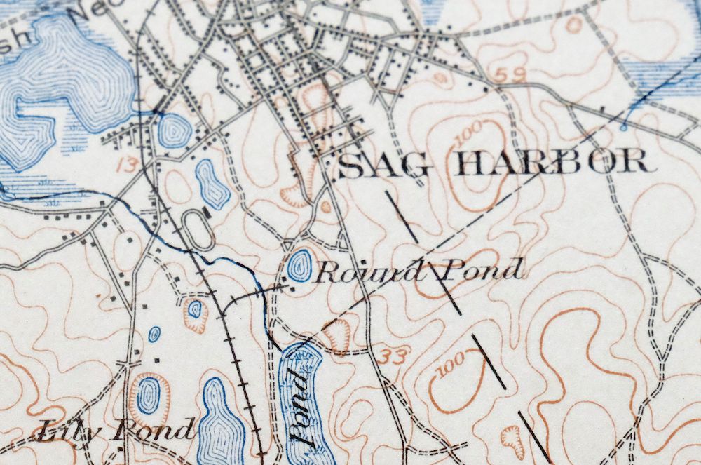
First published in 1904, this USGS 15-minute topographic sheet was printed in 1913 and survives in excellent condition – very lightly handled, never folded, and still smooth and flat, with hole punches along the left collar and a flawless map area. Printed on thick stock from an uncommonly well-preserved collection, it takes in the eastern end of Long Island around Sag Harbor and Southampton, with the quad boundaries also including Hampton Bays, North Sea, Northwest Harbor, and communities across the North and South Forks in Suffolk County. Drawn from a 1903 field survey under geographer H.M. Wilson and engraved in 1904, it records the area before the modern highway system, showing the travel routes, rail lines, placenames, and structures known at the time; the reverse carries printed reference material on reading the map.
In stock
This antique sheet is a 1904 edition of the Sag Harbor New York USGS topographic map. It is an authentic 113-year-old 1913 United States Geological Survey print in excellent condition.
HOW THIS MAP CAN BE USED
In addition to making a fascinating conversation piece, this sheet would look great in a frame or on display, make a unique and prized gift for anyone interested in this area, be perfect as a reference for genealogy studies or general historical research, or fill that missing piece in your collection.
FEATURES SHOWN ON THE MAP
The Sag Harbor 15-minute map shows cities and towns, roads, railroads, rivers, creeks, elevation contour lines, public land survey lines, county, state, and other administrative boundaries as they existed at the time of the survey in 1903. All known structures (houses, businesses, churches, schools, barns, cabins, etc) are also shown, with exceptions in some urban areas, where only landmark buildings may be shown.
A VALUABLE HISTORICAL RECORD
Maps from the 15-minute series for the continental United States are no longer produced or printed by the USGS and original prints are becoming increasingly difficult to find. They are a valuable historical record for an area, as they contain many placenames and features that have been dropped from more recent maps.
Nearby maps
-

Riverhead New York Manorville Calverton USGS Topo Map 1915
$175 Add to cart -

Danbury Connecticut Trumbull Bethel USGS Topo Map 1899
$70 Add to cart -
Uncasville Connecticut Ledyard Norwich USGS Topo Map 1984
$34 Add to cart -

Moodus Connecticut Lake Pocotopaug USGS Topographic Map 1946
$32 Add to cart -
Westport Connecticut Fairfield USGS Topographic Map 1973
$42 Add to cart -
Norwalk South Connecticut Stamford Darien USGS Topo Map 1963
$40 Add to cart -
Litchfield Connecticut Waterbury Oakville USGS Topo Map 1910
$100 Add to cart -

Harlem New York New York Yonkers USGS Topo Map 1913 Antique
$250 Add to cart -

West Point New York Newburgh Peekskill USGS Topo Map 1912
$75 Add to cart -

Park Ridge New Jersey New City Ridgewood USGS Topo Map 1963
$45 Add to cart -

Blackstone Massachusetts Milford Hopedale USGS Topo Map 1944
$22 Add to cart -

Holyoke Massachusetts Springfield USGS Topo Map 1897 Antique
$85 Add to cart -

Schunemunk New York Newburgh Kiryas Joel USGS Topo Map 1915
$65 Add to cart -

Quinsigamond Massachusetts Milford USGS Topographic Map 1910
$90 Add to cart -
Mansfield Massachusetts Sharon Walpole USGS Topo Map 1961
$18 Add to cart -

Goshen New York Middletown Warwick USGS Topographic Map 1913
$55 Add to cart -

Plainfield New Jersey Edison Somerset USGS Topo Map 1965
$42 Add to cart -
Norwood Massachusetts Boston Dover USGS Topographic Map 1960
$18 Add to cart -

New Brunswick New Jersey Spotswood Edison USGS Topo Map 1965
$32 Add to cart -
Whiting New Jersey Barnegat Toms River USGS Topo Map 1907
$85 Add to cart -
Wallpack New Jersey Newton Crandon Lakes USGS Topo Map 1916
$95 Add to cart -

Trenton New Jersey Philadelphia Levittown USGS Topo Map 1907
$150 Add to cart -

Milford Pennsylvania Lackawaxen Pond Eddy USGS Topo Map 1915
$58 Add to cart -

Troy New York Albany Watervliet USGS Topo Map 1907 Antique
$95 Add to cart