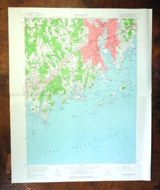
MAP DETAILS | |
|---|---|
| TITLE | Norwalk South |
| STATE | Connecticut |
| LOCATION | 38 miles northeast of New York |
| SERIES | 7.5-minute |
| SURVEYED | 1949 and 1951 Aerial and Field Survey |
| EDITION | 1960 |
| REVISIONS | 1960 |
| PRINTED | 1963 |
| PRINT NOTES | Thick paper stock, includes woodland tint (green to indicate vegetated areas). A reddish tint is used to indicate urban areas where only landmark buildings are shown. |
| SCALE | 1:24000 |
| CONTOUR INTERVAL | 10 feet |
| SHEET DIMENSIONS | 22 x 27 inches |
| MAP DIMENSIONS | 17 1/8 x 22 3/4 inches |
| COVERAGE AREA | 7 x 9 miles |
| SHEET CONDITION For maps of this vintage, effort is made to note all visible flaws, no matter how minor. | |
| OVERALL CONDITION | Very Good |
| SHEET NOTES | lightly handled, midsheet horizontal foldline (in half), title notation pencilled on backside of sheet |
| MAP AREA | no markings, no blemishes |
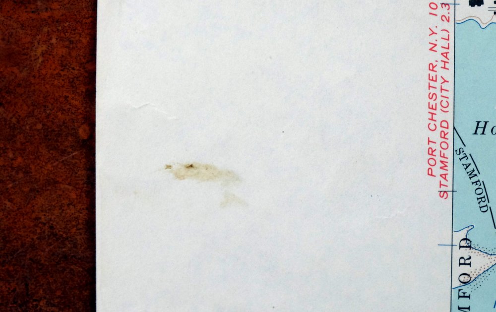
| COLLARS | no wear or tears, no markings, small blemish in center left collar |
 | |
| MAP COVERAGE Quadrangle extent overlaid on current basemap. | |
| PLACENAMES Depending on map series and survey date, all of the features listed below may not be shown on this map. This list contains features that currently exist or historically existed within the area covered by the map. The list can be used as a reference to determine if this map covers your area of interest. Placenames are listed alphabetically next to each feature type. | |
| CITIES AND TOWNS (CURRENT) | Darien, Norwalk, Stamford, and Westport |
| COUNTIES COVERED | Fairfield |
| RIVERS AND STREAMS | Betts Pond Brook, Fivemile River, Goodwives River, Holy Ghost Fathers Brook, Keelers Brook, Norwalk River, and Stony Brook |
| WATER BODIES | Holy Ghost Fathers Pond and Millard Pond |
| Populated Place: Darien, East Norwalk, Harborview, Noroton, Noroton Heights, Norwalk, Round Beach, Rowayton, Shorehaven, South Norwalk, Talmadge Hill, Tokeneke, and West Norwalk. Locations: Greens Ledge Lighthouse, Ox Ridge Hunt Club, Rowayton Station, Shovehaven Golf Course, Wee Burn Country Club, Bradlees Shopping Center, Country Club of Darien, Darien Shopping Center, Darien Station, Darinor Shopping Plaza Shopping Center, East Norwalk Station, Goodwives Shopping Plaza Shopping Center, Isaac Street Plaza Shopping Center, Ischoda Yacht Club, Landmark Square Shopping Center, Noroton Heights Shopping Center, Noroton Yacht Club, Norwalk Country Club, Norwalk Cove Marina, Norwalk Factory Outlet Center Shopping Center, Norwalk Mall Shopping Center, Norwalk Yacht Club, Oak HIlls Park Golf Course, Saugatuck Harbor Yacht Club, Shore and Country Club, South Norwalk Boat Club, Sprite Island Yacht Club, Taylor Farm, and The Ballast. Administrative Boundaries: Town of Darien, Town of Norwalk, and City of Norwalk. Mountains, Peaks, and Summits: Golden Hill, Sasqua Hill, Spring Hill, and Talmadge Hill. Woods: Selleck Woods. Parks: Calf Pasture Park, McGuane Field, Seaview Park, Baker Park, Bayley Beach Park, Boston Post Road Historic District, Calf Pasture Beach City Park, Cherry Lawn Park, Flax Hill Park, Jennie Jenks Park, Mather Fields, Mathews Park, Norwalk Green, South Main and Washington Street Historic District, Springwood Park, Stony Brook Park, Tilley Pond Park, Tokeneke Park, Waveny Park, and Weed Beach Park. Drainages: Betts Pond Brook, Fivemile River, Goodwives River, Holy Ghost Fathers Brook, Keelers Brook, Norwalk River, and Stony Brook. Islands: Beers Rocks, Bell Island, Betts Island, Bold Rock, Brush Island, Butlers Island, Calf Pasture Island, Canfield Island, Cedar Hammock, Chimon Island, Chimon Rock, Contentment Island, Copps Island, Copps Rocks, Cove Rocks, Crow Island, Dog Island, East White Rock, Fish Islands, Grassy Hammock Rocks, Grassy Island, Great Island, Hay Island, Hiding Rocks, Hoyt Island, L'Hammock Island, Little Tavern Island, Manresa Island, Nash Island, Norwalk Islands, Old Baldy, Peach Island, Pratt Island One, Pratt Island Two, Raymond Rocks, Sandy Hammock, Shea Island, Sheep Rocks, Sprite Island, Tavern Island, The Plans, Tree Hammock, White Rock, Wood Island, Yellow Rock, Yellow Rocks, Crab Island, Little Hammock Island, Little Ram, Ned Island, and Sheffield Island. Capes: Calf Pasture Point, Ferry Point, Fitch Point, Gregory Point, Jennings Point, Judy Point, Keyser Point, Long Neck, Long Neck Point, Noroton Neck, Noroton Point, Oyster Shell Point, Pear Tree Point, Roton Point, Wilson Point, Bluff Point, Colyer Point, Liberty Point, Sound View Point, and Southwest Point. Churches: Saint Matthews Church, Talmadge Hill Chapel, Antioch Temple, Beth Israel Synagogue, Bethel African Methodist Episcopal Church, Bible Way Temple, Calvary Baptist Church, Canaan Institution Baptist Church, Christ Episcopal Church, Christ Temple House of Prayer, Christ Temple Pentecostal Church, Church of God, Community Advent Christian Church, Community Baptist Church, Congregation Beth El Church, East Avenue United Methodist Church, First Apostolic Church of Norwalk, First Church of Christ Scientist, First Congregational Church, First United Methodist Church, Grace Baptist Church, Grace Episcopal Church, Holy Temple Church of God, Hungarian Reformed Church, Iglesia Betania Church, Living Bread of LIfe Evangelistic Church, Macedonia Church, Miracle Temple Church of God, Mount Zion Baptist Church, New Life Christian Fellowship, Noroton Presbyterian Church, Norwalk United Methodist Church, Rowayton United Methodist Church, Saint James Baptist Church, Saint Jeromes Church, Saint Johns Church of Darien, Saint Josephs Church, Saint Ladislaus Church, Saint Lukes Episcopal Church, Saint Marys Church, Saint Pauls Episcopal Church, Saint Pauls on the Green Church, Saint Philip Church, Saint Thomas More Church, Saint Thomas the Apostle Church, Salvation Army, Shiloh Baptist Church, Temple Shalom, United Church of Rowayton, United Congregational Church, West Norwalk Church, and World Unity Church. Post Office: Darien Post Office and Noroton Heights Post Office. Hospitals: Norwalk Hospital. Lakes and Ponds: Bermuda Lagoon, Florshiem Pond, Gorhams Pond, Holly Pond, Holy Ghost Fathers Pond, Mill Pond, Millard Pond, and Streets Pond. Buildings: Bates Scofield House, Connecticut Graphis Arts Center and Museum, Darien Library, East Norwalk Library, Lockwood-Mathews Mansion Museum, Maritime Aquarium, Noroton Presbyterian Church Library, Noroton Town Hall, Norwalk Museum, Norwalk Museum Historical Refernce Library, Norwalk Public Library, Norwalk Technical Community College Learning Resources Center, Rowayton Arts Center, Rowayton Free Public Library, Waveny House, Wiggans Health Sciences Library, Darien Emergency Medical Services Post 53, Darien Fire Marshal's Office, Darien Police Department, Darien Volunteer Fire Department, Noroton Fire Department, Noroton Heights Fire Department, Norwalk Fire Department Station 2 - Headquarters, Norwalk Fire Department Station 3, Norwalk Fire Department Station 4, Norwalk Fire Department Station 5, Norwalk Marine Fire Rescue, Norwalk Police Department, and Rowayton Fire Department. Dams: Chasmars Pond Dam, Mathers Pond Dam, and Millard Pond Dam. Channels: Ferry Point Reach, Norfolk River Reach, Oyster Shell Reach, and Seaview Park Reach. Bayous and Sloughs: Farm Creek, Village Creek, and The Gut. Bridges: Rings End Bridge. Beaches: Calf Pasture Beach, Long Beach, Harbor View Beach, Marvin Beach, Pear Tree Point Beach, Rowayton Community Beach, Saint John Beach, and Weed Beach. Bays: Charles Creek, Cove Harbor, Norwalk Harbor, Ram Bay, Scott Cove, Sheffield Island Harbor, Wilson Cove, Zieglers Cove, East Norwalk Harbor, Goeller Cove, Pear Tree Point Cove, and Smith Beach Harbor. Bars: Ballast Reef, Budd Reef, Great Reef, Greens Ledge, Harbor Ledge, Pine Point, Rogers Reef, and Smith Reef. Airports: 50 Washington Street Heliport and Norden Systems Heliport. Census: Darien Downtown Census Designated Place, Noroton Census Designated Place, Noroton Heights Census Designated Place, and Tokeneke Census Designated Place. Schools: Baker School, Benjamin Franklin Middle School, Brien McMahon High School, Brookside Elementary School, Center School, Cherry Lawn School, Columbus Elementary School, Darien High School, Ferndale Seminary, Fitch School, Fox Run Elementary School, Hindley Elementary School, Hollow Tree School, Jefferson Elementary School, Kendall Elementary School, Magrath Elementary School, Marvin School, Mather Junior High School, Middlesex Junior High School, Nathan Hale Middle School, Nathaniel Ely Elementary School, Norwalk High School, Plum Field School, Ponus Ridge Middle School, Royle Elementary School, Sacred Heart Academy, Tokeneke Elementary School, Tracy School, Washington Elementary School, Manrissa Institute, Marvin Elementary School, Naramake Elementary School, Norwalk Technical Community College, Ox Ridge Elementary School, Rowayton Elementary School, Rowayton Middle School, and Rowayton School. Reservoirs and Tanks: Mathers Pond, Chasmars Pond, Chalmers Pond, and Spruce Swamp Pond. Towers: WEFX-FM (Norwalk), WNLK, and WNLK-AM (Norwalk). Pillars: Nat Clocks Rock and Old Pelt. Cemetery: Bell Cemetery, Hebrew Cemetery, Hoyt Cemetery, Raymond Cemetery, Riverside Cemetery, Rowayton Union Cemetery, Saint Johns Cemetery, Slasson Cemetery, Spring Grove Cemetery, Waterbury Cemetery, Weed Cemetery, East Norwalk Cemetery, Rowayton Cemetery, Saint Pauls Cemetery, Pine Island Cemetery, and Spring Grove Veterans Cemetery. | |
| SHIPPING AND RETURNS | |
 This map sheet will be carefully rolled in a sturdy tube and shipped via the US Postal Service. If you find that the sheet you receive is not as described in the listing, you may ship it back to us for a refund of the purchase price. | |

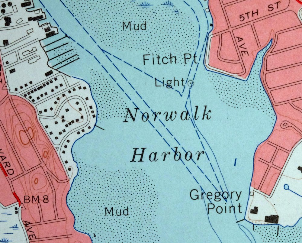


Norwalk South Connecticut Stamford Darien USGS Topo Map 1963
$40
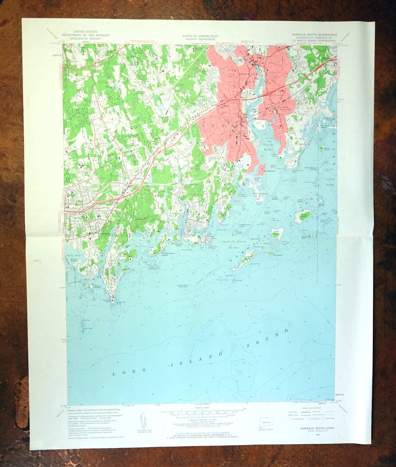
This USGS 7.5-minute topographic map is a 1960 edition printed in 1963, in very good condition on thick stock with a midsheet horizontal foldline and clean map area free of markings or blemishes. Covering roughly seven by nine miles of Connecticut’s Fairfield County coast, the quad area takes in Norwalk, Darien, and portions of Stamford and Westport along Long Island Sound. Drawn from 1949 and 1951 aerial and field surveys, it records this stretch of the Connecticut shoreline at the close of the 1950s, before decades of suburban growth reshaped the towns between Stamford and Westport.
In stock
This vintage sheet is a 1960 edition of the Norwalk South Connecticut USGS topographic map. It is an original 63-year-old 1963 United States Geological Survey print in very good condition.
HOW THIS MAP CAN BE USED
In addition to making a fascinating conversation piece, this sheet would look great in a frame or on display, make a unique and prized gift for anyone interested in this area, be perfect as a reference for genealogy studies or general historical research, or fill that missing piece in your collection. Maps of this vintage are printed on durable stock and are well-suited for outdoor activities and recreation of all kinds, including hiking, backpacking, hunting, rafting and kayaking, backcountry skiing, geocaching, general exploration, treasure hunting, etc.
FEATURES SHOWN ON THE MAP
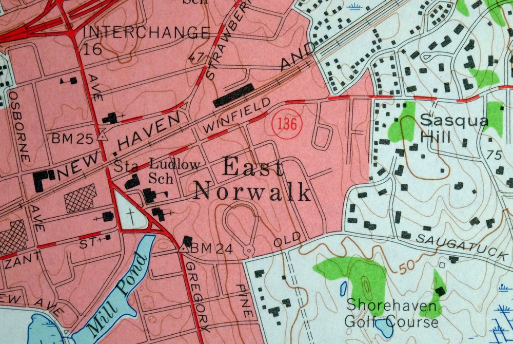
The Norwalk South 7.5-minute map shows cities and towns, roads, paths, railroads, utilities and energy infrastructure, rivers, creeks, elevation contour lines, public land survey lines, county, state, and other administrative boundaries as they existed at the time of the survey in 1949 and 1951. A reddish tint is used on this sheet to indicate urban areas where only landmark buildings are depicted. Outside of those areas, all known structures (houses, businesses, churches, schools, barns, cabins, etc) are shown.
A VALUABLE HISTORICAL RECORD
This map is from the 7.5-minute series, the most detailed series that is widely available from the USGS. The 1960 Norwalk South map is a valuable historical record for the area. It contains some placenames and features that have been dropped from more recent maps.
Nearby maps
-
Westport Connecticut Fairfield USGS Topographic Map 1973
$42 Add to cart -

Park Ridge New Jersey New City Ridgewood USGS Topo Map 1963
$45 Add to cart -

Danbury Connecticut Trumbull Bethel USGS Topo Map 1899
$70 Add to cart -

Harlem New York New York Yonkers USGS Topo Map 1913 Antique
$250 Add to cart -

West Point New York Newburgh Peekskill USGS Topo Map 1912
$105 Add to cart -

Schunemunk New York Newburgh Kiryas Joel USGS Topo Map 1915
$65 Add to cart -

Riverhead New York Manorville Calverton USGS Topo Map 1915
$175 Add to cart -
Litchfield Connecticut Waterbury Oakville USGS Topo Map 1910
$100 Add to cart -

Goshen New York Middletown Warwick USGS Topographic Map 1913
$55 Add to cart -
Sag Harbor New York Hampton Bays USGS Topo Map 1913 Antique
$145 Add to cart -

Moodus Connecticut Lake Pocotopaug USGS Topographic Map 1946
$32 Add to cart -

Plainfield New Jersey Edison Somerset USGS Topo Map 1965
$42 Add to cart -

New Brunswick New Jersey Spotswood Edison USGS Topo Map 1965
$32 Add to cart -
Uncasville Connecticut Ledyard Norwich USGS Topo Map 1984
$34 Add to cart -

Milford Pennsylvania Lackawaxen Pond Eddy USGS Topo Map 1915
$58 Add to cart -

Trenton New Jersey Philadelphia Levittown USGS Topo Map 1907
$150 Add to cart -

Holyoke Massachusetts Springfield USGS Topo Map 1897 Antique
$85 Add to cart -
Hawley Pennsylvania Tafton USGS 15-Min Topo Map 1964 Vintage
$44 Add to cart -

Damascus Pennsylvania Honesdale USGS Topo Map 1964 Vintage
$35 Add to cart -
Whiting New Jersey Barnegat Toms River USGS Topo Map 1907
$115 Add to cart -

Burlington Pennsylvania Trenton USGS Topographic Map 1958
$49 Add to cart -
Honesdale Pennsylvania Carbondale Waymart USGS Topo Map 1945
$49 Add to cart -

Troy New York Albany Watervliet USGS Topo Map 1907 Antique
$110 Add to cart -
Germantown Pennsylvania Horsham USGS Topographic Map 1912
$125 Add to cart