MAP DETAILS | |
|---|---|
| TITLE | Westport |
| STATE | Connecticut |
| LOCATION | 6 miles west of Bridgeport |
| SERIES | 7.5-minute |
| EDITION | 1960 |
| REVISIONS | Photo revision in 1971 is shown in purple. |
| PRINTED | 1973 |
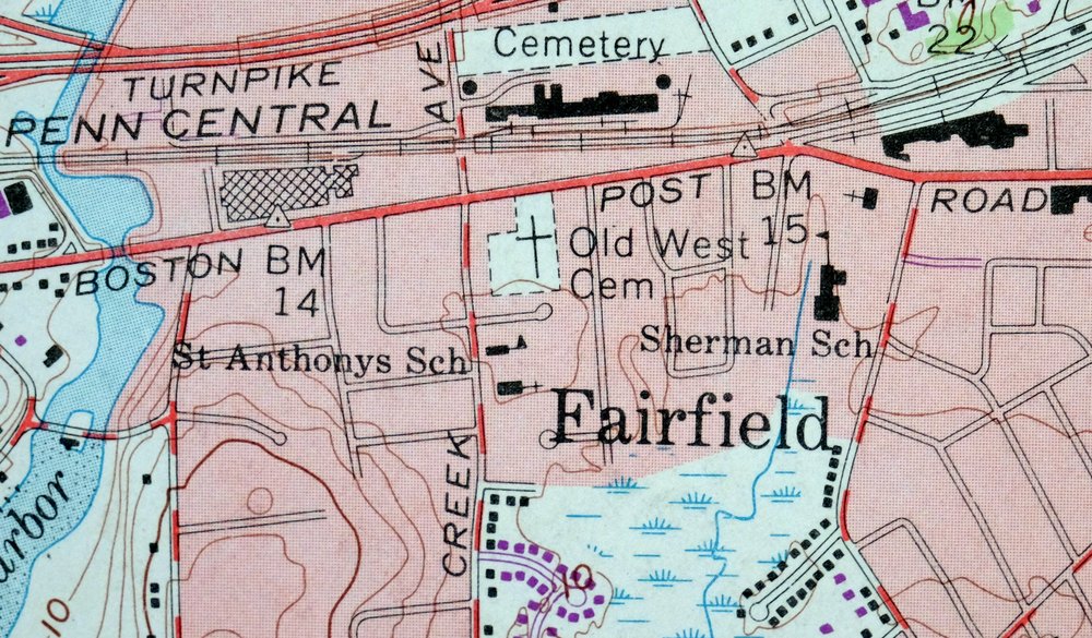
| PRINT NOTES | Thick paper stock, includes woodland tint (green to indicate vegetated areas). A reddish tint is used to indicate urban areas where only landmark buildings are shown. |
| SCALE | 1:24000 |
| SHEET DIMENSIONS | 22 x 27 inches |
| MAP DIMENSIONS | 17 1/8 x 22 3/4 inches |
| COVERAGE AREA | 6 x 9 miles |
| SHEET CONDITION For maps of this vintage, effort is made to note all visible flaws, no matter how minor. | |
| OVERALL CONDITION | Very Good |
| SHEET NOTES | lightly handled, midsheet horizontal foldline (in half), title notation pencilled on backside of sheet |
| MAP AREA | no markings, no blemishes |
| COLLARS | no wear or tears, no markings, no blemishes |
| MAP COVERAGE Quadrangle extent overlaid on current basemap. | |
| PLACENAMES Depending on map series and survey date, all of the features listed below may not be shown on this map. This list contains features that currently exist or historically existed within the area covered by the map. The list can be used as a reference to determine if this map covers your area of interest. Placenames are listed alphabetically next to each feature type. | |
| CITIES AND TOWNS (CURRENT) | Aspetuck, Fairfield, Greenfield Hill, Lyons Plain, Southport, and Westport |
| COUNTIES COVERED | Fairfield |
| RIVERS AND STREAMS | Aspetuck River, Beaver Brook, Browns Brook, Canoe Brook, Cricker Brook, Davidge Brook, Deadman Brook, East Branch Cricker Brook, Great Brook, Hawleys Brook, Jennings Brook, Kettle Creek, Mill River, Muddy Brook, Poplar Plains Brook, Sasco Brook, Saugatuck River, Stony Brook, and West Branch Saugatuck River |
| WATER BODIES | Easton Reservoir, Hemlock Reservoir, Laurel Lake, Pfeiffer Pond, Samp Mortar Reservoir, and Saugatuck Reservoir |
| Populated Place: Aspetuck, Fairfield, Greenfield Hill, Lyons Plain, Mill Plain, Murray, Plattsville, Southport, Westport, and Coley Town. Locations: Birchwood Country Club, Aspetuck Four Corners, Aspetuck Valley Country Club, Carriage Hill Shopping Center, Colonial Green Shopping Center, Compo Acres Shopping Center, Compo Shopping Center, Country Club of Fairfield, Dolan Campus, Dolans Corner Shopping Center, Fairfield Green Shopping Center, Fairfield Railroad Station, Fairfield Shopping Center, Fairfield Station, Greens Farms Plaza Shopping Center, H Smith-Richardson Golf Club, Jennings Plaza Shopping Center, Lake Hills Shopping Center, Penfield Shopping Center, Pequot Yacht Club, Playhouse Plaza Shopping Center, Playhouse Square Shopping Center, Scanlet Square Shopping Center, Southport Station, The Market Place Shopping Center, The Village, Thomas F Dolan Commons, Westport Plaza Shopping Center, and Westport Shopping Center. Administrative Boundaries: Fairfield County, Town of Fairfield, and Town of Weston. Mountains, Peaks, and Summits: Bald Mountain, Benjamin Hill, Camfield Hill, Catamount Hill, Charcoal Hill, Clapboard Hill, Davis Hill, Fanton Hill, Flat Rock Hill, Hoyden Hill, Merwins Hill, Mill Hill, Orchard Hill, Osborne Hill, Pavement Hill, Pop Mountain, Powells Hill, Prospect Hill, Round Hill, Sasco Hill, Sipperly Hill, Sport Hill, Turkey Hill, and Staples Hill. Woods: Fairfield Woods. Parks: Alumni Diamond, Alumni Field, Barlow Field, Brett Woods Park, Campion Field, Connecticut Audubon Society at Larsen Sanctuary, Devils Glen Park, Doubleday Field, Fairfield Village Green, Gault Park, Grace Salmon Memorial Park, Greenfield Hill Historic District, Greenfield Hill Village Green, Imperial Park, Jennings Garden, L A Sturges Park, Lake Mohegan Recreation Area, Ludlowe Recreation Center, Mill Hollow Park, Mill Plain Green, Southport Park, Town Hall Playground, University Field, Varsity Field, and Veterans Park. Drainages: Aspetuck River, Beaver Brook, Browns Brook, Canoe Brook, Cricker Brook, Davidge Brook, Deadman Brook, East Branch Cricker Brook, Great Brook, Hawleys Brook, Ivy Brook, Jennings Brook, Kettle Creek, Mill River, Morehouse Brook, Poplar Plains Brook, Silver Brook, Stony Brook, and West Branch Saugatuck River. Islands: Gorham Island and Wakeman Island. Churches: Saint Pius X Church, Assumption Church, Black Rock Congregational Church, Christ and Holy Trinity Church, Egag Chapel of Saint Ignatius Loyola, Emmanuel Episcopal Church, First Church of Christ Scientist, First Congregational Church, Greenfield Hill Congregational Church, Greens Farms Congregational Church, Jesse Lee United Methodist Church, Notre Dame of Easton, Saint Anthonys Roman Catholic Church, Saint Luke Church, Saint Paul Lutheran Church, Saint Pauls Episcopal Church, Saint Timothy Episcopal Church, Temple Israel, and Unitarian Church in Westport. Post Office: Easton Post Office, Fairfield Post Office, Southport Post Office, and Westport Post Office. Hospitals: Saint Vincent's Behavioral Health Center. Lakes and Ponds: Banks Pond, Bulkley Pond, Davidge Pond, Hoyt Pond, Laurel Lake, Nash Pond, Perrys Millpond, Pfeiffer Pond, Princes Pond, Sherwood Millpond, and Norton Pond. Buildings: Aloysisus P Kelley Theatre, Alumni Hall-Sports Arena, Alumni House, Arts Center, Bannow Science Center, Barone Campus Center, Bellarmine Hall, Berchmans Hall, Burr Homestead, Campion Hall, Canisius Hall, Center for Multicultural Relations, Central Utility Facility, Charles F Dolan School of Business, Claver Hall, Connecticut Audubon Birdcraft Museum, Connecticut Audubon Society Library, Culpeper Language Resource Center, David J Dolan House, DiMenna-Nyselius Library, Donnarumma Hall, Fairfield Historical Society Library, Fairfield Historical Society Museum, Fairfield Public Library, Gonzaga Hall, Grauert Field, Gustav and Dagmar Nyselius Library, Hall-Brooke Hospital Professional Library, Jogues Hall, John C Dolan Hall, Kostka Hall, Lawrence A Wien Experimental Theatre, Loyola Hall, Lukacs Gallery, McAuliffe Hall, Patterson Club, Pedro Arrupe Campus Ministry Center, Pequot Library, Regina A Quick Center for the Arts, Regis Hall, Reverend Frederick W Kelly Computer Center, Roinick Observatory, Saint Ignatius Jesuit Residence, Saint Robert Jesuit Residence, School of Nursing, Southwell Hall, Student Town House Complex, The Levee, Thomas J Walsh Art Gallery, University of Fairfield Media Center, Walsh Athletic Center, Westport Historical Society Library, Westport Town Hall, Xavier Hall, Easton Volunteer Emergency Management Service, Easton Volunteer Fire Department, Fairfield Fire Department Headquarters Station 1, Fairfield Fire Department Station 4, Fairfield Fire Department Station 5, Fairfield Police Department, Southport Volunteer Fire Department, Weston Volunteer Fire Department Station 2, Westport Emergency Medical Services, Westport Fire Department Coleytown Station, Westport Fire Department Greens Farms, Westport Fire Department Headquarters, Westport Police Department, and Westport Town Fire Marshal's Office. Dams: Aspetuck Reservoir Dam, Beaver Brook Pond Dam, Buckley Pond Dam, Easton Reservoir Dam, Hemlock Reservoir Dam, Lees Pond Dam, Nash Pond Dam, Samp Mortar Reservoir Dam, Samuel P Senior Dam, and Sherwood Millpond Dam. Bridges: Burrs Bridges and Saugatuck River Bridge. Beaches: Sasco Hill Beach and Southport Beach. Bays: Southport Harbor. Airports: General Electric Heliport. Census: Coleytown Census Designated Place, Fairfield University Census Designated Place, Greens Farms Census Designated Place, Mill Plain Census Designated Place, Murray Census Designated Place, Plattsville Census Designated Place, Southport Census Designated Place, Staples Census Designated Place, and Westport Village Census Designated Place. Schools: Burrs Farm Elementary School, Coleytown Elementary Regional Center, Fairfield Country Day School, Fairfield University, Graif School, Long Lots Junior High School, Ludlowe High School, Mill Hill School, Oldfield School, Osborne Hill Elementary School, Riverfield High School, Saint Anthonys School, Sherman School, Staples High School, Bedford Middle School, Coleytown Middle School, Dwight Elementary School, Fairfield High School, Greens Farms School, Hellen Keller Middle School, Kings Highway School, Old Staples Academy, Saint Luke School, Saint Thomas Aquinas School, and Tomlinson Middle School. Ridges: Hickory Ridge. Reservoirs and Tanks: Aspetuck Reservoir, Hemlock Reservoir, Lee Pond, Samp Mortar Reservoir, Sherwood Millpond, Beaver Brook Pond, Nash Pond, Bellarmine Pond, Held Pond, Hopkins Pond, and Lake Mohegan. Towers: WVOF-FM (Fairfield) and WWPT-FM (Westport). Cemetery: Aspetuck Cemetery, Assumption Cemetery, Coley Cemetery, Colonial Cemetery, Gilbertown Cemetery, Greenfield Hill Cemetery, Oaklawn Cemetery, Old West Cemetery, Willowbrook Cemetery, B'nai Torah Cemetery, and Saint Thomas Cemetery. | |
| SHIPPING AND RETURNS | |
 This map sheet will be carefully rolled in a sturdy tube and shipped via the US Postal Service. If you find that the sheet you receive is not as described in the listing, you may ship it back to us for a refund of the purchase price. | |

Westport Connecticut Fairfield USGS Topographic Map 1973
$42
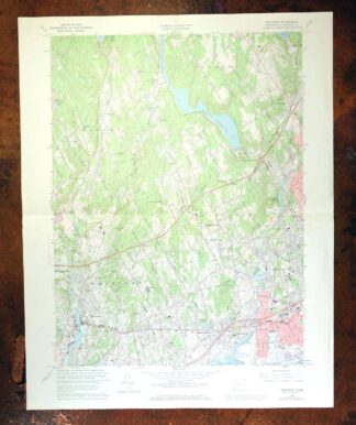
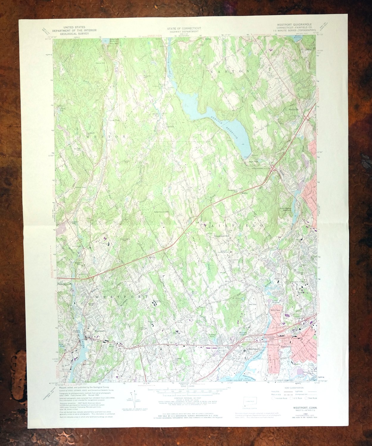
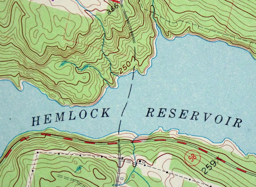
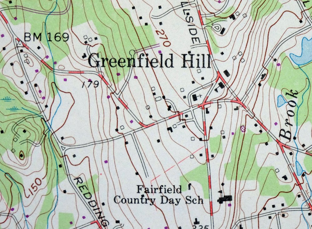
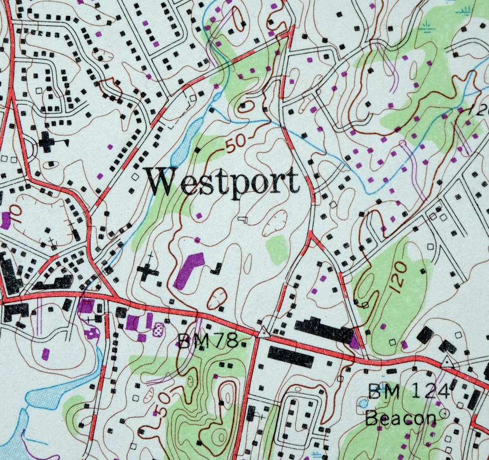
This USGS 7.5-minute topographic map of Westport, Connecticut is a 1960 edition with photorevisions through 1971, printed in 1973 on thick stock and in very good condition, lightly handled with a single horizontal foldline across the middle. The quad sits in Fairfield County a few miles west of Bridgeport, taking in Westport itself along with Southport, Greenfield Hill, Aspetuck, Lyons Plain, and the Hemlock Reservoir that gives the sheet one of its named features. A pencilled title notation on the back is the only other mark, and the map area and collar are clean throughout, showing this stretch of Connecticut’s Gold Coast as it stood at the start of the 1970s.
In stock
This vintage sheet is a 1960 edition of the Westport Connecticut USGS topographic map revised in 1971 using aerial photography. It is an original 53-year-old 1973 United States Geological Survey print in very good condition.
HOW THIS MAP CAN BE USED
In addition to making a fascinating conversation piece, this sheet would look great in a frame or on display, make a unique and prized gift for anyone interested in this area, be perfect as a reference for genealogy studies or general historical research, or fill that missing piece in your collection. Maps of this vintage are printed on durable stock and are well-suited for outdoor activities and recreation of all kinds, including hiking, backpacking, hunting, rafting and kayaking, backcountry skiing, geocaching, general exploration, treasure hunting, etc.
FEATURES SHOWN ON THE MAP
The Westport 7.5-minute map shows cities and towns, roads, paths, railroads, utilities and energy infrastructure, rivers, creeks, elevation contour lines, public land survey lines, county, state, and other administrative boundaries as they existed at the time of the survey. A reddish tint is used on this sheet to indicate urban areas where only landmark buildings are depicted. Outside of those areas, all known structures (houses, businesses, churches, schools, barns, cabins, etc) are shown.
A VALUABLE HISTORICAL RECORD
This map is from the 7.5-minute series, the most detailed series that is widely available from the USGS. The 1960 Westport map is a valuable historical record for the area. It contains some placenames and features that have been dropped from more recent maps.
The map was photorevised in 1971. Any features that changed or were added between the original edition year of 1960 and the photorevision year of 1971 are overlayed in purple. The purple overlay provides an excellent view of the fast-growing and changing areas within the quad boundary.
Nearby maps
-
Norwalk South Connecticut Stamford Darien USGS Topo Map 1963
$40 Add to cart -

Danbury Connecticut Trumbull Bethel USGS Topo Map 1899
$70 Add to cart -

West Point New York Newburgh Peekskill USGS Topo Map 1912
$105 Add to cart -

Harlem New York New York Yonkers USGS Topo Map 1913 Antique
$250 Add to cart -
Litchfield Connecticut Waterbury Oakville USGS Topo Map 1910
$100 Add to cart -

Park Ridge New Jersey New City Ridgewood USGS Topo Map 1963
$45 Add to cart -

Riverhead New York Manorville Calverton USGS Topo Map 1915
$175 Add to cart -

Schunemunk New York Newburgh Kiryas Joel USGS Topo Map 1915
$65 Add to cart -

Moodus Connecticut Lake Pocotopaug USGS Topographic Map 1946
$32 Add to cart -
Sag Harbor New York Hampton Bays USGS Topo Map 1913 Antique
$145 Add to cart -

Goshen New York Middletown Warwick USGS Topographic Map 1913
$55 Add to cart -
Uncasville Connecticut Ledyard Norwich USGS Topo Map 1984
$34 Add to cart -

Plainfield New Jersey Edison Somerset USGS Topo Map 1965
$42 Add to cart -

New Brunswick New Jersey Spotswood Edison USGS Topo Map 1965
$32 Add to cart -

Holyoke Massachusetts Springfield USGS Topo Map 1897 Antique
$85 Add to cart -

Milford Pennsylvania Lackawaxen Pond Eddy USGS Topo Map 1915
$58 Add to cart -
Hawley Pennsylvania Tafton USGS 15-Min Topo Map 1964 Vintage
$44 Add to cart -

Damascus Pennsylvania Honesdale USGS Topo Map 1964 Vintage
$35 Add to cart -

Trenton New Jersey Philadelphia Levittown USGS Topo Map 1907
$150 Add to cart -

Troy New York Albany Watervliet USGS Topo Map 1907 Antique
$110 Add to cart -
Whiting New Jersey Barnegat Toms River USGS Topo Map 1907
$115 Add to cart -

Taconic Vermont Pittsfield Adams USGS Topographic Map 1912
$95 Add to cart -

Blackstone Massachusetts Milford Hopedale USGS Topo Map 1944
$22 Add to cart -

Quinsigamond Massachusetts Milford USGS Topographic Map 1910
$125 Add to cart