MAP DETAILS | |
|---|---|
| TITLE | Superior |
| STATE | Wisconsin, Minnesota |
| LOCATION | Vicinity of Duluth |
| SERIES | 15-minute |
| SURVEYED | 1914 and 1915 Field Survey |
| GEOGRAPHER | R.B. Marshall |
| ENGRAVED | 1917 |
| EDITION | 1917 |
| PRINTED | 1917 |
| PRINT NOTES | Thick paper stock, includes woodland tint (green to indicate vegetated areas) |
| SCALE | 1:62500 |
| CONTOUR INTERVAL | 20 feet |
| SHEET DIMENSIONS | 16 1/2 x 20 inches (approximate) |
| MAP DIMENSIONS | 12 x 17 1/2 inches |
| COVERAGE AREA | 12 x 17 miles |
| MAP NOTES | Very nice cartography. |
| SHEET CONDITION For maps of this vintage, effort is made to note all visible flaws, no matter how minor. | |
| OVERALL CONDITION | Excellent |
| SHEET NOTES | very lightly handled, never folded, lightly age-toned sheet |
| MAP AREA | flawless map area |
| COLLARS | no markings, no blemishes, minor top edge wear, two very minor edge tears carefully stabilized with clear archival tape on backside of sheet |
| MAP COVERAGE Quadrangle extent overlaid on current basemap. | |
| BACKSIDE LEGEND | |
 A map summary is printed on the back side of the Superior sheet similar to the one shown in the picture. It outlines the history, purpose, and status of the USGS mapping program at the time of the printing in 1917. It also provides instructions on how to read contour lines and a description of how they are used to depict the terrain. At the bottom of the page is a legend showing all of the symbols used to represent the cultural, relief, and water features found on the map. | |
| PLACENAMES Depending on map series and survey date, all of the features listed below may not be shown on this map. This list contains features that currently exist or historically existed within the area covered by the map. The list can be used as a reference to determine if this map covers your area of interest. Placenames are listed alphabetically next to each feature type. | |
| CITIES AND TOWNS (CURRENT) | Duluth, Oliver, Proctor, South Superior, Superior, Superior, and Superior |
| COUNTIES COVERED | Douglas and St. Louis |
| RIVERS AND STREAMS | Balsam Creek, Black River, Bluff Creek, Clear Creek, Copper Creek, Crawford Creek, Empire Creek, Keene Creek, Knowlton Creek, Little Amnicon River, Little Balsam Creek, Little Pokegama River, Miller Creek, Mud Creek, Nemadji River, Pokegama River, Red River, Rock Creek, Rocky Run, Saint Louis River, Sargent Creek, and Stony Brook |
| WATER BODIES | Interfalls Lake, Lake Superior, and Mud Lake |
| Wisconsin Locations: Mariner Mall Shopping Center, Nemadji Golf Club, Radio Station, South Breakwater Light, South Pierh Light, and Union Station. Administrative Boundaries: Village of Oliver, City of Superior, Town of Superior, and Village of Superior. Valleys and Canyons: Rocky Gorge. Parks: Billings Park, Central Park, Franklin Square, Gouge Park, Hammond Park, Kelly Park, Memorial Field, Pattison State Park, Priest Field, Tristate Fair Grounds, Washington Park, and Webster Park. Drainages: Balsam Creek, Black River, Bluff Creek, Clear Creek, Copper Creek, Crawford Creek, Empire Creek, Little Balsam Creek, Little Pokegama River, Miller Creek, Mud Creek, Nemadji River, Pokegama River, Red River, Rock Creek, Rocky Run, and Stony Brook. Islands: Barkers Island, Clough Island, and Hog Island. Capes: Chases Point, Connors Point, Dwights Point, and Wisconsin Point. Churches: Apostolic Faith Assembly Church, Bethel Lutheran Church, Calvary Baptist Church, Cathedral Convent, Cathedral of Christ the King, Central Assembly of God Church, Central United Methodist Church, Christ Lutheran Church, Christian and Missionary Alliance Church, Concordia Lutheran Church, First Baptist Church, First Church of Christ Scientist, First Evangelical Covenant Church, First Presbyterian Church, First United Methodist Church, Hammond Avenue Presbyterian Church, Holy Assumption Roman Catholic Church, Holy Trinity Evangelical Lutheran Church, Hope Congregational Church, Immanuel Lutheran Church, Itasca Presbyterian Church, Manitou Falls Church, Ogden Avenue Baptist Church, Our Savior Lutheran Church, Pilgirm Lutheran Church, Saint Adelberts Roman Catholic Church, Saint Albans the Martyr Episcopal Church, Saint Aloysius Church, Saint Francis Xavier Catholic Church, Saint Patricks Roman Catholic Church, Saint Paul Lutheran Church, Saint Stanislaus Catholic Church, Saints Cyril and Methodius Catholic Church (histor, Superior Seventh Day Adventist Church, Temple Bethel, Trinity United Methodist Church, Twin Ports Baptist Church, Wesleyan Church, Zion Lutheran Brethren Church, and Zion Lutheran Church. Harbors: Cumming Slip, East Gate Basin, Howards Bay, Hughitt Slip, Superior Harbor Basin, Tower Bay Slip, and West Gate Basin. Hospitals: Douglas County Hospital, Home for the Aged, Saint Josephs Hospital, Saint Marys Hospital, and Superior Memorial Hospital. Lakes and Ponds: Interfalls Lake. Buildings: Barstow Hall, Central Fire Station, Crownhart Hall, Douglas County Courthouse, Douglas County Historical Museum, Douglas County Jail, East End Branch Superior Public Library, East End Civic Center, Erlanson Hall, Fire Station Number 2, Fire Station Number 4, Fire Station Number 5, Gates Field House, Holden Fine Arts Center, Jim Dan Hill Library, McCaskill Hall, Old Main, Rothwell Student Center, Saint Francis Home, Saint Joseph Orphanage, Saint Marys Hall, Sundquist Hall, Superior City Hall, and Superior Public Library. Waterfalls: Big Manitou Falls and Little Manitou Falls. Dams: Pattison State Park WP433 Dam. Channels: Allowez Bay Channel, Minnesota Channel, South Channel, Superior Entry, and Superior Front Channel. Bridges: Arrowhead Bridge. Bays: Allouez Bay, Kimballs Bay, Little Pokegama Bay, Pokegama Bay, and Superior Bay. Airports: Carlson Airport and Richard I Bong Airport. Schools: Academy School, Blaine Elementary School, Bryant Elementary School, Carpenter School, Cathedral School, Central Junior High School, Cooper Elementary School, Dewey School, East Junior High School, Franklin Public School, Howe School, Industrial Arts School, Lincoln School, Nemadji School, Oakland School, Pattison Elementary School, Saint Adalbert School, Saint Anthony School, Saint Francis Xavier School, Saint Louis Catholic School, Saint Patricks School, Saint Stanislaus School, Superior High School, Superior Vocational School, University of Wisconsin-Superior, and Wisconsin Indianhead Technical College. Reservoirs and Tanks: Interfalls Lake 78. Towers: KUWS-FM (Superior), KXTP-AM (Superior), and WDSM-AM (Superior). | |
| Minnesota Locations: North Breakwater Light and North Pierh Light. Administrative Boundaries: City of Proctor. Mountains, Peaks, and Summits: Bardon Peak. Parks: Birchwood Park, Morgan Park, Fairmount Park, Gasser Park, Indian Park, Indian Point Park, Irving Playfield, Klang Memorial Park, Norton Park, and Snively Park. Drainages: Mud Creek, Clear Creek, Keene Creek, Kingsbury Creek, Knowlton Creek, Red River, Saint Louis River, Sargent Creek, and Stewart Creek. Islands: Bear Island, Kilchlis Meadow, Spirit Island, and Tallas Island. Capes: Minnesota Point, Grassy Point, and Park Point. Lakes and Ponds: Mud Lake and Spirit Lake. Channels: North Channel and Superior Entry Channel. Bridges: Arrowhead Bridge and Bong Bridge. Bays: Superior Bay. Basins: Superior Harbor Basin. Airports: Sky Harbor Airport and Sky Harbor Seaplane Base. Schools: Denfield High School, Fairmount School, Irving School, and Stowe School. Towers: KDAL-AM (Duluth) and WWJC-AM (Duluth). | |
| SHIPPING AND RETURNS | |
 This map sheet will be carefully rolled in a sturdy tube and shipped via the US Postal Service. If you find that the sheet you receive is not as described in the listing, you may ship it back to us for a refund of the purchase price. | |
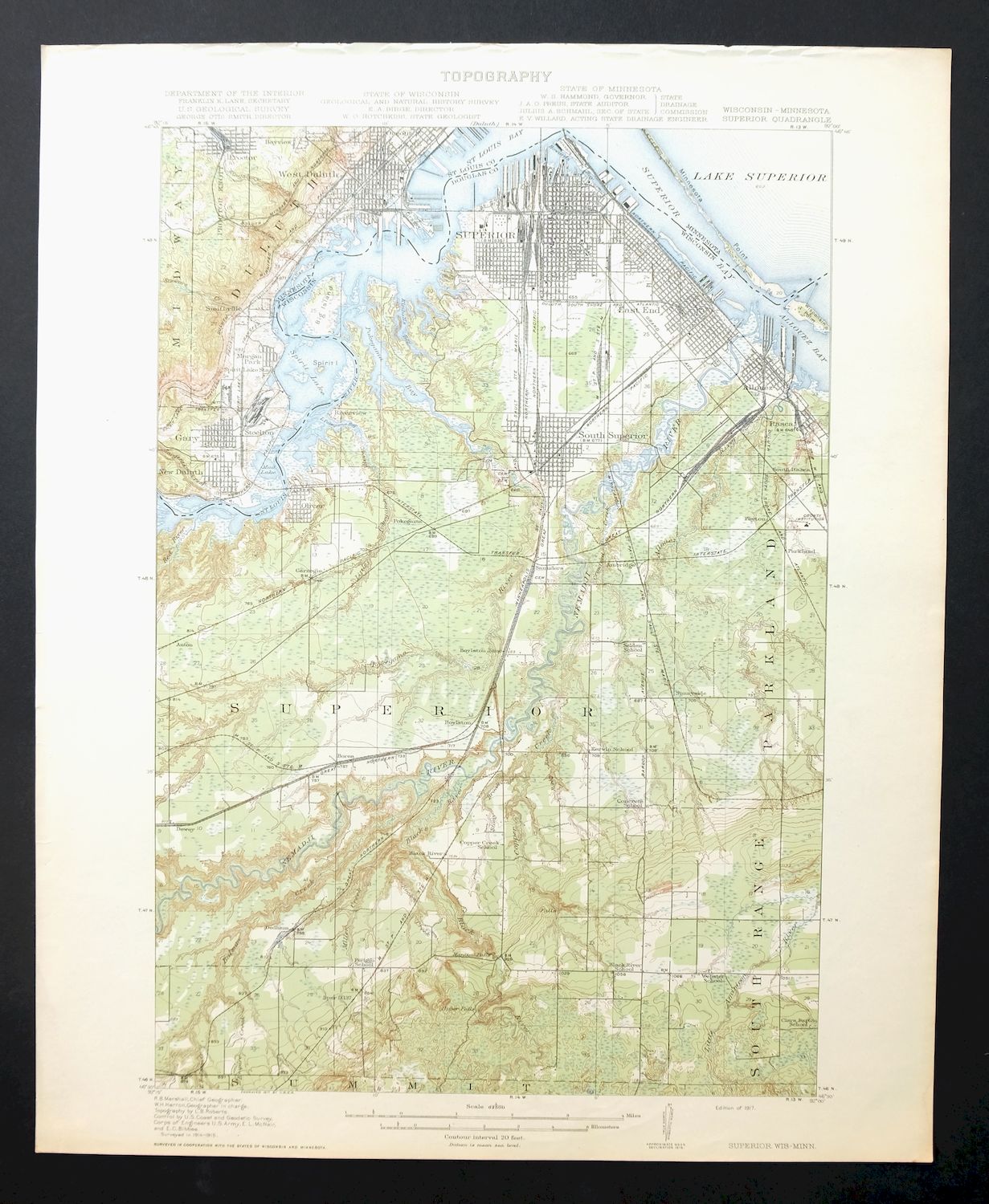
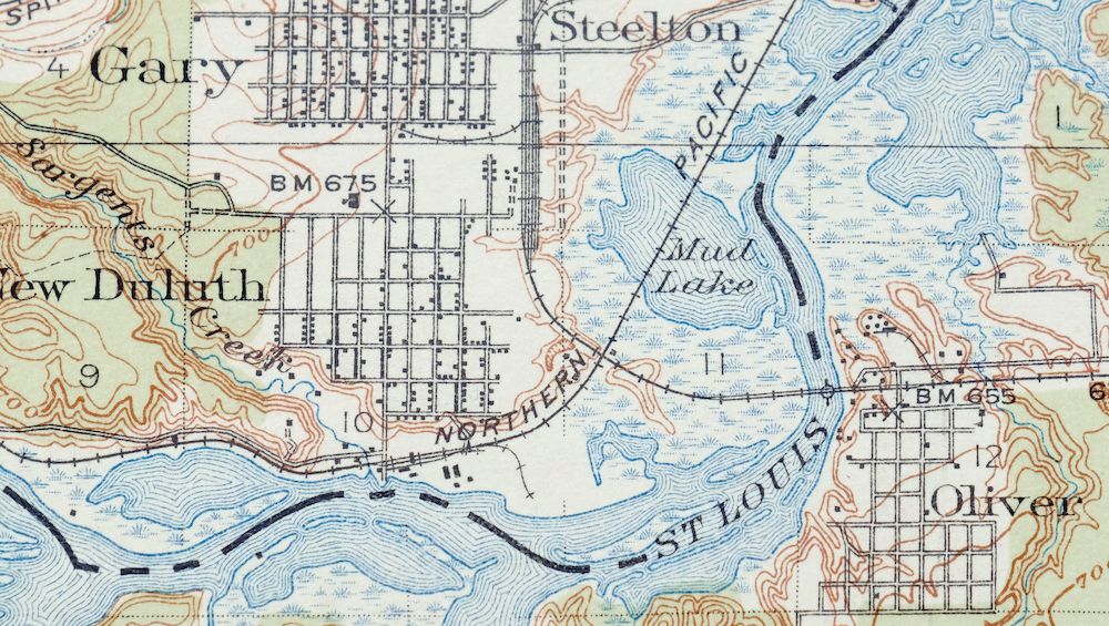
Superior Wisconsin Duluth Proctor USGS Topo Map 1917 Antique
$55
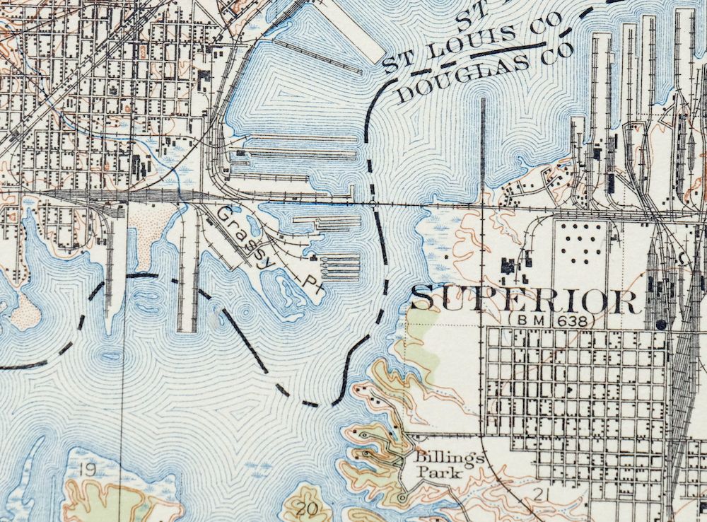
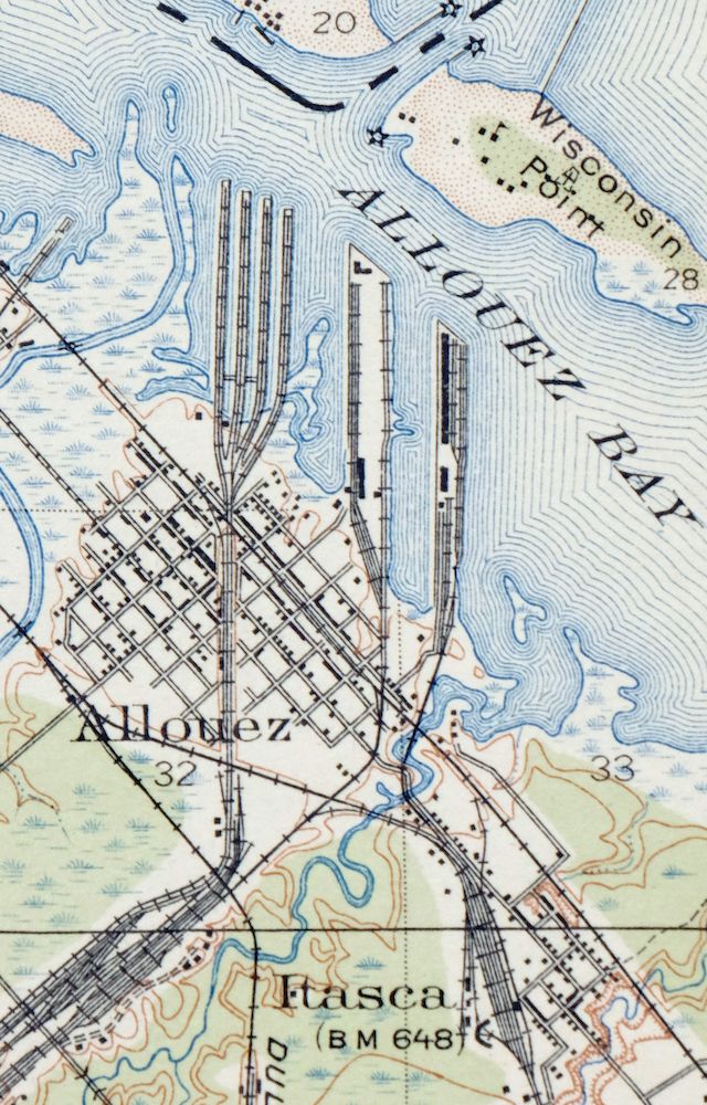
Printed in its first year, 1917, this USGS 15-minute topographic sheet is in excellent condition, never folded and only very lightly handled with light age-toning. Straddling the Wisconsin–Minnesota line at the head of Lake Superior, the quad takes in the twin ports of Duluth and Superior along with Proctor, Oliver, and South Superior across Douglas and St. Louis counties. Engraved in 1917 with R.B. Marshall as geographer, the sheet shows the busy harbor cities as they stood in the middle of the decade, and the cartography here is genuinely handsome. It is printed on thick stock, and its two very minor edge tears have been carefully stabilized with archival tape on the reverse; the back also carries printed reference material from the era’s mapping program.
In stock
This antique sheet is a 1917 edition of the Superior Wisconsin USGS topographic map. It is an authentic 109-year-old United States Geological Survey print in excellent condition.
HOW THIS MAP CAN BE USED
In addition to making a fascinating conversation piece, this sheet would look great in a frame or on display, make a unique and prized gift for anyone interested in this area, be perfect as a reference for genealogy studies or general historical research, or fill that missing piece in your collection.
FEATURES SHOWN ON THE MAP
The Superior 15-minute map shows cities and towns, roads, railroads, rivers, creeks, elevation contour lines, public land survey lines, county, state, and other administrative boundaries as they existed at the time of the survey in 1914 and 1915. All known structures (houses, businesses, churches, schools, barns, cabins, etc) are also shown, with exceptions in some urban areas, where only landmark buildings may be shown.
A VALUABLE HISTORICAL RECORD
Maps from the 15-minute series for the continental United States are no longer produced or printed by the USGS and original prints are becoming increasingly difficult to find. They are a valuable historical record for an area, as they contain many placenames and features that have been dropped from more recent maps.
Nearby maps
-

Whitehall Wisconsin Arcadia Independence USGS Topo Map 1929
$38 Add to cart -

Briggsville Wisconsin Portage Lake Delton USGS Topo Map 1931
$37 Add to cart -

Denzer Wisconsin Baraboo West Baraboo USGS Topo Map 1929
$77 Add to cart -

Cross Plains Wisconsin Madison Middleton USGS Topo Map 1942
$25 Add to cart -
Lancaster Wisconsin Dubuque Asbury USGS Topographic Map 1953
$30 Add to cart -
Evansville Wisconsin Madison Fitchburg USGS Topo Map 1925
$43 Add to cart -
South Wayne Wisconsin Argyle Wiota USGS Topographic Map 1923
$54 Add to cart -
Oconomowoc Wisconsin Waukesha Plat USGS Topographic Map 1947
$26 Add to cart -

Brodhead Wisconsin Orfordville Albany USGS Topo Map 1910
$80 Add to cart -

Shopiere Wisconsin Janesville Clinton USGS Topo Map 1910
$38 Add to cart -

Canton South Dakota Sioux Falls Tea USGS Topo Map 1900
$58 Add to cart -
Forreston Illinois Freeport Shannon USGS Topo Map 1972
$14 Add to cart -
Evanston Illinois Chicago USGS 7.5-Min Topo Map 1964 Vintage
$31 Add to cart -

Woodhull Illinois Wataga Windsor USGS Topo Map 1947 Vintage
$20 Add to cart -
Jackson Park Illinois Chicago USGS Topo Map 1973 Vintage
$36 Add to cart -
Blue Island Illinois Chicago Posen USGS Topographic Map 1965
$28 Add to cart -
Lake Calumet Illinois Chicago Hammond USGS Topo Map 1966
$35 Add to cart -
Harvey Illinois Chicago Heights Dolton USGS Topo Map 1965
$46 Add to cart -
Calumet City Illinois Harvey USGS Topographic Map 1970
$45 Add to cart -
La Harpe Illinois Stronghurst Raritan USGS Topo Map 1918
$49 Add to cart -
Sawyer North Dakota Surrey Logan USGS Topo Map 1929 Antique
$26 Add to cart -
Colchester Illinois Plymouth Tennessee USGS Topo Map 1913
$25 Add to cart -
Battle Creek Michigan Springfield USGS Topo Map 1918 Antique
$40 Add to cart -
Saginaw Michigan Shiawassee NWR Zilwaukee USGS Topo Map 1919
$45 Add to cart