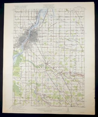
MAP DETAILS | |
|---|---|
| TITLE | Saginaw |
| STATE | Michigan |
| LOCATION | 25 miles north of Flint |
| SERIES | 15-minute |
| SURVEYED | 1916 Field Survey |
| GEOGRAPHER | W.H. Herron |
| ENGRAVED | 1918 |
| EDITION | 1919 |
| PRINTED | 1919 |
| SCALE | 1:62500 |
| CONTOUR INTERVAL | 5 feet |
| SHEET DIMENSIONS | 16 1/2 x 20 inches (approximate) |
| MAP DIMENSIONS | 12 3/4 x 17 1/2 inches |
| COVERAGE AREA | 13 x 17 miles |
| SHEET CONDITION For maps of this vintage, effort is made to note all visible flaws, no matter how minor. | |
| OVERALL CONDITION | Very Good |
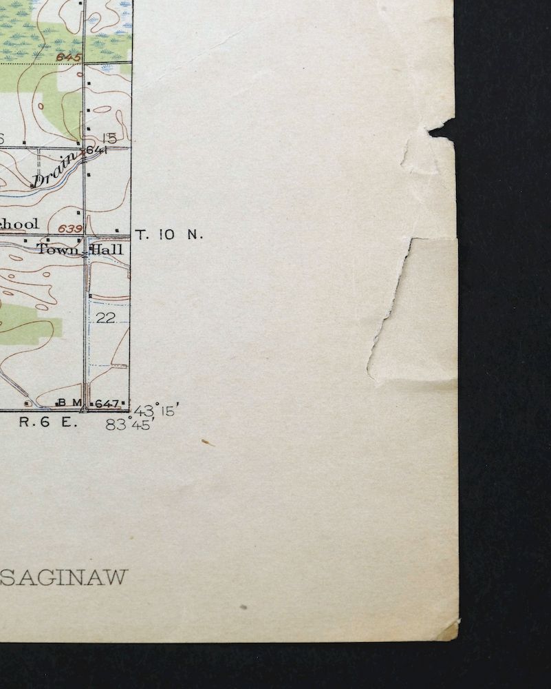
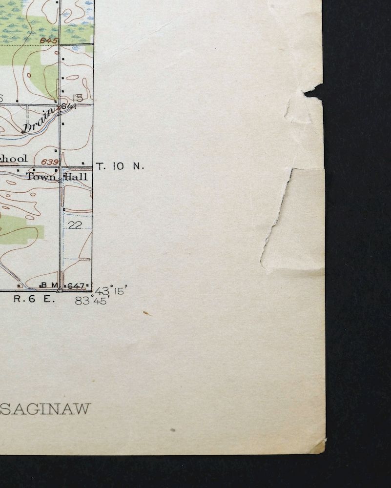
| SHEET NOTES | lightly handled, never folded, lightly age-toned sheet, crease along lower right corner of sheet |
| MAP AREA | no markings, no blemishes |
| COLLARS | no markings, no blemishes, wear and tears along lower right collar |
 | |
| MAP COVERAGE Quadrangle extent overlaid on current basemap. | |
| BACKSIDE LEGEND | |
 A map summary is printed on the back side of the Saginaw sheet similar to the one shown in the picture. It outlines the history, purpose, and status of the USGS mapping program at the time of the printing in 1919. It also provides instructions on how to read contour lines and a description of how they are used to depict the terrain. At the bottom of the page is a legend showing all of the symbols used to represent the cultural, relief, and water features found on the map. | |
| PLACENAMES Depending on map series and survey date, all of the features listed below may not be shown on this map. This list contains features that currently exist or historically existed within the area covered by the map. The list can be used as a reference to determine if this map covers your area of interest. Placenames are listed alphabetically next to each feature type. | |
| CITIES AND TOWNS (CURRENT) | Birch Run, Bridgeport, Buena Vista, Burt, Carrollton, Frankenmuth, Indiantown, Robin Glen-Indiantown, Saginaw, Saginaw Township North, Saginaw Township South, and Zilwaukee |
| COUNTIES COVERED | Bay and Saginaw |
| FEDERAL LAND UNITS | Shiawassee National Wildlife Refuge |
| RIVERS AND STREAMS | Birch Run, Bogart Drain, Bortle Drain, Cass River, Cheboyganing Creek, Cole Drain, Cool Creek, Dead Creek, Flint River, Hutchinson And Young Drain, Misteguay Creek, Pattee Creek, Pine Run, Saginaw River, Shiawassee River, Silver Creek, Spring Brook Drain, Tittabawassee River, and Zehender Drain |
| Locations: Bridgeport Country Club and Dixie Highway Racetrack. Administrative Boundaries: Township of Albee, Township of Birch Run, Township of Blumfield, Charter Township of Bridgeport, Charter Township of Buena Vista, Township of Carrollton, Township of Frankenmuth, City of Saginaw, Township of Spaulding, Township of Taymouth, and City of Zilwaukee. Woods: Deindorfer Woods. Parks: Bliss Park, Crow Island State Game Area, Fordney Park, Hoyt Park, Roeser Park, Rust Park, and Veterans Memorial Park. Drainages: Birch Run, Blumfield Creek, Bogart Drain, Bortle Drain, Cass River, Cole Drain, Cool Creek, Dead Creek, English Drain, Horton Graham Drain, Hutchinson And Young Drain, Jordon Drain, Moon Drain, Pine Run, Runnel Drain, Shiawassee River, Silver Creek, Silver Creek Drain, Spring Brook Drain, Tittabawassee River, and Zehender Drain. Islands: Carrollton Bar, Green Point, and Ojibway Island. Churches: Assumption Church, Kochville Church, Saint Lorenz Church, and Saint Matthew Church. Hospitals: Saint Lukes Hospital and Saint Marys Hospital. Lakes and Ponds: Lake Linton. Buildings: Hoyt Library. Canals: Creens Drain, Kleinart Drain, and Weaver Drain. Bayous and Sloughs: Ferguson Bayou. Airports: Harry W Browne Airport and Saint Marys Hospital Heliport. Schools: Albee School, Baillie School, Banner School, Bethlehem School, Bridgeport High School, Bridgeport School, Brucker School, Brunkow School, Buena Vista High School, Central Junior High School, Dixie School, Doerr School, Downes School, Eddy High School, Emerson School, Fuerbringer School, Griffin School, Haley School, Handley School, Herig School, Hess School, Highland Park School, Hill High School, Hill Technical School, Holy Cross School, Houghton School, Hoyt School, Jerome School, Jewett School, Jones School, Kaufman School, Kempton School, Lincoln School, Longfellow School, Longstreet School, Loomis School, Mackinaw School, Mahar School, Merrill School, Mershon School, Messiah School, Michigan Lutheran Seminary, Miller School, Morley School, North Junior High School, Orville School, Our Lady Help of Christians School, Plainfield School, Potter School, Prosser School, Queen of the Holy Rosary High School, Redeemer School, Ricker Junior High School, Ricker School, Rouse School, Sacred Heart School, Saint Andrews School, Saint Casimir School, Saint Helen School, Saint Joseph School, Saint Joshaphat School, Saint Marys School, Saint Matthews School, Saint Paul School, Saint Stephens High School, Saint Stephens School, Saints Peter and Paul High School, Saints Peter and Paul School, Salina School, South Junior High School, South School, Star School, Stone School, Taymouth School, Toddish School, Tower Lodge School, Trinity School, Webber Junior High School, and White School. Towers: WGER-FM (Saginaw), WIOG-FM (Bay City), WKCQ-FM (Saginaw), WKNX-AM (Frankenmuth), WNEM-TV (Bay City), WSAM-AM (Saginaw), WSGW-AM (Saginaw), and WTLZ-FM (Saginaw). Oilfields: Birch Run Oil Field. | |
| SHIPPING AND RETURNS | |
 This map sheet will be carefully rolled in a sturdy tube and shipped via the US Postal Service. If you find that the sheet you receive is not as described in the listing, you may ship it back to us for a refund of the purchase price. | |
Saginaw Michigan Shiawassee NWR Zilwaukee USGS Topo Map 1919
$45
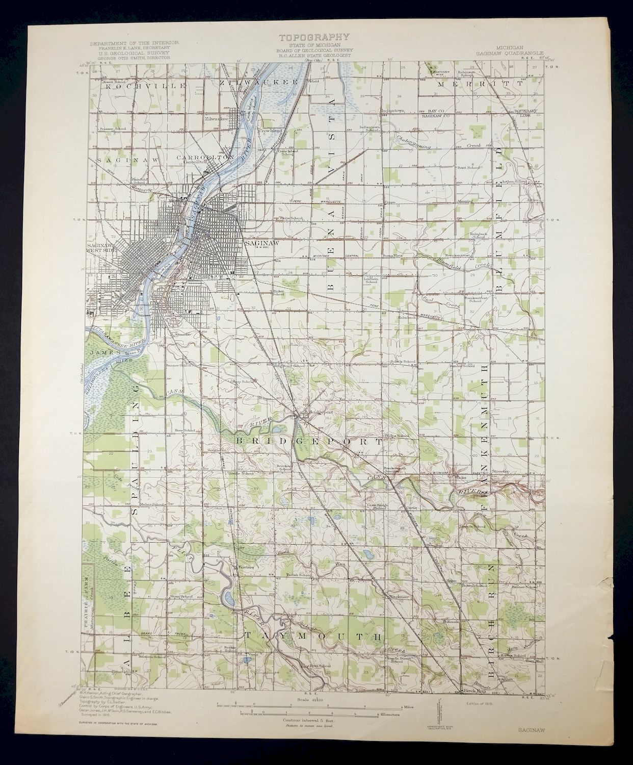
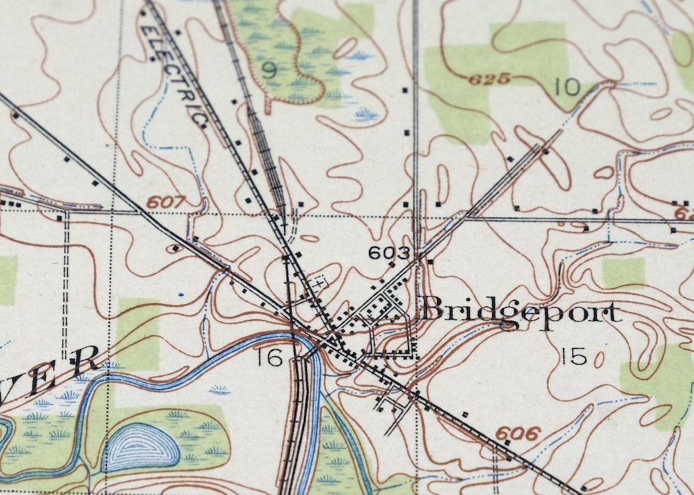
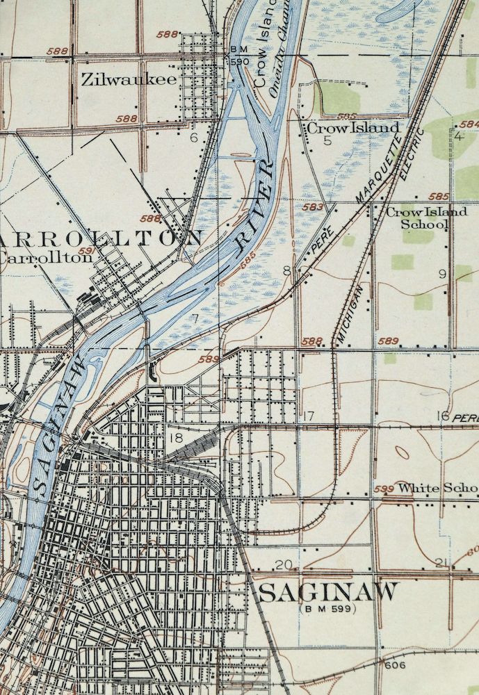
This USGS 15-minute topographic sheet is a first-year 1919 print, published and printed that same year, and survives in very good condition—lightly handled, never folded, and lightly age-toned, with a crease along the lower right corner. Covering an area about 25 miles north of Flint in Saginaw and Bay counties, the quad takes in the city of Saginaw along with Frankenmuth, Bridgeport, Zilwaukee, Carrollton, and part of the Shiawassee National Wildlife Refuge. Engraved in 1918 under geographer W.H. Herron and drawn from a 1916 field survey, it records the Saginaw River valley as it looked in the years just after the region’s lumber era, and the reverse carries printed reference material on reading the map.
In stock
This antique sheet is a 1919 edition of the Saginaw Michigan USGS topographic map. It is an authentic 107-year-old United States Geological Survey print in very good condition.
HOW THIS MAP CAN BE USED
In addition to making a fascinating conversation piece, this sheet would look great in a frame or on display, make a unique and prized gift for anyone interested in this area, be perfect as a reference for genealogy studies or general historical research, or fill that missing piece in your collection.
FEATURES SHOWN ON THE MAP
The Saginaw 15-minute map shows cities and towns, roads, railroads, rivers, creeks, elevation contour lines, public land survey lines, county, state, and other administrative boundaries as they existed at the time of the survey in 1916. All known structures (houses, businesses, churches, schools, barns, cabins, etc) are also shown, with exceptions in some urban areas, where only landmark buildings may be shown.
A VALUABLE HISTORICAL RECORD
Maps from the 15-minute series for the continental United States are no longer produced or printed by the USGS and original prints are becoming increasingly difficult to find. They are a valuable historical record for an area, as they contain many placenames and features that have been dropped from more recent maps.
Nearby maps
-
Corunna Michigan Owosso Durand USGS Topo Map 1929 Antique
$38 Add to cart -
Romulus Michigan Taylor Woodhaven USGS Topo Map 1926 Antique
$35 Add to cart -
Battle Creek Michigan Springfield USGS Topo Map 1918 Antique
$40 Add to cart -

Madison Ohio North Madison North Perry USGS Topo Map 1985
$44 Add to cart -
Conneaut Ohio Hatch Corners USGS Topo Map 1971 Vintage
$44 Add to cart -
Evanston Illinois Chicago USGS 7.5-Min Topo Map 1964 Vintage
$31 Add to cart -
Jackson Park Illinois Chicago USGS Topo Map 1973 Vintage
$36 Add to cart -
Cambridge Springs Pennsylvania Edinboro USGS Topo Map 1964
$38 Add to cart -
Lake Calumet Illinois Chicago Hammond USGS Topo Map 1966
$35 Add to cart -

North East Pennsylvania Wattsburg USGS Topo Map 1962 Vintage
$44 Add to cart -
Calumet City Illinois Harvey USGS Topographic Map 1970
$45 Add to cart -
Westfield New York Mayville Ripley USGS 15-Min Topo Map 1903
$49 Add to cart -
Blue Island Illinois Chicago Posen USGS Topographic Map 1965
$28 Add to cart -
Oconomowoc Wisconsin Waukesha Plat USGS Topographic Map 1947
$26 Add to cart -

Union City Pennsylvania Waterford Elgin USGS Topo Map 1961
$44 Add to cart -
Harvey Illinois Chicago Heights Dolton USGS Topo Map 1965
$46 Add to cart -
Clymer New York Mayville Sherman USGS Topo Map 1905 Antique
$70 Add to cart -
Campbell Ohio Youngstown Boardman USGS Topo Map 1971 Vintage
$37 Add to cart -
Townville Pennsylvania Cooperstown USGS 15-Min Topo Map 1964
$40 Add to cart -
Corry Pennsylvania Spartansburg Elgin USGS Topo Map 1958
$41 Add to cart -

South Charleston Ohio Springfield Catawba USGS Topo Map 1927
$50 Add to cart -
Dayton Ohio Beavercreek Fairborn USGS Topographic Map 1956
$42 Add to cart -

New Castle North Pennsylvania Oakwood USGS Topo Map 1960
$34 Add to cart -
Franklin Pennsylvania Sugarcreek Polk USGS Topo Map 1962
$36 Add to cart