MAP DETAILS | |
|---|---|
| TITLE | Kipahulu |
| STATE | Hawaii |
| SURVEYED | 1950 through 1983 Aerial and Field Survey |
| PRINT NOTES | Includes woodland tint (green to indicate vegetated areas) |
| SCALE | 1:24000 |
| CONTOUR INTERVAL | 40 feet |
| SHEET DIMENSIONS | 24 x 26 7/8 inches |
| MAP DIMENSIONS | 21 3/8 x 22 3/4 inches |
| COVERAGE AREA | 8 x 9 miles |
| SHEET CONDITION For maps of this vintage, effort is made to note all visible flaws, no matter how minor. | |
| SHEET NOTES | lightly handled, never folded, very light horizontal crease |
| MAP AREA | no wear, no markings, blemish in lower left corner |
| COLLARS | no markings, no edge tears, minor wear along left collar, very minor blemish on right collar |
 | |
| MAP COVERAGE Quadrangle extent overlaid on current basemap. | |
| PLACENAMES Depending on map series and survey date, all of the features listed below may not be shown on this map. This list contains features that currently exist or historically existed within the area covered by the map. The list can be used as a reference to determine if this map covers your area of interest. Placenames are listed alphabetically next to each feature type. | |
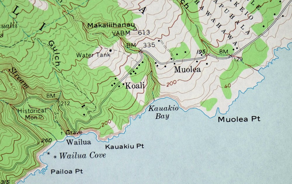
| NOTABLE PLACES | Wailua Falls, Oheo Gulch, and Hana Forest |
| CITIES AND TOWNS (CURRENT) | Haou and Kipahulu |
| COUNTIES COVERED | Maui |
| FEDERAL LAND UNITS | Haleakala National Park and Haleakala Wilderness |
| RIVERS AND STREAMS | Palikea Stream |
| Populated Place: Ha?o?u, Kipahulu, Koali, Mu?olea, and Pu?uiki. Locations: Kanekauila Heiau, Wailua, and ?Ohe?o Campground. Administrative Boundaries: Ahuakeio, ?Alaeiki, ?Alaenui, Hahalawe, Halemano, Ha?o?u, Hulihana, Ka?eho?eho, Kakalehale, Kakiweka, Kakoni, Kakuhalahala, Kalena, Kapuaikini, Kaumakani, Kihapuhala, Kiko?o, Koali, Kukuiulaiki, Ma?ulili, Mu?olea, Paehala, Papahawahawa, Papauluana, Pohakanele, Pohue, Popoloa, Poponui, Pua?alu?u, Pukuilua, Pu?uhaoa, and Pu?uiki. Mountains, Peaks, and Summits: Kaumakani, Makali?ihanau, Palikea, Papaloa, Pu?u?ahu?ula, Pu?uho?olio, and Pu?ukue. Valleys and Canyons: Alaalaula Gulch, Hahalawe Gulch, Kakiweka Gulch, Kaukau?ai Gulch, Kukui?ula Gulch, Maluhianaiwi Gulch, ?Ohe?o Gulch, ?Opelu Gulch, Pa?ihi Gulch, Papahawahawa Gulch, Pua?alu?u Gulch, Pukuilua Gulch, and Wai?eli Gulch. Drainages: Honolewa Stream, Kalena Stream, Lelekea Stream, Palikea Stream, Pipiwai Stream, Wailua Stream, Waiohonu Stream, Ka?ili Stream, and Wai?eli Stream. Islands: Ahole Rock, Laupapa Rock, Mokupala, and Mokupapa. Capes: Ka?apipa Point, Kakanoni Point, Kamilo Point, Kauakiu Point, Kulepeamoa Point, Kuloa Point, Maka?aikuloa Point, Mu?olea Point, O?ahu Point, ?Ohai Point, Pailoa Point, Pi?ilanipapa, Popokanaloa Point, and Puhilele Point. Churches: Palapala Ho?omau Congregational Church. Forests: Kipahulu Forest Reserve. Lakes and Ponds: Pools of ?Ohe?o. Waterfalls: Kanahuali?i Falls, Kekuapo?owai Falls, Waihi?umalu Falls, Wailua Falls, Waimoku Falls, and Makahiku Falls. Channels: ?Alenuihaha Channel. Beaches: Pepeiaolepo Beach. Bays: Awapaewa?a Bay, Ka?apahu Bay, Ka?u Bay, Kauakio Bay, Keawa Bay, Kukui Bay, Ma?ulili Bay, Papaloa Bay, Pepeiaolepo Bay, Pohakuloa Harbor, Wai?a?ama Bay, Wailua Cove, and Waioka. Springs: Waihi Spring. | |
| SHIPPING AND RETURNS | |
 Ships carefully rolled in a sturdy 2" x 26" mailing tube. Shipping and return details are in our terms. | |
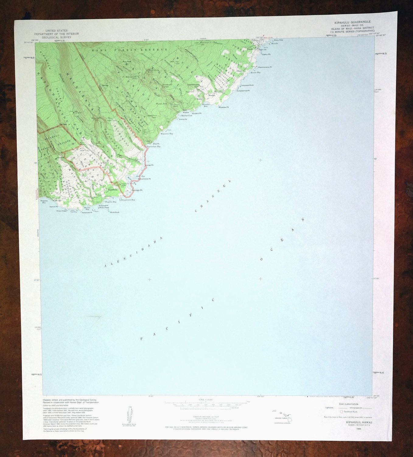
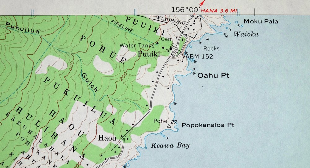
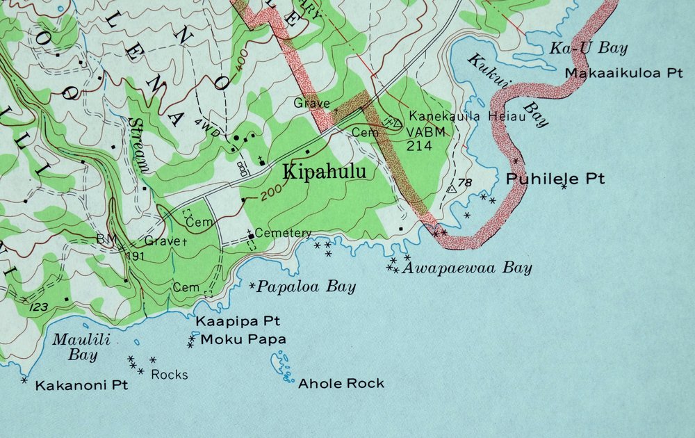
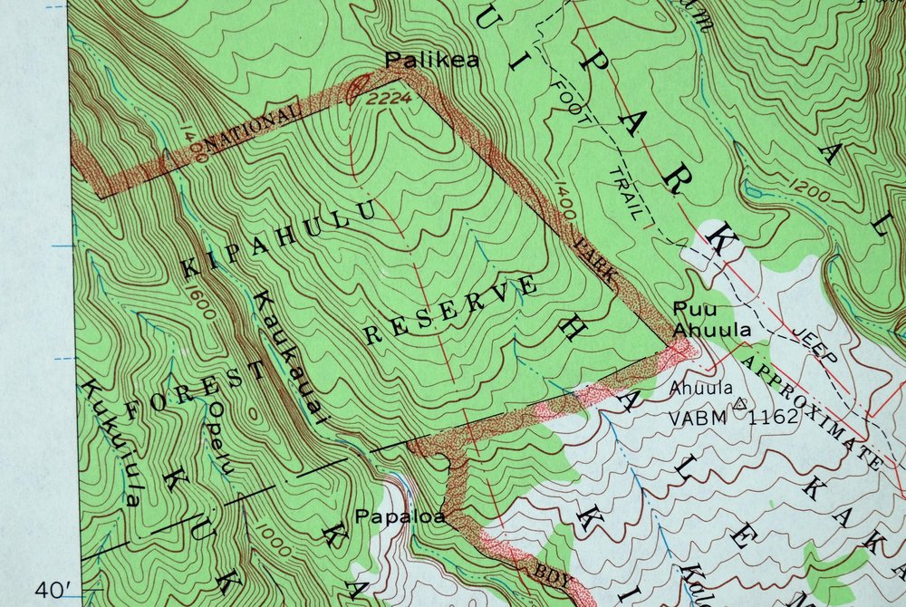
Kipahulu, Hawaii 1983 USGS Topo Map: Wailua Falls
$37
- Haleakala National Park, 29 miles east of Kihei.
- 7.5-minute series, 1983 edition, printed that year.
- Good condition, never folded.
In stock
This vintage sheet is a 1983 edition of the Kipahulu Hawaii USGS topographic map. It is an original 43-year-old United States Geological Survey print in good condition.
HOW THIS MAP CAN BE USED
In addition to making a fascinating conversation piece, this sheet would look great in a frame or on display, make a unique and prized gift for anyone interested in this area, be perfect as a reference for genealogy studies or general historical research, or fill that missing piece in your collection. Maps of this vintage are printed on durable stock and are well-suited for outdoor activities and recreation of all kinds, including hiking, backpacking, hunting, rafting and kayaking, backcountry skiing, geocaching, general exploration, treasure hunting, etc.
FEATURES SHOWN ON THE MAP
The Kipahulu 7.5-minute map shows cities and towns, roads, paths, railroads, utilities and energy infrastructure, rivers, creeks, elevation contour lines, public land survey lines, county, state, and other administrative boundaries as they existed at the time of the survey in 1950 through 1983. All known structures (houses, businesses, churches, schools, barns, cabins, etc) are also shown.
A VALUABLE HISTORICAL RECORD
This map is from the 7.5-minute series, the most detailed series that is widely available from the USGS. The 1983 Kipahulu map is a valuable historical record for the area. It contains some placenames and features that have been dropped from more recent maps.
Nearby maps
-
1983 USGS Topo Map: Hana, Maui, Hawaii (Vintage Print)
$44 Add to cart -

Nahiku, Maui, Hawaii 1983 USGS Topo Map (Haleakala NP)
$42 Add to cart -
Kilohana, Hawaii 1983 USGS Topo Map: Maui
$42 Add to cart -

1983 USGS Topo Map: Keanae, Maui, Hawaii (Original Print)
$43 Add to cart -
1982 USGS Topo Map: Keawanui Bay, Lapakahi Park, Hawaii
$26 Add to cart -
Honokane, Kohala Forest, Hawaii 1982 USGS Topo Map
$34 Add to cart -
Kawaihae, Kaunaoa Beach, Hawaii 1982 USGS Topo Map
$34 Add to cart -

1982 USGS Topo Map: Kamuela, Waimea, Hawaii (Vintage Print)
$34 Add to cart -

1981 USGS Topo Map: Akaka Falls, Hilo Forest Reserve, Hawaii
$37 Add to cart -
Kilauea Crater, Hawaii 1981 USGS Topo Map
$36 Add to cart -
Volcano, Fern Forest, Hawaii 1981 USGS Topo Map
$41 Add to cart -
1981 USGS Topo Map: Kau Desert, Hawaii Volcanoes, Hawaii
$41 Add to cart -
Makaopuhi Crater, Hawaii 1981 USGS Topo Map
$37 Add to cart -
Koko Head, Hawaii 1983 USGS Topo Map: Oahu (Vintage Print)
$42 Add to cart -

Kahana, Hawaii 1983 USGS Topo Map: Oahu (Original Print)
$33 Add to cart -
Pearl Harbor, Oahu, Hawaii 1983 USGS Topo Map
$54 Add to cart -
Waianae, Oahu, Hawaii 1983 USGS Topo Map (Original Print)
$42 Add to cart -
1983 USGS Topo Map: Waialeale, Kauai, Hawaii (Kawaikini)
$40 Add to cart -

Waimea Canyon, Kauai, Hawaii 1983 USGS Topo Map
$42 Add to cart -
Glenblair, CA 1943 Military Army Corp of Engineers Topo Map
$33 Add to cart -
Piercy, California 1950 USGS Topo Map (1971 Print)
$32 Add to cart -
1954 USGS Topo Map: Point Bonita, San Francisco, California
$51 Add to cart -
San Francisco South, CA 1956 USGS Topo Map (1975 Print)
$45 Add to cart -

1954 USGS Topo Map: San Rafael, Manzanita, California
$57 Add to cart
