MAP DETAILS | |
|---|---|
| TITLE | San Rafael |
| STATE | California |
| LOCATION | 14 miles northwest of San Francisco |
| SERIES | 7.5-minute |
| SURVEYED | 1952 and 1954 Aerial and Field Survey |
| EDITION | 1954 |
| PRINTED | 1966 |
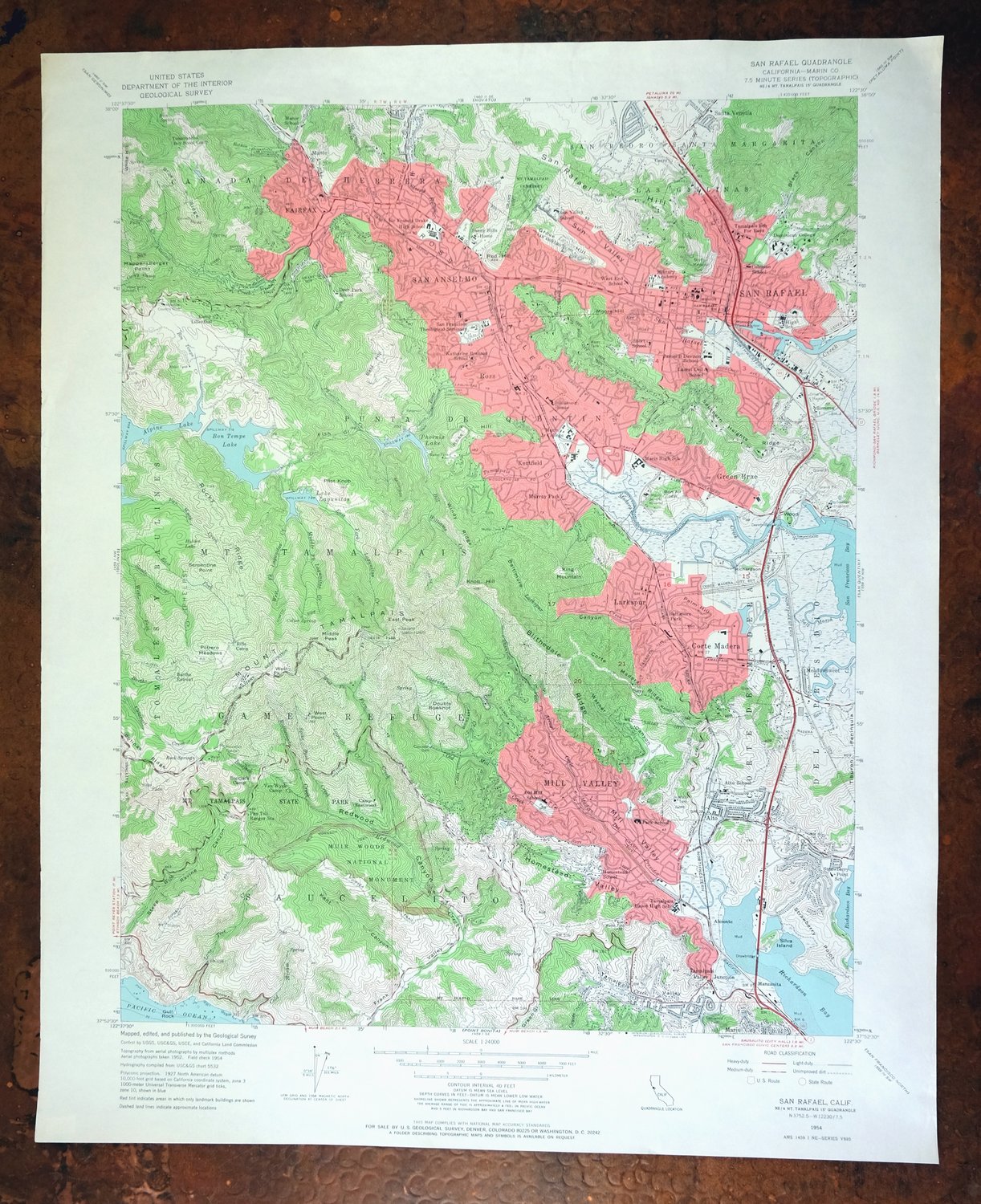
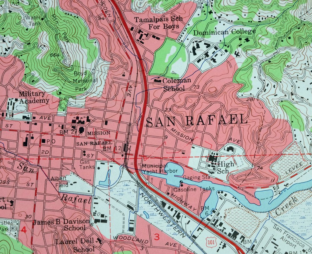
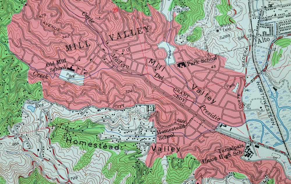
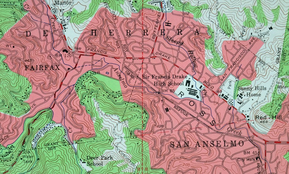
| PRINT NOTES | Includes woodland tint (green to indicate vegetated areas). A reddish tint is used to indicate urban areas where only landmark buildings are shown. |
| SCALE | 1:24000 |
| CONTOUR INTERVAL | 40 feet |
| SHEET DIMENSIONS | 22 x 27 inches |
| MAP DIMENSIONS | 18 x 22 3/4 inches |
| COVERAGE AREA | 7 x 9 miles |
| SHEET CONDITION For maps of this vintage, effort is made to note all visible flaws, no matter how minor. | |
| OVERALL CONDITION | Very Good |
| SHEET NOTES | lightly handled, never folded |
| MAP AREA | no wear, no markings, no blemishes |
| COLLARS | no markings, no blemishes, no edge tears, handling dents in top collar |
| MAP COVERAGE Quadrangle extent overlaid on current basemap. | |
| PLACENAMES Depending on map series and survey date, all of the features listed below may not be shown on this map. This list contains features that currently exist or historically existed within the area covered by the map. The list can be used as a reference to determine if this map covers your area of interest. Placenames are listed alphabetically next to each feature type. | |
| CITIES AND TOWNS (CURRENT) | Almonte, Corte Madera, Fairfax, Green Brae, Kentfield, Larkspur, Mill Valley, Muir Beach, Ross, San Anselmo, San Rafael, Santa Venetia, Strawberry, Tamalpais-Homestead Valley, and Tiburon |
| COUNTIES COVERED | Marin |
| FEDERAL LAND UNITS | California Coastal National Monument, Golden Gate National Recreation Area, and Muir Woods National Monument |
| RIVERS AND STREAMS | Arroyo Corte Madera Del Rprsidio, Bill Williams Creek, Bon Tempe Creek, Cascade Creek, Cataract Creek, Corte Madera Creek, Coyote Creek, Deer Park Creek, East Fork Cataract Creek, East Fork Lagunitas Creek, East Fork Swede George Creek, Fairfax Creek, Fern Creek, Lagunitas Creek, Larkspur Creek, Lone Tree Creek, Middle Fork Lagunitas Creek, Old Mill Creek, Phoenix Creek, Rattlesnake Creek, Redwood Creek, Ross Creek, San Anselmo Creek, San Rafael Creek, Sleepy Hollow Creek, Spike Buck Creek, Swede George Creek, Tamalpais Creek, Van Wyck Creek, and West Fork Lagunitas Creek |
| WATER BODIES | Alpine Lake, Bon Tempe Lake, Lake Lagunitas, and Phoenix Lake |
| Populated Place: Alto, Corte Madera, Escalle, Fairfax, Greenbrae, Manzanita, Murray Park, Ross, San Anselmo, Tamalpais Valley Junction, Almonte, Baltimore Park, Cerro, Chapman, Harbor Point, Kent Woodlands, Kentfield, Larkspur, Los Ranchitos, Manor, Meadowsweet, Mill Valley, Reed, San Rafael, Santa Venetia, Strawberry, Strawberry Manor, Tamalpais Valley, and Homestead Valley. Locations: Barths Retreat, Bootjack Camp, Camp Eastwood, Camp Lilienthal, Mountain Theater, Pan Toll Ranger Station, Rifle Camp, Tamarancho Boy Scout Camp, Van Wyck Camp, Bare Nose, Bay Tree Junction, Bellam Plaza Shopping Center, Bon Air Shopping Center, Eckerts Camp, Falkirk Community Center, Five Corners, Four Corners, Harbor Point Racquet and Beach Club, Harbor Shopping Center, Higgins Landing Small Craft Dock, Inspiration Point, Kentwoodlands Shopping Center, Lagunitas Country Club, Lagunitas Picnic Grounds, Larkspur Landing Shopping Center, Lee Shansky Camp, Marin Art and Garden Center, Marin Co-Op Shopping Center, Marin Square Shopping Center, Marin Town and Country Club, Meadow Country Club, Mill Valley Golf Course, Mill Valley Shopping Center, Montecito Plaza Shopping Center, North Knee, Paradise Shopping Center, Red Hill Shopping Center, San Rafael Community Center, San Rafael Improvement Club, San Rafael Yacht Club, Scott Valley Swim and Tennis Club, Sky Oaks Ranger Station, Strawberry Village Shopping Center, Tamalpais Junction Shopping Center, The Village at Corte Madera Shopping Center, Town Center Corte Madera Shopping Center, Tuckers Camp, and Village Square Shopping Center. Administrative Boundaries: Corte De Madera Del Presidio, Mission San Rafael, Punta De Quentin, City of Larkspur, City of Mill Valley, City of San Rafael, Ross Valley Division, Town of Corte Madera, Town of Fairfax, Town of Ross, and Town of San Anselmo. Mountains, Peaks, and Summits: Bald Hill, East Peak, Knob Hill, Mount Tamalpais, Pilot Knob, Red Hill, San Rafael Hill, West Point, Ballou Point, Bare Knoll, Bon Air Hill, Cardiac Hill, Grove Hill, Homestead Hill, King Mountain, Middle Peak, Moore Hill, Palm Hill, Ross Hill, Serpentine Point, Trojan Point, West Peak, and Wooded Knoll. Valleys and Canyons: Baltimore Canyon, Black Canyon, Fish Gulch, Homestead Valley, Kent Canyon, Mill Valley, Redwood Canyon, Ross Valley, Sleepy Hollow, Sun Valley, Tamalpais Valley, and Warner Canyon. Woods: Bohemian Grove, Cathedral Grove, Jim Wright Grove, and Miller Grove. Parks: Albert Field, Boyd Memorial Park, Gerstle Park, Mount Tamalpais Game Refuge, Mount Tamalpais State Park, Mountain Park, Muir Woods National Monument, Phoenix Lake Park, Alto Bowl Preserve, Baltimore Canyon Preserve, Bayfront Park, Beach Park, Blithdale Park, Blithdale Summit Preserve, Bolinas Park, Bon Air Landing Park, Bothin Marsh Preserve, Bret Harte Park, Brickyard Park, Camino Alto Preserve, Cascade Canyon Preserve, Cascade Park, Corte Madera State Ecological Reserve, Corte Madera Town Park, Creekside Park, Doc Edgar Park, Dolliver Park, Earnscliffe Park, Enchanted Knolls Park, Faude Park, Freeman Park, Granada Park, Hamilton Park, Heatherwood Park, Isabel Cook Recreation Center, King Mountain Preserve, Lonsdale Station Park, Magnolia Park, Menke Park, Molino Park, Niven Park, Norris Memorial Park, Oak Park, Old Mill Park, Piper Park, Robson Park, Ross Common Park, San Anselmo Memorial Park, San Pedro Mountain Preserve, Sorich Ranch Park, Strawberry Park, Sun Valley Park, Sycamore Park, and Tiburon Ridge Open Space Preserve. Trails: Ben Johnson Trail, Dipsea Trail, Eldridge Grade, North Side Trail, Alice Eastwood Trail, Arturo Trail, Baltimore Canyon Trail, Barbara Spring Trail, Benstein Trail, Bill Williams Trail, Bon Tempe Trail, Bootjack Trail, Colier Spring Trail, Corte Madera Trail, Cowboy Rock Trail, Eagle Trail, Fern Canyon Trail, Harry Allen Trail, Harvey Warne Trail, Hidden Cove Trail, Hillside Trail, Homestead Trail, Hoo-Koo-E-Koo Trail, Huckleberry Trail, International Trail, Lagunitas Fire Trail, Lost Trail, Matt Davis Trail, Miller Trail, Miwok Trail, Mountain Top Trail, Nora Trail, Ocean View Trail, Panoramic Trail, Redwood Trail, Rock Spring Trail, Rocky Point Trail, Ross Trail, Sierra Trail, Simmons Trail, Steep Ravine Trail, Sun Trail, Sunnyside Trail, Temelpa Trail, Tenderfoot Trail, Throckmorton Trail, Troop 80 Trail, Tucker Trail, Verna Dunshee Trail, Vic Haun Trail, West Point Trail, and Zig Zag Trail. Drainages: Arroyo Corte Madera Del Presidio, Bill Williams Creek, Bon Tempe Creek, Bootjack Creek, Bothin Creek, Carey Camp Creek, Cascade Creek, Cold Stream, Corte Madera Creek, Coyote Creek, Deer Park Creek, East Fork Fern Creek, East Fork Lagunitas Creek, Fairfax Creek, Fern Creek, Laguna Creek, Larkspur Creek, Lone Tree Creek, Middle Fork Lagunitas Creek, Old Mill Creek, Phoenix Creek, Rattlesnake Creek, Ross Creek, San Anselmo Creek, Sleepy Hollow Creek, Spike Buck Creek, Tamalpais Creek, Van Wyck Creek, West Fork Fern Creek, West Fork Lagunitas Creek, West Fork Swede George Creek, Galena Creek, and Kent Creek. Islands: Gull Rock, Richardson Island, Silva Island, Simms Island, and Wood Island. Capes: Strawberry Point and Pine Point. Churches: Calvary Baptist Church, Church of Christ, Church of Our Lady of Mount Carmel, Church of Our Savior, Church of the Nazarene, Fairfax Community Church, Federated Community Church of Mill Valley, First Baptist Church, First Church of Christ Scientist, First Presbyterian Church, Mission San Rafael Arcangel, Montgomery Memorial Chapel, Redwoods Presbyterian Church, Saint Anselms Catholic Church, Saint Johns Episcopal Church, Saint Nicholas Orthodox Church, Saint Patricks Catholic Church, Saint Pauls Episcopal Church, Saint Raphaels Roman Catholic Church, Saint Ritas Roman Catholic Church, San Rafael Methodist Church, Seventh Day Adventist Church, and Trinity Lutheran Church. Post Office: Corte Madera Post Office, Fairfax Post Office, Larkspur Post Office, Mill Valley Post Office, Ross Post Office, San Anselmo Post Office, San Rafael Post Office, Civic Center San Rafael Post Office, Kentfield Post Office, and Mission Rafael Post Office. Harbors: Kappas Yacht Harbor and San Rafael Yacht Harbor. Hospitals: Marin County Health Center, Marin General Hospital, San Rafael General Hospital, and Kentfield Rehabilitation and Specialty Hospital. Buildings: Marin County Civic Center, Angelic Hall, Archbishop Alemany Library, Civic Center Regional Library Marin County Free Library, Corte Madera Regional Branch Marin County Free Library, Corte Madera Town Hall, Fairfax Regional Branch Marin County Free Library, Forest Meadows Performing Arts Center, Foster Hall, Guzman Hall, Harlan Hall, Larkspur City Hall, Larkspur Ferry Terminal, Larkspur Public Library, Marin County Courthouse, Marin County Historical Society Archives and Library, Marin County Historical Society Museum, Mill Valley City Hall, Mill Valley Public Library, Mill Valley Youth Center, Robson House, Ross Town Hall, Saint Ritas Meeting Hall, Saint Thomas Hall, San Anselmo Public Library, San Anselmo Town Hall, San Rafael City Hall, San Rafael Fire Department Station 1, San Rafael Public Library, Sunny Hills Orphanage, American Medical Response, California Highway Patrol Golden Gate Division - Marin, Central Marin Police Authority - Corte Madera Bayside Substation, Central Marin Police Authority - Larkspur Station, City of Larkspur Fire Department, College of Marin Campus Police Department, Corte Madera Fire Department Station 13, Corte Madera Fire Department Station 14, Fairfax Police Department, Kentfield Fire Protection District, Marin County Fire Department Throckmorton Ridge Station, Marin County Sheriff's Office Kentfield Substation, Marin County Sheriff's Office San Rafael, Mill Valley Fire Department Station 6, Mill Valley Fire Department Station 7 Headquarters, Mill Valley Police Department, Ross Fire Department, Ross Police Department, Ross Valley Fire Department Station 19 Headquarters, Ross Valley Fire Department Station 20, Ross Valley Fire Department Station 21, Saint Josephs Ambulance Service, San Anselmo Police Department, San Rafael Fire Department Station 2, San Rafael Fire Department Station 4, San Rafael Fire Department Station 7, Southern Marin Fire Protection District Station 4 Tamalpais Valley, and Southern Marin Fire Protection District Station 9 Headquarters. Waterfalls: Dawn Falls and Kent Falls. Dams: Cascade Dam, Belvedere 1077 Dam, Bon Tempe 33-006 Dam, Lagunitas 33-002 Dam, and Phoenix Lake 33-003 Dam. Channels: Corte Madera Channel. Bridges: Alexander-Acacia Bridge. Bays: Municipal Yacht Harbor and Pickleweed Inlet. Airports: Commodore Center Heliport and Commodore Center Seaplane Base. Swamps: Hidden Lake and Shorebird Marsh. Census: Kentfield Census Designated Place, Strawberry Census Designated Place, Tamalpais-Homestead Valley Census Designated Place, and Alto Census Designated Place. Schools: Alto School, Anthony G Bacich Elementary School, Blessed Sacrament School, Coleman Elementary School, College of Marin, Cook School, Deer Park School, Dominican University of California, Hall Middle School, Hartzell School, Homestead School, James B Davidson Middle School, Laurel Dell Elementary School, Manor Elementary School, Nova Albion School, Old Mill Elementary School, Park Elementary School, Redwood High School, Saint Rita School, San Francisco Theological Seminary, Short School, Sir Francis Drake High School, Strawberry Point Elementary School, Sun Valley Elementary School, Tamalpais High School, Tamalpais School for Boys, The Branson School, West End School, Adaline E Kent Middle School, Brookside Elementary School, Edna Maguire Elementary School, Lansdale Public School, Madrone High Continuation School, Marin Academy, Marin Primary and Middle School, Mewah Mountain Opportunity High School, Mill Valley Middle School, Mount Carmel School, Neil Cummins Elementary School, Redhill School, Ross School, Saint Anselm School, Saint Patrick School, Saint Raphael Elementary School, San Andreas High School, San Rafael Adult Education School, San Rafael High School, Seminary At Strawberry, Tamiscal High School, The Cedars School, Wade Thomas Elementary School, Brandeis Hillel Day School, Cascade Canyon School, Corte Madera Montessori School, Greenwood School, James R Sylla School, Kumara School, Marin Catholic High School, Marin Horizon School, Montessori School of Central Marin County, Mount Tamalpais School, North Bay Marin School, Phoenix Academy, Ring Mountain Day School, Ross Academy Montessori School, Saint Academy Learning Disability School, Saint Anselm Elementary School, San Anselmo Montessori School, The Allaire School, The Marin School, and The Mountain School. Ridges: Blithedale Ridge, Blue Ridge, Bolinas Ridge, Corte Madera Ridge, Pams Blue Ridge, Rocky Ridge, Southern Heights Ridge, and Windy Ridge. Reservoirs and Tanks: Bon Tempe Lake, Lake Lagunitas, Phoenix Lake, Forbes Hill Reservoir, and Mill Valley Reservoir. Military: Mill Valley Air Force Station. Flats: Double Bowknot, Potrero Meadows, Azalea Flat, Bon Tempe Meadow, and Van Wyck Meadow. Towers: KSRH-FM (San Rafael) and KTID-FM (San Rafael). Pillars: Council Rock. Springs: Colier Spring, Iron Spring, Rock Springs, and Lone Tree Spring. Cemetery: Fernwood Cemetery and Mount Tamalpais Cemetery. | |
| SHIPPING AND RETURNS | |
 This map sheet will be carefully rolled in a sturdy tube and shipped via the US Postal Service. If you find that the sheet you receive is not as described in the listing, you may ship it back to us for a refund of the purchase price. | |
San Rafael California Mill Valley Tiburon USGS Topo Map 1966
$60
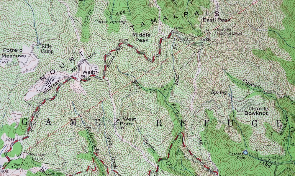
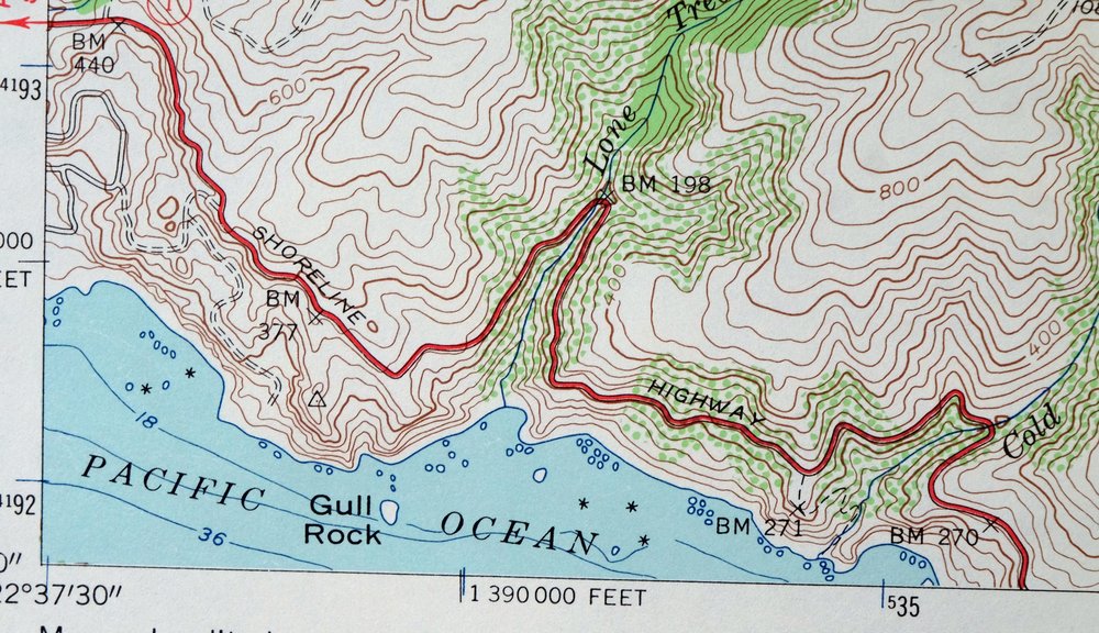
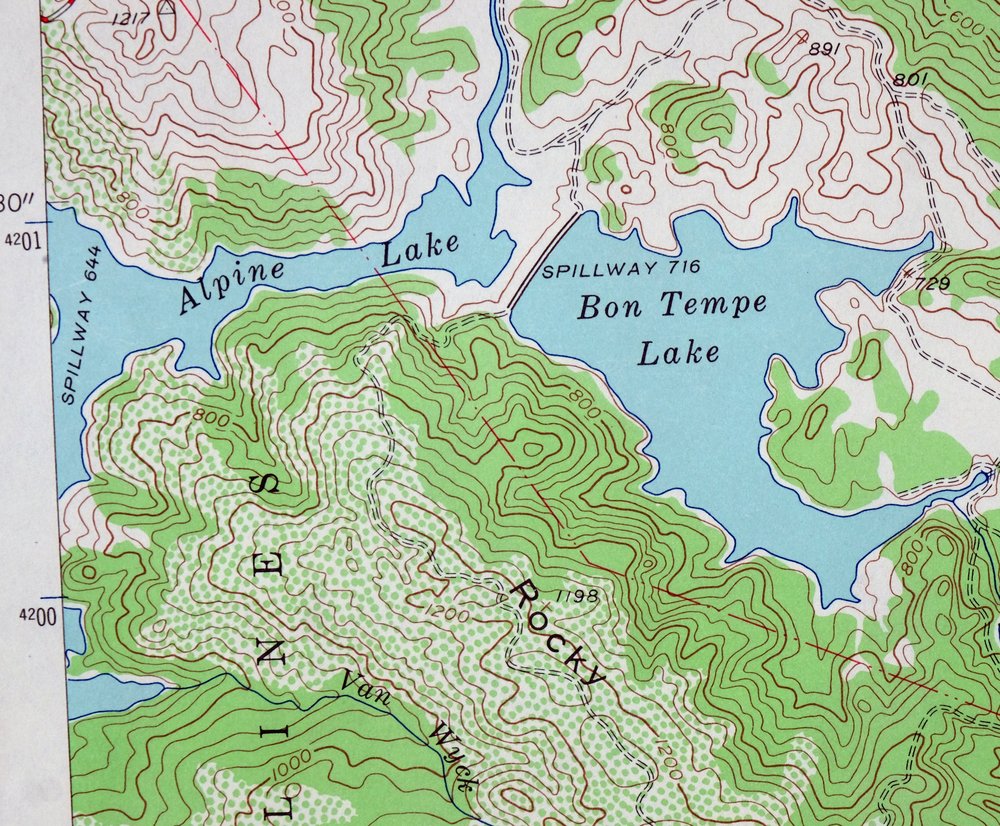
This USGS 7.5-minute topographic map is a 1954 edition printed in 1966, a sheet that was never folded and has been lightly handled, in very good condition. Covering Marin County across the water from San Francisco, the quad area takes in San Rafael, Mill Valley, San Anselmo, Larkspur, and the smaller communities of Corte Madera, Tiburon, and Fairfax, along with part of Muir Woods National Monument. The 40-foot contours trace the steep coastal terrain that rises toward Mount Tamalpais, giving a clear read of how these towns sit tucked among the hills and inlets north of the Golden Gate. Because it was never folded, this sheet lies flat and would frame well.
In stock
This vintage sheet is a 1954 edition of the San Rafael California USGS topographic map. It is an original 60-year-old 1966 United States Geological Survey print in very good condition.
HOW THIS MAP CAN BE USED
In addition to making a fascinating conversation piece, this sheet would look great in a frame or on display, make a unique and prized gift for anyone interested in this area, be perfect as a reference for genealogy studies or general historical research, or fill that missing piece in your collection. Maps of this vintage are printed on durable stock and are well-suited for outdoor activities and recreation of all kinds, including hiking, backpacking, hunting, rafting and kayaking, backcountry skiing, geocaching, general exploration, treasure hunting, etc.
FEATURES SHOWN ON THE MAP
The San Rafael 7.5-minute map shows cities and towns, roads, paths, railroads, utilities and energy infrastructure, rivers, creeks, elevation contour lines, public land survey lines, county, state, and other administrative boundaries as they existed at the time of the survey in 1952 and 1954. A reddish tint is used on this sheet to indicate urban areas where only landmark buildings are depicted. Outside of those areas, all known structures (houses, businesses, churches, schools, barns, cabins, etc) are shown.
A VALUABLE HISTORICAL RECORD
This map is from the 7.5-minute series, the most detailed series that is widely available from the USGS. The 1954 San Rafael map is a valuable historical record for the area. It contains some placenames and features that have been dropped from more recent maps.
Nearby maps
-
San Quentin California Richmond Tiburon USGS Topo Map 1980
$46 Add to cart -
Point Bonita California Sausalito USGS Topographic Map 1955
$44 Add to cart -
Petaluma Point California Novato USGS Topographic Map 1951
$30 Add to cart -
San Francisco South California USGS 7.5-Min Topo Map 1975
$47 Add to cart -
Hunters Point California Oakland USGS Topographic Map 1969
$38 Add to cart -
Port Chicago California Concord Martinez USGS Topo Map 1956
$38 Add to cart -

Redwood Point California Fremont Hayward USGS Topo Map 1948
$24 Add to cart -

Newark California Fremont Hayward USGS Topo Map 1948 Vintage
$47 Add to cart -
Mount Vaca California Fairfield Vacaville USGS Topo Map 1967
$40 Add to cart -
Pittsburg California Concord Fairfield USGS Topo Map 1965
$38 Add to cart -
Palo Alto California Redwood City Ladera USGS Topo Map 1969
$45 Add to cart -
Mindego Hill California Palo Alto USGS Topo Map 1980 Vintage
$32 Add to cart -
Lakeport California Lucerne Nice USGS Topo Map 1977 Vintage
$44 Add to cart -
Stonyford California USGS 15-Min Topo Map 1967 Vintage
$39 Add to cart -

Cressey California Livingston Delhi USGS Topo Map 1948
$23 Add to cart -
Gridley California Oroville Live Oak USGS Topo Map 1959
$37 Add to cart -
Fruto California Stony Creek Nye Creek USGS Topo Map 1944
$30 Add to cart -

Merced California Planada USGS 15-Min Topo Map 1963 Vintage
$18 Add to cart -

Chowchilla California Le Grand El Nido USGS Topo Map 1962
$20 Add to cart -
Greenfield California Salinas River USGS Topo Map 1973
$30 Add to cart -

Jawbone Ridge California Buck Meadows USGS Topo Map 1949
$27 Add to cart -

Richardson Springs California Chico Nord USGS Topo Map 1966
$35 Add to cart -

Firebaugh California Mendota USGS Topo Map 1947 Vintage
$18 Add to cart -
Kentucky Well California USGS 7.5-Min Topo Map 1948 Vintage
$32 Add to cart
