MAP DETAILS | |
|---|---|
| TITLE | Bearden |
| STATE | Tennessee |
| LOCATION | Vicinity of Knoxville |
| SERIES | 7.5-minute |
| SURVEYED | 1953 and 1966 Aerial and Field Survey |
| GEOGRAPHER | Tennessee Valley Authority |
| EDITION | 1966 |
| PRINTED | 1968 |
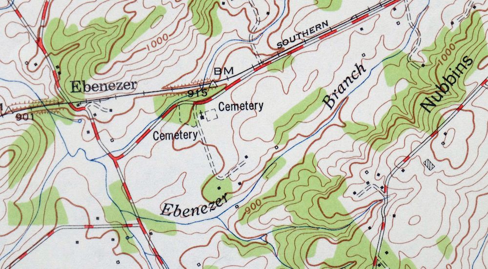
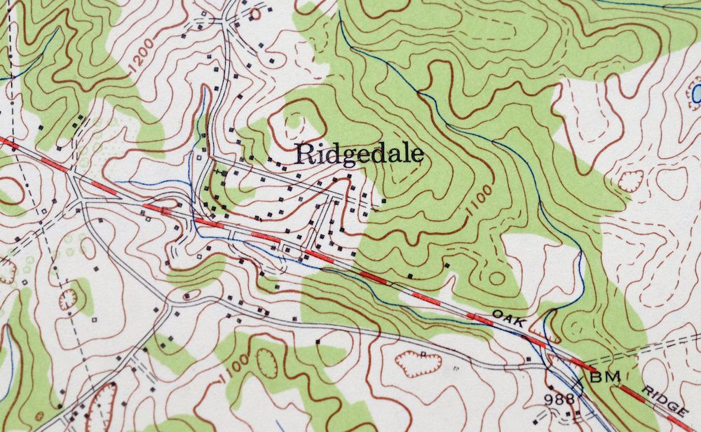
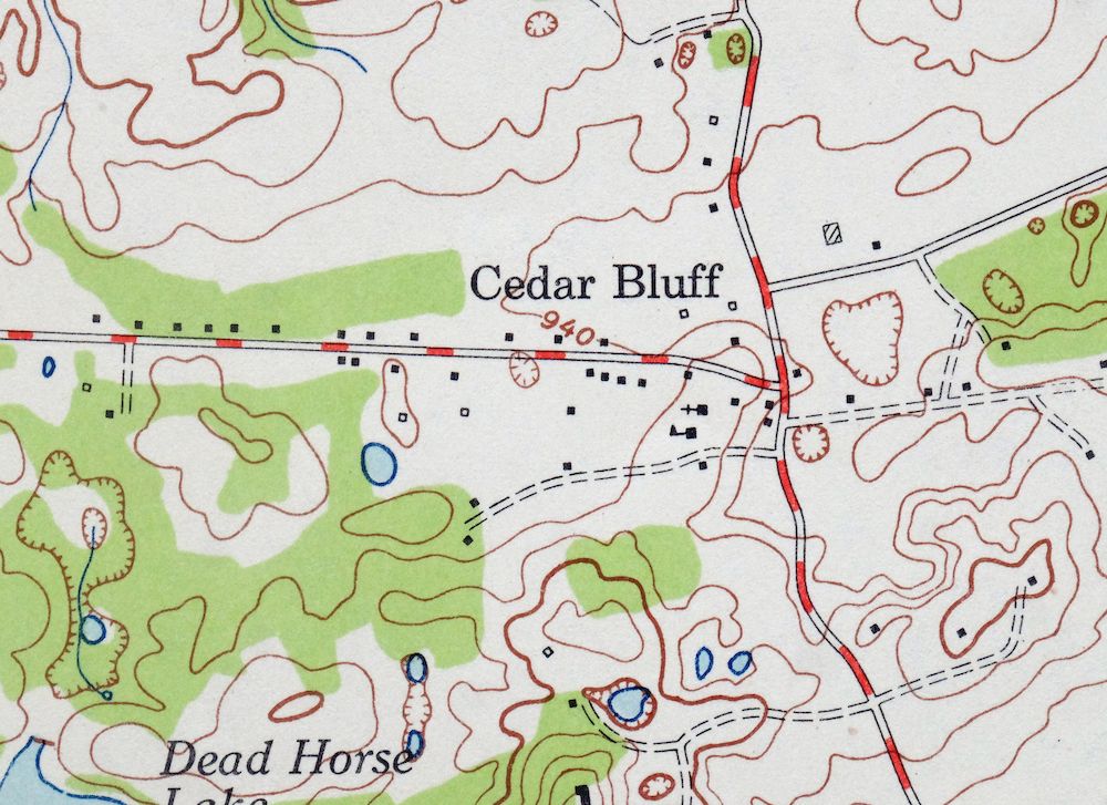
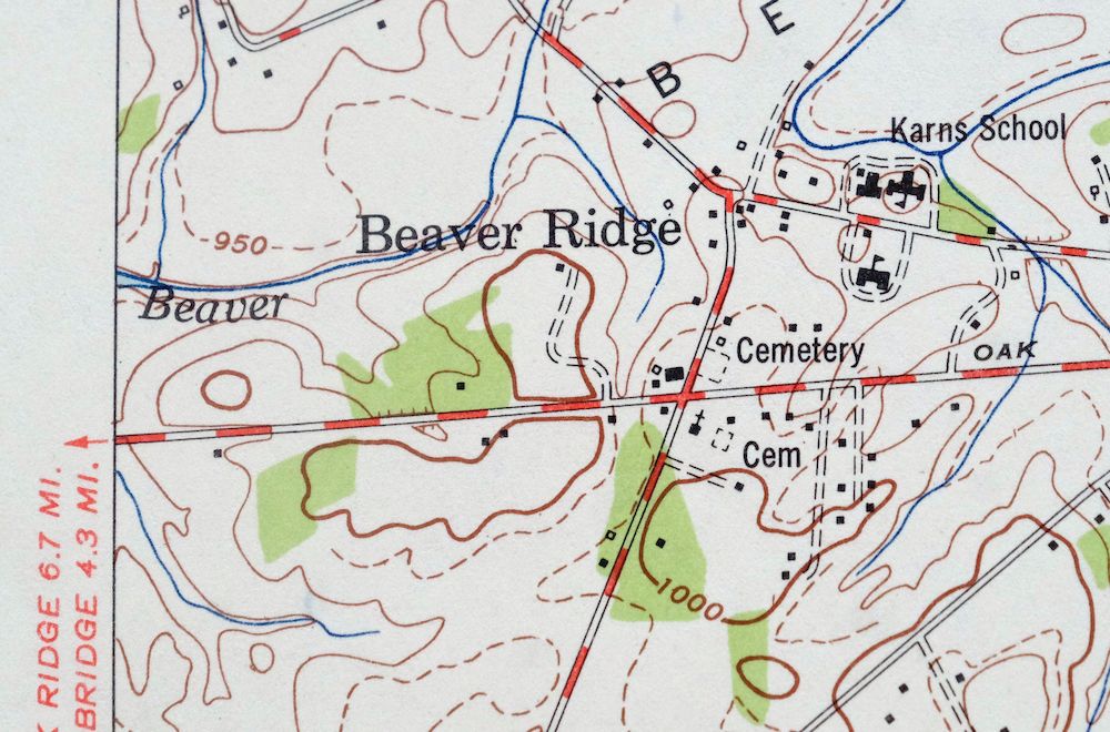
| PRINT NOTES | Thick paper stock, includes woodland tint (green to indicate vegetated areas). A reddish tint is used to indicate urban areas where only landmark buildings are shown. |
| SCALE | 1:24000 |
| CONTOUR INTERVAL | 20 feet |
| SHEET DIMENSIONS | 22 x 27 inches (approximate) |
| MAP DIMENSIONS | 18 1/2 x 22 3/4 inches |
| COVERAGE AREA | 7 x 9 miles |
| SHEET CONDITION For maps of this vintage, effort is made to note all visible flaws, no matter how minor. | |
| OVERALL CONDITION | Very Good |
| SHEET NOTES | lightly handled, never folded |
| MAP AREA | flawless map area |
| COLLARS | no wear or tears, no markings, no blemishes, library stamps in bottom right collar |
| MAP COVERAGE Quadrangle extent overlaid on current basemap. | |
| PLACENAMES Depending on map series and survey date, all of the features listed below may not be shown on this map. This list contains features that currently exist or historically existed within the area covered by the map. The list can be used as a reference to determine if this map covers your area of interest. Placenames are listed alphabetically next to each feature type. | |
| CITIES AND TOWNS (CURRENT) | Alcoa, Karns, and Knoxville |
| COUNTIES COVERED | Anderson, Blount, and Knox |
| FEDERAL LAND UNITS | Fort Loudoun Lake |
| RIVERS AND STREAMS | Beaver Creek, Ebenezer Branch, Fourth Creek, Grassy Creek, Meadow Creek, Sinking Creek, Tennessee River, Third Creek, and Turkey Creek |
| WATER BODIES | Cheoah Lake, Dead Horse Lake, and Fort Loudoun Lake |
| Locations: Bearden Shopping Centery, Cedar Bluff Shopping Center, Cedar Springs Shopping Center, Cumberland Estates Shopping Center, Dead Horse Lake Golf Course, Deane Hill Golf and Country Club, Fox Road Dock, Knoxville Boat Club Dock, Middlebrook Industrial Park, Montvue Shopping Center, Rocky Hill Shopping Center, Statesview, Suburban Shopping Center, Walker Springs Plaza Shopping Center, West Town Mall, and Zion Childrens Home. Valleys and Canyons: Badgett Hollow and Red Hollow. Parks: Ball Camp Park, Karns Community Park, Ridgedale Community Park, Rocky Hill Park, and West Hills Park. Drainages: Beardens Creek, Ebenezer Branch, and Ten Mile Creek. Mines: Cedar Bluff Quarry. Churches: Bethel Church, Ball Camp Baptist Church, Ball Road Church, Beaver Ridge Church, Bethlehem Star Church, Byington Church, Calvary Church, Campground Chapel, Cedar Bluff Church, Cedar Cliff Church, Cedar Springs Church, Central Baptist Church of Bearden, Churhc of the Savior, Cokesburry Church, Ebenezer Church, Everhard Mission Church, Faith Church, First Church of the Nazarene, First Cumberland Presbyterian Church, Gallaher Memorial Baptist Church, Good Samaritan Church, Grace Church, Gradys Chapel, Grove Hill Church, Karns Church, Lakeview Church, Mars Hill Church, Middlebrook Pike Church, Montwood Church, New Covenant Church, Northshore Church, Piney Grove Church, Rocky Hill Baptist Church, Saint Marks Church, Sullivan Road Christian Church, Tekoa Church, Third Creek Baptist Church, Valley Grove Church, Walridge Church, West Emory Church, West End Church, West Hills Church, West Hills Presbyterian Church, West Knoxville Church, West Towne Church, and Wrights Ferry Church. Hospitals: Northwest General Hospital and Park West Hospital. Lakes and Ponds: Dead Horse Lake, Kirby Lake, and Lake Mary Ella. Buildings: Appalachian Child Development Center, Arnstein Community Center, Fire Station Number 1, Fire Station Number 15, Fire Station Number 16, Fire Station Number 4, and West Side YMCA. Dams: Jimmy Baisley Lake Dam. Crossings: Beaver Ford, Interchange 376, Interchange 378, Interchange 379, Interchange 380, and Interchange 383. Bluffs: Cedar Bluff and Wright Bluff. Gaps: Cheneworth Gap and Dye Stone Gap. Airports: Tan Rara Airport. Schools: Amherst School, Pleasant Ridge Elementary School, Ball Camp Elementary School, Bearden High School, Bearden Junior High School, Blue Grass Elementary School, Cedar Bluff Intermediate School, Cedar Bluff Middle School, Cedar Bluff Primary School, Cedar Bluff Schools, Hospital School, Karns High School, Karns Intermediate School, Karns Middle School, Karns Primary School, Lillian A Pedigo School, Ridgedale Elementary School, Rocky Hill Elementary School, Sacred Heart Church and School, Tates School, Webb School, West End Academy, and West Hills Elementary School. Ridges: Beaver Ridge, Blackoak Ridge, and Nubbin Ridge. Reservoirs and Tanks: Bradley Lake, Bud Hodge Lake, and Jimmy Baisley Lake. Springs: Duncan Spring, Eldridge Spring, Fox Spring, Johnson Spring, Maxwell Spring, Oehler Springs, Roberts Spring, Schaad Spring, and Walker Springs. | |
| SHIPPING AND RETURNS | |
 This map sheet will be carefully rolled in a sturdy tube and shipped via the US Postal Service. If you find that the sheet you receive is not as described in the listing, you may ship it back to us for a refund of the purchase price. | |
Bearden Tennessee Knoxville Alcoa USGS Topo Map 1968 Vintage
$58
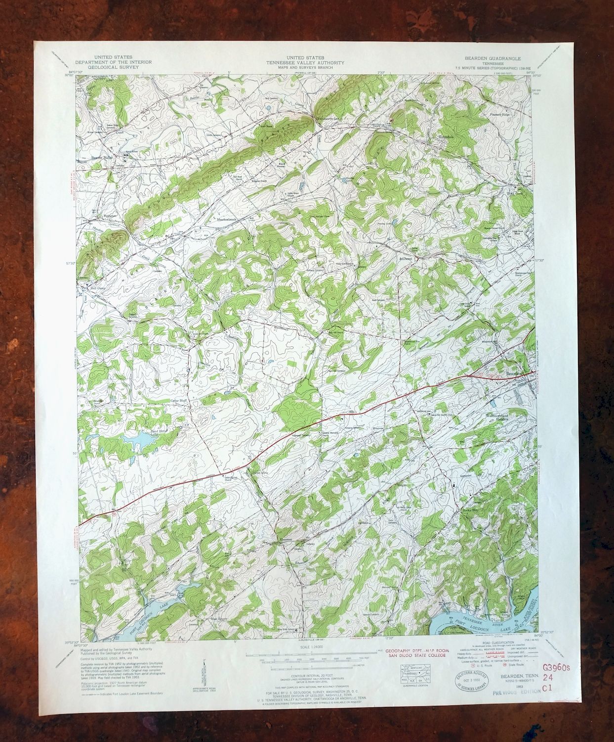
This 1966 edition, printed in 1968, is a USGS 7.5-minute topographic map produced with the Tennessee Valley Authority as geographer, and the sheet is in very good condition: lightly handled, never folded, with a flawless map area and library stamps in the bottom right collar. Covering the Knoxville vicinity in East Tennessee, the quad takes in parts of Knox, Anderson, and Blount counties and includes the western side of Knoxville along with Fort Loudoun Lake, the town of Alcoa, and the community of Karns. Drawn from 1953 and 1966 aerial and field survey, it records the suburban west end of Knoxville at mid-century, and the thick stock and never-folded condition make it well suited to framing.
In stock
This vintage sheet is a 1966 edition of the Bearden Tennessee USGS topographic map. It is an original 58-year-old 1968 United States Geological Survey print in very good condition.
HOW THIS MAP CAN BE USED
In addition to making a fascinating conversation piece, this sheet would look great in a frame or on display, make a unique and prized gift for anyone interested in this area, be perfect as a reference for genealogy studies or general historical research, or fill that missing piece in your collection. Maps of this vintage are printed on durable stock and are well-suited for outdoor activities and recreation of all kinds, including hiking, backpacking, hunting, rafting and kayaking, backcountry skiing, geocaching, general exploration, treasure hunting, etc.
FEATURES SHOWN ON THE MAP
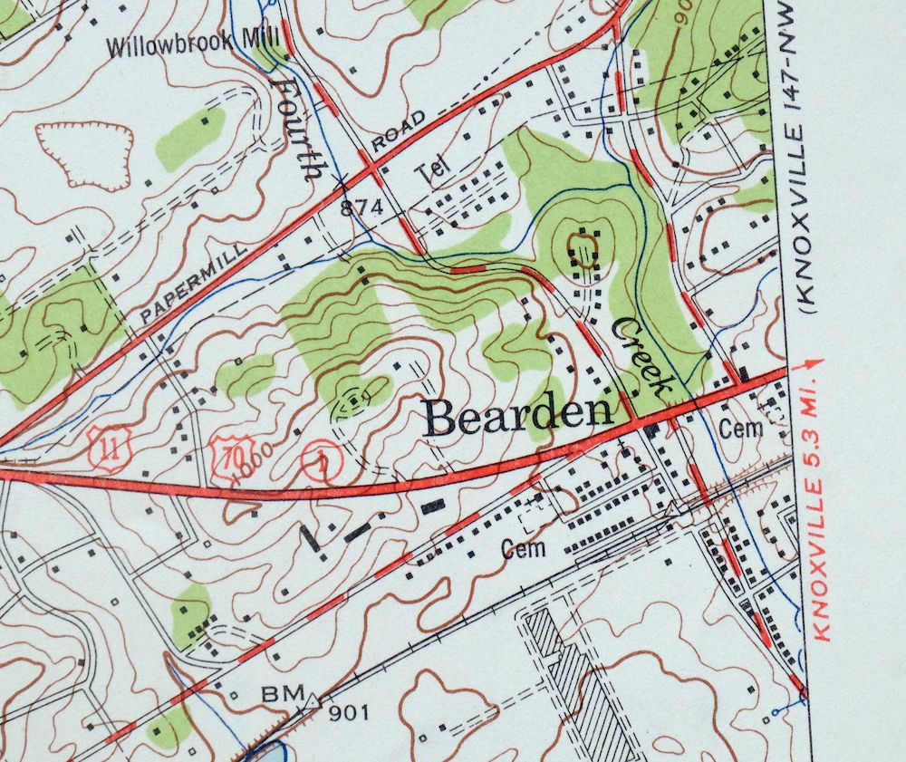
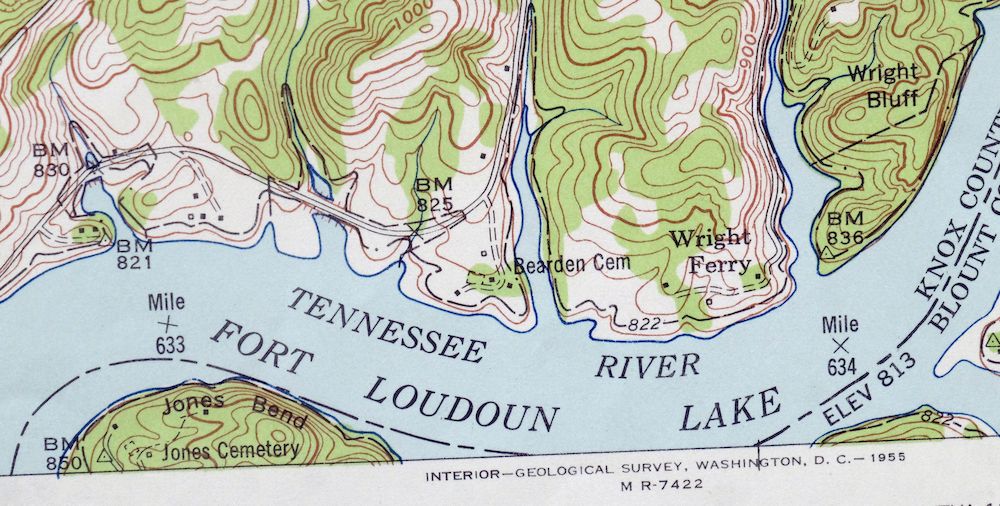
The Bearden 7.5-minute map shows cities and towns, roads, paths, railroads, utilities and energy infrastructure, rivers, creeks, elevation contour lines, public land survey lines, county, state, and other administrative boundaries as they existed at the time of the survey in 1953 and 1966. A reddish tint is used on this sheet to indicate urban areas where only landmark buildings are depicted. Outside of those areas, all known structures (houses, businesses, churches, schools, barns, cabins, etc) are shown.
A VALUABLE HISTORICAL RECORD
This map is from the 7.5-minute series, the most detailed series that is widely available from the USGS. The 1966 Bearden map is a valuable historical record for the area. It contains some placenames and features that have been dropped from more recent maps.
Nearby maps
-

Fountain City Tennessee Knoxville Halls USGS Topo Map 1955
$39 Add to cart -
Shooks Gap Tennessee Knoxville Seymour USGS Topo Map 1955
$38 Add to cart -

John Sevier Tennessee Knoxville Mascot USGS Topo Map 1955
$38 Add to cart -
East Cleveland Tennessee Climer USGS Topographic Map 1966
$34 Add to cart -
South Cleveland Tennessee Hopewell USGS Topographic Map 1966
$38 Add to cart -
Cookeville West Tennessee Westgate Baxter USGS Topo Map 1975
$42 Add to cart -
East Chattanooga Tennessee Cannondale USGS Topo Map 1959
$38 Add to cart -
Manchester Kentucky Booneville McKee USGS Topo Map 1917
$51 Add to cart -
Tigerville South Carolina Tryon USGS Topographic Map 1973
$20 Add to cart -

Whitesburg Kentucky Pikeville Cumberland USGS Topo Map 1910
$115 Add to cart -
Inman South Carolina Boiling Springs USGS Topo Map 1964
$45 Add to cart -

Greer South Carolina Simpsonville Duncan USGS Topo Map 1974
$32 Add to cart -

Salyersville Kentucky West Liberty Zag USGS Topo Map 1918
$47 Add to cart -
Walterhill Tennessee Murfreesboro Smyrna USGS Topo Map 1984
$27 Add to cart -
Antioch Tennessee Brentwood USGS Topographic Map 1971
$48 Add to cart -
Nashville East Tennessee Lakewood USGS Topo Map 1959 Vintage
$40 Add to cart -

Goodlettsville Tennessee Lakewood USGS Topographic Map 1953
$41 Add to cart -

Farmington Tennessee Chapel Hill USGS Topo Map 1968 Vintage
$36 Add to cart -

Nashville West Tennessee Whitebridge USGS Topo Map 1971
$42 Add to cart -

Warfield West Virginia Pikeville Harts USGS Topo Map 1911
$105 Add to cart -

Wytheville Virginia Marion Sparta USGS Topo Map 1907 Antique
$105 Add to cart -

Kenova Kentucky Louisa Grayson USGS Topo Map 1912 Antique
$54 Add to cart -

Wayne West Virginia Dunlow Cove Gap USGS Topo Map 1909
$42 Add to cart -

Oceana West Virginia Logan Gilbert USGS Topographic Map 1912
$58 Add to cart