MAP DETAILS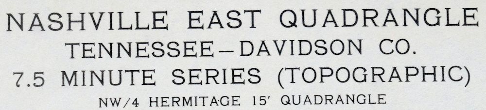 | |
|---|---|
| TITLE | Nashville East |
| STATE | Tennessee |
| SERIES | 7.5-minute |
| SURVEYED | 1951 and 1957 Aerial and Field Survey |
| EDITION | 1957 |
| PRINTED | 1959 |
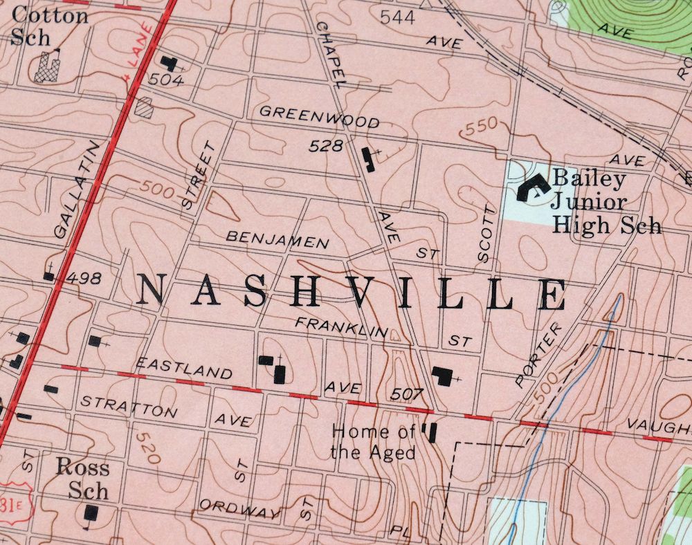
| PRINT NOTES | Thick paper stock, includes woodland tint (green to indicate vegetated areas). A reddish tint is used to indicate urban areas where only landmark buildings are shown. |
| SCALE | 1:24000 |
| CONTOUR INTERVAL | 10 feet |
| SHEET DIMENSIONS | 22 x 27 inches (approximate) |
| MAP DIMENSIONS | 18 3/8 x 22 3/4 inches |
| COVERAGE AREA | 7 x 9 miles |
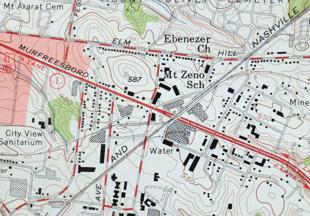
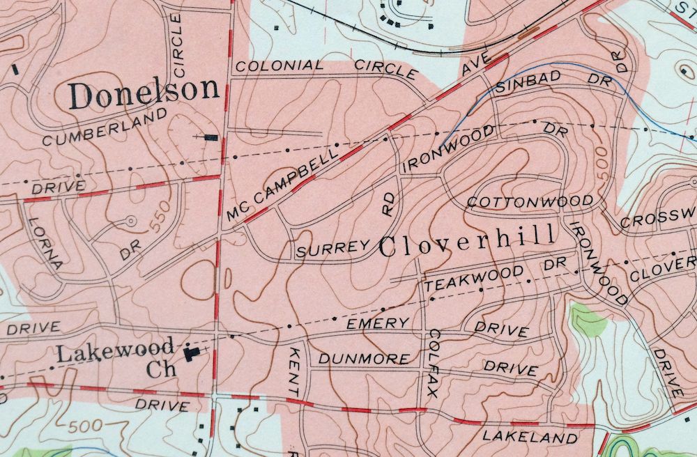
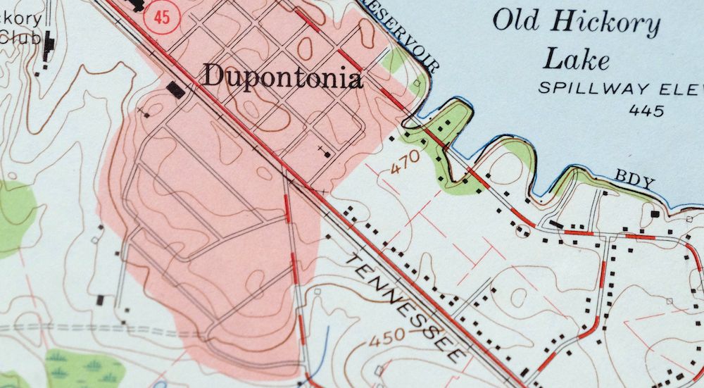
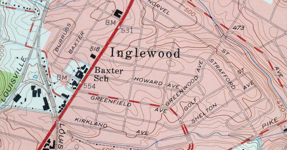
| MAP NOTES | A fascinating historical snapshot of the area from Nashville eastward, showing historic travel routes, river crossings, rail lines, and placenames. |
| SHEET CONDITION For maps of this vintage, effort is made to note all visible flaws, no matter how minor. | |
| OVERALL CONDITION | Good |
| SHEET NOTES | never folded |
| MAP AREA | flawless map area |
| COLLARS | repaired edge tear in bottom right collar, minor handling and storage wear in bottom collar, library stamps and penciled notation in collar |
| MAP COVERAGE Quadrangle extent overlaid on current basemap. | |
| PLACENAMES Depending on map series and survey date, all of the features listed below may not be shown on this map. This list contains features that currently exist or historically existed within the area covered by the map. The list can be used as a reference to determine if this map covers your area of interest. Placenames are listed alphabetically next to each feature type. | |
| CITIES AND TOWNS (CURRENT) | Lakewood and Nashville-Davidson |
| COUNTIES COVERED | Davidson |
| FEDERAL LAND UNITS | J. Percy Priest Lake and Old Hickory Lake |
| RIVERS AND STREAMS | Browns Creek, Cumberland River, Ewing Creek, Gibson Creek, McCrory Creek, Mill Creek, Pages Branch, Sims Branch, Stoners Creek, and Stones River |
| WATER BODIES | Cheek Lake, J. Percy Priest Lake, and Old Hickory Lake |
| Locations: Crescent Plaza Shopping Center, Burrs Landing, Donelson Plaza Shopping Center, Due West Shopping Center, Home of the Aged, Lakewood Marina, Old Hickory Golf Club, Opryland Dock, Ravenwood Country Club, Riverview Golf Course, Two Rivers Golf Club, and Woodyard Landing. Mountains, Peaks, and Summits: Fosters Hill and Todd Knob. Parks: Lock Two Park, Nashville Shores Recreation Area, Opryland, Peeler Park, Shelby Park, Shelby Park Access Area, South Inglewood Park, and Two Rivers Park. Trails: Nawakwa Trail. Drainages: Cooper Creek, Browns Creek, Gibson Creek, Loves Branch, McCrory Creek, Mill Creek, Sims Branch, Stoners Creek, and Stones River. Islands: Crab Island. Churches: Abundant Life Church of God, Bethel Church, Berryville Church, Bible Christian Academy, Bible Pentecostal Church, Body of Christ Church, Broadmoor Baptist Church, Brush Hill Church, Calvary Assembly of God Church, Central Baptist Church, Chapel Avenue Church of Christ, Dalebrook Lane Church of Christ, Dalewood Baptist Church, Donelson Christian Church, Donelson Church, Donelson Church of Christ, Donelson Church of God, Donelson Church of the Nazarene, Donelson Cumberland Presbyterian Church, Donelson Heights United Methodist Church, Donelson Presbyterian Church, Donelson View Baptist Church, East End United Methodist Church, East Nashville General Baptist Church, East Nashville United Pentecostal Church, East Side Church of Christ, Eastland Baptist Church, Eastland Church of Christ, Eastminster Presbyterian Church, Eastwood Christian Church, Eastwood Church, Ebenezer Church, Fatherland Street Church of the Nazarene, First Baptist Church of Donelson, First Baptist Church of South Inglewood, Fosters Chapel, Gallatin Road Baptist Church, Gateway Church, Gospel Truth Missionary Baptist Church, Harmony Missionary Baptist Church, Harsh Church, Hickory Bend Church, Hobson United Methodist Church, Holy Rosary Catholic Church, Home Mission Holiness Church, Inglewood Baptist Church, Inglewood Church of the Nazarene, Inglewood Presbyterian Church, Inglewood United Methodist Church, Jackson Park Church, Jesus Only Tabernacle, Kern Memorial United Methodist Church, Lakewood Church, Lincoya Hills Baptist Church, Lockeland Baptist Church, Lyle Lane Baptist Chapel, Lyle Lane Church, Memorial Lutheran Church, Miracle Worker Temple, Morrison Church, Mount Calvary Church, Neelys Bend Church, New Freedon Missionary Baptist Church, Our Lords Church, Pennington Bend Church, Pennington Church, Perry Heights Church of Christ, Porter Heights Baptist Church, Price Memorial Church, Riverside Baptist Church, Riverside Drive Church of Christ, Riverwood Church of Christ, Rosebank Church, Saint James African Methodist Episcopal Church, Saint James the Less Episcopal Church, Saint Johns Church, Saint Philips Episcopal Church, Scott Avenue Church of Christ, Shelby Avenue Church of Christ, Temple Baptist Church, Trinity Lane Church of Christ, Two Rivers Church, Valley View Church, Vultee Church of Christ, Wayman Chapel, Woodbine Freewill Baptist Church, and Woodland Presbyterian Church. Hospitals: Clover Bottom Hospital, Donelson Hospital, Edgefield Hospital, and Middle Tennessee Hospital. Lakes and Ponds: Cheek Lake and Meadowbrook Lake. Buildings: Nashville Pumping Station and Filtration Plant and Shelby Park Community Center. Dams: Cheek Dam and Two Rivers Lake Dam. Crossings: Hocketts Ford, Interchange 10, Interchange 11, Interchange 12, Interchange 14, Interchange 15, Interchange 213, Interchange 215, Interchange 216, Interchange 5, Interchange 52, Interchange 6, Interchange 7, Interchange 8, and Old Donelson Horse Ford. Bridges: Pennington Bend Bridge. Bends: Clover Bottom, McLeans Bend, Neelys Bend, and Pennington Bend. Airports: Cornelia Fort Airpark, Nashville International Airport, and Nashville Memorial Hospital Airport. Schools: Allen School, Bailey Junior High School, Cora Howe Elementary School, Cotton School, Clover Bottom School, Dalewood School, Donelson Christian School, Donelson Junior High School, Donelson Primary School, Gar-Mar School, Glenview School, Goodpasture School, Gra-Mar Elementary School, Hermitage Elementary School, Hickman Elementary School, Holy Rosary School, Inglewood School, Isaac Litton High School, Issac Linton High School, Issac Litton Middle School, Jere Baxter Middle School, Lockeland School, Maplewood High School, McGavock Elementary School, McGavock High School, Mills School, Mount Zeno School, Nashville College, Neelys Bend Elementary School, Neelys Bend Junior High School, Pennington Elementary School, Rosebank School, Ross School, Saint Josephs School, Stanford School, Stateland School, Stratford High School, Tennessee Preparatory School, Two Rivers High School, and Woodbine Christian Academy. Reservoirs and Tanks: Cheek Lake and Two Rivers Lake. Towers: WAMB-AM (Donelson) and WSIX-AM (Nashville). Springs: Priestly Springs. | |
| SHIPPING AND RETURNS | |
 This map sheet will be carefully rolled in a sturdy tube and shipped via the US Postal Service. If you find that the sheet you receive is not as described in the listing, you may ship it back to us for a refund of the purchase price. | |
Nashville East Tennessee Lakewood USGS Topo Map 1959 Vintage
$40
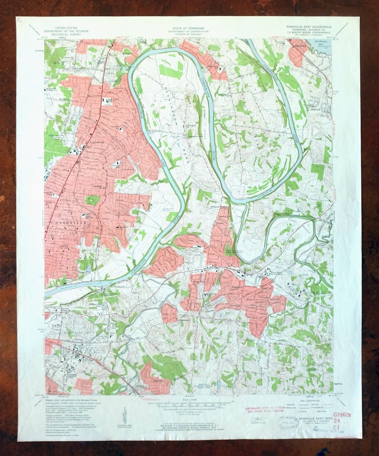
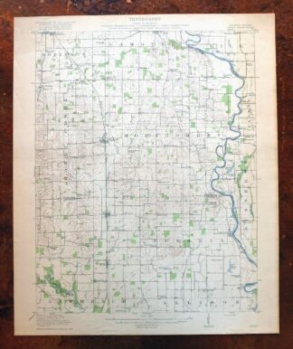
This USGS 7.5-minute topographic map is a 1957 edition printed in 1959, a never-folded sheet on thick stock in good condition with a flawless map area. It takes in the eastern side of Nashville-Davidson in Davidson County, Tennessee, with the quad boundaries including Lakewood, Oakland Acres, and stretches of the Cumberland River corridor toward Old Hickory Lake and J. Percy Priest Lake. Drawn at 1:24,000 with a 10-foot contour interval, it records the historic travel routes, river crossings, rail lines, and placenames of the area as they stood in the late 1950s. The collar carries a repaired edge tear at the bottom right, minor handling and storage wear along the bottom, and library stamps with a penciled notation.
In stock
This vintage sheet is a 1957 edition of the Nashville East Tennessee USGS topographic map. It is an original 67-year-old 1959 United States Geological Survey print in good condition.
HOW THIS MAP CAN BE USED
In addition to making a fascinating conversation piece, this sheet would look great in a frame or on display, make a unique and prized gift for anyone interested in this area, be perfect as a reference for genealogy studies or general historical research, or fill that missing piece in your collection. Maps of this vintage are printed on durable stock and are well-suited for outdoor activities and recreation of all kinds, including hiking, backpacking, hunting, rafting and kayaking, backcountry skiing, geocaching, general exploration, treasure hunting, etc.
FEATURES SHOWN ON THE MAP
The Nashville East 7.5-minute map shows cities and towns, roads, paths, railroads, utilities and energy infrastructure, rivers, creeks, elevation contour lines, public land survey lines, county, state, and other administrative boundaries as they existed at the time of the survey in 1951 and 1957. A reddish tint is used on this sheet to indicate urban areas where only landmark buildings are depicted. Outside of those areas, all known structures (houses, businesses, churches, schools, barns, cabins, etc) are shown.
A VALUABLE HISTORICAL RECORD
This map is from the 7.5-minute series, the most detailed series that is widely available from the USGS. The 1957 Nashville East map is a valuable historical record for the area. It contains some placenames and features that have been dropped from more recent maps.
Nearby maps
-

Nashville West Tennessee Whitebridge USGS Topo Map 1971
$42 Add to cart -

Goodlettsville Tennessee Lakewood USGS Topographic Map 1953
$41 Add to cart -
Antioch Tennessee Brentwood USGS Topographic Map 1971
$48 Add to cart -
Walterhill Tennessee Murfreesboro Smyrna USGS Topo Map 1984
$27 Add to cart -

Farmington Tennessee Chapel Hill USGS Topo Map 1968 Vintage
$36 Add to cart -
Cookeville West Tennessee Westgate Baxter USGS Topo Map 1975
$42 Add to cart -
East Chattanooga Tennessee Cannondale USGS Topo Map 1959
$38 Add to cart -
South Cleveland Tennessee Hopewell USGS Topographic Map 1966
$38 Add to cart -
Jackson North Tennessee Oakfield USGS Topographic Map 1980
$48 Add to cart -
East Cleveland Tennessee Climer USGS Topographic Map 1966
$34 Add to cart -

New Haven Illinois Ridgway Herald USGS Topo Map 1920 Antique
$24 Add to cart -
New Haven Illinois Ridgway Herald USGS Topo Map 1920 Antique
$38 Add to cart -
Bearden Tennessee Knoxville Alcoa USGS Topo Map 1968 Vintage
$58 Add to cart -

Cairo Illinois Mounds Barlow USGS Topo Map 1964 Vintage
$41 Add to cart -
Georgetown Indiana Galena Greenville USGS Topo Map 1947
$32 Add to cart -

Fountain City Tennessee Knoxville Halls USGS Topo Map 1955
$39 Add to cart -

John Sevier Tennessee Knoxville Mascot USGS Topo Map 1955
$38 Add to cart -
Shooks Gap Tennessee Knoxville Seymour USGS Topo Map 1955
$38 Add to cart -

Speed Indiana Clarksville Memphis USGS Topographic Map 1947
$27 Add to cart -

Jonesboro Illinois Cape Girardeau Anna USGS Topo Map 1963
$42 Add to cart -
Manchester Kentucky Booneville McKee USGS Topo Map 1917
$51 Add to cart -

Ellendale Tennessee Memphis Cordova USGS Topo Map 1967
$42 Add to cart -

Millington Tennessee Memphis USGS Topo Map 1994 Contemporary
$40 Add to cart -
Birds Illinois Flat Rock Robinson USGS Topographic Map 1917
$68 Add to cart