MAP DETAILS | |
|---|---|
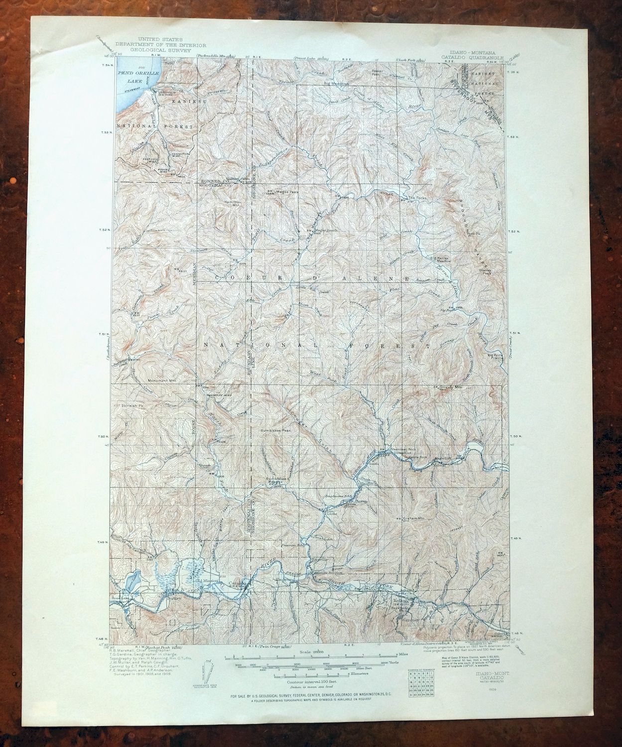
| TITLE | Cataldo |
| STATE | Idaho, Montana |
| LOCATION | Vicinity of Kellogg, 25 miles east of Coeur d'Alene |
| SERIES | 30-minute |
| SURVEYED | 1901 through 1909 Field Survey |
| GEOGRAPHER | R.B. Marshall |
| EDITION | 1909 |
| PRINTED | 1954 |
| PRINT NOTES | Thick paper stock |
| SCALE | 1:125000 |
| CONTOUR INTERVAL | 100 feet |
| SHEET DIMENSIONS | 17 x 21 inches |
| MAP DIMENSIONS | 11 3/4 x 17 1/2 inches |
| COVERAGE AREA | 23 x 35 miles |
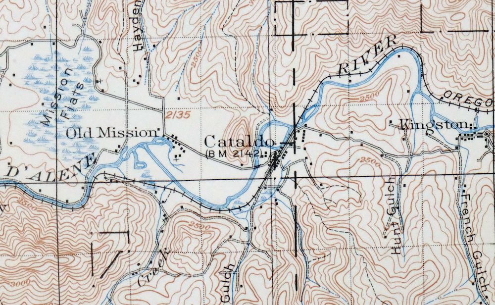
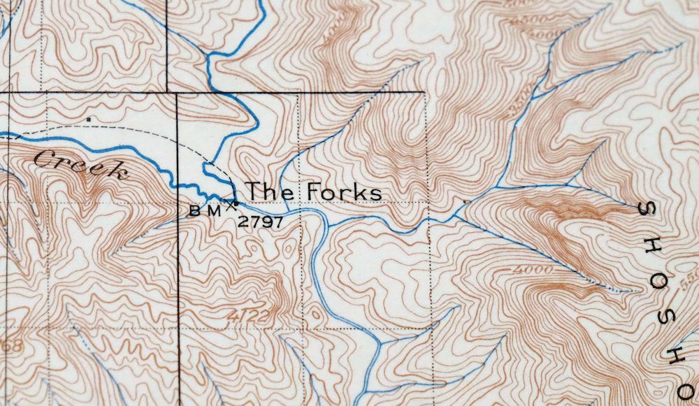
| MAP NOTES | Surveyed before the modern highway system and before the existence of Pinehurst, showing historic travel corridors, rail lines, river crossings, and placenames. |
| SHEET CONDITION For maps of this vintage, effort is made to note all visible flaws, no matter how minor. | |
| OVERALL CONDITION | Very Good |
| SHEET NOTES | lightly handled, never folded |
| MAP AREA | flawless map area |
| COLLARS | no markings, very minor blemishes, no edge tears, minor handling wear in top collar |
| MAP COVERAGE Quadrangle extent overlaid on current basemap. | |
| PLACENAMES Depending on map series and survey date, all of the features listed below may not be shown on this map. This list contains features that currently exist or historically existed within the area covered by the map. The list can be used as a reference to determine if this map covers your area of interest. Placenames are listed alphabetically next to each feature type. | |
| CITIES AND TOWNS (CURRENT) | Enaville, Kellogg, Lakeview, Osburn, Pinehurst, Smelterville, and Wardner |
| COUNTIES COVERED | Bonner, Kootenai, Sanders, and Shoshone |
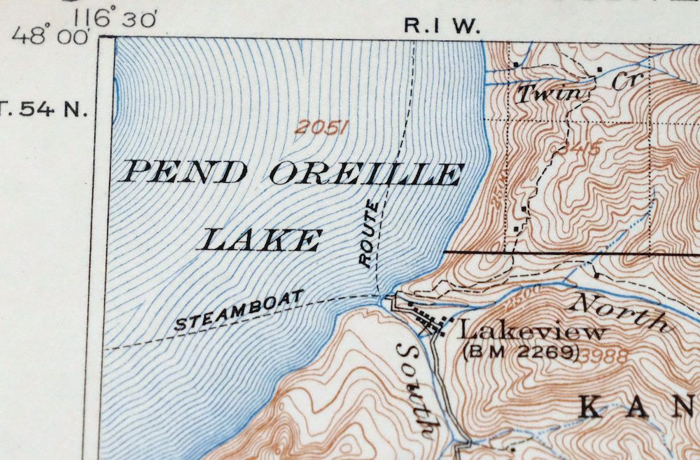
| FEDERAL LAND UNITS | Coeur d'Alene National Forest, Kaniksu National Forest, and Lake Pend Oreille |
| RIVERS AND STREAMS | Alden Creek, Alder Creek, Barney Creek, Barrymore Creek, Bear Creek, Bentley Creek, Big Creek, Big Elk Creek, Big Hank Creek, Blacktail Creek, Bluff Creek, Bootjack Creek, Branch North Gold Creek, Brett Creek, Brown Creek, Buckskin Creek, Bumblebee Creek, Burnt Cabin Creek, Calamity Creek, Callis Creek, Can Creek, Cascade Creek, Cataract Creek, Cedar Creek, Cheer Creek, Cinnamon Creek, Coal Creek, Coeur d'Alene River, Coeur d'lene River, Comfy Creek, Copper Creek, Curran Creek, Debbs Creek, Deception Creek, Declaration Creek, Deer Creek, Devil Creek, Dewey Creek, Downey Creek, Drexall Creek, Dry Creek, East Fork Downey Creek, East Fork Solitaire Creek, East Fork Steamboat Creek, Ellis Creek, Emerson Creek, Ermine Creek, Evans Creek, Fall Creek, Fern Creek, Fisher Creek, Flat Creek, Forks Creek, Fourth of July Creek, Gimlet Creek, Gold Creek, Goose Creek, Graham Creek, Green Creek, Grizzly Creek, Grouse Creek, Halsey Creek, Hemlock Creek, Honey Creek, Hopkins Creek, Independence Creek, Indian Creek, Iron Creek, Jackass Creek, Jordan Creek, Latour Creek, Laverne Creek, Leiberg Creek, Lindsey Creek, Little Baldy Creek, Little Bumblebee Creek, Little East Fork Steamboat Creek, Little Elk Creek, Little Lost Fork, Little North Fork Coeur d'lene River, Little Pine Creek, Little Tepee Creek, Lost Fork, Marie Creek, Mason Creek, Mercury Creek, Milo Creek, Mineral Creek, Miners Creek, Montgomery Creek, Moon Creek, North Creek, North Fork Coeur d'lene River, North Grizzly Creek, North Twin Creek, Omaha Creek, Owl Creek, Pend Oreille River, Picnic Creek, Pine Creek, Pine Flat Creek, Potter Creek, Prado Creek, Rantenan Creek, Rose Creek, Scott Creek, Sentinel Creek, Sho Creek, Short Creek, Shoshone Creek, Skitwish Creek, Skookum Creek, Smith Creek, Snow Creek, Solitaire Creek, South Fork Coeur d'Alene River, South Fork Potter Creek, Spion Kop Creek, Spruce Creek, Steamboat Creek, Stewart Creek, Stoney Creek, Surprise Creek, Tepee Creek, Thomas Creek, Tom Lavin Creek, Trail Creek, Ulm Creek, Valitons Creek, West Elk Creek, West Fork Downey Creek, West Fork Moon Creek, West Fork Solitaire Creek, West Fork Steamboat Creek, West Gold Creek, White Creek, Whitetail Creek, and Yellow Dog Creek |
| WATER BODIES | Lake Pend Oreille and Rose Lake |
| Idaho Locations: Bernard Overlook, Beaver Work Center, Big Hank Campground, Breakwater Campground, Bradley Siding, Bumblebee Campground, Devils Elbow Campground, Erickson Ranch, Honeysuckle Campground, Independence Campground, Jordan Camp, Kellogg Golf Club, Kit Price Campground, Lakeview Sanitary Landfill, Little Guard Peak Lookout, McGee Ranger Station, Pine Point Lookout, Rose Lake Access Area, Rose Lake Recreation Site, Senator Creek Campground, Shont, Shoshone Country Club, Sissons Campground, Spyglass Peak Lookout, Steamboat Camp, Steamboat Rock, Sunshine Mine Disaster Memorial, and Trail Creek Work Center. Mountain Ranges: Shoshone Range. Reserves: Bull Run Lake Access Area and Rose Lake Wildlife Habitat Area. Mountains, Peaks, and Summits: Amethyst Peak, Bennett Peak, Beaver Peak, Boundary Peak, Bull Run Peak, Bumblebee Peak, Cataldo Mountain, Cataract Peak, Cathedral Peak, Character Peak, Colt Mountain, Copper Mountain, Cougar Peak Loookout, Devil Peak, Divide Peak, Downey Peak, Drummond Peak, Drumond Peak, Dudley Peak, East Cathedral Peak, Echo Peak, Faset Peak, Flora Miller Hill, Fubar Peak, Graham Mountain, Grassy Mountain, Green Mountain, Griffith Peak, Grizzly Mountain, Guard Peak, Halfway Peak, Hamilton Mountain, Haystack Peak, Hemlock Mountain, Honey Mountain, Jackknife Peak, John Peak, Lamb Peak, Leiberg Peak, Linfor Hill, Little Guard Peak, Little Sentinel Peak, Magee Peak, McDonald Peak, McLeod Hill, Monument Mountain, North Snow Peak, Pierson Peak, Pond Peak, Prospect Peak, Sentinel Peak, Shoshone Peak, Skitwish Peak, Spion Kop, Spruce Mountain, Spyglass Peak, Steamboat Peak, Suburban Peak, Tepee Peak, Tepee Summit, Thomas Hill, Uranus Peak, Wall Peak, White Peak, and Windfall Peak. Valleys and Canyons: Amy Gulch, Black Canyon, Bogle Draw, Browns Gulch, Caldwell Gulch, Carrol Gulch, Cataldo Gulch, Character Gulch, Chloride Gulch, Clark Gulch, Coon Gulch, Cougar Gulch, Deadwood Gulch, Deceitful Gulch, Deer Lick Gulch, Devils Gorge, Drew Gulch, East Fork Cougar Gulch, East Fork Rosebud Gulch, Fourth Of July Canyon, French Gulch, Gold Run, Government Gulch, Grader Gulch, Hardy Gulch, Hauck Gulch, Hayden Gulch, Hazendorf Gulch, Heim Gulch, Higbee Draw, Holmes Gulch, Hultman Gulch, Humboldt Gulch, Hunt Gulch, Hurricane Gulch, Idaho Gulch, Italian Gulch, Jewell Gulch, Kick Bush Gulch, Klondike Gulch, Lightner Draw, Little Terror Gulch, Matchless Gulch, McFarren Gulch, McKinley Gulch, McPhee Gulch, Mission Gulch, Murray Draw, Polaris Gulch, Prospect Gulch, Rosebud Gulch, Ross Gulch, Simmons Draw, Skeel Gulch, Slaughterhouse Gulch, Spring Gulch, Sweeney Gulch, Swinnerton Gulch, Terrill Draw, Terror Gulch, Tucker Gulch, Weir Gulch, West Fork Cougar Gulch, Weyer Gulch, Whiteman Draw, and Williams Draw. Parks: Gene Day Park, Magee Historic Site, Old Mission State Park, and West Shoshone Park. Trails: Blacktail Creek Trail, Boundary Peak Trail, Coeur d'Alene River National Recreation Trail, Ermine Ridge Trail, Fearn Creek Trail, Green Mountain Trail, Holmes Trail, Independence Creek National Recreation Trail, Jackass Trail, Rock City Pond Peak Trail, Spyglass Miners Trail, and Upper Declaration Trail. Drainages: Alden Creek, Ames Creek, Ash Creek, Arguement Creek, Autumn Creek, Barren Creek, Barrymore Creek, Bennett Creek, Bentley Creek, Bear Creek, Beetle Creek, Betty Creek, Big Bob Creek, Big Creek, Big Elk Creek, Big Gene Creek, Big Hank Creek, Blackie Creek, Blacktail Creek, Bluff Creek, Bootjack Creek, Boston Brook, Boulder Creek, Boundary Creek, Breakwater Creek, Brett Creek, Branch North Gold Creek, Bull Run Creek, Bumblebee Creek, Burnt Cabin Creek, Burnt Creek, Cabin Creek, Brown Creek, Bruce Creek, Buckskin Creek, Calamity Creek, Callis Creek, Camp Creek, Can Creek, Canyon Creek, Cardinal Creek, Cascade Creek, Cataract Creek, Cathedral Creek, Cedar Creek, Cheer Creek, Chute Creek, Cinnabar Creek, Cinnamon Creek, Clark Creek, Clay Creek, Coal Creek, Coffin Creek, Colorado Creek, Comfy Creek, Cook Creek, Cool Water Creek, Copper Creek, County Creek, Cub Creek, Curran Creek, Davy Creek, Debbs Creek, Deception Creek, Declaration Creek, Deer Creek, Delaney Creek, Demorest Creek, Dennis Creek, Devil Creek, Dewey Creek, Dismal Creek, Downey Creek, Dresser Creek, Drexall Creek, Dry Creek, Early Creek, East Alden Creek, East Fork Downey Creek, East Fork Elk Creek, East Fork Graham Creek, East Fork Solitaire Creek, East Fork Steamboat Creek, Eighty Day Creek, Elk Creek, Ellis Creek, Emerson Creek, Emery Creek, Ermine Creek, Evans Creek, Fall Creek, Falls Creek, Fearn Creek, Felder Creek, Ferguson Creek, Fern Creek, First Creek, Fisher Creek, Flat Creek, Forks Creek, Fourth of July Creek, Gimlet Creek, Gold Creek, Goose Creek, Gorsuch Creek, Gosling Creek, Graham Creek, Gravel Run, Green Creek, Griffin Creek, Grizzly Creek, Grouse Creek, Guard Creek, Gurley Creek, Halifax Creek, Halsey Creek, Hamburg Creek, Hamilton Creek, Hart Creek, Harvey Creek, Hearse Creek, Hell Creek, Hemlock Creek, Hill Creek, Homer Creek, Honey Creek, Hoodoo Creek, Hopkins Creek, Hull Creek, Hump Creek, Imp Creek, Independence Creek, Indian Creek, Iron Creek, Jackass Creek, John Creek, June Creek, Knight Creek, Lansdale Creek, Larch Creek, Latour Creek, Laverne Creek, Lavin Creek, Lavoie Creek, Lead Creek, Leiberg Creek, Lewelling Creek, Lindberg Creek, Lindsey Creek, Lion Creek, Little Baldy Creek, Little Bumblebee Creek, Little Canyon Creek, Little East Fork Steamboat Creek, Little Elk Creek, Little Grizzly Creek, Little Lost Fork, Little North Fork Coeur d'Alene River, Little Pine Creek, Little Tepee Creek, Lone Creek, Long Tom Creek, Lost Fork, Lunch Creek, Mac Creek, Magee Creek, Mann Creek, Marsh Creek, Marten Creek, Martin Creek, Mason Creek, McCauley Creek, McHarg Creek, McMahon Creek, McRae Creek, Mercury Creek, Mill Creek, Milo Creek, Mineral Creek, Miners Creek, Minor Creek, Montgomery Creek, Moon Creek, Moose Creek, Morris Creek, Nelson Creek, New Creek, North Creek, North Fork Callis Creek, North Fork Coeur d'Alene River, North Gold Creek, North Grizzly Creek, North Twin Creek, November Creek, Nowhere Creek, October Creek, Omaha Creek, Opposite Creek, Owl Creek, Pablo Creek, Picnic Creek, Pierson Creek, Pine Creek, Plant Creek, Porcupine Creek, Potter Creek, Powder Creek, Prado Creek, President Creek, Prospect Creek, Rablens Fork, Rantenan Creek, Riley Creek, Rookie Creek, Rose Creek, Rusty Creek, Ryan Creek, Sands Creek, Scott Creek, Scribe Creek, Second Creek, Senator Creek, Sentinel Creek, Service Creek, Sheep Run Creek, Sho Creek, Short Creek, Silver Creek, Silver Run, Sissons Creek, Skookum Creek, Sluice Creek, Smith Creek, Snow Creek, Snowbird Creek, Snowshoe Creek, Sob Creek, Solitaire Creek, South Fork Coeur d'Alene River, South Fork Potter Creek, South Twin Creek, Spion Kop Creek, Spring Creek, Spruce Creek, Steamboat Creek, Steep Creek, Stevens Creek, Stewart Creek, Stoney Creek, Stony Creek, Studer Creek, Stull Creek, Surprise Creek, Svee Creek, Swift Creek, Taft Creek, Teddy Creek, Tent Creek, Tepee Creek, Thiesen Creek, Third Creek, Thomas Creek, Tie Creek, Timber Creek, Tom Lavin Creek, Tourist Creek, Trail Creek, Trestle Creek, Trident Creek, Tsuga Creek, U S Creek, Ulm Creek, Valitons Creek, Van Hoosier Creek, Venus Creek, Walker Creek, West Bear Creek, West Elk Creek, West Fork Downey Creek, West Fork Elk Creek, West Fork Montgomery Creek, West Fork Moon Creek, West Fork Solitaire Creek, West Fork Steamboat Creek, West Fork Tepee Creek, West Gold Creek, Whitetail Creek, Wilson Creek, Winton Creek, Wren Creek, Y Creek, and Yellow Dog Creek. Capes: Graham Point and Cape Horn. Mines: Alhambra Mine, Amy-Matchless Mine, Antimony Mine, Bellville Mine, Bobby Anderson Mine, Bunker Hill Mine, Conjecture Mine, Crescent Mine, Dixie Queen Mine, General Mine, Idaho Lakeview Mine, Keep Cool Mine, Lakeview Mines, Last Chance Mine, Mineral Mountain Mine, Nellie Mine, New Rainbow Mine, Page Mine, Polaris Mine, Silver Leaf Mine, Silver Summit Mine, Sunshine Mine, Vulcan Mine, and Weber Mine. Churches: Cataldo Mission. Forests: Coeur d'Alene National Forest. Hospitals: Shoshone Medical Center. Lakes and Ponds: Big Pool, Long Pool, Porters lake, and Rose Lake. Waterfalls: Fern Falls and Shadow Falls. Dams: Bunker Hill Tailings Number One Dam, Bunker Hill Tailings Number Three Dam, Bunker Hill Tailings Number Two Dam, Sunshine Tailings Number One Dam, and Sunshine Tailings Number Two Dam. Bluffs: Castle Rock, Cathedral Rocks, Maple Cliff, Packsack Point, and Stoney Point. Gaps: Bishop Saddle, Black Canyon Saddle, Brown Creek Saddle, Cascade Saddle, Curran Saddle, Eighty Day Saddle, Flat Creek Saddle, Independence Saddle, John Saddle, Jordan Saddle, Laverne Saddle, Leiberg Saddle, Marie Saddle, Mason Saddle, Moon Saddle, Riley Saddle, Skookum Saddle, Skull Saddle, Solitare Saddle, Stull Saddle, Tie Lavin Saddle, Walker Saddle, Weber Saddle, and White Creek Saddle. Bends: Devils Elbow. Bays: Deadmans Eddy. Airports: Magee Airport and Shoshone County Airport. Schools: Canyon Elementary School, Elk Creek School, Kellogg High School, Kellogg Middle School, Pinehurst Elementary School, Silver Valley Christian Academy, and Sunnyside Elementary School. Ridges: Blue Star Ridge, Bobby Anderson Ridge, Browns Ridge, Cascade Spur, Character Ridge, Corrigan Ridge, Crooked Ridge, Graham Ridge, Grizzly Ridge, Kingston Ridge, Lookout Ridge, Maude Ridge, Montgomery Ridge, Shell Ridge, South Fork Ridge, Stewart Creek Ridge, and Uranus Ridge. Flats: Big Meadows, Big Hank Meadow, Bumblebee Meadow, Kit Price Prairie, Mission Flats, and Snowbird Meadows. Towers: KWAL-AM (Wallace). Pillars: Spion Kop Rock and Steamboat Rock. Springs: Bishop Spring, Drexall Spring, Jordan Springs, and McDonald Spring. | |
| Montana Mountains, Peaks, and Summits: Divide Peak. | |
| SHIPPING AND RETURNS | |
 This map sheet will be carefully rolled in a sturdy tube and shipped via the US Postal Service. If you find that the sheet you receive is not as described in the listing, you may ship it back to us for a refund of the purchase price. | |
Cataldo Idaho Lakeview Osburn USGS Topo Map 1954 Vintage
$45
This USGS 30-minute topographic map is a 1909 edition printed in 1954, on thick stock and in very good condition, lightly handled and never folded. It covers the Silver Valley country east of Coeur d’Alene in Idaho, taking in Kellogg, Osburn, Smelterville, and the mining community of Wardner, with the quad reaching east across the Montana line and north toward Lake Pend Oreille within the Coeur d’Alene and Kaniksu National Forests. Based on a field survey of 1901 through 1909 under geographer R.B. Marshall, it predates the modern highway system and the town of Pinehurst, recording the rail lines, river crossings, and travel corridors of the district as they stood at the turn of the century.
In stock
This vintage sheet is a 1909 edition of the Cataldo Idaho USGS topographic map. It is an original 72-year-old 1954 United States Geological Survey print in very good condition.
HOW THIS MAP CAN BE USED
In addition to making a fascinating conversation piece, this sheet would look great in a frame or on display, make a unique and prized gift for anyone interested in this area, be perfect as a reference for genealogy studies or general historical research, or fill that missing piece in your collection. Maps of this vintage are printed on durable stock and are well-suited for outdoor activities and recreation of all kinds, including hiking, backpacking, hunting, rafting and kayaking, backcountry skiing, geocaching, general exploration, treasure hunting, etc.
FEATURES SHOWN ON THE MAP
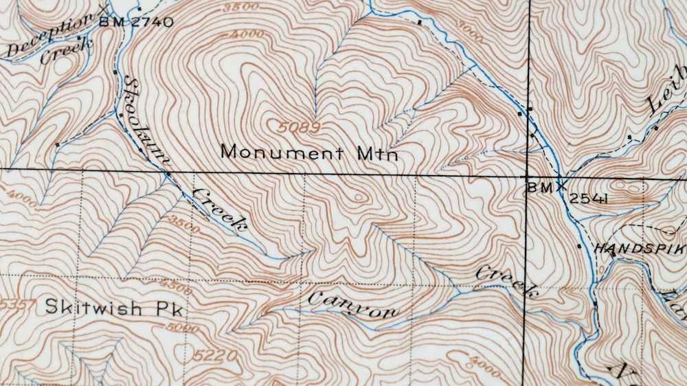
The Cataldo 30-minute map shows cities and towns, roads, railroads, utilities and energy infrastructure, rivers, creeks, elevation contour lines, public land survey lines, county, state, and other administrative boundaries as they existed at the time of the survey in 1901 through 1909.
A VALUABLE HISTORICAL RECORD
Maps from the USGS 30-minute series have been out of print for many years. They have never been common and original prints are increasingly difficult to find. For areas where the 30-minute map was produced, it is usually the first large-scale survey done by the USGS for that area. These are a valuable historical record, as they contain many placenames and features that have been dropped from more recent series’ and editions.
Nearby maps
-

Oakesdale Washington Saint Joe NF Tekoa USGS Topo Map 1938
$29 Add to cart -

Missoula Montana Stevensville Lolo USGS Topographic Map 1925
$57 Add to cart -
Republic Washington Malo Danville USGS Topo Map 1944 Vintage
$38 Add to cart -

Connell Washington Lind Mesa USGS Topo Map 1918 Antique
$34 Add to cart -

Deer Park Washington Spokane Fairwood USGS Topo Map 1951
$40 Add to cart -

Saint Regis Montana St. Regis USGS Topo Map 1968 Vintage
$40 Add to cart -

Clayton Washington Spokane USGS 15-Min Topo Map 1951 Vintage
$42 Add to cart -
Wellpinit Washington Long Lake Ford USGS Topo Map 1944
$42 Add to cart -

La Crosse Washington Winona Palouse River USGS Topo Map 1952
$42 Add to cart -

Benge Washington Hooper Palouse River USGS Topo Map 1952
$35 Add to cart -
Wilbur Washington Creston USGS 15-Min Topo Map 1950 Vintage
$42 Add to cart -
Orient Washington Colville NF Laurier USGS Topo Map 1951
$37 Add to cart -
Limekiln Rapids Idaho USGS 15-Min Topo Map 1946 Vintage
$32 Add to cart -
Barker Canyon Washington USGS 7.5-Min Topo Map 1971 Vintage
$36 Add to cart -

Walla Walla Washington Langdon Mill Creek USGS Topo Map 1978
$43 Add to cart -
Mount Bonaparte Washington Molson Chesaw USGS Topo Map 1966
$38 Add to cart -
Osoyoos Washington Okanogan NF Oroville USGS Topo Map 1937
$36 Add to cart -
Wallula Washington Finley Burbank USGS Topo Map 1918 Antique
$34 Add to cart -
Red Rock Washington Royal City Smyrna USGS Topo Map 1911
$20 Add to cart -
Chopaka Washington Okanogan NF USGS Topographic Map 1917
$42 Add to cart -
Coyote Rapids Washington USGS 15-Min Topo Map 1916 Antique
$45 Add to cart -

Badger Mountain Washington South Richland USGS Topo Map 1978
$43 Add to cart -
Cuprum Idaho USGS 15-Min Topographic Map 1958 Vintage
$31 Add to cart -
Lake Frances Montana Valier USGS 15-Min Topographic Map 1949
$42 Add to cart
