MAP DETAILS | |
|---|---|
| TITLE | Marysvale |
| STATE | Utah |
| LOCATION | 30 miles south of Richfield |
| SERIES | 15-minute |
| SURVEYED | 1937 through 1945 Aerial and Field Survey |
| EDITION | 1947 |
| PRINTED | 1947 |
| PRINT NOTES | Thick paper stock |
| SCALE | 1:62500 |
| CONTOUR INTERVAL | 50 feet |
| SHEET DIMENSIONS | 17 x 21 inches |
| MAP DIMENSIONS | 13 3/4 x 17 1/2 inches |
| COVERAGE AREA | 14 x 17 miles |
| SHEET CONDITION For maps of this vintage, effort is made to note all visible flaws, no matter how minor. | |
| OVERALL CONDITION | Excellent |
| SHEET NOTES | lightly handled, never folded |
| MAP AREA | no markings, no blemishes |
| COLLARS | no wear or tears, no markings, no blemishes, has library stamp in bottom right collar |
| MAP COVERAGE Quadrangle extent overlaid on current basemap. | |
| PLACENAMES Depending on map series and survey date, all of the features listed below may not be shown on this map. This list contains features that currently exist or historically existed within the area covered by the map. The list can be used as a reference to determine if this map covers your area of interest. Placenames are listed alphabetically next to each feature type. | |
| NOTABLE PLACES | Piute Reservoir and Sevier River |
| CITIES AND TOWNS (CURRENT) | Junction and Marysvale |
| COUNTIES COVERED | Piute |
| FEDERAL LAND UNITS | Fishlake National Forest |
| RIVERS AND STREAMS | Beaver Creek, Box Creek, City Creek, Cottonwood Creek, Dry Creek, Durkee Creek, Gold Creek, Manning Creek, Middle Fork Box Creek, North Fork Box Creek, South Fork Box Creek, Swift Spring Creek, and Tenmile Creek |
| WATER BODIES | Barney Lake and Manning Meadows Reservoir |
| Populated Place: Alunite, Marysvale, and Thompsonville. Locations: Dry Creek Guard Station, Durkee Springs Recreation Site, Elbow Ranch, Forshea Trough, Ogden Cabin, and Piute Campground. Administrative Boundaries: Circleville Division, Marysvale Division, and Piute County. Mountains, Peaks, and Summits: Bean Hill, Big Table, Forshea Mountain, Langdon Mountain, Little Table, Malmsten Peak, Marysvale Peak, Twin Peaks, and White Hills. Valleys and Canyons: Anderson Canyon, Bellyache Canyon, Buck Hollow, Dead Horse Canyon, Deer Spring Canyon, Dry Creek Canyon, Dyches Draw, Flat Canyon, Gold Gulch, Hell Hole Canyon, Little Cottonwood Canyon, Marysvale Valley, Mud Spring Draw, North Fork Rock Canyon, Oak Springs Canyon, Rudd Hollow, Six Patch Draw, Smith Canyon, Straight Canyon, Tibadore Canyon, and Tuft Draw. Parks: Deer Study Plot and Piute Lake State Park. Trails: Smith Canyon Trail. Drainages: Beaver Creek, City Creek, Cottonwood Creek, Dry Creek, Durkee Creek, East Fork, Gold Creek, Langdon Creek, Left Fork Dry Creek, Little Meadows Creek, Manning Creek, North Fork Box Creek, Pine Creek, Rudd Spring Creek, Swift Spring Creek, Tenmile Creek, and Vale Creek. Mines: Blackbird Mine, Prospector Mine, VCA Mine, White Mine, and Whitehorse Mine. Churches: The Church of Jesus Christ of Latter Day Saints. Post Office: Marysvale Post Office. Lakes and Ponds: Dry Lake, Little Meadows, Middle Spring Lake, Taylor Pond, and Voyles Pond. Buildings: Marysvale Volunteer Fire Department and Piute County Ambulance Marysvale. Dams: Barney Lake Reservoir Dam, Manning Meadows Dam, Piute Dam, and Upper Box Creek Dam. Airports: Junction Airport. Schools: Oscarson Elementary School. Ridges: Miners Ridge and Windy Ridge. Reservoirs and Tanks: Barney Lake, Big Flat Reservoir, Burnt Flat Reservoir, Dead Horse Reservoir, Durkee Reservoir, Hell Hole Reservoir, Manning Meadows Reservoir, Piute Reservoir, Pole Canyon Reservoir, Rock Canyon Reservoir, Tuft Reservoir, Upper Box Creek Reservoir, and Willis Reservoir. Flats: Big Flat, Burnt Flat, Forshea Pasture, and Manning Meadows. Bench: The Bench. Springs: Brindley Spring, Chimney Spring, Cold Springs, Deer Springs, Don Spring, Durkee Springs, Forshea Spring, Mud Spring, Murrays Spring, Rock Spring, Sevy Spring, Swift Spring, White Ledge Spring, Willow Spring, Willow Springs, and Wills Reservoir. Slopes: The Elbow. Cemetery: Harris Cemetery, Thompsonville Cemetery, Dennis Cemetery, Howes Cemetery, Mountain View Cemetery, and Murrays Cemetery. | |
| SHIPPING AND RETURNS | |
 This map sheet will be carefully rolled in a sturdy tube and shipped via the US Postal Service. If you find that the sheet you receive is not as described in the listing, you may ship it back to us for a refund of the purchase price. | |
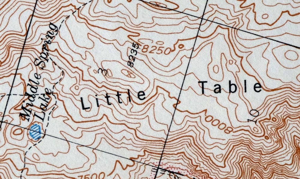
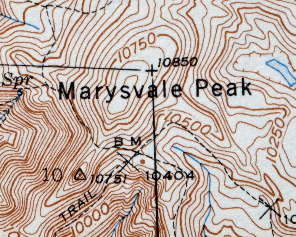
Marysvale Utah Piute Reservoir Junction USGS Topo Map 1947
$50
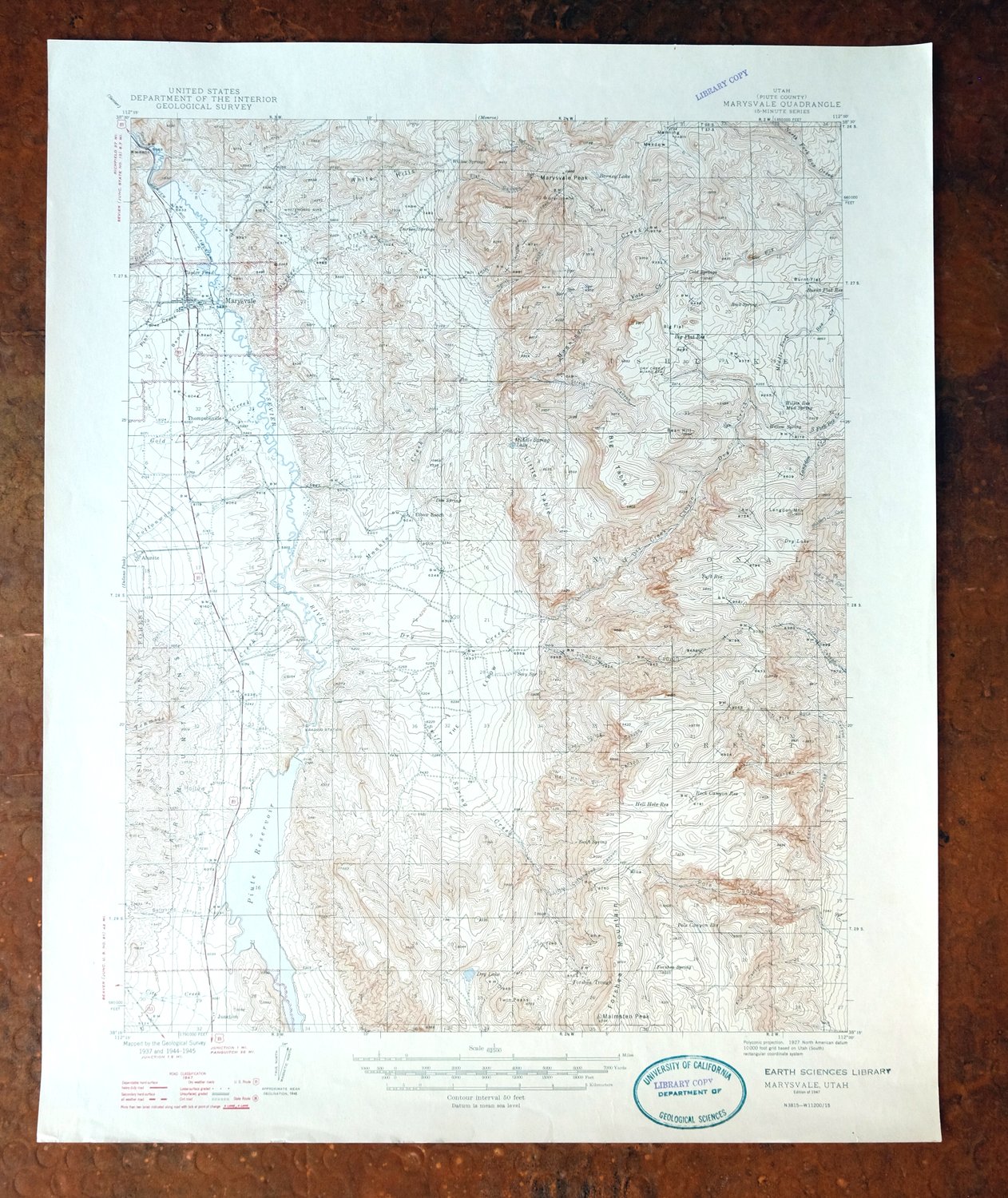
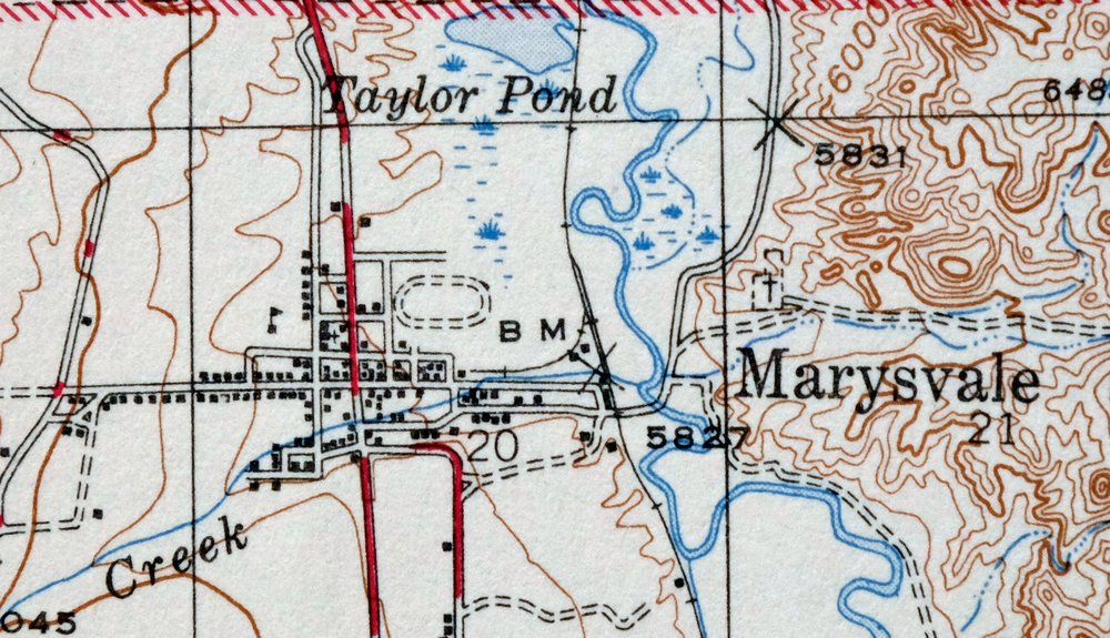
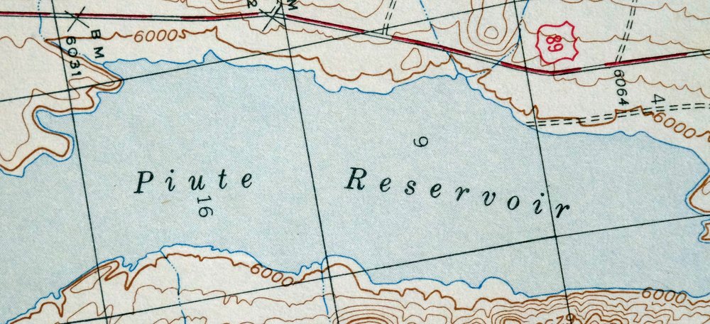
This USGS topographic map of the Marysvale quadrangle in central Utah is a 15-minute sheet at 1:62,500, first published and printed in 1947 and based on aerial and field surveys from 1937 through 1945. The quad covers a stretch of Piute County south of Richfield, taking in the towns of Marysvale and Junction along the Sevier River, Piute Reservoir, and portions of Fishlake National Forest. Marysvale sits in old mining country, where gold, alunite, and uranium were worked in the hills nearby. Printed on thick stock, the sheet is in excellent condition, never folded, with a small library stamp in the lower collar.
In stock
This vintage sheet is a 1947 edition of the Marysvale Utah USGS topographic map. It is an original 79-year-old United States Geological Survey print in excellent condition.
HOW THIS MAP CAN BE USED
In addition to making a fascinating conversation piece, this sheet would look great in a frame or on display, make a unique and prized gift for anyone interested in this area, be perfect as a reference for genealogy studies or general historical research, or fill that missing piece in your collection.
FEATURES SHOWN ON THE MAP
The Marysvale 15-minute map shows cities and towns, roads, railroads, rivers, creeks, elevation contour lines, public land survey lines, county, state, and other administrative boundaries as they existed at the time of the survey in 1937 through 1945. All known structures (houses, businesses, churches, schools, barns, cabins, etc) are also shown.
A VALUABLE HISTORICAL RECORD
Maps from the 15-minute series for the continental United States are no longer produced or printed by the USGS and original prints are becoming increasingly difficult to find. They are a valuable historical record for an area, as they contain many placenames and features that have been dropped from more recent maps.
Nearby maps
-
Fillmore Utah Kanosh Meadow USGS 15-Min Topographic Map 1975
$40 Add to cart -
Notom Capitol Reef NP Utah USGS 15-Min Topo Map 1958 Vintage
$46 Add to cart -
Beaver Utah Dixie NF Fishlake NF USGS Topo Map 1921 Antique
$63 Add to cart -

Castle Dale Utah Ferron Clawson USGS Topographic Map 1925
$45 Add to cart -
The Wickiup Utah Mexican Mountain WSA USGS Topo Map 1967
$20 Add to cart -

Moroni Utah Fountain Green USGS 15-Min Topo Map 1968 Vintage
$39 Add to cart -
Kanab Utah Fredonia Orderville USGS Topo Map 1960 Vintage
$37 Add to cart -
Nipple Butte Utah Wahweap WSA Big Water USGS Topo Map 1962
$36 Add to cart -
Fiddler Butte Utah USGS 15-Min Topographic Map 1958 Vintage
$38 Add to cart -
New Harmony Utah La Verkin Leeds USGS Topographic Map 1960
$47 Add to cart -
1957 USGS Topo Map: Scofield, Clear Creek, Utah (Wattis)
$49 Add to cart -
Cummings Mesa Utah USGS 15-Min Topographic Map 1978 Vintage
$40 Add to cart -

Cummings Mesa Glen Canyon Utah Vintage USGS Topo Map 1964
$78 Add to cart -
House Rock Spring Arizona USGS 15-Min Topo Map 1972 Vintage
$40 Add to cart -

Paria Plateau Arizona Vermillion Cliffs USGS Topo Map 1978
$42 Add to cart -
Shinarump Arizona Kaibab USGS 15-Min Topo Map 1964 Vintage
$35 Add to cart -

Lees Ferry Arizona Page Marble Canyon USGS Topo Map 1971
$58 Add to cart -
The Spur Utah Canyonlands USGS 15-Min Topo Map 1971 Vintage
$38 Add to cart -

Castle Gate Utah Price Helper USGS Topo Map 1968 Vintage
$44 Add to cart -
Colorado City Arizona Moccasin Kaibab USGS Topo Map 1975
$37 Add to cart -
Soldier Summit Utah Gilluly Colton USGS Topographic Map 1942
$50 Add to cart -
Woodside Utah Book Cliffs Cedar USGS Topographic Map 1973
$26 Add to cart -

Jacob Lake Arizona Kaibab Plateau USGS Topo Map 1965 Vintage
$38 Add to cart -
Big Springs Arizona Kaibab Nail Canyon USGS Topo Map 1984
$40 Add to cart