MAP DETAILS | |
|---|---|
| TITLE | Bucksport |
| STATE | Maine |
| LOCATION | Vicinity of Brewer |
| SERIES | 15-minute |
| SURVEYED | 1899 Field Survey |
| GEOGRAPHER | H.M. Wilson |
| ENGRAVED | 1900 |
| EDITION | 1902 |
| PRINTED | 1914 |
| SCALE | 1:62500 |
| CONTOUR INTERVAL | 20 feet |
| SHEET DIMENSIONS | 16 1/2 x 20 inches (approximate) |
| MAP DIMENSIONS | 12 1/2 x 17 1/2 inches |
| COVERAGE AREA | 12 x 17 miles |
| SHEET CONDITION For maps of this vintage, effort is made to note all visible flaws, no matter how minor. | |
| OVERALL CONDITION | Excellent |
| SHEET NOTES | lightly handled, never folded, nicely age-toned paper |
| MAP AREA | no wear, no markings, no blemishes, flawless map area |
| COLLARS | no markings, no edge tears |
| MAP COVERAGE Quadrangle extent overlaid on current basemap. | |
| BACKSIDE LEGEND | |
 A map summary is printed on the back side of the Bucksport sheet similar to the one shown in the picture. It outlines the history, purpose, and status of the USGS mapping program at the time of the printing in 1914. It also provides instructions on how to read contour lines and a description of how they are used to depict the terrain. At the bottom of the page is a legend showing all of the symbols used to represent the cultural, relief, and water features found on the map. | |
| PLACENAMES Depending on map series and survey date, all of the features listed below may not be shown on this map. This list contains features that currently exist or historically existed within the area covered by the map. The list can be used as a reference to determine if this map covers your area of interest. Placenames are listed alphabetically next to each feature type. | |
| CITIES AND TOWNS (CURRENT) | Brewer, Bucksport, Frankfort, Hampden, Hampden Highlands, and Winterport |
| COUNTIES COVERED | Hancock, Penobscot, and Waldo |
| RIVERS AND STREAMS | Black Stream, Brown Brook, Clark Brook, Clements Brook, Cove Brook, Goose River, Lane Brook, Littlefield Brook, Marsh Stream, Meadow Brook, Mill Brook, North Branch Marsh Stream, Penobscot River, Perkins Brook, and Ulmer Brook |
| WATER BODIES | Alger Pond, Fields Pond, Halfmoon Pond, Jacob Buck Pond, Silver Lake, Smith Pond, Stowers Meadows, Swan Lake, Swetts Pond, Trout Pond, and Williams Pond |
| Locations: Areys Corners, Hampden Country Club, Lura E Hoit Pool, The Flying Dutchman Campground, and Winterport Station. Administrative Boundaries: Town of Frankfort, Town of Hampden, Town of Orrington, Town of Prospect, Town of Verona, and Town of Winterport. Mountains, Peaks, and Summits: Bald Hill, Blanchard Hill, Mosquito Mountain, Cobb Hill, Delaware Mountain, Downs Hill, Dutch Mountain, Mount Ephraim, Ersking, Eustis Mountain, Fletcher Hill, Fred Low Hill, Heagan Mountain, Hedgehog Hill, Hedgehog Mountain, Jacob Buck Mountain, Kelly Mountain, Kings Mountain, Mack Mountain, McCloud Mountain, Oak Hill, Mount Olive, Page Hill, Partridge Hill, Pickard Hill, Punchbowl Hill, Smith Hill, Snow Mountain, Town Farm Hill, Mount Tuck, and Mount Waldo. Parks: Dorothea Dix Park, Creative Playground, Fort Knox State Historic Site, and Sandy Point Game Management Area. Drainages: Mill Creek, Brown Brook, Meadow Brook, Carley Brook, Clark Brook, Clements Brook, Colson Stream, Cove Brook, Halfmoon Stream, Hawes Stream, Lane Brook, Littlefield Brook, Main Stream, Marsh Stream, North Branch Marsh River, North Branch Marsh Stream, Orland River, Perkins Brook, Reeds Brook, Souadabscook Stream, South Branch Marsh River, and Ulmer Brook. Islands: Porcupina Island and Verona Island. Capes: Bowden Point, Coles Corner, Gross Point, Oak Point, Snub Point, Spruce Point, and Treat Point. Churches: East Orrington Congregational Church, Elm Street Congregational Church, Evangelical Baptist Church, First Congregational Church, Hampden Highlands United Methodist Church, Neallys Corner Methodist Church, Saint Matthews Catholic Church, West Hampden Baptist Church, and West Winterport Church. Lakes and Ponds: Alger Pond, Halfmoon Pond, Smith Pond, Swan Lake, and Williams Pond. Buildings: Buck Memorial Library and Bucksport Historical Society Museum. Dams: East Orrington Dam, Marsh River Dam, Marsh Stream Dam, Silver Lake Dam, Souadabscook Dam, Stowers Meadow Dam, Swan Lake Dam, and West Winterport Dam. Channels: Bald Hill Reach and Eastern Channel. Bridges: Verona Bridge. Bays: Bald Hill Cove, Bartlett Cove, Mill Cove, Collins Cove, Gondola Cove, Harriman Cove, Lawrence Cove, Luce Cove, and Marsh Bay. Bars: Odom Ledge. Swamps: Burnt Swamp and Stowers Meadows. Schools: Bucksport High School, Center Drive School, Clark School, Earl C McGraw School, Frankfort Elementary School, G Herbert Jewett School, George B Weatherbee School, Hampden Academy, Lane School, Longfellow School, Newburgh Elementary School, Reeds Brook Middle School, Walter H Gardner Middle School, and Weatherbee McGraw School. Reservoirs and Tanks: Fields Pond, Marsh Stream Reservoir, Silver Lake, Souadabscook Stream Reservoir, Stowers Meadow, Swan Lake, and Swetts Pond. Towers: WKIT-FM (Brewer) and WWFX-FM (Belfast). | |
| SHIPPING AND RETURNS | |
 This map sheet will be carefully rolled in a sturdy tube and shipped via the US Postal Service. If you find that the sheet you receive is not as described in the listing, you may ship it back to us for a refund of the purchase price. | |
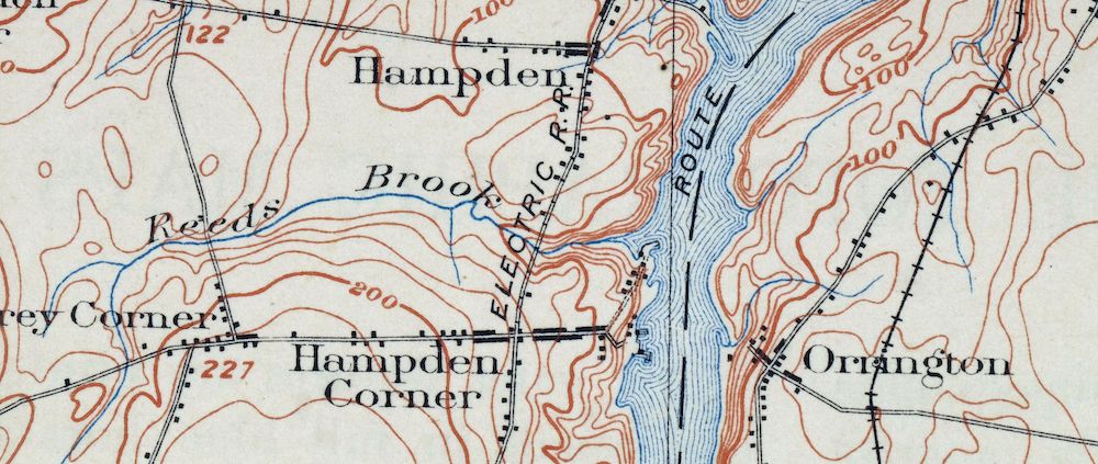
Bucksport Maine Brewer Hampden USGS Topo Map 1914 Antique
$46
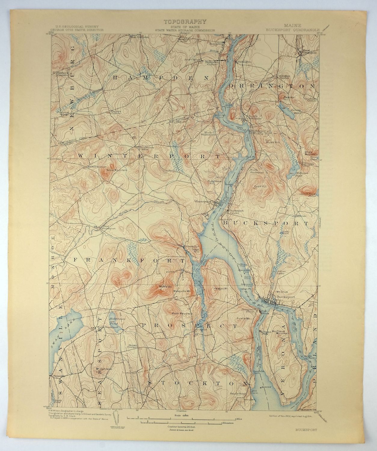
This is a 1902 edition of the Bucksport 15-minute quadrangle, printed in 1914, and the sheet survives in excellent condition — lightly handled, never folded, on nicely age-toned paper. The quad spans parts of Hancock, Penobscot, and Waldo counties along the Penobscot River in eastern Maine, with Brewer, Hampden, Bucksport, and Winterport falling within its boundaries, along with the communities of Hampden Highlands and Frankfort. Drawn from an 1899 field survey and engraved in 1900 under geographer H.M. Wilson, it records the lower Penobscot valley and its river towns as they stood at the turn of the century. The reverse carries printed reference material explaining the map’s symbols and contour lines.
In stock
This antique sheet is a 1902 edition of the Bucksport Maine USGS topographic map. It is an authentic 112-year-old 1914 United States Geological Survey print in excellent condition.
HOW THIS MAP CAN BE USED
In addition to making a fascinating conversation piece, this sheet would look great in a frame or on display, make a unique and prized gift for anyone interested in this area, be perfect as a reference for genealogy studies or general historical research, or fill that missing piece in your collection.
FEATURES SHOWN ON THE MAP
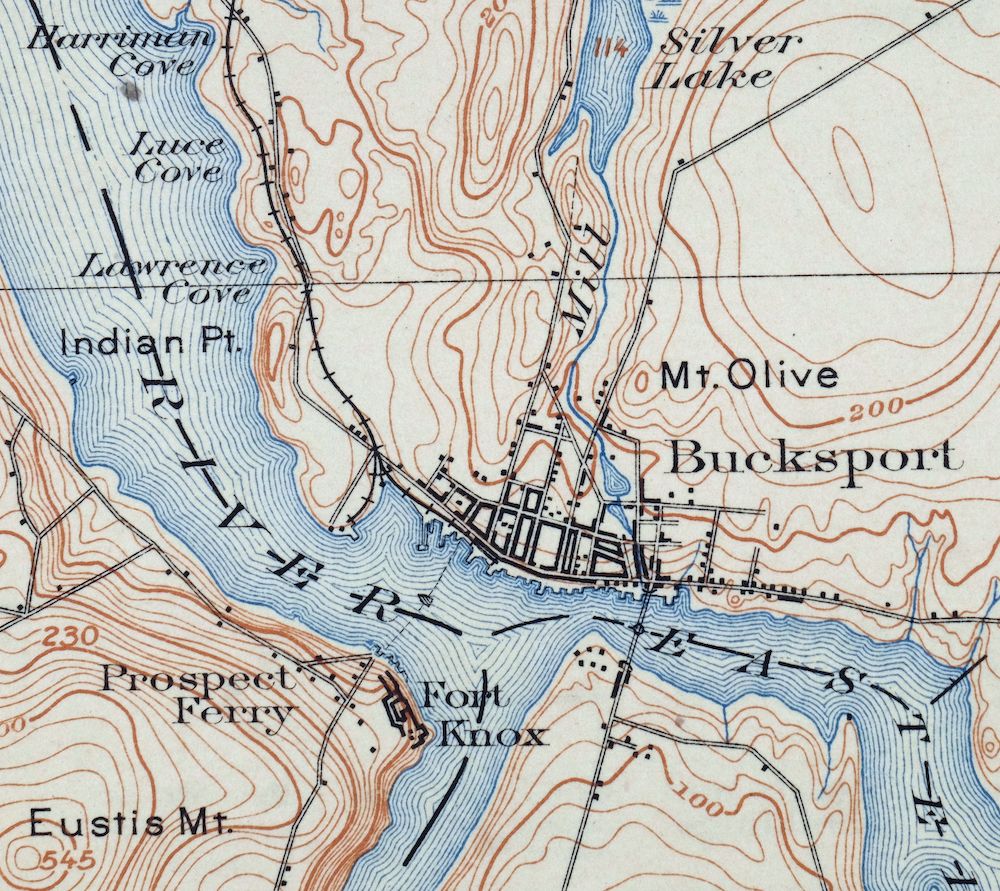
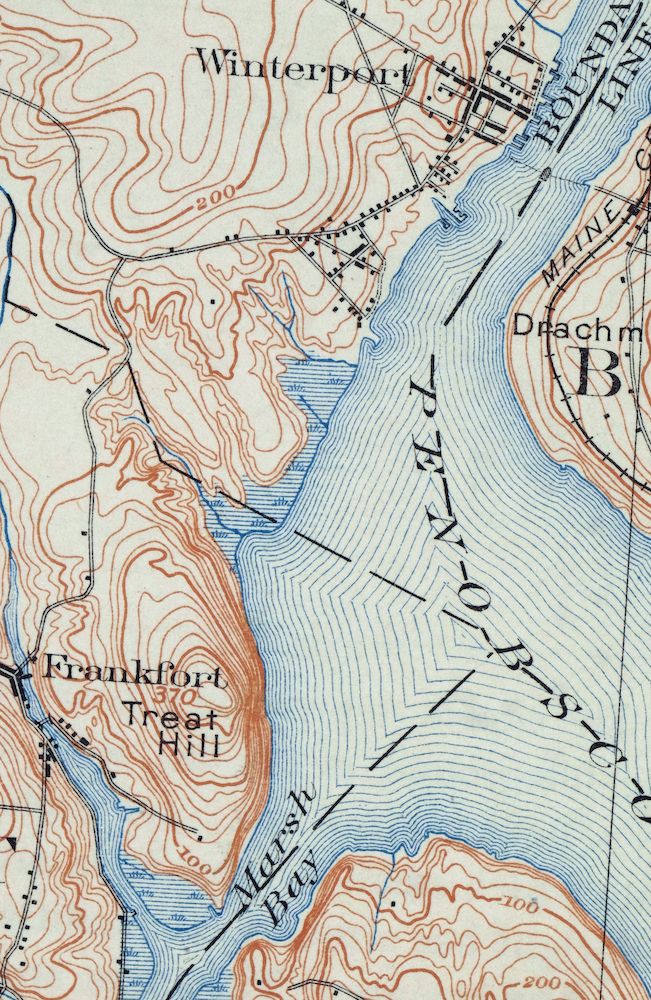
The Bucksport 15-minute map shows cities and towns, roads, railroads, rivers, creeks, elevation contour lines, public land survey lines, county, state, and other administrative boundaries as they existed at the time of the survey in 1899. All known structures (houses, businesses, churches, schools, barns, cabins, etc) are also shown, with exceptions in some urban areas, where only landmark buildings may be shown.
A VALUABLE HISTORICAL RECORD
Maps from the 15-minute series for the continental United States are no longer produced or printed by the USGS and original prints are becoming increasingly difficult to find. They are a valuable historical record for an area, as they contain many placenames and features that have been dropped from more recent maps.
Nearby maps
-

Tug Mountain Maine USGS 15-Min Topographic Map 1958 Vintage
$16 Add to cart -
Boothbay Maine Wiscasset USGS Topographic Map 1972 Vintage
$52 Add to cart -
Waite Maine Topsfield USGS 15-Min Topo Map 1959 Vintage
$24 Add to cart -
Chain Lakes Maine Round Mountain USGS Topo Map 1935 Antique
$26 Add to cart -
Shin Pond Maine USGS 15-Min Topographic Map 1958 Vintage
$15 Add to cart -
Skinner Maine Lowelltown USGS 15-Min Topo Map 1931 Antique
$25 Add to cart -
Grand Lake Seboeis Maine USGS 15-Min Topo Map 1961 Vintage
$18 Add to cart -

Mount Washington New Hampshire Berlin USGS Topo Map 1967
$42 Add to cart -
Ashland Maine USGS 15-Min Topographic Map 1973 Vintage
$18 Add to cart -
Alton New Hampshire Farmington Strafford USGS Topo Map 1977
$12 Add to cart -
Provincetown Massachusetts USGS Topographic Map 1978 Vintage
$58 Add to cart -
Norwood Massachusetts Boston Dover USGS Topographic Map 1960
$18 Add to cart -
Mansfield Massachusetts Sharon Walpole USGS Topo Map 1961
$18 Add to cart -

Middlebury Vermont Bristol Starksboro USGS Topo Map 1905
$67 Add to cart -

Brandon Vermont Green Mountain NF USGS Topo Map 1911 Antique
$52 Add to cart -

Quinsigamond Massachusetts Milford USGS Topographic Map 1910
$90 Add to cart -

Rouses Point New York Champlain Alburg USGS Topo Map 1913
$58 Add to cart -

Blackstone Massachusetts Milford Hopedale USGS Topo Map 1944
$22 Add to cart -
Port Henry Vermont Lake Champlain USGS Topo Map 1913 Antique
$115 Add to cart -

Dannemora New York Peru Saranac USGS Topographic Map 1913
$48 Add to cart -
Mooers New York West Chazy Altona USGS Topo Map 1912 Antique
$57 Add to cart -
Ausable New York Au Sable Forks USGS Topo Map 1909 Antique
$48 Add to cart -
Churubusco New York Lyon Mountain USGS Topo Map 1915 Antique
$48 Add to cart -

Taconic Vermont Pittsfield Adams USGS Topographic Map 1912
$79 Add to cart