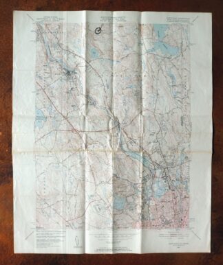
MAP DETAILS | |
|---|---|
| TITLE | Pawtucket |
| STATE | Rhode Island, Massachusetts |
| LOCATION | 35 miles southwest of Boston |
| SERIES | 7.5-minute |
| SURVEYED | 1937 and 1938 Aerial and Field Survey |
| EDITION | 1949 |
| REVISIONS | Aerial revision in 1949. |
| PRINTED | 1957 |
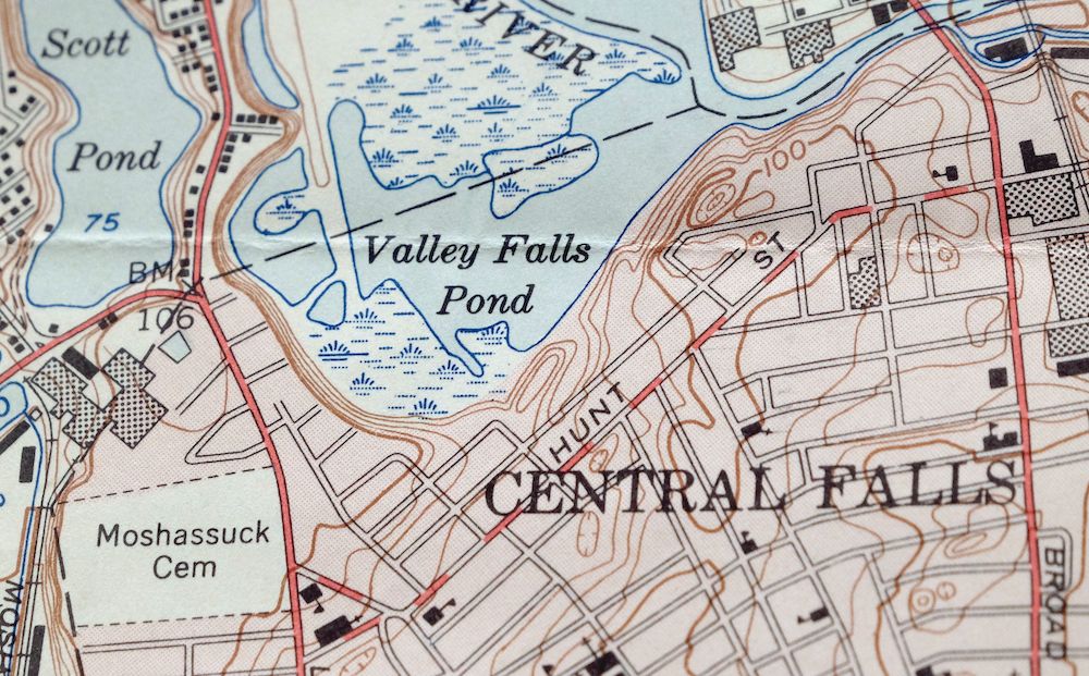
| PRINT NOTES | Thick paper stock. A reddish tint is used to indicate urban areas where only landmark buildings are shown. |
| SCALE | 1:24000 |
| CONTOUR INTERVAL | 10 feet |
| SHEET DIMENSIONS | 22 x 27 inches |
| MAP DIMENSIONS | 17 x 22 3/4 inches |
| COVERAGE AREA | 6 x 9 miles |
| MAP NOTES | An excellent historical reference. |
| SHEET CONDITION For maps of this vintage, effort is made to note all visible flaws, no matter how minor. | |
| OVERALL CONDITION | Fair |
| SHEET NOTES | moderately handled, has foldlines |
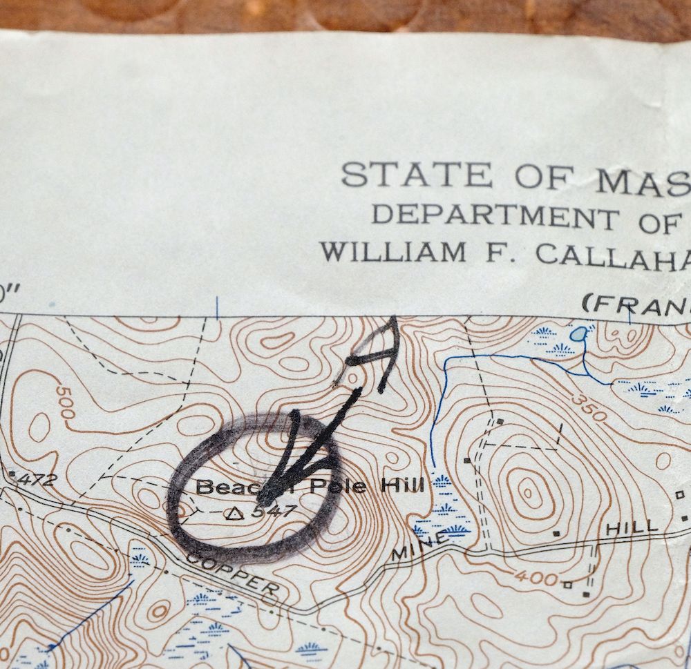
| MAP AREA | minor wear, marker notation in north portion of map |
| COLLARS | no markings, no edge tears |
 | |
| MAP COVERAGE Quadrangle extent overlaid on current basemap. | |
| PLACENAMES Depending on map series and survey date, all of the features listed below may not be shown on this map. This list contains features that currently exist or historically existed within the area covered by the map. The list can be used as a reference to determine if this map covers your area of interest. Placenames are listed alphabetically next to each feature type. | |
| CITIES AND TOWNS (CURRENT) | Attleboro, Central Falls, Cumberland Hill, North Providence, Pawtucket, Valley Falls, and Woonsocket |
| COUNTIES COVERED | Bristol, Norfolk, and Providence |
| RIVERS AND STREAMS | Abbott Run, Blackstone River, Crookfall Brook, Hawkins Brook, Long Brook, Mussey Brook, Seekonk River, Spring Brook, Sylvys Brook, Threadmill Brook, West Sneech Brook, and Woonasquatucket River |
| WATER BODIES | Arnold Mills Reservoir, Barney Pond, Bleachery Pond, Diamond Hill Reservoir, Gilbanes Pond, Happy Hollow Pond, Howard Pond, Laportes Pond, Little Cranberry Pond, Little Pond, Lower Rochambeau Pond, Manville Pond, Meaders Pond, New Pond, Olney Pond, Rawson Pond, Reservoir Number 1, Reservoir Number 2, Robin Hollow Pond, Scott Pond, Sneech Pond, Valley Falls Pond, Wenscott Reservoir, and Woonsocket Reservoir Number 3 |
| Rhode Island Locations: Adams Shopping Plaza Shopping Center, Ann and Hope Street Shopping Center, Bridge Mill Power Plant, Chapel Four Corners, Church Hill Industrial District, Cumberland Plaza Shopping Center, Dexter Quarry, Diamond Hill Vineyards, Follett-Carpenter House and Farm, Lincoln Center Mall Shopping Center, Lincoln Country Club, Lincoln Mall Shopping Center, Lincoln Shopping Center, Mapleshade farm, and Tiffany Plaza Shopping Center. Administrative Boundaries: City of Central Falls, Town of Cumberland, Town of Lincoln, and City of Pawtucket. Mountains, Peaks, and Summits: Beacon Pole Hill, Bear Hill, Brush Hill, Cobble Hill, Copper Mine Hill, Cumberland Hill, Dexters Ledge, Diamond Hill, Hunting Hill, Jenckes Hill, Molasses Hill, Quinsnicket Hill, Stump Hill, Tablerock Hill, Thompson Hill, and Whipple Hill. Valleys and Canyons: Robin Hollow. Parks: Albion Historic District, Arnold Mills Historic District, Ashton Historic District, Berkeley Mill Village Historic District, Central Falls Mill Historic District, Central Street School Historic District, George Washington Memorial Park, Limerock Village Historic District, Lincoln Greyhound Park, Lincoln Woods State Park, Jenks Park, Lonsdale Historic District, Old Ashton Historic District, Quality Hill Historic District, Saylesville Historic District, Slater Park, South Central Falls Historic District, South Street Historic District, Tucker Field, Valley Falls Heritage Park, and Wilkinson Park. Drainages: Abbott Run, Angell Brook, Ash Swamp Brook, Blackstone River, Catamint Brook, Crookfall Brook, East Sneech Brook, Long Brook, Millers River, Monastery Brook, Mussey Brook, Scott Brook, Spring Brook, Sylvys Brook, Threadmill Brook, West River, and West Sneech Brook. Mines: Conklin Limestone Quarry. Churches: Arnold Mills United Methodist Church, Assembly of God Church, Bible Baptist Church, Central Falls Congregational Church, Casade Oracion Gethsemane Church, Dormition of the Virgin Mary Church, Emmanuel Church, First Baptist Church, First Baptist Church of Pawtucket, Four Corners Community Chapel, Lincoln Christian Fellowship, Lincoln Seventh Day Adventist Church, Good Shepherd Church, Greek Orthodox Assumption Church, Holy Trinity Church Complex, Kingdom Hall of Jehovahs Witnesses, Lighthouse Family Worship Center, Lonsdale Baptist Church, Pawtucket Congregational Church, Providence Zen Center, Refuge Deliverance Tabernacle, Sacred Heart Rectory, Saint Aidans Rectory, Saint Ambrose Church, Saint Anthonys Greek Orthodox Church, Saint Edwards Rectory, Saint Ephraims Church, Saint Georges Roman Catholic Church, Saint Joan Church, Saint John Church, Saint John the Baptist Church, Saint Johns Episcopal Church, Saint Josephs Church Complex, Saint Josephs Roman Catholic Church, Saint Judes Rectory, Saint Marys Antiochian Church, Saint Marys Greek Orthodox Church, Saint Matthews Church, Saint Patricks Church, Saint Patricks Convent, Saint Pauls Church, Sayles Memorial Church, Saylesville Meeting House, Smithfield Avenue United Church of Christ, Smithfield Friends Meeting House, Trinity Church, and United Church of Christ. Hospitals: Notre Dame Hospital. Lakes and Ponds: Gilbanes Pond, Little Pond, Gould Pond, Manville Pond, Mill Pond, Sneech Pond, and Spectacle Pond. Buildings: Adams Memorial Library, American Legion Post Number 14, American-French Genealogical Society Library, Blackstone Valley Historical Society Building, Central Falls City Hall, Central Falls Free Public Library, Childrens Museum of Rhode Island, Deborah Cook Sayles Memorial Library Pawtucket Public Library, Edward J Hayden Library Cumberland Public Library, Eleazar Arnold House, Fire Station Number 4, Lincoln Public Library, Lincoln Town Hall, Grayrock, Harris Warehouse, Kelly House, Pawtucket Boys Club, Pawtucket City Hall, North Tollgate House, Slater Mill Historic Site Library, Valley Falls Library, and William F Flanagan Learning Resources Center. Waterfalls: Albion Falls and Pawtucket Falls. Dams: Albion Dam, Ashton Dam, Barney Pond Dam, Central Falls Dam, Diamond Hill Reservoir Dam, Happy Hollow Pond Dam, Manville Dam, Pawtucket Reservoir Dam, Olney Pond Dam, Rawson Pond Dam, Pratt Dam, Robin Hollow Pond Dam, Slatersville Reservoir Lower Dam, Valley Falls Pond Dam, and Woonsocket Reservoir Number 3 Dam. Crossings: Interchange 10, Interchange 11, and Interchange 9. Canals: Blackstone Canal. Bridges: Albion Bridge, Arnold Mills Bridge, Ashton Viaduct, Broad Street Bridge, Church Street Bridge, Howard Road Bridge, and Main Street Bridge. Beaches: Frank Moody State Beach. Airports: North Central State Airport and Wgng Airport. Swamps: Ash Swamp and Town Line Swamp. Schools: Ashton School, B F Norton Elementary School, Central Falls Junior-Senior High School, Central Street School, Broad Street School, Captain G Harold Hunt School, Community College of Rhode Island, Community School, Cumberland High School, Cumberland Hill Annex, Cumberland Hill School, Cumberland Middle School, District 14 Schoolhouse, Doctor Earl F Calcutt Middle School, Ella Risk School, Fairlawn Elementary School, Fallon Memorial School, Garvin Memorial School, Lincoln Central Elementary School, Lincoln Middle School, Henry J Winters School, Hunt School, Kwan Um Zen School, Lonsdale Elementary School, M Virginia Cunningham School, Margaret I Robertson School, North Cumberland Middle School, Northern Lincoln Elementary School, Saint Elizabeth Ann Seton Academy, Saint Patricks Parochial School, Saint Raphael Academy, Saylesville Elementary School, Spurwick School II, Veterans Memorial Elementary School, William E Tolman Senior High School, William M Davies Junior Career-Technical High School, and Woodlawn Catholic Regional School. Reservoirs and Tanks: Arnold Mills Reservoir, Barney Pond, Blackstone River Reservoir, Bleachery Pond, Butterfly Pond, Diamond Hill Reservoir, Happy Hollow Pond, Howard Pond, Laportes Pond, Lower Rochambeau Pond, Meaders Pond, Pawtucket Reservoir, New Pond, Olney Pond, Rawson Pond, Reservoir Number 1, Reservoir Number 2, Robin Hollow Pond, Rochambeau Ponds, Scott Pond, Stump Hill Reservoir, Valley Falls Pond, Woonsocket Reservoir Number One, Woonsocket Reservoir Number Three, and Woonsocket Reservoir Number Two. Towers: Cogswell Tower and WGNG-AM (Pawtucket). | |
| Massachusetts Valleys and Canyons: Robin Hollow. Drainages: Abbott Run and Millers River. Lakes and Ponds: Little Cranberry Pond. | |
| SHIPPING AND RETURNS | |
 This map sheet will be carefully rolled in a sturdy tube and shipped via the US Postal Service. If you find that the sheet you receive is not as described in the listing, you may ship it back to us for a refund of the purchase price. | |


1957 Pawtucket Rhode Island/Massachusetts USGS Topo Map
$16
An excellent historical reference. This is the Pawtucket quadrangle, a 7.5-minute USGS topographic map at 1:24,000 scale, first published in a 1949 edition and printed here in 1957 on thick paper stock. The sheet spans the Rhode Island–Massachusetts line, covering an industrial stretch of the Blackstone River valley that takes in Pawtucket, Central Falls, North Providence, and Woonsocket, with Attleboro, Massachusetts to the east and Cumberland Hill to the north.
In stock
This vintage sheet is a 1949 edition of the Pawtucket Rhode Island USGS topographic map revised in 1949 using aerial photography. It is an original 69-year-old 1957 United States Geological Survey print in fair condition.
HOW THIS MAP CAN BE USED
In addition to making a fascinating conversation piece, this sheet would make a unique and prized gift for anyone interested in this area, be perfect as a reference for genealogy studies or general historical research, or fill that missing piece in your collection. Maps of this vintage are printed on durable stock and are well-suited for outdoor activities and recreation of all kinds, including hiking, backpacking, hunting, rafting and kayaking, backcountry skiing, geocaching, general exploration, treasure hunting, etc.
FEATURES SHOWN ON THE MAP
The Pawtucket 7.5-minute map shows cities and towns, roads, paths, railroads, utilities and energy infrastructure, rivers, creeks, elevation contour lines, public land survey lines, county, state, and other administrative boundaries as they existed at the time of the survey in 1937 and 1938. A reddish tint is used on this sheet to indicate urban areas where only landmark buildings are depicted. Outside of those areas, all known structures (houses, businesses, churches, schools, barns, cabins, etc) are shown.
A VALUABLE HISTORICAL RECORD
This map is from the 7.5-minute series, the most detailed series that is widely available from the USGS. The 1949 Pawtucket map is a valuable historical record for the area. It contains some placenames and features that have been dropped from more recent maps.
Nearby maps
-

Blackstone Massachusetts Milford Hopedale USGS Topo Map 1944
$22 Add to cart -
1961 Mansfield Massachusetts USGS Topo Map: Sharon
$13 Add to cart -
Norwood Massachusetts Boston Dover USGS Topographic Map 1960
$18 Add to cart -

Quinsigamond Massachusetts Milford USGS Topographic Map 1910
$125 Add to cart -
Uncasville Connecticut Ledyard Norwich USGS Topo Map 1984
$34 Add to cart -

Moodus Connecticut Lake Pocotopaug USGS Topographic Map 1946
$32 Add to cart -
Provincetown Massachusetts USGS Topographic Map 1978 Vintage
$48 Add to cart -

Holyoke Massachusetts Springfield USGS Topo Map 1897 Antique
$80 Add to cart -
Sag Harbor New York Hampton Bays USGS Topo Map 1913 Antique
$145 Add to cart -
Litchfield Connecticut Waterbury Oakville USGS Topo Map 1910
$80 Add to cart -

Riverhead New York Manorville Calverton USGS Topo Map 1915
$180 Add to cart -
Alton New Hampshire Farmington Strafford USGS Topo Map 1977
$12 Add to cart -

Danbury Connecticut Trumbull Bethel USGS Topo Map 1899
$48 Add to cart -

Taconic Vermont Pittsfield Adams USGS Topographic Map 1912
$75 Add to cart -
Westport Connecticut Fairfield USGS Topographic Map 1973
$42 Add to cart -
Norwalk South Connecticut Stamford Darien USGS Topo Map 1963
$40 Add to cart -

Troy New York Albany Watervliet USGS Topo Map 1907 Antique
$94 Add to cart -
1966 USGS Topo Map: Glenville, Connecticut/New York
$48 Add to cart -
West Point New York Newburgh Peekskill USGS Topo Map 1912
$80 Add to cart -
Schunemunk New York Newburgh Kiryas Joel USGS Topo Map 1915
$69 Add to cart -
Harlem New York New York Yonkers USGS Topo Map 1913 Antique
$250 Add to cart -
Park Ridge New Jersey New City Ridgewood USGS Topo Map 1963
$45 Add to cart -
Amsterdam New York Rotterdam Hagaman USGS Topo Map 1912
$45 Add to cart -

Goshen New York Middletown Warwick USGS Topographic Map 1913
$65 Add to cart