MAP DETAILS | |
|---|---|
| TITLE | Irasburg |
| STATE | Vermont |
| LOCATION | Vicinity of North Troy, 50 miles northeast of Burlington |
| SERIES | 15-minute |
| SURVEYED | 1923 Field Survey |
| GEOGRAPHER | Hersey Munroe |
| EDITION | 1925 |
| PRINTED | 1925 |
| PRINT NOTES | Thick paper stock |
| SCALE | 1:62500 |
| CONTOUR INTERVAL | 20 feet |
| SHEET DIMENSIONS | 16 1/2 x 20 inches (approximate) |
| MAP DIMENSIONS | 12 3/8 x 17 1/2 inches |
| COVERAGE AREA | 12 x 17 miles |
| SHEET CONDITION For maps of this vintage, effort is made to note all visible flaws, no matter how minor. | |
| OVERALL CONDITION | Good |
| SHEET NOTES | never folded |
| MAP AREA | no wear, no markings, no blemishes |
| COLLARS | no markings, no edge tears, minor blemishing and handling wear along top and bottom collars |
| MAP COVERAGE Quadrangle extent overlaid on current basemap. | |
| BACKSIDE LEGEND | |
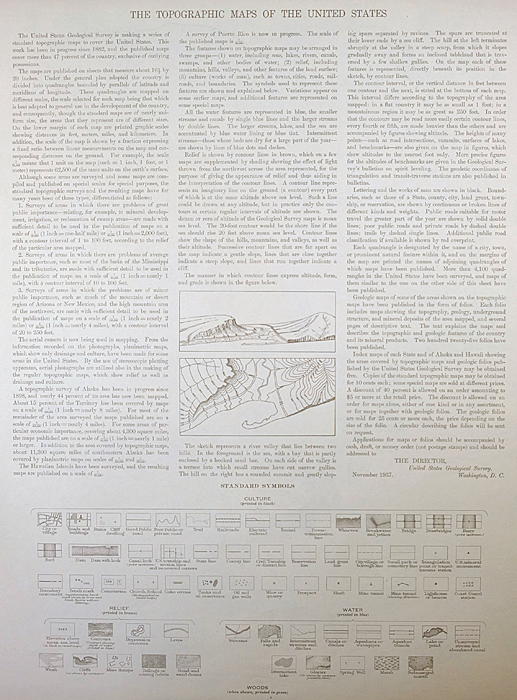 A map summary is printed on the back side of the Irasburg sheet similar to the one shown in the picture. It outlines the history, purpose, and status of the USGS mapping program at the time of the printing in 1925. It also provides instructions on how to read contour lines and a description of how they are used to depict the terrain. At the bottom of the page is a legend showing all of the symbols used to represent the cultural, relief, and water features found on the map. | |
| PLACENAMES Depending on map series and survey date, all of the features listed below may not be shown on this map. This list contains features that currently exist or historically existed within the area covered by the map. The list can be used as a reference to determine if this map covers your area of interest. Placenames are listed alphabetically next to each feature type. | |
| CITIES AND TOWNS (CURRENT) | Lowell and North Troy |
| COUNTIES COVERED | Lamoille and Orleans |
| RIVERS AND STREAMS | Ace Brook, Alder Brook, Allen Brook, Beetle Brook, Black River, Brighton Brook, Burgess Branch, Buybee Brook, Coburn Brook, Crook Brook, Dunn Brook, East Branch Missisquoi River, Jay Branch, Lamphean Brook, Le Clair Brook, Lilly Branch, Lords Creek, McCleary Brook, Mill Brook, Mineral Spring Brook, Missisquoi River, Mud Creek, Snider Brook, Taft Brook, Tamarack Brook, Truland Brook, and Ware Brook |
| WATER BODIES | Griggs Pond, Kidder Pond, Lake Memphremagog, McAllister Pond, Lake Memphremagog, Phillips Pond, Potters Pond, Sargent Pond, Smith Pond, and Walker Pond |
| Locations: Summit Siding, Lowell Plain, and Mill Brook Campground. Administrative Boundaries: Town of Irasburg, Town of Jay, Town of Lowell, Town of Newport, Town of Troy, and Town of Westfield. Mountain Ranges: Lowell Mountains. Mountains, Peaks, and Summits: Stony Hill, Allen Hill, Black Hill, Browns Ledges, Burton Hill, Chamberlain Hill, Cleveland Hill, Coburn Hill, Farman Hill, Gilpin Mountain, Leland Hill, Round Hill, and Warner Hill. Parks: Irasburg Square. Drainages: Snider Brook, Stony Brook, Allen Brook, Ace Brook, Beetle Brook, Brighton Brook, Burgess Branch, Buybee Brook, Coburn Brook, Crook Brook, Dunn Brook, East Branch Missisquoi River, Jay Branch, Le Clair Brook, Lilly Branch, Lords Creek, Mill Brook, Mineral Spring Brook, Taft Brook, Tamarack Brook, Truland Brook, and Ware Brook. Churches: Federated Church, Federated Protestant Church, Grace Brethren Church, and United Church of Irasburg. Forests: Lowell Municipal Forest and Westfield Municipal Forest. Buildings: Leach Public Library and William H and Lucy F Rand Memorial Library. Waterfalls: Big Falls. Dams: Bakers Falls Dam. Bridges: Orne Covered Bridge and River Road Covered Bridge. Schools: Brighton School, Brown School, Burington School, Burton Hill School, Coventry Village School, Farrar School, Hitchcock School, Irasburg Village School, Jay-Westfield Joint School, Lowell School, Newport Town School, Troy Elementary School, and West Hill School. Reservoirs and Tanks: Sargent Pond, Smith Pond, Griggs Pond, Kidder Pond, McAllister Pond, Phillips Pond, Potters Pond, and Walker Pond. | |
| SHIPPING AND RETURNS | |
 This map sheet will be carefully rolled in a sturdy tube and shipped via the US Postal Service. If you find that the sheet you receive is not as described in the listing, you may ship it back to us for a refund of the purchase price. | |
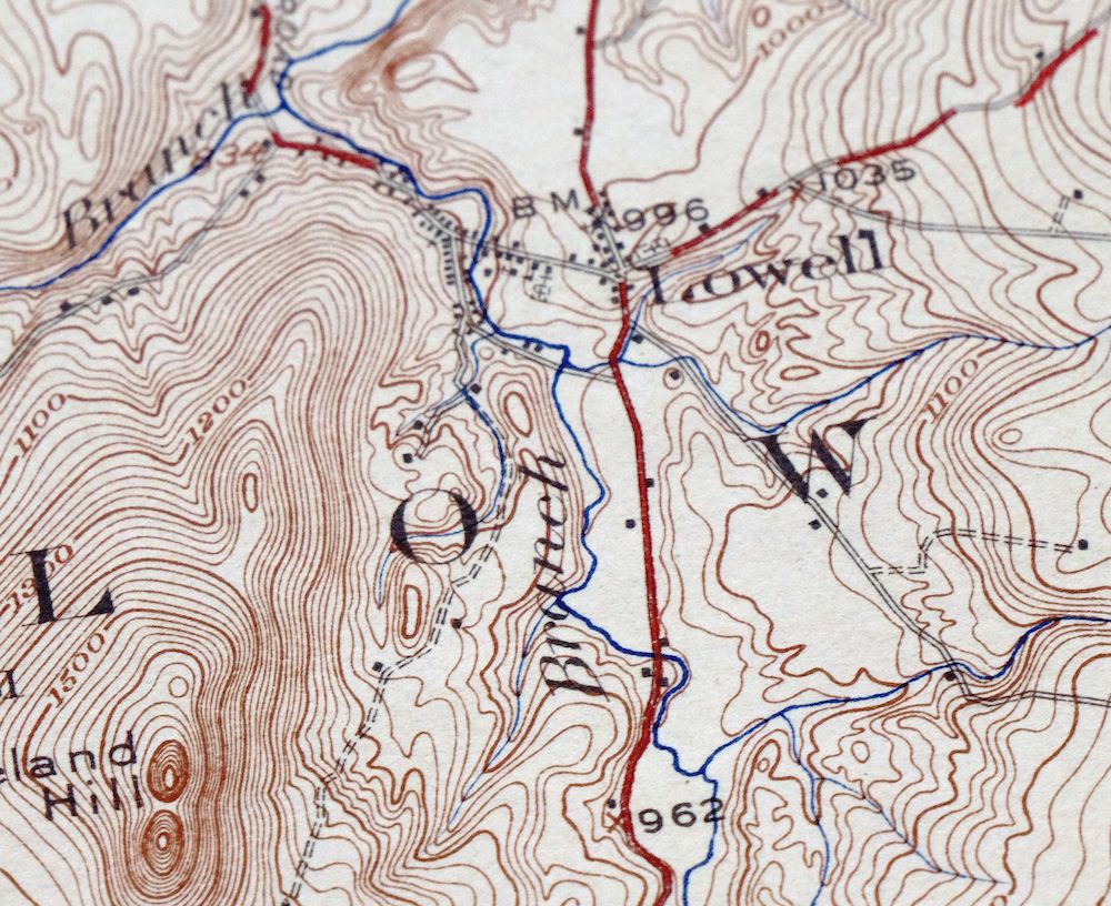
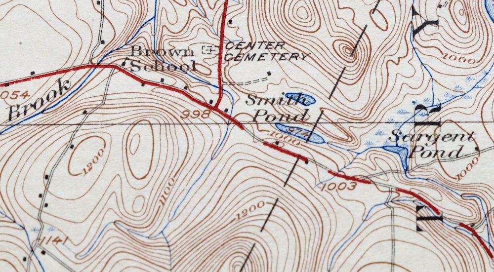
Irasburg Vermont North Troy Lowell USGS Topographic Map 1925
$48
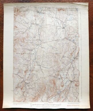
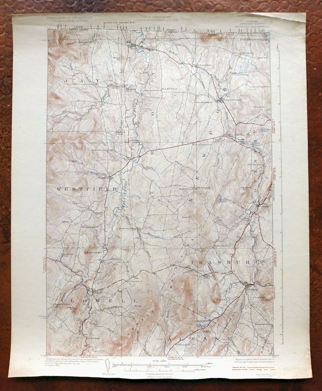
This Irasburg sheet is an antique 15-minute topographic map, published and printed by the USGS in 1925 from a field survey done two years earlier under geographer Hersey Munroe. It covers a stretch of northern Vermont near the Canadian border, taking in the village of North Troy, the small community of Lowell, and the surrounding country across Orleans and Lamoille counties. Printed on thick paper stock and never folded, it has reached its full century in good shape, with a clean map area that would frame well.
In stock
This antique sheet is a 1925 edition of the Irasburg Vermont USGS topographic map. It is an authentic 101-year-old United States Geological Survey print in good condition.
HOW THIS MAP CAN BE USED
In addition to making a fascinating conversation piece, this sheet would look great in a frame or on display, make a unique and prized gift for anyone interested in this area, be perfect as a reference for genealogy studies or general historical research, or fill that missing piece in your collection.
FEATURES SHOWN ON THE MAP
The Irasburg 15-minute map shows cities and towns, roads, railroads, rivers, creeks, elevation contour lines, public land survey lines, county, state, and other administrative boundaries as they existed at the time of the survey in 1923. All known structures (houses, businesses, churches, schools, barns, cabins, etc) are also shown, with exceptions in some urban areas, where only landmark buildings may be shown.
A VALUABLE HISTORICAL RECORD
Maps from the 15-minute series for the continental United States are no longer produced or printed by the USGS and original prints are becoming increasingly difficult to find. They are a valuable historical record for an area, as they contain many placenames and features that have been dropped from more recent maps.
Nearby maps
-

Rouses Point New York Champlain Alburg USGS Topo Map 1913
$58 Add to cart -

Mount Washington New Hampshire Berlin USGS Topo Map 1967
$42 Add to cart -
Mooers New York West Chazy Altona USGS Topo Map 1912 Antique
$57 Add to cart -

Middlebury Vermont Bristol Starksboro USGS Topo Map 1905
$105 Add to cart -

Dannemora New York Peru Saranac USGS Topographic Map 1913
$48 Add to cart -
Ausable New York Au Sable Forks USGS Topo Map 1909 Antique
$48 Add to cart -
Port Henry Vermont Lake Champlain USGS Topo Map 1913 Antique
$115 Add to cart -
Churubusco New York Lyon Mountain USGS Topo Map 1915 Antique
$48 Add to cart -

Brandon Vermont Green Mountain NF USGS Topo Map 1911 Antique
$52 Add to cart -

Chateaugay New York Burke USGS 15-Min Topo Map 1915 Antique
$46 Add to cart -
Skinner Maine Lowelltown USGS 15-Min Topo Map 1931 Antique
$25 Add to cart -
Alton New Hampshire Farmington Strafford USGS Topo Map 1977
$12 Add to cart -

Massena New York Stockholm Norwood USGS 15-Min Topo Map 1909
$52 Add to cart -
Potsdam New York Norwood Colton USGS Topographic Map 1908
$85 Add to cart -
Raquette Lake New York Speculator USGS Topo Map 1964 Vintage
$32 Add to cart -
Raquette Lake New York Speculator USGS Topo Map 1912 Antique
$145 Add to cart -

Waddington New York Norwood Madrid USGS 15-Min Topo Map 1905
$115 Add to cart -

Canton New York Potsdam Norwood USGS Topo Map 1911 Antique
$49 Add to cart -

Red Mills New York Saint Lawrence River USGS Topo Map 1906
$46 Add to cart -
Ogdensburg New York Heuvelton Lisbon USGS Topo Map 1905
$85 Add to cart -
Old Forge New York USGS 15-Min Topographic Map 1913 Antique
$90 Add to cart -

Gouverneur New York Edwards Richville USGS Topo Map 1915
$52 Add to cart -
Boothbay Maine Wiscasset USGS Topographic Map 1972 Vintage
$52 Add to cart -

Taconic Vermont Pittsfield Adams USGS Topographic Map 1912
$110 Add to cart