MAP DETAILS | |
|---|---|
| TITLE | Boothbay |
| STATE | Maine |
| LOCATION | Vicinity of Damariscotta-Newcastle, 35 miles northeast of Portland |
| SERIES | 15-minute |
| SURVEYED | 1941 Aerial and Field Survey |
| EDITION | 1957 |
| REVISIONS | 1957 |
| PRINTED | 1972 |
| PRINT NOTES | Includes woodland tint (green to indicate vegetated areas) |
| SCALE | 1:62500 |
| CONTOUR INTERVAL | 20 feet |
| SHEET DIMENSIONS | 17 x 21 inches |
| MAP DIMENSIONS | 12 5/8 x 17 1/2 inches |
| COVERAGE AREA | 12 x 17 miles |
| MAP NOTES | Includes bathymetric depth isolines. |
| SHEET CONDITION For maps of this vintage, effort is made to note all visible flaws, no matter how minor. | |
| OVERALL CONDITION | Excellent |
| SHEET NOTES | lightly handled, never folded |
| MAP AREA | flawless map area |
| COLLARS | no wear or tears, no markings, no blemishes |
| MAP COVERAGE Quadrangle extent overlaid on current basemap. | |
| PLACENAMES Depending on map series and survey date, all of the features listed below may not be shown on this map. This list contains features that currently exist or historically existed within the area covered by the map. The list can be used as a reference to determine if this map covers your area of interest. Placenames are listed alphabetically next to each feature type. | |
| NOTABLE PLACES | Pemaquid Point, Five Islands, and Edgecomb |
| CITIES AND TOWNS (CURRENT) | Boothbay Harbor, Damariscotta-Newcastle, and Wiscasset |
| COUNTIES COVERED | Lincoln and Sagadahoc |
| RIVERS AND STREAMS | Back River, Chewonki Creek, Damariscotta River, Little River, Meadow Brook, Montsweag Brook, Pemaquid River, Sheepscot River, and Wiley Brook |
| WATER BODIES | Adams Pond, Appalachie Pond, Boyd Pond, Charles Pond, Clareys Pond, Clark Cove Pond, Heal Pond, Hilton Pond, Knickerbocker Lakes, Lily Pond, Lower Pond, Sherman Lake, Southport Water Supply Pond, Upper Pond, Wiley Pond, and Wolf Pond |
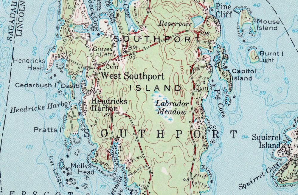
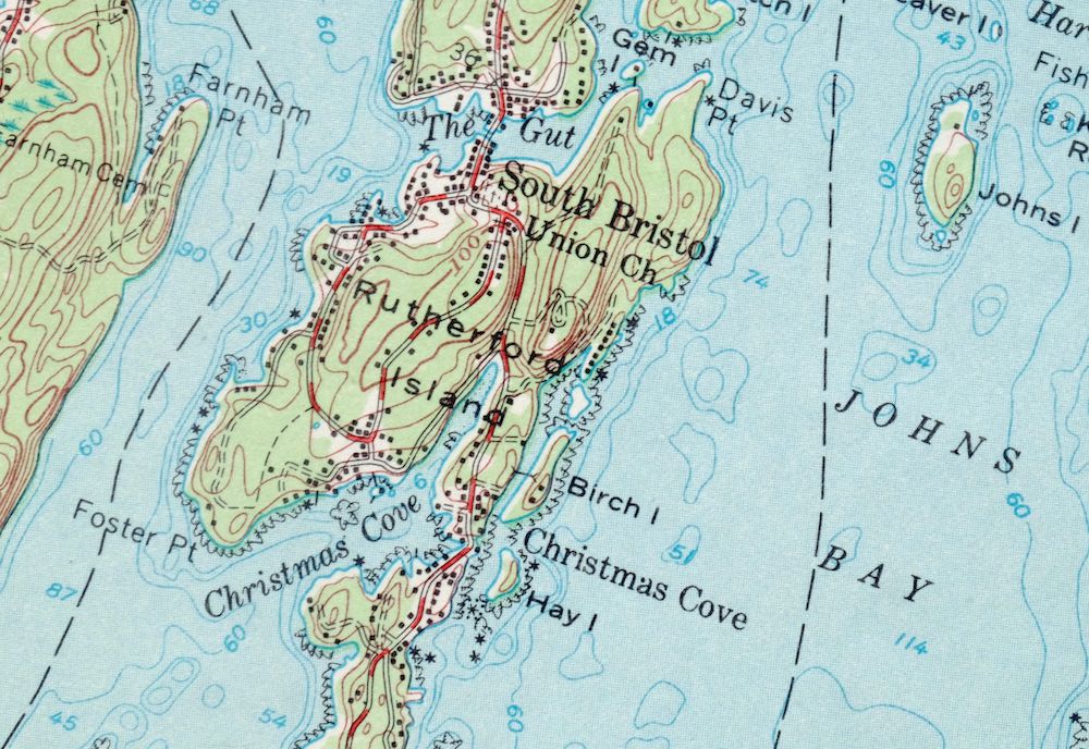
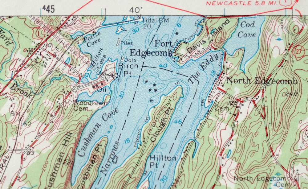
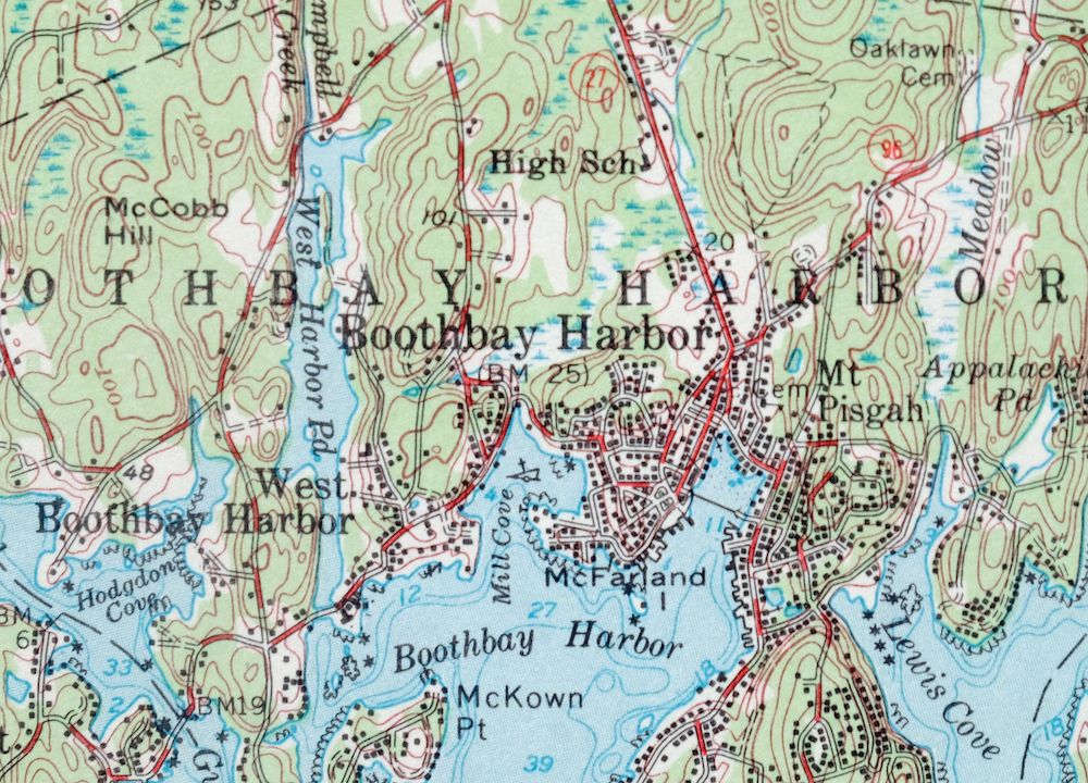
| Locations: Boothbay Harbor Yacht Club, Boothbay Railway Village, Boothbay Region Country Club, Meadow Shopping Center, Burnt Island Light Station, Camp Sequin, Campers Cove Campground, Central Maine Power Plant, Chewonki Campground, Cuckolds Lighthouse, Damariscove Lifesaving Station, East Boothbay Shipyards, Fishermans Wharf, Gray Homestead Campground, Hendricks Head Light Station, Hunters Landing, Knickerane Picnic Area, Little Ponderosa Campground, Pemaquid Lighthouse, Pier 1, Pier 6, Pier 7, Pier 8, Ram Island Light Station, Robinhood Marine Center, Robinson Wharf, Shore Hills Campground, Southport Yacht Club, Wattons Wharf, Wawenock Country Club, Woods End, and YMCA Camp. Administrative Boundaries: Town of Boothbay Harbor, Town of Boothbay, Town of Edgecomb, Town of Georgetown, Town of South Bristol, Town of Southport, and Town of Westport. Mountains, Peaks, and Summits: Beech Hill, Doggett Castle, Burleigh Hill, Cushman Hill, Haggett Hill, High Head, Mount Hunger, Kenniston Hill, Knubble, McCobb Hill, Ozone Mountain, Smith Hill, and Tyler Hill. Parks: Barrett Park, Dodge Point Preserve, Colonial Pemaquid State Historic Site, Fishermans Memorial Park, Fort Edgecomb State Park, Harold B Clifford Playground, Indiantown Preserve, Inner White Island Preserve, Josephine Newman Sanctuary, Kitzi-Colby Preserve, Levison Preserve, Little River Dam Preserve, Ovens Mouth Preserve, Pemaquid Lighthouse Park, Porter Preserve, Reid State Park, and Singing Meadow Preserve. Drainages: Montsweag Brook, Meadow Brook, Campbell Creek, Chewonki Creek, Cross River, Damariscotta River, Eastern Branch Johns River, Johns River, Little Falls Brook, Little River, North Branch Johns River, Parsons Creek, Pemaquid River, Sheepscot River, Squam Creek, Ward Brook, and Wiley Brook. Islands: The Ark, Bareneck Island, Barters Island, Beal Island, Beaver Island, Miller Island, Mink Island, Boston Island, Berry Island, Birch Island, Merrow Island, Merry Island, Middle Mark Island, Miles Island, Mouse Island, Burnt Island, Cabbage Island, Cape Island, Capitol Island, Carlisle Island, Castle Island, Castle Rock, Cedarbush Island, Clam Rock, Crow Island, The Cuckolds, Damariscove Island, David Island, Davis Island, Farmers Island, Fish Hawk Island, Fisherman Island, Five Islands, Fog Island, Fort Island, Foster Island, Fox Island, Foxbird Island, Gem Island, Gooseberry Island, Green Island, Green Islands, Harper Island, Hay Island, Hen Island, High Island, Hodgdon Island, Hodgsons Island, Hunting Island, Indiantown Island, Inner Heron Island, Inner Island, Johns Island, Little Green Island, Little Knubble, Little Oak Island, Lobster Rock, Lower Mark Island, MacMahan Island, Malden Island, McFarland Island, Negro Island, Oak Island, Outer Head, Outer Heron Island, Outer Island, Peabow Island, Perch Island, Peters Island, Phebe Island, Pine Island, Pleasant Cove Island, Powderhorn Island, Pratts Island, Prentiss Island, Pumpkin Island, Ram Island, Ram Islands, Reeds Island, Rutherford Island, Sawyer Island, Southport Island, Spectacle Islands, Isle of Springs, Squirrel Island, Thomas Great Toe, Thrumcap Island, Tibbet Island, Tumbler Island, Turnip Island, Tyler Islands, Upper Mark Island, Webber Island, Westport Island, White Islands, Whites Island, Whittum Island, Witch Island, and Wood Island. Capes: Albee High Head, Bailey Point, Bareneck Point, Bartlett Point, Bluff Head, Mill Point, Mollys Head, Montgomery Point, Brook Point, Brooks Point, Bennett Neck, Birch Point, Dodge Point, Dogfish Head, Doggard Point, Cameron Point, Carlisle Point, Cavis Point, Chewonki Neck, Clifford Point, Clough Point, Cross Point, Crow Point, Cushman Point, Davis Point, Dry Point, Farnham Point, Fish Point, Fitch Point, Fort Point, Foster Point, Fowle Point, Hendricks Head, Hillton Point, Hubbard Point, Jewett Point, Jones Point, Juniper Point, Kehali Point, Kelsey Point, Linekin Neck, Lowe Point, Lower Fitch Point, McFarland Point, McFarlands Point, McGuire Point, McKown Point, Cape Newagen, Newdick Point, North Point, Northeast Point, Oak Point, Paradise Point, Pea Point, Pemaquid Point, Phipps Point, Point Pleasant, Plummer Point, Quarry Point, Railway Point, Rocky Point, Round Cove Point, Soldier Point, Sproul Point, Spruce Point, Thomas Point, Thurston Point, Todds Point, Wall Point, Wentworth Point, White Point, Wiley Point, Willis Point, and Young Point. Churches: All Saints By The Sea Episcopal Church, Boothbay Baptist Church, Berean Church, Congregational Church of Boothbay Harbor, Congregational Church of Bristol, East Boothbay United Methodist Church, Edgecomb Congregational Church, First Church of Christ Scientist, First United Methodist Church, Five Island Second Baptist Church, Harrington Meetinghouse, Ocean Point Chapel, Old Walpole Meetinghouse, Our Lady Queen of Peace Roman Catholic Church, Saint Columbas Episcopal Church, Southport United Methodist Church, Spruce Point Chapel, Union Church of South Bristol, Westport Church, and Woolwich-Wiscasset Church. Hospitals: Saint Andrews Hospital and Family Care Center. Lakes and Ponds: Appalachie Pond, Mill Pond, Charles Pond, Clareys Pond, Heal Pond, Ice Pond, Knickerbocker Lakes, Lily Pond, Lower Pond, Upper Pond, Wiley Pond, and Wolf Pond. Buildings: Boothbay Chamber of Commerce Tourist Information Center, Boothbay Harbor Memorial Library, Boothbay Harbor Municipal Building, Boothbay Harbor Region Chamber of Commerce, Boothbay Regional Historical Society and Museum, Boothbay Town Hall, Bigelow Laboratory for Ocean Sciences Library, Fishermans Museum and Art Gallery, Fort Edgecomb Block House, Grand Banks Schooner Museum, Hawks Nest Teen Center, Hendricks Hill Museum, Kenneth E Stoddard Shell Museum, Lions Club, Maine Department of Marine Resources Aquarium, Maine Department of Marine Resources Bigelow Laboratory, Maine Yankee Energy Information Center, Pemaquid Fishermans Co-operative Building, Pemaquid Historical Association Library, Saint Andrews Hospital Medical Library, South Bristol Town House, Southport Town Hall, Thompson Harvesting Museum, and YMCA Building. Dams: Adams Pond Dam, Appalachie Pond Dam, Montsweag Dam, Bristol Mills Dam, Clark Cove Pond Dam, Hilton Pond Dam, Southport Water Supply Pond Dam, and West Harbor Pond Dam. Channels: Cowseagan Narrows, Fisherman Island Passage, Goose Rock Passage, Little Hell Gate, Little Sheepscot River, Lower Hell Gate, The Narrows, and Oven Mouth. Bayous and Sloughs: Back River, The Gut, Sasanoa River, and Townsend Gut. Bridges: Southport Bridge and Trevett Swing Bridge. Beaches: Mile Beach and Pemaquid Beach. Bays: Bailey Cove, Beal Cove, Blake Cove, Mill Cove, Moffat Cove, Montsweag Bay, Boothbay Harbor, Bradstreet Cove, Briar Cove, Brookings Bay, Brooks Cove, Dodge Lower Cove, Dodge Upper Cove, Meadow Cove, Mears Cove, Merrill Cove, Burnham Cove, Cameron Cove, Campbell Cove, Cape Harbor, Card Cove, Cavis Cove, Christmas Cove, Clam Cove, Clark Cove, Colby Cove, Coombs Cove, Cozy Harbor, Cushman Cove, Damariscove Harbor, Deckers Cove, Deep Cove, Ebenecook Harbor, The Eddy, Factory Cove, Fitch Cove, Five Mile Harbor, Fossetts Cove, Fowle Cove, Golf Cove, Gotts Cove, Greenleaf Cove, Hall Bay, Harmon Harbor, Heal Cove, Hendricks Harbor, Hilton Cove, Hockomock Bay, Hogdon Cove, Jewett Cove, Johns Bay, Jones Cove, Knubble Bay, Lewis Cove, Lighthouse Cove, Linekin Bay, Little Good Harbor, Long Cove, Love Cove, Lowes Cove, Maddock Cove, McCarty Cove, McFarlands Cove, Newdick Cove, Ocean Harbor, Pea Cove, Pemaquid Harbor, Pierce Cove, Pig Cove, Pleasant Cove, Poorhouse Cove, Pottle Cove, Prentiss Cove, Riggs Cove, Robinhood Cove, Round Cove, Rum Cove, Salt Marsh Cove, Seal Cove, Sheepscot Bay, Squirrel Cove, Tarbox Cove, Thomas Cove, Wadsworth Cove, Webber Cove, West Harbor Pond, White Cove, and Wiley Cove. Bars: The Black Rocks, Blacksmithshop Ledge, Boiler Rock, The Boilers, Dictator Ledge, Merrill Ledge, Middle Ledge, The Motions, Bull Ledge, The Bulldog, Card Ledge, Cat Ledges, Clous Ledge, Collector Ledge, Corvette Ledge, Cranberry Ledge, Decker Rock, Dry Ledge, Eastern Ledge, Fourfoot Rock, Gall Rock, Gangway Ledge, Glidden Ledge, Goose Rock, Greenleaf Ledge, Griffith Head Ledge, Halftide Rock, Harding Ledge, Heron Island South Ledge, Hodgdon Ledge, Holbrook Ledge, The Hypocrites, Inner Heron Island Ledge, Kelp Ledge, Knowles Rocks, Little River Ledges, Long Ledge, McFarlands Ledges, Nick Ledge, Outer Heron Island Ledge, Pemaquid Ledge, Pig Island Ledge, Pollock Rock, Powderhorn Ledge, Pumpkin Island Northeast Ledge, Pumpkin Ledges, Ram Island Ledge, Seal Rock, Seal Rocks, Shag Ledge, Sixfoot Rock, Sloop Ledge, Spruce Point Ledges, Stover Ledge, Thread of Life Ledges, Thrumcap Ledge, Tibbits Ledge, Western Ledge, White Island Ledge, and Wylie Rock. Airports: Wiscasset Airport. Swamps: Labrador Meadow. Schools: Boothbay Region Elementary School, Boothbay Region High School, Bristol Consolidated School, Edgecomb Eddy School, Teaching and Service Ira C Darling Center for Research, South Bristol Elementary School, and Southport Central School. Ridges: Whaleback Ridge. Reservoirs and Tanks: Adams Pond, Appalachie Pond, Biscay Pond, Montsweag Reservoir, Clark Cove Pond, Hilton Pond, Southport Water Supply Pond, and West Harbor Pond. | |
| SHIPPING AND RETURNS | |
 This map sheet will be carefully rolled in a sturdy tube and shipped via the US Postal Service. If you find that the sheet you receive is not as described in the listing, you may ship it back to us for a refund of the purchase price. | |
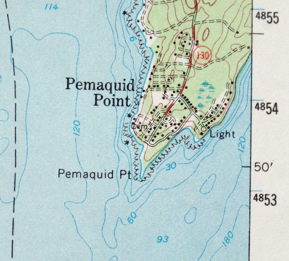
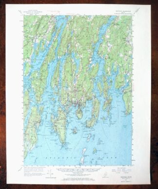
Boothbay Maine Wiscasset USGS Topographic Map 1972 Vintage
$52
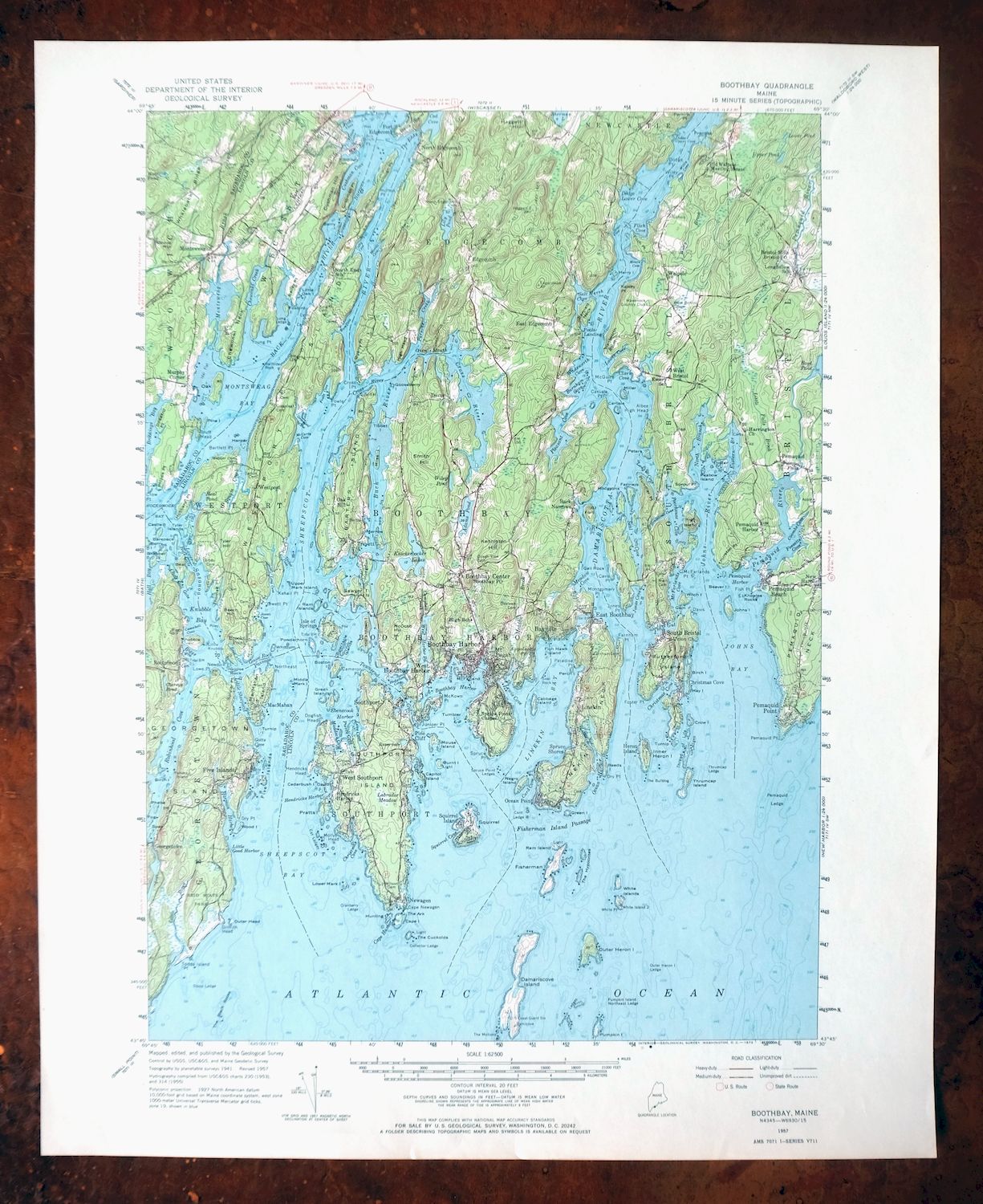
This USGS 15-minute topographic map is a 1957 edition, printed in 1972, and the sheet is in excellent condition – lightly handled and never folded, with a flawless map area and a clean collar free of wear, tears, or markings. It takes in the tidal coast of Lincoln and Sagadahoc counties in Maine, with the quad boundaries including Boothbay Harbor, Damariscotta-Newcastle, and Wiscasset, roughly 35 miles northeast of Portland. Bathymetric depth isolines trace the offshore waters here, detail that suits a stretch of coast defined by its inlets, harbors, and peninsulas. Because the sheet was never folded, it lies flat and takes well to framing.
In stock
This vintage sheet is a 1957 edition of the Boothbay Maine USGS topographic map. It is an original 54-year-old 1972 United States Geological Survey print in excellent condition.
HOW THIS MAP CAN BE USED
In addition to making a fascinating conversation piece, this sheet would look great in a frame or on display, make a unique and prized gift for anyone interested in this area, be perfect as a reference for genealogy studies or general historical research, or fill that missing piece in your collection. Maps of this vintage are printed on durable stock and are well-suited for outdoor activities and recreation of all kinds, including hiking, backpacking, hunting, rafting and kayaking, backcountry skiing, geocaching, general exploration, treasure hunting, etc.
FEATURES SHOWN ON THE MAP
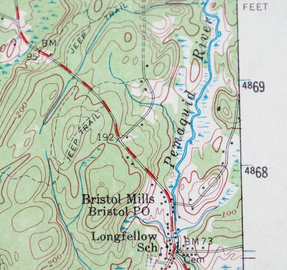
The Boothbay 15-minute map shows cities and towns, roads, railroads, utilities and energy infrastructure, rivers, creeks, elevation contour lines, public land survey lines, county, state, and other administrative boundaries as they existed at the time of the survey in 1941. All known structures (houses, businesses, churches, schools, barns, cabins, etc) are also shown.
A VALUABLE HISTORICAL RECORD
Maps from the 15-minute series for the continental United States are no longer produced or printed by the USGS and original prints are becoming increasingly difficult to find. They are a valuable historical record for an area, as they contain many placenames and features that have been dropped from more recent maps.
Nearby maps
-
Bucksport Maine Brewer Hampden USGS Topo Map 1914 Antique
$46 Add to cart -
Alton New Hampshire Farmington Strafford USGS Topo Map 1977
$12 Add to cart -

Mount Washington New Hampshire Berlin USGS Topo Map 1967
$42 Add to cart -
Provincetown Massachusetts USGS Topographic Map 1978 Vintage
$58 Add to cart -
Skinner Maine Lowelltown USGS 15-Min Topo Map 1931 Antique
$25 Add to cart -
Norwood Massachusetts Boston Dover USGS Topographic Map 1960
$18 Add to cart -
1961 Mansfield Massachusetts USGS Topo Map: Sharon
$18 Add to cart -
Irasburg Vermont North Troy Lowell USGS Topographic Map 1925
$48 Add to cart -

Quinsigamond Massachusetts Milford USGS Topographic Map 1910
$125 Add to cart -

Blackstone Massachusetts Milford Hopedale USGS Topo Map 1944
$22 Add to cart -

Brandon Vermont Green Mountain NF USGS Topo Map 1911 Antique
$52 Add to cart -

Middlebury Vermont Bristol Starksboro USGS Topo Map 1905
$105 Add to cart -
Port Henry Vermont Lake Champlain USGS Topo Map 1913 Antique
$115 Add to cart -

Holyoke Massachusetts Springfield USGS Topo Map 1897 Antique
$85 Add to cart -

Rouses Point New York Champlain Alburg USGS Topo Map 1913
$58 Add to cart -

Taconic Vermont Pittsfield Adams USGS Topographic Map 1912
$110 Add to cart -
Ausable New York Au Sable Forks USGS Topo Map 1909 Antique
$48 Add to cart -

Dannemora New York Peru Saranac USGS Topographic Map 1913
$48 Add to cart -
Uncasville Connecticut Ledyard Norwich USGS Topo Map 1984
$34 Add to cart -
Mooers New York West Chazy Altona USGS Topo Map 1912 Antique
$57 Add to cart -

Moodus Connecticut Lake Pocotopaug USGS Topographic Map 1946
$32 Add to cart -

Troy New York Albany Watervliet USGS Topo Map 1907 Antique
$110 Add to cart -
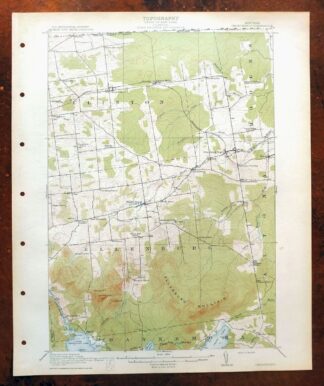
Churubusco New York Lyon Mountain USGS Topo Map 1915 Antique
$48 Add to cart -

Chateaugay New York Burke USGS 15-Min Topo Map 1915 Antique
$46 Add to cart