MAP DETAILS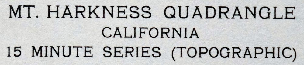 | |
|---|---|
| TITLE | Mount Harkness |
| STATE | California |
| LOCATION | Lassen Volcanic National Park, vicinity of Chester, 55 miles east of Redding |
| SERIES | 15-minute |
| SURVEYED | 1951 and 1956 Aerial and Field Survey |
| EDITION | 1956 |
| PRINTED | 1978 |
| PRINT NOTES | Thick paper stock, includes woodland tint (green to indicate vegetated areas) |
| SCALE | 1:62500 |
| CONTOUR INTERVAL | 80 feet |
| SHEET DIMENSIONS | 18 x 22 inches |
| MAP DIMENSIONS | 13 3/8 x 17 1/2 inches |
| COVERAGE AREA | 13 x 17 miles |
| SHEET CONDITION For maps of this vintage, effort is made to note all visible flaws, no matter how minor. | |
| OVERALL CONDITION | Excellent |
| SHEET NOTES | very lightly handled, never folded, smooth and flat |
| MAP AREA | flawless map area |
| COLLARS | no wear or tears, no markings, no blemishes |
| MAP COVERAGE Quadrangle extent overlaid on current basemap. | |
| PLACENAMES Depending on map series and survey date, all of the features listed below may not be shown on this map. This list contains features that currently exist or historically existed within the area covered by the map. The list can be used as a reference to determine if this map covers your area of interest. Placenames are listed alphabetically next to each feature type. | |
| NOTABLE PLACES | Lassen Volcanic National Park, Juniper Lake, and Deer Creek |
| CITIES AND TOWNS (CURRENT) | Chester |
| COUNTIES COVERED | Lassen, Plumas, Shasta, and Tehama |
| FEDERAL LAND UNITS | Caribou Wilderness, Lassen National Forest, and Lassen Volcanic Wilderness |
| RIVERS AND STREAMS | Benner Creek, Bunchgrass Creek, Canyon Creek, East Fork Hat Creek, Hot Springs Creek, Kings Creek, Louse Creek, Louse Spring, Marian Creek, North Fork Feather River, Soldier Creek, South Arm Rice Creek, Swamp Creek, Warner Creek, West Fork Hat Creek, and Willow Creek |
| WATER BODIES | Blue Lake, Cliff Lake, Crumbaugh Lake, Crystal Lake, Drake Lake, Echo Lake, Hidden Lake, Horseshoe Lake, Indian Lake, Island Lake, Jakey Lake, Little Willow Lake, Summit Lake, Swan Lake, Upper Twin Lake, Willow Lake, and Wilson Lake |
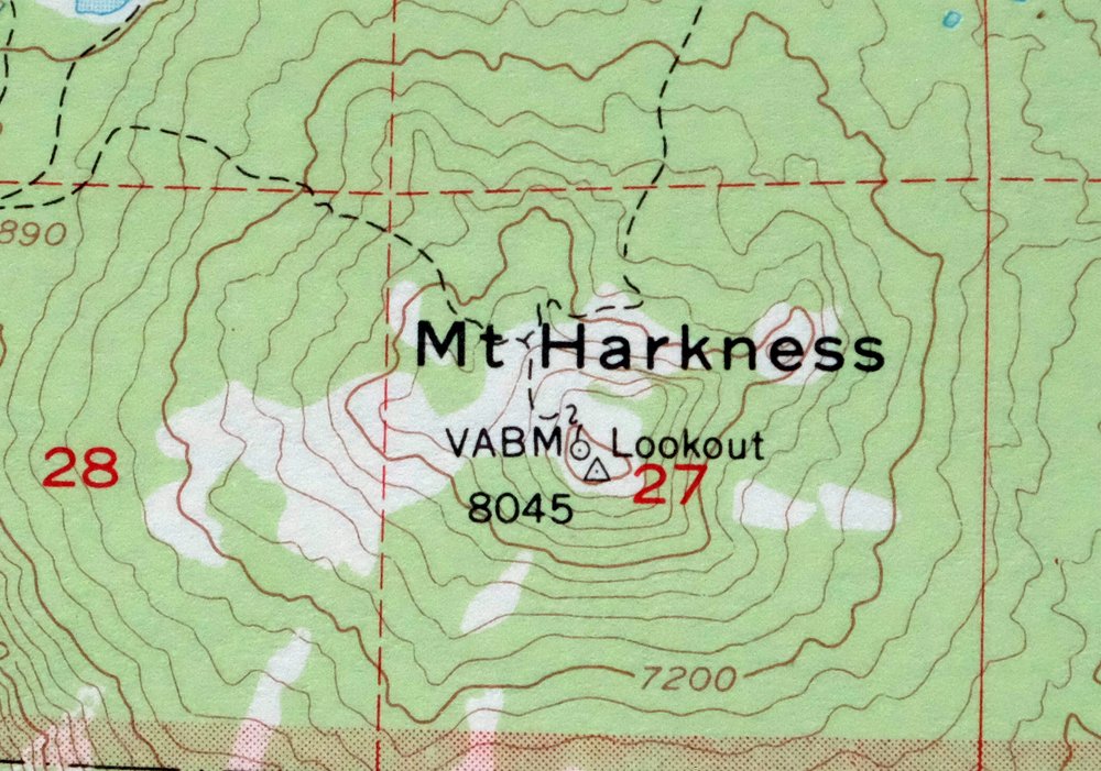
| Locations: Benner Creek Campground, Browns Camp, Deer Creek Station, Domingo Spring Campground, Feather River, Feather River Rod and Gun Club, Fire Mountain, Fleischmann Boy Scout Camp, Gurnsey Creek Campground, High Bridge Campground, Kelly Camp, Kings Creek Campground, Lee Camp, Lost Creek Maintenance Station, Rice Creek Campground, Smith Cabin, Stover Camp, Stover Mountain Ski Area, Summit Lake Recreation Site, United States Forest Service Outdoor Classroom, Warner Creek Campground, Warner Valley Campground, Willow Creek, Willow Creek Homesite, and Willow Spring Campground. Mountains, Peaks, and Summits: Bonte Peak, Bumpass Mountain, Crater Butte, Mount Harkness, Mount Hoffman, Ice Cave Mountain, Kelly Mountain, North Stover Mountain, Old Ski Hill, Pilot Mountain, Reading Peak, Red Cinder Cone, Saddle Mountain, Sifford Mountain, Ski Hill, Small Butte, Stover Mountain, and Wild Cattle Mountain. Valleys and Canyons: Grassy Swale, Locherman Canyon, and Warner Valley. Parks: Lassen Volcanic National Park. Trails: Childs Meadows Trail, Growler Trail, Hanna Trail, Lassen Trail, and Spencer Meadow Trail. Drainages: Alder Creek, Bunchgrass Creek, Carter Creek, Domingo Creek, Gurnsey Creek, Hot Springs Creek, Kings Creek, Lost Creek, Louse Creek, Marian Creek, Panther Creek, Rice Creek, South Arm Rice Creek, Summit Creek, Warner Creek, and Willow Creek. Capes: Inspiration Point. Lakes and Ponds: Bench Lake, Blue Lake, Bluff Lake, Boiling Springs Lake, Cliff Lake, Cold Boiling Lake, Conard Lake, Crater Pool, Crumbaugh Lake, Crystal Lake, Deer Lake, Domingo Lake, Drake Lake, Dream Lake, Duck Lake, East Lake, Echo Lake, Elizabeth Lake, Fleischmann Lake, Glen Lake, Hemlock Lake, Hidden Lake, Horseshoe Lake, Indian Lake, Island Lake, Jakey Lake, Juniper Lake, Little Willow Lake, Patricia Lake, Ridge Lake, Shadow Lake, Sifford Lakes, Summit Lake, Swan Lake, Terrace Lake, Willow Lake, and Wilson Lake. Waterfalls: Kings Creek Falls. Dams: Chester Diversion Dam. Bluffs: Crystal Cliffs and Warner Valley Rim. Gaps: Deer Creek Pass. Bridges: High Bridge. Swamps: Cameron Meadows and Stump Ranch. Ridges: Flatiron Ridge. Flats: Cameron Meadow, Childs Meadows, Chummy Meadows, Corral Meadow, Deer Creek Meadows, Devils Kitchen, Feather River Meadows, Lower Kings Creek Meadow, Moody Meadows, Rhodes Meadow, Spencer Meadow, Sunflower Flat, Twin Meadows, Upper Kings Creek Meadow, and Upper Meadow. Plains and Plateaus: Lost Creek Plateau. Springs: Benner Spring, Buzzard Springs, Cascade Springs, Domingo Spring, Drakes Springs, Edge Cabin Spring, Fern Springs, Lost Creek Spring, Louse Spring, Mosquito Springs, and Stover Spring. | |
| SHIPPING AND RETURNS | |
 This map sheet will be carefully rolled in a sturdy tube and shipped via the US Postal Service. If you find that the sheet you receive is not as described in the listing, you may ship it back to us for a refund of the purchase price. | |
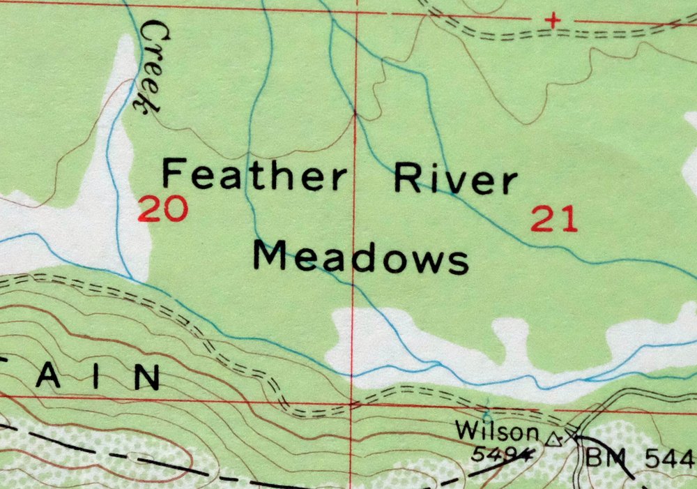
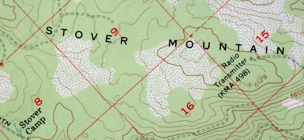
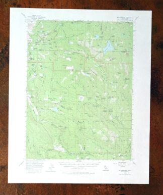
1978 USGS Topo Map: Mount Harkness, California
$36
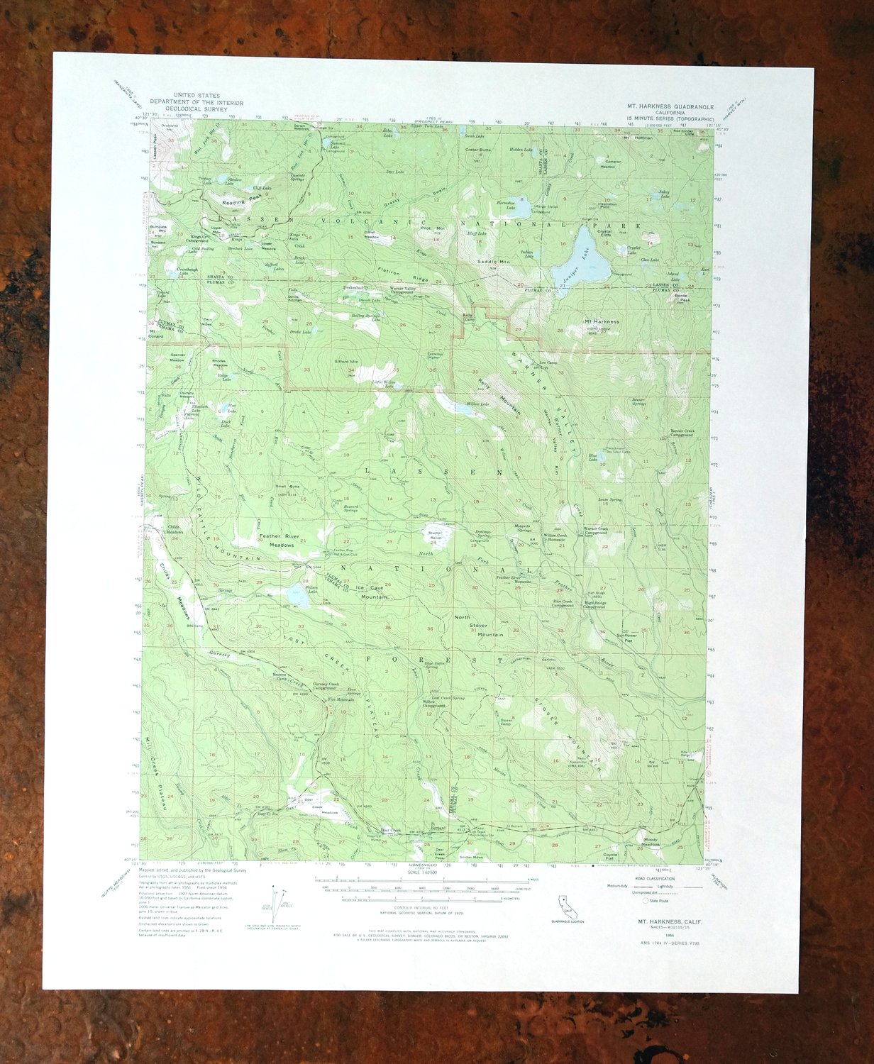
This 15-minute topographic sheet of Mount Harkness covers part of Lassen Volcanic National Park in northeastern California, about 55 miles east of Redding, spanning parts of Lassen, Plumas, Shasta, and Tehama counties. The quad takes in high volcanic country around Juniper Lake, with portions of Lassen National Forest and the Lassen Volcanic and Caribou wilderness areas, and the town of Chester lying to the east. From a 1956 edition printed in 1978 on thick stock with green woodland tint, it has never been folded and remains smooth and flat.
In stock
This vintage sheet is a 1956 edition of the Mount Harkness California USGS topographic map. It is an original 48-year-old 1978 United States Geological Survey print in excellent condition.
HOW THIS MAP CAN BE USED
In addition to making a fascinating conversation piece, this sheet would look great in a frame or on display, make a unique and prized gift for anyone interested in this area, be perfect as a reference for genealogy studies or general historical research, or fill that missing piece in your collection. Maps of this vintage are printed on durable stock and are well-suited for outdoor activities and recreation of all kinds, including hiking, backpacking, hunting, rafting and kayaking, backcountry skiing, geocaching, general exploration, treasure hunting, etc.
FEATURES SHOWN ON THE MAP
The Mount Harkness 15-minute map shows cities and towns, roads, railroads, utilities and energy infrastructure, rivers, creeks, elevation contour lines, public land survey lines, county, state, and other administrative boundaries as they existed at the time of the survey in 1951 and 1956. All known structures (houses, businesses, churches, schools, barns, cabins, etc) are also shown.
A VALUABLE HISTORICAL RECORD
Maps from the 15-minute series for the continental United States are no longer produced or printed by the USGS and original prints are becoming increasingly difficult to find. They are a valuable historical record for an area, as they contain many placenames and features that have been dropped from more recent maps.
Nearby maps
-
Manzanita Lake California Viola USGS Topo Map 1974 Vintage
$39 Add to cart -
Westwood California USGS 15-Min Topographic Map 1961 Vintage
$38 Add to cart -
Panther Spring California USGS 15-Min Topo Map 1970 Vintage
$36 Add to cart -
Susanville California Janesville USGS Topo Map 1966 Vintage
$39 Add to cart -
Fredonyer Peak California USGS 15-Min Topo Map 1972 Vintage
$32 Add to cart -

Richardson Springs California Chico Nord USGS Topo Map 1966
$35 Add to cart -
Litchfield California Susanville USGS Topo Map 1972 Vintage
$40 Add to cart -
Milford California USGS 15-Min Topographic Map 1966 Vintage
$40 Add to cart -
1968 Chico California USGS Topo Map: Sacramento River
$41 Add to cart -
Lamoine California Shasta Lake USGS Topo Map 1974 Vintage
$42 Add to cart -
Gridley California Oroville Live Oak USGS Topo Map 1959
$37 Add to cart -
Fruto California Stony Creek Nye Creek USGS Topo Map 1944
$30 Add to cart -
Sierraville California Calpine Loyalton USGS Topo Map 1969
$42 Add to cart -
1950 USGS Topo Map: Chilcoot, California/Nevada (1983 Print)
$40 Add to cart -
Shasta California McCloud USGS 15-Min Topo Map 1968 Vintage
$40 Add to cart -
1955 USGS Topo Map: Loyalton, California/Nevada (1980 Print)
$42 Add to cart -
Big Sage Reservoir California Alturas USGS Topo Map 1972
$40 Add to cart -
1972 USGS Topo Map: Reno, Toiyabe NF, Nevada (Vintage Print)
$22 Add to cart -
Stonyford California USGS 15-Min Topo Map 1967 Vintage
$39 Add to cart -
1953 USGS Topo Map: Helena, California
$34 Add to cart -
Tulelake California USGS 15-Min Topographic Map 1970 Vintage
$33 Add to cart -
1974 Cecilville California USGS Topo Map: Trinity Alps
$34 Add to cart -
1950 Dorris California USGS Topo Map: Somerset
$40 Add to cart -
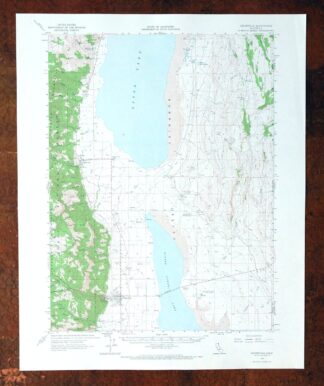
1962 USGS Topo Map: Cedarville, Lake City, California
$40 Add to cart