MAP DETAILS | |
|---|---|
| TITLE | Gridley |
| STATE | California |
| LOCATION | Vicinity of Oroville, 55 miles north of Sacramento |
| SERIES | 15-minute |
| SURVEYED | 1952 Aerial and Field Survey |
| EDITION | 1952 |
| PRINTED | 1959 |
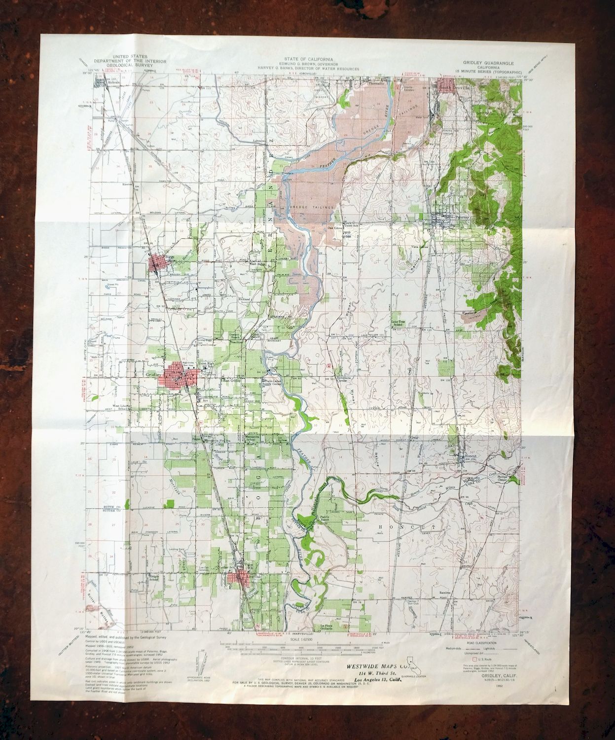
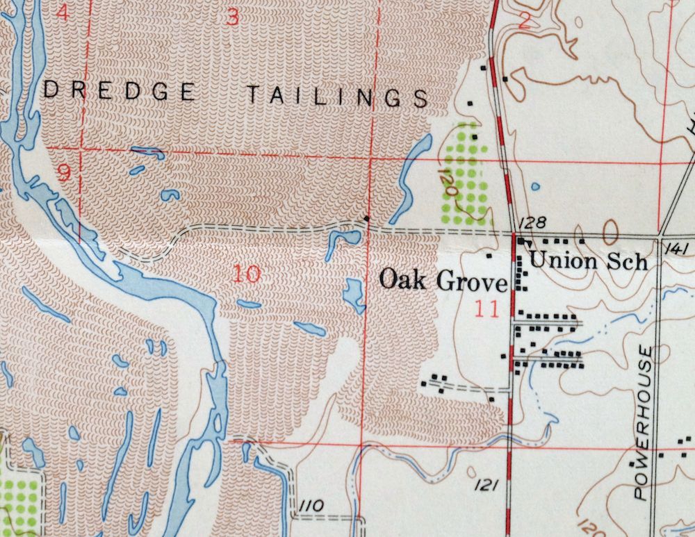
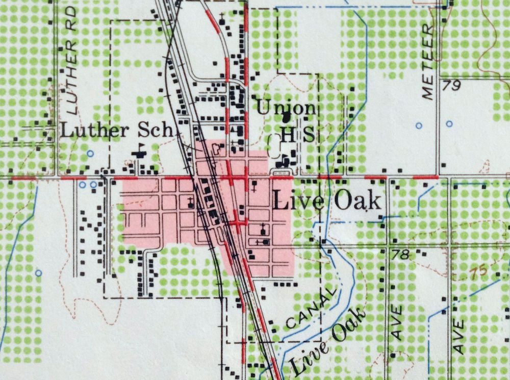
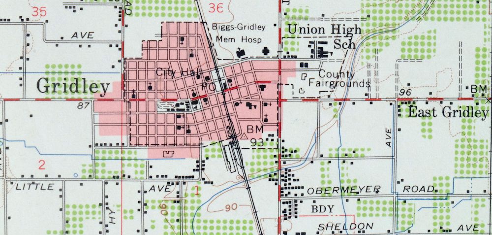
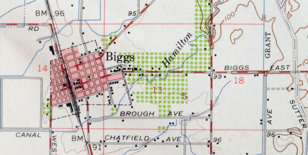
| PRINT NOTES | Thick paper stock, includes woodland tint (green to indicate vegetated areas). A reddish tint is used to indicate urban areas where only landmark buildings are shown. |
| SCALE | 1:62500 |
| CONTOUR INTERVAL | 10 feet |
| SHEET DIMENSIONS | 17 x 21 inches |
| MAP DIMENSIONS | 13 1/2 x 17 1/2 inches |
| COVERAGE AREA | 13 x 17 miles |
| SOURCE | From the vintage map collection of Richard Dahlke, Santa Barbara, California |
| SHEET CONDITION For maps of this vintage, effort is made to note all visible flaws, no matter how minor. | |
| OVERALL CONDITION | Good |
| SHEET NOTES | moderately handled, has foldlines |
| MAP AREA | no markings, no blemishes |
| COLLARS | no markings, no blemishes, no edge tears, library stamp in bottom collar |
| MAP COVERAGE Quadrangle extent overlaid on current basemap. | |
| PLACENAMES Depending on map series and survey date, all of the features listed below may not be shown on this map. This list contains features that currently exist or historically existed within the area covered by the map. The list can be used as a reference to determine if this map covers your area of interest. Placenames are listed alphabetically next to each feature type. | |
| CITIES AND TOWNS (CURRENT) | Biggs, Gridley, Honcut, Live Oak, Oroville, Oroville East, Palermo, Richvale, South Oroville, and Thermalito |
| COUNTIES COVERED | Butte, Sutter, and Yuba |
| RIVERS AND STREAMS | Feather River, North Honcut Creek, South Honcut Creek, and Wyandotte Creek |
| WATER BODIES | Thermalito Afterbay |
| Locations: Garden Ranch, Heritage Oak Shopping Center, La Finca Orchards, Leo Chesney Correctional Center, Manzanita Fire Station, Onstott Ranch, Pacific Ranch, Palermo Substation, Section Seven Gun Club, Table Mountain Municipal Golf Course, USDA Rice Experimental Station, and Wyandotte Substation. Administrative Boundaries: Boga, Fernandez, and Honcut. Valleys and Canyons: Wyman Ravine. Parks: Butte County Fairgrounds, Live Oak Memorial Park, Manuel Vierra Park, Nick Daddow Plaza, Oroville Wildlife Area, and Palermo Park. Drainages: North Honcut Creek, South Honcut Creek, Wilson Creek, and Wyandotte Creek. Churches: Apostolic Church, Biggs Assembly of God Church, Biggs United Methodist Church, Calvary Baptist Church, Calvary Chapel of Gridley, Church of God in Christ, Church of the Nazarene, Evangelical Free Church, First Baptist Church, First Christian Church, First Church of Christ Scientist, First Presbyterian Church, Grace Baptist Church, Grace Lutheran Church, Gridley Christian Church, Holy Church of God, Iglesia Gentil De Cristo, Kingdom Hall of Jehovahs Witnesses, Lighthouse Tabernacle, Pentecostal Church of God, Sacred Heart Catholic Church, Saint Timothys Episcopal Church, Seventh Day Adventist Church, The Church of Jesus Christ of Latter Day Saints, and Truth Tabernacle. Hospitals: Biggs Gridley Memorial Hospital. Buildings: Barber Branch Sutter County Free Library, Biggs Branch Butte County Library, Biggs City Hall, Central House, Gridley Branch Butte County Library, and Gridley City Hall. Dams: Thermalito Afterbay 1-055 Dam. Crossings: Burts Ferry. Canals: Biggs Extension, Burns Government Lateral, Burns Lateral, Butler Canal, Center Ditch, Cherokee Canal, Cox Spillway, Fleming Lateral, Henderson Ditch, High Lift Lateral, Lateral A, Lateral A-6, Lateral East, Lateral East-7, Lateral H, Lateral H-3, Lee Lateral, Live Oak Canal, Low Lift Lateral, Main Canal, Main Chandon Lateral, Main Ditch A, Main Ditch B, McQueen Lateral, North Ditch, South Ditch, Stine Lateral, Sunset Avenue Lateral, Sutter Butte Canal, Traynor Lateral, and Western Canal. Bayous and Sloughs: Hamilton Slough. Airports: Bowles Airport, Jones/Aviation Airport, Oroville Municipal Airport, and Siller Brothers Incorporated Airport. Schools: Biggs Elementary School, Biggs High-Middle School, Burbank School, Feather River School, Gridley High School, Hedger School, Helen M Wilcox Elementary School, Honcut School, Las Plumas High School, Live Oak High School, Live Oak Middle School, Live Oak Unified Alternative Education Center, Lone Tree School, Luther Elementary School, Manzanita Elementary School, McKinley Elementary School, Oakdale Heights Elementary School, Palermo School, Richvale Elementary School, Sycamore Elementary School, Valley Oak Continuation High School, West Liberty School, and Wilson Elementary School. Reservoirs and Tanks: Thermalito Afterbay. | |
| SHIPPING AND RETURNS | |
 This map sheet will be carefully rolled in a sturdy tube and shipped via the US Postal Service. If you find that the sheet you receive is not as described in the listing, you may ship it back to us for a refund of the purchase price. | |
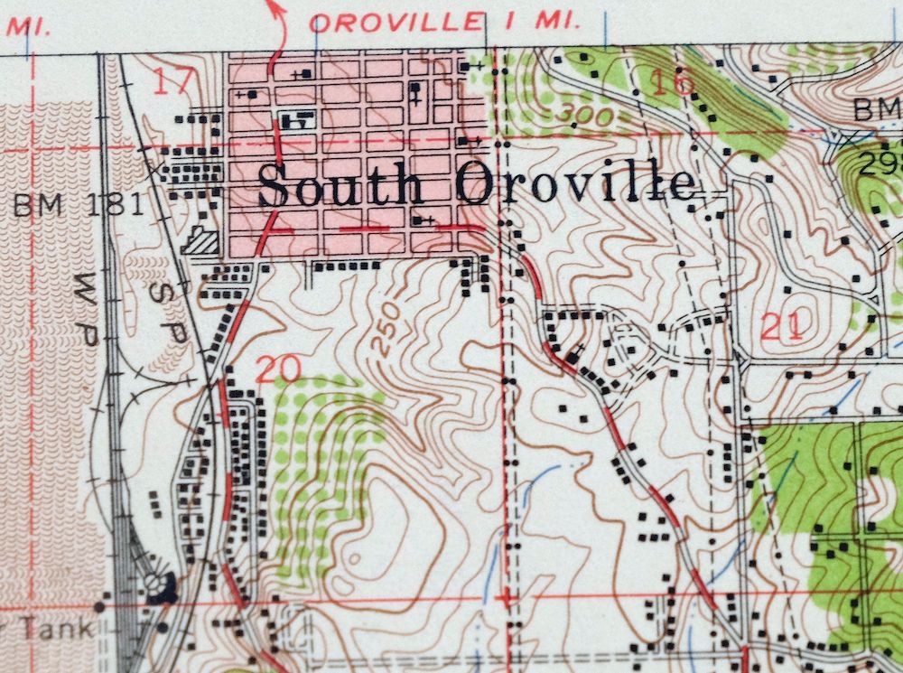
Gridley California Oroville Live Oak USGS Topo Map 1959
$37
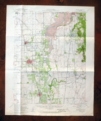
This USGS 15-minute topographic map is a 1952 edition, printed in 1959, and the sheet is in good condition with foldlines and moderate handling; it is printed on thick stock. Covering ground in the Sacramento Valley about 55 miles north of Sacramento, the quad takes in the area around Oroville and includes Thermalito, Palermo, Live Oak, Richvale, and Honcut across Butte, Sutter, and Yuba counties. Drawn from a 1952 aerial and field survey with a fine 10-foot contour interval, it records the flat rice-and-orchard country of the valley floor in careful detail, and this sheet comes from the vintage map collection of Richard Dahlke of Santa Barbara.
In stock
This vintage sheet is a 1952 edition of the Gridley California USGS topographic map. It is an original 67-year-old 1959 United States Geological Survey print in good condition.
HOW THIS MAP CAN BE USED
In addition to making a fascinating conversation piece, this sheet would look great in a frame or on display, make a unique and prized gift for anyone interested in this area, be perfect as a reference for genealogy studies or general historical research, or fill that missing piece in your collection. Maps of this vintage are printed on durable stock and are well-suited for outdoor activities and recreation of all kinds, including hiking, backpacking, hunting, rafting and kayaking, backcountry skiing, geocaching, general exploration, treasure hunting, etc.
FEATURES SHOWN ON THE MAP
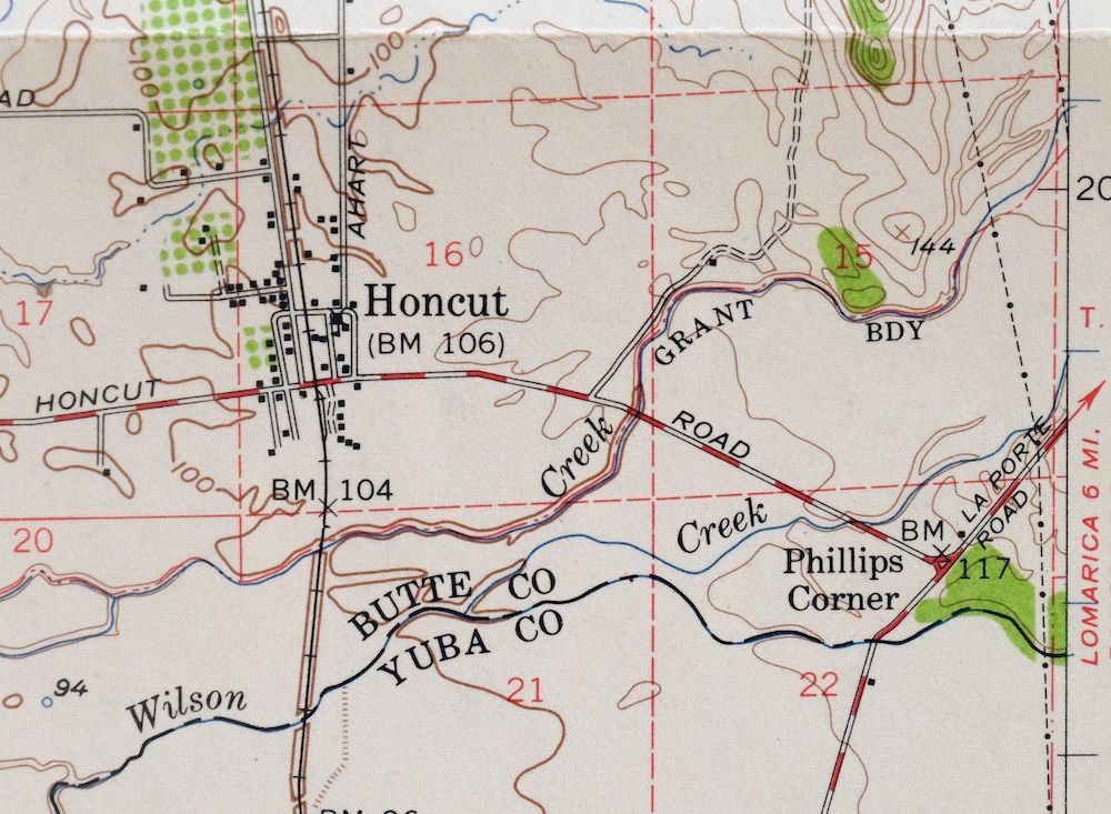
The Gridley 15-minute map shows cities and towns, roads, railroads, utilities and energy infrastructure, rivers, creeks, elevation contour lines, public land survey lines, county, state, and other administrative boundaries as they existed at the time of the survey in 1952. A reddish tint is used on this sheet to indicate urban areas where only landmark buildings are depicted. Outside of those areas, all known structures (houses, businesses, churches, schools, barns, cabins, etc) are shown.
A VALUABLE HISTORICAL RECORD
Maps from the 15-minute series for the continental United States are no longer produced or printed by the USGS and original prints are becoming increasingly difficult to find. They are a valuable historical record for an area, as they contain many placenames and features that have been dropped from more recent maps.
Nearby maps
-

Richardson Springs California Chico Nord USGS Topo Map 1966
$35 Add to cart -
Fruto California Stony Creek Nye Creek USGS Topo Map 1944
$30 Add to cart -
Stonyford California USGS 15-Min Topo Map 1967 Vintage
$39 Add to cart -
Panther Spring California USGS 15-Min Topo Map 1970 Vintage
$36 Add to cart -
Sierraville California Calpine Loyalton USGS Topo Map 1969
$40 Add to cart -
Lakeport California Lucerne Nice USGS Topo Map 1977 Vintage
$44 Add to cart -
Mount Vaca California Fairfield Vacaville USGS Topo Map 1967
$40 Add to cart -
Westwood California USGS 15-Min Topographic Map 1961 Vintage
$38 Add to cart -
Milford California USGS 15-Min Topographic Map 1966 Vintage
$40 Add to cart -
Manzanita Lake California Viola USGS Topo Map 1974 Vintage
$39 Add to cart -
Susanville California Janesville USGS Topo Map 1966 Vintage
$39 Add to cart -
Pittsburg California Concord Fairfield USGS Topo Map 1965
$38 Add to cart -
Port Chicago California Concord Martinez USGS Topo Map 1956
$38 Add to cart -
Litchfield California Susanville USGS Topo Map 1972 Vintage
$40 Add to cart -
Petaluma Point California Novato USGS Topographic Map 1951
$30 Add to cart -
Fredonyer Peak California USGS 15-Min Topo Map 1972 Vintage
$40 Add to cart -
San Quentin California Richmond Tiburon USGS Topo Map 1980
$46 Add to cart -
Lamoine California Shasta Lake USGS Topo Map 1974 Vintage
$40 Add to cart -

San Rafael California Mill Valley Tiburon USGS Topo Map 1966
$60 Add to cart -
Point Bonita California Sausalito USGS Topographic Map 1955
$44 Add to cart -
Hunters Point California Oakland USGS Topographic Map 1969
$38 Add to cart -
San Francisco South California USGS 7.5-Min Topo Map 1975
$47 Add to cart -
Piercy California USGS 15-Min Topographic Map 1971 Vintage
$33 Add to cart -

Newark California Fremont Hayward USGS Topo Map 1948 Vintage
$47 Add to cart