MAP DETAILS | |
|---|---|
| TITLE | Stonyford |
| STATE | California |
| LOCATION | 25 miles southwest of Willows |
| SERIES | 15-minute |
| SURVEYED | 1948 and 1951 Aerial and Field Survey |
| EDITION | 1951 |
| PRINTED | 1967 |
| PRINT NOTES | Includes woodland tint (green to indicate vegetated areas) |
| SCALE | 1:62500 |
| CONTOUR INTERVAL | 50 feet |
| SHEET DIMENSIONS | 18 x 22 inches |
| MAP DIMENSIONS | 13 1/2 x 17 1/2 inches |
| COVERAGE AREA | 13 x 17 miles |
| SHEET CONDITION For maps of this vintage, effort is made to note all visible flaws, no matter how minor. | |
| OVERALL CONDITION | Excellent |
| SHEET NOTES | very lightly handled, never folded, smooth and flat |
| MAP AREA | flawless map area |
| COLLARS | no wear or tears, no markings, no blemishes |
| MAP COVERAGE Quadrangle extent overlaid on current basemap. | |
| PLACENAMES Depending on map series and survey date, all of the features listed below may not be shown on this map. This list contains features that currently exist or historically existed within the area covered by the map. The list can be used as a reference to determine if this map covers your area of interest. Placenames are listed alphabetically next to each feature type. | |
| CITIES AND TOWNS (CURRENT) | Stonyford |
| COUNTIES COVERED | Colusa, Glenn, and Lake |
| FEDERAL LAND UNITS | East Park Reservoir, Mendocino National Forest, and Snow Mountain Wilderness |
| RIVERS AND STREAMS | Bear Wallow Creek, Briscoe Creek, Cold Creek, Dark Hollow Creek, Dry Creek, Frenzel Creek, Goulding Creek, Hyphus Creek, Ida Creek, Indian Creek, Little Stony Creek, Little Sullivan Creek, Middle Fork Stony Creek, Mill Creek, Miner Creek, Montgomery Creek, North Fork Mill Creek, North Fork Stony Creek, Paradise Creek, Pigeon Creek, Rice Fork, Salt Creek, South Fork Stony Creek, Stony Creek, Sullivan Creek, and Trout Creek |
| WATER BODIES | East Park Reservoir, Lily Pond, and Upper Letts Lake |
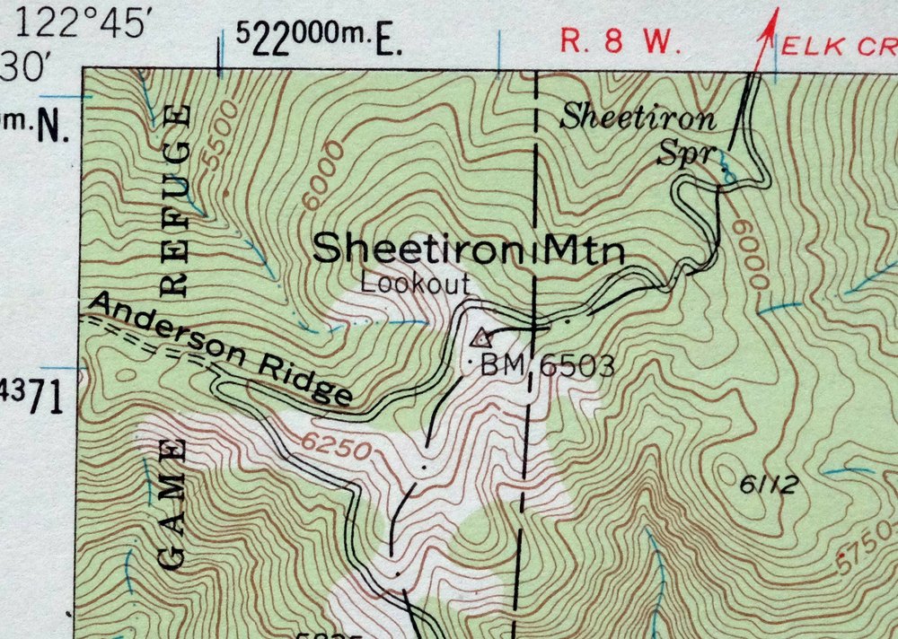
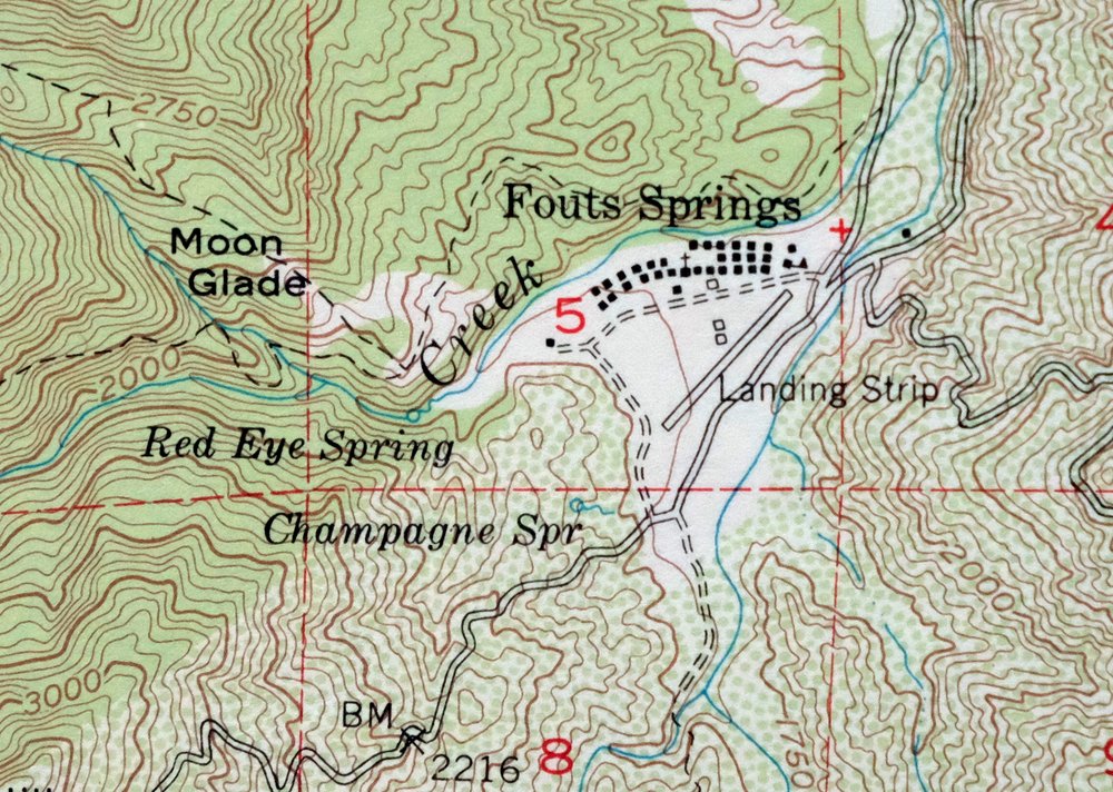
| Populated Place: Bonnie View, Fouts Springs, and Stonyford. Locations: Bearwallow Trailhead Parking, Black Oak Campground, Brittan Ranch, Cedar Camp, Century Ranch, Deafy Glade Trailhead Parking, Digger Pine Campground, Diversion Dam Campground, Fouts Camp, Fouts Recreation Site, Happy Camp, Horse Glade Camp, Letts Recreation Site, McDaniel Recreation site, Meyers Cabin, Mill Creek Recreation Site, Mill Valley Campground, North Fork Campground, Old Mill Campground, Red Rock Cabin, Sanborn Cabin, Stonyford District Ranger Office, Stonyford Work Center, Trout Creek Trailhead Parking, Windy Point Trailhead, Windy Point Trailhead Parking, and Stonyford Rodeo Grounds. Administrative Boundaries: Stonyford Rancheria. Mountains, Peaks, and Summits: Elephant Hill, Gilmore Peak, Goat Mountain, Hornet Nest Hill, Potato Hill, Saint John Mountain, Sheetiron Mountain, Steel Trap Rock, Sugarloaf Hill, Triplet Butte, Dry Creek Hill, Goat Rock, and High Rock. Valleys and Canyons: Green Valley, Indian Valley, Mule Canyon, Pleasant Valley, and Sullivan Valley. Parks: Frenzel Creek Research Natural Area. Trails: Bathhouse Trail, Bear Wallow Trail, Bonnie View Trail, Trout Creek Trail, Box Spring Loop, and Milk Ranch Trail. Drainages: Bear Wallow Creek, Black Diamond Creek, Dark Hollow Creek, Dry Creek, Frenzel Creek, Goulding Creek, Hyphus Creek, Ida Creek, Letts Creek, Little Stony Creek, Little Sullivan Creek, Middle Fork Stony Creek, Mill Creek, Miner Creek, Montgomery Creek, North Fork Stony Creek, Paradise Creek, Pigeon Creek, Salt Creek, South Fork Stony Creek, Sullivan Creek, and Trout Creek. Mines: Ruby King Mine. Churches: Saint Mary of the Mountain Church and Stonyford Community Church. Post Office: Stonyford Post Office. Lakes and Ponds: Lily Pond. Buildings: Bear Valley - Indian Valley Fire Protection District and United States Forest Service Mendocino National Forest Stonyford Work Center Fire Company. Dams: Coleman Dike Dam, East Park Dam, Gordon Dike Dam, and Letts Valley 1-039 Dam. Gaps: Low Gap. Bridges: Red Bridge. Basins: Lower Letts Valley, Salt Spring Valley, Star Valley, Summit Valley, and Mill Valley. Bars: The Pocket. Census: Lodoga Census Designated Place and Stonyford Census Designated Place. Schools: Indian Valley School. Ridges: Auk Auk Ridge, Black Diamond Ridge, Board Camp Ridge, Brushy Ridge, Crackerbox Ridge, Gilmore Ridge, Hornet Nest Ridge, Letts Ridge, Little Sullivan Ridge, Miner Ridge, Open Ridge, Peavine Ridge, Pine Ridge, Smelt Road Ridge, Sullivan Ridge, and Trough Spring Ridge. Reservoirs and Tanks: East Park Reservoir and Upper Letts Lake. Flats: Black Diamond Glades, Bowery Flat, Davis Flat, Deafy Glade, Moon Glade, Rattlesnake Glade, Welton Glade, and Wolf Glade. Pillars: Red Rock. Springs: Board Camp Spring, Box Spring, Candy Bucket Spring, Champagne Spring, Cold Spring, Cooks Springs, Freezeout Spring, Hornet Nest Spring, Red Eye Spring, Salt Spring, Sheetiron Spring, Sulphur Spring, Trough Spring, Twin Springs, and Watson Spring. Cemetery: Stonyford Cemetery. | |
| SHIPPING AND RETURNS | |
 This map sheet will be carefully rolled in a sturdy tube and shipped via the US Postal Service. If you find that the sheet you receive is not as described in the listing, you may ship it back to us for a refund of the purchase price. | |

Stonyford California USGS 15-Min Topo Map 1967 Vintage
$39
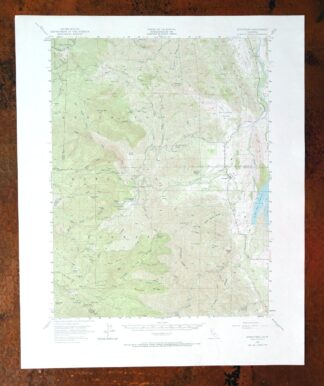
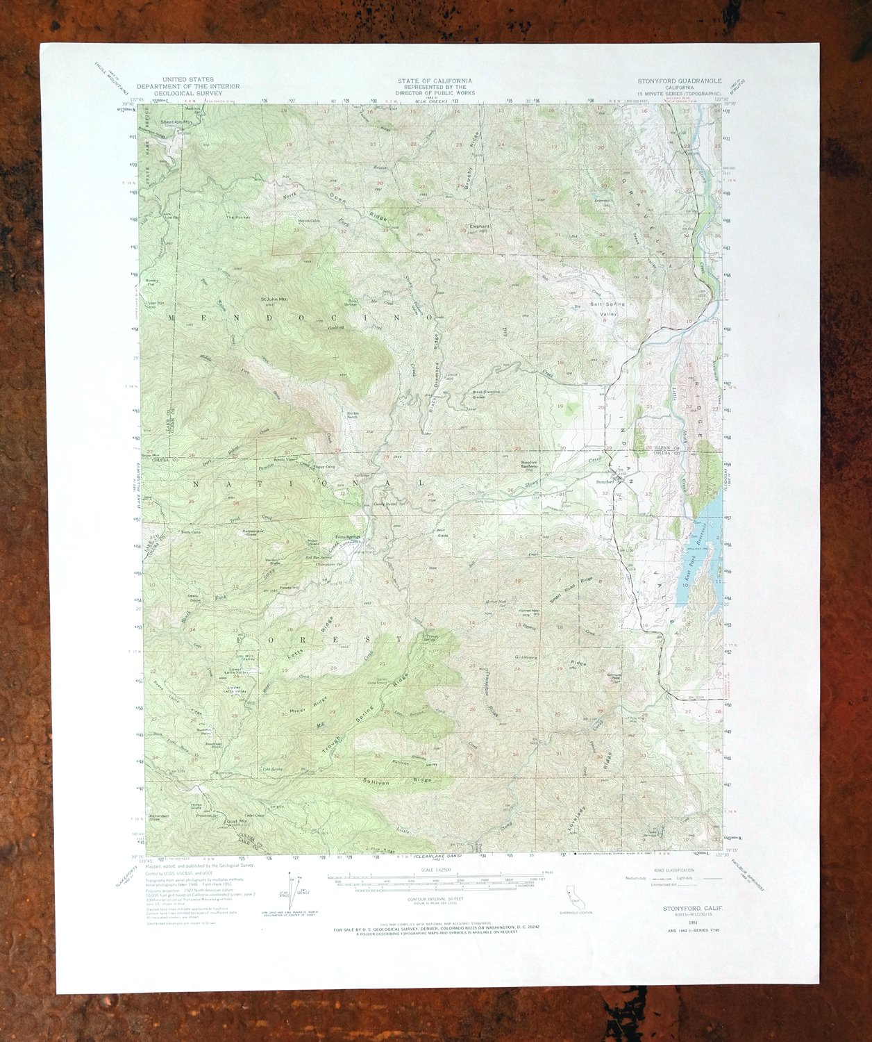
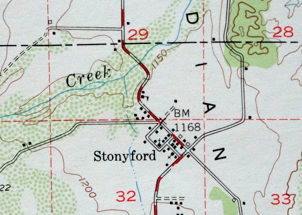
This USGS 15-minute topographic map is a 1951 edition printed in 1967, and the sheet is in excellent condition, never folded and kept smooth and flat with a flawless map area. Based on aerial and field survey work from 1948 and 1951, it takes in the community of Stonyford in the Coast Ranges southwest of Willows, spanning parts of Colusa, Glenn, and Lake counties, and includes portions of Mendocino National Forest, East Park Reservoir, and the Snow Mountain Wilderness. The 50-foot contour interval traces the rugged foothill terrain along the eastern edge of the national forest, the kind of country that draws people into this stretch of Northern California’s backcountry. Because the sheet was never folded, it lies flat and would frame well.
In stock
This vintage sheet is a 1951 edition of the Stonyford California USGS topographic map. It is an original 59-year-old 1967 United States Geological Survey print in excellent condition.
HOW THIS MAP CAN BE USED
In addition to making a fascinating conversation piece, this sheet would look great in a frame or on display, make a unique and prized gift for anyone interested in this area, be perfect as a reference for genealogy studies or general historical research, or fill that missing piece in your collection. Maps of this vintage are printed on durable stock and are well-suited for outdoor activities and recreation of all kinds, including hiking, backpacking, hunting, rafting and kayaking, backcountry skiing, geocaching, general exploration, treasure hunting, etc.
FEATURES SHOWN ON THE MAP
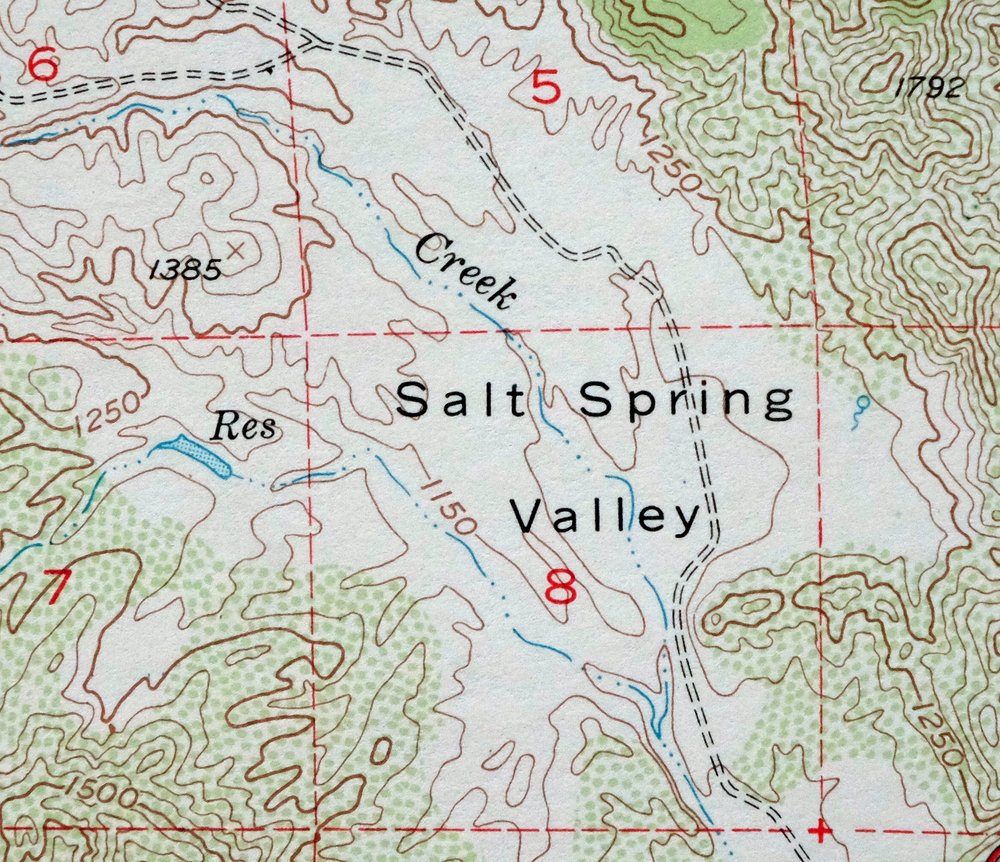
The Stonyford 15-minute map shows cities and towns, roads, railroads, utilities and energy infrastructure, rivers, creeks, elevation contour lines, public land survey lines, county, state, and other administrative boundaries as they existed at the time of the survey in 1948 and 1951. All known structures (houses, businesses, churches, schools, barns, cabins, etc) are also shown.
A VALUABLE HISTORICAL RECORD
Maps from the 15-minute series for the continental United States are no longer produced or printed by the USGS and original prints are becoming increasingly difficult to find. They are a valuable historical record for an area, as they contain many placenames and features that have been dropped from more recent maps.
Nearby maps
-
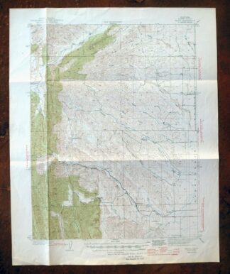
Fruto California Stony Creek Nye Creek USGS Topo Map 1944
$30 Add to cart -
Lakeport California Lucerne Nice USGS Topo Map 1977 Vintage
$44 Add to cart -

Richardson Springs California Chico Nord USGS Topo Map 1966
$35 Add to cart -
Gridley California Oroville Live Oak USGS Topo Map 1959
$37 Add to cart -
Panther Spring California USGS 15-Min Topo Map 1970 Vintage
$36 Add to cart -
Mount Vaca California Fairfield Vacaville USGS Topo Map 1967
$40 Add to cart -
Piercy California USGS 15-Min Topographic Map 1971 Vintage
$33 Add to cart -
Petaluma Point California Novato USGS Topographic Map 1951
$30 Add to cart -
Pittsburg California Concord Fairfield USGS Topo Map 1965
$38 Add to cart -
Port Chicago California Concord Martinez USGS Topo Map 1956
$38 Add to cart -

San Rafael California Mill Valley Tiburon USGS Topo Map 1966
$60 Add to cart -
San Quentin California Richmond Tiburon USGS Topo Map 1980
$46 Add to cart -
Manzanita Lake California Viola USGS Topo Map 1974 Vintage
$39 Add to cart -
Lamoine California Shasta Lake USGS Topo Map 1974 Vintage
$40 Add to cart -
Point Bonita California Sausalito USGS Topographic Map 1955
$44 Add to cart -
Westwood California USGS 15-Min Topographic Map 1961 Vintage
$38 Add to cart -
San Francisco South California USGS 7.5-Min Topo Map 1975
$47 Add to cart -
Hunters Point California Oakland USGS Topographic Map 1969
$38 Add to cart -
Sierraville California Calpine Loyalton USGS Topo Map 1969
$40 Add to cart -
Susanville California Janesville USGS Topo Map 1966 Vintage
$39 Add to cart -

Redwood Point California Fremont Hayward USGS Topo Map 1948
$24 Add to cart -

Newark California Fremont Hayward USGS Topo Map 1948 Vintage
$47 Add to cart -
Milford California USGS 15-Min Topographic Map 1966 Vintage
$40 Add to cart -
Palo Alto California Redwood City Ladera USGS Topo Map 1969
$45 Add to cart