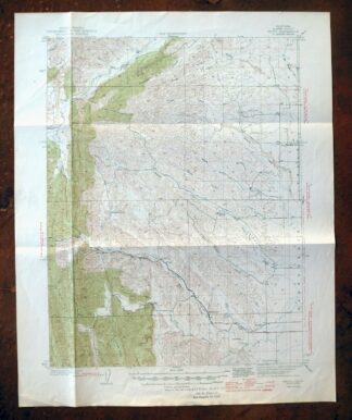
MAP DETAILS | |
|---|---|
| TITLE | Fruto |
| STATE | California |
| LOCATION | 10 miles northwest of Willows |
| SERIES | 15-minute |
| SURVEYED | 1941 and 1942 Field Survey |
| GEOGRAPHER | F.H.Purdy |
| EDITION | 1944 |
| PRINTED | 1944 |
| PRINT NOTES | Thick paper stock, includes woodland tint (green to indicate vegetated areas) |
| SCALE | 1:62500 |
| CONTOUR INTERVAL | 50 feet |
| SHEET DIMENSIONS | 17 x 21 inches |
| MAP DIMENSIONS | 13 1/2 x 17 1/2 inches |
| COVERAGE AREA | 13 x 17 miles |
| SOURCE | From the vintage map collection of Richard Dahlke, Santa Barbara, California |
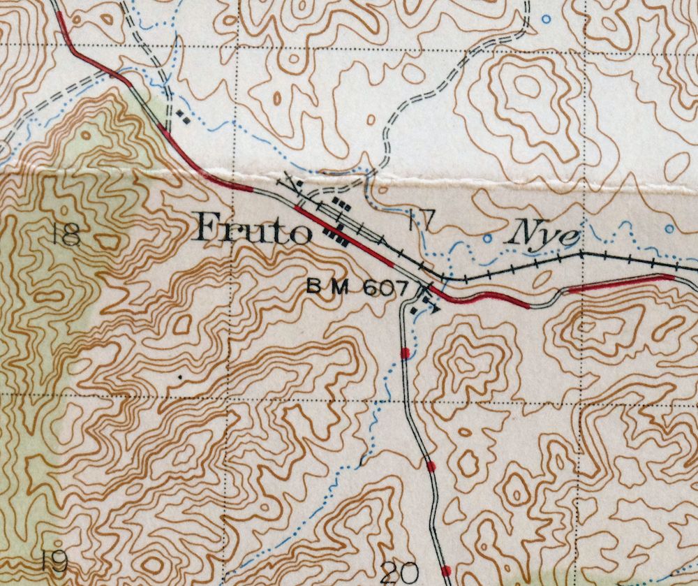
| MAP NOTES | A fascinating historical snapshot surveyed before the modern highway system and Thunderhill Raceway Park, showing historic overland travel routes, rail lines, and early placenames including Millsholm and Kurand. |
| SHEET CONDITION For maps of this vintage, effort is made to note all visible flaws, no matter how minor. | |
| OVERALL CONDITION | Good |
| SHEET NOTES | has foldlines, bottom of sheet has been moderately handled |
| MAP AREA | no markings, no blemishes |
| COLLARS | no markings, no edge tears, library stamp in bottom collar |
| MAP COVERAGE Quadrangle extent overlaid on current basemap. | |
| BACKSIDE LEGEND | |
 A map summary is printed on the back side of the Fruto sheet similar to the one shown in the picture. It outlines the history, purpose, and status of the USGS mapping program at the time of the printing in 1944. It also provides instructions on how to read contour lines and a description of how they are used to depict the terrain. At the bottom of the page is a legend showing all of the symbols used to represent the cultural, relief, and water features found on the map. | |
| PLACENAMES Depending on map series and survey date, all of the features listed below may not be shown on this map. This list contains features that currently exist or historically existed within the area covered by the map. The list can be used as a reference to determine if this map covers your area of interest. Placenames are listed alphabetically next to each feature type. | |
| COUNTIES COVERED | Glenn |
| FEDERAL LAND UNITS | Black Butte Lake |
| RIVERS AND STREAMS | Burris Creek, Gopher Creek, Hayes Hollow Creek, Logan Creek, Nye Creek, Salt Gulch Creek, Stony Creek, White Cabin Creek, and Willow Creek |
| WATER BODIES | Black Butte Lake |
| Locations: Bunnell Ranch, French Ranch, Michael Ranch, and Stone Valley Ranch. Mountain Ranges: Hoodoo Hills. Mountains, Peaks, and Summits: Julian Rocks. Valleys and Canyons: Clark Valley, Salt Gulch, and Stone Valley. Drainages: Fillippi Creek, Gopher Creek, Hayes Hollow Creek, Nye Creek, Salt Gulch Creek, and Tall Cabin Creek. Basins: Hubbard Valley. Schools: Cherokee School. Flats: Squaw Flat. Springs: Harmes Spring. | |
| SHIPPING AND RETURNS | |
 This map sheet will be carefully rolled in a sturdy tube and shipped via the US Postal Service. If you find that the sheet you receive is not as described in the listing, you may ship it back to us for a refund of the purchase price. | |
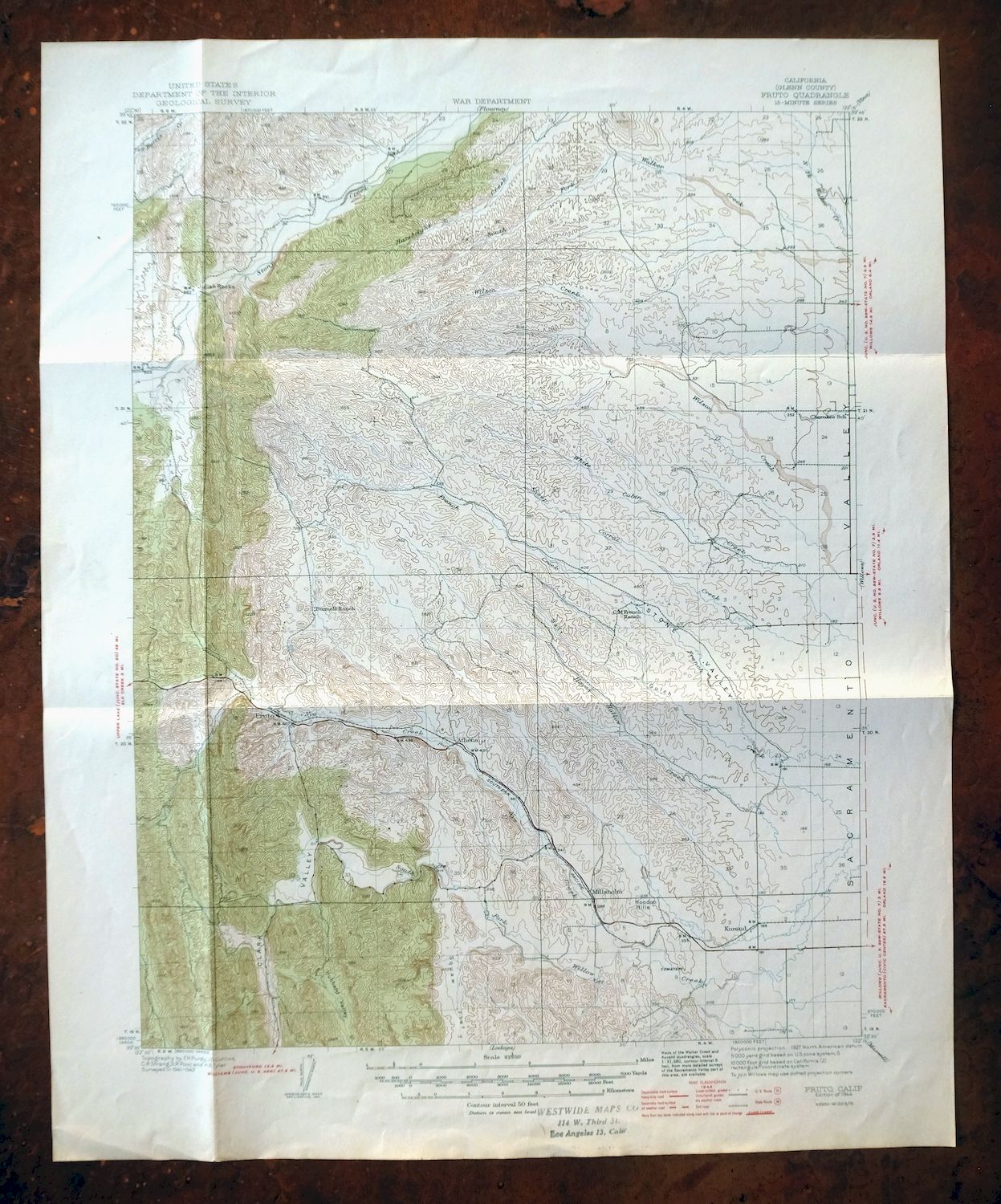
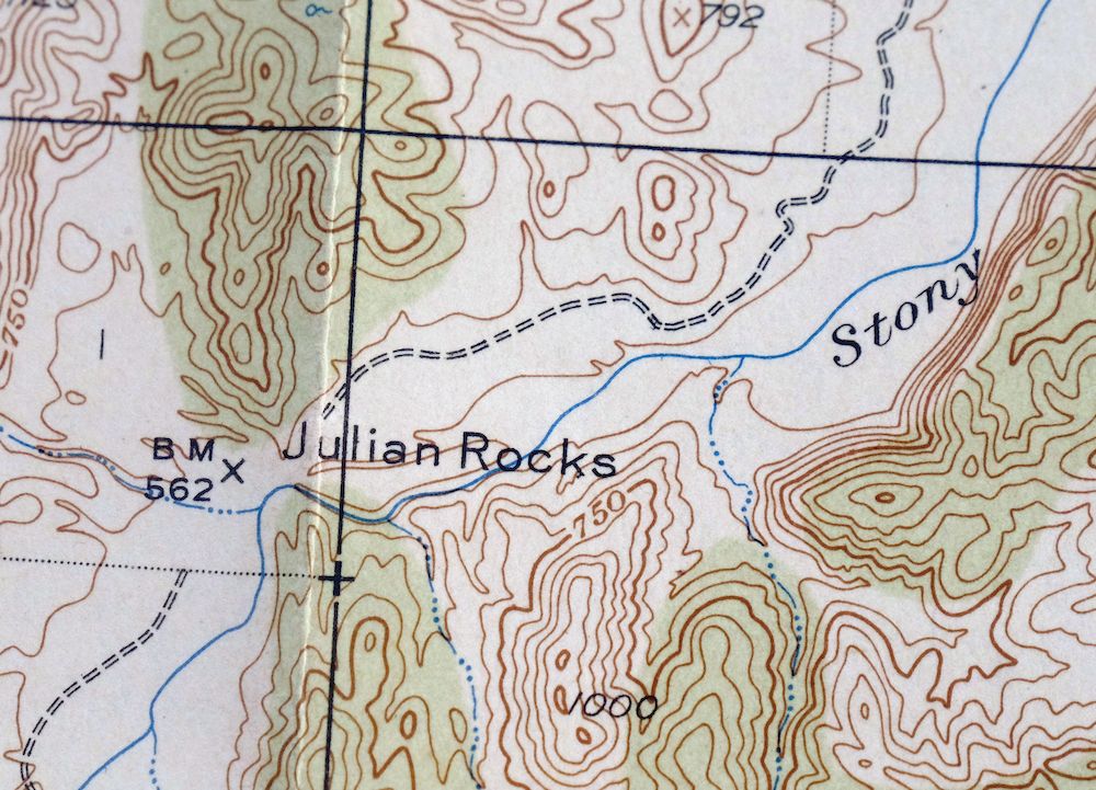
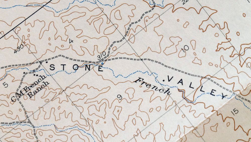
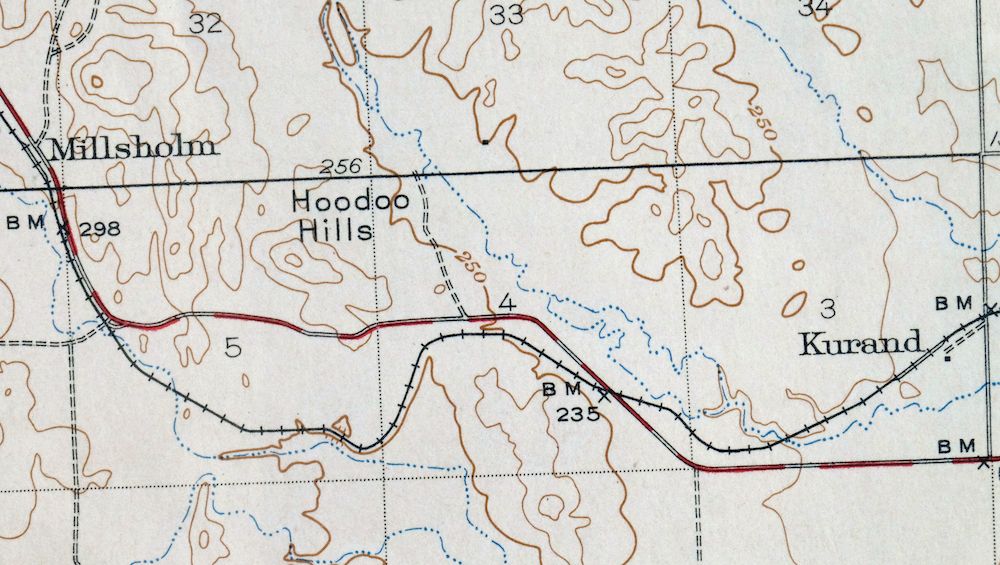
Fruto California Stony Creek Nye Creek USGS Topo Map 1944
$30
Printed in 1944 in its year of first publication, this 15-minute USGS topographic sheet is in good condition, with foldlines and moderate handling along the bottom; it comes on thick stock and carries a library stamp in the bottom collar. Located about 10 miles northwest of Willows in Glenn County, the quad takes in Stony Creek and Nye Creek along with part of Black Butte Lake, drawn from a 1941 and 1942 field survey. Surveyed before the modern highway system and Thunderhill Raceway Park, it records overland travel routes, rail lines, and early placenames such as Millsholm and Kurand, and comes from the vintage map collection of Richard Dahlke of Santa Barbara, California. The reverse carries printed reference material on the USGS mapping program of the era.
In stock
This vintage sheet is a 1944 edition of the Fruto California USGS topographic map. It is an original 82-year-old United States Geological Survey print in good condition.
HOW THIS MAP CAN BE USED
In addition to making a fascinating conversation piece, this sheet would look great in a frame or on display, make a unique and prized gift for anyone interested in this area, be perfect as a reference for genealogy studies or general historical research, or fill that missing piece in your collection.
FEATURES SHOWN ON THE MAP
The Fruto 15-minute map shows cities and towns, roads, railroads, rivers, creeks, elevation contour lines, public land survey lines, county, state, and other administrative boundaries as they existed at the time of the survey in 1941 and 1942. All known structures (houses, businesses, churches, schools, barns, cabins, etc) are also shown.
A VALUABLE HISTORICAL RECORD
Maps from the 15-minute series for the continental United States are no longer produced or printed by the USGS and original prints are becoming increasingly difficult to find. They are a valuable historical record for an area, as they contain many placenames and features that have been dropped from more recent maps.
Nearby maps
-
Stonyford California USGS 15-Min Topo Map 1967 Vintage
$39 Add to cart -

Richardson Springs California Chico Nord USGS Topo Map 1966
$35 Add to cart -
Panther Spring California USGS 15-Min Topo Map 1970 Vintage
$36 Add to cart -
Gridley California Oroville Live Oak USGS Topo Map 1959
$37 Add to cart -
Lakeport California Lucerne Nice USGS Topo Map 1977 Vintage
$44 Add to cart -
Manzanita Lake California Viola USGS Topo Map 1974 Vintage
$39 Add to cart -
Piercy California USGS 15-Min Topographic Map 1971 Vintage
$33 Add to cart -
Lamoine California Shasta Lake USGS Topo Map 1974 Vintage
$40 Add to cart -
Mount Vaca California Fairfield Vacaville USGS Topo Map 1967
$40 Add to cart -
Westwood California USGS 15-Min Topographic Map 1961 Vintage
$38 Add to cart -
Susanville California Janesville USGS Topo Map 1966 Vintage
$39 Add to cart -
Sierraville California Calpine Loyalton USGS Topo Map 1969
$40 Add to cart -
Pittsburg California Concord Fairfield USGS Topo Map 1965
$38 Add to cart -
Petaluma Point California Novato USGS Topographic Map 1951
$30 Add to cart -
Port Chicago California Concord Martinez USGS Topo Map 1956
$38 Add to cart -
Milford California USGS 15-Min Topographic Map 1966 Vintage
$40 Add to cart -
Fredonyer Peak California USGS 15-Min Topo Map 1972 Vintage
$40 Add to cart -
San Quentin California Richmond Tiburon USGS Topo Map 1980
$46 Add to cart -

San Rafael California Mill Valley Tiburon USGS Topo Map 1966
$60 Add to cart -
Litchfield California Susanville USGS Topo Map 1972 Vintage
$40 Add to cart -
Shasta California McCloud USGS 15-Min Topo Map 1968 Vintage
$40 Add to cart -
Point Bonita California Sausalito USGS Topographic Map 1955
$44 Add to cart -
Hunters Point California Oakland USGS Topographic Map 1969
$38 Add to cart -
San Francisco South California USGS 7.5-Min Topo Map 1975
$47 Add to cart