MAP DETAILS | |
|---|---|
| TITLE | Young |
| STATE | Arizona |
| SURVEYED | 1958 and 1961 Aerial and Field Survey |
| PRINT NOTES | Thick paper stock, includes woodland tint (green to indicate vegetated areas) |
| SCALE | 1:62500 |
| CONTOUR INTERVAL | 80 feet |
| SHEET DIMENSIONS | 17 x 21 inches |
| MAP DIMENSIONS | 14 1/2 x 17 1/2 inches |
| COVERAGE AREA | 14 x 17 miles |
| SHEET CONDITION For maps of this vintage, effort is made to note all visible flaws, no matter how minor. | |
| SHEET NOTES | lightly handled, never folded |
| MAP AREA | flawless map area |
| COLLARS | no markings, no blemishes, minor crease in lower right collar corner, no edge tears, hole punches in left collar |
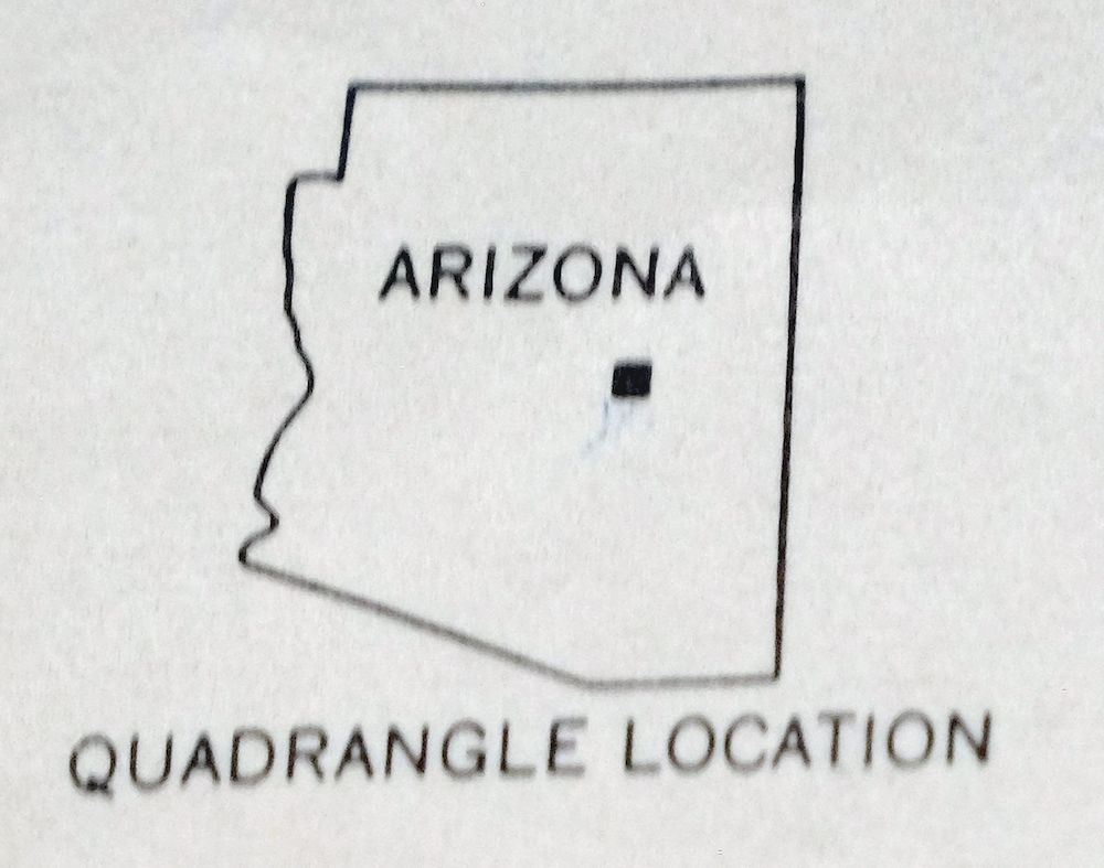
| MAP COVERAGE Quadrangle extent overlaid on current basemap. | |
| PLACENAMES Depending on map series and survey date, all of the features listed below may not be shown on this map. This list contains features that currently exist or historically existed within the area covered by the map. The list can be used as a reference to determine if this map covers your area of interest. Placenames are listed alphabetically next to each feature type. | |
| CITIES AND TOWNS (CURRENT) | Young |
| COUNTIES COVERED | Gila and Navajo |
| FEDERAL LAND UNITS | Fort Apache Indian Reservation and Tonto National Forest |
| RIVERS AND STREAMS | Ash Creek, Bear Creek, Canyon Creek, Cherry Creek, Cow Creek, Crouch Creek, Dry Creek, Ellison Creek, Gentry Creek, Gordon Canyon Creek, Haigler Creek, Marsh Creek, Pine Creek, Rock Creek, Sloan Creek, Swamp Creek, Turkey Creek, Walnut Creek, and Wilson Creek |
| Locations: Bar X Ranch, Flying V Ranch, Nail Ranch, Pleasant Valley Ranger Station, Q Ranch, Red Lake Guard Station, and Redman Cave. Mountains, Peaks, and Summits: Catholic Peak, Cherry Creek Hill, Colcord Mountain, Crouch Mesa, Gentry Mountain, Middleton Mesa, Oxbow Mountain, Round Mountain, Shell Mountain, Squaw Mesa, Squaw Peak, and Vosburg Mesa. Valleys and Canyons: Bull Flat Canyon, Colcord Canyon, Deadman Canyon, Fourmile Canyon, Graveyard Canyon, Gruwell Canyon, Hells Canyon, Hog Canyon, Lost Salt Canyon, Mexican Canyon, Naegelin Canyon, Naegelin Spring Canyon, Parallel Canyon, Pleasant Valley, Saunders Canyon, and Valentine Canyon. Trails: Chamberlain Trail. Drainages: Ashurst Creek, Cow Creek, Crouch Creek, Dry Creek, Gentry Creek, Gordon Canyon Creek, Pine Creek, Swamp Creek, Turkey Creek, Walnut Creek, and West Prong Gentry Creek. Mines: Cook Mine. Bluffs: Naegelin Rim. Airports: Pleasant Valley Airstrip and Waldrip Airstrip. Schools: Blue Ridge Elementary School, Blue Ridge Junior High School, and Pleasant Valley School. Ridges: Lost Tank Ridge. Reservoirs and Tanks: Allen Tank, Bar X Tank, Billy June Tank, Big Tank, Boundary Tank, Bryant Ridge Tank, Burn Tank, Byrant Ridge Tank, Caine Tank, Calf Tank, Catholic Peak Tank, Cherry Creek Tank, Clark Tank, Cline Pasture Tank, Clover Flat Tank, Clover Flat Tank Number 2, Cochran Tank, Cooks Trick Tank, Cross Y Tank, Crouch Mesa, Deer Tank, Double Tank, Dry Creek Tank, Dry Creek Trough, Ellison Creek Tank, Fillmore Tank, Frog Pond, Gentry Mesa Tank, Gentry Tank, Grasshopper Tank, Henry Tank, Hog Canyon Tank, Hog Tank, Jerky Tank, Joe Tank, Juniper Tank, Lost Lake, Lost Tank, Lower Bell Tank, Lower Frio Canyon Tank, Lower PV Trick Tank, Lower Sparky Tank, Magnet Tank, Martin Tank, Maxwell Tank, McInturf Trick Tank, McKinney Tank, Mexican Tank, Middleton Mesa Tank, Mud Tank, Naegelin Rim Tank, Natural Tank, Oxbow Mountain Tank, Oxbow Tank, Ramer Tank, Red Ledge Mesa Tank, Reservation Tank, Ridge Tank, Rim Tank, Ruth Tank, Shell Mountain Tank, Snow Tank, Squaw Tank, Steve Tank, Stone Tank, Trail Tank, Upper Bell Tank, Upper Frio Canyon Tank, Upper Tank, Valentine Tank, Vosburg Tank, Vosburg Trick Tank, Whiskey Tank, Willis Tank, and Windy Pass Tank. Wells: Buttes Well, Gruwell Well, and Pine Creek Well. Springs: Bill Spring, Bottle Spring, Box Spring, Brewer Spring, Carroll Spring, Charles Williams Spring, Cherry Creek Spring, Clay Spring, Creek Spring, Cunningham Spring, Divided Spring, Divided Water Spring, Ed Spring, Gentry Canyon Spring, Gruwell Spring, Joes Spring, Lost Salt Spring Number One, Lost Salt Spring Number Two, McInturf Spring, McKenney Spring, Mud Spring, Naegelin Spring, Pine Spring, Rock Spring, Rock Tanks Spring, Saunders Spring, Scarlet Spring, Sheep Corral Spring, Slide Spring, Sparky Spring, Tunnel Spring, Turkey Spring, Walnut Spring, and Wolf Spring. | |
| SHIPPING AND RETURNS | |
 Ships carefully rolled in a sturdy 2" x 18" mailing tube. Shipping and return details are in our terms. | |
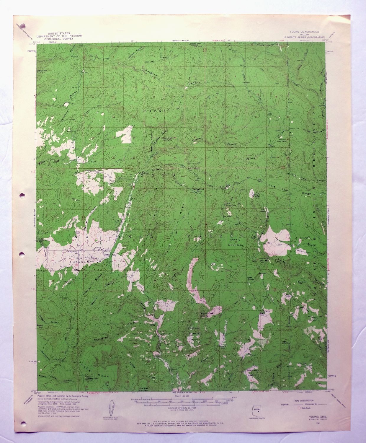
1961 USGS Topo Map: Young, Tonto NF, Arizona (Vintage Print)
$45
- 85 miles northeast of Phoenix.
- 15-minute series, 1961 edition, printed in 1963.
- Very good condition, never folded.
In stock
This vintage sheet is a 1961 edition of the Young Arizona USGS topographic map. It is an original 63-year-old 1963 United States Geological Survey print in very good condition.
HOW THIS MAP CAN BE USED
In addition to making a fascinating conversation piece, this sheet would look great in a frame or on display, make a unique and prized gift for anyone interested in this area, be perfect as a reference for genealogy studies or general historical research, or fill that missing piece in your collection. Maps of this vintage are printed on durable stock and are well-suited for outdoor activities and recreation of all kinds, including hiking, backpacking, hunting, rafting and kayaking, backcountry skiing, geocaching, general exploration, treasure hunting, etc.
FEATURES SHOWN ON THE MAP
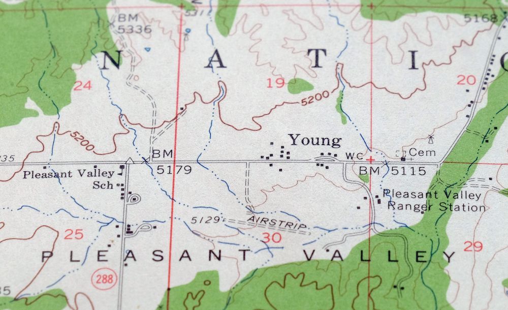
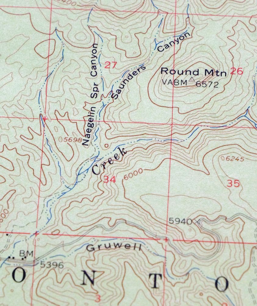
The Young 15-minute map shows cities and towns, roads, railroads, utilities and energy infrastructure, rivers, creeks, elevation contour lines, public land survey lines, county, state, and other administrative boundaries as they existed at the time of the survey in 1958 and 1961. All known structures (houses, businesses, churches, schools, barns, cabins, etc) are also shown.
A VALUABLE HISTORICAL RECORD
Maps from the 15-minute series for the continental United States are no longer produced or printed by the USGS and original prints are becoming increasingly difficult to find. They are a valuable historical record for an area, as they contain many placenames and features that have been dropped from more recent maps.
Nearby maps
-
1961 USGS Topo Map: Chediski Peak, Cibecue, Arizona
$23 Add to cart -
1961 USGS Topo Map: Woods Canyon, Sitgreaves NF, Arizona
$30 Add to cart -
1952 USGS Topo Map: Promontory Butte, Arizona
$38 Add to cart -
Payson, Gisela, Arizona 1936 USGS Topo Map (1965 Print)
$53 Add to cart -
1961 USGS Topo Map: Cibecue, Sitgreaves NF, Arizona
$27 Add to cart -

Payson, Gisela, Arizona 1936 USGS Topo Map (1965 Print)
$40 Add to cart -
Pine, Strawberry, Arizona 1940 USGS Topo Map
$35 Add to cart -
1961 USGS Topo Map: Clay Springs, Pinedale, Arizona
$29 Add to cart -
Show Low, Arizona 1961 USGS Topo Map: Mogollon Rim
$53 Add to cart -
Globe, Arizona 1901 USGS Topo Map (1955 Print)
$40 Add to cart -
1902 USGS Topo Map: Globe, Pinal Mountains, Arizona
$75 Add to cart -

Superior, Oak Flat, Arizona 1948 USGS Topo Map
$50 Add to cart -

Camelback, Tonto NF, Arizona 1906 USGS Topo Map (1948 Print)
$47 Add to cart -
Holbrook, Woodruff, Arizona 1955 USGS Topo Map
$31 Add to cart -

Desert Well, Apache Junction, Arizona 1906 USGS Topo Map
$66 Add to cart -
1904 USGS Topo Map: Desert Well, Arizona (1958 Print)
$21 Add to cart -
Roosevelt, Arizona 1907 USGS Topo Map (1956 Print)
$45 Add to cart -
Globe, Arizona 1945 USGS Topo Map: Miami (1982 Print)
$27 Add to cart -
1933 USGS Topo Map: Turret Peak, Verde River, Arizona
$57 Add to cart -
Turret Peak, Arizona 1929 USGS Topo Map (1962 Print)
$44 Add to cart -

Cave Creek, Arizona 1930 USGS Topo Map (1963 Print)
$32 Add to cart -

Mcdowell Peak, Arizona 1965 USGS Topo Map: Paradise Valley
$36 Add to cart -
Apache Junction, AZ 1956 USGS Army COE Topo Map (1975 Print)
$39 Add to cart -

1902 USGS Topo Map: Florence, Arizona
$51 Add to cart