MAP DETAILS | |
|---|---|
| TITLE | Promontory Butte |
| STATE | Arizona |
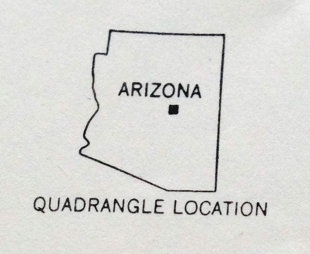
| LOCATION | Vicinity of Sun Valley, 85 miles northeast of Phoenix |
| SERIES | 15-minute |
| SURVEYED | 1933 through 1952 Aerial and Field Survey |
| EDITION | 1952 |
| PRINTED | 1960 |
| PRINT NOTES | Thick paper stock, includes woodland tint (green to indicate vegetated areas) |
| SCALE | 1:62500 |
| CONTOUR INTERVAL | 50 feet |
| SHEET DIMENSIONS | 17 x 21 inches |
| MAP DIMENSIONS | 14 1/2 x 17 1/2 inches |
| COVERAGE AREA | 14 x 17 miles |
| SHEET CONDITION For maps of this vintage, effort is made to note all visible flaws, no matter how minor. | |
| OVERALL CONDITION | Excellent |
| SHEET NOTES | very lightly handled, never folded, smooth and flat |
| MAP AREA | flawless map area |
| COLLARS | no wear or tears, no markings, no blemishes, hole punches in left collar |
| MAP COVERAGE Quadrangle extent overlaid on current basemap. | |
| PLACENAMES Depending on map series and survey date, all of the features listed below may not be shown on this map. This list contains features that currently exist or historically existed within the area covered by the map. The list can be used as a reference to determine if this map covers your area of interest. Placenames are listed alphabetically next to each feature type. | |
| CITIES AND TOWNS (CURRENT) | Sun Valley |
| COUNTIES COVERED | Coconino and Gila |
| FEDERAL LAND UNITS | Coconino National Forest, Hellsgate Wilderness, Sitgreaves National Forest, and Tonto National Forest |
| RIVERS AND STREAMS | Bonita Creek, Brody Creek, Christopher Creek, Dick Williams Creek, Dry Dude Creek, Dude Creek, East Fork Horton Creek, Ellison Creek, Green Valley Creek, Horton Creek, Hunter Creek, Lewis Creek, Moore Creek, Spring Creek, Tonto Creek, Turkey Creek, and Willow Creek |
| WATER BODIES | Bear Canyon Lake and Knoll Lake |
| Locations: Boy Scout Camp, Buck Springs Guard Station, Bush Cabin, Camp Tontozona, Double Cabin, Gentry Tank, Holder Cabin, Horseshoe Vista, Horton Picnic Area, Limestone Ranch, McGuire Crossing, Mead Ranch, O'Haco Cabins, Ponderosa Group Camp, Pyle Ranch, R Bar C Ranch, Tonto State Fish Hatchery, Winters Ranch, and Wipala Wiki Ranch. Areas: Indian Gardens. Mountains, Peaks, and Summits: Diamond Point, Horse Mountain, Kushs Mountain, Mogollon Mesa, and Roberts Mesa. Valleys and Canyons: Bearhide Canyon, Beaver Canyon, Bear Canyon, Big Canyon, Bill McClintock Draw, Box Canyon, Broad Draw, Buck Springs Canyon, Cabin Draw, Cave Draw, Doubtful Canyon, East Bear Canyon, East Leonard Canyon, East Miller Canyon, Fred Haught Canyon, Hells Gate Canyon, Jim Roberts Draw, Little Green Valley, Maverick Canyon, Merritt Draw, Middle Leonard Canyon, Moonshine Draw, Oak Spring Draw, Open Draw, Preacher Canyon, Pyeatt Draw, Sandstone Canyon, See Canyon, Thompson Draw, Walk Moore Canyon, West Bear Canyon, West Leonard Canyon, and West Moonshine Draw. Parks: Bear Canyon Lake Recreation Area, Bear Flat Campground, Christopher Creek Campground, Horton Campground, Knoll Lake Campground, Ponderosa Campground, and Tonto Creek Campground. Trails: Bear Flat Pleasant Valley Trail, Derrick Trail, General George Crook Natioanl Recreation Trail, General George Crook National Recreation Trail, Hells Gate Trail, Highline Trail, Horton Creek Trail, and Myrtle Trail. Drainages: Bonita Creek, Christopher Creek, Dick Williams Creek, East Fork Horton Creek, East Leonard Canyon Creek, Fuller Creek, Horton Creek, Hunter Creek, Lewis Creek, Moore Creek, Perley Creek, Spring Creek, and Turkey Creek. Lakes and Ponds: Dude Lake, Horseshoe Lake, Lost Lake, Myrtle Lake, and Lake Number Four. Buildings: Zane Grey Lodge. Dams: Bear Canyon Dam and Knoll Dam. Bluffs: Alcatraz Point, Burnt Point, Myrtle Point, and Promontory Butte. Gaps: Gilliland Gap. Ridges: Bear Beaver Ridge, Beaver Turkey Ridge, Buck Springs Ridge, Christopher Mountain, Dane Ridge, Diamond Rim, Dick Hart Ridge, Fred Haught Ridge, Gentry Ridge, Hospital Ridge, King Ridge, Knoll Ridge, McClintock Ridge, Mescal Ridge, and Turkey Ridge. Reservoirs and Tanks: Anderson Tank, Bear Canyon Lake, Bear Flat Trail Tank, Box Trap Tank, Boy Tank, Bull Tank, Cabin Tank, Cave Tank, Christopher Tank, Diamond Point Tank, Dines Tank, Franklin Tank, Horse Pasture Tank, Jackass Tank, King Ridge Tank, King Tank Number Three, Knoll Lake, Knoll Tank, Limestone Tank, Mescal Ridge Tank, Mescal Ridge Tank Number One, Neal Tank, Oak Spring Draw Tank, Pine Thicket Tank, Roberts Draw Tank, Sandstone Tank, Schoolhouse Tank, Scout Tank, Turkey Tank, Turkey Tree Tank, Twenty Tank, and Upper Bull Canyon Tank. Flats: Bear Flat, Beaver Park, and Limestone Pasture. Towers: Diamond Point Lookout Tower, O'Haco Lookout Tower, and Promontory Lookout Tower. Wells: Yunker Ranch Well. Springs: Bearhide Spring, Aspen Spring, Barbershop Spring, Bootleg Spring, Coyote Spring, Crackerbox Spring, Dane Spring, Diamond Spring, Double Cabin Spring, Drift Fence Spring, Fred Haught Spring, Gentry Spring, Gilliland Spring, Herman Spring, Horton Spring, Jumping Spring, Lion Spring, Lower Buck Spring, Mayberry Spring, Mayfield Spring, McClintock Spring, McFarland Spring, Merritt Spring, Moonshine Spring, Mud Spring, Nappa Spring, Pinchot Spring, Section Thirty-three Spring, See Spring, Tonto Spring, Turkey Spring, Upper Buck Spring, West Moonshine Spring, Whistling Spring, and Wildcat Spring. | |
| SHIPPING AND RETURNS | |
 This map sheet will be carefully rolled in a sturdy tube and shipped via the US Postal Service. If you find that the sheet you receive is not as described in the listing, you may ship it back to us for a refund of the purchase price. | |

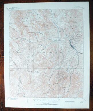
Promontory Butte Arizona Coconino NF USGS Topo Map 1960
$46
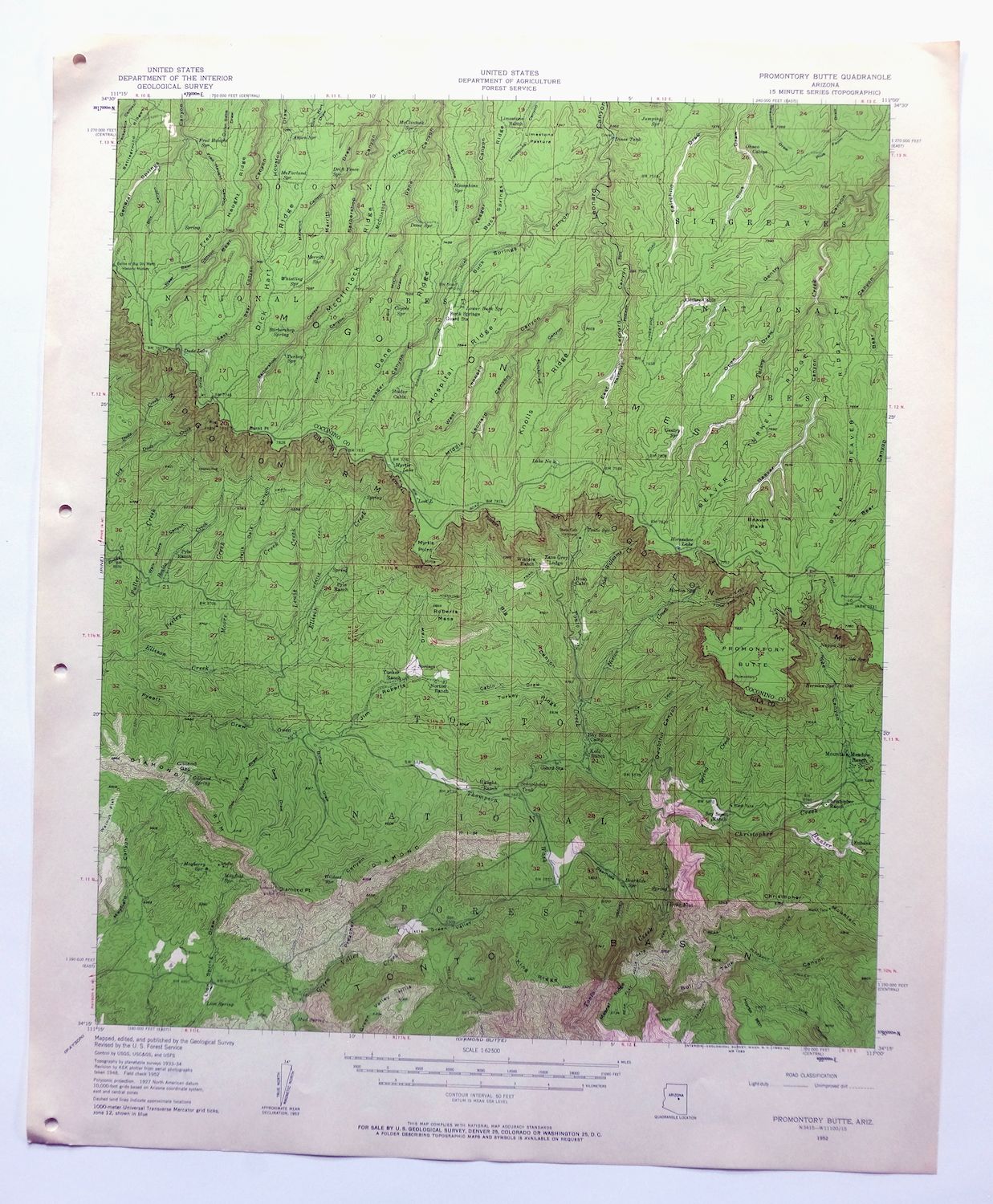
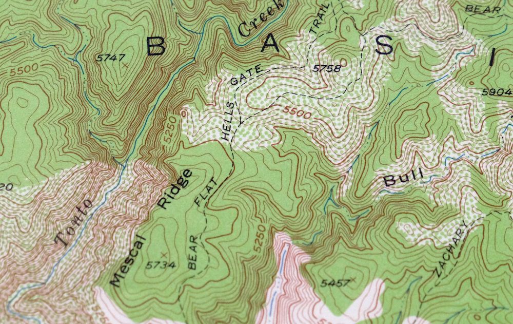
This 15-minute USGS topographic sheet is a 1952 edition printed in 1960, in excellent condition: very lightly handled, never folded, smooth and flat on thick stock, with hole punches in the left collar. Drawn from a 1933 through 1952 aerial and field survey at 1:62,500, it takes in high country along the Mogollon Rim northeast of Phoenix, spanning parts of Coconino and Gila counties and including portions of the Tonto, Coconino, and Sitgreaves National Forests along with the Hellsgate Wilderness. The rugged forest and canyon terrain here, laced with 50-foot contours, gives a clear read of the steep drop-offs and drainages that define this stretch of the Rim.
In stock
This vintage sheet is a 1952 edition of the Promontory Butte Arizona USGS topographic map. It is an original 66-year-old 1960 United States Geological Survey print in excellent condition.
HOW THIS MAP CAN BE USED
In addition to making a fascinating conversation piece, this sheet would look great in a frame or on display, make a unique and prized gift for anyone interested in this area, be perfect as a reference for genealogy studies or general historical research, or fill that missing piece in your collection. Maps of this vintage are printed on durable stock and are well-suited for outdoor activities and recreation of all kinds, including hiking, backpacking, hunting, rafting and kayaking, backcountry skiing, geocaching, general exploration, treasure hunting, etc.
FEATURES SHOWN ON THE MAP
The Promontory Butte 15-minute map shows cities and towns, roads, railroads, utilities and energy infrastructure, rivers, creeks, elevation contour lines, public land survey lines, county, state, and other administrative boundaries as they existed at the time of the survey in 1933 through 1952. All known structures (houses, businesses, churches, schools, barns, cabins, etc) are also shown.
A VALUABLE HISTORICAL RECORD
Maps from the 15-minute series for the continental United States are no longer produced or printed by the USGS and original prints are becoming increasingly difficult to find. They are a valuable historical record for an area, as they contain many placenames and features that have been dropped from more recent maps.
Nearby maps
-
Pine Arizona Payson Sun Valley USGS Topo Map 1940 Antique
$45 Add to cart -
Woods Canyon Arizona Sitgreaves NF USGS 15-Min Topo Map 1963
$35 Add to cart -
Payson Arizona Sun Valley Gisela USGS Topo Map 1965 Vintage
$64 Add to cart -
Heber Arizona Overgaard Mogollon Rim USGS Topo Map 1982
$45 Add to cart -
Chediski Peak Arizona Cibecue USGS Topo Map 1963 Vintage
$32 Add to cart -
Clay Springs Arizona Pinedale Aripine USGS Topo Map 1971
$34 Add to cart -
Cibecue Arizona Sitgreaves NF USGS Topo Map 1963 Vintage
$32 Add to cart -
Winslow Arizona USGS 15-Min Topographic Map 1958 Vintage
$37 Add to cart -
Mingus Mountain Arizona Cottonwood USGS Topographic Map 1970
$51 Add to cart -
Show Low Arizona Pinetop-Lakeside USGS Topo Map 1972 Vintage
$40 Add to cart -

Clarkdale Arizona Cottonwood Jerome USGS Topo Map 1948
$44 Add to cart -
Holbrook Arizona Woodruff USGS 15-Min Topo Map 1969 Vintage
$36 Add to cart -

Camelback Arizona Tonto NF Phoenix USGS 15-Min Topo Map 1948
$55 Add to cart -

Camp Verde Arizona Cottonwood Sedona USGS Topo Map 1965
$56 Add to cart -
Roosevelt Arizona Four Peaks Tonto Basin USGS Topo Map 1956
$52 Add to cart -

Cave Creek Arizona Phoenix Mesa USGS Topo Map 1963 Vintage
$44 Add to cart -
Mountainaire Arizona Coconino NF USGS Topo Map 1964 Vintage
$36 Add to cart -

Mcdowell Peak Arizona Scottsdale USGS Topo Map 1967 Vintage
$37 Add to cart -
Globe Arizona Miami Claypool USGS Topo Map 1982 Vintage
$28 Add to cart -

Superior Arizona Top-of-the-World USGS Topo Map 1957 Vintage
$45 Add to cart -
Apache Junction Arizona Tonto NF Mesa USGS Topo Map 1975
$42 Add to cart -
Leupp Arizona USGS 15-Min Topographic Map 1959 Vintage
$44 Add to cart -
Globe Arizona Miami Claypool USGS Topo Map 1955 Vintage
$54 Add to cart -

Mount Union Arizona Prescott NF Mayer USGS Topo Map 1949
$34 Add to cart