MAP DETAILS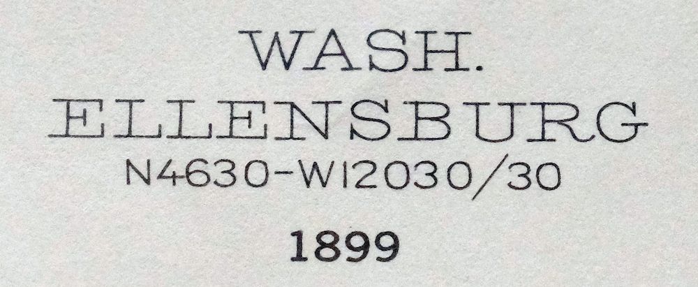 | |
|---|---|
| TITLE | Ellensburg |
| STATE | Washington |
| LOCATION | Vicinity of Yakima |
| SERIES | 30-minute |
| SURVEYED | 1899 Field Survey |
| GEOGRAPHER | R.U. Goode |
| EDITION | 1899 |
| PRINTED | 1957 |
| PRINT NOTES | Thick paper stock |
| SCALE | 1:125000 |
| CONTOUR INTERVAL | 100 feet |
| SHEET DIMENSIONS | 17 x 21 inches |
| MAP DIMENSIONS | 12 x 17 1/2 inches |
| COVERAGE AREA | 24 x 35 miles |
| SHEET CONDITION For maps of this vintage, effort is made to note all visible flaws, no matter how minor. | |
| OVERALL CONDITION | Good |
| SHEET NOTES | lightly handled, midsheet horizontal and vertical foldlines (1/4), title notation in marker on backside of sheet |
| MAP AREA | no wear, no markings, no blemishes |
| COLLARS | no wear or tears, no markings, no blemishes |
| MAP COVERAGE Quadrangle extent overlaid on current basemap. | |
| PLACENAMES Depending on map series and survey date, all of the features listed below may not be shown on this map. This list contains features that currently exist or historically existed within the area covered by the map. The list can be used as a reference to determine if this map covers your area of interest. Placenames are listed alphabetically next to each feature type. | |
| CITIES AND TOWNS (CURRENT) | Ahtanum, Ellensburg, Eschbach, Fruitvale, Gleed, Naches, Selah, South Broadway, Summitview, Terrace Heights, Tieton, Union Gap, West Valley, and Yakima |
| COUNTIES COVERED | Kittitas and Yakima |
| FEDERAL LAND UNITS | Snoqualmie National Forest, Wenatchee National Forest, and Yakama Indian Reservation |
| RIVERS AND STREAMS | Ahtanum Creek, Bachelor Creek, Benton Creek, Cherry Creek, Coleman Creek, Cottonwood Creek, Counterfeit Creek, Cowiche Creek, Dry Creek, Foundation Creek, Gold Creek, Hatton Creek, Hudson Creek, Indian Creek, Lefthand Fork Rock Creek, Little Rattlesnake Creek, Manastash Creek, Milk Creek, Naches River, Naneum Creek, Nasty Creek, Nile Creek, North Fork Ahtanum Creek, North Fork Cowiche Creek, North Fork Manastash Creek, North Fork Oak Creek, North Fork Wenas Creek, Oak Creek, Patemas Creek, Rattlesnake Creek, Reecer Creek, Reynolds Creek, Righthand Fork Rock Creek, Rock Creek, Roza Creek, Sentinel Creek, South Fork Ahtanum Creek, South Fork Cowiche Creek, South Fork Manastash Creek, South Fork Oak Creek, South Fork Wenas Creek, Spring Creek, Tepee Creek, Tieton River, Umtanum Creek, Wenas Creek, Wilson Creek, Yakima River, and Yellow Jacket Creek |
| WATER BODIES | Manastash Lake, Mud Lake, Lake Myron, Tjossem Pond, and Wenas Lake |
| Locations: Bannister, Barnes Cabin, Bonlow, Chalet Mall Shopping Center, Cheney Ranch, Congdon, Eastman, Elks Golf and Country Club, Exchange, Glenwood Shopping Center, Hanging Tree Campground, Henrybro, High Valley Ranch, Lower Naches Grange, Mallett, Manastash Lookout, Meadow Brook, Meadowbrook Mall, Nob Hill Plaza, Orchard, Ramblers Park, Rattlesnake Ranger Station, Rimrock Retreat, Schwarder, Selah Heights, Soda Springs Forest Camp, Southgate Shopping Center, Stewart, The Cottonwoods, Trout Lodge, Twin Bridges, Viking Village Shopping Center, Wenas Camp, Wenas Valley Grange, Westpark Shopping Center, Windy Point Campground, and Yakima Mall. Mountains, Peaks, and Summits: Bald Mountain, Cowiche Mountain, Craigs Hill, Eagle Rock, The Island, Naches Heights, Pine Mountain, Pleasant Hill, and Selah Heights. Valleys and Canyons: Ahtanum Valley, Bear Canyon, Big Burn Canyon, Box Spring Canyon, Benwy Canyon, Black Canyon, Burn Canyon, Carmack Canyon, Carpenter Gulch, Catlin Canyon, Clint Canyon, Coleman Canyon, Cottonwood Canyon, Cougar Canyon, Cow Canyon, Cowiche Canyon, Crusher Canyon, Dipping Vat Canyon, Evans Canyon, French Canyon, Garrett Canyon, Goodwin Canyon, Hardy Canyon, Hoover Canyon, Horse Trough Canyon, Johnson Canyon, Jones Canyon, Kelley Hollow, Lady Bug Canyon, Lemon Canyon, Logger Canyon, Long Tom Canyon, Lower Naches Valley, McDaniel Canyon, Meloy Canyon, Meystre Canyon, Middle Fork Canyon, Milk Canyon, Mill Canyon, NPK Canyon, Nile Valley, North Riggs Canyon, Pecks Canyon, Pine Canyon, Pine Tree Canyon, Reed Canyon, Sanford Canyon, Selah Valley, Shushuskin Canyon, South Riggs Canyon, Spring Canyon, Spud Canyon, Stone Quarry Canyon, Upper Naches Valley, Watering Trough Canyon, Waterworks Canyon, Weddle Canyon, Wenas Valley, Wide Hollow, and Woodcamp Canyon. Parks: Ahtanum Youth County Park, Broadway Park, Carlon Park, Elks Memorial Park, Franklin Park, Gilbert Park, Indian Painted Rocks State Park, L T Murray State Wildlife Recreation Area, Larson Park, Legion Park, Lions Park, Lower Naches Community Park, Memorial Park, Miller Park, Milroy Park, Mountain View Park, Oak Creek State Wildlife Area, Palm Park, Reed Park, West Side Park, Whitney Park, and Wixon Park. Trails: Davis Trail, Gold Creek Trail, and Summit Trail. Drainages: Bachelor Creek, Benton Creek, Buckskin Slough, Cottonwood Creek, Counterfeit Creek, Cowiche Creek, Dry Creek, Foundation Creek, Hatton Creek, Hudson Creek, Indian Creek, Lefthand Fork Rock Creek, Little Rattlesnake Creek, Manastash Creek, Mercer Creek, Naches River, Naneum Creek, Nasty Creek, Nile Creek, North Fork Ahtanum Creek, North Fork Cowiche Creek, North Fork Manastash Creek, North Fork Oak Creek, North Fork Wenas Creek, Oak Creek, Rattlesnake Creek, Reecer Creek, Reynolds Creek, Righthand Fork Rock Creek, Rock Creek, Sentinel Creek, South Fork Ahtanum Creek, South Fork Cowiche Creek, South Fork Manastash Creek, South Fork Oak Creek, South Fork Wenas Creek, Spring Creek, Tepee Creek, Tieton River, Wilson Creek, and Yellow Jacket Creek. Churches: Nile Community Church and Saint Joseph Mission. Lakes and Ponds: Little Mud Lake, Manastash Lake, Milk Lake, Mud Lake, Lake Myron, Rotary Lake, and Tim Ponds. Dams: Parker Reservoir Dam, Stevenson Dam, Tjossem Pond Dam, and Wenas Dam. Crossings: Interstate Eighty-two Interchange and South Ellensburg Interchange. Bluffs: Devils Slide, Lookout Point, and Windy Point. Gaps: Ellensburg Pass and Rocky Saddle. Canals: Ahtanum Canal, Bull Ditch, Clinesmith Irrigation Ditch, Congdon Canal, East Unit 1 Highline Canal, Fogarty Ditch, Gleed Ditch, John Cox Ditch, Kelly Ditch, Lateral A, Lateral B, Lateral C, Lateral E, Lateral F, Lateral G, Lateral J, Lateral K, Lateral L, Lateral N, Lateral P, Lateral R, Lateral S, Lateral T, Lesh Ditch, Longmire Wenas Canal, Lowry Ditch, Naches And Cowiche Ditch, Number 1 Lateral, Number 2 Lateral, Selah Valley Canal, Shaw Knox Ditch, South Branch Extension, Tjossem Ditch, Town Canal, Union Canal, Wapatox Canal, and Yakima Tieton Main Canal. Bends: Horseshoe Bend. Basins: Cowiche Basin. Airports: Apple Valley Airport, Don Williams Private Heliport, Reids Field, Saint Elizabeth Hospital Heliport, Yakima Air Terminal Airport, and Yakima Valley Memorial Hospital Heliport. Schools: Ahtanum Valley Elementary School, Apple Valley Elementary School, Barge-Lincoln Elementary School, Broadway School, Brookside Academy, Cascade Junior High School, Castlevale School, Central High School, Cowiche School, Damman Elementary School, Davis High School, Eisenhower High School, Ellensburg High School, Franklin Middle School, Garfield Elementary School, Gilbert Elementary School, Grace Lutheran School, Highland High School, Hoover Elementary School, John Campbell Elementary School, Klein School, Lewis and Clark Middle School, Lincoln Elementary School, Lincoln School, Lower Naches School, Marcus Whitman School, Marcus Whitman-Cowiche Elementary School, McClure Elementary School, McKinley Elementary School, Mountain View Elementary School, Naches Valley High School, Naches Valley Intermediate School, Naches Valley Middle School, Naches Valley Primary School, Nob Hill Elementary School, Perry Institute, Pulse Alternative School, Robert S Lince Intermediate School, Robertson Elementary School, Roosevelt Elementary School, Saint Andrews School, Saint Josephs-Marguette Middle School, Saint Pauls Cathedral School, Selah High School, Selah Middle School, Stanton Florence School, Summitview Elementary School, Sunset School, Tieton Middle School, Washington Elementary School, West Side Christian School, West Valley High School, West Valley Junior High School, Whitney Elementary School, Wide Hollow Elementary School, Wilson Middle School, Yakima Valley Junior College, and Yakima Valley School. Ridges: Ahtanum Ridge, Bethel Ridge, Cleman Mountain, Cowpuncher Ridge, Horse Ridge, and Sedge Ridge. Reservoirs and Tanks: Berglund Lake, Parker Reservoir, Tjossem Pond, and Wenas Lake. Flats: Canteen Flats, Carrol Flats, Fisher Flat, Iowa Flat, Mud Flats, Rocky Prairie, and Sanford Pasture. Towers: KAPP-TV (Yakima), KATS-FM (Yakima), KDNA-FM (Yakima), KIMA-TV (Yakima), KNDO-TV (Yakima), KRSE-FM (Yakima), KSOH-FM (Wapato), KUTI-AM (Selah), KYKA-FM (Naches), KYSC-FM (Yakima), KYVE-TV (Yakima), and KYXE-AM (Selah). Pillars: Sentinel Rock. Springs: Barber Springs, Box Spring, Bowser Spring, Cattle Camp Spring, Mud Spring, Oak Spring, Oasis Spring, Sandstone Spring, Summit Spring, Two Point Spring, Willow Spring, and Wright Spring. | |
| SHIPPING AND RETURNS | |
| This map sheet ships via the US Postal Service. Choose your preferred packaging at eBay checkout: rolled in a sturdy tube, or folded in a padded mailer. If you find that the sheet you receive is not as described in the listing, you may ship it back to us for a refund of the purchase price. | |
1957 USGS Topo Map: Ellensburg, Snoqualmie NF, Washington
$39
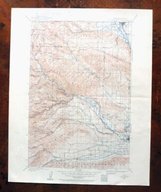
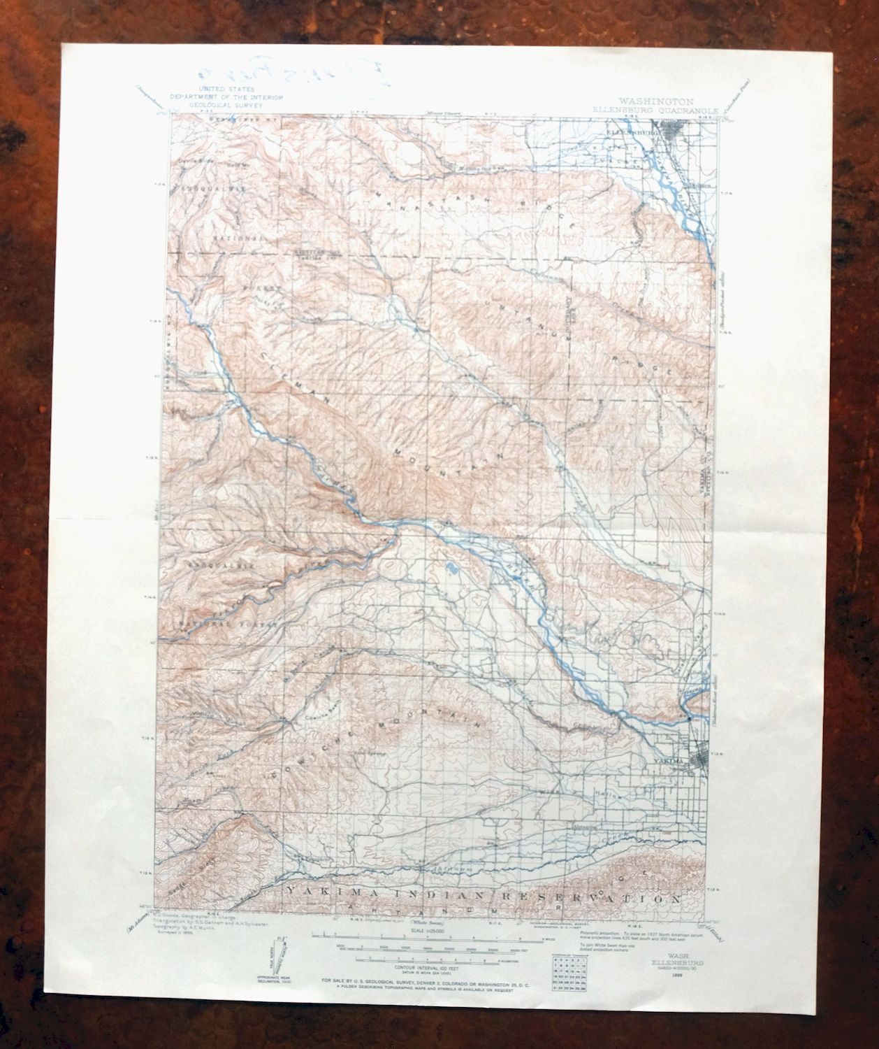
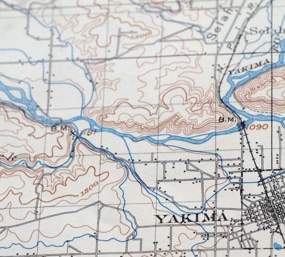
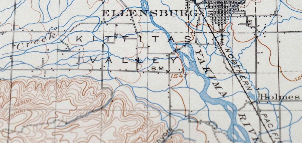
This is a 1957 print of the Ellensburg quadrangle, a 30-minute topographic map at 1:125,000 first published in 1899 from an 1899 field survey led by geographer R.U. Goode. The sheet covers a stretch of central Washington in Kittitas and Yakima counties, taking in portions of the Snoqualmie and Wenatchee national forests and part of the Yakama Indian Reservation, with Terrace Heights and Union Gap lying east of the mapped area. The hundred-foot contours trace the Cascade foothills and river valleys that shaped how this part of the state was settled, drawn on thick stock that has held up well.
In stock
This vintage sheet is an 1899 edition of the Ellensburg Washington USGS topographic map. It is an original 69-year-old 1957 United States Geological Survey print in good condition.
HOW THIS MAP CAN BE USED
In addition to making a fascinating conversation piece, this sheet would look great in a frame or on display, make a unique and prized gift for anyone interested in this area, be perfect as a reference for genealogy studies or general historical research, or fill that missing piece in your collection. Maps of this vintage are printed on durable stock and are well-suited for outdoor activities and recreation of all kinds, including hiking, backpacking, hunting, rafting and kayaking, backcountry skiing, geocaching, general exploration, treasure hunting, etc.
FEATURES SHOWN ON THE MAP
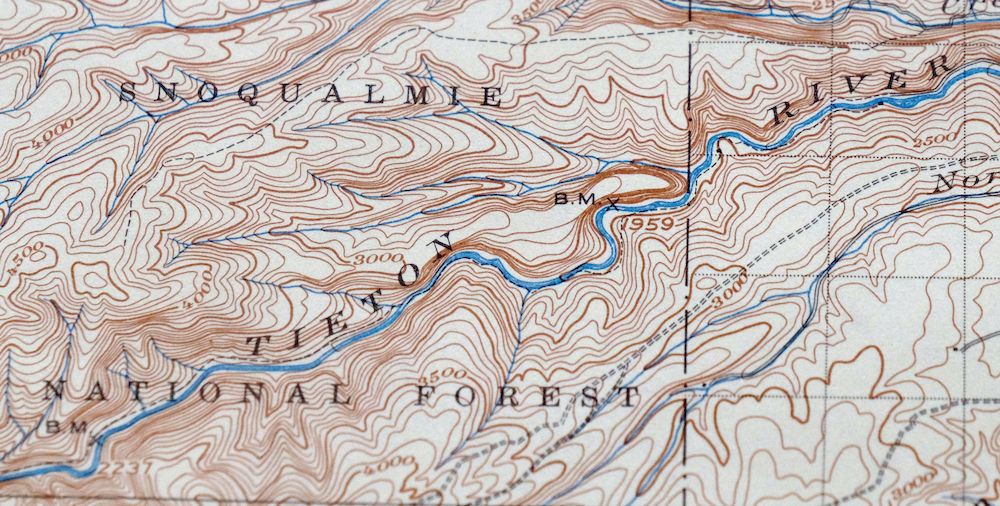
The Ellensburg 30-minute map shows cities and towns, roads, railroads, utilities and energy infrastructure, rivers, creeks, elevation contour lines, public land survey lines, county, state, and other administrative boundaries as they existed at the time of the survey in 1899.
A VALUABLE HISTORICAL RECORD
Maps from the USGS 30-minute series have been out of print for many years. They have never been common and original prints are increasingly difficult to find. For areas where the 30-minute map was produced, it is usually the first large-scale survey done by the USGS for that area. These are a valuable historical record, as they contain many placenames and features that have been dropped from more recent series’ and editions.
Nearby maps
-
Colockum Pass Washington Wenatchee USGS 30-Min Topo Map 1922
$36 Add to cart -
1923 USGS Topo Map: Mount Adams, Washington
$46 Add to cart -
1964 USGS Topo Map: Mount Adams, Washington
$19 Add to cart -
Chehalis Washington Lacey Tumwater USGS Topographic Map 1916
$68 Add to cart -

Connell Washington Lind Mesa USGS Topo Map 1918 Antique
$34 Add to cart -
Wallula Washington Finley Burbank USGS Topo Map 1918 Antique
$34 Add to cart -
Glacier Peak Washington Suiattle River USGS Topo Map 1946
$36 Add to cart -
Yakima East Washington Moxee Parker USGS Topo Map 1985
$37 Add to cart -
Yakima East Washington Union Gap USGS Topographic Map 1968
$25 Add to cart -
Yakima East Washington Union Gap USGS Topographic Map 1941
$49 Add to cart -
Boylston Washington Vantage Doris USGS Topographic Map 1943
$28 Add to cart -
Black Rock Spring Washington Yakima Ridge USGS Topo Map 1941
$32 Add to cart -
Grandview Washington Sunnyside USGS Topo Map 1951 Vintage
$30 Add to cart -
Snoqualmie Pass Washington Hyak USGS Topographic Map 1965
$21 Add to cart -
Red Rock Washington Royal City Smyrna USGS Topo Map 1911
$20 Add to cart -
1966 USGS Topo Map: Smyrna, Royal City, Washington
$40 Add to cart -
Coyote Rapids Washington USGS 15-Min Topo Map 1916 Antique
$48 Add to cart -
Rock Island Washington South Wenatchee USGS Topo Map 1967
$41 Add to cart -
Enumclaw Washington Buckley Upper Mill USGS Topo Map 1976
$42 Add to cart -

Sumner Washington South Hill Auburn USGS Topo Map 1976
$35 Add to cart -

Maple Valley Washington Covington USGS Topographic Map 1976
$38 Add to cart -
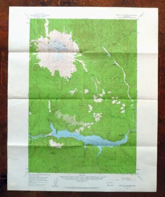
1961 USGS Topo Map: Mount Saint Helens, Washington
$32 Add to cart -

Badger Mountain Washington South Richland USGS Topo Map 1978
$34 Add to cart -

Puyallup Washington Tacoma Waller USGS Topographic Map 1976
$42 Add to cart