MAP DETAILS | |
|---|---|
| TITLE | Bonanza |
| STATE | Colorado |
| LOCATION | 15 miles southwest of Salida |
| SERIES | 15-minute |
| SURVEYED | 1954 and 1959 Aerial and Field Survey |
| EDITION | 1959 |
| PRINTED | 1965 |
| PRINT NOTES | Thick paper stock, includes woodland tint (green to indicate vegetated areas) |
| SCALE | 1:62500 |
| CONTOUR INTERVAL | 80 feet |
| SHEET DIMENSIONS | 17 x 21 inches |
| MAP DIMENSIONS | 13 3/4 x 17 1/2 inches |
| COVERAGE AREA | 14 x 17 miles |
| SHEET CONDITION For maps of this vintage, effort is made to note all visible flaws, no matter how minor. | |
| OVERALL CONDITION | Excellent |
| SHEET NOTES | very lightly handled, never folded |
| MAP AREA | flawless map area |
| COLLARS | no wear or tears, no markings, no blemishes |
| MAP COVERAGE Quadrangle extent overlaid on current basemap. | |
| PLACENAMES Depending on map series and survey date, all of the features listed below may not be shown on this map. This list contains features that currently exist or historically existed within the area covered by the map. The list can be used as a reference to determine if this map covers your area of interest. Placenames are listed alphabetically next to each feature type. | |
| NOTABLE PLACES | Mount Ouray, San Isabel NF, and Poncha Mountain |
| CITIES AND TOWNS (CURRENT) | Bonanza |
| COUNTIES COVERED | Chaffee, Fremont, Gunnison, and Saguache |
| FEDERAL LAND UNITS | Gunnison National Forest, Rio Grande National Forest, San Isabel National Forest, and Sangre de Cristo Wilderness |
| RIVERS AND STREAMS | Alder Creek, Baxter Creek, Beaver Creek, Brewery Creek, Clover Creek, Cottonwood Creek, Dorsey Creek, Droz Creek, East Middle Creek, Flagstaff Creek, Ford Creek, Grays Creek, Green Creek, Indian Creek, Kelly Creek, Kerber Creek, Little Cochetopa Creek, Lone Tree Creek, Merkt Creek, Millswitch Creek, North Decker Creek, Pass Creek, Peterson Creek, Poncha Creek, Redman Creek, San Luis Creek, Silver Creek, Skunk Creek, Slaughterhouse Creek, Spring Creek, Spruce Creek, Starvation Creek, Stumpy Creek, and Swidinski Creek |
| WATER BODIES | Silver Creek Lakes |
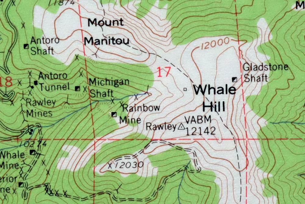
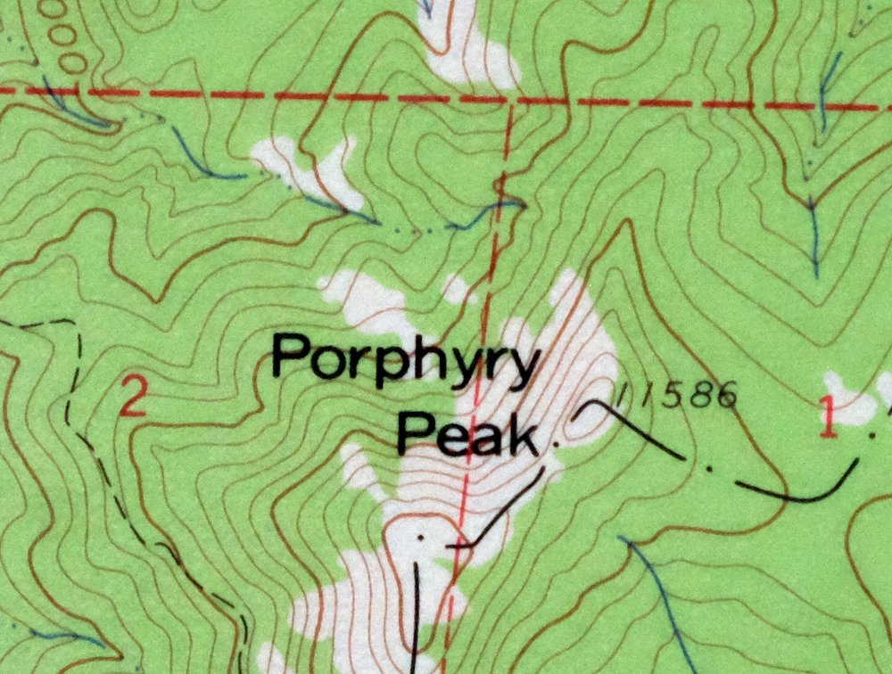
| Locations: Blanchard Ranch, Brewery Creek Guard Station, Davidson Ranch, Kerber City, Little Bonanza Mill, Mears Junction, O Haver Lake Campground, Shewalter Ranch, and Superior Mill. Mountains, Peaks, and Summits: Antora Peak, Baxter Mountain, Burnt Mountain, Flagstaff Mountain, Chipeta Mountain, Cleveland Mountain, Hayden Peak, Mount Manitou, Methodist Mountain, Mount Ouray, Poncha Mountain, Porphyry Peak, Raspberry Peak, Round Hill, Round Mountain, Sheep Mountain, and Whale Hill. Valleys and Canyons: Euclid Gulch, Camp Rock Gulch, Chloride Gulch, Copper Gulch, Dry Lake Gulch, Eagle Gulch, Elkhorn Gulch, Graveyard Gulch, Greenback Gulch, Hunter Gulch, Picnic Gulch, Rawley Gulch, Round Hill Gulch, Sawmill Gulch, Simmons Gulch, Sosthenes Gulch, Toll Road Gulch, Turquoise Gulch, Wagon Box Gulch, and Wild Bill Gulch. Trails: Divide Trail, Round Hill Trail, Round Mountain Trail, Sheep Mountain Trail, and Simmons Peak Trail. Drainages: Alder Creek, Antora Creek, Bear Creek, Beaver Creek, Box Creek, Brewery Creek, Browns Creek, Flagstaff Creek, Clover Creek, Cow Creek, Decker Creek, Dorsey Creek, Droz Creek, Grays Creek, Lone Tree Creek, Merkt Creek, Mosquito Creek, North Decker Creek, Ouray Creek, Phantom Creek, Silver Creek, Skunk Creek, Slaughterhouse Creek, South Decker Creek, Spring Creek, Spruce Creek, Squirrel Creek, Starvation Creek, Stumpy Creek, Swidinski Creek, and Tent Creek. Mines: Ajax Mine, American Mammoth Mine, American Revenue Mine, Antoro Shaft, Antoro Tunnel, Arkansas Mine, Atlantic Mine, Black Bess Mine, Bonanza Mine, Bonita Group Mine, Brighton Mine, Burlington Mine, Euclid Mine, Exchequer Mine, Express Mine, Chicago Mine, Chief Mine, Chloride Mine, Cinderella South Mine, Cliff Mine, Clover Creek District Mine, Cocomongo Mine, Colorado Belle Mine, Commander Mine, Cora Mine, Coronet Mine, D and J Mine, Defiance Mine, Demming Mine, Eagle Mine, Empress Josephine Mine, Erie Number Twenty-eight Mine, Essie Mine, Gem City Mine, Gladstone Shaft, Great Mogul Mine, Gypsy Queen Mine, Hall Turquoise Mine, Hanover Mine, Hornet Manganese Mine, Hortense Mine, Ignacio Mine, Joe Wheeler Mine, Josephine Mine, Jupiter Mine, Keystone Mine, Kismuth Mine, Legal Tender Mine, Liberty Mine, Little Bonanza Mine, Little Darling Mine, Little Jennie Mine, Little Manitou Mine, Manitou Sunlight Mine, Marine Lode Mine, May Queen Mine, Michigan Shaft, Minnie Lynch Mine, Morning Star Mine, New York Mine, Oregon Mine, Oregon Tunnel, Paragon Tunnel Mine, Payson Mine, Queen City Mine, Radcliff Shaft Mine, Rainbow Mine, Rawley Mine, Rosalie Mine, Saint Joe Mine, Saint Louis Mine, Sarah D Mine, Senator Mine, Shawmut Mine, Sosthenes Mine, Stemwinder Minne, Superior Mine, Twins Mine, Vallejo Mine, Valley View Mine, Veni-vidi-vici Mine, Villa Grove Mine, Wainright Mine, Warwick Mine, Washakee Mine, Whale Mine, Wheel of Fortune Mine, Wide Awake Mine, Yellow Type Mine, and Zero Tunnel Mine. Lakes and Ponds: Dry Lake, O'Haver Lake, Pass Creek Lake, and Silver Creek Lakes. Dams: Grays Creek Dam, Mountain Lake Dam, and O Haver Lake Dam. Bluffs: Windy Point. Gaps: The Gate, Marshall Pass, and Poncha Pass. Basins: Devils Armchair and Murphys Hole. Ridges: Center Ridge. Reservoirs and Tanks: Lake O'Haver and Mosquito Lake. Flats: Antora Meadows and Elkhorn Peak. Springs: Poncha Hot Springs and Wicker Spring. | |
| SHIPPING AND RETURNS | |
 This map sheet will be carefully rolled in a sturdy tube and shipped via the US Postal Service. If you find that the sheet you receive is not as described in the listing, you may ship it back to us for a refund of the purchase price. | |
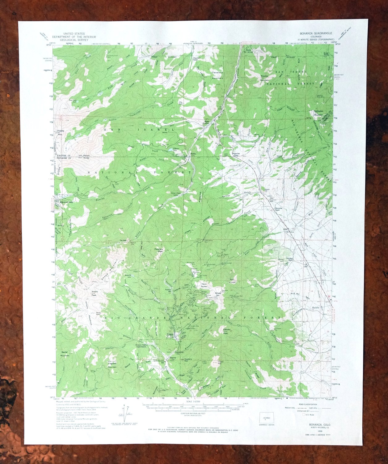
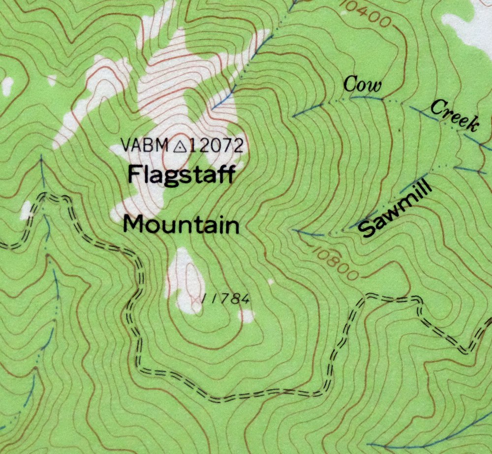
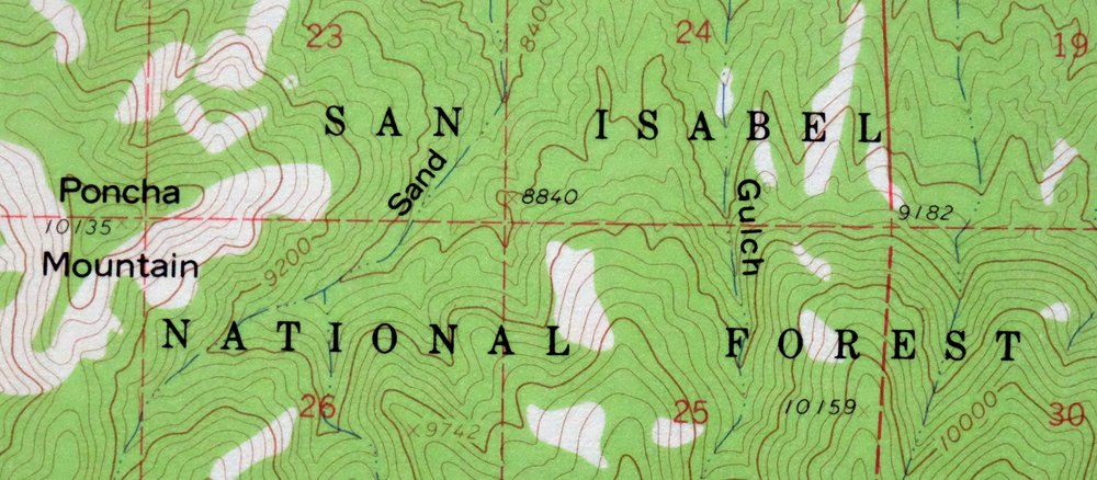
1965 USGS Topo Map: Bonanza, Mount Ouray, Colorado
$40
This is a USGS 15-minute topographic map of Bonanza, Colorado, a 1959 edition printed in 1965 at a scale of 1:62,500. The quad sits about 15 miles southwest of Salida, spanning parts of Chaffee, Fremont, Gunnison, and Saguache counties, and takes in portions of the San Isabel, Rio Grande, and Gunnison national forests along with part of the Sangre de Cristo Wilderness. This is high, rugged country, crowned by Mount Ouray at over 13,000 feet. Never folded and in excellent condition, it would frame well.
In stock
This vintage sheet is a 1959 edition of the Bonanza Colorado USGS topographic map. It is an original 61-year-old 1965 United States Geological Survey print in excellent condition.
HOW THIS MAP CAN BE USED
In addition to making a fascinating conversation piece, this sheet would look great in a frame or on display, make a unique and prized gift for anyone interested in this area, be perfect as a reference for genealogy studies or general historical research, or fill that missing piece in your collection. Maps of this vintage are printed on durable stock and are well-suited for outdoor activities and recreation of all kinds, including hiking, backpacking, hunting, rafting and kayaking, backcountry skiing, geocaching, general exploration, treasure hunting, etc.
FEATURES SHOWN ON THE MAP
The Bonanza 15-minute map shows cities and towns, roads, railroads, utilities and energy infrastructure, rivers, creeks, elevation contour lines, public land survey lines, county, state, and other administrative boundaries as they existed at the time of the survey in 1954 and 1959. All known structures (houses, businesses, churches, schools, barns, cabins, etc) are also shown.
A VALUABLE HISTORICAL RECORD
Maps from the 15-minute series for the continental United States are no longer produced or printed by the USGS and original prints are becoming increasingly difficult to find. They are a valuable historical record for an area, as they contain many placenames and features that have been dropped from more recent maps.
Nearby maps
-
Poncha Springs Colorado Salida Nathrop USGS Topo Map 1970
$42 Add to cart -
1945 USGS Topo Map: Garfield, Monarch Pass, Colorado
$32 Add to cart -
1974 USGS Topo Map: Garfield, Monarch Pass, Colorado
$44 Add to cart -
1968 USGS Topo Map: Cotopaxi, Colorado
$40 Add to cart -
1973 Black Mountain Colorado USGS Topo Map: Loco Mountain
$29 Add to cart -
Electric Peak Colorado Sangre de Cristo USGS Topo Map 1974
$33 Add to cart -
1972 USGS Topo Map: Mount Harvard, Sawatch Range, Colorado
$40 Add to cart -
1966 Royal Gorge Colorado USGS Topo Map: Galena (Canon City)
$42 Add to cart -
Anthracite Colorado USGS 15-Min Topographic Map 1918 Antique
$38 Add to cart -
1975 USGS Topo Map: Mount Elbert, Sawatch Range, Colorado
$37 Add to cart -
Iola Colorado USGS 7.5-Min Topographic Map 1963 Vintage
$31 Add to cart -

Mount Massive Colorado Vintage USGS Topographic Map 1975
$36 Add to cart -
1964 Aspen Colorado USGS Topo Map: Buttermilk
$40 Add to cart -
Highland Peak Colorado Snowmass Village USGS Topo Map 1988
$40 Add to cart -
Pueblo Colorado San Isabel NF Penrose USGS Topo Map 1923
$53 Add to cart -
1930 San Cristobal Colorado USGS Topo Map: Santa Maria Lake
$33 Add to cart -
Shawnee Colorado Singleton USGS Topographic Map 1972 Vintage
$39 Add to cart -

Frisco Colorado Dillon Reservoir Dillon USGS Topo Map 1973
$38 Add to cart -
Bailey Colorado Will-O-The-Wisp Wandcrest USGS Topo Map 1973
$40 Add to cart -

Keystone Colorado USGS 7.5-Min Topographic Map 1963 Vintage
$35 Add to cart -

Red Cliff Colorado Vail USGS 7.5-Min Topo Map 1988 Vintage
$35 Add to cart -
1973 USGS Topo Map: Red Cliff, Vail Ski Resort, Colorado
$50 Add to cart -
Montezuma Colorado Keystone USGS 15-Min Topographic Map 1926
$58 Add to cart -
1972 Montezuma Colorado USGS Topo Map: Keystone
$46 Add to cart