MAP DETAILS | |
|---|---|
| TITLE | Royal Gorge |
| STATE | Colorado |
| LOCATION | Vicinity of Canon City, 45 miles southwest of Colorado Springs |
| SERIES | 15-minute |
| SURVEYED | 1954 and 1959 Aerial and Field Survey |
| EDITION | 1959 |
| PRINTED | 1966 |
| PRINT NOTES | Thick paper stock, includes woodland tint (green to indicate vegetated areas) |
| SCALE | 1:62500 |
| CONTOUR INTERVAL | 80 feet |
| SHEET DIMENSIONS | 17 x 21 inches |
| MAP DIMENSIONS | 13 3/4 x 17 1/2 inches |
| COVERAGE AREA | 14 x 17 miles |
| SHEET CONDITION For maps of this vintage, effort is made to note all visible flaws, no matter how minor. | |
| OVERALL CONDITION | Good |
| SHEET NOTES | never folded |
| MAP AREA | no markings, no blemishes |
| COLLARS | no markings, no blemishes, minor handling and edgewear in bottom collar |
| MAP COVERAGE Quadrangle extent overlaid on current basemap. | |
| PLACENAMES Depending on map series and survey date, all of the features listed below may not be shown on this map. This list contains features that currently exist or historically existed within the area covered by the map. The list can be used as a reference to determine if this map covers your area of interest. Placenames are listed alphabetically next to each feature type. | |
| NOTABLE PLACES | Galena, Canon City, and Parkdale |
| COUNTIES COVERED | Custer and Fremont |
| FEDERAL LAND UNITS | Lower Grape Creek Wilderness Study Area, McIntyre Hills Wilderness Study Area, San Isabel National Forest, and Upper Grape Creek Wilderness Study Area |
| RIVERS AND STREAMS | Arkansas River, Chandler Creek, Currant Creek, Grape Creek, Mill Creek, Oak Creek, Sandy Creek, South Chandler Creek, and Tallahassee Creek |
| Locations: Adamic Cow Camp, Griffin Ranch, Oak Creek Campground, Oak Creek Picnic Grounds, Parkdale, Parkdale Siding, Payne Ranch, and Spikebuck. Areas: Granite Country. Mountain Ranges: Gorge Hills and Grand Canyon Hills. Mountains, Peaks, and Summits: Baldy Mountain, Curley Peak, Dawson Mountain, Deer Mountain, Elkhorn Mountain, Fremont Peak, Horseshoe Mountain, Iron Mountain, Locke Mountain, McClure Mountain, McIntyre Hills, McKinley Mountain, Nonans Peak, Poverty Mountain, Red Mountain, Tanner Peak, and Y M C A Mountain. Valleys and Canyons: Arkansas River Canyon, Baker Gulch, Bear Gulch, Black Gulch, Bootlegger Gulch, Buckskin Gulch, Bumback Gulch, Falling Rock Gulch, Cedar Gulch, Chute Gulch, Copper Gulch, East Bear Gulch, East Mill Gulch, East Sunset City Gulch, Granite Gulch, Hale Gulch, Hellgate Gulch, Indian Springs Gulch, Isinglass Gulch, Jennings Gulch, Lion Canyon, Little Granite Gulch, Max Canyon, McClure Gulch, McIntyre Gulch, Mow Spring Gulch, Ohio Canyon, Pine Gulch, Poverty Gulch, Ralph Gulch, Royal Gorge, Sand Draw, Sawmill Gulch, Smith Gulch, South Marsh Gulch, Spike Buck Gulch, Sulphur Gulch, Sunset City Gulch, Surrey Gulch, Talbert Gulch, Tanner Gulch, Temple Canyon, Titusville Gulch, Volcano Gulch, Washtub Gulch, West Mill Gulch, West Pierce Gulch, and Westfall Gulch. Parks: Grape Creek Picnic Ground, Royal Gorge Park, and Temple Canyon Park. Trails: Highline Trail, Stultz Trail, and Tanner Trail. Drainages: Currant Creek, Democrat Creek, Grape Creek, Sand Creek, Sandy Creek, and Tallahassee Creek. Mines: A Griffin Ranch Mine, Big Chief One Mine, Big Mac Group One-three Mines, Border Feldspar Mine, Brown Lava Lode Mine, Climax Mine, Copper Girl Mine, Deer Ridge Claim, Devils Hole Quarry, Goat Hill Quarry, Green Mountain Mine, Hoover Quarry, Iron Mountain Mine, McIntyre Mine, Meyers Mine, Parkdale Quarry, R. H. Magnuson Mine, School Section Mine, Spikebuck Mine, Sunset Mine, Suzanna Mine, and Volcano Gulch Mine. Dams: Harvey-Murry Dam. Gaps: Copper Gulch Divide, Devils Gap, and The Tights. Bridges: Royal Gorge Bridge. Basins: Little Hole and Sheep Basin. Airports: Browns Fort Heliport. Ridges: Scrapping Ridges and Susies Ridge. Reservoirs and Tanks: Harvey-Murry Reservoir. Flats: Chute Park, Cody Park, Eightmile Park, Goat Park, Indian Springs Park, South Webster Park, and Threemile Park. Springs: Falling Rock Spring, Canon City Hot Springs, Deadhorse Spring, Indian Springs, and Mow Spring. | |
| SHIPPING AND RETURNS | |
 This map sheet will be carefully rolled in a sturdy tube and shipped via the US Postal Service. If you find that the sheet you receive is not as described in the listing, you may ship it back to us for a refund of the purchase price. | |
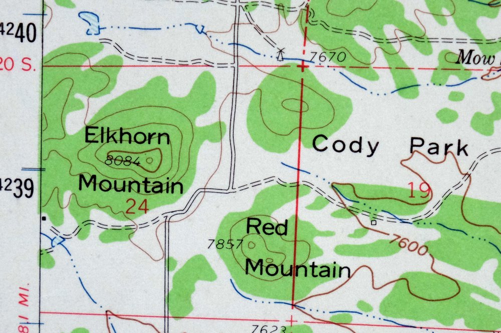
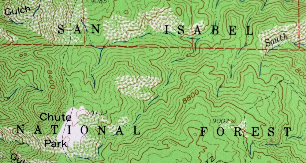
1966 Royal Gorge Colorado USGS Topo Map: Galena (Canon City)
$42
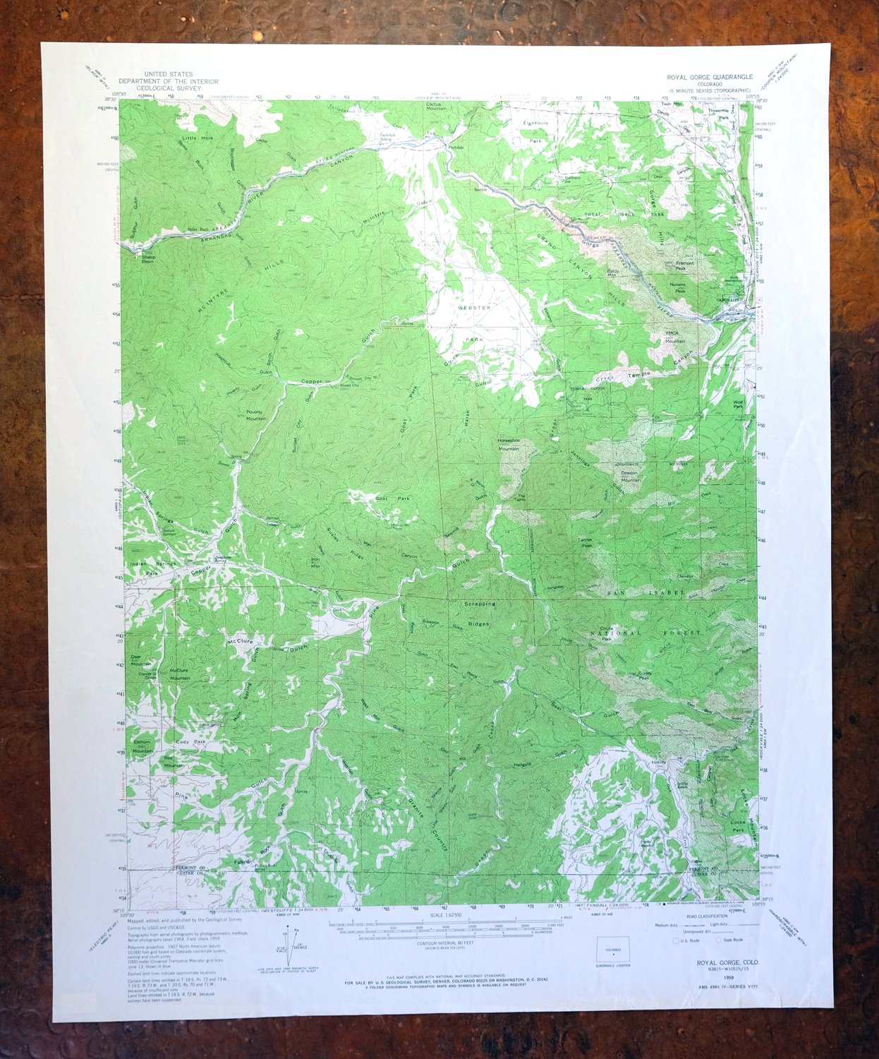
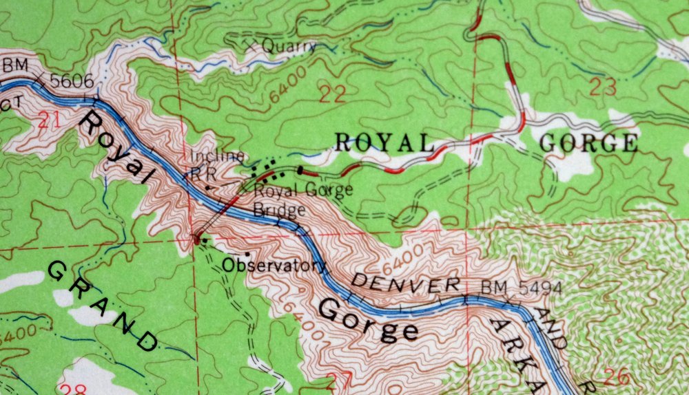
This is a 1959 edition USGS topographic map of the Royal Gorge quadrangle in central Colorado, printed in 1966 at 1:62,500 scale on thick paper stock with a green woodland tint marking vegetated areas. The 15-minute sheet covers about 14 by 17 miles southwest of Canon City in Custer and Fremont counties, taking in part of the San Isabel National Forest and several stretches of the rugged Grape Creek country. The gorge itself, where the Arkansas River cuts a sheer canyon over a thousand feet deep, is the centerpiece here, with contours at 80-foot intervals showing just how steeply the land drops. Never folded, it suits framing.
In stock
This vintage sheet is a 1959 edition of the Royal Gorge Colorado USGS topographic map. It is an original 60-year-old 1966 United States Geological Survey print in good condition.
HOW THIS MAP CAN BE USED
In addition to making a fascinating conversation piece, this sheet would look great in a frame or on display, make a unique and prized gift for anyone interested in this area, be perfect as a reference for genealogy studies or general historical research, or fill that missing piece in your collection. Maps of this vintage are printed on durable stock and are well-suited for outdoor activities and recreation of all kinds, including hiking, backpacking, hunting, rafting and kayaking, backcountry skiing, geocaching, general exploration, treasure hunting, etc.
FEATURES SHOWN ON THE MAP
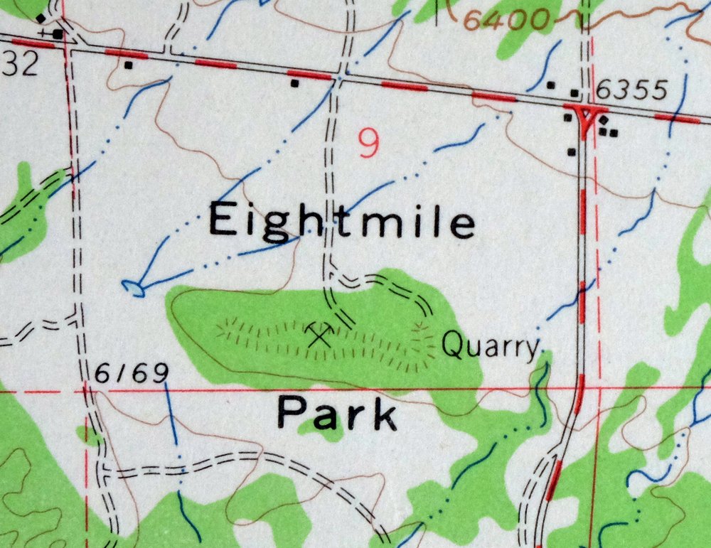
The Royal Gorge 15-minute map shows cities and towns, roads, railroads, utilities and energy infrastructure, rivers, creeks, elevation contour lines, public land survey lines, county, state, and other administrative boundaries as they existed at the time of the survey in 1954 and 1959. All known structures (houses, businesses, churches, schools, barns, cabins, etc) are also shown.
A VALUABLE HISTORICAL RECORD
Maps from the 15-minute series for the continental United States are no longer produced or printed by the USGS and original prints are becoming increasingly difficult to find. They are a valuable historical record for an area, as they contain many placenames and features that have been dropped from more recent maps.
Nearby maps
-
1968 USGS Topo Map: Cotopaxi, Colorado
$40 Add to cart -
1973 Black Mountain Colorado USGS Topo Map: Loco Mountain
$29 Add to cart -
Electric Peak Colorado Sangre de Cristo USGS Topo Map 1974
$33 Add to cart -
1965 USGS Topo Map: Bonanza, Mount Ouray, Colorado
$40 Add to cart -
Poncha Springs Colorado Salida Nathrop USGS Topo Map 1970
$42 Add to cart -
1945 USGS Topo Map: Garfield, Monarch Pass, Colorado
$32 Add to cart -
1974 USGS Topo Map: Garfield, Monarch Pass, Colorado
$44 Add to cart -
1972 USGS Topo Map: Mount Harvard, Sawatch Range, Colorado
$40 Add to cart -
Pueblo Colorado San Isabel NF Penrose USGS Topo Map 1923
$53 Add to cart -

1904 Nepesta Colorado USGS Topo Map: Vineland
$48 Add to cart -
1900 USGS Topo Map: Big Springs, Ellicont, Colorado
$45 Add to cart -
Bailey Colorado Will-O-The-Wisp Wandcrest USGS Topo Map 1973
$40 Add to cart -
Apishapa Colorado Thatcher Delhi USGS Topo Map 1897 Antique
$54 Add to cart -
Platte Canyon Colorado South Platte USGS Topo Map 1955
$46 Add to cart -
Shawnee Colorado Singleton USGS Topographic Map 1972 Vintage
$39 Add to cart -
1975 USGS Topo Map: Mount Elbert, Sawatch Range, Colorado
$37 Add to cart -
Kassler Colorado Roxborough Park Louviers USGS Topo Map 1956
$45 Add to cart -

Mount Massive Colorado Vintage USGS Topographic Map 1975
$36 Add to cart -
1949 USGS Topo Map: Highland Ranch, Lone Tree, Colorado
$34 Add to cart -
Georgetown Colorado Idaho Springs USGS Topo Map 1980 Vintage
$41 Add to cart -

Keystone Colorado USGS 7.5-Min Topographic Map 1963 Vintage
$35 Add to cart -

Frisco Colorado Dillon Reservoir Dillon USGS Topo Map 1973
$38 Add to cart -
Montezuma Colorado Keystone USGS 15-Min Topographic Map 1926
$58 Add to cart -
1972 Montezuma Colorado USGS Topo Map: Keystone
$46 Add to cart