MAP DETAILS | |
|---|---|
| TITLE | Garfield |
| STATE | Colorado |
| LOCATION | 20 miles west of Salida |
| SERIES | 15-minute |
| SURVEYED | 1938 through 1940 Field Survey |
| GEOGRAPHER | Max J. Gleissner |
| EDITION | 1945 |
| PRINTED | 1945 |
| PRINT NOTES | Thick paper stock |
| SCALE | 1:62500 |
| CONTOUR INTERVAL | 50 feet |
| SHEET DIMENSIONS | 17 x 20 7/8 inches |
| MAP DIMENSIONS | 13 5/8 x 17 1/2 inches |
| COVERAGE AREA | 13 x 17 miles |
| MAP NOTES | Surveyed before the existence of Monarch Mountain Ski Area. |
| SHEET CONDITION For maps of this vintage, effort is made to note all visible flaws, no matter how minor. | |
| OVERALL CONDITION | Very Good |
| SHEET NOTES | lightly handled, has foldlines, minor age discoloration along some foldlines |
| MAP AREA | no markings |
| COLLARS | no markings, minor repaired edge tear in top collar |
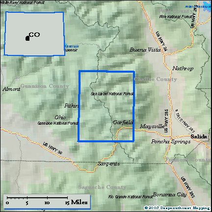
| MAP COVERAGE Quadrangle extent overlaid on current basemap. | |
| PLACENAMES Depending on map series and survey date, all of the features listed below may not be shown on this map. This list contains features that currently exist or historically existed within the area covered by the map. The list can be used as a reference to determine if this map covers your area of interest. Placenames are listed alphabetically next to each feature type. | |
| NOTABLE PLACES | Monarch Pass, Sawatch Range, and Saint Elmo |
| CITIES AND TOWNS (CURRENT) | Garfield |
| COUNTIES COVERED | Chaffee and Gunnison |
| FEDERAL LAND UNITS | Gunnison National Forest and San Isabel National Forest |
| RIVERS AND STREAMS | Baldwin Creek, Bonanza Creek, Browns Creek, Buckhorn Creek, Chalk Creek, Cree Creek, Cyclone Creek, East Willow Creek, Fooses Creek, Graveyard Creek, Hot Springs Creek, Jennings Creek, Lost Creek, Major Creek, Mc Coy Creek, Middle Fork South Arkansas River, Middle Willow Creek, Mineral Creek, Mosquito Creek, No Name Creek, North Fooses Creek, North Fork Chalk Creek, North Fork South Arkansas River, North Quartz Creek, Quartz Creek, Robbins Creek, South Arkansas River, South Fooses Creek, South Quartz Creek, Stridiron Creek, Tomichi Creek, Triano Creek, and West Willow Creek |
| WATER BODIES | Alpine Lake, Baldwin Lake, Billings Lake, Grizzly Lake, Hancock Lake, Hunkydory Lake, Hunt Lake, Island Lake, Maid Lake, Mirror Lake, North Fork Reservoir, Pomeroy Lake, Tunnel Lake, Upper Hancock Lake, Upper Pomeroy Lake, and Waterdog Lakes |
| Locations: Alpine Station, Blistered Horn Mill, Garfield Campground, Middle Quartz Campground, Mirror Lake Campground, Monarch Park Campground, Monarch Ski Area, North Fork Campground, North Star, Quartz Campgound, and Snowblind Campground. Mountains, Peaks, and Summits: Mount Aetna, Mount Arps, Bald Mountain, Banana Mountain, Boulder Mountain, Brittle Silver Mountain, Fitzpatrick Peak, Calico Mountain, Carbonate Hill, Carbonate Mountain, Central Mountain, Mount Chapman, Chrysolite Mountain, Clover Mountain, Contact Hill, Cyclone Mountain, Duncan Hill, Emma Burr Mountain, Gold Hill, Granite Mountain, Grizzly Mountain, Mount Helmers, Mount Helmers, Lake Hill, Little Baldy, Lost Mountain, Mount Mamma, Missouri Hill, Monumental Peak, Napoleon Mountain, Paywell Mountain, Pomeroy Mountain, Mount Poor, Mount Poor, Sawmill Hill, Sewanee Peak, Stella Mountain, Syncline Hill, Tabeguache Peak, Taylor Mountain, Van Wirt Mountain, Vulcan Mountain, and West Point Hill. Valleys and Canyons: Annie Gulch, Baldwin Gulch, Fitzpatrick Gulch, Coal Camp Canyon, Columbus Gulch, Deadman Gulch, Deer Canyon, Deer Gulch, Eldorado Gulch, Fort Scott Gulch, Grizzly Gulch, Grouse Canyon, Halls Gulch, Hicks Gulch, Hunkydory Gulch, Kangaroo Gulch, Lake Gulch, Payne Gulch, Pomeroy Gulch, Poplar Gulch, Porcupine Gulch, Sawmill Gulch, Sheep Canyon, Slaughterhouse Gulch, Snowblind Gulch, Taylor Gulch, Tincup Gulch, Tunnel Gulch, Weldon Gulch, and Wildcat Gulch. Trails: Fooses Creek Trail, Coyote Park Trail, and Pitkin Stock Driveway. Drainages: Baldwin Creek, Bonanza Creek, Bonnie Creek, Buckhorn Creek, Buffalo Fork, Canyon Creek, Cyclone Creek, East Canyon Creek, Egg Rock Creek, Galena Creek, Graphite Creek, Graveyard Creek, Horseshoe Creek, Jennings Creek, Middle Fork South Arkansas River, Middle Quartz Creek, Mosquito Creek, North Fooses Creek, North Fork Chalk Creek, North Quartz Creek, Robbins Creek, South Fooses Creek, South Quartz Creek, Spring Branch, Spring Creek, Stridiron Gulch, and Woodchopper Creek. Mines: Akron Mine, Alaska Mine, Alpha and Beta Mine, Alpine Number One Quarry, Anna Huffman Copper Mine, April Fool Mine, Ben Bolts Paymaster Mine, Black Hawk Mine, Black Tiger Mine, Big Red Twenty-two Mine, Bonnie Belle Mine, Brighton Mine, Brittle Basin Mine, Burton Quarry, Evening Star Mine, Fairplay Mine, Fairview Mine, Flora Belle Mine, Clinton Mine, Columbus Mine, Cumberland Mine, Darling Mine, David H Shaft Mine, Delaware Mine, Desdemona Mine, Eclipse Mine, Elkington Mine, Elmer McMurray Mine, Ensign Tunnel Mine, Erie Mine, Forward Gold Mining Company Mine, Fraction Mine, French Quarry, Garfield Mine, Garfield Quarry, Giant Eclipse Mine, Gold Cup Republic Mine, Golden Age Mine, Grand Monarch Mine, Graphite Basin Mine, Great Monarch Mine, Half Moon Mine, Hawkeye Number One Mine, Hawkeye Number Three Mine, Hawkeye Number Two Mine, Indianapolis Mine, Irishwood Esther Mine, Iron Chest Mine, Iron Duke Mine, Jewell Tunnel Mine, Jimmie Mack Mine, Josephine Number One Quarry, Kerntucky Belle-Baby Gerald Mine, Last Chance Mine, Lehigh Mine, Lilly Mine, Lily Mine, Little Charm Mine, Little Wonder Mine, Madonna Mine, Major Mine, Maple Leaf Mine, Mary Murphy Mine, Mason Mine, Matilda Mine, Missouri Boy Mine, Monarch Lime Quarry, Monongahela Mine, Morning Glory Mine, Morning Star Mine, Moss Flower Mine, Mountain Chief Mine, Nest Egg Mine, New Gold Cup Mine, New York Mine, North Star Mine, Ohio and Morningstar Mine, Old Gold Cup Mine, Ole Bull Mine, Oshkosh Mine, Page Mine, Parole Mine, Paymaster Mine, Pearson Property Mine, Pilgrim Group Mine, Pinyon Mine, Pride of the West Mine, Princeton and Blackhawk Mine, Rainbow-Eagle Bird Mine, Rarus Warrior Mine, Rolla Mine, Shamrock Mine, Silent Friend Mine, Silver King Mine, Song Bird Mine, South Quartz Creek Mine, Stonewall Shaft Mine, Thirty-six-thirty Mine, Tilden Mine, Tomichi Mine, Uncle Sam Mine, Victor Mine, White Pine Mine, and Wilson Mine. Lakes and Ponds: Baldwin Lake, Billings Lake, Graphite Lake, Grizzly Lake, Hancock Lake, Hunkydory Lake, Hunt Lake, Island Lake, Maid Lake, Mirror Lake, Pomeroy Lake, Tunnel Lake, Upper Hancock Lake, Upper Pomeroy Lake, and Waterdog Lakes. Dams: Boss Lake Dam and North Fork Dam. Bluffs: The Palisades. Gaps: Chalk Creek Pass, Cumberland Pass, Hancock Pass, Mapoleon Pass, Napoleon Pass, Original Monarch Pass, Tincup Pass, Tomichi Pass, and Williams Pass. Basins: Bone Basin, Brittle Silver Basin, and Graphite Basin. Ridges: Porcupine Ridge. Reservoirs and Tanks: Alpine Lake, Boss Lady Reservoir, Boss Lake Reservoir, North Fork Reservoir, and Ross Lake Reservoir. Flats: Depler Park and Hoffman Park. Tunnels: Old Alpine Tunnel. Springs: Hermit Springs. | |
| SHIPPING AND RETURNS | |
 This map sheet will be carefully rolled in a sturdy tube and shipped via the US Postal Service. If you find that the sheet you receive is not as described in the listing, you may ship it back to us for a refund of the purchase price. | |
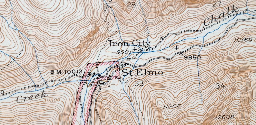
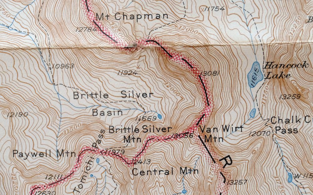
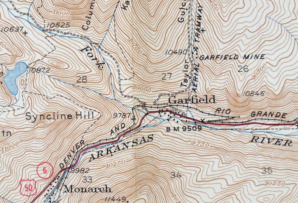
Garfield Colorado USGS 15 Minute Topo Map 1945 Vintage
$39
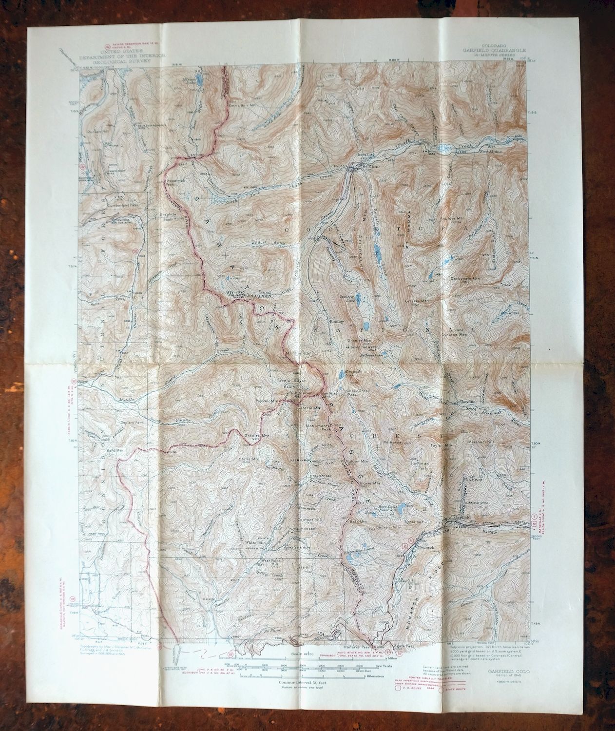
Surveyed before the existence of Monarch Mountain Ski Area. This is the first-year 1945 edition of the Garfield quadrangle in central Colorado, a 15-minute USGS topographic sheet at 1:62,500 built from field survey work done between 1938 and 1940 under geographer Max J. Gleissner. The quad sits about 20 miles west of Salida along the Chaffee–Gunnison county line, taking in the old mining settlement of Garfield and portions of the San Isabel and Gunnison national forests.
In stock
This vintage sheet is a 1945 edition of the Garfield Colorado USGS topographic map. It is an original 81-year-old United States Geological Survey print in very good condition.
HOW THIS MAP CAN BE USED
In addition to making a fascinating conversation piece, this sheet would look great in a frame or on display, make a unique and prized gift for anyone interested in this area, be perfect as a reference for genealogy studies or general historical research, or fill that missing piece in your collection.
FEATURES SHOWN ON THE MAP
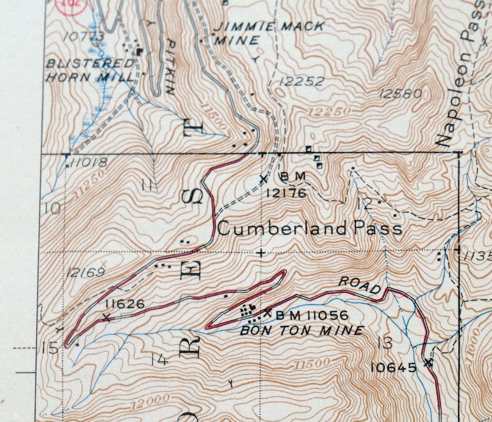
The Garfield 15-minute map shows cities and towns, roads, railroads, rivers, creeks, elevation contour lines, public land survey lines, county, state, and other administrative boundaries as they existed at the time of the survey in 1938 through 1940. All known structures (houses, businesses, churches, schools, barns, cabins, etc) are also shown.
A VALUABLE HISTORICAL RECORD
Maps from the 15-minute series for the continental United States are no longer produced or printed by the USGS and original prints are becoming increasingly difficult to find. They are a valuable historical record for an area, as they contain many placenames and features that have been dropped from more recent maps.
Nearby maps
-
1974 USGS Topo Map: Garfield, Monarch Pass, Colorado
$50 Add to cart -
Poncha Springs Colorado Salida Nathrop USGS Topo Map 1970
$41 Add to cart -
1973 Black Mountain Colorado USGS Topo Map: Loco Mountain
$29 Add to cart -
Anthracite Colorado USGS 15-Min Topographic Map 1918 Antique
$38 Add to cart -
Electric Peak Colorado Sangre de Cristo USGS Topo Map 1974
$33 Add to cart -
Iola Colorado USGS 7.5-Min Topographic Map 1963 Vintage
$31 Add to cart -

Mount Massive Colorado Vintage USGS Topographic Map 1975
$36 Add to cart -
Aspen Colorado USGS 7.5-Min Topographic Map 1964 Vintage
$48 Add to cart -
Highland Peak Colorado Snowmass Village USGS Topo Map 1988
$43 Add to cart -

Red Cliff Colorado Vail USGS 7.5-Min Topo Map 1988 Vintage
$35 Add to cart -
1973 USGS Topo Map: Red Cliff, Vail Ski Resort, Colorado
$52 Add to cart -

Frisco Colorado Dillon Reservoir Dillon USGS Topo Map 1973
$38 Add to cart -
Leon White River NF Colorado USGS 7.5-Min Topo Map 1988
$36 Add to cart -

Keystone Colorado USGS 7.5-Min Topographic Map 1963 Vintage
$35 Add to cart -
Shawnee Colorado Singleton USGS Topographic Map 1972 Vintage
$39 Add to cart -
Vail East Colorado USGS 7.5-Min Topographic Map 1973 Vintage
$37 Add to cart -
Vail West Colorado Avon USGS 7.5-Min Topo Map 1973 Vintage
$38 Add to cart -
Montezuma Colorado Keystone USGS 15-Min Topographic Map 1926
$65 Add to cart -
1972 Montezuma Colorado USGS Topo Map: Keystone
$48 Add to cart -
1988 Edwards Colorado USGS Topo Map: Avon (Original Print)
$48 Add to cart -
Bailey Colorado Will-O-The-Wisp Wandcrest USGS Topo Map 1973
$40 Add to cart -
Georgetown Colorado Idaho Springs USGS Topo Map 1980 Vintage
$42 Add to cart -
Georgetown Colorado Silver Plume USGS Topo Map 1962 Vintage
$33 Add to cart -
Platte Canyon Colorado South Platte USGS Topo Map 1955
$44 Add to cart