MAP DETAILS | |
|---|---|
| TITLE | Kino Peak |
| STATE | Arizona |
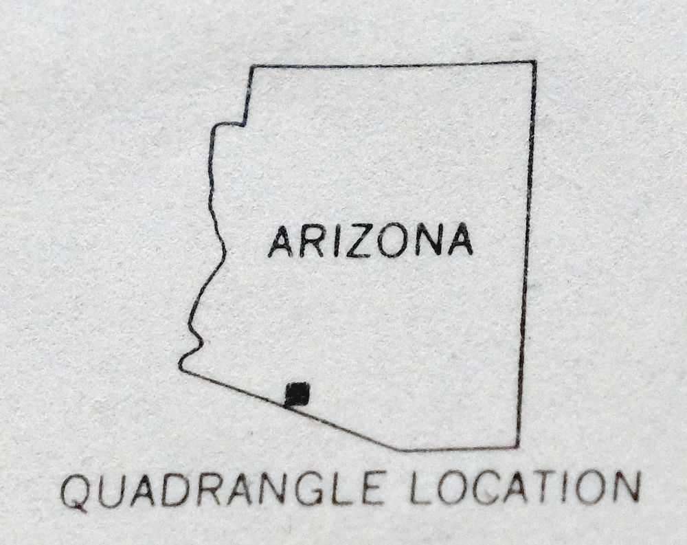
| LOCATION | 15 miles south of Ajo |
| SERIES | 15-minute |
| SURVEYED | 1961 and 1963 Aerial and Field Survey |
| EDITION | 1963 |
| PRINTED | 1969 |
| PRINT NOTES | Thick paper stock, includes woodland tint (green to indicate vegetated areas) |
| SCALE | 1:62500 |
| CONTOUR INTERVAL | 40 feet |
| SHEET DIMENSIONS | 17 x 21 inches (approximate) |
| MAP DIMENSIONS | 14 7/8 x 17 1/2 inches |
| COVERAGE AREA | 15 x 17 miles |
| MAP NOTES | Bates Mountains in the Organ Pipe National Monument. |
| SHEET CONDITION For maps of this vintage, effort is made to note all visible flaws, no matter how minor. | |
| OVERALL CONDITION | Very Good |
| SHEET NOTES | lightly handled, never folded, smooth and flat |
| MAP AREA | flawless map area |
| COLLARS | no wear or tears, no markings, minor blemishes |
| MAP COVERAGE Quadrangle extent overlaid on current basemap. | |
| PLACENAMES Depending on map series and survey date, all of the features listed below may not be shown on this map. This list contains features that currently exist or historically existed within the area covered by the map. The list can be used as a reference to determine if this map covers your area of interest. Placenames are listed alphabetically next to each feature type. | |
| COUNTIES COVERED | Pima |
| FEDERAL LAND UNITS | Cabeza Prieta National Wildlife Refuge, Organ Pipe Cactus National Monument, and Organ Pipe Cactus Wilderness |
| RIVERS AND STREAMS | Aguajita Wash, Alamo Wash, Cherioni Wash, Cuerda de Lena, Growler Wash, Gunsight Wash, and Kuakatch Wash |
| Locations: Bates Well and Gunsight. Mountain Ranges: Puerto Blanco Mountains. Mountains, Peaks, and Summits: Bates Mountains, Cipriano Hills, Kino Peak, Lime Hill, Pinkley Peak, Scarface Mountain, and Tillotson Peak. Valleys and Canyons: Growler Canyon. Parks: Organ Pipe Cactus National Monument. Trails: Puerto Blanco Drive. Drainages: Alamo Wash, Cherioni Wash, Cuerda de Lena, and Kuakatch Wash. Mines: Bluebird Mine and Copper Mountain Mine. Gaps: Growler Pass and Puerto Blanco Pass. Wells: Acuna Well, Armenta Well, Bandeja Well, Bonita Well, and Daniells Well. Springs: Dripping Springs. | |
| SHIPPING AND RETURNS | |
 This map sheet will be carefully rolled in a sturdy tube and shipped via the US Postal Service. If you find that the sheet you receive is not as described in the listing, you may ship it back to us for a refund of the purchase price. | |
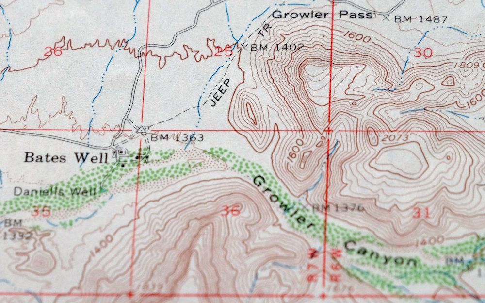
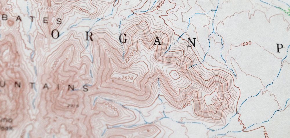
1969 Kino Peak Arizona USGS Topo Map
$48
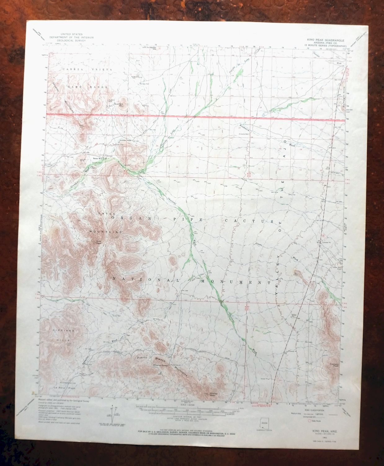
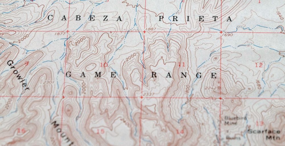
Bates Mountains in the Organ Pipe National Monument. This 1963 edition, printed in 1969, maps the Kino Peak quadrangle at 1:62,500, covering roughly 15 by 17 miles of the Sonoran Desert in Pima County, about 15 miles south of Ajo, Arizona. The quad area takes in portions of Organ Pipe Cactus National Monument and its wilderness to the east, along with part of the Cabeza Prieta National Wildlife Refuge to the west.
In stock
This vintage sheet is a 1963 edition of the Kino Peak Arizona USGS topographic map. It is an original 57-year-old 1969 United States Geological Survey print in very good condition.
HOW THIS MAP CAN BE USED
In addition to making a fascinating conversation piece, this sheet would look great in a frame or on display, make a unique and prized gift for anyone interested in this area, be perfect as a reference for genealogy studies or general historical research, or fill that missing piece in your collection. Maps of this vintage are printed on durable stock and are well-suited for outdoor activities and recreation of all kinds, including hiking, backpacking, hunting, rafting and kayaking, backcountry skiing, geocaching, general exploration, treasure hunting, etc.
FEATURES SHOWN ON THE MAP
The Kino Peak 15-minute map shows cities and towns, roads, railroads, utilities and energy infrastructure, rivers, creeks, elevation contour lines, public land survey lines, county, state, and other administrative boundaries as they existed at the time of the survey in 1961 and 1963. All known structures (houses, businesses, churches, schools, barns, cabins, etc) are also shown.
A VALUABLE HISTORICAL RECORD
Maps from the 15-minute series for the continental United States are no longer produced or printed by the USGS and original prints are becoming increasingly difficult to find. They are a valuable historical record for an area, as they contain many placenames and features that have been dropped from more recent maps.
Nearby maps
-
Agua Dulce Mountains Arizona USGS Topo Map 1971 Vintage
$32 Add to cart -
Ajo Arizona Batamote Mountains Childs USGS Topo Map 1969
$47 Add to cart -
Ajo Arizona Batamote Mountains Childs USGS Topo Map 1934
$38 Add to cart -

Sikort Chuapo Mountains Arizona Why USGS Topo Map 1963
$34 Add to cart -
O’neill Hills Arizona Cabeza Prieta NWR USGS Topo Map 1971
$16 Add to cart -
Cimarron Peak Arizona Papago Hickiwan USGS Topo Map 1964
$40 Add to cart -
Granite Mountains Arizona USGS 15-Min Topo Map 1966 Vintage
$31 Add to cart -
Hat Mountain Arizona Sauceda Mountains USGS Topo Map 1959
$30 Add to cart -
Isla Pinta Arizona Cabeza Prieta NWR USGS Topo Map 1970
$34 Add to cart -
Gu Achi Arizona Santa Rosa Anegam USGS Topo Map 1964 Vintage
$28 Add to cart -

Theba Arizona Sauceda Mountains Gila Bend USGS Topo Map 1951
$32 Add to cart -
Gila Bend Arizona Bosque USGS 15-Min Topo Map 1955 Vintage
$38 Add to cart -
Kim Arizona USGS 15-Min Topographic Map 1961 Vintage
$36 Add to cart -
Sells Arizona Topawa Cowlic USGS 15-Min Topographic Map 1948
$45 Add to cart -
Stoval Arizona Kofa Horn USGS 15-Min Topo Map 1966 Vintage
$38 Add to cart -
Mohawk Arizona Tacna USGS 15-Min Topo Map 1960 Vintage
$37 Add to cart -

Vamori Arizona San Miguel USGS 15-Min Topo Map 1958 Vintage
$34 Add to cart -

Mobile Arizona Goodyear USGS 15-Min Topo Map 1951 Vintage
$37 Add to cart -
Vaca Hills Arizona Papago USGS Topographic Map 1965 Vintage
$32 Add to cart -
Baboquivari Peak Arizona USGS 15-Min Topo Map 1967 Vintage
$48 Add to cart -
Casa Grande Arizona Stanfield Bon USGS Topographic Map 1959
$44 Add to cart -
Roll Arizona Growler USGS 15 Minute Topo Map 1962 Vintage
$35 Add to cart -
Maricopa Arizona Ak-Chin Rancho El Dorado USGS Topo Map 1968
$45 Add to cart -
Presumido Peak Arizona USGS 15-Min Topo Map 1960 Vintage
$48 Add to cart