MAP DETAILS | |
|---|---|
| TITLE | Beaver |
| STATE | Utah |
| SURVEYED | 1953 through 1958 Aerial and Field Survey |
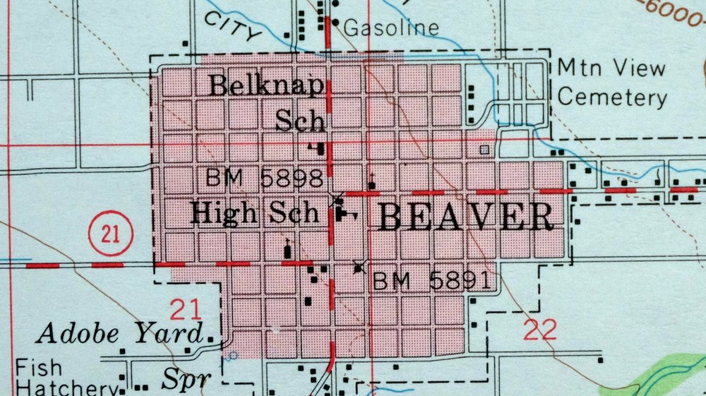
| PRINT NOTES | Thick paper stock, includes woodland tint (green to indicate vegetated areas). A reddish tint is used to indicate urban areas where only landmark buildings are shown. |
| SCALE | 1:62500 |
| CONTOUR INTERVAL | 80 feet |
| SHEET DIMENSIONS | 17 7/8 x 22 inches |
| MAP DIMENSIONS | 13 3/4 x 17 1/2 inches |
| COVERAGE AREA | 14 x 17 miles |
| SHEET CONDITION For maps of this vintage, effort is made to note all visible flaws, no matter how minor. | |
| SHEET NOTES | lightly handled, never folded |
| MAP AREA | no markings, no blemishes |
| COLLARS | no markings, very minor blemishes, no edge tears, light handling wear |
| MAP COVERAGE Quadrangle extent overlaid on current basemap. | |
| PLACENAMES Depending on map series and survey date, all of the features listed below may not be shown on this map. This list contains features that currently exist or historically existed within the area covered by the map. The list can be used as a reference to determine if this map covers your area of interest. Placenames are listed alphabetically next to each feature type. | |
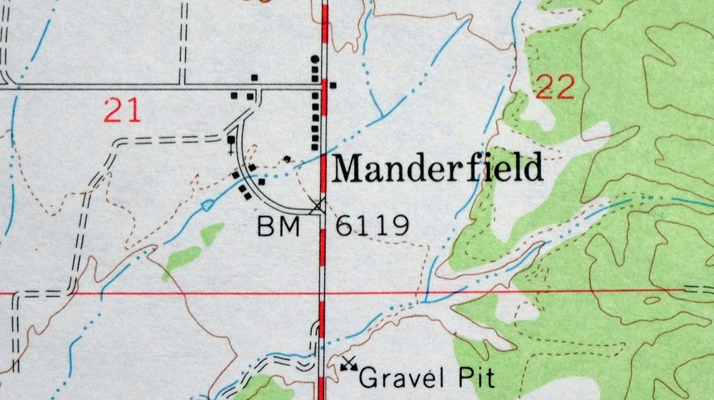
| NOTABLE PLACES | Tushar Mountains and Manderfield |
| CITIES AND TOWNS (CURRENT) | Beaver and Greenville |
| COUNTIES COVERED | Beaver and Piute |
| FEDERAL LAND UNITS | Fishlake National Forest |
| RIVERS AND STREAMS | Beaver River, Big Slough, Birch Spring Creek, Bullberry Slough, Dry Creek, First Spring Creek, Grassy Creek, Indian Creek, Jim Reed Creek, North Creek, North Fork North Creek, Pine Creek, Pole Creek, Shingle Creek, South Fork North Creek, and Wildcat Creek |
| Locations: Beaver Fish Hatchery, Beaver Municide Power Plant, Delano Trailer Park, Jackson County Hill, Little Cottonwood Campground, Lower Power Plant, and Ponderosa Park. Mountains, Peaks, and Summits: Cedar Knoll, Black Mountain, Johnson Peak, Crater Knoll, Gillies Hill, Little Bald Hill, Pole Mountain, Rattlesnake Peak, Red Knoll, Tanner Mountain, Wittwer Hill, and Woodtick Hill. Valleys and Canyons: Bear Canyon, Bell Spring Hollow, Big Hollow, Briggs Hollow, Burnt Hollow, Cave Hollow, Black Hollow, Bone Hollow, Brush Hollow, Bull Hollow, Chokecherry Hollow, Johnson Hollow, Cunningham Wash, Drag Hollow, East Fork Baker Canyon, Fortuna Canyon, Grassy Canyon, Hell Canyon, Last Chance Hollow, Merchant Hollow, Mill Hollow, Miller Hollow, Mud Spring Hollow, North Fork Baker Canyon, Pole Canyon, Salt Hollow, Sheeprock Canyon, South Fork Baker Canyon, Sway Hollow, Tanner Hollow, Twitchell Canyon, and Wet Hollow. Parks: North Creek Recreation Site and United Beaver Camperland. Drainages: Big Slough, Bullberry Slough, Birch Spring Creek, Jim Reed Creek, Dry Creek, First Spring Creek, Grassy Creek, North Creek, North Fork North Creek, North Wildcat Creek, Pine Creek, Pole Creek, Second Spring Creek, South Creek, and South Fork North Creek. Capes: Limestone Point. Mines: Fortune Mine, Glider Mine, Harris Mine, Rob Roy Mine, Sheeprock Mine, Sunday Mine, and White Cliff Mine. Churches: Assembly of God Church, First Baptist Church, and The Church of Jesus Christ of Latter Day Saints. Hospitals: Beaver Valley Hospital. Lakes and Ponds: Little Dry Lake. Dams: Robinson-Tanner Dam. Canals: 2D Northwest Ditch, Carter Ditch, City Ditch, County Road Drain, Harris Ditch, Last Chance Canal, Mammoth Canal, Manderfield Ditch, Old Manderfield Ditch, Owens Ditch, Patterson Ditch, South Field Ditch, and Willis Ditch. Bayous and Sloughs: Greenwood Slough and Spring Branch Slough. Basins: Little Basin. Schools: Beaver High School and Belknap School. Ridges: Bald Ridges, Black Ridge, Cork Ridge, Fourmile Ridge, The Hogback, The Hogs Back, Mud Spring Ridge, and Red Butte Hills. Reservoirs and Tanks: Robinson-Tanner Reservoir. Flats: Lion Flat, Maple Flats, Skull Flat, Table Grounds, and Wildcat Fields. Towers: KBBD-FM (Beaver). Springs: Adobe Yard Spring, Bell Spring, Cold Spring, Cowboy Spring, Drag Hollow Spring, Fourmile Spring, Hawks Nest Spring, Mud Spring, Pine Hen Spring, and Wiregrass Spring. | |
| SHIPPING AND RETURNS | |
 Ships carefully rolled in a sturdy 2" x 18" mailing tube. Shipping and return details are in our terms. | |
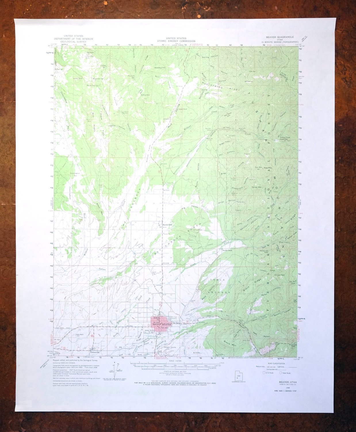
1958 USGS Topo Map: Beaver, Tushar Mountains, Utah
$35
- 55 miles northeast of Cedar City.
- 15-minute series, 1958 edition, printed in 1971.
- Very good condition, never folded.
In stock
This vintage sheet is a 1958 edition of the Beaver Utah USGS topographic map. It is an original 55-year-old 1971 United States Geological Survey print in very good condition.
HOW THIS MAP CAN BE USED
In addition to making a fascinating conversation piece, this sheet would look great in a frame or on display, make a unique and prized gift for anyone interested in this area, be perfect as a reference for genealogy studies or general historical research, or fill that missing piece in your collection. Maps of this vintage are printed on durable stock and are well-suited for outdoor activities and recreation of all kinds, including hiking, backpacking, hunting, rafting and kayaking, backcountry skiing, geocaching, general exploration, treasure hunting, etc.
FEATURES SHOWN ON THE MAP
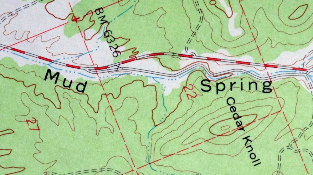
The Beaver 15-minute map shows cities and towns, roads, railroads, utilities and energy infrastructure, rivers, creeks, elevation contour lines, public land survey lines, county, state, and other administrative boundaries as they existed at the time of the survey in 1953 through 1958. A reddish tint is used on this sheet to indicate urban areas where only landmark buildings are depicted. Outside of those areas, all known structures (houses, businesses, churches, schools, barns, cabins, etc) are shown.
A VALUABLE HISTORICAL RECORD
Maps from the 15-minute series for the continental United States are no longer produced or printed by the USGS and original prints are becoming increasingly difficult to find. They are a valuable historical record for an area, as they contain many placenames and features that have been dropped from more recent maps.
Nearby maps
-
Minersville, Black Mountains, Utah 1958 USGS Topo Map
$33 Add to cart -
Marysvale, Piute Reservoir, Utah 1947 USGS Topo Map
$39 Add to cart -
Milford, Star Range, Utah 1958 USGS Topo Map (Vintage Print)
$35 Add to cart -
1962 USGS Topo Map: Fillmore, Kanash, Utah (Meadow)
$34 Add to cart -
Cedar Breaks, Brian Head Ski, Utah 1958 USGS Topo Map
$35 Add to cart -
Torrey, Utah 1952 USGS Topo Map: Capitol Reef NP
$32 Add to cart -
Beaver, Dixie NF, Utah 1885 USGS Topo Map (1921 Print)
$60 Add to cart -
New Harmony, Utah 1957 USGS Topo Map: Toquerville
$37 Add to cart -
Notom, Utah 1952 USGS Topo Map: Capitol Reef NP
$40 Add to cart -
Kanab, Utah/Arizona 1957 USGS Topo Map
$32 Add to cart -
1951 USGS Topo Map: Nephi, Levan, Utah (1973 Print)
$41 Add to cart -

Castle Dale, Utah 1925 USGS Topo Map: Ferron (Antique Print)
$42 Add to cart -
1923 USGS Topo Map: Castle Dale, Ferron, Utah (1968 Print)
$39 Add to cart -

1951 USGS Topo Map: Moroni, Fountain Green, Utah
$38 Add to cart -
Nipple Butte, Utah/Arizona 1953 USGS Topo Map
$31 Add to cart -
Fredonia, Kaibab, Arizona 1954 USGS Topo Map
$33 Add to cart -
1954 USGS Topo Map: Colorado City, Arizona (1975 Print)
$32 Add to cart -
Shinarump, Kaibab, Arizona 1957 USGS Topo Map
$30 Add to cart -
House Rock Spring, Coyote Buttes, Arizona 1957 USGS Topo Map
$37 Add to cart -
Hanksville, Utah 1963 USGS Topo Map: Dirty Devil River
$33 Add to cart -

Paria Plateau, Arizona 1954 USGS Topo Map (1978 Print)
$35 Add to cart -
Santaquin, Mona, Utah 1951 USGS Topo Map (1971 Print)
$41 Add to cart -
The Wickiup, Mexican Mountain, Utah 1954 USGS Topo Map
$16 Add to cart -

1954 USGS Topo Map: Lees Ferry, Marble Canyon, Arizona
$48 Add to cart